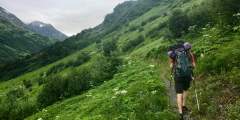
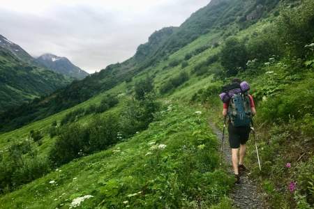
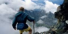
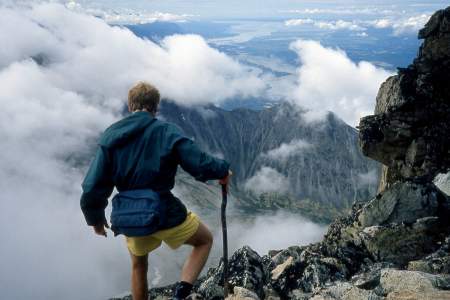
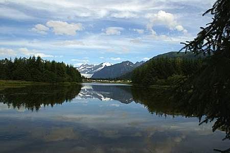
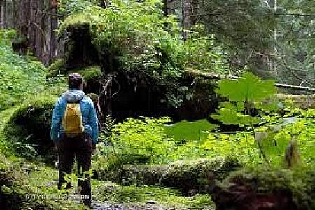
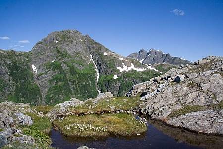
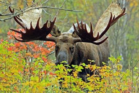
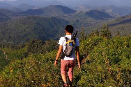
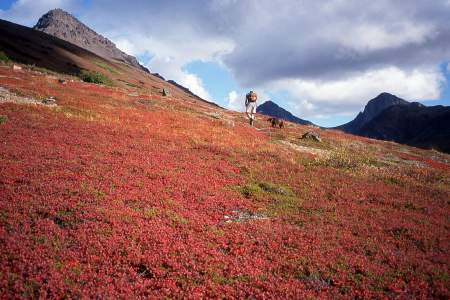
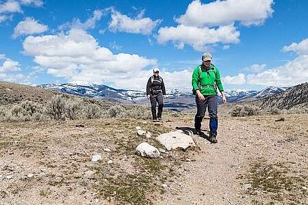
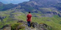
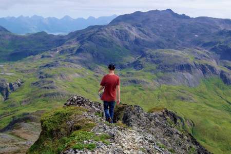
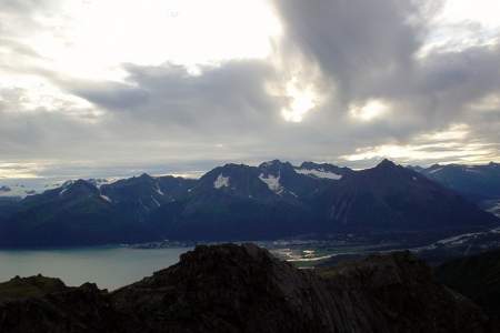
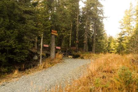
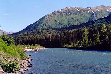
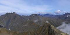
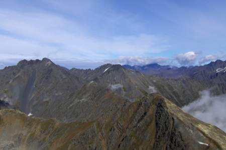
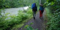
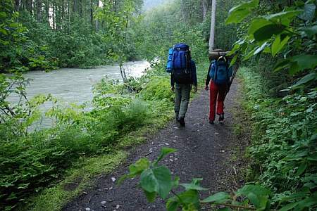
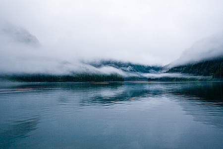
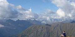
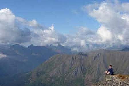
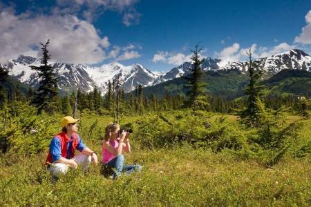
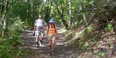
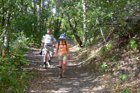
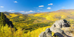
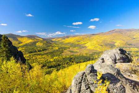
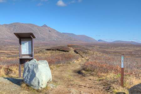
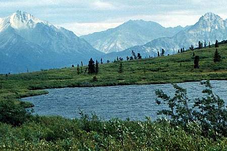
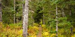
The joys of hiking in Alaska are clear: amazing panoramic views, the chance to see wildlife (moose, eagles, maybe even bears), and it doesn’t cost anything. But national, state, and local parks all have great trails—how do you decide which ones to visit? A good start is with our list of more than 750 trails, highlighting the best in each area of Alaska. Whether you’re a casual walker or a veteran hiker, you can find a trail suited to your ability.
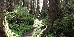
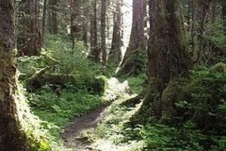
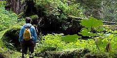
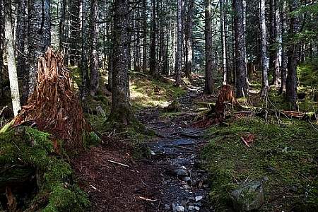
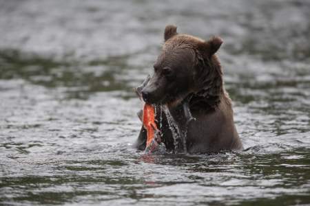
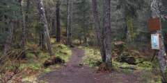
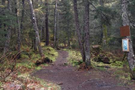
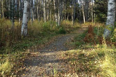
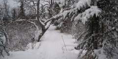
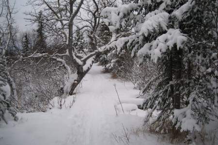
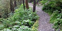
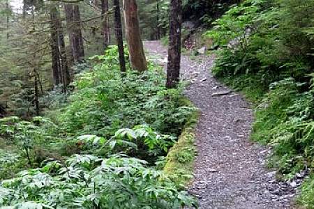
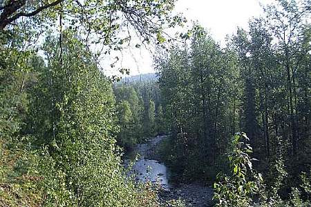
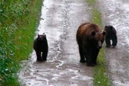
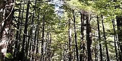
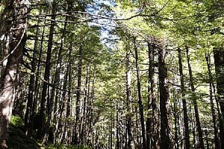
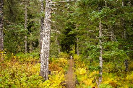
Many trails are easily accessible; some are short and located close to towns, while others require multiple days to complete and take you far away from everyone. (Some even have public use cabins along the way, so you won’t even need a tent.) If you’re hiking a mountain trail, you’ll often begin in the forest—surrounded by the scent of spruce, alder, and cottonwoods—then finish above tree line, with a spectacular view laid out in front of you. Just remember, stay away from Devils Club and Cow parsnip plants. Be prepared for mosquitoes. And be wary of bears, especially when hiking near spawning salmon.
What to Wear
Of course, plan to dress in layers (the weather can change very quickly) and bring plenty of water (some glacial water is suitable for drinking, but don’t take chances). See our complete hiking clothing guide here. If you need hiking gear, like trekking poles, a day pack, waterproof layers, and more, you can rent it from Alaska Outdoor Gear Outfitters & Rentals.
If you see a trail that you've hiked that could use a better description, please email Bob. Thanks!
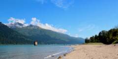
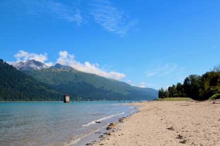
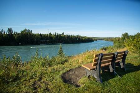
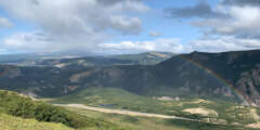
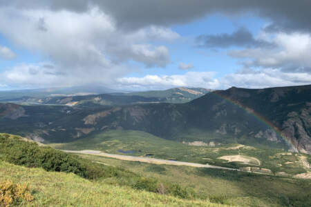
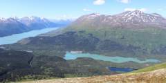
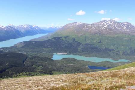
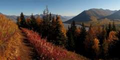
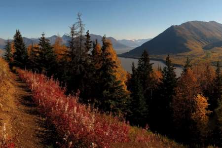
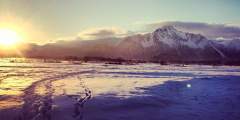
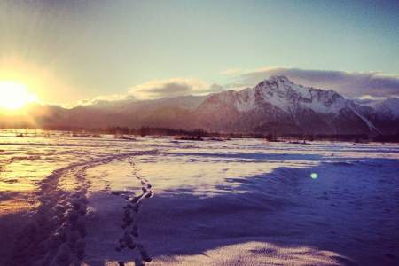
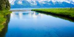
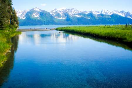
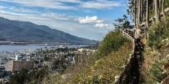
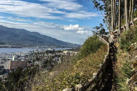
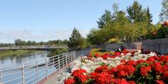
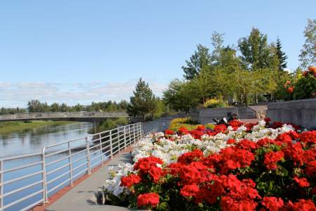
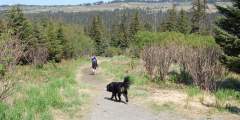
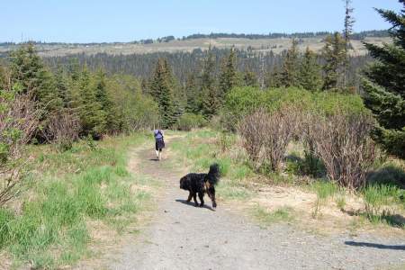
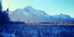
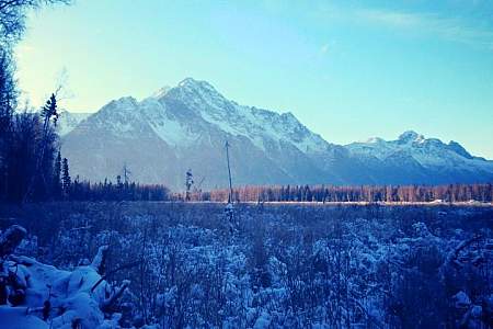
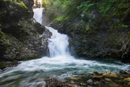
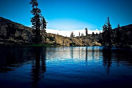
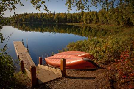
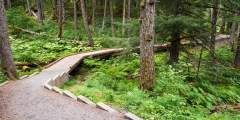
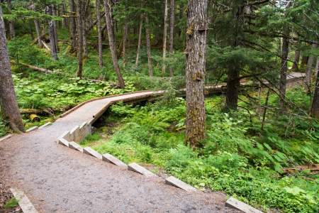
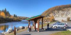
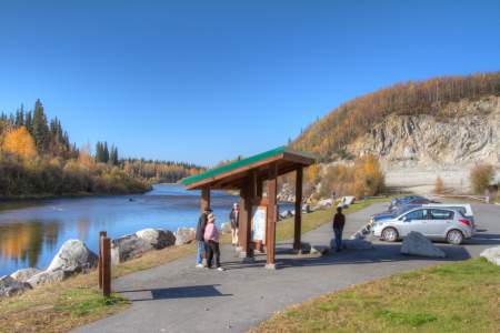
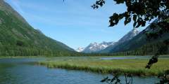
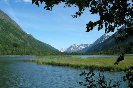
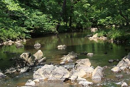
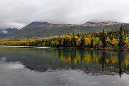
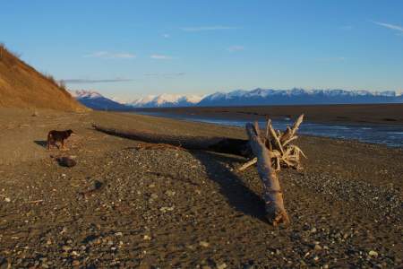
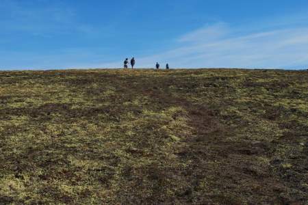
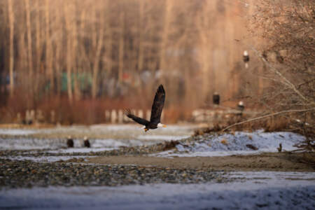
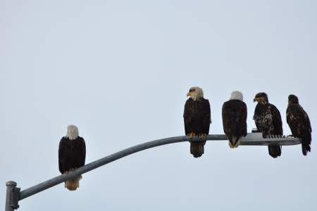
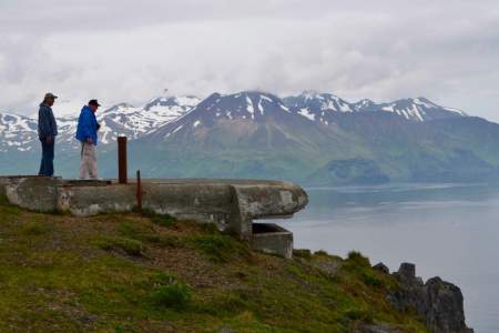
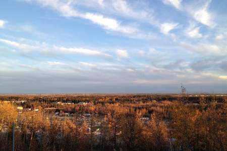
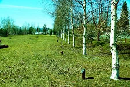
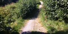
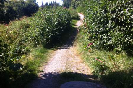
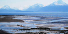
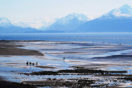
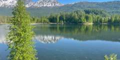
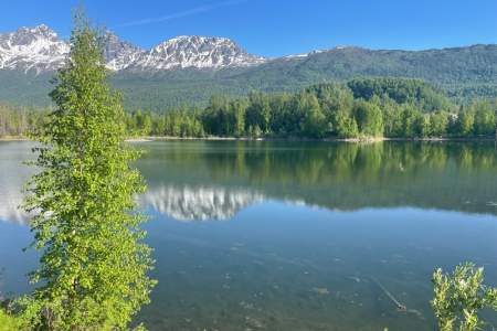
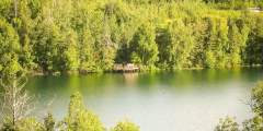
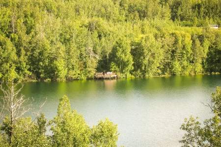
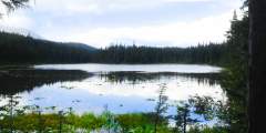
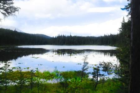
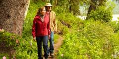
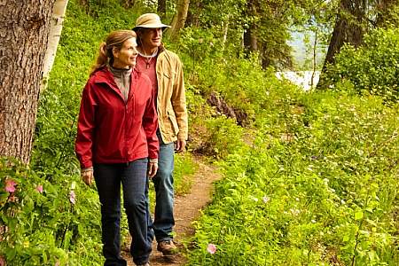
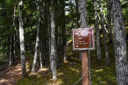
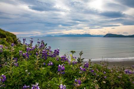
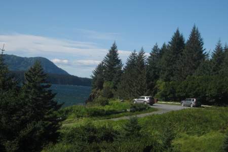
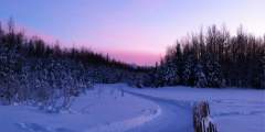
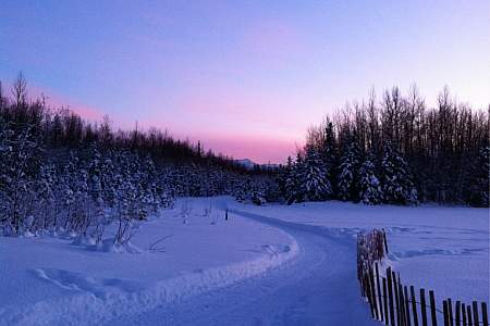
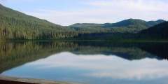
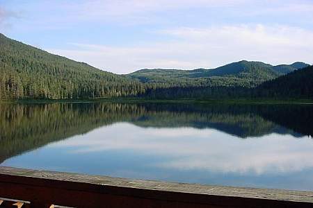
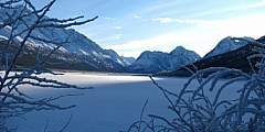
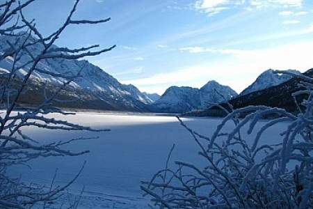
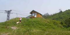
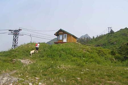
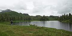
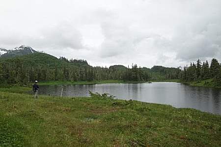
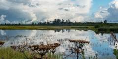
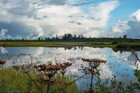
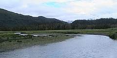
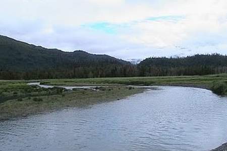
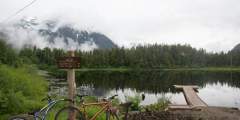
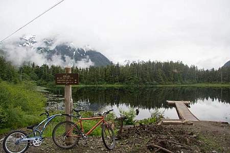
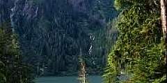
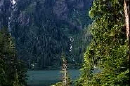
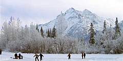
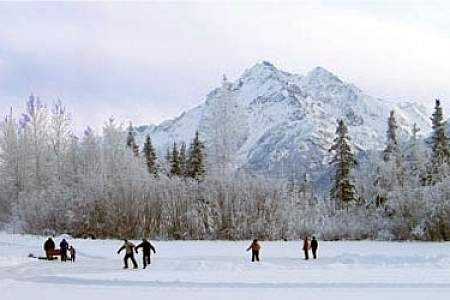
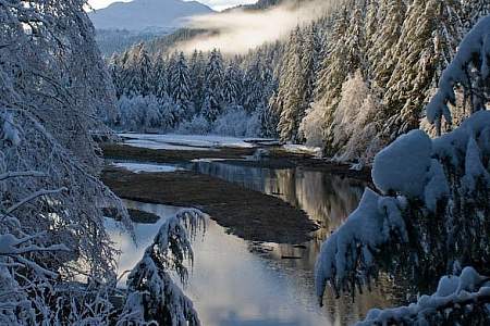
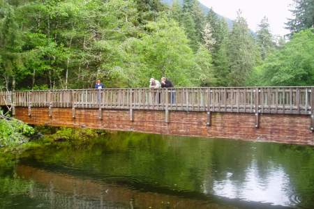
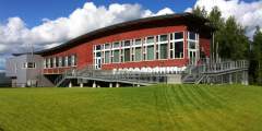
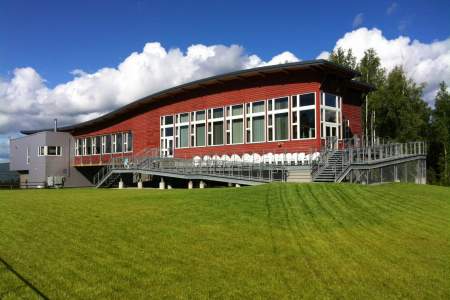
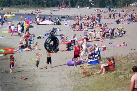
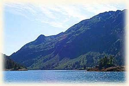
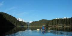
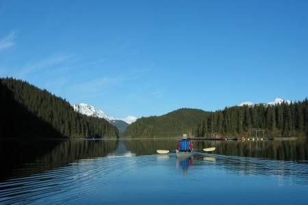
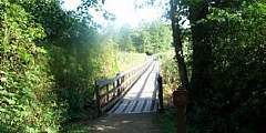
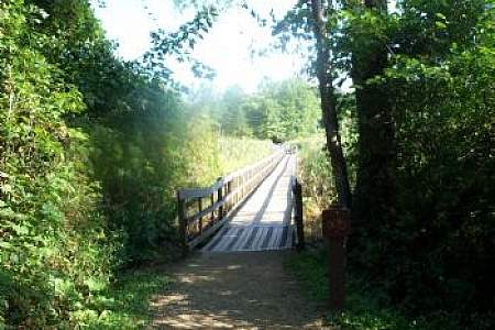
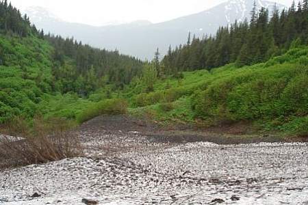
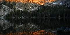
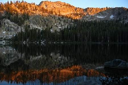
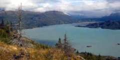
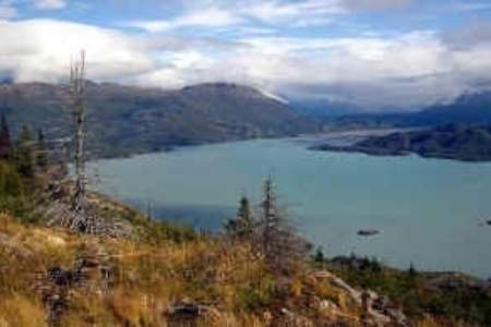
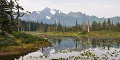
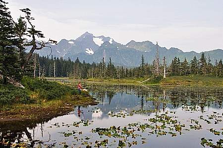
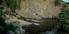
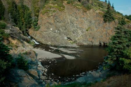
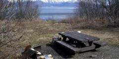
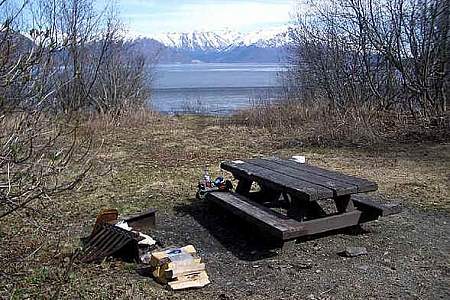
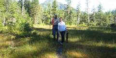
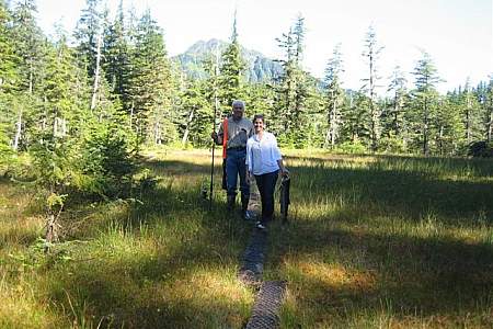
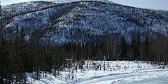
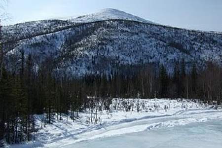
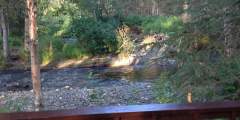
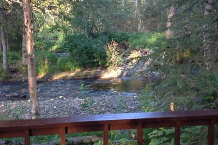
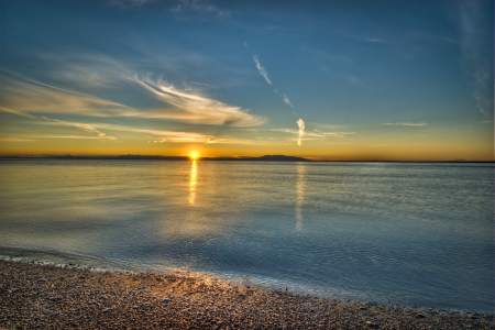
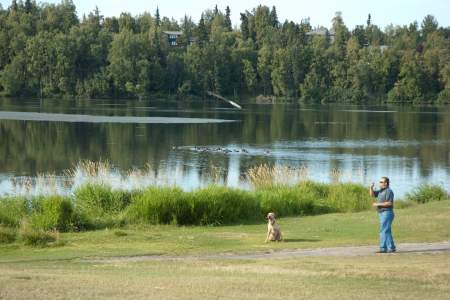
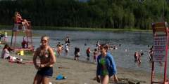
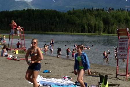
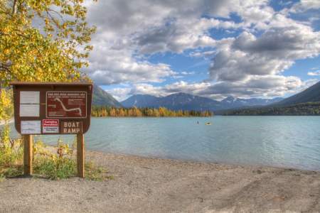
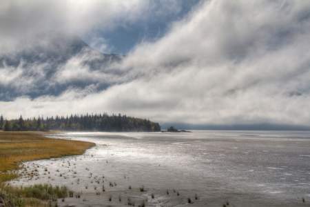
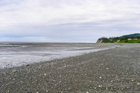
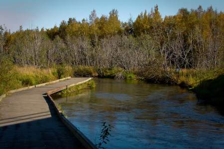
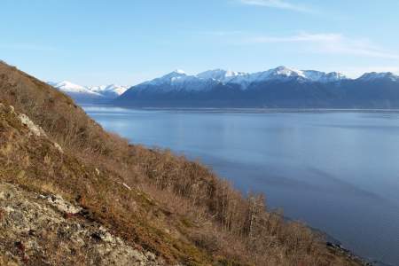
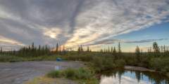
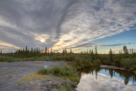
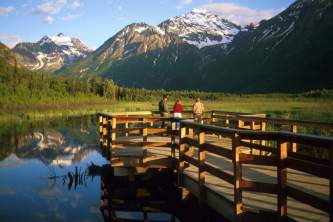
Nestled at the end of Douglas Highway, Savikko Park, often referred to as Sandy Beach, is a local favorite and a hidden gem for visitors. It’s the perfect spot for a scenic stroll, and locals love bringing their dogs here to run. Be sure to bring your camera — this is one of the best places to snap a photo, whether it’s the mountains, the water, or a bald eagle soaring by.
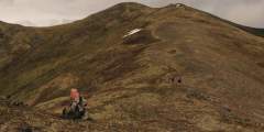
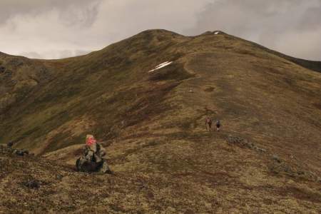
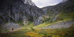
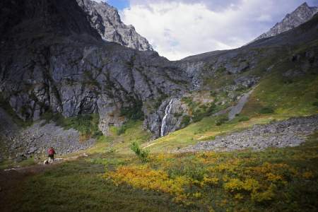
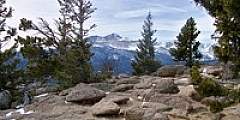
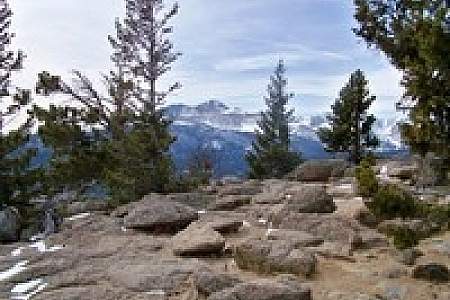
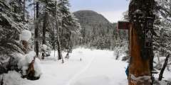
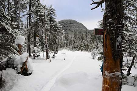
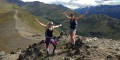
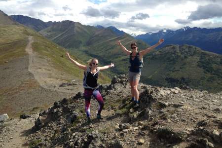
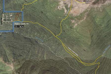
Difficulty: Moderate
Distance: 7 miles
Elevation Gain: 1100 feet
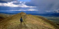
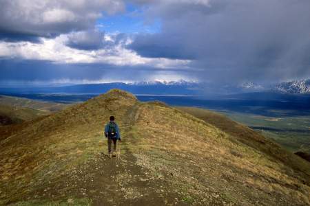
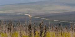
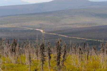
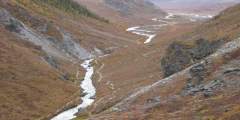
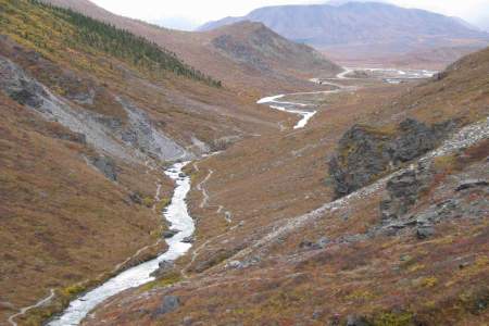
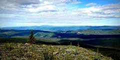
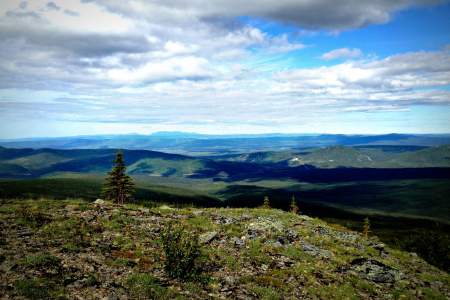
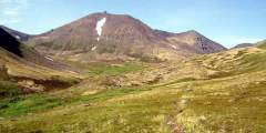
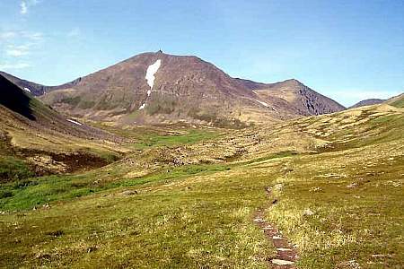
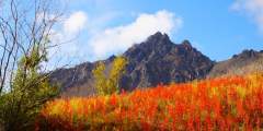
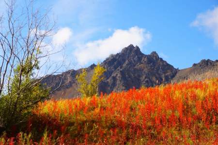
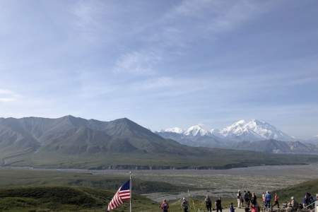
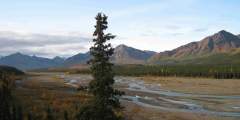
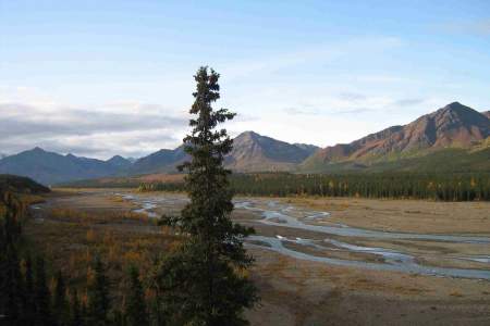
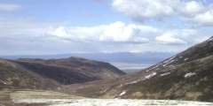
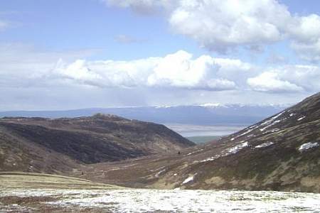
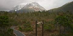
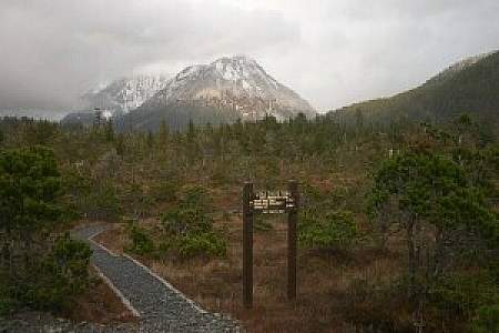
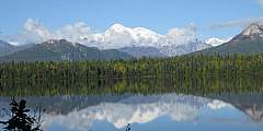
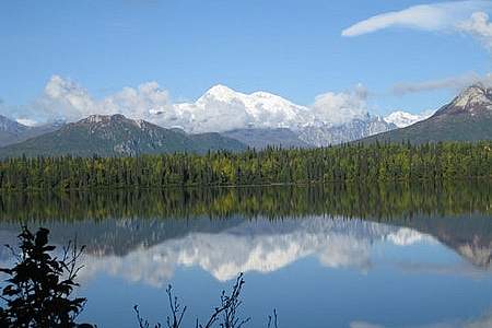
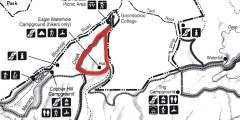
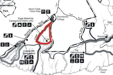
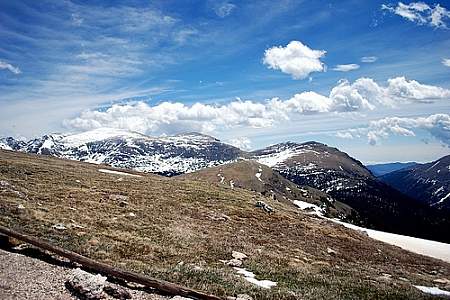
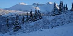
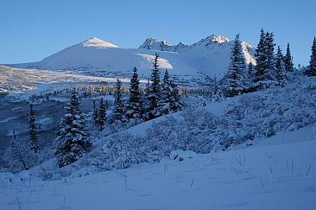
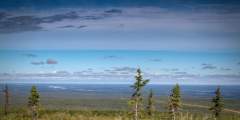
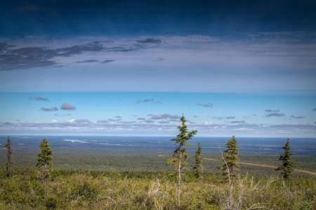
The Curry Ridge Trail is a newly constructed trail (2016) that departs from the Kesugi K’en Campground and climbs moderately (1100 ft in about 3.5 miles) up Curry Ridge. On a clear day, hikers are rewarded with stunning views of Mt. Denali in the distance.
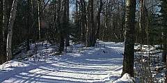
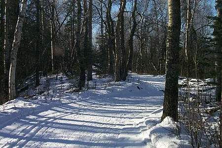
In summer, the trails are open to all kinds of foot-powered recreation — walking, running, hiking, biking, photoshoots, wildlife watching and berry-picking. There’s even an 18-hole disc golf course. K‑9 feet are welcome, too. In winter, locals hit the trails for cross-country skiing and fat-tire biking. There are more than 25 kilometers of groomed ski trails, perfect for classic and skate cross-country skiing.
This 10-mile circuit of different loop trails is well-maintained and makes for fun hiking and skiing. Look for access from the parking lot at the Kenai National Wildlife Refuge Visitor Center, where there are bathrooms and outdoor port-a-potties. If you come here to ski, warm up inside the center, next to the soapstone masonry heater.
This wide, multi-use trail is popular with locals and a fun hike for everyone. The ADA-compliant trail winds through boreal forest, and it’s the only headquarters trail open to dogs and bicycles. You can even get your pup certified as a B.A.R.K. Ranger, meant to strengthen the relationship with your dog on federal public lands.
This 2.2‑mile loop trail is an off-shoot of the Keen-Eye Trail that departs from the Kenai National Wildlife Refuge Visitor Center. It is less crowded than the Keen-Eye Trail (which was built to accommodate large groups), and while it’s not a difficult hike, it features some light hills and varied terrain.
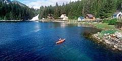
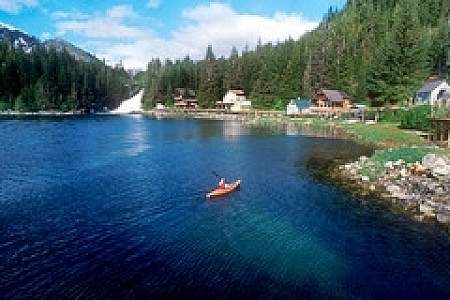
During the summer months it’s a great spot for canoeing, kayaking, paddle boarding, even paddleboard yoga. The colder months are just as lively as the warmer ones. There’s a skating loop on the lake’s perimeter, as well as several skating areas on the lake. The City offers free public skates Saturday afternoons, ice conditions dependent, December through February.
The popular, paved Unity Trail begins in Soldotna and winds its way around 9 miles to Kenai. It’s popular with locals and travelers alike for all kinds of activities: walking, biking, jogging, birding, rollerblading, and more.
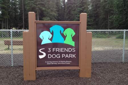
This park is a can’t miss for dog owners and dog lovers! It’s one of the busiest parks in town, with people and their dogs there practically 24⁄7. If you’re traveling with your dog, it’s a great place to give Fido some exercise. You’ll also have an opportunity to meet the locals, learn what it’s like to live in Soldotna, and get the inside scoop on the best things to see and do from people who live here.
The Centennial Campground Loop Trail is a great place for a walk right in town at any time of year. It’s well-trafficked, well-marked, wide, and easy for most people to use. The trail is busiest in summer — especially the part near the campground where anglers access the Kenai River — and a little quieter during the other seasons.
This beautiful park set along the turquoise Kenai River hosts community events, has a boardwalk, access to the river, playground and more. There’s an ice loop for skating (free ice skates are available during winter festivals) and animal cutouts with white twinkle lights on them.
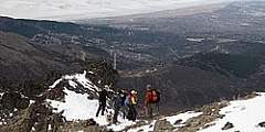
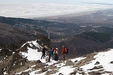
Difficulty: Difficult
Distance: 4 miles
Elevation Gain: 2700 feet
Sugarloaf offers fun, steep, and challenging ridge hiking above the hotels and restaurants of the commercial area North of Denali National Park. It’s a great place to scramble freely in this region’s semi-arid alpine zone or to enjoy a long midnight sunset. The broad, west facing peak of Sugarloaf Mountain is a rewarding summit, and once you’ve climbed the steepest trail section at the beginning you’ll likely have the rest of trail to yourself,
...more
A roadside hike that gains quick elevation and leads to soaring views? Count me in. A little traveled creek that rushes into one of the wildest whitewater rivers in Alaska? Hmm. Yes, please. A trail all to yourself just a few minutes from Denali’s busy front country area? Now you’re talking. Dragonfly Creek has all this and more, and you’ll only just be getting your feet wet.
Difficulty: Difficult
Distance: 7 miles
Elevation Gain: 4000 feet
This hike introduces you to the best that Denali has to offer. The Bison Gulch trail is all about stunning views of steep river canyons, a solid, well-broken trail through alpine tundra, and an exciting summit scramble for those that reach it. For those with less time, this hike is favored for its quick access to high alpine views directly off of the Parks Highway. No need to go all the way to the summit if you haven’t the time or motivation; the
...more
Difficulty: Moderate
Distance: 7 miles
Elevation Gain: 680 feet
This trail has a split personality: It’s broken out into two different sections that will appeal to two different kinds of hikers! Section A is the tame sibling — a 6.5‑mile moderate round-trip that takes about 4 hours. Section B is the wild child: A full 12.6 miles out and back, this stretch takes 10 hours or so to hike and is difficult.
Difficulty: Moderate
Distance: 12 miles
Elevation Gain: 800 feet
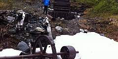
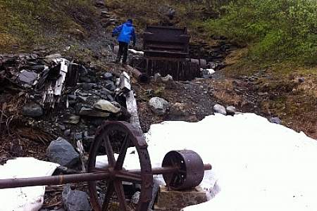
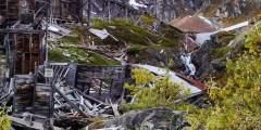
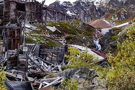
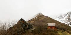
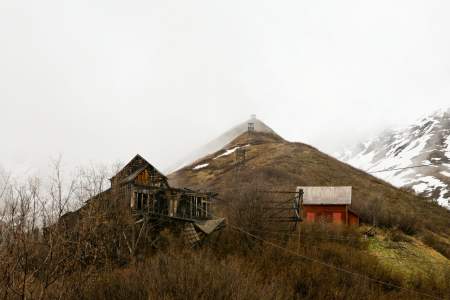
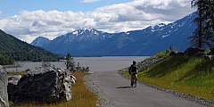
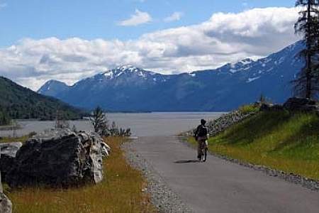
If you’re interested in seeing remnants of Alaska’s Gold Rush heritage, you’ll find some fantastic ruins from that era along this 12.2‑mile trail that follows an old gravel road and takes about 6 hours. Don’t want to walk it all? Rent a bike in Valdez and pedal your way.
This easy loop trail — just 0.8 miles long with less than 500 feet in elevation gain — offers probably the best bang for your buck in Valdez. It’s close to town yet feels immersed in nature, comes with awesome views, and you can do it in just 30 – 45 minutes at a leisurely pace.
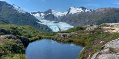
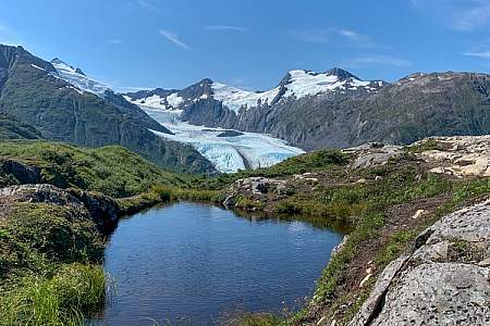
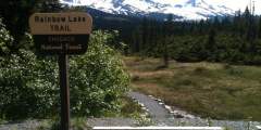
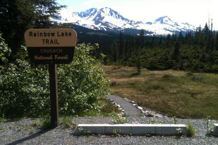
6.2 round-trip easy hike through the Chugach National Forest to a glacial lake. Popular in winter for fat biking and ice skating. In summer, hiking and paddleboarding.
This 1.5‑mile hike is an easy stroll down to the lake that offers a great payoff in the form of a gorgeous glacier. If you’re here in winter and the conditions are right, it’s a great spot for wilderness ice skating, fat biking, or cross-country skiing!
Whittier’s newest trail is a gem — a gentle, ¾‑mile stroll that follows Whittier Creek from the railroad crossing up to the waterfall. Locals love it: It’s right in the middle of town, but the lush greenery makes you feel like you’re far from civilization.
This is a very steep, 6.4‑mile round-trip trail that’s mostly unmarked and requires experience with scrambling and climbing over rocks. Your reward for the effort, though, is some very dramatic views of Shotgun Cove and the glaciers in Blackstone Bay.
This is a 6.6‑mile round-trip trail with very little elevation gain, making it a great option for the whole family. Along the way, you’ll glimpse amazing views of Prince William Sound. It takes about 90 minutes to hike halfway, out to the cove. And it’s worth the trip: Here you’ll find a lagoon fed by the tide and full of huge starfish.
Sitka was Alaska’s first official Bike-Friendly Community, and it shows. Bike lanes and racks abound. Besides 14 miles of paved roads, there are many mountain biking trails, and even a new, single-track route of the intimate experience of riding through old-growth forest.
The Salvage Trail is an out-and-back trail that rolls up and down through the woods, paralleling Revilla Road. The trail is a wide gravel path where two-to-three people can walk beside each other.
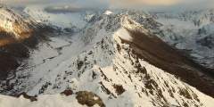
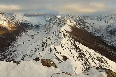
Here is our list of Alaska mountains that are both spectacular to view while also offering reasonably fit people a route to the summit. These include mountains that can be explored during a day trip without professional guides or specialized mountaineering equipment.
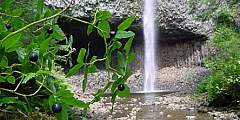
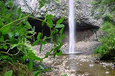
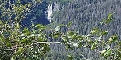
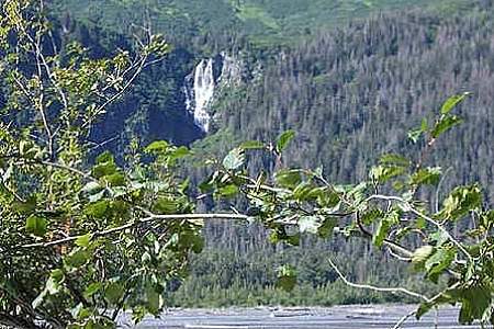
On one of the run-off creeks from Achilles Mountain or Twin Peaks Mountain above pours a 100-foot or more waterfall right beside Tongass Highway towards the end of the road
This 0.4‑mile-long trail, which begins within earshot of downtown Homer, plays host to a variety of birds and plants. Wheelchairs may have some trouble in the first few feet of soft gravel, but once they reach the plastic boardwalk they should find the going much easier — and maybe worth the trouble it took to drive 4 hours from Anchorage.
More a gated road than a trail, this hike largely remains a local secret among the residents of Cooper Landing, the fishing mecca located some 105 miles south of Anchorage on Sterling Highway. Many in this town consider it their personal getaway, which makes it quite a popular secret. A foreman for Chugach Electric (the company that manages the dam on Cooper Lake) said he often experienced congestion while driving to the dam, due to the heavy
...more
If you are a lover of alpine, stunning views, and longer, more challenging hikes, then this all-day, one-way mountain traverse between Carlanna Lake and Perseverance Lake is the perfect choice.
Difficulty: Easy
Distance: 2 miles
Elevation Gain: 200 feet
This hike offers a nice wide-open space experience and is not very long. Much like hiking the access road to Lower Silvis Lake, the Whitman Trail is another service road to two dams that generate electricity for Ketchikan residents and was recently made available for hiking and recreation; however, no motorized vehicles are permitted. Informative signs are posted on a fence gate up the road and on both dams.
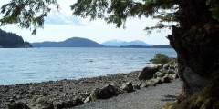
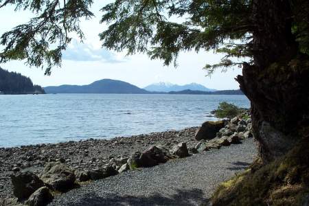
Refuge Cove State Recreation Site is a sliver of land lining part of an edge of a neighborhood and is a popular beach picnicking destination with the locals. The site comes complete with pit toilets, sheltered and unsheltered picnic tables with fire grates, and a quarter-mile trail accompanied by interpretive signs that address the local natural history.
Leaving from the end of Tongass Highway, enter the Lunch Creek Trail and very soon take the trail to the left as this steps you quickly down to a waterfall viewing platform and then the rest of the way down to where, to the right, you can also cross the Lunch Creek bridge, which provides waterfall views as well as the ocean where the creek flows into.
The 23-mile Johnson Pass Trail offers hikers, backpackers and bikers a well-marked route through a lush pass in the Kenai Mountains — featuring gradual climbs, two lakes with fish, spectacular peaks and some way cool gorges.
Beginning a 1‑hour drive north of Anchorage in Government Hill Recreation Area, Government Peak Race Trail offers a fine opportunity for a hard workout; it climbs some 3,700 vertical feet in just 3 miles. Plus, this climb doesn’t include any extraordinary dangers. (A friend refers to one short ledge on this trail as “death rock,” but she tends to exaggerate.) Some sections require special care to negotiate, but you won’t have to traverse any
...more
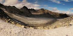
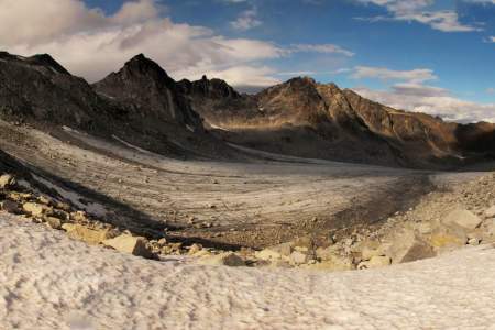
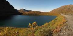
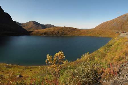
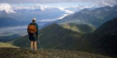
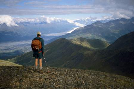
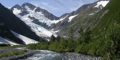
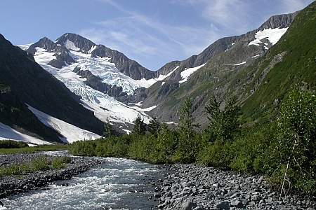
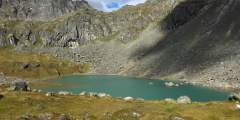
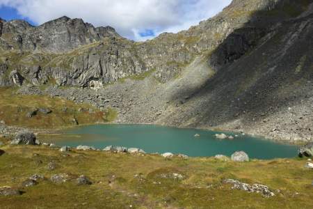
It’s not very often that people can see a glacier in an untamed and remote location, far from any road or cruise-ship route. But if you feel capable and confident enough to climb a very rough trail up many vertical feet of rocky terrain, then you might consider undertaking the hike to Snowbird Pass, located high in the Talkeetna Mountains just north of Hatcher Pass. From this vantage point you can look down the entire length of Snowbird Glacier.
...more
Difficulty: Easy
Distance: 2 miles
Elevation Gain: 700 feet
This leisurely, 0.75-mile trail begins just south of Whittier, a little seaside town located some 2 hours south of Anchorage. The trail doesn’t climb much, but it will take you high enough to get an unobstructed view of numerous waterfalls, including the long-dropping waters of Horsetail Falls as it sheets over the sheer rock face of Blackstone Ridge.
You don’t have to be a mountaineer to reach the summit of O’Malley Peak — the prominent spire rising from the Front Range above Anchorage — but don’t mistake it for an easy climb. Some of the 5‑mile-long trail climbs quite steeply; other parts add very loose gravel to the incline. Still, these conditions don’t make this hike excessively dangerous, just satisfyingly laborious.
Want to feel dwarfed by Alaska’s mountains? Take a 2‑hour drive north on the Parks Highway and then up Hatcher Pass Road, where you’ll find this 2‑mile-long ATV trail — a wide but occasionally steep path that leads to the crest of Box Lake Ridge. From the big, rounded top of this ridge, you can’t help but feel overwhelmed by the enormous Talkeetna Mountains that surround you.
No other mining trail on the Kenai Peninsula climbs as high or takes in more extensive views as the 6‑mile-long Crown Mine Trail. Beginning some 2 hours south of Anchorage on the appropriately named Mine Road just south of Trail Lake, this trail climbs to 3,900 feet above sea level to a unique spot — a glacial cirque littered with mining paraphernalia.
This 4.5‑mile trail, some 2 hours north of Anchorage on the west side of Hatcher Pass, climbs 1,000 feet up a very typical Talkeetna valley — long, broad, and lined with towering peaks on both sides. It also passes by relics and ruins of old mining days, when these valleys echoed with the sounds of picks and drills.
If you have some outdoor experience and an adventurous spirit, consider this 11-mile traverse up the Colorado Creek valley and down the Summit Creek. Beginning 2 hours south of Anchorage, this traverse doesn’t involve any rock scrambling, river crossings, or arduous bushwhacking. But if you feel comfortable hiking in wide and trackless country, you may reap the reward of having an entire valley to yourself.
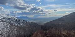
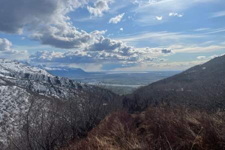
Explore the expansive gravel beds or meander along the mighty Matanuska-Susitna River and link up with the Matsu River Park trails, located in the trees to the west.
There are some nice long downhills with banked turns, a few shallow creek crossings, and some chunk sections. Most of this trail lies on south-facing hillsides, with views of the Knik River Valley and Pioneer Peak.
Difficulty: Moderate
Distance: 5 miles
Elevation Gain: 100 feet
Located in the Tongass National Forest, Ward Creek is wide enough to drive a truck down, though no vehicles are permitted, and is popular with the locals for walking dogs. Across the road from the Ward Lake Recreation Area parking lot, trailhead 1 takes you north and follows Ward Creek, which flows out of Connell Lake, by the Last Chance campground, and through Ward Lake to eventually meet the ocean in Ward Cove.
Difficulty: Difficult
Distance: 10 miles
Elevation Gain: 1300 feet
If you want to get away and don’t have a boat or a plane, this is as far away north one can easily get from Ketchikan. The trail ends at the headwaters of Lunch Creek — the shores of Lake Emery Tobin, which is surrounded by a rim of steep mountainsides often capped with snow ridges and peaks.
Difficulty: Difficult
Distance: 2 miles
Elevation Gain: 170 feet
The one-mile gravel trail to Coast Guard Beach winds through Ketchikan Gateway Borough land and then crosses into Alaska Mental Health Trust Land. Mostly the trail descends to the beach; however, a few hills do rise along the way. This beach is a good place for walking, sunbathing, beachcombing, photography, writing, reading, meditation, tai-chi, just sitting, marine-life viewing, and dog swimming.
This beautiful 5‑mile trail begins at Moose Flats Recreation Area and winds through forests, wetlands, streams, and glacial landscapes on its way to Portage Lake. Along the route, hikers enjoy stunning views of mountains, hanging glaciers, and evidence of the glacier that once filled the valley. The trail ends near the lake shore, offering panoramic views and a chance to experience the dramatic changes that have shaped this iconic Alaskan
...more
Our guide to the best bike trails around Girdwood and Turnagain Arm. You’ll find gorgeous mountain scenery, lakes, creeks, and a variety wildlife — as well as plenty of bicycle trails that make it easy to absorb it all at your own pace. Need a bicycle? You can rent them at Powder Hound Ski and Bike Shop, located in the heart of Girdwood at the base of Alyeska Resort.
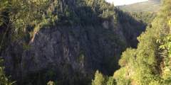
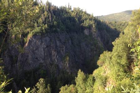
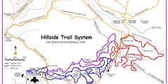
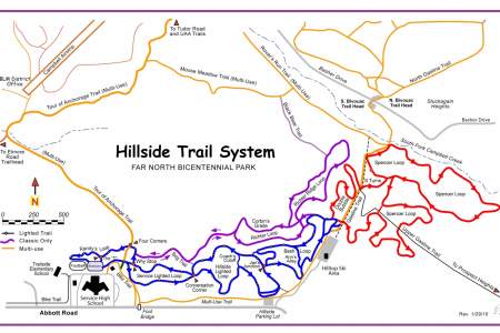
The Campbell Creek Gorge overlook is one of Anchorage’s best kept secrets. It’s just a 25-minute uphill hike — even shorter on bike— from both the Hillside Ski Chalet parking area and North Bivouc Trailhead, or a slightly longer 1‑hour hike from Campbell Airstrip. From the tree-covered overlook, you can gaze hundreds of feet down a sheer cliff to Campbell Creek as it crashes through a narrow, brush-infested canyon.
The hike to Tonsina Creek, a scenic 3 mile trail that takes about 1 hour in each direction, is a local favorite. Locals and visitors alike walk out to the creek itself, and some continue on to Caines Head State Park.
Running just above and parallel to Ketchikan’s Third Avenue Bypass, Rainbird Trail is perfect if you only have a couple hours but still want to experience a small piece of Southeast Alaska’s rainforest. The trailhead is only 20 minutes from downtown (a short drive relative to most other trails), and the trail’s southern end — just beyond the top of the metal stairs — offers great views of downtown Ketchikan, the Tongass Narrows, and the neighboring
...more
Difficulty: Easy
Distance: 3 miles
Elevation Gain: 150 feet
If you are looking for a shortish “in-town” trail, this trail begins at the back of a neighborhood and walks up a service road to a dam that overlooks a mountain-lake scene.
The Chena Riverwalk makes for a relaxing self-paced stroll along the Chena River and through the most scenic parks and plazas of historic downtown. It’s best when flowers are in full bloom (July-August). The path stretches approximately 3.5 miles between Pioneer Park and Airport Way, with longer options available. Or — park at Immaculate Conception Church or in the Downtown Transportation Center for a shorter jaunt.
Primarily built to provide pack-rafters and kayakers access to the headwaters of Twentymile River, this 9‑mile-long trail has also proved a draw for hikers — and with good reason. Just 45 minutes south of Anchorage, it makes for a very scenic hike into some high, wild, glacier-girted country.
From the base of the Homer Spit, take this 4‑mile paved trail to the Nick Dudiak Fishing Lagoon. The trail is in excellent condition and is flat as a pancake for most of its length. The first mile of trail is along a broad estuary that is great for birding. Once you pass the one-mile mark you’ll be riding past fishing boats that are out of the water being worked on as well as a few shops.
This is one of Homer’s top hikes. It starts on top of Baycrest Hill, crosses Diamond Ridge Road, then follows Crossman Ridge to the Bridge Creek Reservoir. Throughout, it rolls through forests, meadows and over streams. The area is excellent for birding and catching a glimpse at the occasional moose.
This is a popular weekend hike if you want to spend two-to-four hours in the Tongass National Forest and is only about 15 – 20 minutes north of town. Though you gain elevation on the hike up to the lake, it is not unforgivingly steep. Perseverance Lake is one of Ketchikan’s picturesque mountain-lake scenes.
One of the top trails on the Homer side of Kachemak Bay, Diamond Creek is a 2‑mile trail that takes you through forest, alders, and tall grass meadows before descending to the beach, where you’ll find small Alaskan sealife.
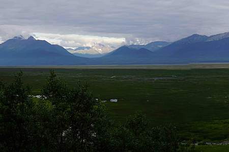
Visible outside the windows of the Mat-Su Convention and Visitors Bureau, this state wildlife refuge is the result of the 1964 earthquake. Literally overnight, the land dropped by 6 to 20 feet; hay fields and pastureland became salt flats and marshland. Once home to cows and grains, the land is now prime habitat for moose, birds, and fish. Some 20,000 acres are protected in the refuge, which is a popular recreation and wildlife-viewing…
...more
In the Talkeetna Mountains between the towns of Willow and Palmer, Hatcher Pass is a local favorite for recreation or a scenic drive. Hike in alpine tundra dotted with wildflowers and ptarmigan, ski fresh, deep powder, or visit Independence Mine Historical State Park.
This short, paved trail is an hour’s drive north of Anchorage in southern Wasilla. It leads out to a bluff on Palmer Hay Flats — a large stretch of wetlands with all kinds of wildlife. There, a viewing platform overlooks the flats and the Chugach Mountains beyond.
Difficulty: Moderate
Distance: 10 miles
Elevation Gain: 1300 feet
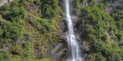
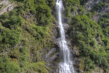
The 5‑mile-long Eska Falls Trail is located a 2‑hour drive north of Anchorage in the mountains above the town of Sutton. And it leads to one of nature’s symmetrically framed wonders — a 100-foot waterfall located at the end of a mile-long valley that’s flanked by two massive summits. This setting makes Eska Falls not so much a hike to a destination as much as a hike to a presentation.
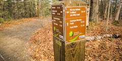
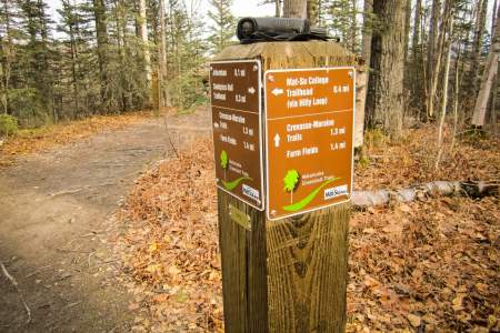
Two trails travel over the Mat-Su College lands; one from the college and one from Snodgrass Hall. The Mat-Su College trailhead leads to a hilly loop and opens to beautiful views of Lazy Mountain, Twin Peaks, Bodenburge Butte, and Knik Glacier — the best mountain views in the entire greenbelt system.
Located one-third of the way from Palmer to Wasilla, this 33-mile trail system meanders through boreal forest, farmland, and the rolling moraines left by the glaciers of the last Ice Age. The trails are some of the only non-mountain, non-motorized pathways in the area, and they’re popular with dog walkers, mountain bikers, geo-cachers, cross-country skiers, runners, and equestrians.
Summit Lake, located some 60 miles north of Anchorage at the crest of Hatcher Pass, offers a short, memorable lakeside ramble. Here you can explore the surrounding gullies and slopes or just sit and watch hang gliders drift out over the long Willow Creek Valley, which extends for miles from the west side of the pass.
Easily one of the most scenic drives in the Interior, the trip out to Table Top Mountain from Fairbanks winds deep into the center of White Mountains National Recreation Area, rising up hillsides and dipping down into valleys for a rolling picture show of spruce forest and snaking riverbeds. The hike to Table Top Mountain is just as spectacular, providing panoramic views of the White Mountains from the center of the range, and is a short “must
...more
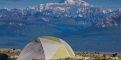
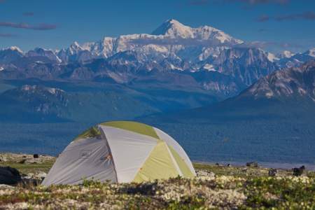
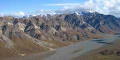
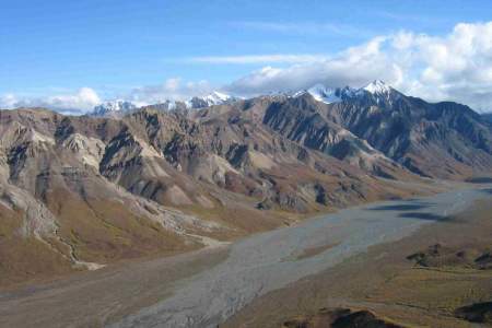
During periods of clear weather, this route through Denali State Park offers similar terrain and scenery to Denali National Park — including unparalleled views of Denali — without the cumbersome permitting process. This trail system offers many options for starting and ending points, as there are four trailheads along its length.
How to get ThereThe Plumley-Maud Trail can be accessed from the end of Maud Road, or from the corner on Plumley Road near Caudill Road. 1) Access from Maud Road: From Palmer go south east 31⁄2 miles on the Old Glenn Highway, take a left on Maud Road, follow Maud Road for 11⁄2 miles. There is a small turn around and limited parking before the creek directly east of the road. Please be careful not to block the entrance to the trail or the…
...more
Are you a mountain runner looking for a tough workout? Consider Pioneer Ridge Trail. This trail, located a 1‑hour drive north of Anchorage on scenic Knik River Road, climbs some 5,200 feet over its 6 miles. Other trails, like Lazy Mountain Trail and Mount Marathon Race Route, may be steeper or rockier, but no trail in the Chugach Mountains climbs so steadily for so long as Pioneer Ridge.
No official trail in Southcentral Alaska climbs as high as Matanuska Peak Trail. Beginning in a subdivision across the Matanuska River from Palmer, this nearly 6‑mile-long trail runs up some 5,700 vertical feet. Your destination is the 6,119-foot summit of Matanuska Peak, the very prominent rock spire that fills the sky just east of Palmer. But despite the imposing appearance of this mountain, the trail to its summit requires no extensive
...more
Once you reach the Mountain House at the 1,800-foot level of Mount Roberts, step onto trails that begin in a sub-alpine ecosystem and climb another 300 feet into the true alpine. With sixty stair steps, a length of one-half mile and an elevation gain of just 150ft, the main trail will take you to open vistas, mountain valleys, snow gullies, rocky ridges and stunning views of mountains in Glacier Bay, British Columbia, the Southeast Alaskan…
...more
Either drive your own car or take the free shuttle 15 miles out the park road to the Savage River check station. This is a popular hiking trail, and you won’t be alone, but at least you’re away from the entrance area and entering the true wilderness of Denali National Park. This is a tundra walk on a developed trail that follows the river. Good hike for kids, with possibility of seeing Dall sheep, marmots, and caribou. You can do a loop walk,
...more
This path was constructed to provide a place for hikers to view the plantlife around interior Alaska. This is a unique trail that allows hikers to view things that would be impossible to hike without a trail. There are all types of wildlife and small plants. Waterboots are recommended in spring.
Located in Mendenhall Wetlands State Game Refuge, this trail is wheelchair-accessible and close to the airport. It has many opportunities for waterfowl and bird watching. It is excellently maintained. This makes the trail a very easy hike. Many times you will see strollers, runners and bikers on this trail because it is paved.
Close to town on moderate terrain, this trail is a popular destination for locals and travelers and is used for everything from family walks to trail runs. The trail follows the turquoise blue Indian River up through the valley to a waterfall. This riverside terrain makes it a good place to look for birds and other wildlife like deer. In late summer, the river fills with salmon (though fishing is prohibited). The bears have their own trail on
...more
This 4.1‑mile trail starts through forest and muskeg meadows. You’ll cross a beautiful bridge over a creek that in mid-July and August is full of spawning chum salmon Then once you’re at the top take in views of Cordova, Nelson Bay, and Prince William Sound.
Connell Lake is a good choice if you want a trail that is less popular but just as close to town as the Perseverance trail. The rocky, dirt path gently climbs through the rainforest canopy and hugs the shoreline of the lake. On the other side is a nice flat area that the creek bows around, creating a small peninsula. A fire-pit indicates that this is a preferred spot to spend some time or camp.
Your best bet for this trail is to go out on one low tide, spend the night — in either a forest service cabin or campsite — and then return the following day or several days later on another low tide. Great forest-to-beach hiking trail.
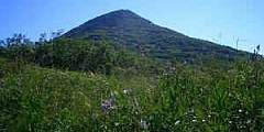
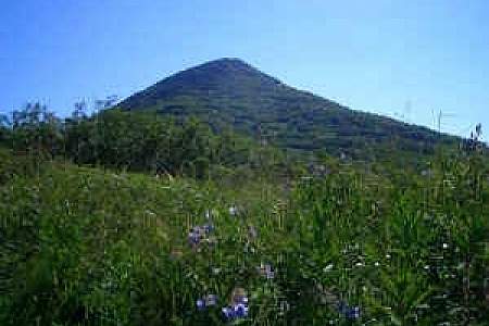
With a length of just 1.5 miles and a summit reaching only 874 feet, West Butte Trail on Bodenburg Butte — a 45-minute drive north of Anchorage — makes for a fine family outing. But even if you’re a more experienced hiker, don’t let the butte’s dwarf-like height dissuade you. This small bump in the center of a grand alluvial plain offers far-reaching views from its summit; plus, the climb includes a pulse-quickening 0.25 miles of stairs up the steep
...more
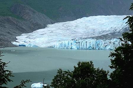
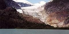
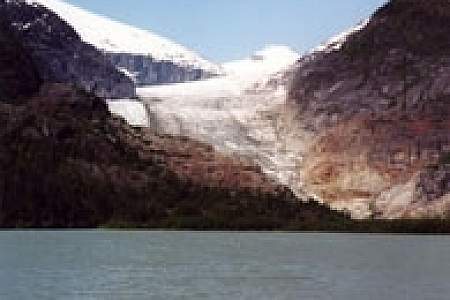
The lake and glacier are the premier destination for the thousands of cruise-ship tourists who visit Juneau, but they don’t venture much beyond the visitor center and the short trails just outside it, leaving the mountains above the center very quiet in comparison.
This is a wheelchair-accessible trail that follows the Mendenhall River greenbelt area, starting at Brotherhood Bridge off Glacier Hwy. The name is Tlingit for “going back clearwater trail.” Expect a lot of traffic. The trail is 2‑miles long, paved, and provides one of the great views of Mendenhall Glacier, beginning at the Brotherhood Bridge trailhead. In mid-summer, over a flat field of iris and fireweed, the Mendenhall rises between…
...more
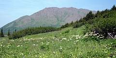
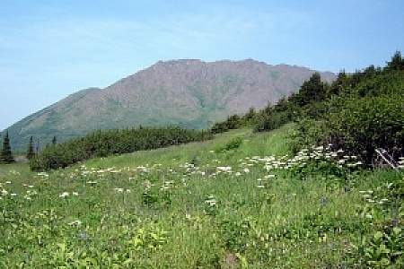
This is a beautiful hike in June and July, when the alpine wildflowers are at their peak. But it’s a beautiful hike anytime, because the views from up top — facing Mount Edgecumbe and overlooking Sitka Sound — are awesome. There are two ways up this mountain: a big climb or a big drive.
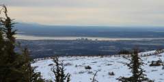
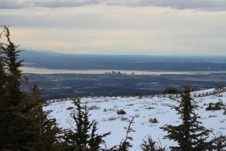
This trail has its own sitting area and viewing deck with views of Anchorage, the Alaska Range, and Cook Inlet. It is really good for seeing sunsets in the evening but it is also windy. The whole route is wheelchair accessible. This is a good short hike for the family to see the view over Anchorage, but not a good trail for the training runner.
This trail is less than a mile, and very kid friendly. Two viewing decks offer views looking down the impressive valley, and wildlife is often seen here. Beaver Pond is also part of the show, and salmon spawning can be seen in late August through September. This popular trail is usually packed with walkers, strollers, and the family dog — all easily accommodated. The trail is wheelchair accessible and begins on a wide, slightly downhill path to
...more
This is a popular, 4.3‑mile-long (8.6 round-trip) trail located 2 hours north of Anchorage in the Hatcher Pass area. It’s also gorgeous. At one point it climbs directly alongside a sheet of waterfalls falling from a wide granite ledge. As the trail winds its way to these falls, it passes the lake into which the falls drain. And after the falls, the trail ends at the tarn from which the falls drain. In other words, hike this trail and you’ll see a
...more
Why Take This Hike This trail, located 90 minutes north of Anchorage just across the Matanuska River from downtown Palmer, makes no pretense about its purpose. Almost immediately after leaving the parking area, it begins to climb straight up the steep west face of Lazy Mountain. For some 2,000 feet, there’s nary a switchback or respite as the trail winds up to the summit ridge. It’s a truly breathless workout. The Details Out of Palmer,…
...more
This popular trail attracts lots of folks, so don’t expect to be the only hiker. It’s still worth the trip. The trail begins at Mile 0.9 on the park road near the railroad tracks. You’ll walk on a developed trail down to the lake. After you reach the Overlook, the trail drops steeply. Along the way, especially at the overlook bench, you’ll have a panoramic view of the Nenana River, the development called “Glitter Gulch” right outside the park,
...more
As you approach the Independence Mine Parking Lot, the trail can be seen to the far right end. It crosses over a small bridge, and winds up past an old abandoned mining cabin, and then up a debris field and finally to the lake. Round trip, the hike is almost 2 miles, and the elevation gain is approximately 600 feet. The trail can be muddy and wet for the first .25 miles, but it’s worth the hike to see Gold Cord Lake, and a great view of the Mine
...more
This trail is a good day hike for the whole family. It alternates between open meadows and forests and offers the option of tent camping or staying in Crescent Lake Cabin. There are options for longer hikes and there is a lot of wildlife to be seen such as moose, goats and bears.
If you want a great workout — to stunning mountain views high above the valley floor below — but want to save your knees on the way down, this trail is for you. It leaves from the Alyeska Resort tram building and climbs steep switchbacks 2.2 miles and 2000 feet to the mid-mountain restaurant where you can catch a free aerial tram ride back down to the hotel.
The path to the Perseverance trailhead, Basin Road, showcases a dramatic change from urban to wilderness, leading from downtown Juneau to a spectacular canyon. At the end of it is where Perseverance Trail begins, and this former rail line (named for the mine it once serviced) quickly climbs up above the Gold Creek valley. There’s plenty to see along the way, including old mine shafts that blow cool winds, and a stretch of trail where the
...more
Beginning 103 miles south of Anchorage on the Seward Highway, the 3.5‑mile-long Ptarmigan Lake Trail makes for a fine family outing. The lake itself is a long and narrow body of water squeezed between ridges and mountains that tower as high as 6,000 feet. It even offers a small beach upon which to relax and enjoy the view while cooling your feet.
Difficulty: Moderate
Distance: 16 miles
Elevation Gain: 2900 feet
A straightforward trip with big scenery payoffs, like the picturesque Mint Hut and a valley dotted with hanging glaciers. This trip is a great first backpacking trip in Alaska with simple logistics. It’s 16 miles with options for additional miles and side trips.
Who can say no to a cool waterfall only a half-hour’s drive from town? One of the most popular “first hikes” for families with small children, the one-mile trail to Thunderbird Falls traverses a handsome birch forest along the Eklutna River canyon to reach a deck with views of a 200-foot waterfall. During winter, the falls can freeze, forming fabulous columns of blue ice.
You’ll have a hard time losing your way on this 2.5‑mile climb of 4,301-foot-high McHugh Peak. You’ll also have a hard time forgetting the view from the summit, which extends up the length of Turnagain Arm and across Knik Arm to the Alaska Range. It’s even more satisfying knowing that you found your way to the summit with only minimal help from the trail.
This trail, hands down, is one of the most popular hikes in the Kachemak Bay State Park. It is one of the easiest hikes in the park as the trail is well maintained, and you can’t beat the view of the glacier at the lake. For the first 1.5 miles, the trail meanders through mixed cottonwood and Sitka spruce. These cottonwoods are some of the largest in the park so take time to appreciate their enormous size. After 1.5 miles, the trail proceeds
...more
Probably the second most traveled trail in the park, this trail offers a great day hike for those spending time in the lagoon. You can start hiking the trail from the ranger station or the trailhead in Halibut Cove Lagoon. The trail traverses up numerous switchbacks to a place called First Lake. On a hot summer day, a soak in this lake can’t be beat.
This recreation area is just a mile and a half from town, but it feels like wilderness — with deep woods and several lakes, it’s a great place to hike, run, canoe, fish, or look for wildlife. In winter, cross-country ski, walk, or fat bike on the multi-use trails.
Kincaid Park offers the easiest way to get deep in the woods right in town. It’s a mecca for outdoor sports of all kinds in a wilderness-like setting on the site of a former Cold War missile base. This 1,500-acre park sprawls over an ancient and rugged moraine at the southwest tip of the Anchorage Bowl at the west end of Raspberry Road. From its panoramic views of Denali and the vast Cook Inlet to its intimate deep woods enclaves, the park is
...more
Difficulty: Difficult
Distance: 3 miles
Elevation Gain: 1500 feet
The drive out to the Dude Mountain trailhead is one of the most scenic drives that Ketchikan has to offer. The trail begins winding through lush rainforest. The last part is steep and can be muddy in wet weather or covered in snow in spring and fall.
Some 50 miles north of Anchorage, this 1.5‑mile trail makes for a fine family outing. From the picnic table at the uppermost end of the trail, you’ll find a satisfying panoramic view of the Matanuska River and Knik River valleys. It’s a view as good, or better, than that from many summits.
Every Fourth of July, racers scramble to the top and back in one of the state’s oldest traditions. But you don’t have to race to reach the top. Hikers can take a well-marked trail for a quieter, steadier climb. Whether you’re here for the race, the view, or just a good leg workout, Mount Marathon delivers.
Flattop is Alaska’s most visited peak. Ascend the 1.5 — mile, 1,350 vertical foot trail to the rocky, football field-sized summit in about an hour and take in panoramic views from Denali (Mt. McKinley) to the Aleutian Islands. If you want vistas without the hike, walk the short path from the parking lot to the overlook.
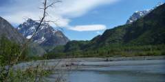
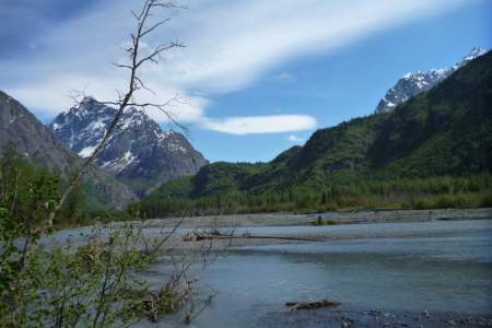
Where else can you walk to the end of Main Street and find yourself at the confluence of three wild rivers, overlooking a 20,000-foot peak? Close to downtown, this large, river-centered park offers wide open, untouched spaces, along with great panoramic view of the Alaska Range.
Beginning almost 120 miles northeast of Anchorage on the Glenn Highway, the trail to the summit of Gunsight Mountain takes a while to reach. After all, it involves a 3.5‑mile, 3,300-foot climb through some very big country. But the view from the top makes for an all-day excursion that you won’t easily forget.
If people suggest climbing Flattop, tell them you’d rather climb Rendezvous Peak. Flattop is arguably Alaska’s most popular (and therefore, most crowded) mountain; Rendezvous is far less crowded and offers better views from the summit. See them by hiking up 1,500 feet to the 4,050-foot summit.
This wildlife sweet spot is worth a visit. The Russian Lakes Trail begins off the access road to the Russian River Campground in Cooper Landing, at milepost 52 of the Sterling Highway. Get off-the-beaten path, hike two miles to the falls and enjoy the immediate reward of spectacular salmon viewing.
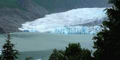
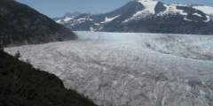
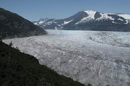
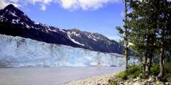
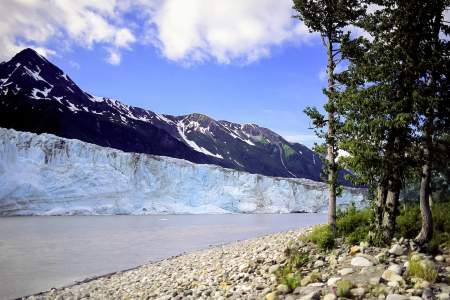
One of the most visited natural attractions along the Richardson Highway, this four-mile-long glacier descends almost to pavement and is easy to approach on foot. The state recreation site features parking, pit toilets, and a covered pavilion with a model of the glacier and interpretive signs, all close to small lake.
Winner Creek Trail in Girdwood (45 minutes south of Anchorage) is one of our favorite trails to take visiting friends and family. It’s an easy 3‑mile hike or bike ride on a wide, well-developed trail with a gentle elevation gain that winds through America’s northernmost rainforest, crosses a wooden bridge over a thundering blue-water gorge. 2022: Hand tram currently closed, may replace with bridge. Local weighing in.)
This 7‑mile hike, which begins in the mountains just above Anchorage, takes you to the numerous Williwaw Lakes, all of which are clustered below the sheer north face of Mount Williwaw — the highest peak in the Front Range.
The White Mountains National Recreation Area is home to 200+-miles of trail traversing a million acres of wilderness and a mountain range named for the dominant color of its limestone foundation. To get there, drive 28 miles on the Elliott Highway from Fox (where it splits with the Steese) and look for signs marking the trailhead. The trailhead is the starting point for both the Summit Trail, and the Ski Loop Trail, a 5‑mile loop and a nice
...more
The mostly-flat Ward Lake trail follows the circumference of the lake’s shore in a swath of gravel that is wide enough for two people to walk abreast. Ward Lake is tucked into the edge of the Tongass National Forest boundary. Its proximity to town makes the recreation area popular with the locals.
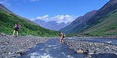
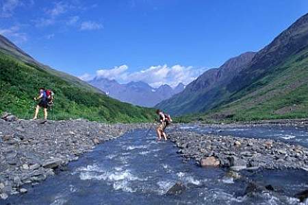
This meandering, single-track path leads to some of the Kenai Mountain’s most remote and fragile high country. On a route once trekked by gold rush prospectors, this trail ascends from spruce forest through the jungled zone of alders into a realm of sweeping tundra, with incredible views and productive berry picking. Plus, the top of the nine-mile journey ends in Resurrection Pass, about midway through the 39-mile Resurrection Pass Trail.
Difficulty: Moderate
Distance: 9 miles
Elevation Gain: 850 feet
Rarely do two lakes lie within a few feet of each other. Fortunately, the trail to see this geological rarity begins just a 30-minute drive north of Anchorage. From the trailhead for South Fork Eagle River Trail, it’s a gradual 4.8‑mile (one-way) climb up a wide valley, leading to a narrow isthmus between the green waters of Eagle Lake and the blue waters of Symphony Lake.
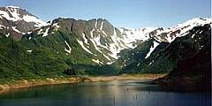
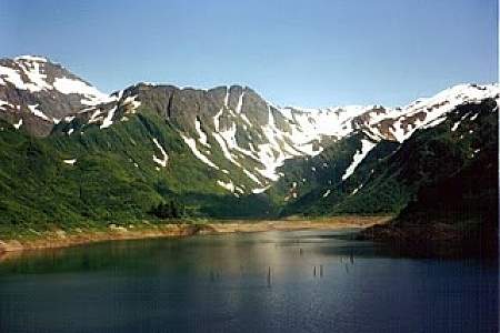
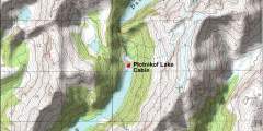
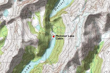
Popular with hikers and backpackers, this easy-to-follow trail connects the state’s most intense sockeye salmon sports fishery with stunning mountain backcountry. It offers many of the Kenai Peninsula’s highlights in one trip. The 21-mile route accesses Russian River Falls, Lower and Upper Russian Lakes, Cooper Lake, 3 federally managed recreational cabins, and numerous campsites
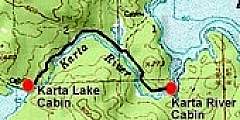
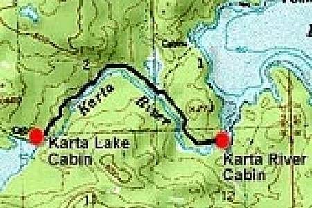
This 38 mile long USFS trail climbs Resurrection Pass (elev. 2,600) and descends to the north to another trailheadtrailhead near Hope on Turnagain Arm. There are 8 public use cabins along the trail, making this an advanced but comfortable day cabin-to-cabin hike. There are also 19 campsites available along the trail.
This 38 mile long USFS trail starts in Hope and climbs Resurrection Pass (elev. 2,600) towards the south before descending to the opposite trailhead near Cooper Landing. There are 8 public use cabins along the trail, making this an advanced but comfortable day cabin-to-cabin hike. There are also 19 campsites available for tent camping.
This 2‑mile-long, family-friendly trail, which begins 90 minutes south of Anchorage at the far end of the Whittier Tunnel, remains the only easy way to see Portage Glacier on foot. And it’s has a spectacular conclusion: After cresting Portage Pass, the trail drops through glacial scrub before popping out on the wide gravel shores of Portage Lake, directly across from the snout of gorgeous Portage Glacier.
Well used trail by locals as a short (1−2 hour) aerobic hike with nice views. Take Eagle River Loop to Skyline, and follow the road as it swichbacks going up and eventually ends with parking alongside the road.
This trail is also called the Primrose trail at the north end. It begins in a beautiful rainforest and eventually takes you up to a multiple of beautiful lakes in high meadows. Anglers can fish for rainbow trout in the lake.
The wildflowers are abundant and verdant undergrowth can be check high sometimes. Most of the trail lies below treeline, so there are established camp clearings along the way that are nestled into the trees. One of the best campsites is 10 miles in from the northern trailhead, set among trees on a spruce-covered knoll looking over the trail and Bench Lake.
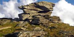
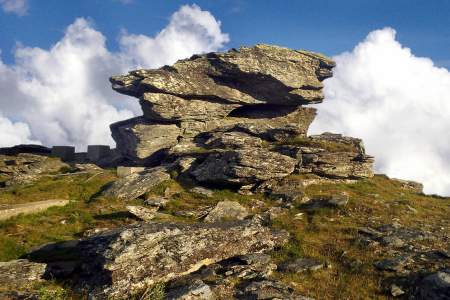
This 15-mile loop is well worth the moderate to strenuous hike. This trail provides views of tors, unusually shaped outcroppings that were formed 70 million to 90 million years ago when molten rock pushed upward and cooled before reaching the surface.
Well-maintained and suitable for summer hiking and biking, the 10-mile Devil’s Pass Trail features a steep route up a spectacular V‑shaped valley that intersects with the Resurrection Pass Trail and a rental cabin in the alpine realm. The country is rugged, with great access to cross-country tundra exploration and berry picking.
Difficulty: Difficult
Distance: 5 miles
Elevation Gain: 2600 feet
Deer Mountain is Ketchikan’s iconic backdrop. The path briefly threads between residential lots, then turns to a rocky trail that quickly ascends. On the way up there are multiple scenic overlooks.
Difficulty: Moderate
Distance: 21 miles
Elevation Gain: 3500 feet
Considered to be one of the best hikes in all of the Chugach Mountains, Crow Pass follows a portion of the original Iditarod Trail, including its highest point. End to end, it’s a 21-mile trail, which most people do in 2 days, but just the first 4 miles will lead you past some breathtaking scenery. Along the way you’ll find glaciers, waterfalls, wildflowers, wildlife, mine ruins, and berries (in late August and September). Hiking is not
...more
This short day hike — with an easily accessible trailhead a few hundred meters from the Begich Boggs Visitor Center — offers you big views of the Byron Glacier.
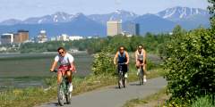
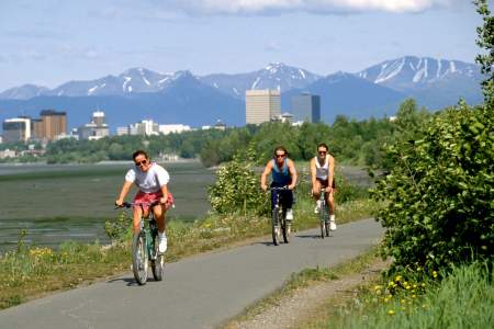
The Tony Knowles Coastal Trail is one of four greenbelt trails located in Anchorage. Even though the trail spans 11.0 miles each way (from Kincaid Park to just north of where 2nd Avenue ends in the Cook Inlet), it is easily picked up from several points in the city, so you can enjoy any segment and hike as little or much of the trail as you desire. In the winter, the trail is groomed for cross country skiing.
The Fishhook Trailhead parking lot is located at mile 16.5 of Hatcher Pass Road. This area is actively used year round. In the summer it’s a great area to hike and in late summer the slopes are abundant with blueberries. This trailhead also leads to Marmot Mountain, were paragliders launch from the top and land in the parking lot. In the winter, the area draws individuals to sled, ski and snowmachine. This trailhead intersects with The Hatcher
...more
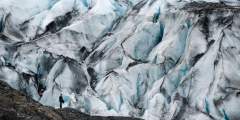
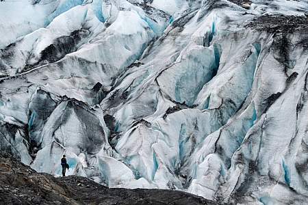
You can hike right up to Seward’s Exit Glacier and feel the dense blue ice while listening to it crackle. Walk the lower trail to get a good photo in front of the glacier face. Or, choose the more challenging 7‑mile round-trip Harding Icefield Trail. There is a short ranger-led walk daily at 11am and 3pm, from Memorial Day through Labor Day.
Forty minutes from downtown Anchorage lies Eagle River Nature Center, a gateway to Chugach State Park and a glacial river valley as wild and dramatic as any in Alaska. Enjoy an easy, 3‑mile nature walk on the Albert Loop or trek up-valley 5 miles to see plunging waterfalls and 3,000-foot cliffs. In winter, traverse the trails on cross-country skis or snowshoes.
This trail quickly gains elevation on its way to an alpine meadow framed by the dramatic Twin Peaks and Goat Rock, but climbs to magnificent views overlooking the entire valley. Dall Sheep are often spotted above the timberline. From here there is a spectacular view of the lake below. This is also a good place for berry picking in the fall. Because of the crushed rocks, the trail is hardly ever muddy.
Bridal Veil Falls and the Valdez Goat Trail: This two-mile-long hike is a restored section of the Trans-Alaska Military Pack-train Trail that was the first glacier-free route from Valdez to the interior of Alaska. There’s a fantastic overlook about a mile down the trail.
For decades just a wide spot in the road, this new, pocket park captures the most emblematic scene in Haines, the stately buildings of historic Fort Seward against the relief of the towering Chilkat Peaks.
This trip requires some logistics, including renting bikes and arranging for a lift to Canadian border, but it’s worth it. The wall of mountains to the west provides a staggering vista and you can see wildlife to boot.
Some would rather avoid it, but climbing to the top of Fort Seward puts cyclists in range of the town’s prettiest beaches – along Chilkat Inlet. You won’t regret the extra work required.
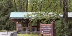
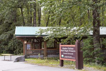
Built to take eagle photographers out of harm’s way along the Haines Highway, this 1.5- mile trail includes lookouts and interpretive panels about the adjacent Bald Eagle Council Grounds, where thousands of eagles gather each year. Warm upwellings of river water keep sections ice-free, providing birds with an important meal.
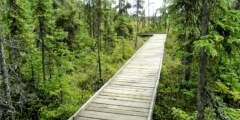
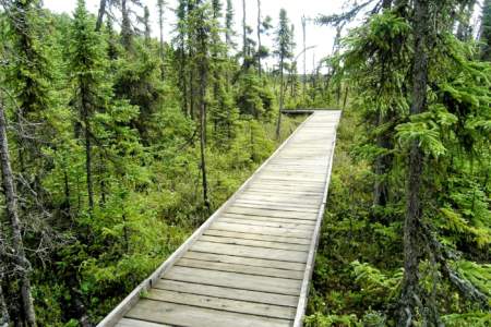
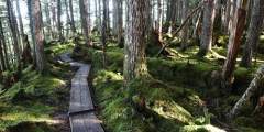
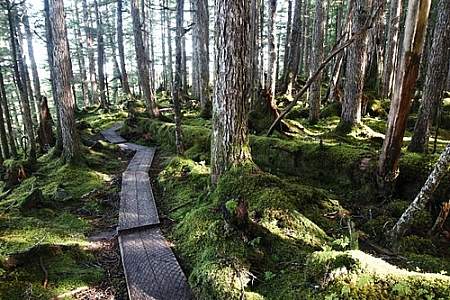
This trail through an urban forest offers a close view of a muskeg, a swampy wetland critical to the health of rainforest rivers and fisheries. It’s flat and easy, with long sections of boardwalk, plus park benches.
A site of historic sawmills and a now-closed road, nature has reclaimed this former industrial site, which has become one of the town’s most attractive and tucked-away trails. Managed by the Takshanuk Watershed Council, the trail is open to the public. The trail extends .3 miles from the parking lot and ends at the picnic shelter.
Paddle around a quiet lagoon with the impressive Shoup Glacier at one end and icebergs that have calved from the glacier, marvel at the lively black-legged Kittiwake Rookery, and take in the feeling of being somewhere remote — even if you’re only 5 miles from town.
Difficulty: Moderate
Distance: 5 miles
Elevation Gain: 2506 feet
Discover year-round recreation above Cordova on this gorgeous mountain. In winter, you can lose yourself among the puffy snowdrifts and powder-covered trees as you schuss down the slopes. And in the summer, you’ll find berry picking, hiking, and festivals.
Located at mile 19.5 of the Denali Highway — just shy of the Tangle Lakes area — this foot trail can be strenuous. After a wet initial quarter-mile, the short steep route climbs 1,500 feet over a mile or so up the mountain to the south, delivering stunning views of the Tangle Lakes, Amphitheater Mts., and Alaska Range. No vehicles on this trail!
Follow the footsteps of the Porcupine Caribou Herd and test your off-trail travel skills in some of Alaska’s best hiking terrain. If you plan to continue to Arctic Village via packraft, give yourself another 3 – 5 days. The East Fork of the Chandalar River is mostly Class I, II- but be aware of wood hazards and potential flooding after heavy rain.
Camp beneath the iconic Arrigetch Peaks — a great destination for backpackers and hardcore climbers alike. 22 miles minimum — 12 miles one-way from the float plane drop off to the Arrigetch Valley. Once in the valley, there are many options for day hikes or even climbs, if rock climbing is your objective.
Experience a landscape like no other — a desert-like moonscape ringed by glaciated volcanoes. Recommended for intermediate backpackers, this adventurous route beginning in Brooks Camp takes you across rivers, through bear territory, and through the windy Katmai Pass.
Find out why the Brooks Range is known to have the best off-trail hiking in Alaska. You can choose to trek the entire route from the village of Anaktuvuk Pass to the Dalton Highway or the abbreviated route by chartering a flight to Summit Lake and proceeding in either direction. This trip is exclusively off-trail hiking.
A Chugach classic with big glacier views, this trail is widely considered one of the best in Alaska! It begins outside of Girdwood and ends at the Eagle River Nature Center, with an option to packraft roughly 9 miles of Eagle River. Suitable for a novice backpacker and beginner packrafter (if you choose the packrafting route option).
An amazing look at the history of the Alaskan Gold Rush, with the added novelty of hiking from Alaska to Canada. This trip offers a variety of scenery and distinctly different ecosystems: river valley, coastal temperate rainforest, exposed alpine, and arid boreal forest. (CURRENTLYCLOSEDTOTHROUGH-HIKERS)
One of the best trips near Fairbanks features incredible views, excellent walking, and easy logistics. For much of the route you’ll follow rock cairns accompanied by mileage posts as you cruise through undulating alpine terrain. This is a suitable trip for a beginner backpacker who has a high level of fitness.
Hike 2 miles roundtrip from the Eielson Visitor Center to the Gorge Creek and Thorofare River Bars. Beyond the end of the trail, you can continue off-trail and reach backcountry camping units within the park.
From the trailhead at the Eielson Visitor Center, hike well-marked switchbacks to the top of Thorofare Ridge. At the top, you’ll enjoy views of Denali and wide-open tundra.
An easy, mile-long trail follows the outlet of Pats Lake down to its drainage in salt water. It’s located 11 miles south of downtown, at a spot where Zimovia Highway intersects several gravel roads.
Completing this all-day climb, a 10-mile round trip climbing nearly 5,000 feet, isn’t for beginners. But at the top, you’ll be on the ridge separating the Dyea and Skagway river valleys, with an awe-dropping, 360-degree view. Once above the treeline, some rock cairns mark the way, but the trail can be vague due to heavy brush and rocky terrain.
This moderate, 2‑mile loop trail near the Skagway River circles a boulder strewn outcropping. It also features sunny lookouts while meandering through a birch and pine forest and leading to a protected cove and picnic area.
Tucked on the mountainside overlooking the cruise ship docks, this moderate hike offers great views down Taiya Inlet and an idyllic camping spot. This 8‑mile round trip trail is unknown even to some locals. It leads through a mixed stand of trees and descends to a beachfront jutting south towards Haines on Lynn Canal.
If you’re in Skagway for a summer job or just a weekend fling, take your bike. Mostly flat terrain and a compact urban layout makes this town a fantastic spot to see on two wheels. There’s even a free bike-repair station out front of Skagway’s public library.
This park across from the Skagway River offers ballfields, horseshoe pitches, a BMX trail, and a disc golf course. Outdoor town events and concerts, including the annual solstice celebration, are held at the park’s stage/amphitheater.
A half-mile boardwalk connects Forest Road 8530 to Wukuklook Beach, at the confluence of Wukuklook Creek and Chatham Strait. The trail winds through a spruce forest and meadow before reaching scenic Wukuklook Beach and its panoramic view of Chatham Strait.
This unique, “E”-shaped trail system allows hikers to meander between three lakes and also connects to saltwater through a short connector to Frederick Sound. There are trout in the lakes and rowboats are provided for public use. Deer, beavers, bears and sometimes sandhill cranes can be spotted here.
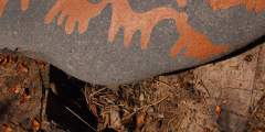
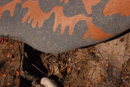
Located on Sandy Beach Loop Road and 1.6 miles from downtown. The park offers three enclosed picnic shelters that can be rented, restrooms and running water. This beachfront park and picnic area also offers vestiges of the Native civilization of the area, including remnants of an ancient fish trip and petroglyphs.
This 1.5‑mile, round-trip trail includes sights of sinkholes, deep pits, streams that disappear down holes, while providing natural history information about flora unique to the saturated topography that also gives rise to Southeast’s biggest trees: bog laurel and Labrador tea.
Choose this trip if you definitely want to visit Richard Proenneke’s cabin and you want a challenging hike. Of the main three Lake Clark backpacking trips, this trip offers the most challenging terrain and requires the most backcountry navigation skills.
Choose this trip if you want to commit to fewer miles and don’t mind a little bushwacking. The flights for this trip are typically the least expensive of the trips listed here; since it’s the closest to Port Alsworth it requires less flight time.
This 12-plus-mile backpacking route lets you see the park’s most iconic lakes: the alpine Turquoise Lake and the boreal Twin Lakes. Wildlife is common along this route, especially Dall sheep in the alpine valleys between the lakes.
Difficulty: Difficult
Distance: 3 miles
Elevation Gain: 1000 feet
This trail leaves from the Emerson Creek delta, on the north side of Upper Twin Lakes, just east of the stream that connects the Upper and Lower Twin Lakes. A good ending point is a large waterfall, 1.75 miles up the trail. You can stop at the bottom of the falls or climb a steep trail to the bluff above the falls. The trail continues into the alpine, but eventually disappears into the tundra.
Difficulty: Moderate
Distance: 5 miles
Elevation Gain: 1200 feet
This trail leaves from the primitive campground at Hope Creek. The trail follows the south side of Hope Creek ascending the creek’s valley for miles. This is a great valley for catching a glimpse of black or brown bears or Dall sheep.
This out-and-back trail leaves from the Historic Proenneke Cabin site and ascends to a prominent point ½‑mile behind the cabin to the north of Hope Creek. A uniquely balanced rock marks the end of this trail and makes a great spot to take in the view of Upper Twin Lake.
Climb the only maintained trail outside of Port Alsworth. Follow the trail for one mile to cross Portage Creek. Continue another two miles into the alpine tundra. From the end of the trail, you can explore for miles along an alpine ridge overlooking Lake Clark.
Difficulty: Difficult
Distance: 8 miles
Elevation Gain: 4700 feet
This is the most strenuous of the hiking options in Port Alsworth, but the views are worth the effort. From the summit of Tanalian Mountain, you’ll enjoy a 360-degree view of Lake Clark, Kontrashibuna Lake, and the Chigmit Mountains.
Difficulty: Moderate
Distance: 5 miles
Elevation Gain: 800 feet
Begin this hike on the Tanalian Falls trail; continue past the falls to the shores of Kontrashibuna Lake. This long, narrow lake is nestled between steep mountains on either shore. The official trail ends at the lake, but a brushed, unmaintained social trail continues along the lake’s north shore.
Difficulty: Moderate
Distance: 4 miles
Elevation Gain: 650 feet
This relatively level, moderately intense trail meanders through the forest, with intermittent views of Lake Clark to the North, Tanalian Mountain to the east, and Holey and Martha’s Mountains to the south. It ends at the impressively powerful Tanalian Falls. Make it a loop by returning via the Beaver Pond Loop.
Difficulty: Easy
Distance: 3 miles
Elevation Gain: 600 feet
This trail makes a loop around a small beaver pond and connects back via the Tanalian Falls trail. It’s especially beautiful in fall, fall, when golden birch trees explode in color. This is the gentlest of the available hikes in Port Alsworth.
Want to feel like you’ve stumbled into an old Indiana Jones movie? A rugged cliff-top trail reaches south from Chitina along the Copper River into the gorge of Wood Canyon — offering access to three creeks, the ruins of an old trestle, a historic train tunnel and, finally, a sandy beach suitable for camping.
Access to the Palmer-Moose Creek RR Trail is slightly tricky. Parking is available in the wayside. Cross the highway, then follow the creek side trail to the old railroad bed and trail.
The discovery of gold at Jacksina Creek in 1899 was an exciting find for prospector K.J. Fjeld, but it proved too remote to develop successfully. Other prospectors were persistent though, and in 1925 Carl Whitham found a rich lode on White Mountain. That find, and his subsequent development of the mine, led to the construction of Nabesna Road. At its height, between 40 and 70 men were employed at the mine. It also provided trading…
...more
Settlers Cove State Recreation Site, at Mile 18 of North Tongass Highway near Ketchikan, offers 13 wooded campsites along Clover Passage. Surrounded by spruce and hemlock, it features two sandy beaches, vault toilets, picnic shelters, and a trail to a waterfall. Campers can swim, paddle, beachcomb, or take in coastal views, with Ketchikan’s attractions just a short drive away.
This is a privately maintained trail, located at Mile 187 on the Glenn Highway. In Glennallen, turn north on Co-op Drive, trailhead and parking area are marked with a sign that says “Aspen Interpretive Trail.” Trail is rated “easy,” allow about 1 hour for 1 mile round-trip. The beginning of this trail has been re-routed. At the trailhead, look for signs to the right, indicating the new route. The trail passes through three distinct ecosystems
...more
Many visitors pass through Tok on the long drive along the Alaskan Highway. What sounds better than stretching your legs after a long drive? Tok has a maintained bike and walking path system leaving from the center of town.
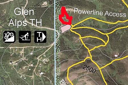
Not everyone should undertake this 13-mile traverse that begins at Glen Alps above Anchorage. Considerable off-trail hiking, plus a steep climb to a ridge top, might be outside your comfort zone. But this trail does offer a profound sense of solitude and some spectacular views. It also includes the novelty of hiking a mile-long sheep trail that traverses the back of The Wedge, some 500 feet above the secluded waters of Ship Lake.
If you only have a limited amount of time in Anchorage but want go out for a great hike, consider Kincaid Bluff Trail. Just a 20-minute drive from downtown Anchorage, this is a 6‑mile loop hike to Kincaid Chalet. Along the way, you’ll find 3 miles of rugged trail that skirt the summit of precipitous bluffs at the end of the Anchorage Peninsula.
Reaching the summit of Avalanche Mountain takes a considerable amount of effort: a 5.5‑mile hike up Powerline Trail followed by a 1.5‑mile off-trail scramble. But this 3,200-foot climb — which begins at the Glen Alps parking area, just 10 miles from downtown Anchorage — takes no mountaineering skills. If you feel at all comfortable hiking and climbing over some loose stones and boulders, you should find this to be a very gratifying adventure.
...more
Difficulty: Difficult
Distance: 2 miles
Elevation Gain: 2100 feet
It’s not as difficult as you might think to hike to stand atop the precipitous, gully-scarred face of Bear Point. But it’s not easy, either. The 2‑mile hike ascends 2,100 feet and can be tricky. But your reward is an amazing view in all directions, from the Kenai Peninsula to Denali and the Chugach Mountains to Matanuska Peak.
If you’d like to explore a snow-bound trail system through a majestic rain forest that gets little visitation in winter, try out Bird Valley in Chugach State Park south of Anchorage off the Seward Highway. You and the family can stroll, ski, snowshoe or snow-bike for hours through a serene and almost surreal setting of towering trees with an occasional stupendous view of Penguin Peak and Bird Ridge.
A great “a‑to‑b” style backpacking route that allows backpackers to move through a large portion of the Brooks Range. After a culturally interesting start in the village of Anaktuvuk Pass, travelers are treated vast, trail-less wilderness, stunning views of snowcapped peaks and a high likelihood of close encounters with Alaskan wildlife.
You’ll get stunning views of Knik Glacier, the Knik River, and the Chugach mountain range. Watch for eagles, either conversing on the sand bars or soaring overhead.
This riverbed trail follows the Knik River towards the Knik River Glacier, with Pioneer Peak looming above. Hike this trail and you’ll understand why Pioneer Peak is called “The Watcher.” Head east towards the Chugach Mountains, meanwhile, and you’ll get a glimpse of the Knik Glacier, glittering 20 miles in the distance.
This bike ride takes you along a pretty flat and mellow single track, and through the heart of Girdwood. Running along Glacier Creek, the trail connects the new and old town sites. This is a great ride for anyone new to mountain biking, but it’s also an efficient way to get from one end of town to the other.
Take this trail from the Gird-Bird Trail or from the Crow Creek entrance: You’ll enter at California Creek Trailhead and take a left at the marking onto Beaver Pond Trail. The trail then runs approximately 2.5 miles along the base of Penguin Ridge. Although the trail can be a bit overgrown, crews have improved it immensely in recent years, and it’s now more accessible, all season. Hike or bike.
The trail down to Cathedral Falls isn’t very long, but involves a steep 100-foot descent (and ascent when it’s time to go back!). Down at the creek, you can explore behind the falls, fish for trout and salmon, or watch black bear, which are likely to be fishing as well.
Big John Bay trail is the furthest hike out from Kake, in a remote area right on tidal and saltwater flats. After a drive of 16 miles and a hike of about 2.1 miles, you’ll come to Big John Bay cabin, which can be reserved for the night through the U.S. Forest Service. Getting there requires strict attention to tide tables, as the 15-foot variation in tide restricts trail and cabin access.
...more
The trail along Hamilton Creek is busiest around 5 in the morning, as savvy anglers know that’s when the fish are biting! The trail is about 2 miles round-trip, but you can follow the creek for miles, fishing and picnicking along the way. You will be sharing the experience with bears, so secure your snacks, and any fish you catch.
Of all the accessible hiking trails near Kake, the Portage Bay Trail is the closest to town (just over a mile south). It’s a short, one-mile stroll along the beach, where you might see eagles, black bear, salmon and trout.
Goose Lake Trail is a 1.5 mile round-trip, flat and easy hike that ends at Goose Lake, where you’ll find a picnic area and rowboat handy for further exploration or some trout fishing.
More than 120 miles of logging roads wind through Kupreanof Island, offering access to trailheads and other remote parts of the island. You can drive on the frequently used roads, and explore others by bike or by foot.
The Cross Admiralty Canoe Route, a 32-mile water trail between Angoon and Seymour Canal, links seven mountain lakes, trails and portages that allow for kayak and canoe travel across the island. It’s an amazing adventure for experienced independent travelers, especially with Forest Service cabins providing shelter along the way.
Danger Point Trail leads from Angoon through a densely-treed area north of town, toward Danger Point, a perfect spot for summer whale watching. The game trail can be rough, but at just 2.5 miles round-trip, it’s a fairly easy hike through old-growth forest that ends with a spectacular view of Chatham Strait and nearby islands.
Angoon’s Cemetery Trail is aptly named. It’s a well-traveled local trail through the cemetery that links up with Danger Point Trail for a short tour of the wooded isthmus just north of the village of Angoon.
Yakobi Island’s Bohemia Basin, just 7 miles northwest of Pelican, offers shelter, and a 4‑mile trek through old-growth forest, past lakes, and an historic mining area. Plan to hike and camp out to fully enjoy this rugged and remote part of the world.
A short but strenuous hike up Pelican’s mountainside provides great views of Lisianski Inlet. Climb 300 feet in half a mile and you’ll have your workout in for the day. Take a friend and watch for brown bear!
Explore Yakobi Island’s lush rainforest on the 8‑mile round-trip Takanis Lake Trail (also known as Bohemia Trail). It begins at the mouth of Bohemia Creek and wanders through old-growth forest, past two lakes, and an historic nickel mine from the 1920s and 30s.
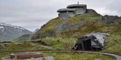
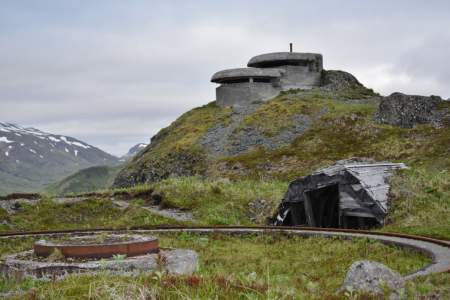
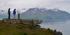
A short boat ride to George Island brings chances to see whales and marine life along the way, followed by invertebrates at low tide and a lovely walk through a beautiful temperate rainforest to an historic site that still has gun emplacements left over from World War II.
Take the hike up Anvil Mountain for incredible views of the city of Nome and the Bering Sea beyond. Running up and down the mountain can be done in 22 minutes, as proven by the local cross-country team. You’ll probably want to take it a little slower, to enjoy the tundra flowers, wildlife and view from the top.
Difficulty: Moderate
Distance: 4 miles
Elevation Gain: 700 feet
Spend a magical afternoon hiking to Dorothy Falls, which provides just enough variety to feel like a real Alaskan adventurer: a river crossing, ascent to a ridgeline, steep descent to the falls and a walk along Dorothy Creek!
Difficulty: Moderate
Distance: 2 miles
Elevation Gain: 1099 feet
In the 1940s, soldiers stationed in Nome enjoyed a rope tow up Newton Peak for skiing and ski-jumping. The tow line is gone, but this is still a winter hot spot for skiing and snowboarding, and is great for a summertime hike.
King Mountain is just a little northeast of Nome, providing easy access for day hike up the peak for incredible views of the Kigluaik Mountains or the Bering Sea.
Each October and November, between 3,000 and 4,000 bald eagles descend upon this 48,000-acre preserve centered on river bottomlands a few miles north of Haines to feast on late runs of salmon. Eagles can be found throughout the preserve, however, with an estimated 300 to 400 of the birds in the area throughout the year.
Just south of the Chilkat Island is Sullivan Island, and at its southern end, you’ll find Sullivan Island State Marine Park. It has the same accessibility issues as the Chilkat Islands; the easiest way to see these islands is to look for them as you cruise via ferry or cruise ship down the Lynn Canal between Haines and Juneau.
This is a rarely visited group of islands south of Chilkat State Park. Unpredictable winds, huge tides, and strong currents make them a challenging destination to visit. Combined with the lack of any public transportation, these islands remain a near-pristine wilderness left for the serious boater to explore.
At the Government Peak Recreation area you will find an extensive trail system for nordic skiing, walking, hiking, fat tire biking, and mountain biking. The newest addition is a Chalet that is available to warm winter visitors. It’s also available for rent.
Anvil Rock perches above Nome, an early landmark for gold miners and an easy hike for those who want to take in spectacular views of Nome, the Bering Sea, and the Kigluaik Mountains. Its resemblance to a blacksmith’s anvil generated names for many nearby landscape features, including Anvil Mountain and Anvil Creek. The hike also promises a good chance to see musk oxen, birds, and maybe even reindeer or red fox.
...more
Take in many dimensions of Unalaska in just an hour on a 2‑mile hike around a spot called “Little South America.” Watch boats in the harbor, look for whales, spot birds (including puffins nesting in the cliffs), walk the beaches, search tidepools, and talk with locals who are also hiking or enjoying a beach party.
The Agamgik Bay trek is a bit longer than the others, has some difficult spots not easy for the very young or the very old, and offers access to an even longer hike over to English Bay, where Captain Cook arrived in 1778. As a longer, more difficult trail, it is also less frequented, a bonus for those who yearn for a more solitary journey.
Beaver Inlet, on the other side of Unalaska Island, was an historic portage for the native Unangan people who lived in the village of Biorka just across on Sedanka Island. You can only get there by boat or by foot, but the pristine views away from the more populated areas of Unalaska are worth the effort. One popular and accessible route is the Peace of Mind Trail, a three-mile round-trip trek that showcases a range of topography and winds
...more
For thousands of years, being able to survive in the Aleutians has depended on the ability to use what the land and sea provide. The rugged, remote and stunning landscape continues to inspire – and challenge – locals and visitors alike. Understanding this primal connection with the land is best done by exploring on foot. Hiking the Ugadaga Trail – reportedly in use for more than 9,000 years – allows the imagination to wander, and wonder, about
...more
The 2,300-foot Pyramid Peak is surrounded by Pyramid Valley, Captains Bay and miles of popular hiking trails, including a circuit around the peak. This location is for the birder who wants to get out of the city and industrial areas of town to listen for birdsong while sitting among the wildflowers or berries of the Aleutian tundra.
A hike to the windy, northernmost point of Amaknak Island provides a good uphill workout, a peek into World War II history, and a breathtaking panoramic vista of the Bering Sea and the islands around you.
Jutting half a mile into the center of Unalaska Bay, the Dutch Harbor Spit offers a short, sea-level hike for all ages, with beach access, wildlife viewing and birding. The trail follows an old roadbed, which makes for an ideal hiking surface. You’ll want to stop frequently with a ready camera for close-up views of marine mammals on either side of the spit.
Difficulty: Moderate
Distance: 2 miles
Elevation Gain: 1634 feet
Mt. Ballyhoo is a lure for hikers wanting a moderate climb and an outstanding vista. Both the airport and city dock are located right at its base, so the south face of Ballyhoo is the first thing you’ll notice when you get here. Its 1,634-foot-peak is the highest point on Amaknak Island, with a panoramic view that helps orient you to Unalaska/Dutch Harbor geography.
The mild stroll around Strawberry Hill offers great views, wildlife and some historic flavor. Old military roads cover the area, providing easy walking. Adventurers can bushwhack or scramble short distances for better views of the surrounding area or get up close to WWII-era trenches and the remains of old bunkers.
If your travel group includes a WWII enthusiast, a wildlife devotee, a birder, and a kid who enjoys rolling around on the tundra, Bunker Hill is the perfect spot. Plus, it has the best photo ops, with a 360-degree view of the entire area: Captains Bay, Amaknak Island, Unalaska Bay and Iliuliuk Harbor.
A drive or walk up Mt. Ballyhoo is interesting for both birders and those interested in World War II history. It’s such as good view that you might even catch sight of whales in the distance. The view from the 1,634-foot mountain gives you an idea of how birds might see the area (that is, if you can imagine the view with a lot more color and super-sharp clarity)
The Ship Creek Trail itself begins at the Alaska Railroad depot on the north side of Anchorage and travels east from downtown for 2.6 miles to end at Tyson Elementary School in the city’s Mountain View neighborhood. The paved trail follows its namesake creek for nearly its entire length, crossing it a few times.
There are parks, playgrounds, and opportunities for salmon viewing along the way. You may also see locals fishing or taking a float down Campbell Creek when the water is high enough.
This steep hike is a bit of a challenge, but it pays off. The trail winds through a spruce and hemlock forest into the sub-alpine and alpine zones, with breathtaking panoramic views of Resurrection Bay and Seward. Be sure to bring a camera and plenty of water!
The trail begins at mile 12.1 of the Seward Highway. Watch closely for the sign and pull into the off-highway parking area. The trail begins as the Iditarod Trail, and many improvements have been made to this section. The Troop Lake Trail branches off of this famous trail approximately 1 mile from the start, reaching the lake about a half mile later.
The Ray Clapp Trail is a nice short hike in Homer. It is located approximately 1 mile out East End Road in the Stream Hill Park Subdivision. You can park your car or bicycle at the trail head which is marked with a little footbridge. It winds through the edge of an estate and is filled with lovely meadows of wildflowers along with beautiful birch and cottonwood trees.
Beautiful ponds, waterfalls, and mountain scenery make this a worthwhile hike. Many birds, Arctic Ground Squirrels and even a few ducks can be sighted enroute. The trail ends at Lane Hut at the end of the Valley. Extra exploring opportunities are everywhere!
The 40-acre Karen Hornaday Park is the new favorite spot for families in Homer. BBQ grills and picnic facilities are available for summer gatherings, as well as public restrooms. For those looking to relax, benches offer views of Kachemak Bay and surrounding mountains and glaciers.
Set along the Coastal Trail at the very end of 5th Avenue in Anchorage, Elderberry boasts 1.5 acres of scenic parkland with great views of Cook Inlet. Because it’s close to downtown, you can make this a rest stop while touring and shopping downtown. Come with a picnic, or just a walk while enjoying the view.
Trails were established by prospectors traveling through the Turnagain Pass area. The Ingram Creek trail followed the creek from Turnagain Arm up to Turnagain Pass. After the pass, the trail followed Granite Creek to Sixmile Creek, which then led prospectors to Sunrise and Hope.
Palmer Creek and the road that follows it were named after George Palmer, who in 1894 first discovered gold on its banks. The creek was the site of early placer mining and later lode mining. Evidence of the historic Lucky Strike and Hirshey mines, as well as the Swetmann camp, can be found along trails that lead to Palmer Lakes. Several hiking trails are accessible from the Palmer Creek Road.
One of the ways in which the University of Alaska Fairbanks (UAF) distinguishes itself is through an institution-wide affinity for the outdoors (their newest slogan is “Naturally Inspiring”). And much to the delight of students and residents, UAF maintains an in-town trail network for skiing, hiking, snowshoeing, biking, and running that is directly accessible from campus (also very popular with dog walkers).
Murphy Dome is a recreational site most popular with ATV riders and hikers. It lies about twenty miles outside of the Fairbanks, most of which are traveled on Murphy Dome Road off of Sheep Creek Road which can be accessed from the UAF campus. This Dome is also a popular place to watch sunsets in the summer and fall, or to observe the northern lights in winter.
Grapefruit Rocks is on the short list of favorite spots for local rock climbers, who make frequent weekend trips to these limestone formations and boulders standing 50 miles north of Fairbanks. Grapefruit Rocks is both “off the beaten path” and yet still accessible by road, and offers some of the best rock climbing in the Interior. It makes for a great day hike to watch climbers attempt runs on a variety of limestone facades. Feeling bold?
...more
This is the site of the original airfield in Fairbanks, from which the first airplane to leave the ground in Alaska took flight in 1913. Today, residents often use the grassy open areas to fly kites, exercise their dogs, or have a picnic. School children walk between the library and elementary school that border the park to the east and west. Wildlife sightings are always a possibility, particularly for birds and moose.
The trail is considered between easy and moderate in difficulty. The Otter-bahn is a dirt trail that winds through old-growth spruce forest and has exposed roots and rocks throughout its length. There are just a few moderate inclines, but otherwise is a fairly flat trail. Local school children built the trail some twenty years ago.
Hiking up Mt. Alyeska is a challenge, but the reward is great views of Turnagain Arm, the seven “hanging” glaciers of Girdwood Valley, and peaks stretching deep into the Chugach Mountain range. Below you’ll find our recommended routes to the top; all leave from the Alyeska Hotel (where you’ll find trail maps). While any summer day is good for this hike, try to time your visit around one of the area’s events — you’ll have something extra to…
...more
This is one of Alaska’s few flat state parks. And because it’s studded with lakes, it’s a great place to take a summer canoe trip or winter cross-country or snowmobile expeditions. The state has created several different loops — complete with portage routes and cabins — that make for easy, multi-day adventures. Another unique feature of this park is its mostly deciduous forest. In the last century, fires burned the big spruce trees; in their…
...more
This side trail leads to the edge of the AJ Glory Hole, a massive chasm with 800 foott deep walls. The mine produced millions of dollars in gold during its operational life. The hole was created in a process where miners would blast under a mound of earth and have it collapse. This allowed for easy mining of the ore and then the hole could be blasted a layer deeper. The hole is roughly 1⁄2 mile long and 1⁄3 mile wide and has vertical walls.…
...more
Located at the northwest corner of Westchester Lagoon, and next to the Coastal Trail and Westchester Bike Path, the playground’s groupings of equipment create a brilliant play environment that is fun and challenging.
This is an extension from Lower Angel Creek Cabin and serves as the summer access route to reach Upper Angel Creek Cabin because the winter route is too wet to hike until the trail freezes.
A winter use trail that accesses two cabins; Angel Creek Lower Cabin and Angel Creek Upper Cabin. It’s possible to hike in during the summer, but the ground is usually very wet, so it’s advisable to take the new summer trail to the upper cabin. It leaves from near the lower cabin and traverses the hillsides for several miles before descending to the upper cabin.
This public use area roughly 2,000 acres is sandwiched between Sheep Creek, Goldstream and Ballaine roads. The area is criss-crossed with dog mushing, skiing, skijoring and snowmachine trails. This is also is a popular blueberry-picking spot.
The Iditarod National Historic Trail is Alaska’s sole National Historic Trail. This network of 2,300-mile winter trails evolved to connect Alaskan Native villages, established the dog-team mail and supply route during Alaska’s Gold Rush, and now serves as a vital recreation and travel link.
The Raven’s Way Loop is accessed from the Sterling Highway. You will see the Trailhead and large parking lot. The trail meanders through open spruce and muskeg terrain and there it is a great chance to see lots of eagles and ravens.
This trail is a connector between Pioneer Ave and the Homer Bypass. It winds through the woods in town and a spur trail leads to the Homer Public Library.
This is an easy two-mile trail through meadows and forests that’s great for hiking in the summer and skiing during the winter. In summer, the highlight is fields of wildflowers, especially from June through August: Lupine, Wild Geranium, False Hellebore, Monk’s Hood, Chocolate Lily, Fireweed, and much more.
The trailhead is located 3⁄4 miles east of the Skyline Drive intersection. The trail follows Crossman Ridge Rd before going down to cross bridge creek. From here it climbs up to Diamond Ridge Road where there’s another trailhead. You can also access the Homested Trail from the Rogers Loop Rd Trailhead.
This trail offers a rugged climb to the top of Bert Mountain. It ends at a helicopter pad constructed by forest firefighters for use in area fire suppression.
Begin hiking at Lost Lake campground and follow the right side of Lost Lake. Continue 1.3 miles along the spruce bog until you reach Moose Pond where you can watch for waterfowl, moose, beavers, and other wildlife.
This trail starts at Quartz Lake campground and skirts the western edge of the lake for .5 miles before climbimg the hill to Glatfelder Cabin. It continues around the front of the cabin, crests the hill, then enters the Lost Lake Trail and follows this back to the the Quartz Lake campground.
Seward Waterfront Park extends from the small boat harbor to the SeaLife Center and contains paid tent and RV camping, playgrounds, a skate park, picnicing areas, beach access, and a trail lined with historical landmarks.
The idea of this downtown plaza stemmed from a celebration of the silver anniversary of Alaska’s statehood in 1984. Through the work of Festival Fairbanks, Inc. ’84 Director, William R. Wood, the Fairbanks City Council supported the creation of the Golden Heart Plaza. Construction was completed in 1987 and funded by donations from Fairbanks citizens, families, businesses, and associations.
The Beach Trail departs from Glacier Bay Lodge in Gustavus and follows the shore for one mile, traversing beach meadows and forest habitats, home to porcupines, bears and moose.
Blueberries and cranberries can be found along the bike path around the lake. Try for raspberries along the river near the boat launch. The best time to pick is August 1 — Sept 15.
The trail is half a mile long and takes you through a mature birch forest that is carpeted with devil’s club and watermelon berry plants. It’s an easy walking, ideal for small children, and ends at a small camping area on a slight bluff that overlooks Bishop’s Beach and Bishop Creek.
This trail provides spring, summer and autumn waterway access to remote Refuge wetlands as well as the upper reaches of Knik Arm. Recreational opportunities include fishing during the summer and waterfowl hunting access each autumn. When winter conditions are right, ice-biking is popular as well.
At its peak, the Independence hard-rock gold mine was home to 206 workers and 16 families who lived high above tree line. Digging and blasting, these workers recovered 140,000 ounces of gold before the mine shut down in the wake of World War II. There are 1.5 miles of paved walkways throughout the site, with informational placards for a self-guided tour.
This is a mellow, 1.1‑mile-long, family-friendly loop trail, easily accessible from the Glenn Highway. The highlight is the built-up viewing deck, where visitors can get a breathtaking view of the Knik Arm, the surrounding mountain ranges, and the Palmer Hay Flats. Bring binoculars.
Part of the Palmer Hay Flats State Game Refuge, this trail meanders through tidal flats and wetlands. Highlights are great views of the mountains surrounding Palmer (Pioneer Peak, the Chugach and Talkeetna ranges) and excellent bird watching.
Two trails travel over the Mat-Su College lands; one from the college and one from Snodgrass Hall. The Mat-Su College trailhead leads to a hilly loop and opens to beautiful views of Lazy Mountain, Twin Peaks, Bodenburge Butte, and Knik Glacier — the best mountain views in the entire greenbelt system. There are signs indicating what you see in the distance, as well as benches in a few areas. (Be prepared for construction as the college grows…
...more
The hiking here is mostly flat with a few forested hills, and there are nice views from the fields overlooking Matanuska Lake. For beginner hikers and bikers, this is the best place in the greenbelt for easy walks.
Very few hikers use this trailhead (most opt for the Matanuska Lakes Trailhead), but it’s a good walk. It’s also very popular for anglers. Be prepared for a rutted gravel access road, which may not be plowed in winter.
This trailhead is just 100 yards from Matanuska Lake (the area’s most popular lake), and is wheelchair-accessible down to the lake and the fishing docks — it’s a great walk in the woods, past prime waterfowl habitat.
Summit Trail follows a ridge all the way from Elliot Highway to Beaver Creek. There is a shelter cabin 8 miles from the trail head that is available to hikers on a first-come, first-served basis.
This is a 16 mile trail that is popular with both hikers and 4‑wheelers. The trail crosses through spruce-forested valleys, alpine tundra, and cold mountain streams.
This is a moderately difficult 5 mile long trail that begins and ends at the Wickersham Dome Trailhead at Mile 28 Elliot Highway. This trail offers beautiful views of the Alaska Range and Denali (Mt. McKinley).
There is a 25-foot wide, 17b Easement that provides foot access to the Gulkana River through privately owned Native lands. The beginning is steep and can be slippery during wet conditions. Parking is available at the trailhead.
At mile 14.5 McCarthy Road, turn left on the access road and follow it 2.5 miles to Nugget Creek and Dixie Pass trailheads. These remote trails offer visitors the chance to explore the wilderness and embark on an adventure they will never forget!Ask a park ranger for more information and trail descriptions.
The rock cut you’re about to drive through was blasted out in 1909 as a railway to supply and support the Kennecott Copper Mines when they were being built. The railroad began in Cordova and followed the Copper River to current day Chitina before turning through the rock cut and heading east towards the Wrangell Mountains.
These popular trails lead to two beautiful, pristine lakes. Even better, they’re both easy hikes, which makes them perfect for people of all ages. Bring a fishing pole and angle for stocked trout in Meridian Lake or grayling in Grayling Lake.
Access: Trailhead is located at the end of the maintained portion of the Nabesna Road, Mile 42. As you near the end of the maintained portion of the Nabesna Road, you will reach private property owned by the Ellis family, who operate Devil’s Mountain Lodge, established here in the 1950s. Please respect their privacy and take care not to park on their property or private air strip. Continue driving on the road through the Ellis property.…
...more
The trail begins at the Skookum Volcano trailhead (Mile 36.8 Nabesna Road) and follows until the pass (see SkookumVolcano trail descriptionfor more information). From the pass on, there is no trail, and one must pick one of two routes.
Easily accessible from downtown Palmer, the trail follows a sometimes narrow path along bluffs above the glacially fed Matanuska River. Traveling from the Palmer side, views of the Chugach Mountains peek through birch and cottonwood forest.
A winter trail system consisting of two north-south trails and one east-west route that allow snowmachiners, dog mushers and skiers to travel the area lying north of Petersville Road and west of the Parks Highway. The combined mileage of the trails is over 50 miles.
The Talkeetna Mail Trail and Central Trail are year round, multi-use trails that run north south between Willow Creek and the Kashwitna River. The trails were originally used for hauling mail, but recent logging has opened new access and short dead-end trails leading both east and west. Some of the trail crosses wet areas that are sensitive to heavy use. Plans are underway to harden or relocate portions of the trail to better accommodate year…
...more
How to get ThereAccess to the Lake Lucille Park Trail System is located at the north end of Endeavor Road in Wasilla. From Wasilla — go south on the Knik-Goose Bay Road, 2 miles from Wasilla take a right on Endeavor Street and follow it for 1⁄2 mile to the park entrance and parking areas.General DescriptionLake Lucille Park has approximately 1.6 miles (2.5 kilometers) of trails built around the perimeter of the park and connecting the athletic…
...more
Flathorn Lake Trail is approximately 21 miles long and traverses the vast wetlands of the Susitna Flats Game Refuge and rolling hills of the Fish Creek watershed. The trail allows snowmachiners, dog mushers and skiers to travel from the Point MacKenzie area to the ‘Susitna Station’ on the Susitna River. The trail crosses the Little Susitna River, through a maze of frozen swamps and ponds, along Fish Creek, across Flathorn Lake before heading…
...more
Crooked Lake Trail connects the Big Lake area with trails to the west and north. The trail heads west from Papoose Twins Lake Road and connects with the Iron Dog Trail, which then continues on to the Susitna River. The trail is approximately 10 miles long from Papoose Twins Lake Road to the Iron Dog Trail. The trails traverse large swamps and ridges of mixed forest. Crthwest for about 5 miles then turning southwest for 7 ½ miles where it…
...more
A winter trail system consisting of a series of loops that allow dog mushers (and other nonmotorized trail users) to travel 3, 5, 7, 10, 12 or 16 miles depending on the route one takes. The trails traverse large swamps and Black Spruce forests and are generally wide enough for one dog sled (3 – 5’). In some places along the trails the tracks are wide enough for two sleds to pass. The trails must be traveled in a specific direction to avoid…
...more
Alcantra Athletic Complex Trail System has approximately 1.6 miles (2.5 kilometers) of trails which form two loops; one short loop around the baseball fields and another longer loop that parallels the residential area to the south. There are two shorter trails that connect the athletic fields, Larson Elementary School and Teeland Middle School to the loops. Most of the trail network traverses gentle terrain through a mixed forest of birch and
...more
On the west side of Bodenburg Butte, this somewhat steep trail leads to the top of the butte, which juts out of the valley and offers panoramic views of all the area’s top features: Matanuska and Knik River valleys, Talkeetna Mountains, Pioneer Peak, and even the Knik Glacier. The first ½ mile is a wide gravel path through spruce and alder trees, and there’s a bench where you can sit and enjoy a nice view of the Talkeetna Mountains and…
...more
This well-maintained Borough trail is great as a standalone hike through dense boreal forest or as a connection point to Lazy Mountain or Matanuska Peak.
Only a few miles outside of Palmer, this popular winter recreation area features groomed cross-country skiing trails that are also open to snowshoeing and skijoring. The upper trails are designed for novices, while the lower trails are meant for experts. If you really want to go big — and have good weather — access the Lazy Mountain Trail and climb high into the alpine, with views of the Matanuska and Knik River valleys. (Note: To avoid a…
...more
Difficulty: Moderate
Distance: 3 miles
Elevation Gain: 800 feet
The trail proceeds in a northeast direction towards the hills. The trail is an ATV route, and as such there are some muddy areas where you may be required to walk off the trail. The beginning of the trail goes through the valley bottom with low tundra vegetation. Views are great. As the trail continues, the forest surrounds the trail with spruce, alder, willow and wildflowers.
Choose between four hiking trails on the McKinley Princess property, from easy to strenuous, and explore the Alaskan wilderness, with great views and wildlife.
Once the administrative headquarters for an empire stretching from Asia to California and Hawaii, Castle Hill today is little more than a grassy hill with a few interpretive signs, a modest stonewall, several old cannons, and a few flagpoles. But when you visit the top of this hill, you’re standing on rich historic grounds.
Harbor Mountain Trailhead can take you to the summit of Harbor Mountain, but you have to drive up to 1,800 feet. This road was originally built during World War II to provide access for military installations. Be careful: the road is in decent shape, but it’s narrow. From the trailhead/parking area, the trail follows a ridge with great views in all directions. It’s had recent upgrades, so it’s easy to follow and there are rock benches and…
...more
Starting from the Baranof Street trailhead, it’s about 2 miles up to 2,400 feet! That’s steep — steep enough to make for a challenging race, the Alpine Adventure Run, which coincides with an annual meeting of specialists in the sports medicine field. The trail starts easily, with a raised boardwalk that takes you through open meadows and then a forest of big hemlock and spruce to a steep trail, with stairs and steps. You can climb this for 1.6…
...more
One of the newest trails in Sitka, this beautiful hike follows a creek, passes several waterfalls, and takes you through old-growth forest. It’s quite popular, and you’ll find the Herring Cove parking area crowded on the weekends. It’s also great for families, despite being a little steep at points, thanks to fun trail features and fishing platforms at a lake stocked with grayling. The trail — made from gravel, rock steps, and…
...more
If you’re looking for a nice day along the waterfront with the family, this is the spot. Watch fishing boats come and go, have a picnic at one of the covered shelters, or go tidepooling with the kids. At low tide you can access Magic Island and look for sea creatures. A nice one-mile loop trail winds through the park — it’s a good place to stretch your legs. And there’s an interesting modern totem pole, carved by Tommy Joseph in remembrance of…
...more
This is a very scenic and easy hike with great birding and flower viewing. During April and early May this is a prime location to view migrating gray whales. Check out all of the rocky outcrops, beaches and offshore waters for birds. Look for bank swallows nesting in the sea cliffs and harbor seals lounging on the rocks.
This trail can be hard to follow as it meanders through wet areas, thick vegetaion and up salmonberry slopes before it reaches the rich subalpine meadows and eventually leads into a bowl-shaped glacial cirque at the base of the mountain. There is plenty of great bird habitat along the trail so watch for pipits and ptarmigan up high and songbird and snipe in the lower elevations.
Old Womens Mountain hike provides great views of Chiniak Bay, the Coast Guard base and Kodiak city and harbor. The surrounding mountain scenery is breathtaking. About 1⁄2 mile south of the airport road, take a right turn on the paved road up to “Aviation Hill.” Turn left at the entrance to the subdivision and park at the end of the road behind the Coast Guard Loran building. You will find the trailhead at the far end of the parking lot. An…
...more
The trail parallels Island Lake Creek, which tumbles steeply through the woods over falls and boulders. This is a good place to see dippers, as well as forest birds such as winter wrens, varied thrush, chickadees, nuthatches and creepers.
Only limited access is allowed to this military reservation. Access the trails through the pedestrian gates in the fence at the end of Woodland Drive. Walk along an old road to the cape. There are nice short hikes along the sea cliffs and a northeasterly beach. This area is especially recommended on stormy nd rainy days when easterly gales will unveil the ocean’s fury. The wildflower meadows are beautiful resting spots on calm sunny days in…
...more
For a gentle stroll on a surfaced path, Kodiak’s Biking & Walking Path begins at the corner of Benny Benson and Rezenof Road, and parallels Rezanof northward 2 miles to the entrance to Fort Abercrombie State Historical Park. This is a relatively flat path used by joggers dog walkers, bikers and walkers, that travels past Mill Bay Beach, a French pastry and coffee shop and the trail had to the Island Lake Trail. For a longer walk, add…
...more
During summer the meadows are full of wildflowers and the views of Chiniak Bay are spectacular. The south cape is a good place to look for Horned and Tufted Puffins, Balck-legged Kittiwakes, Pelagic and Double-crested Cormorants, Black Oystercatchers and various ducks including Harlequins, scoters and Long-tailed Ducks.
Take an easy hike on a well-maintained trail from the Wonder Lake Campground to the McKinley River. This is part of the historic route that climbers used to access Denali (Mt. McKinley). Look for wildlife along the way, especially when you get close to the river.
Head either direction on the Teklanika Riverbed. The river bar is really wide in this area so the going is generally easy, even though you’re still below tree-line. Choose to go as far afield as you like. There are numerous route options.
Pick up the trail right after you cross over Tatter Creek. Follow Tattler Creek upstream for 1⁄4 mile to a steep ravine that comes in from the left. Follow this ravine up until you reach a ridge that overlooks the Sable Pass restricted area. If you only plan to spend time on the ridge without going farther afield you may want to stock up on water in the ravine because there are no sources on the ridgeline. From the ridge you can choose to…
...more
This informal hiking area begins at the Primrose rest area and heads up a gentle ridge until you reach the bench, which provides panoramic views of the park. Wildflowers are abundant in this area and usually peak between July 20 and August 10.
If you’ve ventured this far into the park, why stop here? In this area of the park you are encouraged to use old mining roads and established trails to get around. Skyline Drive takes you up into the Kantishna Hills, providing access to Quigley Ridge and the Wickersham Dome. You will be passing through chunks of private property that were grandfathered into the park so it is best if you don’t leave the road until you are on the ridge. Once you…
...more
Originally constructed by the Alaska Road Commission in 1924 – 1925, the Savage cabin and interpretive trails are now used as part of living history presentations in the summer months. During the winter the cabin become strictly utilitarian by providing shelter for patrols.
Difficulty: Difficult
Distance: 2 miles
Elevation Gain: 3920 feet
Accessed from 7‑Mile Haines Highway, this climb is a thigh-burning beast that will reward the fit and the willing with great views, extended time in the alpine, bright wildflowers, great blueberry and salmonberry picking, and the chance to see mountain goats and bears. The shortest route is from the 7 mile trailhead, which climbs nearly 4,000 feet in 2.5 miles! It’s steep and challenging all the way, from the forest to the top. Half way up…
...more
If you’re in shape and ready for a climb, this towering yet gentle peak above town makes for a great hike. You’ll experience the different ecosystems of a Southeast Alaskan mountain — lush forest, subalpine stunted trees, alpine meadow, and rocky summit. The weather can be variable at the top, so bring layers, food, and plenty of water. Also bring a camera and binoculars, to look for the resident herd of mountain goats that populate these alpine…
...more
This trail — a steady climb of almost 2,000 feet in 2.5 miles from the Mud Bay trailhead to the top of Mount Riley — affords amazing panoramic views of rivers, oceans, mountains, and glaciers. You’ll walk through old-growth coastal forest, sub-alpine stunted trees, and boggy alpine muskegs, all while surrounded by glacially-striated rocks. Hike up and back from the Mount Riley side, or make a bigger trip of it, climbing point-to-point from the…
...more
This popular trail offers an easy jaunt out to a pebble beach — the first half of the mile-long path is even paved. Travelers, locals, and guide companies all enjoy the walk so you won’t find solitude here unless it’s a stormy day. But hiking the trail is a great way to check out the forest and enjoy the water, where you may see surf scoters, seals, sea lions, and humpback whales, especially in May and June. So bring some binoculars and a…
...more
The first mile of this trail, which begins near the new Murie Science and Learning Center, is moderately steep, hiking through the forest. The forest eventually gives way to tundra. Trees turn to shrubs, and the landscape opens wide. The last 1.5 miles are even steeper. Your reward, however, is sweeping views of the Denali National Park entrance area, the Nenana River Valley, Healy Ridge, and nearby alpine ridges. Those who want to climb to the
...more
You can begin hiking at Mile 231 Parks Highway, on the west side of the road, where there is a small pullout for parking. The trail climbs steeply, and crosses the Alaska Railroad tracks. Then, the trail moderates and emerges from the forest to a grand view of the Nenana River and the Alaska Range looking south toward Windy Pass. From there the trail loops around the ridge and follows a series of three scenic lakes. Eventually, the park plans
...more
If you’re headed to the dog demonstration at the kennels, or if you just want to stretch your legs, try walking this wide, comfortable trail through the forest, up to headquarters from the Visitor Access Center. It basically follows the road, occasionally wandering out of sight of the traffic. Length: 1.8 miles Elevation: 300 ft. Time: 45 – 1 hr. one way
A steep trail leads down to the creek from the gravel parking lot. Only pedestrian traffic is allowed on the trails (sorry, no ATV’s). The trail is difficult going at times due to its steep grade and lack of upkeep so watch your footing and perhaps take a hiking stick.
5th Avenue Park is where you will find the famous red and white striped North Pole. This is one of two poles made to place at the geographic North Pole where its twin still lays today. 5th Avenue Park features a playground, picnic tables, pavilion and access to Beaver Springs Nature Trail.
Located on Santa Claus Lane, the Terry Miller Memorial Park features a picnic area, children’s playground, a spacious gazebo donated by the North Pole Rotary Club and an up close view of the Alaska Railroad as it passes by.
Climb to the summit of Belanger Pass, bike an all-day loop to Caribou Creek or off-road in a four-wheeler or ATV. This public access area is a gateway to adventure in the rolling tundra and alpine ridges of Belanger Pass and Syncline Mountain. The hike to the top of Belanger Pass is 90 minutes, following an old, rutted road. You can also bike this, following the Mining Road Trail for an all-day, 35 mile ride to Syncline Mountain and Caribou…
...more
This amazing trail system was started by miners 50 years ago, and today they are maintained by Sheep Mountain Lodge Sheep Mountain Lodge owner Zack Steer. Zoom down Thriller on your mountain bike, enjoy a picnic with a view at the top of Corkscrew, search for a geocache site or come berry picking in the fall. There are 12 miles of maintained trails, which are groomed for cross-country skiing in winter. Peak blueberry season is from Aug. 15…
...more
Be careful, it’s easy to miss this turn-off as you drop down the hill, but look out for the sign “Caribou Creek Recreational Area.” This seldom-used campground is a quiet place to camp, away from highway noise. It has fire rings and picnic tables, and there’s a trail to the creek. It’s a one-mile walk to the water. It’s a nice stream and it’s part of the State Recreational Gold Mining Area. So bring a pan and try your luck!
Lion’s Head is famous throughout the state. This rock outcropping is the prominent feature beside the Matanuska Glacier and is featured in magazines and advertisements all over Alaska. And you can hike it! You’ve got to be in good shape and ready for a scrambling, one-hour climb. You’ll be rewarded by great views, looking down a 2,000-foot cliff face to the glacier. You’re panorama will include views of the Matanuska River, Caribou Creek with…
...more
Mayflower Beach is a black sand and stone beach with views across the bay to forested hills and mountains. Listen to the waves crash against the shore and smell the fresh ocean smell. Beachcombing, picnicking, & hiking are all great things to do in this area.
One of the area’s more popular hikes (or drives, as there’s a road to the top), Pillar Mountain offers a moderate, 2.5‑mile climb to an alpine summit overlooking town. Your heart, lungs, and legs may burn, but you’ll have great views and see excellent wildflowers, as most of the trail is above treeline. You’ll recognize the peak, since it dominates the sky over Kodiak. And if you get winded on this hike, consider the runners who race up here…
...more
This is Kodiak’s most popular mountain, and for good reason: It’s a challenge, the views are stunning, and it feels like a true mountain climb — there’s a 2,073-foot elevation gain in just a few miles. A well-trod trail leads up the ridge, which you can access from the end of the airport runway. Follow an old gravel road to the northeast ridge, where a trail breaks on your left. The first part runs through the brush, but you’ll break into open…
...more
Just over the bridge, this park offers easy beach walking and great photo opportunities of Kodiak. Snap shots of the waterfront, have a picnic, or enjoy quiet beaches. The park is forested, with excellent spruce groves that are silent havens for birds and squirrels. There’s excellent bird watching at the end of the trail. Walk the mossy earth and head over to the pebble beaches — it’s a great midday retreat close to town.
This is the end of the road, and outside intrepid surfers and beachcombers, you won’t find many people here. The road maintenance ends and it’s tough to get here, but if you make it, you’ll find great beachcombing and fossil hunting. The beach is at the mouth of a small river, which drains Twin Lakes. And the fossils are in cliffs located at the left side of the beach. Accessible only at low tide, the cliff face has fossilized remnants of…
...more
This is a well-used and busy ATV road that leads up the American River and over a pass to Saltery Cover. It is only open to trail bikes, ATVs and hikers. While it is possible to hike the road, be aware that you will need to ford some streams.
One of the easiest beaches to access from town, this park has a nice overlook and excellent waterfront with picnic sites. In late July through September, you can fish from the beach for silver and pink salmon. Birding is good year round, but it’s especially great during the winter.
Loved by locals and travelers alike, this 182-acre state park has numerous trails, beaches, and rocky viewpoints. For history buffs, the trails take you past bunkers and relics from WWII outposts in the area. You’ll also find summer naturalist programs where you can learn about ecology as well as ocean and forest creatures.
This is the highest mountain close to town. If you tackle this hike, you’re in for a climb, but a large portion of the trail is in the alpine, with beautiful flowers and tundra. You’ll be climbing 2,400 feet in elevation in just two miles. Watch for upland birds including Willow and Rock Ptarmigan, and American Pipits.
Follow the trail that winds upward through tall grass crossing some wet places. After about 1.5 miles, you come to the lake, which is a beautiful place for a picnic or swim on a sunny day. Keep an eye out for upland birds, bear, deer, and goats.
A six-mile round-trip hike that climbs to just over 2,000 feet, this climb will get you great views of Women’s Bay and the rolling mountains of the island. Look for ptarmigan up here…this is a hike the Audubon Society does annually.
Buskin River State Recreation Site near Kodiak offers 15 wooded campsites along a top salmon fishery. Surrounded by spruce forest and coastal beaches, it features vault toilets, picnic shelters, and a wheelchair-accessible fishing platform. Ideal for fishing sockeye, coho, and pink salmon, beachcombing, wildlife watching, or exploring Kodiak’s wild charm, with the town minutes away.
The Auke Lake Trail was originally built to access the John Muir Cabin. It also provides access to Spaulding Meadows, an excellent place for Nordic skiing during the winter. The trail provides views of the Chilkat Mountains, Admiralty Island, Gastineau Channel, and Mts. Stroller White and McGinnis. The trail also offers plenty of birding opportunities, especially now that a recent $1.2 million update was completed by the University of Alaska…
...more
Juneau is one of only two capitols in the United States that isn’t accessed by roads — only boats and planes can reach the city. But there is a stretch of paved road that runs north from town, past Auke Bay and towards Berner’s Bay. You’ll pass the University of Southeast Alaska and the ferry terminal before getting “out” of town. It’s a great trip, nearly 50 miles out and back.
Adjacent to the Airport and accessible off Ratcliffe Road, this trail runs through the wetlands between the mainland and Douglas Island. It’s a great walk for families, birdwatchers, and exercisers.
Steep trail that is worth the climb: you’ll find excellent views of Gastineau Channel, Juneau, and Douglas from here. NOTE: The 6th Street trail head is no longer maintained. Hikers must access Mt Roberts via the Basin Road trail head.
A side trail from Perseverance that breaks off 2 miles into the hike, this trail is generally muddy because of the beautiful waterfalls and snow that resides on the mountains until early summer. (And there’s extreme avalanche danger in winter.) But it’s a great day hike, and if you keep to the left you can access the alpine high country of Mount Juneau. There are beautiful alpine lakes and wildflowers along the way as you gain over 1,200…
...more
Trailhead is at eastern end of beach. Path winds its way up to one of the higher elevations on the island: 508 feet. Spectacular views of Big Bay, northern Shuyak, the Barren Islands and the Katmai Mountains can be seen from the rock outcrops at the end of the trail.
This trail will take you to silver and pink salmon fishing at Little Creek. At extreme low tides, the lagoon can be crossed to reach the 508 trailhead or salmon fishing at Big Creek.
To silver and pink salmon fishing at Twin Creeks. Note: Neketa Hump floods at high tide and may not be fordable at extreme high tides. Western Twin Creek is fordable at low tide; at high tide follow alternate route.
This trail provides access to the open tundra areas of Eagle Cape. The marked trail ends just past edge of forest and if you continue you’ll get spectacular views of the Katmai Mountains and Afognak Island.
Difficulty: Moderate
Distance: 22 miles
Elevation Gain: 2860 feet
This spectacular backcountry route connects the Lost and Trail Creek drainages via a 6000’ pass. Explore these trails as day hikes from Nabesna Road or as one big loop in either direction over 3 to 4 days. Trail Creek and Lost Creek were used by generations of Ahtna people, who hunted moose and trapped gophers and porcupine. In the 1930s a few cabins were built at Lost Creek and the Ahtna residents made a living hunting, fishing and selling…
...more
Hike uphill until you reach about 3100ft where you will find a good place to cross the stream. At 3500ft you will need to cross yet another stream. Walk alongside the hill until you reach a laks. The trail opens for many options here, all with excellent views of glaciers, ravines, and peaks.
Difficulty: Moderate
Distance: 7 miles
Elevation Gain: 1640 feet
Follow Root Glacier Trail to its termination at Root Glacier, then continue on past the rockslide to a camping area with a bear-proof food storage box. From here, descend over the top of the moraine, carefully making your way down the rocky slope. At the bottom, you’ll head north off-trail until steep cliffs are towering on your right. Curve around the point and continue on to Erie Lake and the Stairway Icefall, which is a 7,000 ft vertical…
...more
Difficulty: Moderate
Distance: 9 miles
Elevation Gain: 3750 feet
The Dixie Pass trail gains over 5,000 feet as it leads you into the alpine. The views are world-class, and there’s always a good shot at spotting wildlife on this hike. It’s best to give yourself 3 or 4 days to fully explore this area, but an overnight is definitely better than not going at all. There are no support facilities here, so bring your own tent, sleeping bag, and supplies because there are plenty of great camping spots near water…
...more
This is a privately maintained trail. It is located 14 miles west of Glennallen at the Tolsona Wilderness Campground, at mile 173 on the Glenn Highway. Hikers who are not registered campers are asked to pay a fee of $5 per vehicle.
From the trailhead, the trail leads up an alluvial fan, through white spruce forest and alder for approximately 0.8 mile. The trail surface is gravel/cobble and dry.
This route begins at the Park Service and Information Station. Follow the flags, and they will lead you to an unmaintained footpath. This trail requires a lot of bushwacking and the footholds are not strong, especially after the first four miles.
Denali is one of the coldest mountains in the world. Temperatures on the mountain can be as low as negative 40 degrees with winds of 80 to 100 miles per hour in the summer. The West Buttress, South Face and Muldrow Glacier routes are the most popular. You should travel in groups of four or greater and carry provisions for 2 weeks longer than you plan on being there. Each person going should be a highly skilled climber in their own right. The…
...more
The trail starts in a wooded area then leads to a open meadow. The trail eventually leads to Wolf Run Cabin on the hillside then gently climbs through the forest and emerges on an overlook of Fossil Creek drainage with fantastic views of the White Mountains, Limestone Gulch aand Windy Arch. The trail then descends to Windy Gap Cabin
This is a developed trail with boardwalks over the wettest areas. The trail climbs past wickersham dome at a fair grade and reaches its highest point at mile ten, then descends. If you intend to reach the Borialis-Lefevre Cabin, use extreme caution when crossing Beaver Creek. It can be dangerous at times of high water.
There are no shelters along this trail and it is 23 miles to Windy Gap Cabin. This trail leaads through spruce forest and crosses lakes and creeks with beautiful scenery on all sides.
About four miles in, there is a fish hatchery on this trail. The trail was created to provide a close look at the hatchery’s dam, lake, and aqueducts. It also offers a good view of the Port of Valdez. It can be a step hike at times.
Liberty creek is accessible via Liberty Creek Campground. The campground surrounds a clearwater creek at the bottom of a beautiful waterfall. Campgrounds are on either side of the creek in a surreal setting.
This trail is part of the historic Chickaloon-Knik-Nelchina Trail System and, in the early summer, almost always has Dall sheep birthing low on the mountain sides. There are moose here all the time. Be careful when crossing Boulder Creek.
This is part of the historic Chickaloon-Knik-Nelchina Trail System and travels high to show hikers beautiful sights. It starts in thick forest, but gradually climbs past lakes into wide open spaces. It used to be used to supply gold miners with equipment.
This trail is part of the historic Chickaloon-Knik-Nelchina Trail System and was created to provide access to the gold found at Albert Creek. It offers beautiful views of the surrounding mountains and leads to some good trout fishing spots.
This is a great hike for a family picnic. This is part of the Chickaloon-Knik-Nelchina Trail System.This trail covers fairly flat terrain through big cottonwood trees.
An off-shoot of the Viewpoint Trail, Moose Meadow Trail cuts back towards the South Fork of Campbell Creek. You’ll wind through mixed forests of spruce, aspen, and even some cottonwoods. Keep an eye out for a special type of moss known to locals as Old Man’s Beard. It typically grows on the underside of evergreens boughs and, in the right light, creates an eerie ambiance. The Moose Meadow Trail connects up with Rover’s Run near the Creek. If…
...more
The name says it all – during the winter months at least. The trail is off limits once snow flies, but as soon as the snow is gone in the spring, recreate to your heart’s content. This network of wintertime dog mushing trails offers a wide array of options throughout the summer. With a little creativity you can put together outings from 1.4 to 12+ miles. Do be aware that mushers sometimes train their teams here with wheeled buggies. If you…
...more
This is part of the Chickaloon-Knik-Nelchina Trail System. The trail then goes to the left about a mile to a high cliff that overlooks Kings River. This trail gives hunters access to game country which keeps the trail free of brush but makes mud holes muddier. The first part of the trail is good for the whole family but gets more difficult as it continues on.
This is part of the Chickaloon-Knik-Nelchina Trail System. The trail is rough and indistinct and interconnects with many other trails in the system. There are many moose, caribou, brown bear and Dall sheep in the area. Sheep cannot be hunted on Sheep mountain.
Difficulty: Moderate
Distance: 15 miles
Elevation Gain: 1000 feet
This trail leads to numerous mines in the area. This is a great place to explore old mining sites and get some pictures, as well as gold pan. This is a good day hike and can be long or short depending on what you want to do. Be sure to take the whole family on this one!
Difficulty: Easy
Distance: 9 miles
Elevation Gain: 3200 feet
This hike does not require crossing any glaciers or dangerous streams, which makes for a good overnight hike for those who carry an overnight camping permit.
This lake is in a valley with two other lakes but this one has its own trail. The trail is well-maintained. It is a gravel trail that leads to a great spot to camp and fish. This is an ideal family day hike or overnight.
The trail goes across alpine ridgetops that are entirely above the timberline, providing great vistas. Wooden mileposts are along the trail and wooden planks offer safe travel over the muskeg. Any length of this hike is well worth the views.
This is a wheelchair-accessible trail that is for walkers. This is not a challenging running trail. The trail offers a beautiful panorama of Three sisters, Pioneer Peak, Knik Glacier, Bodenburg Butte, and the Talkeetnas. The observation deck overlooks Okeson Pond.
The Matanuska River Park features almost two miles of family-friendly trails just minutes from downtown Palmer. Trails meander between the adjacent campground and the Matanuska River, rolling gently through old-growth forest.
Difficulty: Moderate
Distance: 4 miles
Elevation Gain: 1000 feet
On this trail, summer hikers get an impression of the land much like what the old miners got. The trail is very brushy in areas, but the trail is not well-marked. It is a great ski trail in winter.
This trail winds its way back to three cabins in Point Bridget State Park. If you’re interested, find out more information about Cowee Meadow Cabin, Blue Mussel Cabin, and Camping Cove Cabin. It begins by quickly descending from muddy meadows through forest and into a broad valley. Another mile on this easy, well-maintained path brings you to Cowee Meadows cabin. Here you’ll find wonderful views of the surrounding mountains, just a few…
...more
This hike begins on West Glacier Trail (Mendenhall Glacier) West Glacier Trail (Mendenhall Glacier) , which you’ll stay on from the parking lot past skater’s cabin. Keep going. You’ll gain elevation as you hike the edge of the Mendenhall Glacier down on your left. After a mile or so, the trail turns sharply to the left as you begin a long and strenuous ridge hike that eventually takes you to the apex of Mount McGinnis — the most perfect peak…
...more
This flat trail — a must for birders — takes you past the Juneau International Airport runway and into the famed Mendenhall Wetlands. You’ll start by following the Mendenhall River until you get past the runway. Then the trail veers left, but a smaller footpath follows the embankment above the Mendenhall out to where it empties into Lynn Canal. Follow the main trail for about another 1.5 miles, past a small covered shelter and the largest tree…
...more
Don’t confuse this unnamed trail with Sheep Creek Trail (which is a relatively flat, three-miler also worth your time). So how do you find the trail head? With your back to the water, it’s to the right of Sheep Creek and the hatchery buildings, to the left of the first house, and at the top of the embankment that leads up to the road. Hike up to the power line (from Snettisham Lake — Juneau is nearly 100% hydropower), cross it, and then follow…
...more
Drive to the end of Thane road and park at the dead end, where a nice waterfall sets the mood for this three-mile hike through a beautiful rain forest. Mud and exposed roots make for difficult footing, but the trail is flat — a rarity around here.
Two lefts past the Alaska Marine Highway Juneau Terminus is the road to Auke Bay Recreational Area. Inside, you’ll find Point Louisa, a traditional fishing ground for the Auke people (a subgroup of Southeast Alaska’s First People, the Tlingit). Point Louisa is a good fishing spot with good water views, covered picnic areas, and gently sloping gravel beach make it a family favorite.
Looking to break up your drive with a jog or bike ride? This little-used, 2‑mile section of the former Glenn Highway has little to no traffic. Rocks and shrubs are creeping onto the road surface in places. It’s quiet, scenic, and hilly. The roadway is officially closed in the middle but easily-passable.
This trail follows the former mining tramway. The bridges are in poor condition and the trail has not been maintained in years. The area is very scenic with high populations of brown bears. The trail ends in Yankee Basin and connects to Bessie Creek Trail.
Beyond the Rainbow Falls Trail is the Institute Creek Trail. This trail leads you to a shelter that overlooks Shoemaker Bay. Traveling further along the trail, you’ll climb up into higher country reaching more shelters. This part of the trail is almost entirely surfaced with stairs, log steps, and a boardwalk. Be careful as all the stairstepping can be rough on your knees and hips.
This trail was named for a local forester and is an undeveloped route. There are many flowers and blueberries as well as salmonberries along the trail. The trail begins with a moderate grade butsteepens quickly and becomes wet with no switchbacks. The trail disappears above the timberling, but you can continue on to Carin Peak if you wish to do so. Waterproof hiking boots are recommended.
This is part of the Hillside Trail System. It is one of the trails that is groomed for skiing in winter. There is access to this trail available via the Upper Hillside Trailhead and the Gasline Trail.
This is an excellent trail for black & brown bear, harbor seal, bald eagle, various gull viewing (July — Aug.) It is also a great spot for the fishing of Steelhead (April — May), cutthroat trout, and Dolly Varden, pink salmon (July — Aug). June 15 through September 15 is the only time there is access for fishing and fishing is only permitted from shore at trailhead. Along this trail is the Anan Wildlife Observatory, an open log style…
...more
As you approach the south side of Herbert River, there’s a turnoff that ends at the Windfall Lake trailhead. The trail, some of which is planked, follows the Herbert River through the forest. A spur trail once led to Herbert Glacier, but because of beaver damming it is no longer accessible during the summer. However, you can ski to Herbert Glacer via this trail in winter. This is a three-mile hike to a Forest Service cabin on picturesque…
...more
This trail was built to provide access to the John Muir Cabin. The trail is extremely muddy in summer and rubber boots are recommended then, but it is a great snowshoe and ski trail in winter. There are many huckleberries and blueberries alongside the trail and most of the trail has been planked or has small bridges to protect the undergrowth. The cabin is open to the public between 10am and 5pm.
Trailhead is located at the Canoe Point Picnic Area in Trocadero Bay (approximately 8 water miles from Craig) and is accessed by boat or float plane. It is a .25 mile one-way trail with a gravel and natural tread that leads to a spectacular 130-foot waterfall.
This trail can only be accessed by boat or by float plane and crosses Sea Level Slough. Sea Level Slough can only be crossed during low tide. Getting wet should be anticipated. Much of the trail goes through the Muskeg, making the trail difficult to find in places. Wildlife and fish are abundant here.
Mostly walks through brush, and forest. These trails can take you to a Chickaloon-Knik-Nelchina Trail System, which provide access to multiple creeks, lakes, and other trails. Caribou, bear, fish, and other wildlife are quite abundant in this area.
The Karta River Trail travels 5 miles from the mouth of the Karta River at Karta Bay to Salmon Lake Cabin. It provides exciting and challenging access to wilderness resources, including free-flowing rivers, forests and opportunities for solitude. Also, Karta Falls and Karta Bay Trails extend from the Karta River Trail. At Salmon Lake Cabin, more adventurous hikers may follow the Anderson Creek Trail to the mouth of Anderson Creek. You can…
...more
The Mill Creek Trail connects the saltwatery mouth of Mill Creek to the Virginia Lake outlet. It provides portage opportunities for small watercrafts. The trail surface ranges from unimproved old roadbed to mostly gravel, to about 750 feet of boardwalk near the end. The trail passes the remnants of an old sawmill and an active fish ladder at the very beginning. Note that it is open to Off Highway Vehicles up to 50-inches wide.…
...more
This trail is easy but has many roots and can be muddy. 1.5 miles from the trailhead a spur trail to the right leads to a spot that is good saltwater fishing for dolly varden.
This trail can only be accessed by boat or float plane. It has slippery planking and muddy and brushy sections. Part of this is due to the spectacular waterfall. It is difficult to follow this trail through the muskegs but a great place to see bears. The lower part of the trail follows an abandoned mining tramway. There are the remains of some old mining machinary and structures. Please do not disturb, destroy or remove any cultural resource…
...more
This makes for a good half-day to overnight hike that leads to a small lake with a fee cabin. Peterson Lake isn’t a classic beauty of an alpine lake, but its lower elevation (only about 750 feet above sea level) means a longer hiking season, and it is a peaceful spot to relax and row around a pretty lake edged by a garden of floating pond lilies
This is part of the Hillside Trail System. It is one of the trails that is groomed for skiing in winter. There is access to this trail available via the Powerline, Gasline, White Spruce, Blueberry Hollow, Alder, Panorama View, and Golden Grass trails.
2.2 miles from Bailey Bay to Lake Shelokum Shelter. Access to Bailey Bay Hot Springs-one of the most scenic areas you will ever experience! The trail is challenging. A landslide has buried the trail in one place. Expect to scramble over rocks on a steep sidehill in this area. Mooring buoy located at trailhead.
This trail leads from Short Bay in northern Behm Canal to Reflection Lake cabin. The trail provides access to Reflection Lake Cabin. At last survey the bridge about 3⁄4 mile from saltwater is washed out, so hikers must ford the stream, which is only possible during low water. There is Steelhead and salmon fishing in Short Creek and both trout and dolly vardens are available in Reflection Lake. A mooring buoy is located in Short Bay, adequate…
...more
As you follow this valley back, sharp peaks are on either side and where it gets steeper is actually the face of a rock glacier. Stay to the left and climb up to the ridge to see an awesome unobstructed view of Mount Rumble. From this point, look down over 4,000 feet to the head waters of Peter’s Creek, which surround Mt. Rumble, which now towers straight up to over 7,000 feet. Should you continue back on the rock glacier, you will find many…
...more
The first part of the trail follows an old tramline where there are many berries. The right branch of the trail leads to the dam, which was built in 1914 to create hydroelectric power. The other trail leads to the reservoir.
This trail can only be accesses by boat or by float plane. There are small rainbow trout in both of the lakes. This trail starts in a spruce forest then leads to a brushy meadow that is lined with salmonberry thickets. The trail then goes above the stream it parallels to get to the lake. This portion of the trail can be muddy. The trail ends at a log jam at Davidof Lake.
This trail was named after John Lemon, one of the first prospectors to cross the Chilkoot Trail. It is recommended that you wear water boots and long-sleeved shirts because of the mud and overgrown brush. There are many berries and, therefore black bears in this area.
0.5 miles from Mink Bay to Hugh Smith Lake, the trail is an easy hike with one steep hill traversed by a series of switchbacks located at the midpoint of the trail. At the lake, a hiker can observe Alaska Department of Fish & Game biologists working at a fish weir conducting a sockeye salmon population study. Trout and salmon fishing in this system is considered to be excellent. No skiff is provided on this lake.
This unmarked trail is named for Alaska’s Second Regional Forester, B. Frank Heintzleman. He was also Territorial Governor between 1953 and 1957. Mountain goats are often seen along this route. After crossing Jordan Creek, the steep ascent begins. It is possible to hike from the Mendenhall Glacier Visitor Center from this trail.
Long Lake Trail is a quick day trip to a forested lake. The trail is entirely surfaced by boardwalks and bridges so you won’t even have to touch the ground of wet meadows. At the lake, there is a shelter and a rowboat. The skinny, mile-long lake is a perfect spot for trout fishing. Difficulty: Easy Distance: 0.6 miles
Access to Abe’s Trail is via the Californa Creek/Beaver Pond Trail North Access. This is a steep climb that affords nice views of the Cook Inlet and Girdwood area.
This trail was named for Bessie Mine, which was active in the early 1900’s. It is no longer a maintained trail and the last quarter mile of the trail is undeveloped. The trail leads through spruce forest and ends near a small lake at Bessie Mine and a historic cabin.
This trail can be accessed by boat or float plane and is about 20 miles east of Sitka. This trail is boardwalk and dirt trail that starts at the main dock then leads through the forest. The spur trails along the way lead to the lakeside and along the river. There are cutthroat trout in Baranof Lake.
The trail starts near Nugget Creek dam and hikes through the small vegetation to the Vista Creek Shelter. It passes through incredible chasms to above the timberline. Bears and mountain goats are often seen here and there are mining ruins alongside the trail.
This is part of the Hillside Trail System. It is one of the trails that is groomed for skiing in winter. You can access this trail via the Powerline, Gasline, Denali View, and Golden Grass Trails.
The trail is very steep from this point to the summit. When the weather is good, some people walk over toward Granite Basin on the ridge. There are marmot, spruce grouse and black bears seen here often.
This is a short offshoot of the Eklutna Lakeside Trail that leads to Yuditna Creek Cabin. This trail as well as Eklutna Lakeside Trail have restrictions on when ATVs and snomobiles are allowed. It is a popular trail for seeing the fall colors. The cabin is available for rent. More information about cabin rental can be found at http://dnr.alaska.gov/parks/cabins.
This trail can be accessed via the Swede Lake Trail. It parallels the Middle Fork of Gulkana River and can be extremely wet. Rubber boots are recommended.
This easy trail accesses Swan Lake and the Swan Lake Picnic Area that is located in upper Carroll Inlet. Please check-in with Ketchikan Public Utilities via the trailhead phone before starting your hike (a phone is provided at the trailhead for this purpose). There is a dock at the trailhead.
This trail is off of Albert loop and exists to provide access to the River Yurt. It is a trail in the summer or, you can walk on the river in the winter. The Yurt can be rented out most months for 7 days at a time. The trail only increases in elevation by about 15 feet. For thse who wish to hike all day then sleep trailside that night, this is the place for you!
This trail extends from the Caine’s Head North Beach through rainforests and alpine meadows to several linked beaches that are great for picnicing and beach combing.
The first mile and a half of this trail leads up over rocky slopes that offer a great view of Eyak Lake and the Orca Inlet. At this point the trail splits in two and the hiker has a choice of going around the south end of Mt. Eyak or climbing straight up to the top.
If you want a taste of dim spruce forest along a wild river bottom, try the first few miles of this mostly level route into the Resurrection River Valley. From the trailhead Mile 7 of Exit Glacier Road, the trail runs 4.5 miles to Martin Creek and is suitable for mountain biking or skiing after snowfall. It features two primitive campsites and occasional access or views of to the river.
The easy-to-follow Ptarmigan Valley Trail guides you through forested slopes and eventually to open alpine tundra in the Ptarmigan Valley. It starts out relatively steep and gradually climbs until you hit the tundra above the tree line.
If you only have a little experience doing off-trail hiking, then this scenic 5‑miler will help you get a bit more under your belt. Beginning on Rabbit Creek Trail, in the Front Range just above Anchorage, this hike visits a surprisingly expansive and scenic plateau that remains hidden from sight until you actually climb to it.
While many people find satisfaction in climbing to the top of Bear Point, others may wonder about reaching the summit of Mount Eklutna, the prominent peak rising just to the east. It involves two more miles of hiking, up 1,100 feet, including a short, sharp scramble up a gravel trail. You can return to the Peters Creek Trail trailhead via an alternate route, which makes for a fine loop hike.
If you’re here on a sunny day, you know this peak — it’s the dominant, gentle volcano that fills the view to the west. And intrepid hikers can walk all the way to the top. The trail is about 10 miles west of Sitka and is only accessible by boat, so you’ll have to charter a boat and be comfortable with wilderness hiking.
This 9.5 mile trail continues almost flat to the west end of Seventeen mile Lake, a water body tucked into the foothills. Because this trail is in the Department of Fish and Game’s Controlled Use Area, you must stay on the trails provided and not continue on where the trail ends. It is kid friendly, suitable for biking and running.
This is a lightly sloping trail that parallels the Scott Valley and passes the shores of large and small lakes. The trail passes through an area that was previously logged. It is not a well-maintained trail.
This trail can only be accessed by boat or float plane. The trail is an old logging road. This is a really good trail for skiing in winter as well as snowmobiling.
As glaciers retreat, plants move in to occupy the recently exposed land in a process called succession. This entire trail is a classic example of Ice Age succession, since you’ll pass from mature forest to scrub trees to rocky moraines as you approach the glacier. There are picturesque views along the Herbert River, and while the hike is mostly flat and one of the area’s easier walks, it’s long — about 5 hours round-trip. The trail is open to…
...more
This trail is in Independence Mine State Historical Park and is a self-guided hike. This is one of many trails surrounding Independence Mine.
The trail begins at the end of Archangel road. It meanders through alders and brush, gaining elevation slowly at first. Eventually it will lead you to a cabin up in the alpine meadows.
The Dew Mound Trail runs parallel to the historic Iditarod Trail. This easy 7.0‑mile loop trail offers three return loop options along the way to shorten the hike, should you decide to head back sooner. The trail passes through a variety of plant communities showcasing tall grasses, shrubs and thickets, and beautiful spans of spruce and birch trees. Large boulder fields and rocky ravines add to the adventure of this hike. Interesting things…
...more
For those squeamish about getting far underground, this shallow cave provides a look inside one, as well as a connecting trail to the lake above, a full-circuit example of the geologic process that gives rise to Southeast’s caves.
A pleasant trail system meanders through the forest around the campus of the Wrangel-St. Elias Visitor Center near Copper Center, offering an introduction to the local ecosystem as well as extraordinary views of three volcanoes and the Copper River Valley.
This wide trail continues from mile 4, up the valley to the Bird Creek crossing. A less developed trail continues on for another 2 miles, then quickly gains elevation to the pass. Traveling to the East from Bird Creek Pass will lead you to Grizzly Bear Lake and Moraine Pass.
This popular trail is well suited for family outings. It leads through stunted forests to a boardwalked section of the trail near Beaver Lake. Once you have reached the lake, there is a boat available for public use. This is a great place to take the kids and keep an eye open for grayling in the lake. It was periodically stocked with grayling between 1986 and 1991.
This trail is a spur off of the main trail that connects the North and South Beach trails in Caines Head State Recreation area. This is a really good hike for the whole family with gorgeous views of the surrounding mountains. Also, because it is part of a trail system, this makes for an excellent day trip. There are many trails to hike and opportunities to get some great pictures!
This ridge route has amazing views of Prince William Sound, Eyak Lake, and the Copper River Delta. About halfway down the trail, there is small shelter available for day use or overnight camping. It is available on a first-come first-serve basis.
Located at Mile 17 of the Copper River Highway. An accessible boardwalk leads visitors to stunning views of both the expansive wetlands of the Copper River Delta and the surrounding mountains. A wide variety of wetland animals including trumpeter swans, moose, brown bear, and shorebirds can be seen in the area, especially during the spring and fall. The first half of this trail is paved with geoblock, so that it does not have a negative…
...more
If you don’t mind the 45-minute drive from Anchorage up to the Eagle River Nature Center, where this trail begins, this trail is one of the most scenic easy hikes anywhere near Anchorage. You’ll walk a well-maintained loop that passes through beautiful forest, over a couple nice wooden bridges, past beaver deams, and along the swiftly flowing glacial waters of Eagle River.
This trail is close to town and starts on a floodplain. The Cross trail intersects Gavan Hill Trail at mile 1 then leads throough thick trees. Another off-shoot trail leads to Sitka High School. The next part of the trail is an old logging road and comes out behind the baseball field. The trail ends shortly thereafter.
Overlooking the Eastern Channel, this park is designed for whale watching, with 3 covered viewing shelters, public-use binoculars, and 11 interpretive signs. Learn about whales’ feeding habits, migrations, and biology while walking the boardwalk.
Going north from the Humpy Creek Trailhead, the trail will skirt along the edge of the high tide line through the grass. Follow the orange trail markers along the beach until the trail enters into the woods. BEWARE: The trail section along the beach may be impassable at times when the tide exceeds 17 or 18 feet. As the trail climbs into the woods it is strenuous at times, but you are rewarded with views back down into Humpy Creek drainage…
...more
This is part of the hillside trail system. It is not one of the trails that is groomed for skiing in winter. It is located at the entrance to the trail system and provides access to many other trails in the system.
This is one of four trails that lead to Kesugi Ridge. From the Denali State Park campground at Byers Lake, this gentle stroll is the perfect way to spend a few hours. Wander through spruce and birch trees on the north side of the lake and enjoy big views of the Alaska Range and Denali (formerly Mt. McKinley) from the east side.
A premier lake fishery south of Wrangell, the Thoms Lake Trail is a long, 2‑foot wide gravel trail that provides access from the road system on Wrangell Island to Thom’s Lake. A State-owned public recreation cabin is located on the shore of the lake, approximately half a mile from the trail’s end along an unmaintained path.
Starting at the National Park Service Visitor Center, this trail system takes you through rich coastal forest and along a salmon stream, then opens to views of the shoreline and coastal mountains. It also travels past totem poles and memorial sites, including that of the 1804 Battle of Sitka. The last armed conflict with the Tlingits in Sitka and the beginning of Russian rule, this battle is memorialized with a plaque installed in 2011. Park…
...more
This beautiful trail is part of an extensive local system of trails and boardwalks. It’s popular with locals and state ferry travelers, since it can be linked via trail to the ferry terminal, the Forest and Muskeg Trail, and the Estuary Life Trail.
Near the end of the North Douglas highway is a small half-mile trail leading out to the north end of Douglas Island. The small beach there offers excellent views of Admiralty Island, the Chilkats, Lynn Canal, and the mountains behind the Mendenhall Glacier. You’ll see sport fishers trolling for king salmon, and the occasional humpback. The trail is wheelchair accessible and used by tour bus groups, but go after 5PM and you’ll likely be…
...more
Relatively easy but long (up to 7 hours), this full-day hike is worth the effort for the views at the end. You’ll want to have good shoes and watch your footing, as the trail is lined with roots and is often wet. The trail winds through old-growth forest, past beaver dams and old mining rails, and ends at a log cabin nestled at the edge of a scenic lake with gorgeous views of Eagle Glacier and the surrounding mountains.
This trail can only be accessed by boat or float plane. It is a muddy but gradual incline and a great place to see bears. The lake is full of salmon and trout and the trail begins at the cabin.
This trail is about 25 miles northwest of Sitka and is accessible by boat or floatplane. There is a beautiful mile-long white sandy beach at the beginning of the hike. It’s a great place to do some beachcombing and to view sea lions. The trail then leads through muskeg and forest until it reaches a small lake that is good for swimming, but also very cold. The trail ends in Sealion Cove.
This is a popular trail for cyclists, families, and swimmers! Yep, on sunny days this is one of the warmer spots to take a dip. That’s because the small lakes warm up in the summer (relatively…if you’re from Florida you might disagree). The trail can be accessed using public transport, and cyclists can even mount their bike on the bus. A local bike shop does a tour here, and if you come back down Blue Lake Road there are some fun, steep…
...more
A boardwalk takes you the first 500 feet of this trail and the remaining distance is unsurfaced. The Salamander Ridge Trail provides you access to the subalpine mountain region and boasts excellent views of the Eastern Passage. To get here from Wrangell, drive about 27 miles south on the Zimovia Highway and continue on Forest Road 6265 to its intersection with Forest Road 50050. The trailhead will be on the right near the end of the road.
...more
This trail is perfect for days when your time or energy for a longer hike is lacking. Lying on the outskirts of Anchorage, these trails are mostly flat. Though it is popular with locals, especially for skiing and snowshoeing in the winter, the trail is hardly crowded.
This trail winds along Halibut Cove and passes though to Halibut Creek delta, a wet boggy section. The river can be forded at low tide but may be difficult to cross at other times. The trail continues on to lead you to China Poot Lake Trail, should you choose to go on.
This trail forks off of the Shelikof Trail. It leads along Iris Meadows until it runs into muskeg. It is an old logging road about 17 miles west of Sitka.
Sheep Creek was named by Joe Juneau and Richard Harris after mistaking mountain goats for sheep. The trail begins in the forest, rises abruptly, then drops into Sheep Creek Valley. The old mining buildings are barely standing. The trail then switchbacks up. If the rest of the trail is hard to find, follow the powerlines. Be aware though — the powerlines are still fully charged!
This trail stretches from Berg Bay to the mouth of Berg Creek. The first half mile of the trail is surfaced with a boardwalk. There is also access to wildlife viewing and hunting in this area.
This is a popular lunch stop. It is an easy stroll and a nice walk after lunch. The trail travels through a spruce forest then offfers a view of downtown Glennallen. Pets are welcome.
The hike is about 35 miles northeast of Sitka and can be accessed by boat or float plane. The trail begins in a spruce forest that is lined with salmonberry and is, at times, hard to follow because of erosion. It is muddy in places and there is sometimes standing water. This is a great place to see bears because there is great salmon and dolly varden fishing. It also has the best steelhead fishing in the district.. It is a good place to hunt…
...more
This trail offers fantastic views of the surrounding mountains. The trail is not maintained and may be muddy in places. Above the treeline there are many wildflowers and small pools of water. Hiking boots as well as water boots are recommended.
The whole purpose of this trail was to provide access to North Beach Recreation Cabin for motorized and non-motorized use. Riders must stay on a designated trail, in the parking area, or on the beach with their vehicles. As the trail gets near the beach, it splits and the east fork leads to the cabin, while the other leads to the beach.
This trail is part of the Hillside Trail System. It is groomed in winter for cross-country skiers. You can gain access to this trail via the Powerline, Gasline and Silver Fern trails.
This trail provides access to two good trout fishing spots and is accessible by boat or float plane. Many of the boardwalk bridges have collapsed and are not safe to use. The trail is wet and muddy. Alongside the trail is a shelter in poor condition. Bears are often seen on this route, so keep your eyes open!
This trail is muddy, steep and wet. It is a good place to see bears because of the Cutthroat trout fishing in both lakes. The trail starts in an open muskeg, but don’t let that fool you into thinking the whole hike will be that way!
This trail is an offshoot of the South Fork Trail that leads to Eagle and Symphony Lakes. It provides some awesome views of the Eagle River Valley and South Fork Eagle River as it works its way up into the hanging valley perched above the Eagle River Valley floor. The final destination for most hikers, near the end of the valley, is the hidden Hanging Valley Tarn, nestled in a secluded cirque. This is an excellent camping area garlanded with…
...more
This trail will take you the short hike from Yes Bay to Wolverine Island in McDonald Lake where you can access the McDonald Lake Recreation Cabin as well as fishing.
This trail is in good condition but is prone to rockslides which can do some damage to the bridges. The trail was originally part of a trail system meant to service mining sites. The trail leads through muskeg and connects with Windfall Lake Trail, which leads 3 miles to mile 27 of the Glacier Hwy. Features: Skiing, Running
This is a big climb: you’ll gain 2,550 feet en route to the summit. And you can continue along an alpine ridge to the next summit (about one hour), Arrowhead, which sits at 3,300 feet! If you make it to these peaks, you’ll be rewarded with big views and a beautiful alpine environment. And the trail can be accessed via public transport.
This hike is great for the early-rising fly fisherman. The lake is full of grayling and there are often caribou, moose and bears along the trail. The hike follows an old mining trail that parallels the Susitna River to Snodgrass Lake. There are many active mines along this hike and be sure to keep an eye out for grizzleys.
This is the only trail that ATVers can ride that is accessible by road. Much of the trail is actually an old logging road and crosses many bridges. Riders are asked to stay out of streambeds so that salmon can spawn. This trail is easy for hikers and ATVs but moderate for bikers.
This trail is nearly flat but wet and muddy. It is a good place to see bears because of the great fishing in Lake Eva. There are many types of salmon and trout in the lake and the good vistas make up for the unmaintained last mile and a half of the trail.
The trail is very muddy in summer but is a great ski trail in winter. It leads through a muskeg meadow, through the woods to another meadow. The hills past this trail offer many more skiing opportunities. The eastern part of this trail is open to snowmobiles.
This trail is a good one for runners with dogs. Dogs must be on a leash when on the trail and open fires are prohibited. This is a beautiful trail any time of year and is easy and a good trip for the whole family. Please be sure to avoid the water because there are beavers in the area and it is possible to get beaver fever aka Giardiasis.
This is a quick hike to do. You can get great views of the surrounding area and to the top in less than an hour. There is also a spur trail within 200 feet of the trailhead. It can get wet during the spring because of the snow runoff.
This is hike is really in the wilderness. To get to the summit of Knoya, you have to climb three miles past three notches. The way to get to Tikishla is to the southeast. If you are planning on hiking Tikishla, you might want to consider doing it as an overnighter.
The trailhead is located 15 air miles north of Ketchikan in Moser Bay and can be accessed by boat or plane. It provides access to a 1930’s Civilian Conservation Corps 3‑sided shelter at the outlet of Wolf Lake. Both trout fishing and hunting are possible in the area. The creek between upper and lower Wolf Lakes must be forded, so plan accordingly.
This trail is popular in the winter for skiing (low avalanche danger) and summer for views, and berry picking. Many people begin at Glen Alps Parking lot and initially follow Powerline Pass trail until it turns off to the left. Go down and over the creek and then follow the trail up an easy slope towards what is commonly known as the Ramp and the Wedge, on either side of the valley. When you get to the pass, or ridge, look down towards the…
...more
This trail is about 10 miles southeast of Sitka and is accessible by boat or floatplane. There is good fishing in Salmon LakeThe trail follows the valley past unmaintined spur trails that lead to the Lucky Chance Mountain Mining Areas. The tread is rough in areas and the planking is often slick and muddy. The trail ends at beautiful Redoubt Lake.
The Petersburg Mountain Trail is 3.6 miles long. It begins at the Kupreanof State Dock and ends on the top of Petersburg Mountain. The trail is open for the following uses: Hiking
5.4 miles from the Naha Bay Dock to Heckman Lake Cabin. The trail passes both the Naha River Shelter and the Jordan Lake Cabin and there are excellent opportunities for wildlife observation, fishing, and camping.
This trail was designed to be a hiking and skiing trail, and while there usually isn’t enough snow for great skiing, recent upgrades have made this an excellent hike through the woods. Big trees, good footing, and the remains of mines make for an interesting walk, and watch for porcupine and deer. You’ll be hiking near the Treadwell Ditch, which collected water runoff from the lakes above and turned it into hydroelectric power for miners.
...more
This is a great, easy walk that can be linked to the Forest and Muskeg Trail and Mosquito Cove Trail. The boardwalk trail travels through a rich tidelands ecosystem, where you’ll find good bird watching for shore and seabirds. You may even spot bears, who show up here to feed on young grasses in early summer and return in mid-July to the end of September for the pink and silver salmon runs. The U.S. Forest Service manages the area, and the…
...more
There is a good guide for this trail available at the Begich, Boggs Visitor Center at Portage Glacier. Numbered trail posts correspond to things in the guide. This is a great place to view spawning salmon in the fall. It is a well-maintained path with a thirty-foot bridge. This hike is wheelchair accessible and there are lots of berries and various wildlife species.
This is the southernmost trail that leads to Kesugi Ridge. On average, it takes a hiker 4 hours to get above the treeline. This trail is often closed due to flooding as well as bear activity for the safety of its hikers. Please check with Alaska’s Department of Natural Resources to make sure that the trail is open to hikers before starting this trip.
Hike through forested paths along the shoreline east or west of Tenakee Springs. Heading west brings you to many beautiful little bays. Going east leads you over a picturesque suspension bridge, then to Cannery Point and Coffee Cove. Eventually you’ll find one of the old logging roads, which could lead you all the way to Hoonah!
Highlights: Wildlife, open tundra, spectacular scenery. Soda Lake was created by a large landslide, most likely in response to an earthquake and past movement along the Totshunda Fault. The fascinating terrain near the outlet of Soda Lake resulted from the landslide, creating a topography which contrasts from its surroundings. The lake now seeps through this landslide rubble.Hazards: Creeks, especially Soda Creek, may be high on hot sunny…
...more
Its trailhead located across Zimovia Highway from the Shoemaker Bay campground, this 4 – 5 mile hike is steep, but spectacular. Beautiful Rainbow Falls comes into view after the first mile. Climbing past the falls, hikers are rewarded with views of Chichagof Pass and narrow Zimovia Strait.
This is considered Misty Fiord’s most popular trail. It begins as a combination of boardwalk and natural tread. As the route starts to gain elevation, stairs are notched out of old fallen trees and switchbacks lead up the slope.
Just before Echo Cove is Bridget Point State Park, where you’ll find this well-maintained trail. It meanders through muskeg, mature forest, and grassland until it reaches a beaver dam and views of the Lynn Canal. Bears often visit the meadow, but leave it to fish the stream.
The trail starts in Maclaren Summit and travels south to the northwest shore of Osar Lake. It crosses glacial eskers and is fairly dry. The gravel trailhead area offers parking with space to bivouac for the night away from the highway.
The trail goes up for a short distance and then joins with the original trail which is more direct but it crosses private property. Continue up, and when you get to the saddle, you can turn right onto the Mt. Magnificant Trail to follow the ridge that ends at the mountain, or left continuing along the original trail. The trail offers nice views of Cook Inlet and even Denali on a clear day.
Just past Archangel Road, you will see a pullout on the left. In the winter months, this is an extremely popular spot among backcountry skiers and snowboarders. However, this steep, unmaintained freestyle is not recommended for novices. During the summer months the trails are used for mountain biking.
Mainland, 23 miles NW of Wrangell by boat. A 2.7‑mile trail from Mallard Slough Cabin to Leconte Bay. Trail has minimal surfacing first 0.4 mile and none thereafter. Access to wildlife viewing and hunting.
This trail is the northernmost trail that provides access to Kesugi Ridge. On a clear day, Little Coal Creek Trail takes you to amazing views of Denali (Mt. McKinley). It also gives you those views in the shortest amount of time, about 1.5 hours, of any of the access trails to Kesugi Ridge.
2.3 miles from Grace Cove to Lake Grace. This trail is rated most difficult. Be prepared for some hard hiking, but the beauty and excellent trout fishing make it all worth while. Except for the trail, there are no recreation facilities present on site.
This is one of four trails that lead to the high Kesugi Ridge along the Parks Highway about an hour north of Talkeetna. The trail begins in a forested area and ends up above the tree line looking down on muliple drainages. The view at the top is wonderful, so bring a camera! It takes about 2 hours on average to get above treeline.
This is a short day hike, but a fantastic fishing spot. There are many lake trout, grayling and whitefish. It is one of the best fishing spots in the area. Fox, bear, moose and caribou are often seen in this area and there are good berrypicking opportunities along the trail.
Long, beautiful hike. 1st five miles flat and easy, so you can ride your bike in and ride on in the woods. Spectacular view of Eklutna lake below and Bold Peak. This long day hike or overnight trip offers one of the best panoramas in Chugach State park and is good for berrypicking in the fall. Bikes are available for rental at the trailhead.
Difficulty: Easy
Distance: 2 miles
Elevation Gain: 100 feet
This trail passes along an intertidal lagoon and through a forest of spruce and hemlock before ending at the Bartlett estuary. You may see coyotes, moose, bear, and river otter along the beach. Ducks, geese and other water birds concentrate in the intertidal area during migrations and molting. Salmon run up the river later in the summer that draws in hungry harbor seals. To reach the trailhead, park at the Glacier Bay Lodge/Visitor Center and…
...more
Arrange a water taxi ride to this man made archipelago extending into Sitka Sound, a relic of decaying fortifications built to defend Alaska from foreign invasion during World War II. During World War II, Sitka was the hub of military activity in Southeast Alaska, with a U.S. Naval Air Station and other installations.
Located north of Wasilla about 45 minutes on the west side of the Parks Hwy. Lakes are all connected with trails, and make for a great day of canoeing. They can also be skied in the winter and campgrounds are available as well. This hike can only be done in winter or the lakes will not be frozen enough to walk on.
With flat stretches and steep hills (that are groomed in winter), this trail is very popular with mountain bikers, trail runners, and cross-country skiers. It was built on landfill, so as it expands, these trails will change. Most of it is rolling forest that has covered the gravelly moraines left by retreating glaciers.
This rustic log cabin nestles into the forest about 1.5 miles up the Iditarod Trail off on a side trail. It has the feel of an old-time Alaskan trapper’s home. Although perched at the edge of hard-core wilderness — deep inside the mountains — this cabin is close to trails maintained by the Nature Center itself, giving families with small children the option of combining short hikes with education. The facilities can also be used as a
...more
This trail is part of the Eagle River Nature Center Trail System. Bear and moose are often sighted along this trail. These trails allow dogs to be on leashes as you meander through the scenic trails of various lengths.
This is one of the prettiest trails for a visitor who’s not a big hiker. It’s an interpretive trail with a self-guided brochure, and you’ll travel through prime examples of the dominant forest ecosystems in the area: forest and muskeg. Learn about these ecologies while walking a gently sloping trail of gravel and boardwalk. One of the best ways to enjoy this trail is to park at Old Sitka State Park located just ½‑mile north of the Ferry…
...more
This trail follows Power Creek then leads it’s hikers up multiple switchbacks. Midway, the Cordova Electric Hydropower Dam Can be seen from the trail. The last half passes by many beaver ponds and hanging glaciers.
A short road called Konikson located just past Bird Ridge heading east will take you to the trailhead. Stay to the right until you see a trail about a quarter mile in going right and up. The trail follows a small drainage, and quickly gets past the tree line.
Hikers will descend bluffs and cross Intermittent Creek, Glacier Creek and Crystal Creek. There are freshwater streams for drinking water but boil all of it. There are places to camp that require an overnight permit. The views are spectacular.
This is a short trail that leads to a public use cabin off of the Eagle River Nature Center Trail System. The trail is nothing too special but the cabin it leads to might just be your destination. Contact the Eagle River Nature Center about cabin use.
This trail starts with a climb up a fifty-foot bluff then drops back down to cross Sunshine Creek. Dall sheep are often seen on the surrounding mountainsides. There is a long, beautiful, rocky canyon that is a great place to camp.
This trail follows Troublesome Creek .3 miles down to where it enters the broad, glacial gravel bar of the Chulitan River. Marvel at the Ent-like Grandaddy Cottonwood, just five minutes down the trail. The trail’s end has been swept away by floods, so it can be confusing, but the adventurous can keep going onto the Chulitna’s gravel bar to look for wildlife, tracks, or views of Denali. The large-leaved plants along the trail are Cow Parsnip and
...more
At the beginning of this trail there is a muddy area. This trail travels south then branches into two. The southeast trail goes about 5 miles to a viewpoint of the upper Tangle Lakes and the southwest branch goes on 8 miles to Osar lake. Water crossings may be difficult after heavy rain.
This trail extends approximately 3 miles to the south end of Landmark Gap Lake. The trail is rocky and dry with one marshy spot. Except after heavy rainfall, you can sidestep the marshy area without getting your feet wet. This is one of the easiest and most popular hikes in the Tangle Lakes vicinity.
This BLM wayside is for day-use only (no camping) and is equipped with a picnic area and toilets. The boat launch provides access and parking for extended wilderness canoe trips in the Upper Tangle Lakes system to the south, where numerous lakes of all sizes provide important wildlife habitat.
This is an easy .8‑mile boardwalk trail with lots of stairs. The boardwalk leads to an overlook of the Copper River Delta with many signs. Be sure to bring your camera because this is a great place to see moose and bear.
Growden Park is an expansive park situated in downtown Fairbanks. Growden’s playground and open play areas are popular with Fairbanks families, and utilized for a variety of recreational activities ranging from frisbee football to medieval arts and role playing.
Recreational and competitive cross-country skiers alike are passionate about Birch Hill Recreation Area; a favorite among locals with its extensive and challenging trails that are always well-groomed, for both classical and skate skiers.
There are only a few places where you can spend time along the Lowe River without the sound of cars and motor homes — this unmarked turnoff is one of them. From here you can explore a little bit upstream and find a nice place to relax next to the river. And the only people you may see are local rafters, as this is used as a pickup spot after floating through Keystone Canyon.Just one warning: don’t fall into the water! Alaskan water temperatures…
...more
Follow in the footsteps of the original prospectors and native Alaskan inhabitants by going for a hike or mountain bike ride along the Klutina River. This trail covers the 23 miles between Copper Center and Klutina Lake, which was part of the original prospecting trail from Valdez to the Copper River. The river is fed by the massive glaciers of the Chugach Mountains to the south, and the beautiful turquoise color of the water indicates the…
...more
By the time you reach this trailhead you’ve already had the pleasure of gazing upon the Chrystalline Hills . The Wrangell Mountains contain a wide variety of mountain compositions. They were formed millions of years ago by classic plate-tectonic thrusting. If you look closely, you should be able to see folds in the rock. While being formed, these young mountains were shaken up by serious volcanic activity. Things heated up when the terrain…
...more
People travel from all over the world for a backpacking trip within Wrangell St. Elias National Park & Preserve. One common misconception is that the more expensive the bush-plane flight, the more impressive the scenery and terrain. It would be more accurate to say that the more expensive the bush-plane flight, the farther away from the airstrip you’re flying. Since the McCarthy airstrip and the 60-mile dirt road to the airstrip are in the…
...more
Elevation Gain: 873 feet Difficulty: Moderate Length: 2.8 miles Time: 11÷2−2 hours Going north from the Humpy Creek Trailhead, the trail will skirt along the edge of the high tide line through the grass. Follow orange trail ?T?s? along the beach until the trail enters into the woods. BEWARE: The trail section along the beach may be impassable at times when the tide exceeds 17 or 18 feet. As the trail climbs into the woods it is strenuous at…
...more
The trailhead is in Halibut Cove In conjunction with the Grewingk Glacier Lake Trail, this is the most heavily traveled trail in the park. Usually, people hike the Grewingk Glacier Lake Trail, hang out at the lake and hike the Saddle Trail back to Halibut Cove for their water taxi pickup.
Difficulty: Moderate
Distance: 2 miles
Elevation Gain: 72 feet
What a great easy trail! Leave the trailhead and head south across a rustic log bridge. Watch pink salmon spawn here in late August and September. Enjoy a leisurely stroll through the spruce and cottonwood forest for the first mile. Keep an eye out for multiple Bald Eagles resting in the trees after feasting on salmon in Humpy Creek. Follow rock cairns through the alluvial flats until the trail?s terminus at the Grewingk Tram. Take time to…
...more
Difficulty: Moderate
Distance: 5 miles
Elevation Gain: 1568 feet
Access: Get to the trail from Humpy Creek or the Grewingk Glacier Trail. Description of this trail is from access via Humpy Creek North Trail. Trail begins at 650 via the Humpy Creek North Trail. The trail gains elevation quickly for close to 2 miles and will eventually leave the dead and down forest into alder fields. At this point you start to get great views north and south of Kachemak Bay. You will see the Homer Spit in all its glory. At…
...more
Note: To get to the summit you most get to the Summit Junction, and continue the final .3 miles from there. The trail begins .5 miles beyond China Poot Lake. The elevation gain tells it all — 1632 feet in just over a mile! This trail doesn’t mess around. It is difficult but can be fun. Right from the trail junction, the trail will climb straight up, with no traversing or switchbacks. The trail climbs over exposed tree roots, several slick…
...more
Although this can be a busy spot, it is a lot less congested than the Homer Spit. Things to do here include: taking small day hikes, paddling in the lagoon, camping, staying at one of the three nearby public use cabins, and the most popular, fishing for Kings during the month of June.
Only 33 miles from the summit of Denali, and at an elevation of 3300’, Eielson offers some of the most spectacular views of Denali (formerly Mt McKinley). There are many activities you can do here, including ranger-guided hikes up to nearby Thorofare Pass and self-guided expiration of the high-alpine tundra environment.
Get a real taste of Talkeetna by walking a full loop around town. Start by strolling along the Susitna River (downstream) until you come to the end of the village airstrip. Then walk up D Street, which will bring you right back to Main Street. It’s a popular route, so in the summer you may well see people camping, while in the winter people come here for snowshoeing, skiing, dog mushing, and snowmachining.
Difficulty: Moderate
Distance: 4 miles
Elevation Gain: 2100 feet
There are two different trails to reach the alpine area of Sadie Knob; from either the north or south trailheads. Each has campsites you can use as a base camp for hiking. You can hike from trailhead to trailhead and never go into the alpine if you choose. These are very well graded trails and offer leisurely hike if one wants to ‘smell the roses’ and do some bird watching or flower identification. The junction at the spur trail that takes…
...more
Hike 2 miles along the China Poot Lake Trail. The Moose Valley trail is one of the more unique trails in the park. It is one of the best hikes in the park because it can be combined with other trails to make a very big loop. The hike is full of flowers, deciduous trees, stands of cottonwoods and alpine lakes.
Difficulty: Difficult
Distance: 8 miles
Elevation Gain: 3184 feet
Access: Tutka Bay There are two trailheads for Grace Ridge. One is at the northern end of Tutka Bay at Kayak Beach. The second is located in the southern end of the bay about two thirds of the way down on the north shore. Some folks never hike the entire length of the trail, but rather hike from Kayak beach to the summit of Grace ridge, and back to the beach. This is a worthy hike, but if you can hike from north to south completely along…
...more
For a longer day hike, add this popular route to the Glacier Lake Trail loop. You’ll pick up the trail heading south down the Saddle Trail, then climb a steep ridge above tree-line to alpine tundra, with great views of Kachemak Bay, Grewingk Glacier, and the glacial valley. In August, you’ll find ripe blueberries. Retrace your steps and continue down the Saddle Trail to the Halibut Cove pickup. It is 5 miles out and back, plus Glacier Lake…
...more
Before you get to town, you’ll get your first glimpse of Denali (Mt. McKinley). About 13 miles down the Talkeetna Spur Road just across from the entrance to the Talkeetna Alaskan Lodge, there’s a pull-out on the left. You’ll get great views with the Susitna River and foothills in the foreground. The peaks in the foreground are 3,000 – 4,000 feet high, roughly the vertical gain of most ski resorts in the American West. And behind them looms Denali,
...more
If you have some serious time and serious energy, take an adventure: hike the 20 miles out the Chase Trail to see what’s left of a luxury hotel built as a layover for the railroad journey between Seward and Fairbanks.
Stand on the beach at Talkeetna Riverfront Park and you may notice folks fishing on the point across the river. You can get there too. Start by walking up the Talkeetna river and crossing over the massive railroad bridge. Imagine yourself back in the 1920s; Talkeetna was the most populous city in Alaska, and the Railroad commission chose it to be the headquarters for building the rail line between Seward and Anchorage.
Talkeetna may have one of Alaska’s best adult playgrounds, as it hosts mountain climbers and adventurers from all over the world, but that doesn’t mean kids don’t fit in, too. A group of mothers got together in 2008 and built this playground, worthy of a frontier town. Constructed from rough-hewn timbers, the play area incorporates mazes, cabins, swings, slides, and even art from local children.
This easy trail winds along the banks of three lakes. There is a camping area on the side of the trail. The trail climbs a saddle and drops down into the valley. It can be dangerous to cross the rivers, as they are glacier-fed and you cannot see the bottom. The rivers are lower during the beginning of the year, but they are also colder.
This 1,100 foot long woodchip trail winds along the Kenai River. It was established in 1992 to preserve, protect and interpret the Kenaitze Indian Tribe cultural and natural resources in this area. This is also a good spot for fishing.
After parking, continue down the road until it narrows into a trail. The land crosses briefly some private land. Hundreds of people hike or ski this trail every year. The trail is a gradual ascent up Rabbit Creek Valley, with the creek and McHugh Peak on the right and the back side of flattop, and Ptarmagan Peak on your left. The trail starts in alders, but within a mile or two, opens onto alpine meadows. The trail eventually takes you to…
...more
Watch for community fish wheels on the Copper River, they can be very interesting to watch and photograph. Keep in mind, it is illegal to walk on the fish wheel platforms or touch the fish if you do not have a license for the wheel.
This local dog park, located near Alaska Pacific University, is a popular destination. There are both on-leash and off-leash trails, depending on your preference, as well as great places to throw a frisbee or ball.
This trail was once used as access to gold mining territory. In 1925 a diptheria epidemic threatened Nome and the route was covered in 127 hours to deliver serum to those who were ill. It is now raced every year on dog sled to commemorate that and is the longest sled dog race in the world. The trail is easy in pieces and difficult in its entirety.
A short 1.5‑mile hike will lead you to an overlook above what remains of the Mosquito Fork Dredge, which was used as part of the Lost Chicken Hill Mine. This dredge was shut down in 1938 after operating for only two seasons.
This trail begins at the Bird Ridge parking lot. Access the paved trail and follow it south to the Bird Ridge turn-off where you’ll have the option to take a right for great views of Cook Inlet. The trail is flat and paved or covered with a boardwalk so this is a great option for all age groups.
You are now entering the 397-square mile Chena River State Recreation Area. Here you’ll find activities year round from hiking, rock climbing, and berry picking to dog sledding and cross-country skiing. Maintained and well-marked trails lead into alpine country and access very different hiking experiences. Once above treeline, smaller trails lead away from the main, developed trails to reach even more remote areas, many with unobstructed…
...more
This trail is part of the Hillside Trails System. It is not one of the trails that is groomed for skiing in winter. This trail meanders up and down hills and alongside beautiful Long Lake. Wildlife can be seen from the lake, mostly birds with the occasional moose.
This round trip trail winds through spruce and aspen up to a small alpine lake. St Elias Lake has four tent pads, a food cache, and an outhouse. Bring repellent for bugs and bears.
The first part of this trail is a bit steep, but once you’re out of the spruce forest, the rest of the hike is pleasant and takes you along the ridge. Once on the ridge, there are places where the trees open up and there are great views of the surrounding mountains. The official trail ends at mile 1.7, but you can continue another 0.25 miles to the lake and even further on unbroken trails.
There is no road access, but this 11-mile moderate to strenuous hike is well worth the trip. The trail has spectacular views as it crosses over Tolovana Hot Springs Dome. The hot springs has two hot tubs, 3 cabins as well as outhouses.
This trail is basically a mining access trail that is very steep in the beginning, very wet in some places, but levels out to a beautiful mountain valley.
This is part of the Hillside Trail System and is open all year long. This is one of the Hillside trails that is groomed for skiing. It is a short connective trail and there is access to it via the Powerline, Gasline, South Fork Rim, Blueberry Hollow, and Denali View Trails.
This trail quickly gains elevation on its way to an alpine meadow. The Meadow is framed by the dramatic Twin Peaks and Goat Rock. Dall Sheep are often spotted above the timberline. It is suggested that you bring binoculars so that you can see them.
The Grizzly Ridge Trail heads west through boreal forest to Cairnes Creek, then climbs steeply to rocky slopes, providing views of Mount Monolith and the North Klondike River Valley.
This trail follows an old road along the Copper River and has excellent views of the glacier along the way. The trail starts out in a section of thick vegetation, then follows the river until it reaches Childs Glacier Recreation Area. In early summer, this is the place to be for birdwatching.
The Coalition Loop is a moderately difficult trail in Kachemak Bay State Park. It’s five and a half miles long with short steep climbs up to 400 feet, and it takes roughly three hours to hike the loop. Boat access to the trail is at the China Poot Bay trailhead during high tide. You can also join this trail at mile .2 and mile 1.8 of the China Poot Lake Trail. The trail itself connects Halibut Cove Lagoon with China Poot Bay. It climbs…
...more
Parking lot with 44 spaces, 2 tennis courts, 2 little league baseball fields, picnic tables, large grill, toddler equipment suitable for 2 – 5 year olds, play equipment suitable for 5 – 12 year olds, trails and access to the Coastal Trail.
On a sunny summer day, take a delightful hike to Ship Lake Pass then climb a 5,240-foot peak. From the pass, the mountainside does indeed resemble a ramp. The walk up is a moderately steep climb, gaining 1,200 feet elevation in about half a mile. From the top are fine views, especially of the Ship Creek headwaters, and the drop toward Williwaw Lakes takes your breath away. An easier summit is The Wedge (4,660 feet) southwest of the pass. The…
...more
This trail’s purpose is to provide access to the Tutka Bay Lagoon Hatchery. Be sure to bring a kayak and the family to play in the lagoon for the day!
Short, flat hike to access main braid of Eagle River. Walk is approximately one mile through woods. To the right of the parking lot is a smaller braid of the river that blends into main channel in about 1 mile as well. The river at this point can be floated very easily, but unless you have experience with rapids, recommend you get out at the bridge. Although the bridge is only 5.5 miles from where you put in as the crow flies, the river is…
...more
This widely used 8 mile long trail has fantastic views of Paxson Lake. The trail’s primary use is motorized, but it is becoming an increasingly popular hiking trail.
Cuddy Family Park was a labor of love for many volunteers for years. The park was established in the early 1980’s. But it was only when the speed skating oval was built out in 2011 and the playground added in 2013 that Midtown Anchorage gained its own park on par with Westchester Lagoon in downtown.
Take the trail on the right hand side of the road a mile or two before Alpenglow Ski resort. The area is forested and heads downward two miles prior to reaching Ship Creek. There is a branch that goes straight and follows the road that many kids use for sledding in the winter, and it will take you to the Arctic Valley road in a couple of miles where parents await to pick them up. However, hikers take a left after a mile and this trail…
...more
Take a short half-mile interpretive hike and learn about rock glaciers. Rock Glaciers are very rare and are similar to ice glaciers in that they move very slowly. But, in a rock glacier the ice is hidden. Water flows in between rocks and freezes underground creating permafrost. Eventually ice build up causing the rock mass to mobilize.
Look for the large rock outcroppings. These are very popular with technical rock climbers. A closer look at the Grapefruit Rocks is just a short hike away.
This is part of the Hillside Trail System and is open all year long. This is one of the Hillside trails that is groomed for skiing. It is a short connective trail and there is access to it via the Powerline, Gasline, South Fork Rim and Denali View Trails.
There is a campground here located North East side of town, with soccer fields, etc. It is up against Military land to the East. This trail is mostly used for cross-country skiing. 3.1 miles of the trail is unlighted and 0.6 miles of the trail is lit. There is access to the ball fields from this trail. This trail is also used for sledding and is very kid-friendly. There are some who use this trail for Alpine skiing and there is a rope tow to…
...more
This is an easy hike, if not a bit muddy in the spring up to a popular peak. Take the trail out of Prospect Heights parking lot and turn left within 200 feet. The trail drops down to a creek and then climbs to where it eventually splits. Go straight for Near Point, or turn right for Wolverine. Near the top ridge, keep your eyes open for the remains of an old aircraft that crashed many years ago. Directions: From the new Seward Highway go…
...more
The trail takes hikers past mine activity on the lower part of the trail. The first mile is steep, but after that it levels out. Mountain goats and brown bears are seen on the mountainside occasionally. There is excellent berry-picking here in the fall. This trail should only be traveled in the summer due to avalanche danger.
Getting out to the Kennicott Glacier is the first challenge. You need to hike onto the Root Glacier, cross over the monster rock moraine to your left, cross another tongue of ice on the Root Glacier, then cross yet another monster rock moraine between the Root and the Kennicott glaciers. It’s tricky terrain and not to be taken lightly. When facing down the second moraine, you’ll want to hit the low point that’s close to where the black mud…
...more
To get a little further away from civilization, you can also camp at the end of the Root Glacier trail, about 4 miles from Kennecott. This is hardly a traditional campground; there are a few creative spots to pitch a tent, one of which is on the trail itself. There’s also a bearproof food storage box, since this is definitely bear country. But few people and amazing views make the hike out here worth it. You’ll know you’re at the end of the…
...more
This trail goes north to the northern end of Swede Lake. It then continues on to the Middle Fork Gulkana Branch Trail and another half mile to Alphabet Hills Trail. It is usually a very wet trail so rubber boots are usually recommended. Both Big Swede and Little Swede Lakes offer good opportunities for fishing. Lake Trout are found in Little Swede. Lake trout, grayling, burbot, and whitefish are found in Big Swede.
The hike begins through the forest before it begins to climb. There are rock cairns to help guide you along the way. From the top, you’ll have impressive views of the Sheridan and Sherman glaciers.
This trail has a short option and a longer one. One hour of walking from the trailhead takes you to Moose Meadows, a pretty beach meadow with great views of the Rainbow Glacier. For a long day hike, or an overnight hike, continue on the trail all the way to the tip of the Chilkat Peninsula to a place now known by its Tlingit name Ayiklutu (“point within a point. )” This six-mile (one-way) coastal trail can be a rugged scramble over beach rocks
...more
Located in Wrangell-St. Elias National Park, this 4.4‑mile trail takes hikers through a rugged landscape of ice, rock, and streams. It’s a moderately challenging hike that offers stunning views of the glacier and surrounding mountains.
Trail head begins by traversing private land, but an easement has been provided for such. Easy to bike, ski, run or walk to mild slope with a wide sides, making is safe from avalanches in the winter. Should you choose to turn left at the start, you can go to Flat Top as an alternative route or Peak 2 or 3, depending how far down you go down the trail before turning left. Ptarmagan Peak would be a more prominate peak just before the Rabbit creek
...more
Steep mountain walls, mountain peaks, beautiful valleys and streams, mature Sitka spruce forest, and areas rich in wildlife provide plenty of enjoyment. Dall sheep can sometimes be seen grazing. Use binoculars to scan grassy fingers below ridges across the valley, especially during spring and summer mornings.
This trail has impressive views of the Chugach Mountains. Short spur trails offer access to five small lakes that are excellent for cutthroat fishing.
The Nizina River is a classic Alaskan monster — almost 1.5 miles wide. Once stepping out of the forest you may need to walk 20 minutes to reach the river channel currently being used. Walk around and you’ll find here lots of cool rocks, as well as rewarding views of the dramatic Chugach Mountains that you won’t get from McCarthy or Kennicott. You’ll also catch a glimpse of the historic steel bridge once used as part of the route to the gold…
...more
Located at Mile 1.0 of the Portage Highway, this site has a short boardwalk trail along several ponds. It is a good site for observing waterfowl that nest and rear their young in the ponds and river channels.
This is an easy 2.4‑mile hike with excellent fishing for sockeye, Dolly Varden and cutthroat. You’ll find access to McKinley Trail and McKinley Lake public use cabins. It is a well-maintained trail that has several bridges for easy stream crossings and interpretive signs to explain the trail’s history.
With just a short walk from the parking area you will find a beautiful 20 foot water fall. The trailhead starts off paralleling the Turnagain Arm and there are a number of small trails that go to different lookouts. Take the trail to the left for a short distance and you will find the McHugh Trail branching off to the right. The trail zig-zags upward through the woods and provides ever better views of the Turnagain Arm and mountains.
The Keen-Eye Nature Trail is .75 miles long through a wooded area with a side trail leading down to Headquarters Lake. The Centennial Trail provide an additional 1.9 mile loop through a wooded area with further opportunity to view wildlife in the area.
Jumbo Mine is located 3,000 feet above Kennecott — get there via a gorgeous and strenuous hike that will leave most people very happy, and very tired. The mine building ruins pale in comparison to the dramatic mountain scenery that surrounds you. The buildings were initially built on a rock glacier, in which loose rock accumulates and is lubricated by frozen water, then moved by gravity. Needless to say, after 80 years, not many buildings are…
...more
The Johnson Pass Trail originated in the 1890s as a route for Iditarod miners who raced north from Seward to Nome. It later was developed into a wagon road by merchants and miners who settled the area. The Alaska Road Commission then used it as a thoroughfare through the 1930s. Today this popular hiking trail travels portions of the historic Iditarod Trail between Moose Pass and Granite Creek with bridged streams, mostly easy grades, and…
...more
This trail crosses Indian Creek several times on its gradual climb through the old growth forest. Brush and Alder give way to a panoramic a‑line near Indian Creek Pass. Parts of the trail can be difficult to follow, especially when traveling through the grass of the sub-alpine. This is part of the “Arctic to Indian” winter ski traverse.
This is an easy .8‑mile boardwalk trail with lots of stairs. The boardwalk leads to overlook of the Copper River Delta with many signs. Be sure to bring your camera, this is a great place to see moose and bear.
This well-maintained trail has a level path with gradual grades. It follows an old wagon road and parallels Turnagain Arm. There are many berries, which makes this a fun activity for the whole family. It is suggested that you bring binoculars to see wildlife up-close on the mountains above.
Difficulty: Difficult
Distance: 8 miles
Elevation Gain: 3145 feet
This popular trail begins at Kayak Beach Campsite, accessible by water taxi, between Tutka Bay and Sadie Cove. Head up through spruce and alders, and stop at the alpine knob at 1,745 feet for great photo opportunities of Eldred Passage, Sadie Peak, and Cook Inlet volcanoes. Watch for mountain goats, black bears, and golden and bald eagles.
Coming around the corner after milepost 28, you can’t help but notice the Gilahina Trestle. There are 85+ miles of bridges and trestles within the 196 miles of rail between Cordova and Kennicott. Building them was a big job. The Gilahina Trestle is visual confirmation of the size of job it was, standing 80 – 90 feet high and 880 feet across. The crew used a half-million board-feet of lumber and completed the job in eight days.
If you like cascading waterfalls, a great stream, and exceptional views of Turnagain Arm, you don’t want to miss this hike. The rumbling stream with gradual cascading falls and mountain views provides a picturesque valley setting unique to this trail. The trail is rough and steep and climbs high enough that you’re likely to see Dall sheep, golden eagles, and Arctic ground squirrels in the higher elevations. Spruce grouse can also be spotted…
...more
The 3.3‑mile long trail is mostly boardwalk over muskeg. This is an excellent spot to bird-watch, look for waterfowl feeding on Eyak Lake. Trumpeter swans frequent this lake. Most fly south for the winter however, up to 100 swans will winter here in this ice-free lake.
The start of this trail leads to the secluded Eklutna Lake, a great spot to picnic, hike, or fish. The trail is nice and easy, and takes you out 10 miles where you can then continue on to get a better look at Eklutna Glacier! Eklutna Lakeside Trial is also a popular biking trail. Alternate days 4 wheelers have use, but they cannot use the cutoffs closest to the lake. The trail follows the lakeshore for 7 miles, then onto glacial gravel…
...more
Difficulty: Easy
Distance: 2 miles
Elevation Gain: 550 feet
This hike is a great opportunity to prolong the Crystalline Hills experience. It’s relatively easy traveling and gets you some nice views of the mountains looming above, as well as looking south towards the Chugach Mountains. About 15 – 20 minutes of hiking will get you to a viewpoint worth leaving your car for. This area has long been used by sheep hunters, so if you have binoculars you may want to spend some time scanning these hills. If it’s…
...more
This is a steep climb that ends where Crater Lake sits. The first half climbs over rocky sections with numerous switchbacks, with muddy areas and wood bridges. The second half continues to climb, but at a much nicer grade. At mile 1.2 there is an intertie to Ski Hill trail and at the lake there is the option to hike the Alice Smith Intertie. The entire loop from Crater Lake to Power Creek Trailhead is 12 miles. Along this trail there is good…
...more
An easy trail, about 0.6 miles long, that will take about 1 hour to hike and leads you to excellent views of Child’s Glacier. Important note: While the Forest Service still maintains it, you can’t get here by car, as the Copper River highway is washed out at Mile 36. You can only access the trail by hiring a boat or a plane from town.
This trail is only used in winter because it crosses extensive wetlands. Look for the information board about local gold, the Dalton Highway and Walter Roman, who discovered the prehistoric blue ox; which is on display ay the UAF Museum of the North. The winter use trail leads 15 miles to Colorado Creek cabin.
The first three miles of each end of the trail lead to the timberline. You begin in verdant spruce forests in the valley and quickly get into expansive alpine tundra. This is a very scenic hike and can be done in three days — though 4 – 5 may be more comfortable — if you plan to hike it end-to-end, and most locals recommend that you start at the upper trailhead. The trail loops around the entire Angel Creek drainage system. There is good…
...more
Camp right at the toe of the Root Glacier, in a National Park Service camping area. This is a great way to experience the glacier without the traffic of hikers and tourists that pass through during the day. The area has a few camping spots carved out of the hillside, as well as bear boxes (and there’s another just past Jumbo Creek). Jumbo Creek is the boundary for camping – with no permission to camp before you cross it. Be wary of bears: In…
...more
This hike takes you up the historical wagon road to the top of the mountain, where you’ll find the ruins of mine buildings. Start by hiking along the Root Glacier Trail until a NPS junction sign points you right up the mountain. You’ll ascend about 2,000 feet (1.5 – 2 hours) before rising above the tree line; even if you go no further, the view is worth the effort. However, you can also continue up another 2,000 – 3,000 feet to the top, where the…
...more
Black Tail Rocks is a very airy climb that stretches to 4,446 feet above Eagle River, a town located just north of Anchorage. It’s a journey that involves only a minimal amount of hand-over-hand scrambling; you’ll be following a trail for most of the 4‑mile, 2,750-foot hike. And you’ll have a fine view from the top, looking up the length of the secluded Meadow Creek Valley and well into the deep inner reaches of the Chugach Mountains.
Without hesitation, the Bird to Gird is the most beautiful bike path in Western Alaska. This trail is 12 miles one way or 24 miles round trip; either way, the paved ride hugs Turnagain Arm and connects three communities (Girdwood, Bird and Indian). It’s perfect for any level biker — whether you just want to just cruise, go fast on a mountain bike, or experience the trail as a tourist (or even as a curious local). It’s a shared trail, so you’ll
...more
This hike is popular in spring for those looking for an aerobic workout. It is very steep, but offers secure footing. One of many highlights along the scenic Seward Highway, Bird Ridge Trail climbs 3,000 feet in a little more than a mile to magnificent views of the fjord-like Turnagain Arm.
A short or long day hike awaits at Angel Rocks, a scenic drive out Chena Hot Springs Road and within easy range of the rejuvenating waters that have drawn travelers for over a century. The best option for a short day trip in this area is the 3.5‑mile loop that begins on even ground along the north fork of the Chena River and then sharply climbs up 900ft. For a longer hike to end with a refreshing dip in natural hot springs, park at the same
...more
The Alyeska Multi-Use Pathway is a paved, lighted multi-use trail that extends from the Seward Hwy to the Hotel Alyeska. The path is popular with walkers and runners, and with a fresh batch of snow it becomes a great classic ski trail.
Part of the Abbott Trail System, this is a well-defined access trail that drops before crossing the South Fork Campbell Creek and intersecting with the Spencer Loop. (Go left, cycling clockwise.)
This historical trail through the woods between McCarthy and Kennicott was the walking/wagon road when the railroad was still running. It’s a nice alternative to walking or biking up the 4.5‑mile-long road between McCarthy and Kennicott, where you’ll find more vehicles and dusty conditions.
If you’ve spent the day in Kennicott, on the glacier trail, or in the mountains and still can’t get enough of the outdoors, skip the shuttle ride down the hill to McCarthy and take this nice 1.5‑hour walk. The Wagon Trail cuts off the main road just to the right of the St. Elias Guides office.
The trail follows the south end of Cooper Lake and ends at Upper Russian Lakes Cabin, 13 miles from the winter trailhead. There is little elevation gain or loss on this forested trail.
This 191.7‑acre Anchorage park, which was created in 1994 as Municipal dedicated parkland, is highly valued for its wildlife habitat, coastal tidelands and recreational value. The Tony Knowles Coastal Trail runs through it and the area has spectacular views of the inlet and surrounding mountain ranges. You can spot whales in the inlet and watch the jets land and take off from the Ted Stevens International Airport. Point Woronzof got its name…
...more
The trailhead to this route provides access to Bear Mountain and Mt. Eklutna. It leads along an old roadbed that can be steep and muddy in sections. The trail also has a few stream crossings without bridges for the average adventurer.
If you’re hiking this trail to the glacier across the valley, it’s highly recommended that you not only take repellent for all kinds of critters, but that you also have a mosquito net with you. (And follow the high road where the trail splits.) Well worth the effort, it’s been described as “Tolkien’s Misty Mountains.”
For an easy, scenic walk in Anchorage, check out the Chester Creek Trail. The 4‑mile-long path, which runs from Westchester Lagoon to Goose Lake, is not only flat, but also paved, making for an easy stroll. And though it passes close to neighborhoods, the trail is part of the city’s “greenbelt” — a wooded area that makes you feel like you’ve left the city behind.
Looking for a mellow 3- to 4‑hour walk and a nice spot to relax with a book or a journal? Check out McCarthy Creek. To get here, just walk straight through McCarthy’s Main Street, past Ma Johnson’s Hotel (on the left), down the hill, and past the Wrangell Mountain Center.
If you’re looking for a wild oasis that’s just a 15-minute walk from downtown Anchorage, look no further than Westchester Lagoon (also known as Margaret Eagan Sullivan Park). One of the city’s most popular places, this is where locals come to play, as it has something for everyone. You’ll find access to great trails and wildlife, as well as year-round activities and events for the entire family.
In 1984 when the Performing Arts Center was being built plans were included for Town Square. In the summer it is a good spot to sit and take a break. In the winter, the trees are strung with christmas lights and an ice skating rink is created at the center of the park.
Russian Jack Springs Park is approximately 300-acres in size and offers endless activities for any time of the year ranging from a golf course, to a dog park as well as one of the best sledding hill Anchorage has to offer!
This is a great pocket of wilderness right in Anchorage: easy to get to, quiet and pretty idyllic. Set in the northeastern section of Kincaid Park, Little Campbell Lake is packed with lily pads and surrounded by a thick forest lined with trails. Spend the afternoon hiking, swimming, fishing, or paddling around the lake.
Goose Lake is located in central Anchorage, near the university district. You’d never know you’re in the heart of Anchorage as you view Pacific loons nesting at the far end of the lake from mid-May to mid-September.
Once a small dairy owned by a couple named Creamer, this land is now an extraordinary wildlife refuge. More than 100 species of birds and mammals call this wilderness home (sandhill cranes and mallards show up all summer), and there are miles of trails that meander through a variety of habitats.
Take a stroll down the boardwalk as it winds along the river. There are several interpretive signs with information about fishing, dall sheep, rafting and boat safety. You’ll also find access to Pioneer Village where you can pan for gold at Prospector John’s Authentic Gold Panning.
This very active glacier forms a wall along the fabled Copper River near a historic railroad route that once serviced the world’s largest copper mine. NOTE: A bridge at Mile 36 of the Copper River Highway is currently (2020) impassable, with repairs not expected for several years. Child’s Glacier is not currently accessible by road. Contact Cordova Ranger District for current venders providing transportation options to the far side.
...more
Here’s another great stop to take in the scenic beauty of the mountains and the Turnagain Arm. Here you can access the Bird to Gird paved multi use pathway. From this spot it’s a six-mile journey down the trail, which features stunning views and interpretive signs. Take a walk or a bike ride to Girdwood for a bite to eat. And don’t forget to look for Beluga whales a few hours before high tide (as they come in with the tide to feed on the…
...more
Copper brought people to Kennicott/McCarthy, and gold kept them coming, usually via Dan Creek Road. The Cordova Chamber of Commerce built this road back in 1914 to promote access into the gold-rich interior of Alaska. Today you can use this road to get to the old airstrip, a miner’s cabin at the top of the bluff above McCarthy Creek (a 25-minute walk from McCarthy), and the Nizina River, some 9 miles away. Watch for the bridge over McCarthy…
...more
This is a trail with access to Copper Lake. Copper Lake has opportunities for Lake Trout, Grayling, and Burbot fishing. The first 2.5 miles are suitable for hiking, then the trail crossses Tanada Creek, which can be high and fast, and trail conditions deteriorate.
Chilkat State Park, seven miles south of Haines, is less visited than Chilkoot Lake, probably because it’s further from town and the road is gravel. But don’t let that stop you. The park is quiet, it’s one of the best local areas to look for moose, and the view of the Rainbow Glacier — a hanging glacier with a huge waterfall dropping from its face — is world-class.
Stop off here during the summer for an eagle’s eye view of an annual Alaskan fishing frenzy. We really love our salmon, and it shows! Or, just count the bald eagles circling high overhead.
Everyone wants to explore a tidepool, don’t they? This is a must for the kids — even that little kid in those slightly more mature visitors. Here’s the perfect spot. Bring a towel and let’s have an intertidal adventure.
This 64.3 acre park has lots to offer with open fields, skijoring trails, a sledding hill, one soccer field, fishing during designated seasons, and a fish viewing platform that is best during the mid to late summer.
The park has a few campsites, but no outhouses. The dock at the park provides public access to Mosquito Lake, which offers great fishing, especially for cutthroat trout and Dolly Varden char. The lake fills with migrating ducks in the spring and fall, and trumpeter swans use the lake as a stopover on their migrations. Up to 80 swans have been seen at one time on the lake. In the winter, locals like to ice fish and cross-country ski on the lake
...more
The campground is pretty open, since bark beetles killed the big, old spruce trees. The campsites attract RVers and campers, and each of the 24 sites has a fire ring and picnic table. There’s potable water at a hand pump.
This is an easy, well-marked BLM trail that leads 1.3 miles south through the spruce forest to a picnic site overlooking the Tonsina River. You’ll enjoy stunning views of the Chugach Mountains and the abundant wildflowers here.
Older books might have referred to this as the old Johnson Trail, but another trail of the same name on the Kenai Peninsula made it too confusing for them to both keep their names. This trail is the first of the trails available for hiking in the spring. It follows the highway, with mild elevation gains to allow awesome views of the Turnagain Arm.
This trail follows an old mining road to the-still active- Primrose Mine. After mile 4 the trail becomes steep and eroded. There is a viewpoint that offers nice vistas here. The trail continues to a bridge that will take you to Lost Creek and Lost Lake eventually. This is a good 2 – 3 day hike for fishing and camping.Keep an eye out for black bear and mountain goats.
This ski trail weaves through muskeg and forest and gradually gains elevation until it ends. The trail leads to a high muskeg that overlooks the Copper River Delta, Heney Range and the Gulf of Alaska. This trail is very wet during all seasons excluding winter and is not a hiking trail.
Explore the 4000-acre Far North Bicentennial Park to experience true wilderness within Anchorage. Though the area looks very wild, a few locations near Campbell Creek had substantial development during World War II when the nearby Campbell Airstrip was readied for use by fighter planes.
This 134-acre park is set in the woods where, in 1964, an entire neighborhood slid into the ocean during last century’s most powerful earthquake. The earthquake was measured at a 9.2 on the Richter scale and lasted 4 minutes. Today, this tragic event is commemorated in Anchorage’s Earthquake Park, where you’ll find signs explaining the circumstances of the quake and its effect on the area.
This clearing at the edge of town once functioned as a firebreak between Anchorage and its neighboring forest. At other times, it acted as an airstrip, a golf course and even a makeshift housing development, when people lived here during the 1940s boom in apartments created out of old barracks. Today the Park Strip — just one block wide but 13 blocks long — is home to ball fields, a gym, ice rink and a giant steam…
...more
The museums are housed in historical cabins at the Copper Center Lodge. They contain early Russian religious articles, Athabascan baskets, telegraph equipment, mineral displays, copper and gold mining memorabilia and trapping articles from the early-day Copper Valley. A short walk takes you to the Stampeders Cemetery.
This trail is short and steep through thick forest that leads to incredible scenary. The trailhead can be reached via the highest point of the Lagoon Trail, two miles from the ranger station. Rock cairns mark the trail to an open alpine ridge, where the trail gently climbs to a summit that has some of the finest views anywhere of Kachemak country.
Hear shrieks and squeals of excitement as kids wade around in tidepools with their buckets finding all manner of critters – eels, bullheads, snails, hermit crabs, sea urchins, sea anemones, starfish, blimmies (eeltype fish), small octopus, eelgrass, clams, mollusks, and kelps.
The Rocky Ridge Trail is one of the most well used — and well-developed — trails in the Seldovia area. The whole trail, which makes a loop, only takes about two hours to hike, and from here you’re within walking distance of any spot in town. There are two trailheads: one behind the airport and another three quarters of a mile out of town, on Rocky St. If you do the full loop, it’s a moderate-to-difficult hike, but you can also make it an…
...more
You’ll likely see plenty of other hikers here, since this is a popular maintained trail, but you’ll get plenty of scenery, too. You start by following a creek, walking beneath alders then hiking up out of it onto tundra. Dinosaur fossil footprints were found here, and today you can hear plenty of songbirds, too. Terrain goes from pebbles to squishy tundra.
This short trail leads you along the mouth of the Eagle River and a salt marsh estuary. Be sure to pack a picnic as there are tables near the end of the trail.
Experience a number of different ecosystems along this trail. You’ll walk through open meadow, wetland, and rainforest muskeg just to name a few. You’ll also find beautiful flowers in the spring and juicy berries in the summer and early fall. Distance 1.8 miles Type Loop Features Wheelchair Accessible
You can access the Homestead Trail where the trail crosses Diamond Ridge Road at Rucksack. Get here by following West Hill Road to the Diamond Ridge intersection and turning left. Continue for two miles and the trail takes off in either direction.
A 25-foot wide, 17b Easement that provides foot access to excellent views of the Wrangell Mountains and Copper River. The one mile trail is in good condition but fairly steep. There is parking at the trailhead.
A 25-foot wide, 17b Easement that provides foot access to the bluffs overlooking the scenic lower Tonsina River. The trail is approximately 2 miles and is excellent for hiking. There is parking at the trailhead.
A small pullout in the left provides access to a trail to Strelna Lake. The Alaska Department of Fish & Game stocks this lake with rainbow trout.
The Stormy Lake boat launch and day use area is located within the Captain Cook State Recreation Area. Anglers can fish for rainbow trout and Arctic Char in Stormy Lake. There’s a picnic shelter, water, and toilets available on site.
Cross Fox Lakes on Kodiak Island are an excellent destination for a family outing, picnic, or swim on a hot summer day. You can continue past the lakes and explore the terrain farther up the valley. In winter, the lakes are a great place for ice skating.
The View Point Trail is also known as the Tour of Anchorage Trail. It offers gentle terrain and a touch of solitude for those looking for an easy trail not far from the city. Because the Campbell Tract is adjacent to Far North Bicentennial Park and Chugach State Park beyond that, it offers a direct corridor for animals moving in and out of the Anchorage bowl so keep an eye out for moose with their young in the spring and be especially mindful
...more
This is a flat and easy trail. There is no bridge at South Fork Eagle River like you would expect. This is a nice ski trail as well. The trails continue on to the opposite side of river.
The Mallard Bay Trail is an easy to moderate hike of one mile, with an elevation gain of 250ft that should take about 30 minutes. It’s accessed by boat at high tide only because the bay goes dry at low tide. Camping is available with a tent platform and outhouse at the trailhead, but be advised that extreme high tides flood the trailhead beach
Difficulty: EasyDistance: 0.3 milesElevation Gain: Less than 500ftType: Out-and-BackThis trail is part of the Hillside Trail System. It is groomed in winter for cross-country skiers. Access to this trail is available via the Woverine Bowl as well as Middle Fork Loop.Features: Kid Friendly, Skiing, Running
This area is accessed from multiple trails. Most people start at the Glen Alps parking lot and follow the trail toward Williwaw Lakes. Once you cross over Campbell Creek, you can go over the ridge by taking a right where the trail forks (steep but fast) or around to left (easier, but much longer). Good for hiking, snowshoeing or skiing. Some even run this trail.
A Fairbanks family favorite, the playground is located at the center of the park and is designed for several age groups with an animal train, swings, spiral slide, net climber, and additional play areas.
This Creek flows into the northeast end of Campbell Lake. Arctic Grayling can be found in the pools of cabin Creek and cranberries are plentiful in the fall. There are picnic tables, barbecue pits, firewood and outhouses. (Not, however, always stocked with toilet tissue)
285.8 acres 16 parking spaces available as well as 2 handicap parking spaces. Toddler playground equipment for 2 – 5 year olds (ADA accessible), small ball field area, a portable restroom may be available May through August, fishing on Campbell Creek, lit trail, skiing, salmon viewing. Located in the Campbell Creek Greenbelt.
This is a well-lit trail that is groomed and mapped for cross-country skiers. There is a chalet on the left-hand side of the road just past the high school off of S. Birchwood Road.
Stop at the pullout and walk to the viewpoint for a view of the Richardson Mountains, Mackenzie Delta, Peel River and Fort McPherson. There are interpretive panels and a boardwalk out to the viewpoint, which is also a great berry picking area!
The Gwich’in name for this park means “water flowing out in all directions.” Facilities here include an interpretive center, campsites, firewood, a kitchen shelter, toilets, and 24-hour security. The interpretive center is open from June to September 1, 12 hours a day. It features exhibits and displays describing traditional ways of living and the Arctic environment. The beautiful log building was constructed from locally cut Peel River timber.
...more
Access the Beaver Dam Trail across Campbell Airstrip Rd from the Campbell Tract parking area. You’ll head off into a forest of ancient aspen trees and shoulder height rose bushes. This is a favorite hangout spot for the local moose because the browse is so accessible. During late summer and into the fall you’ll also find copious amounts of rosehips, an abundant natural vitamin C ‘pill’. Miners were known to eat a hip or two a day to ward off…
...more
If you have your own canoe or kayak, stop for a paddle on Skilak Lake, located in the Kenai National Wildlife Refuge. For a quick hike with good views, go down Skilak Lake Road, past Hidden Lake campground, to Skilak Lake Lookout Trail. Get a glimpse of Skilak Glacier and look out over the lake. You can be up and back in 1−1.5 hours. Up for something longer? Here are two good day hikes: Depending on time, tackle the Skyline Trail. Right…
...more
This park was named for the abundant cranberries, blueberries, and cloud berries in the area. The park has 24-hour reception and security. Facilities include six sites with power and 32 nonpower sites, along with picnic tables, barbecue pits, firewood, water, kitchen shelter, toilets and showers. There’s also a 30 foot high lookout tower and walking trails.
[{"slug":"juneau","title":"Juneau"},{"slug":"denali-state-park","title":"Denali State Park"},{"slug":"soldotna","title":"Soldotna"},{"slug":"denali-national-park","title":"Denali National Park & Preserve"},{"slug":"valdez","title":"Valdez"},{"slug":"cordova","title":"Cordova"},{"slug":"whittier","title":"Whittier"},{"slug":"sitka","title":"Sitka"},{"slug":"ketchikan","title":"4 Days in Ketchikan"},{"slug":"chugach-national-forest","title":"Chugach National Forest"},{"slug":"cooper-landing","title":"Cooper Landing"},{"slug":"palmer-wasilla","title":"Palmer & Wasilla"},{"slug":"anchorage","title":"Anchorage"},{"slug":"willow","title":"Willow"},{"slug":"moose-pass","title":"Moose Pass"},{"slug":"hope","title":"Hope"},{"slug":"girdwood","title":"Girdwood"},{"slug":"seward","title":"Seward Audio Guide"},{"slug":"fairbanks","title":"Fairbanks"},{"slug":"homer","title":"Homer"},{"slug":"talkeetna","title":"Talkeetna"},{"slug":"kenai-peninsula","title":"Kenai Peninsula Audio Guide"},{"slug":"prince-william-sound","title":"Prince William Sound"},{"slug":"haines","title":"Haines"},{"slug":"arctic-national-wildlife-refuge","title":"Arctic Nat'l Wildlife Refuge"},{"slug":"gates-of-the-arctic","title":"Gates of the Arctic"},{"slug":"skagway","title":"Skagway"},{"slug":"wrangell","title":"Wrangell"},{"slug":"tongass-national-forest","title":"Tongass National Forest"},{"slug":"hoonah-icy-strait","title":"Hoonah \/ Icy Strait"},{"slug":"petersburg","title":"Petersburg"},{"slug":"lake-clark-natl-park-preserve","title":"Lake Clark National Park & Preserve"},{"slug":"chitina","title":"Chitina"},{"slug":"wrangell-st-elias-national-park","title":"Wrangell St. Elias National Park"},{"slug":"tok","title":"Tok"},{"slug":"kake","title":"Kake"},{"slug":"angoon","title":"Angoon"},{"slug":"pelican","title":"Pelican"},{"slug":"elfin-cove","title":"Elfin Cove"},{"slug":"nome","title":"Nome"},{"slug":"dutch-harbor-unalaska","title":"Unalaska"},{"slug":"delta-junction","title":"Delta Junction"},{"slug":"seldovia","title":"Seldovia"},{"slug":"glacier-bay-national-park","title":"Glacier Bay National Park"},{"slug":"mat-su-valley","title":"3 Days in the Mat-Su Valley"},{"slug":"kodiak","title":"Kodiak"},{"slug":"mccarthy","title":"McCarthy-Kennicott"},{"slug":"glacier-view","title":"Glacier View"},{"slug":"copper-center","title":"Copper Center"},{"slug":"eagle-river","title":"Eagle River"},{"slug":"kenai","title":"Kenai"}]