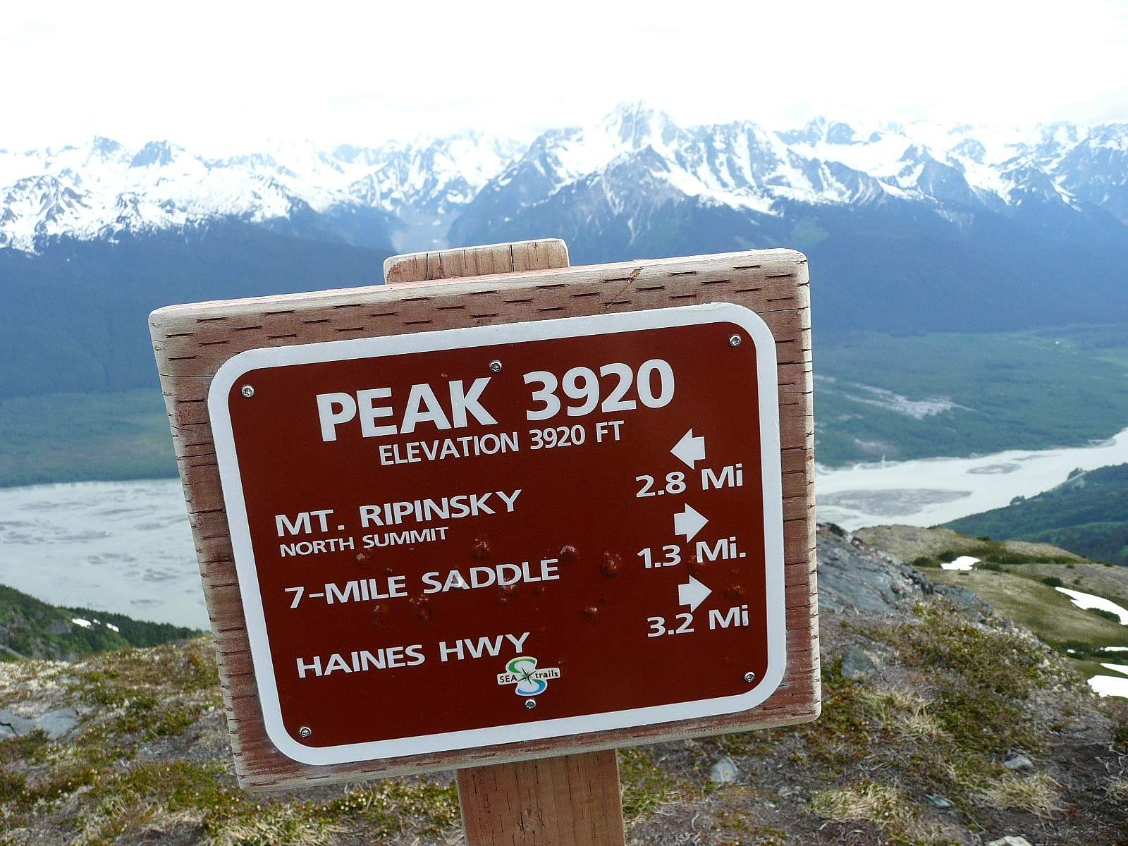
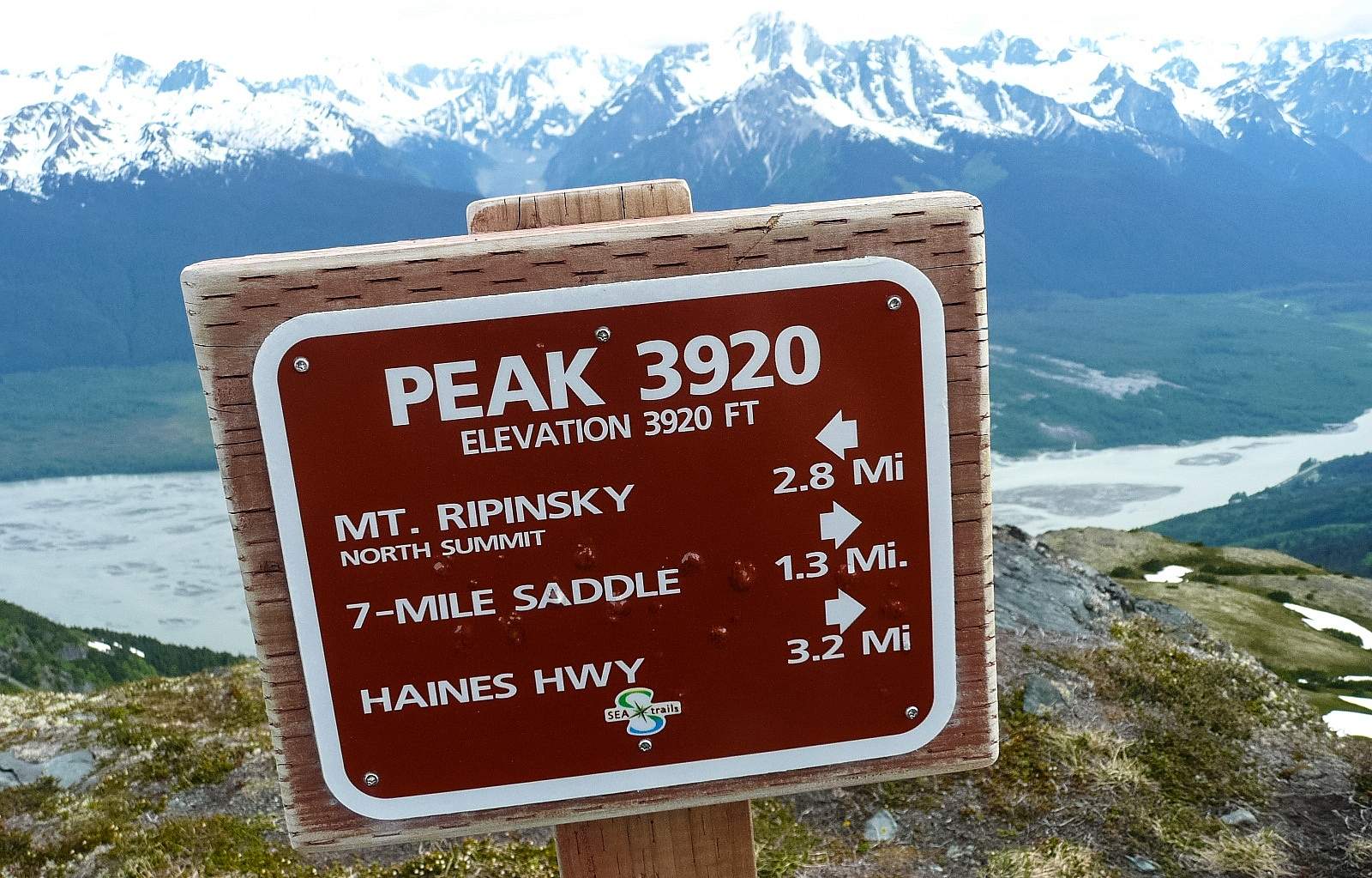
Accessed from 7-Mile Haines Highway, this climb is a thigh-burning beast that will reward the fit and the willing with great views, extended time in the alpine, bright wildflowers, great blueberry and salmonberry picking, and the chance to see mountain goats and bears. The shortest route is from the 7 mile trailhead, which climbs nearly 4,000 feet in 2.5 miles! It’s steep and challenging all the way, from the forest to the top. Half way up you’ll leave the forest and enter scrub growth, filled with blueberries and salmonberries in August and September. In June, this stretch of trail will have tall, curved fiddlehead ferns. The trail then enters mountain hemlock, before branching right (south) toward the summit. From here, it’s really steep and you’ll scramble up rocky slopes and small snowfields. The summit is the reward though. Take in the big views in every direction and linger as long as you can.
You can turn around and descend the way you came, or continue on the ridge towards town. This will give you another two miles of rolling hiking in spectacular alpine terrain. You’ll pass wildflowers, cliff edges, mountain goats, and big views of the Cathedral Mountains and the Chilkat Range across the river. You’ll then climb again to the summit of 3920 or to Mount Ripinski and drop into town. (replace with, You’ll then climb to the summit of Mt. Ripinski and follow the trail back down to town.
If you choose this route, make sure you arrange a shuttle or transportation beforehand.
Directions
Drive out of town, north on the Haines Highway. At 7 mile, park on the right side of the road. The trailhead is adjacent to the parking area.