Haines Parks & Hiking Trails
All of the great hikes in Haines are close to town. And, Haines experiences less rainfall than nearby Juneau, Ketchikan, or Sitka, making it a fantastic hiking destination in Southeast, Alaska. Still, like any hiking adventure in Alaska, you should come prepared with rain gear, as well as sunscreen, bear spray and a water bottle. Then hit the trails, which include several mostly flat coastal hikes, and two steep trails that access alpine tundra.
Parks & Trails
Flat Hikes

A site of historic sawmills and a now-closed road, nature has reclaimed this former industrial site, which has become one of the town’s most attractive and tucked-away trails. Managed by the Takshanuk Watershed Council, the trail is open to the public. The trail extends .3 miles from the parking lot and ends at the picnic shelter.
This trail through an urban forest offers a close view of a muskeg, a swampy wetland critical to the health of rainforest rivers and fisheries. It’s flat and easy, with long sections of boardwalk, plus park benches.
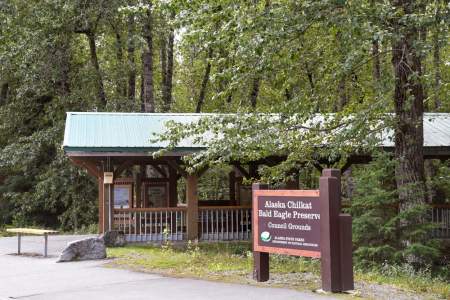
Built to take eagle photographers out of harm’s way along the Haines Highway, this 1.5- mile trail includes lookouts and interpretive panels about the adjacent Bald Eagle Council Grounds, where thousands of eagles gather each year. Warm upwellings of river water keep sections ice-free, providing birds with an important meal.
This trail has a short option and a longer one. One hour of walking from the trailhead takes you to Moose Meadows, a pretty beach meadow with great views of the Rainbow Glacier. For a long day hike, or an overnight hike, continue on the trail all the way to the tip of the Chilkat Peninsula to a place now known by its Tlingit name Ayiklutu (“point within a point. )” This six-mile (one-way) coastal trail can be a rugged scramble over beach rocks ...more
Alpine Hikes
There are two main alpine hikes in Haines- Mt Riley, south of town, and Mt. Ripinski, just north of town. The Mt. Ripinski area also includes peak 3920 and the Seven Mile Saddle, which are so closely connected geographically they can be combined into one long day hike.
If you’re in shape and ready for a climb, this towering yet gentle peak above town makes for a great hike. You’ll experience the different ecosystems of a Southeast Alaskan mountain — lush forest, subalpine stunted trees, alpine meadow, and rocky summit. The weather can be variable at the top, so bring layers, food, and plenty of water. Also bring a camera and binoculars, to look for the resident herd of mountain goats that populate these alpine… ...more
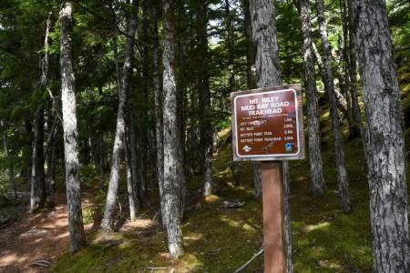
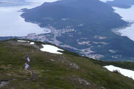
This trail — a steady climb of almost 2,000 feet in 2.5 miles from the Mud Bay trailhead to the top of Mount Riley — affords amazing panoramic views of rivers, oceans, mountains, and glaciers. You’ll walk through old-growth coastal forest, sub-alpine stunted trees, and boggy alpine muskegs, all while surrounded by glacially-striated rocks. Hike up and back from the Mount Riley side, or make a bigger trip of it, climbing point-to-point from the… ...more
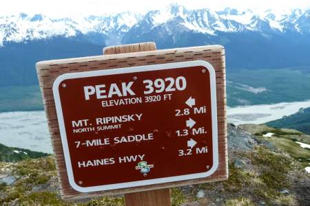
Accessed from 7‑Mile Haines Highway, this climb is a thigh-burning beast that will reward the fit and the willing with great views, extended time in the alpine, bright wildflowers, great blueberry and salmonberry picking, and the chance to see mountain goats and bears. The shortest route is from the 7 mile trailhead, which climbs nearly 4,000 feet in 2.5 miles! It’s steep and challenging all the way, from the forest to the top. Half way up… ...more
Biking
Road Accessible Parks
For decades just a wide spot in the road, this new, pocket park captures the most emblematic scene in Haines, the stately buildings of historic Fort Seward against the relief of the towering Chilkat Peaks.
The park has a few campsites, but no outhouses. The dock at the park provides public access to Mosquito Lake, which offers great fishing, especially for cutthroat trout and Dolly Varden char. The lake fills with migrating ducks in the spring and fall, and trumpeter swans use the lake as a stopover on their migrations. Up to 80 swans have been seen at one time on the lake. In the winter, locals like to ice fish and cross-country ski on the lake ...more
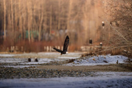
Each October and November, between 3,000 and 4,000 bald eagles descend upon this 48,000-acre preserve centered on river bottomlands a few miles north of Haines to feast on late runs of salmon. Eagles can be found throughout the preserve, however, with an estimated 300 to 400 of the birds in the area throughout the year.
Chilkoot Lake State Rec Site sits 9.6 miles from Haines along Lutak Road, offering 32 lakeside sites in Alaska’s Southeast near Chilkoot Lake. Managed by Alaska State Parks, it’s surrounded by spruce forest and mountains with direct lake access, featuring vault toilets, drinking water, and a boat launch.
Portage Cove State Rec Site provides a small, tent-only camping area less than a mile south of Haines’ cruise ship dock, perfect for foot or bicycle travelers exploring Alaska’s Southeast. Nestled along Beach Road with no vehicle access, this site features a handful of sites near the water, plus a scenic overlook trail through the forest offering views of Portage Cove and the Chilkat Mountains.
Chilkat State Park, seven miles south of Haines, is less visited than Chilkoot Lake, probably because it’s further from town and the road is gravel. But don’t let that stop you. The park is quiet, it’s one of the best local areas to look for moose, and the view of the Rainbow Glacier — a hanging glacier with a huge waterfall dropping from its face — is world-class.
Boat Accessible Parks
Just south of the Chilkat Island is Sullivan Island, and at its southern end, you’ll find Sullivan Island State Marine Park. It has the same accessibility issues as the Chilkat Islands; the easiest way to see these islands is to look for them as you cruise via ferry or cruise ship down the Lynn Canal between Haines and Juneau.
This is a rarely visited group of islands south of Chilkat State Park. Unpredictable winds, huge tides, and strong currents make them a challenging destination to visit. Combined with the lack of any public transportation, these islands remain a near-pristine wilderness left for the serious boater to explore.