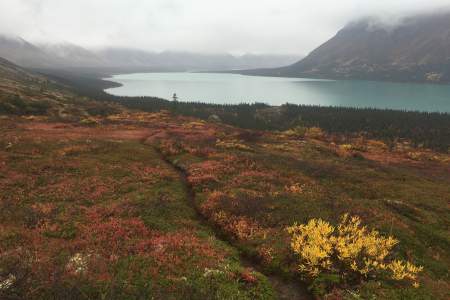
Alaska Float Trips
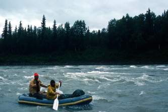
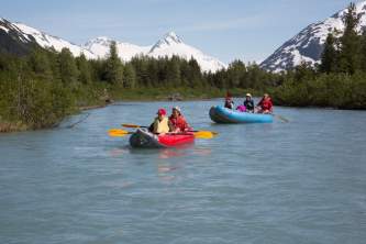
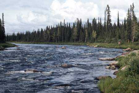
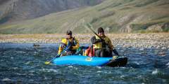
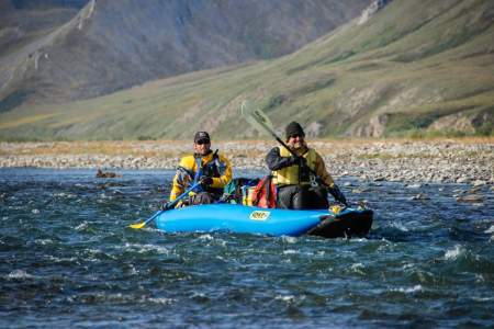
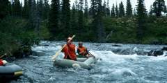
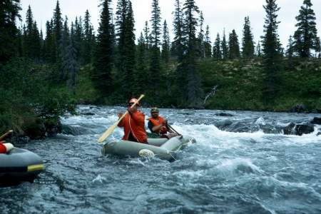
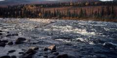
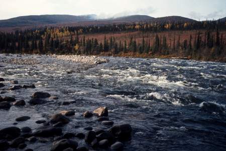
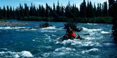
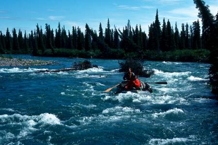
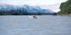
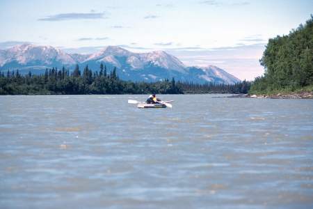
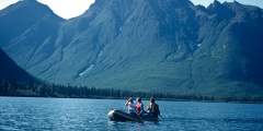
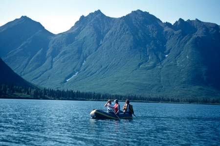
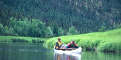
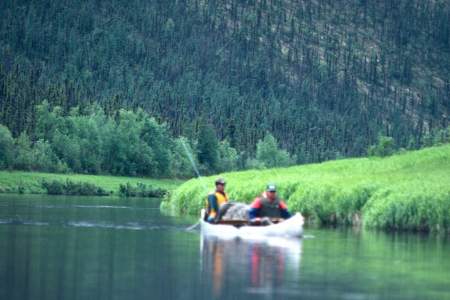
Ever rafted a river in the Lower 48? That’s nothing like rafting in Alaska. Up here, those rivers are known as creeks. Alaska’s rivers are huge bodies of water that move fast, run deep, and are cold. Fed by snowmelt or glaciers, a flipped boat or swim in a river can lead to hypothermia. In short, Alaska rivers are serious forces of nature.
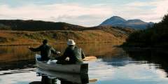
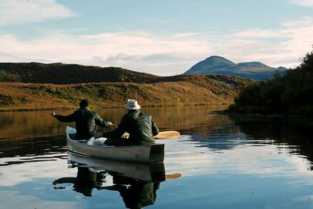
Floating down one of these aquatic highways is an unforgettable way to experience Alaska. Rivers take you quickly into the heart of the Alaskan wilderness, without the physical exertion of hiking or climbing. Everyone travels at the same pace, silently, watching the wildlife without scaring them away. And you can bring along little luxuries—an extra tent, good food, bottles of wine—that would make for an impossibly heavy backpack on a hiking trip.
So get out there and go rafting, Alaska style!
Trip Planning Considerations
Things to think about before you even start planning. Your answers will affect where in the state you go, what river you run, and what time of year you start out.
- Are you looking for whitewater/rapids or a scenic float?
- Is there particular wildlife you’d like to see?
- Are we experienced enough for the river we want to float, or should we hire a guide?
- Should we shuttle cars at drop-off & pick-up spots, or budget for air service?
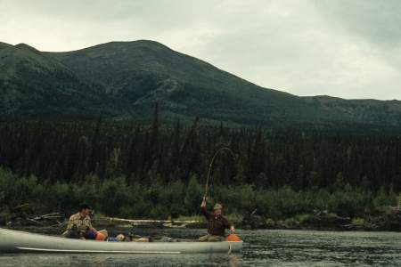
- Does anyone want to fish or go for day hikes?
- Pick up a copy of The Alaska River Guide, a great resource for investigating floatable rivers.
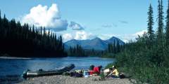
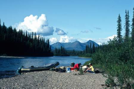
Trip Preparations
Some things to think about before you set out:
- How comfortable are you and/or your group being alone in the wilderness?
- Who have you talked to about this river?
- Are there significant winds?
- Any tricky rapids or good camp spots to be looking for?
- Did you talk to anyone about the water level?
- What will the weather be like?
- Where’s the patch kit?
- What is the bear situation?
- What is the weather like? Is there an optimal month or time for this river, especially as it relates to water flows?
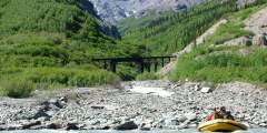
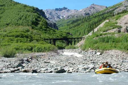
What Kind of Boat?
Everyone uses self-bailing boats nowadays. But you will have to decide between:
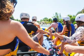
- Paddle rafting. Each person has their own paddle; you work together to maneuver the boat. This gives everyone an activity, but has limited gear capacity.
- Oar rafting. One person paddles using oars on a metal frame. Unless your paddlers are all very strong, oar rafting gives you more control over the boat. Those not manning the oars can relax and watch the scenery go by.
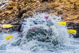
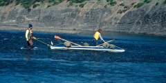
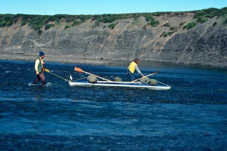
- On harder rivers, try to have more than one boat in case one boat dumps, loses gear, or rafters fall out. The other boat can help with rescue and recovering gear, though you should lash your gear to the boat so it won’t fall out—even if the boat turns upside down and scrapes the rocky bottom.
Show Map
Float Trips
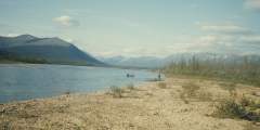
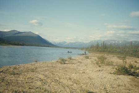
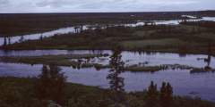
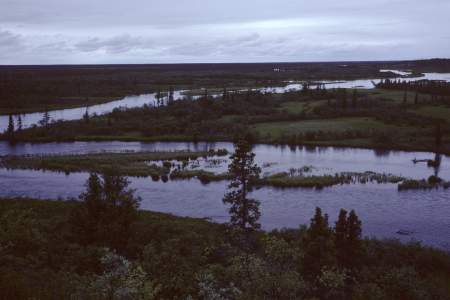
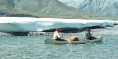
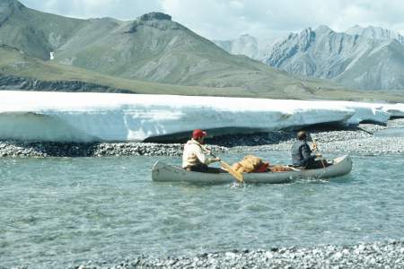
The Sheenjek River flows 290 miles from Alaska’s Brooks Range to Fort Yukon, earning a National Wild and Scenic River designation. It offers canoe and kayak trips through vast wilderness, with routes from 120 to 268 miles. Most of its length lies within wildlife refuges and serves as winter range for the Porcupine Caribou Herd. Olaus and Mardy Murie chronicled its history in Two In The Far North.
The Gulkana River is an 80-mile National Wild and Scenic River, popular for whitewater trips and fishing. It takes 5 – 7 days to paddle, starting with a 7‑mile stretch on Paxson Lake. Rapids range from Class I‑IV, with a fast, boulder-filled canyon (Class IV) that non-experts should portage. The river features King Salmon runs, scenic views, and a mix of slow and rocky waters, ideal for experienced paddlers.

A combination of classic Alaskana: float planes, big mountains, crystal blue lakes, and homesteading history. This “route” is uniquely freeform. You’ll be able to choose from hundreds of available hiking options. With the vast majority of the paddling being on flat water this is a great option for a novice packrafter.

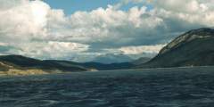
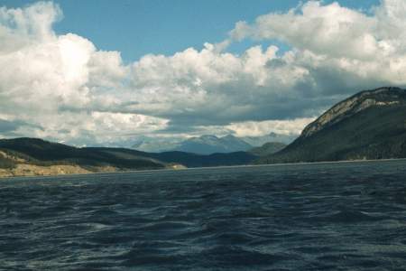
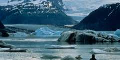
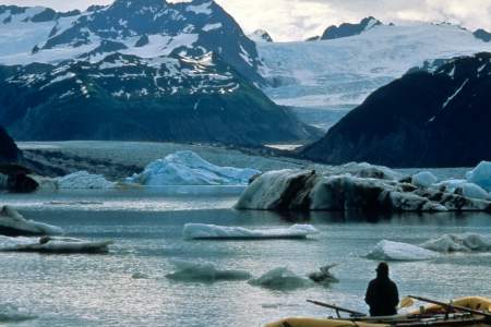
The Tatshenshini River, a 152-mile wilderness float, flows from Yukon to Alaska, passing glaciers, whitewater canyons, and grizzly territory. It traverses major fault lines, surging glaciers, and Pleistocene-like landscapes before joining the Alsek River. Ending in Glacier Bay, it offers a journey through alpine terrain, icebergs, and powerful waters, making it one of North America’s greatest river adventures.
Just 40 minutes from Anchorage, the North Fork Eagle River offers a scenic, 7‑mile Class I float with a remote feel. The unbraided river has many bends, making the actual float closer to 8 miles and taking 3 – 5 hours. It’s a great full-day trip, especially with kids, with time for gravel bar play. Despite its gentle nature, sweepers and submerged logs add challenge. It’s more secluded than Portage, with few boats even on busy weekends.
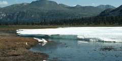
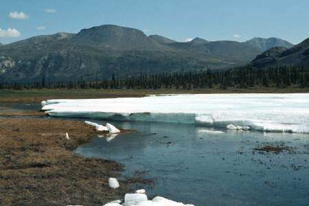
The Delta River offers diverse floating challenges, from quiet lakes to Class IV rapids. Stunning scenery, abundant wildlife, and great fishing make it a favorite. It’s a two-day trip from Tangle Lakes to mile 212 on the Richardson Highway. Beyond that, Black Rapids features Class IV rapids requiring portaging. The river then flows 30 miles of Class III and 18 miles of Class I‑II to the Tanana River.
The Tana River is a 36-mile Class IV+ glacial run from the Chugach to Wrangell Mountains, requiring skill for its cold, fast waters. Flowing from the Tana Glacier, a tributary of the Bagley Ice Field, it offers stunning scenery, sand dunes, and tricky rapids. When combined with the Chitina River, a 95-mile trip is possible. McCarthy River Tours & Outfitters is the only company offering guided trips.
The Kongakut River in Alaska’s Arctic Refuge offers rafting, hiking, and wildlife viewing in a remote tundra landscape. Flowing from the Brooks Range to the Beaufort Sea, it features Class II – III rapids, caribou, moose, and Arctic char. August brings autumn colors, while summer’s midnight sun extends adventures in this fly-in-only Arctic wilderness.
The Nigu and Etivluk Rivers, in Gates of the Arctic National Park, flow north from the Brooks Range through tundra to the Colville River. Shallow waters favor kayaks and folding canoes, though small rafts can navigate with effort. The Class I‑II rivers offer scenic views, fishing, and archaeological sites. Trips span 6 – 10 days, covering up to 100 miles with boulder gardens and riffles along the way.
The Kenai River flows 80 miles from Kenai Lake to Cook Inlet, passing through canyons, whitewater, and Skilak Lake. A 4 – 5 day trip offers stunning scenery, Class III rapids, and world-class fishing. The river is heavily visited, especially in July and August, with powerboats and crowded fishing spots. Most of it lies within the Kenai National Wildlife Refuge, home to one of Alaska’s greatest salmon runs.
The Chena River flows 50 miles from the White Mountains through Fairbanks. Fed by five tributaries, it is a Class II river with logjams, small channels, and campgrounds. The Middle Fork serves as the main section. The Chena Hot Springs Resort is a common starting point. With interesting features along its length, the river takes 5 to 7 days to complete.
The Andreafsky and East Fork Rivers are remote, Wild and Scenic waterways in Alaska, flowing 105 – 122 miles through tundra and forest. This Class I river is ideal for a 5 – 7 day float, best suited for inflatable kayaks or small rafts. The East Fork features more trees and bogs, while the area is home to diverse wildlife, including the rare Bristle-thighed Curlew. Few travel here outside of local groups and fishing parties.
The Fortymile River, a Yukon tributary, flows through rugged terrain with Class I‑IV rapids. Known for its twisting route and blind turns, it has major rapids at The Kink and Canyon Rapids. The Taylor Highway provides multiple access points, with trips from 2 – 5 days. More remote sections require flying in. The area has a rich Athapaskan history, extensive mining, and federally designated Wild and Scenic River status.
The Ambler River is an 80-mile clear water route from the Schwatka Mountains to the Kobuk River, featuring rocky rapids, braided channels, and a challenging 3‑mile canyon. Its diverse habitat supports Sheefish, making it great for fishing. The journey, ideal for kayaks and canoes, takes 6 – 8 days, allowing for a mix of adventure and relaxation through forested and open landscapes.
The John River flows south from the Arctic through Anaktuvuk Pass into the Endicott Mountains, linking Inuit and Athabaskan cultures. It offers clear waters, great fishing, hiking, and abundant wildlife. The headwaters require dragging boats before a swift Class III run, while the middle and lower sections are easier. The 100-mile stretch is the most popular, taking about 7 days to complete.
The Charley River, a National Wild and Scenic waterway, flows 108 miles to the Yukon, passing through valleys, cliffs, and floodplains. It offers clear waters, hiking, and whitewater, with Class II-III rapids and occasional Class IV in high water. Rich in history, it has evidence of early occupants and gold mining relics. Most trips cover 88 miles in 6 – 10 days, making it a premier Alaskan wilderness adventure.
Beaver Creek National Wild and Scenic River has its headwaters in the White Mountains, north of Fairbanks, Alaska. The river flows west past the jagged limestone ridges of the White Mountains before flowing to the north and east, where it enters the Yukon Flats and joins the Yukon River. It is one of the few road accessible streams in Alaska with a Wild and Scenic designation. The first 127 miles of Beaver Creek were designated a National… ...more
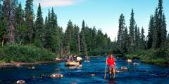
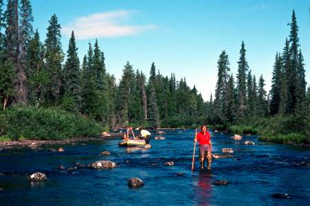
Experience the backcountry of Denali National Park in a way few others do. You’ll board a bus from the Visitor Center and disembark just before Sable Pass and then immerse yourself in the wild Alaska landscape. Recommended for intermediate backpackers and beginner packrafters.
Overview With the Talkeetna Mountains to the north and the Chugach Mountains to the south, the Matanuska River pours forth from the large Matanuska Glacier in a swift, freezing cold, torrent of Class II to Class IV whitewater for nearly 70 miles before it meets the sea where the Knik Arm of Cook Inlet reaches into the interior. The river runs down the trench formed where the Border Ranges Fault line separates the two mighty mountain ranges,… ...more
The Hula Hula River is a classic Arctic adventure, featuring 80+ miles of whitewater, mountain scenery, and vast coastal plains. It flows through the 10 02 Land, home to the Porcupine Caribou Herd, at the heart of oil drilling debates. Paddlers may see caribou, polar bears, and eider ducks while navigating Class III+ rapids. Solid planning is essential for this 10-day journey to the Beaufort Sea.
This bit of river system is a crystalline, spring-fed watershed that flows into the Tanana River and is famous as being the largest documented spawning area for Coho Salmon of the entire Yukon River system. It is a fairly short river of 20 miles with 12 miles you can float, but when combined with the 30 miles of Tanana River down to the Alcan Highway Bridge, a long weekend or up to a 3 day trip is possible and is entirely accessible by car.… ...more
The Squirrel River is a clear Arctic river flowing from the Baird Mountains to the Kobuk River at Kiana. It’s an easy float, ideal for families and beginners with good fishing and hiking. After August, only folding canoes and kayaks can navigate the upper stretch, while the lower 56 miles suit rafts. A historic route between the Kobuk and Noatak watersheds, it offers 80 or 56-mile Class I trips lasting 5 – 7 days.
Overview The Marsh Fork is a tributary of the Canning River, an arctic river that forms the western boundary of the Arctic National Wildlife Refuge and flows through the dramatic Phillip Smith Mountains and past the Franklin Mountains. The trip we describe is a 35-mile section of the Marsh Fork and a 5‑mile stretch of the Canning River to the first takeout option that is a gravel strip at Plunge Creek. The Marsh Fork requires some Class… ...more
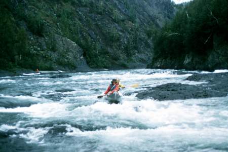
Overview Six Mile Creek is, perhaps, Alaska’s most accessible technical whitewater run, well suited to kayak or paddle raft, mostly Class IV and one class V canyon. Flowing in the rugged Chugach Mountains of the Kenai Peninsula, within Chugach National Forest, this stream has a reputation of booming whitewater and fast gorge style rapids. A small volume stream, it has 3 distinct canyons, with each one more difficult than the previous. At most… ...more
The Copper River drains a vast North American region of mountains, ice, and forests. Its lower reaches flow over 200,000 cubic feet per second, while headwaters carve steep gorges and glacial valleys. Spanning subarctic to temperate zones, it borders the world’s largest nonpolar ice field. The most common trip, from Chitina to Cordova, covers 80 miles in 5 – 7 days. Rafts work well; canoes can be tippy.
The Nushagak River flows 275 miles through southwest Alaska, offering top-tier fishery habitat with salmon, trout, char, and grayling. A Class I river, it’s ideal for families with wilderness skills, passing native villages, tundra, and scenic bluffs. Popular for rafting, fishing, and hiking, it joins key rivers like the Mulchatna. Trips range from 5 days to 2 weeks, with logjams and sweepers as main hazards.
The Talachulitna River, or “Tal,” is a 5 – 7 day float trip through scenic gorges and past the Tordrillo Mountains. It begins with 16 miles of Class I creek, followed by 32 miles of Class I – IV rapids, and ends with 13 miles on the Skwentna River. Best for small rafts and kayaks, it’s a top fishing spot with historic Athabascan significance. The Tal was Alaska’s first catch-and-release-only river for Rainbow Trout.
The Chulitna River flows south from Broad Pass, offering a 75-mile float taking 3 – 5 days. The upper section is great for canoes and kayaks, while the lower is more challenging. The East and Middle Forks are popular mid to late summer, attracting floaters and anglers. As the West Fork joins, the river changes from a clear, rocky stream to a powerful glacial river with strong eddies and big holes.
The Little Su is a clear, warmer Alaskan river flowing from the Talkeetnas. It offers two trips: a Class IV+ whitewater run for expert kayakers and a calmer Class I‑II section ideal for fishing, floating, and camping. Popular routes are 84 or 56 miles, taking up to 5 days. Below the Parks Highway, motorboats are allowed on the second and fourth weekends from Nancy Lake Creek to the Little Su Access Road.
The Aniuk River flows 80 miles from Howard Pass to the Noatak River, offering a remote, scenic route with rocky rapids and rich wildlife. It traverses alpine tundra, marshy valleys, and upland habitats in the Noatak National Preserve. The river is above the tree line and follows a historic migratory path. A trip takes 4 – 6 days, with Cutler River as the first exit. Inflatable kayaks and canoes are ideal.
Overview Located in southwestern Alaska, in one of the richest fisheries in the world, the Wood-Tikchik State Park has a great, easy to moderate float trip that is perfect for families with wilderness camping experience and for diehard fishing enthusiasts. From the furthest inland lake to Dillingham, Alaska is a 130-mile trip that involves paddling your way the length of 4 large lakes and down the three rivers that connect the lakes and then… ...more
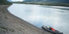
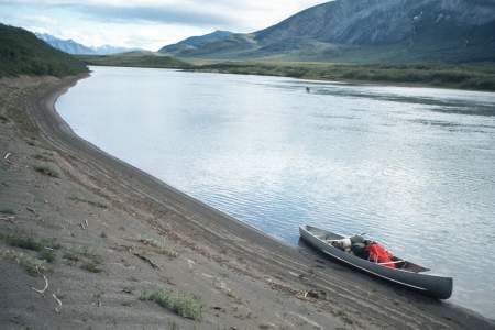
The Nabesna River is a glacially fed Class I‑II river in Alaska, flowing 80 miles from the Wrangell-St. Elias Mountains through canyons and valleys before joining the Chisana River to form the Tanana. It starts steep and swift, then slows as it meanders into the Tetlin National Wildlife Refuge. Ideal for a 3 – 4 day trip, it has no major obstacles but requires constant maneuvering through its busy currents.
The Alsek River is a powerful, glacial-fed waterway flowing from Canada to Alaska through vast protected wilderness. It features massive glaciers, swift whitewater, and the highest concentration of grizzlies in North America. The journey includes a mandatory helicopter portage at Turnback Canyon and takes 13 – 16 days. Harsh weather and complex logistics make it a true expedition, best suited for expert paddlers.
The Happy River is a top-rated Alaska Range river, first floated in the last 20 years. It features swift, rocky rapids, stunning views, and parallels the Iditarod Trail. Flowing into the Skwentna River, it offers a 6 – 8 day journey through remote wilderness. Kayakers find it easy, but rafters face challenges. Cold, splashy waters require dry suits. Accessible only by air, it’s a true adventure.
The Killik River flows 135 miles through Gates of the Arctic National Park, offering a 7 – 10 day rafting trip with Class I – III rapids. It begins in the Endicott Mountains, winding through tundra and permafrost country before joining the Colville River. The route passes archaeological sites and evidence of early Native American habitation. Rafters can start at Easter Creek or upriver near April Creek.
The Salmon River, a National Wild and Scenic River in Kobuk River National Park, flows 100 miles from the Baird Mountains to Kiana. A Class I waterway, it passes through tundra, forests, and rolling hills. While its upper reaches may be too shallow, it’s ideal for campers and fishermen seeking remote wilderness. The trip, taking 6 – 10 days, offers stunning scenery and opportunities to meet local native families.
Overview This interesting combination of rivers and lake is a rarely done circuit that would be a great multi-day wilderness float trip for kayaks and rafts. With good fishing opportunities and only Class III at times, it is mostly a Class II trip and for 80 miles it travels through an amazing landscape. The Nelchina River system is a rocky glacial river with daily water level fluctuations amid a forested valley and with spectacular views of… ...more
The Holitna River is a 200-mile, 8 – 10 day Class I float in southwest Alaska, flowing through vast wilderness from the Taylor Mountains. It’s the largest river in the lower Kuskokwim basin, offering a scenic trip with a chance to meet locals in Kashegelok. A major fishing destination, it hosts all five salmon species, Arctic Char, Northern Pike, and Sheefish. The journey starts at the Kogrukluk River and Shotgun Creek confluence.
The Chickaloon River flows from the Talkeetna Mountains to the Matanuska River. A 33-mile Class II-III+ stretch offers fast, continuous rapids with some blind drops requiring scouting. This is not for beginners but is an excellent weekend trip for experienced rafters with good gear and read-and-run skills. The river is glacial-fed, and access to the upper sections is limited, often requiring helicopter transport.
Portage Creek is the easiest float near Anchorage, a 1 – 2 hour float down flat water with the option of take outs at mile 4.5 or 6.5. With kids, however, you’ll want to turn it into a half-day adventure, stopping on gravel bars to play and explore. You’re never far from Portage Valley Road, which can provide a sense of comfort. Even though the road does not have a deep wilderness feel, you are surrounded by several-thousand foot mountains which… ...more
The Firth River, Canada’s oldest, flows through Yukon’s Ivvavik National Park, home to caribou migrations and rich history. This remote, 150-mile river features rugged landscapes, Class III-IV rapids, and excellent Arctic Char fishing. Flowing through four unique regions, it offers an unparalleled wilderness rafting experience. Permits are required, and trips take 6 – 10 days in this pristine Arctic setting.
The Chilikadrotna River, a Wild and Scenic River, flows 60 miles through Lake Clark National Park to the Mulchatna River. Averaging 5 mph, it runs through birch and spruce forests with jagged peaks above. The trip takes 4 – 8 days, featuring swift water, rapids, and occasional sweepers. A popular fly-in fishing spot, it offers thrilling whitewater for experienced boaters in an 82-mile journey.
Overview Beginning far up into the mountains of Lake Clark National Park, the Stony River is a little known but beautiful glacial river that flows south away from the Revelation Mountains and out of Sled Pass to a point where it then flows northwest through the rolling foothills to where it eventually joins the Kuskokwim River near the village of Stony River. The upper 50 miles of river are inaccessible and rarely see summertime traffic.… ...more
The Fortymile River, a Yukon tributary, flows through rugged terrain with Class I‑IV rapids. Known for its twisting route and blind turns, it has major rapids at The Kink and Canyon Rapids. The Taylor Highway provides multiple access points, with trips from 2 – 5 days. More remote sections require flying in. The area has a rich Athapaskan history, extensive mining, and federally designated Wild and Scenic River status.
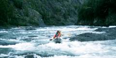
The Nenana River, forming Denali National Park’s eastern boundary, is Alaska’s top rafting destination, offering various difficulty levels. A thriving industry provides 2‑hour to overnight trips. Kayakers enjoy its waters, including the annual Nenana Wildwater Race. Its Class IV gorge hosts wildlife like sheep and eagles. In 2012, extreme flooding tripled its flow, with guides navigating peak floodwaters after careful planning.
The North Fork of the Goodnews River in Alaska offers a 60-mile, 5‑day float trip through Togiak Refuge, surrounded by tundra mountains. The river is rich in fish, with good current in the upper reaches and tidal influences at its mouth. Togiak Refuge spans 4.7 million roadless acres, featuring mountains, rivers, lakes, and estuaries. Primary access is by air or water, making it a true remote wilderness adventure.
Float Through Anchorage Neighborhoods
The Colville River flows from the DeLong Mountains through Arctic tundra, draining into the Arctic Ocean. Frozen for much of the year, it floods each spring. Its cut banks hold dinosaur fossils and support one of North America’s largest Peregrine Falcon populations. A 375-mile section, mostly Class I‑II, can be floated in up to 20 days, passing through one of the continent’s most remote regions.
Overview Within the Brooks Range lies the Endicott Mountains and in the heart of these mountains is the Gates of The Arctic National Park and Preserve. Where the mountains rise to meet the sky the beginnings of the North Fork of the Koyukuk River lie. This is a river that begins in these mountains and eventually flows into the giant Yukon-Kusko delta region. But at its start are the 7000-foot high mountains of the Gates, with Mt Doonerak the… ...more
Lake Creek is one of south central Alaska’s most famous streams, primarily due to its superior salmon runs. King Salmon use Lake Creek and Chelatna Lake as a spawning site and return in large numbers and trout and grayling follow right behind them. Lake Creek is a clear, swift, and at times, very strong river with two sections of Class III+ and IV rapids and many technical boulder garden rapids to get through. The two hardest sections can be… ...more
The Hoholitna River is a remote, rarely traveled 180-mile float (Class I & II) with world-class fishing. Beginning at Whitefish Lake, it winds through tundra, spruce, and poplar forests before meeting the Holitna and Kuskokwim Rivers. The trip takes 5 – 10 days, covering 165 miles on the Hoholitna and 20 more on the Holitna to Sleetmute. Expect solitude, slow turns, and stunning Alaskan wilderness.
The Alatna River, a wild and scenic river in Alaska, flows 184 miles from the Brooks Range to Allakaket. It passes Circle Lake, the Arrigetch Peaks, and Helpmejack Hills, offering stunning views. The upper section is rocky with Class II+ rapids, while the lower section mellows into meandering boreal forest. A popular float trip destination, it takes 4 – 14 days, best navigated by inflatable kayak or small raft.
The Wild River is a 63-mile, Class I family-friendly float trip through remote wilderness. It flows from a forested lake to the Koyukuk River, passing Bettles. Easily floated in 6 days, it starts as a swift, crystal-clear stream before slowing near the Koyukuk. With only a few lineable Class II riffles, it offers a scenic and accessible adventure far from civilization.
The upper Kobuk River flows through a scenic, forested valley from Walker Lake, featuring Class I – IV rapids. It transitions from wilderness to a travel corridor with fish camps and rich archaeological sites like Onion Portage. The journey to Kobuk village is 115 miles (5 – 8 days), while reaching Noorvik takes 16 – 20 days (285 miles). This route is ideal for kayaks and rafts.
The Nizina River flows from the Nizina Glacier into the Wrangell Mountains, offering 45- to 90-mile trips with Class III rapids. A tributary of the Chitina River, it features braided glacial plains, a narrow canyon, and diverse wildlife, including bears, moose, and bison. Surrounded by the St. Elias, Wrangell, and Chugach Mountains, it runs through one of the most scenic and remote wilderness areas in Alaska.
The Chitina River flows through a vast Alaskan valley, dividing the Wrangell and St. Elias Mountains. Fed by Logan and Chitina Glaciers, it shaped a mineral-rich region where native populations and miners have long explored. Peaks rise to 16,000 feet as it joins the Copper River. A remote, moderate-difficulty rafting trip, it spans 60 – 112 miles, taking 4 – 10 days through rugged wilderness.
The Kanektok River in Southwest Alaska flows 85 miles from Pegati Lake to the Bering Sea. Starting in the Ahklun Mountains, it winds through the Kuskokwim lowlands, offering world-class fly fishing. Lodges and camps line the river, with motorboats common mid-July to mid-August. Its gentle Class I‑II flow is usually clear, though sweepers pose hazards. Plan 4 – 7 days for a trip ideal for anglers and campers.
The Noatak River, a Wild and Scenic River, flows 400 miles through the Brooks Range and tundra, offering stunning scenery, fishing, and wildlife. It begins in Gates of the Arctic National Park, meandering through valleys, canyons, and rolling hills before reaching Kotzebue Sound. Primarily a Class I‑II river, it’s ideal for canoes and kayaks. Trips range from a week to 28 days, with mosquitoes being a seasonal challenge.
Aniakchak River, a remote 35-mile Class IV run, flows from Surprise Lake through a volcanic caldera and dense brown bear habitat to the Pacific. The trip takes 3 – 4 days, ending in Aniakchak Bay. Weather can be severe, with July as the best rafting month. The route features rugged terrain, fast waters, and stunning scenery. Inflatable 14-foot rafts are ideal for navigating this wild and scenic river.
The Canning River flows from the Phillip Smith Mountains, forming the Arctic Refuge’s western boundary. Ideal for small boats, it features a wide, glacier-carved valley with meandering channels. Though not a whitewater challenge, low water levels can make navigation tricky. A 14-foot raft or inflatable kayak works best. Expeditions Alaska offers 7 – 12 day guided trips through this remote Arctic wilderness.
The Alagnak river, a federally designated Wild and Scenic River that originates in Katmai National Park and Preserve, is a fisherman’s paradise and the most popular fishing float trip in the Bristol Bay region. From it’s headwaters at Kukaklek or Nonvianuk Lake, it is a 75 mile Class I and II river with one Class III canyon that is a mile long and has a short falls, not easily portaged or lined due to the steep walls. The river is a good… ...more
The Porcupine River flows 500 miles from Canada to Alaska, joining the Yukon River near Fort Yukon. A Class I wilderness trip, it passes through boreal forests and is home to the Porcupine Caribou herd. Used for centuries by Gwich’in Athapaskan traders, it features smooth-walled canyons and scenic flats. Popular routes start in Old Crow, with trips ranging from 10 to 14 days, depending on the put-in location.
The Chatanika River, a Class II stream in the Yukon River drainage, flows from the Alaska Range through valleys before reaching Minto Flats. Ideal for canoes and kayaks, it includes the 28-mile Chatanika River Canoe Trail, a BLM-registered route. The longest floatable section is 45 miles, taking 3 to 4 days. The river features clear or lightly tannic waters and offers a scenic wilderness experience.
The Talkeetna River is a classic Alaska whitewater trip with Class IV – V rapids, fast canyons, and turquoise glacial water. It offers stunning Denali views, great hiking, fishing, and abundant wildlife. A bush plane is required for access, and jet boats crowd the lower reaches during King Salmon season. The 60-mile route takes 3 – 7 days and suits medium to large rafts or kayaks. Bears are common during the salmon run.
The Yanert River, a hidden gem and the largest tributary of the Nenana, flows through a dramatic valley near Mt. Deborah. This 20-mile Class II river passes through a glacial outwash plain, a deep gorge, and rugged mountains before joining the Class III+ Nenana. Ideal for a 3 – 4 day trip, it offers great hiking and stunning scenery. Rafts are best, though kayakers complete it in two days.
The Nowitna River (Novi) is a remote, tea-colored Class I‑II river in Alaska, flowing 300+ miles through the Nowitna National Wildlife Refuge. Originating in the Susulatna Hills and Sunshine Mountains, it meanders through wooded terrain to the Yukon River near Ruby. A stretch of whitewater exists in Nowitna Canyon. The lower river is slow and winding. A 245-mile float takes 10 – 14 days.
The Tlikakila River flows through Lake Clark National Park, where the Alaska and Aleutian Ranges meet. Its 51-mile route features glaciers, cliffs, caves, waterfalls, and deep gorges. Though mostly Class I‑II, one section reaches Class III+. The river’s source has shifted due to glacial changes, but it remains a stunning wilderness float, taking 3 – 6 days to complete.
The Ivishak River, 95 miles long, originates in glacial lakes, flowing north through Alaska’s Arctic National Wildlife Refuge. It transitions from rocky riffles to a wide, braided floodplain, fed by glaciers and springs. Rich birdlife, over 100 species, thrives here. The upper section is a designated Wild and Scenic River. It joins the Sagavanirktok River near Prudhoe Bay. A 90-mile Class I/II float, taking 5 – 10 days, is possible. Extended trips ...more
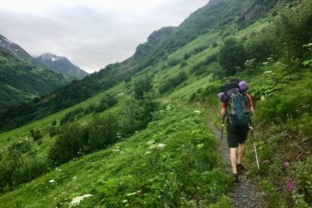
The Winner Creek to 20 Mile River loop is a great first packrafting trip. For those with packrafting skills, this route offers a quick, easy-to-access, multi-sport adventure. The hike up to Berry Pass is seriously underrated, and the views of the 20 Mile watershed are absolutely stunning.