Southwest and Aleutians Alaska Float Trips
Its Boundaries
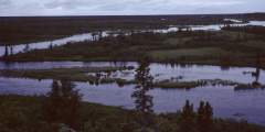
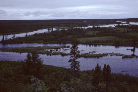
This region begins roughly at Nunivak Island and includes the Kuskokwim Delta region, and the tributaries arising south of the Kuskokwim River—including the Kanektok, Goodnews and Togiak watersheds, as well as the Wood, Nushagak, Kvichak and Naknek watersheds. These rivers are also associated with the famed Bristol, Togiak and Nushagak bays.
What It’s Like
The Southwest and Aleutians river region is often thought of as the world's greatest fishing destination—abounding with salmon runs and all the fish that accompany the huge biomass that enters the rivers each year. It’s also a region of huge lakes, and the big brown bears that make their home in Katmai and Lake Clark National Parks.
Rich with small villages, fishing lodges and plenty of fly-fishermen, this isn’t an area known for solitude. Still, there are many rivers that head in the mountains, away from the valley, where you won’t find that many people.
Show Map
Float Trips
Southwest and Aleutians Alaska Float Trips

Overview Located in southwestern Alaska, in one of the richest fisheries in the world, the Wood-Tikchik State Park has a great, easy to moderate float trip that is perfect for families with wilderness camping experience and for diehard fishing enthusiasts. From the furthest inland lake to Dillingham, Alaska is a 130-mile trip that involves paddling your way the length of 4 large lakes and down the three rivers that connect the lakes and then… ...more
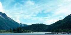
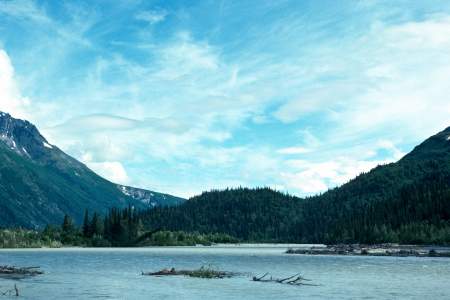
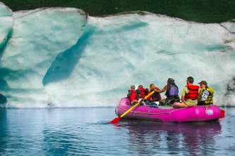
The Tlikakila River flows through Lake Clark National Park, where the Alaska and Aleutian Ranges meet. Its 51-mile route features glaciers, cliffs, caves, waterfalls, and deep gorges. Though mostly Class I‑II, one section reaches Class III+. The river’s source has shifted due to glacial changes, but it remains a stunning wilderness float, taking 3 – 6 days to complete.
Overview Beginning far up into the mountains of Lake Clark National Park, the Stony River is a little known but beautiful glacial river that flows south away from the Revelation Mountains and out of Sled Pass to a point where it then flows northwest through the rolling foothills to where it eventually joins the Kuskokwim River near the village of Stony River. The upper 50 miles of river are inaccessible and rarely see summertime traffic.… ...more
This trip is best started from Dillingham, which can be reached by regularly scheduled air service from Anchorage. From there, a chartered plane on wheels can take you to one of several gravel bar landing areas near the confluences with the Chichitnok River.
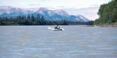
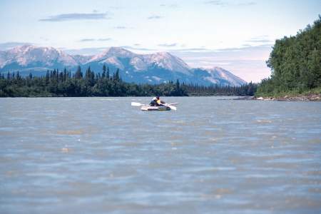
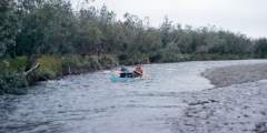
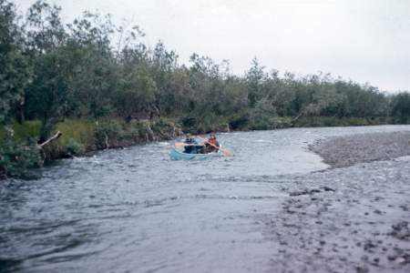
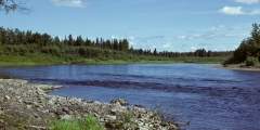
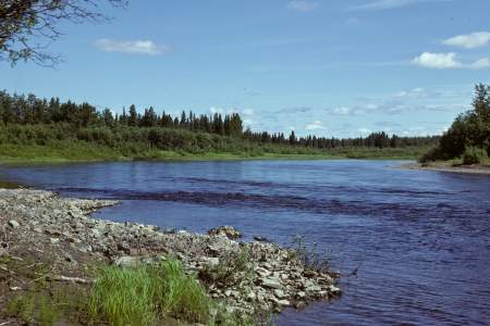
The Nushagak River flows 275 miles through southwest Alaska, offering top-tier fishery habitat with salmon, trout, char, and grayling. A Class I river, it’s ideal for families with wilderness skills, passing native villages, tundra, and scenic bluffs. Popular for rafting, fishing, and hiking, it joins key rivers like the Mulchatna. Trips range from 5 days to 2 weeks, with logjams and sweepers as main hazards.
The Kanektok River in Southwest Alaska flows 85 miles from Pegati Lake to the Bering Sea. Starting in the Ahklun Mountains, it winds through the Kuskokwim lowlands, offering world-class fly fishing. Lodges and camps line the river, with motorboats common mid-July to mid-August. Its gentle Class I‑II flow is usually clear, though sweepers pose hazards. Plan 4 – 7 days for a trip ideal for anglers and campers.
The Holitna River is a 200-mile, 8 – 10 day Class I float in southwest Alaska, flowing through vast wilderness from the Taylor Mountains. It’s the largest river in the lower Kuskokwim basin, offering a scenic trip with a chance to meet locals in Kashegelok. A major fishing destination, it hosts all five salmon species, Arctic Char, Northern Pike, and Sheefish. The journey starts at the Kogrukluk River and Shotgun Creek confluence.
The Hoholitna River is a remote, rarely traveled 180-mile float (Class I & II) with world-class fishing. Beginning at Whitefish Lake, it winds through tundra, spruce, and poplar forests before meeting the Holitna and Kuskokwim Rivers. The trip takes 5 – 10 days, covering 165 miles on the Hoholitna and 20 more on the Holitna to Sleetmute. Expect solitude, slow turns, and stunning Alaskan wilderness.
The North Fork of the Goodnews River in Alaska offers a 60-mile, 5‑day float trip through Togiak Refuge, surrounded by tundra mountains. The river is rich in fish, with good current in the upper reaches and tidal influences at its mouth. Togiak Refuge spans 4.7 million roadless acres, featuring mountains, rivers, lakes, and estuaries. Primary access is by air or water, making it a true remote wilderness adventure.
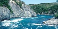
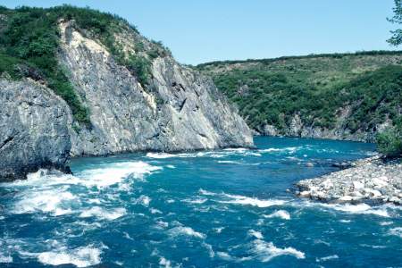
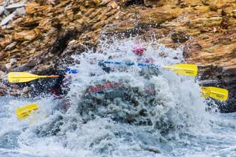
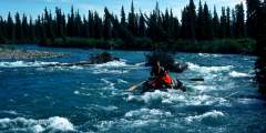
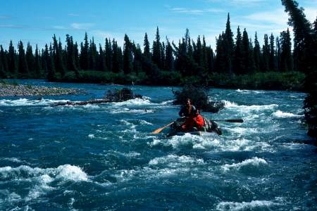
The Mulchatna River flows from Alaska’s Chigmit Mountains through rugged terrain with swift currents, rocky shallows, Class III drops, and log jams. Ideal for skilled adventurers, it offers solitude, multi-day trips, great fishing, and camping along sandy banks. Though less dramatic than nearby rivers, it promises a challenging, rewarding journey from June to September.
The Chilikadrotna River, a Wild and Scenic River, flows 60 miles through Lake Clark National Park to the Mulchatna River. Averaging 5 mph, it runs through birch and spruce forests with jagged peaks above. The trip takes 4 – 8 days, featuring swift water, rapids, and occasional sweepers. A popular fly-in fishing spot, it offers thrilling whitewater for experienced boaters in an 82-mile journey.
The Andreafsky and East Fork Rivers are remote, Wild and Scenic waterways in Alaska, flowing 105 – 122 miles through tundra and forest. This Class I river is ideal for a 5 – 7 day float, best suited for inflatable kayaks or small rafts. The East Fork features more trees and bogs, while the area is home to diverse wildlife, including the rare Bristle-thighed Curlew. Few travel here outside of local groups and fishing parties.
The Alagnak river, a federally designated Wild and Scenic River that originates in Katmai National Park and Preserve, is a fisherman’s paradise and the most popular fishing float trip in the Bristol Bay region. From it’s headwaters at Kukaklek or Nonvianuk Lake, it is a 75 mile Class I and II river with one Class III canyon that is a mile long and has a short falls, not easily portaged or lined due to the steep walls. The river is a good… ...more
Expert Advice