Bison Gulch
Distance
7 miles
Elevation Gain
4000 ft.
Difficulty
Difficult
Why Take this Hike?
You’ve reached Denali and you’re fired up to get out and explore. This steep and strenuous trail alongside Bison Gulch up to the northeast summit of Mt. Healy is the perfect start! This hike introduces you to the best that Denali has to offer. The Bison Gulch trail is all about stunning views of steep river canyons, a solid, well-broken trail through alpine tundra, and an exciting summit scramble for those that reach it. For those with less time, this hike is favored for its quick access to high alpine views directly off of the Parks Highway. No need to go all the way to the summit if you haven’t the time or motivation; the view is good at every point.
Details
The Bison Gulch Trailhead is located at Mile 243.5 of the Parks Highway. A large parking lot accommodates many vehicles on the east side of the highway. Cross the highway to the west around the guardrail and find your way through brush until you’re up above the creek bank. The trail ahead of you continues to climb steeply with few natural breaks. Make sure those boots are laced up tight!
The elevation gain to the summit of Mt. Healy is a little over 4,000 feet. The summit is roughly 3.5 miles from the parking lot, making this a seven-mile hike if completed round trip. It’s important to get an early jump if you’re planning to reach the summit. The wind can get very pushy on the summit ridge of Mt. Healy. The Nenana River canyon creates a funnel for air moving through the Alaska Range, and there is lots of exposure on this hike. It’s essential to bring a proper windbreaker and some spare layers.
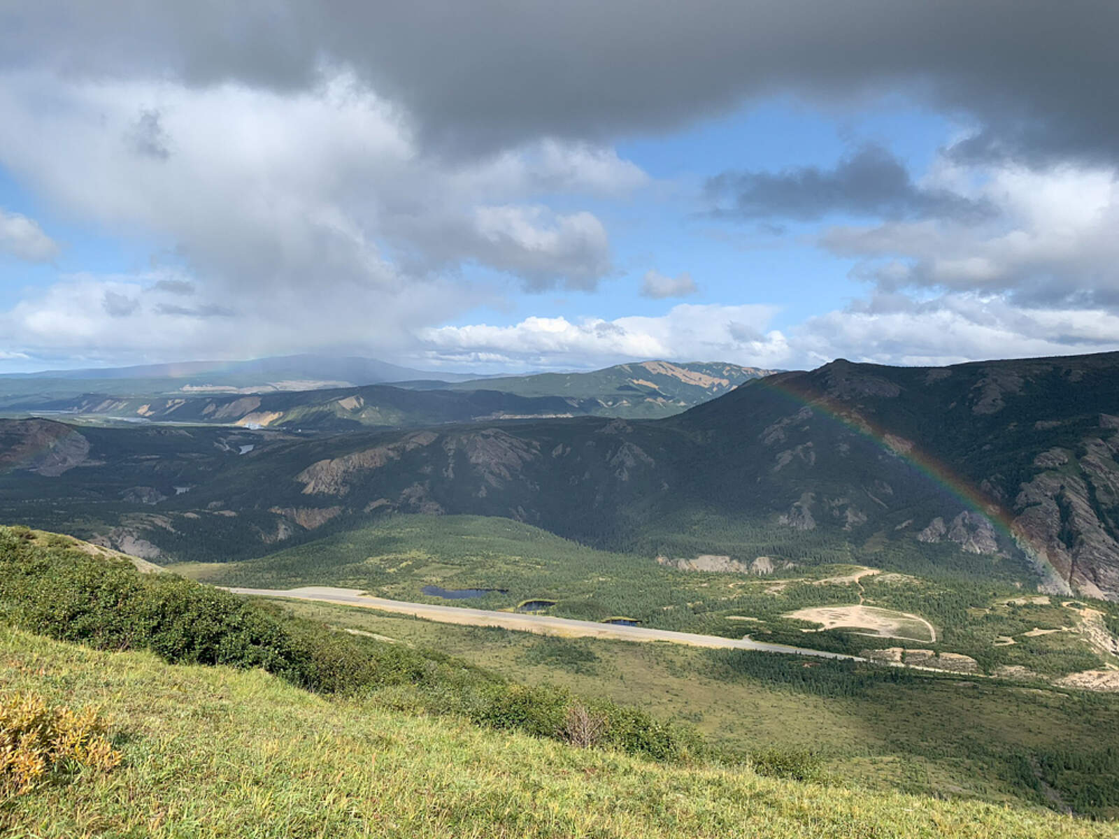
Your route departs the gulch slightly to the North after a short section where you’ll be looking directly down into the gully. The skyline above you is the ridge that leads to Mt. Healy’s rugged summit. Continue to follow the trail through steep and occasionally loose scree patches to the first obvious viewpoint, about 1.8 miles in. This point is a great turnaround spot if you’ve reached your personal summit. You’ve gained about half of the elevation you’ll need to make the true summit. From this viewpoint, the Nenana River Valley stretches both South and North for miles. To the North, the Nenana eventually drains into the Tanana River, which flows into the Yukon and finally the Bering Sea. Salmon have been seen as far upstream the Nenana as Lignite Road, which is north of you by only several miles. Consider what it took you to reach this place, and you see how strong of swimmers Salmon can be.
Dall Sheep commonly cling to the sandy cliffs across the Nenana from Mt. Healy’s East Side. There was a time following the most recent glaciations in this area when those cliffs were submerged under a deep lake. The 400-foot deep glacial Lake Moody stretched the length of the canyon below you for 11 miles, from Healy to the Denali Park Road Entrance. It formed as ice melted and held upstream of a large terminal moraine and bedrock ridge that protrudes just south of the town of Healy. The remnants of this moraine can still be seen from this overlook, looking east and north. Moody Bridge, below you to the south, is the tall bridge over the Nenana’s Inner Gorge. Its name is a nod to the lake that once existed and still causes problems for road and railroad engineers.
As you continue your hike toward Mt. Healy’s upper ridge, the trail may begin to fade. This is a testament both to the wind that sweeps and erodes the mountainside you’re walking on, as well as to the fact that few hikers reach this point. The lower sections of this trail are well trafficked. By now you’ve surpassed the high point of most day hikers, and you’re on your way to the summit block. Some snow and ice may be present depending on the season, so please be aware of your skill set and footwear limitations. A fall or injury at this point in the hike would be dangerous and a rescue could take hours.
Wherever you choose to turn around on the upper reaches of Mt. Healy’s northeast side is a phenomenal spot to sit for a moment, take it all in, and let the wind blow in your ears. If you’re able to withstand what’s sure to be a heavy wind, it may be worth scanning the crags and valleys across the canyon to your east for Dall Sheep. When ready, your descent route is the same way you came up. Your knees are in for a punishing workload, but you’ll be thanking yourself for the effort once you make it back to the parking lot and can pick out your high point with your naked eye.

Photos