Best Hiking Trails in Denali National Park
Hiking Near the Park Entrance
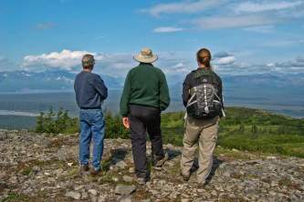
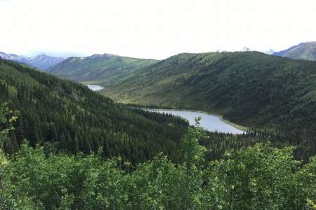
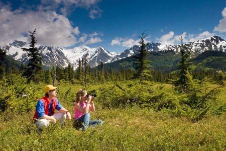
You don't have to board a bus or carry a hefty backpack to enjoy hiking through the wilderness surrounding Denali National Park. Near the entrance area, there are plenty of developed trails that offer views, a bit of solitude, and chance encounters with wildlife. Here’s a map of the Park Entrance Area trails.
Hiking in Denali National Park
The National Park Service's green shuttle buses make exploring the park easy and liberating: You hop off when you want, and then hop back on when another bus comes back through.
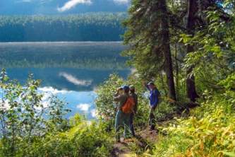
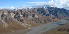
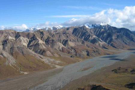
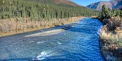
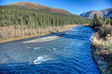
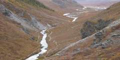
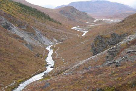
There aren't many maintained trails in Denali, so hiking here is pretty free-form. The Denali backcountry is managed by not having formalized trails, which helps to preserve a sense of exploration and route finding in the park. One popular way to hike in Denali is along the river bars, which tend to be wide, fairly dry, and easy walking. Setting off across the tundra, particularly at lower elevations, is a little more difficult. In places, you may need to whack through brush, get your feet wet in creeks, or bobble on the tundra (which some people compare to walking on carpeted basketballs). Here are more tips for hiking in Denali's backcountry.
Not ready to venture out on your own? Hire a local guide with Traverse Alaska to prepare for your independent hiking adventures. Or, sign up for on of the parks Discovery Hikes where you’ll explore Denali’s trail-less wilderness with a Denali Park Ranger.
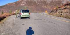
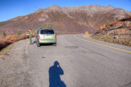
2025-2026 Partial Road Closure Update: Construction will continue on a bridge to bypass a landslide at MP 45.4 of the Denali Park Road. Transit buses will travel as far as MP 43.
How to Prepare & What to Wear
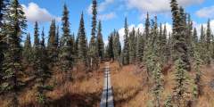
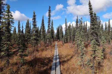
Whether you're doing a day hike, or heading into the backcountry for several days, you'll want to make sure you have the proper gear. Here's our advice for what to wear hiking in Alaska. Don't have that kind of gear in your closet? Rent it from Alaska Outdoor Gear Outfitter & Rentals. They have everything from hiking clothes and day packs, to ultralight backpacking gear so you don't feel weighed down on your expedition.
Also be mindful of wildlife. See our tips for staying safe around bears and moose, and respecting other species.
And, if you’re traveling with your furry friend, please abide by the park’s rules. They’re allowed on the park road, in parking lots, or on campground roads, but not on park trails or in the off-trail wilderness. The only exceptions are the Roadside Trail and Bike Path near the park entrance.
Show Map
Denali Hiking Trails
Trails Near the Park Entrance

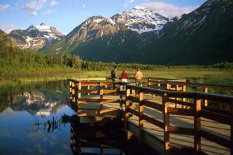
This popular trail attracts lots of folks, so don’t expect to be the only hiker. It’s still worth the trip. The trail begins at Mile 0.9 on the park road near the railroad tracks. You’ll walk on a developed trail down to the lake. After you reach the Overlook, the trail drops steeply. Along the way, especially at the overlook bench, you’ll have a panoramic view of the Nenana River, the development called “Glitter Gulch” right outside the park, ...more
A roadside hike that gains quick elevation and leads to soaring views? Count me in. A little traveled creek that rushes into one of the wildest whitewater rivers in Alaska? Hmm. Yes, please. A trail all to yourself just a few minutes from Denali’s busy front country area? Now you’re talking. Dragonfly Creek has all this and more, and you’ll only just be getting your feet wet.
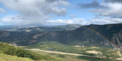
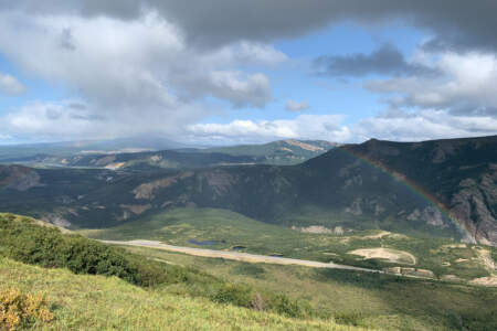
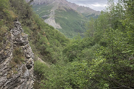
This hike introduces you to the best that Denali has to offer. The Bison Gulch trail is all about stunning views of steep river canyons, a solid, well-broken trail through alpine tundra, and an exciting summit scramble for those that reach it. For those with less time, this hike is favored for its quick access to high alpine views directly off of the Parks Highway. No need to go all the way to the summit if you haven’t the time or motivation; the ...more

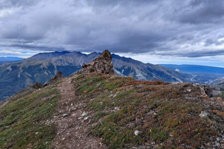
Sugarloaf offers fun, steep, and challenging ridge hiking above the hotels and restaurants of the commercial area North of Denali National Park. It’s a great place to scramble freely in this region’s semi-arid alpine zone or to enjoy a long midnight sunset. The broad, west facing peak of Sugarloaf Mountain is a rewarding summit, and once you’ve climbed the steepest trail section at the beginning you’ll likely have the rest of trail to yourself, ...more
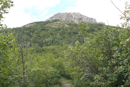
The first mile of this trail, which begins near the new Murie Science and Learning Center, is moderately steep, hiking through the forest. The forest eventually gives way to tundra. Trees turn to shrubs, and the landscape opens wide. The last 1.5 miles are even steeper. Your reward, however, is sweeping views of the Denali National Park entrance area, the Nenana River Valley, Healy Ridge, and nearby alpine ridges. Those who want to climb to the ...more
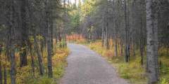
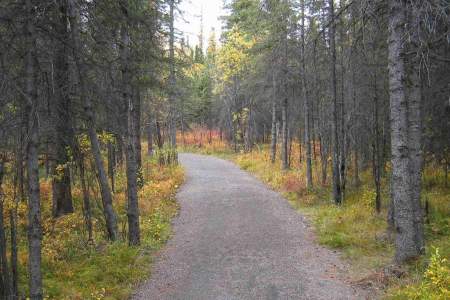
If you’re headed to the dog demonstration at the kennels, or if you just want to stretch your legs, try walking this wide, comfortable trail through the forest, up to headquarters from the Visitor Access Center. It basically follows the road, occasionally wandering out of sight of the traffic. Length: 1.8 miles Elevation: 300 ft. Time: 45 – 1 hr. one way
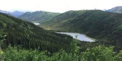
You can begin hiking at Mile 231 Parks Highway, on the west side of the road, where there is a small pullout for parking. The trail climbs steeply, and crosses the Alaska Railroad tracks. Then, the trail moderates and emerges from the forest to a grand view of the Nenana River and the Alaska Range looking south toward Windy Pass. From there the trail loops around the ridge and follows a series of three scenic lakes. Eventually, the park plans ...more
Off-Trail Hiking Areas in the Park
Not formalized trails. Unmaintained
This hike does not require crossing any glaciers or dangerous streams, which makes for a good overnight hike for those who carry an overnight camping permit.
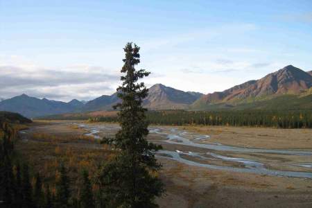
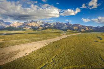
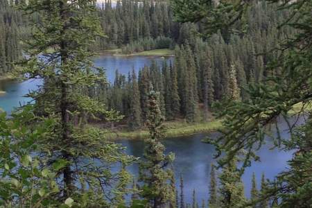
Head either direction on the Teklanika Riverbed. The river bar is really wide in this area so the going is generally easy, even though you’re still below tree-line. Choose to go as far afield as you like. There are numerous route options.
This is an unmarked, unmaintained trail and can be difficult to follow, but is a good example of the real outdoors in Denali National Park.
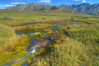
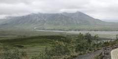
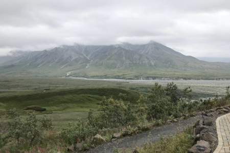
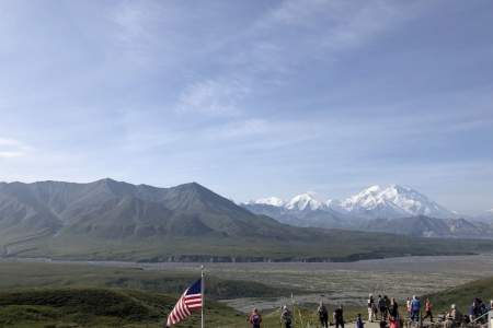
Only 33 miles from the summit of Denali, and at an elevation of 3300’, Eielson offers some of the most spectacular views of Denali (formerly Mt McKinley). There are many activities you can do here, including ranger-guided hikes up to nearby Thorofare Pass and self-guided expiration of the high-alpine tundra environment.
This informal hiking area begins at the Primrose rest area and heads up a gentle ridge until you reach the bench, which provides panoramic views of the park. Wildflowers are abundant in this area and usually peak between July 20 and August 10.

You’ll likely see plenty of other hikers here, since this is a popular maintained trail, but you’ll get plenty of scenery, too. You start by following a creek, walking beneath alders then hiking up out of it onto tundra. Dinosaur fossil footprints were found here, and today you can hear plenty of songbirds, too. Terrain goes from pebbles to squishy tundra.
Trails in the Park
Either drive your own car or take the free shuttle 15 miles out the park road to the Savage River check station. This is a popular hiking trail, and you won’t be alone, but at least you’re away from the entrance area and entering the true wilderness of Denali National Park. This is a tundra walk on a developed trail that follows the river. Good hike for kids, with possibility of seeing Dall sheep, marmots, and caribou. You can do a loop walk, ...more
Take an easy hike on a well-maintained trail from the Wonder Lake Campground to the McKinley River. This is part of the historic route that climbers used to access Denali (Mt. McKinley). Look for wildlife along the way, especially when you get close to the river.
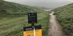
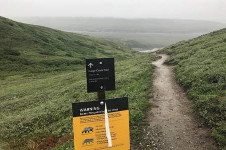
Hike 2 miles roundtrip from the Eielson Visitor Center to the Gorge Creek and Thorofare River Bars. Beyond the end of the trail, you can continue off-trail and reach backcountry camping units within the park.
A 0.3 mile loop departing from the Eielson Visitor Center in Denali National Park allows visitors to explore the alpine tundra.
From the trailhead at the Eielson Visitor Center, hike well-marked switchbacks to the top of Thorofare Ridge. At the top, you’ll enjoy views of Denali and wide-open tundra.