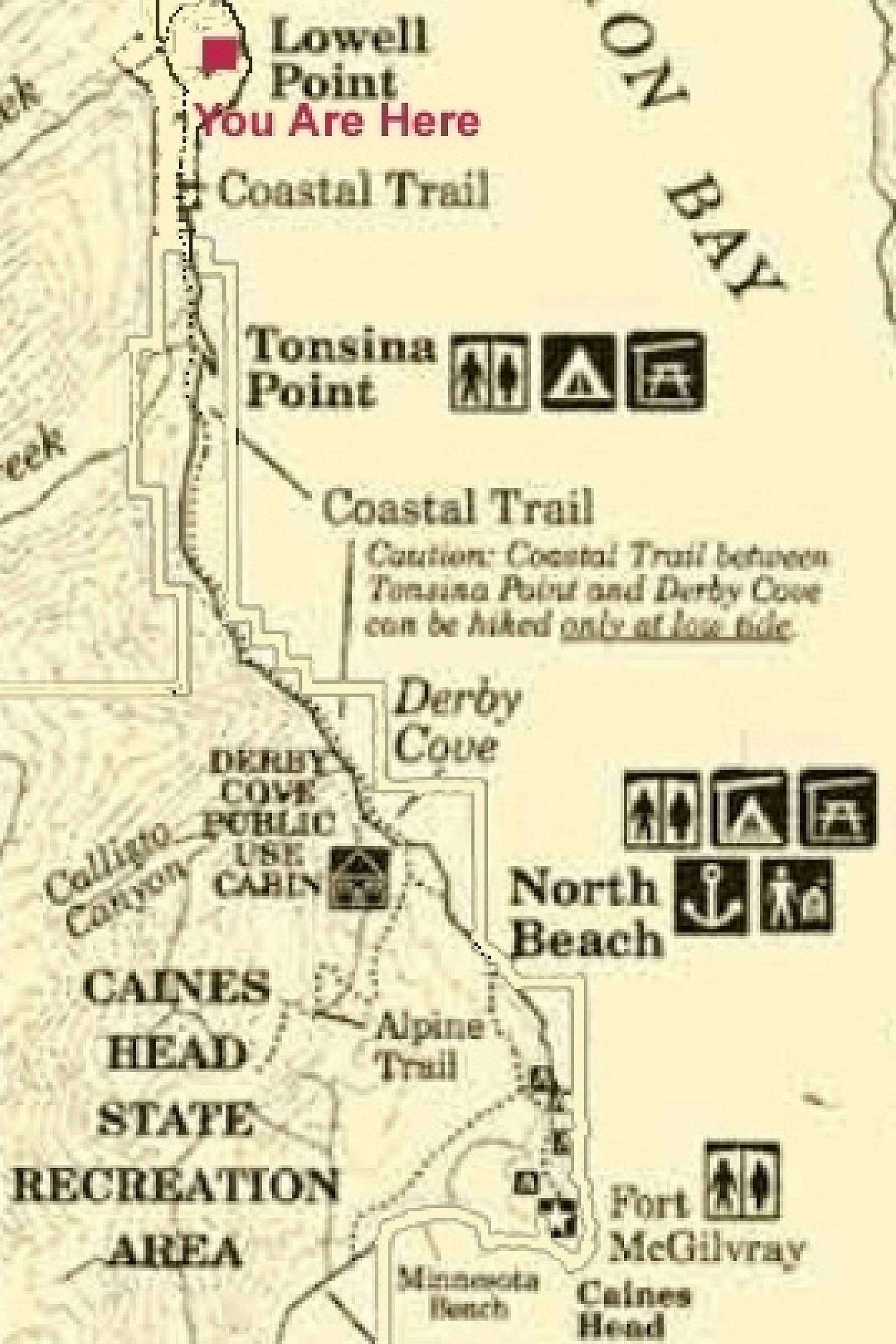
This hiking area is rich with beach trails, glaciers, bald eagles and World War II history. Start by departing from the end of road in Seward, at a nice parking area near Miller’s Landing. For the first three miles you’ll follow the Tonsina point trail that uses the remnants of an old wagon track before zigzagging down the hillside through an ancient rainforest hanging with moss and ferns. At the bottom, you’ll cross a salmon-filled creek that’s popular with the local eagles.
From Forest to Beach
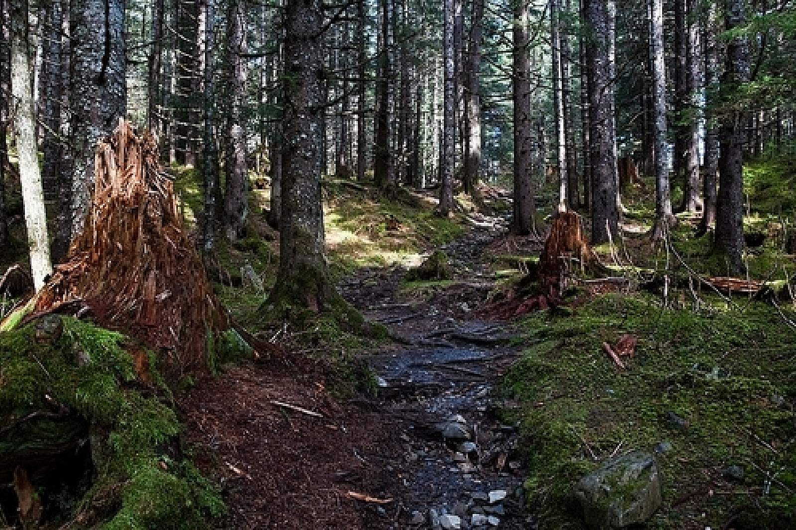
From the creek, continue along the trail that cuts through a forest of grand spruce trees that protect a mossy forest floor that is nearly devoid of other undergrowth. This mossy section of trail is reason enough to make the hike, but continue on and you’ll soon reach the beach trail, which accesses even more beautiful views.
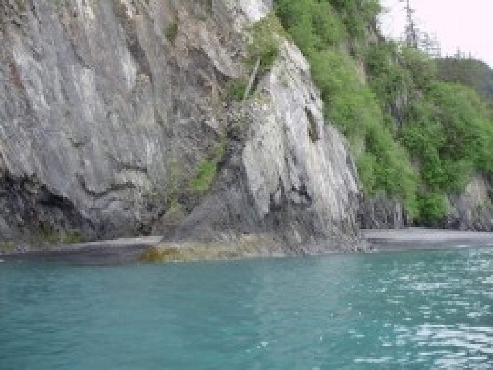
Once on the beach, follow Resurrection Bay south until you reach a sign for Caine’s Head, at a vertical cliff that extends into the ocean and won’t allow passage. The trail climbs over a forested ridge and then brings you either to another beach or, if you continue climbing, to a WWII fort where you can explore bunkers and the turret mounts for giant canons that once protected this waterway.
Backcountry Glaciers
If you’re so inclined, there’s another trail that climbs steeply into the high country, and provides backcountry access to incredible views of the fjord and a massive glacial field. This is one of the Kenai Peninsula’s best trails, but you must be very aware of the tides. If you’re doing the trail in one day, it’s best to start hiking a couple hours before low tide to get out to the fort and back without getting cliffed in when the tide comes in, which means that the water becomes too high and covers the beaches. Your best bet for this trail is to go out on one low tide, spend the night—in either a forest service cabin or campsite—and then return the following day or several days later on another low tide.