Why Take This Hike
It’s not very often that people can see a glacier in an untamed and remote location, far from any road or cruise-ship route. But if you feel capable and confident enough to climb a very rough trail up many vertical feet of rocky terrain, then you might consider undertaking the hike to Snowbird Pass, located high in the Talkeetna Mountains just north of Hatcher Pass. From this vantage point you can look down the entire length of Snowbird Glacier. And you probably won’t have to share that view with anyone but your hiking companion(s). Enveloped by that magical sense of remote solitude, the view becomes all the more special.
The Details
Reaching backcountry glaciers usually requires both skill and work. You must carry ropes, crampons, and an ice axe, and have the wherewithal to travel through trackless country. Snowbird Glacier, in the Hatcher Pass area, is an exception. It requires just over 4 miles of hiking (from the trailhead for Reed Lakes Trail) to reach Glacier Pass and overlook Snowbird Glacier. But don’t mistake it for an easy hike. The last 3 miles take considerable work; fortunately, you’ll have a trail to follow almost the entire way.
From the bridge on Archangel Road, you first hike the wide and mostly level Reed Lakes Trail. After 1.5 miles, you’ll reach the all-but-gone Snowbird Mine Village, the remnants of which lie in a small clearing at the road’s end.
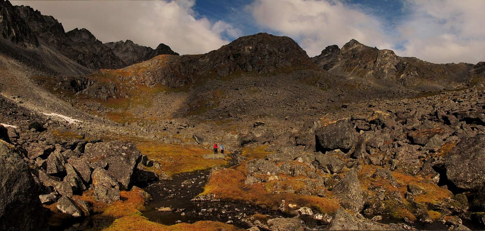
Just beyond, the trail splits; the left-hand trail leads toward Snowbird Pass, and you begin climbing in earnest up the valley’s left wall. On this very rough, steep trail you’ll pass rusted cables and rotten wood beams, as well as other remnants of the pulley system that moved ore from Snowbird Mine to the village below.
Just over the lip of the hanging valley, you begin winding up through the remains of this mine. Here, you pass even more remnants of the mining days of yore: collapsed cabins, broken trestles, and rusted cables, all now lying in the silence of slow decay. Beyond the upper end of the mine, you’ll continue to pass old pipes. Then, upon entering a pool-dotted canyon, the trail all but peters out.
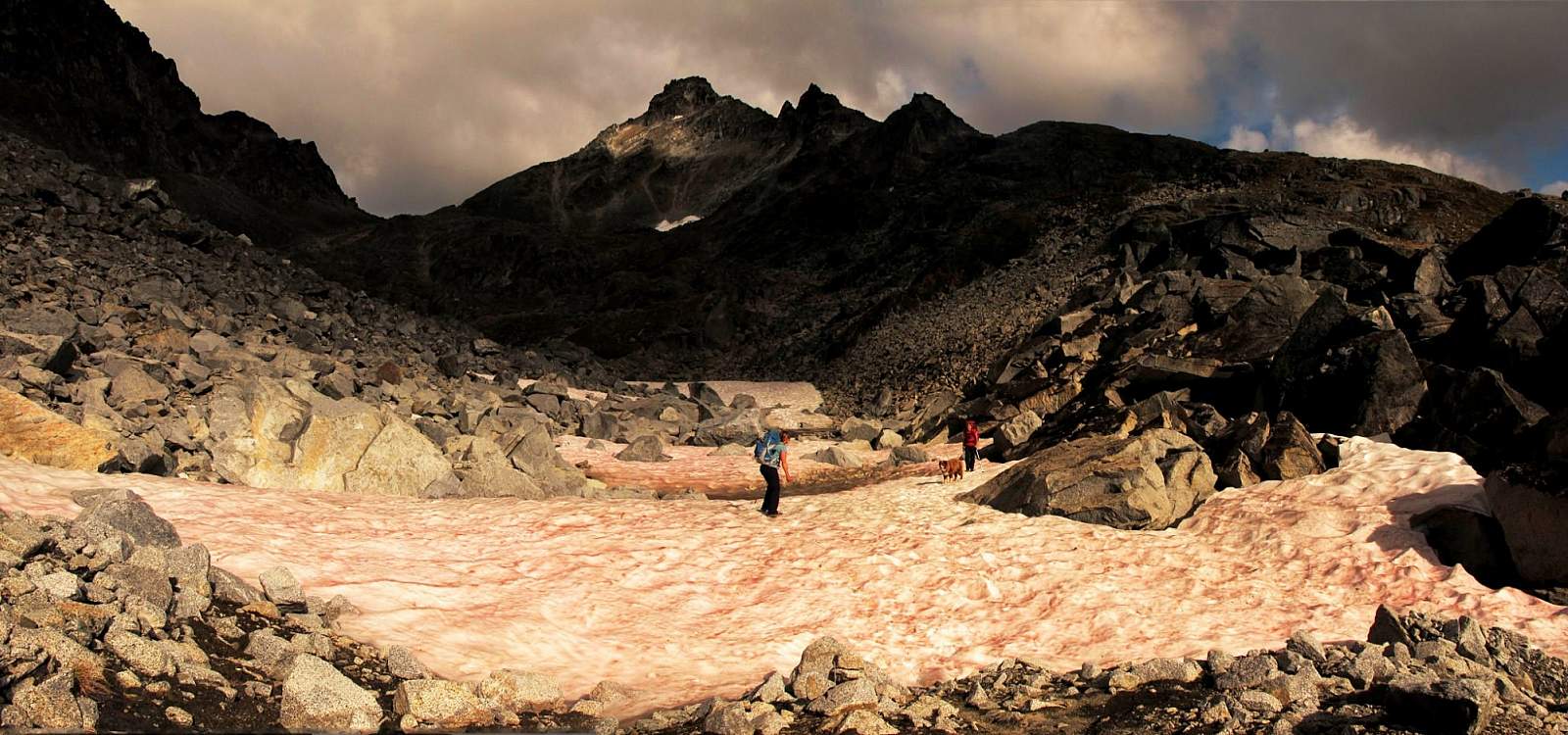
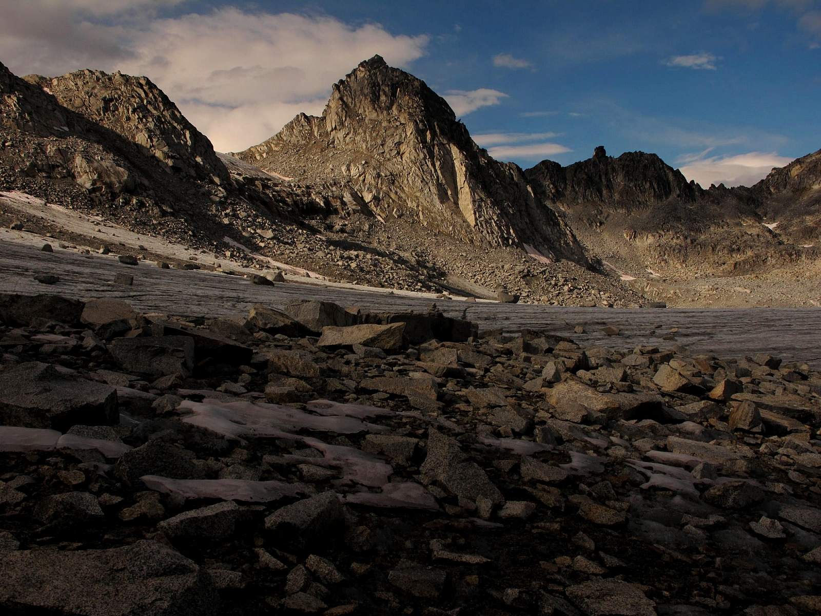
At this point, follow the remnants of Glacier Creek up the gully on the left side of the valley. When you reach the gap above the last sources of Glacier Creek, you should again come upon a trail. If you have only limited experience with off-trail hiking, you’ll probably find this comforting. But you don’t really need the trail. Continue making your way up the gully as it winds upward, past impassable ledges and spires on your left, and a high pile of moraine rising on your right. You may have to cross some snow patches and occasionally jump a small rivulet, but these should prove minor obstacles.
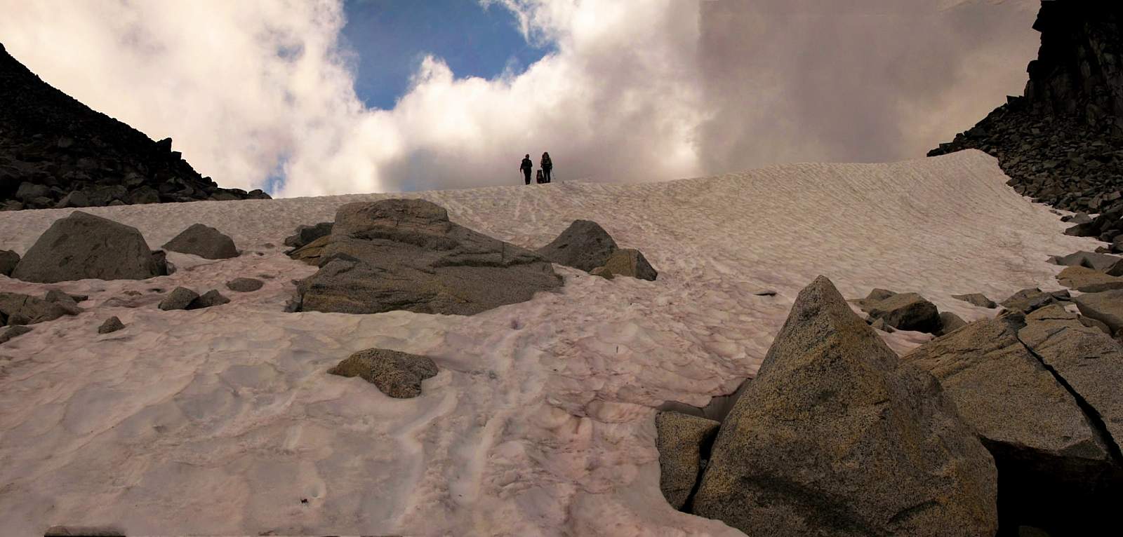
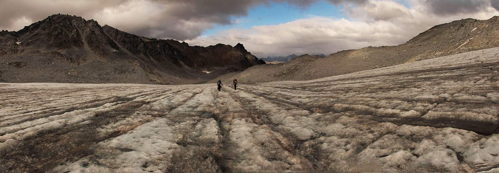
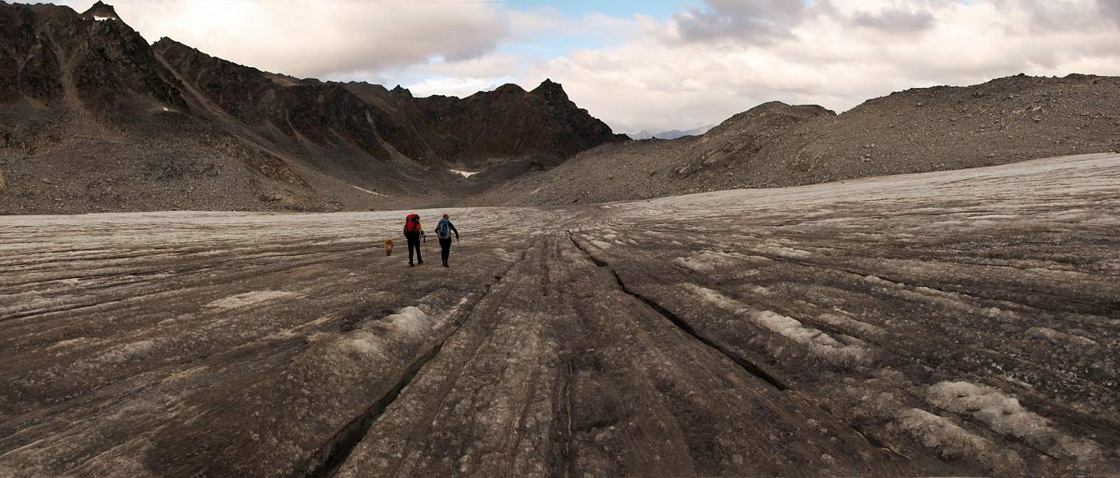
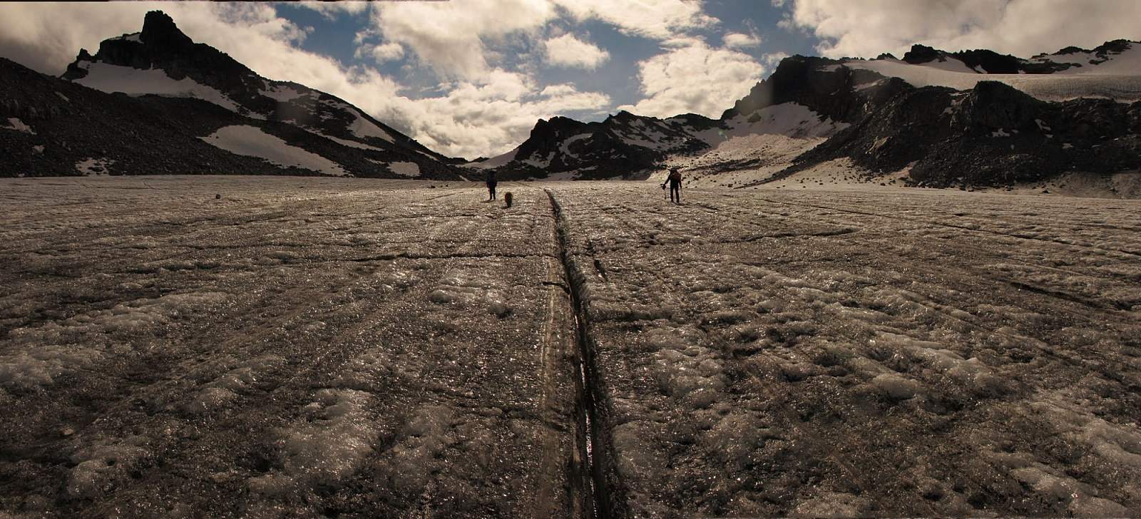
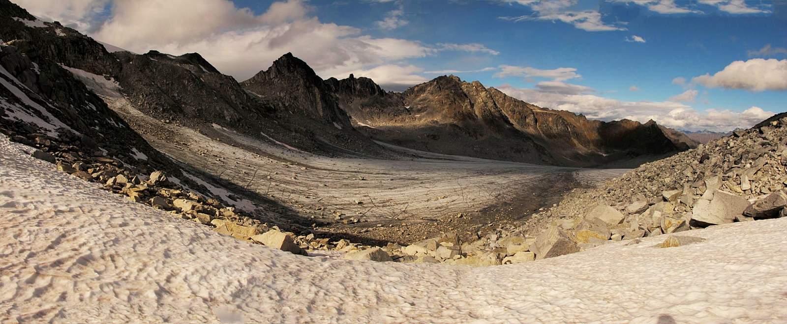
When the crest of the pass comes into view it’s just a few more feet to reach it (approximately 5,100 feet). After hiking the short way across the pass to its far side, you’ll stand above the steep slope of a big boulder. At the base of this pile of rocks lies the uppermost end of Snowbird Glacier. From this high point, the glacier extends down and away from you for more than 1 mile.
The glacier appears so suddenly that you might feel as if a curtain has lifted, allowing the great mass of hard-packed snow and ice to shine before you. After climbing for so long through rocks and dirt, this sudden appearance of ice seems to shine in contrast to the dingy peaks surrounding it.
Not many years ago, Snowbird Glacier reached right to the crest of the pass where you now stand. One could literally walk off the pass onto ice. No longer, though. Like most glaciers in the Chugach and Talkeetna mountains, the glacier has receded substantially in recent years. If global warming continues at its present rate, it won’t take many more decades before it melts into the rocks below. For now, though, it still remains a commanding sight—and well worth the long climb.
(For more, see Walk-About Guide to Alaska, Volume Four by Shawn R. Lyons)