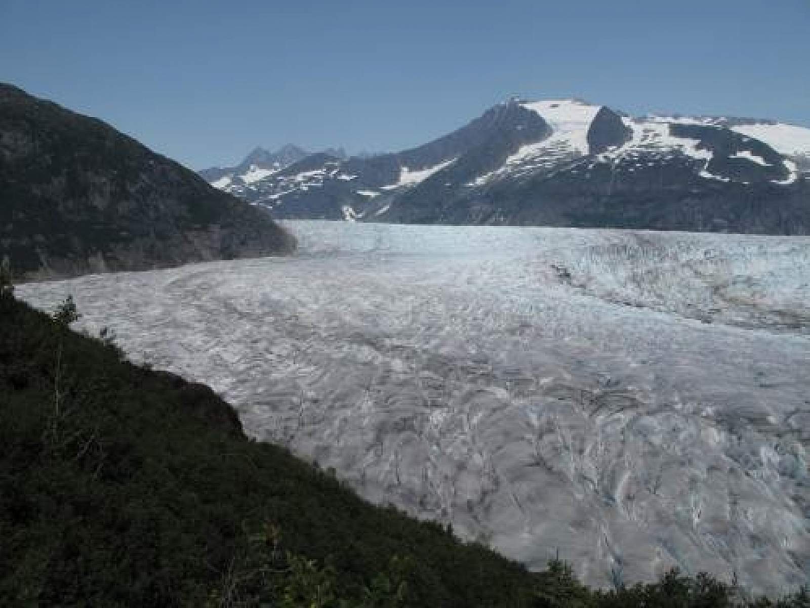
This rugged, high-adventure outing on the west side of the lake leads 3.5 miles (one way) to a rocky outcrop with a stunning overlook of the Mendenhall Glacier. Ambitious hikers prepared for self-sufficient backcountry travel and route-finding through difficult terrain can also climb the slopes of 4,228-foot Mt. McGinnis or explore a route to the edge of the Mendenhall Glacier itself.
The view from the overlook affords incredible views of what seems to be an ocean of ice. This trail has long sections with little change in elevation then short bursts where you're rapidly gaining elevation, including some pretty long rock staircases (some with railings.) You will have to cross a few small creeks to get to the end of the trail, but nothing that will come up past your ankles. Expect slippery rocks, wet spots and places where the route is not immediately obvious.
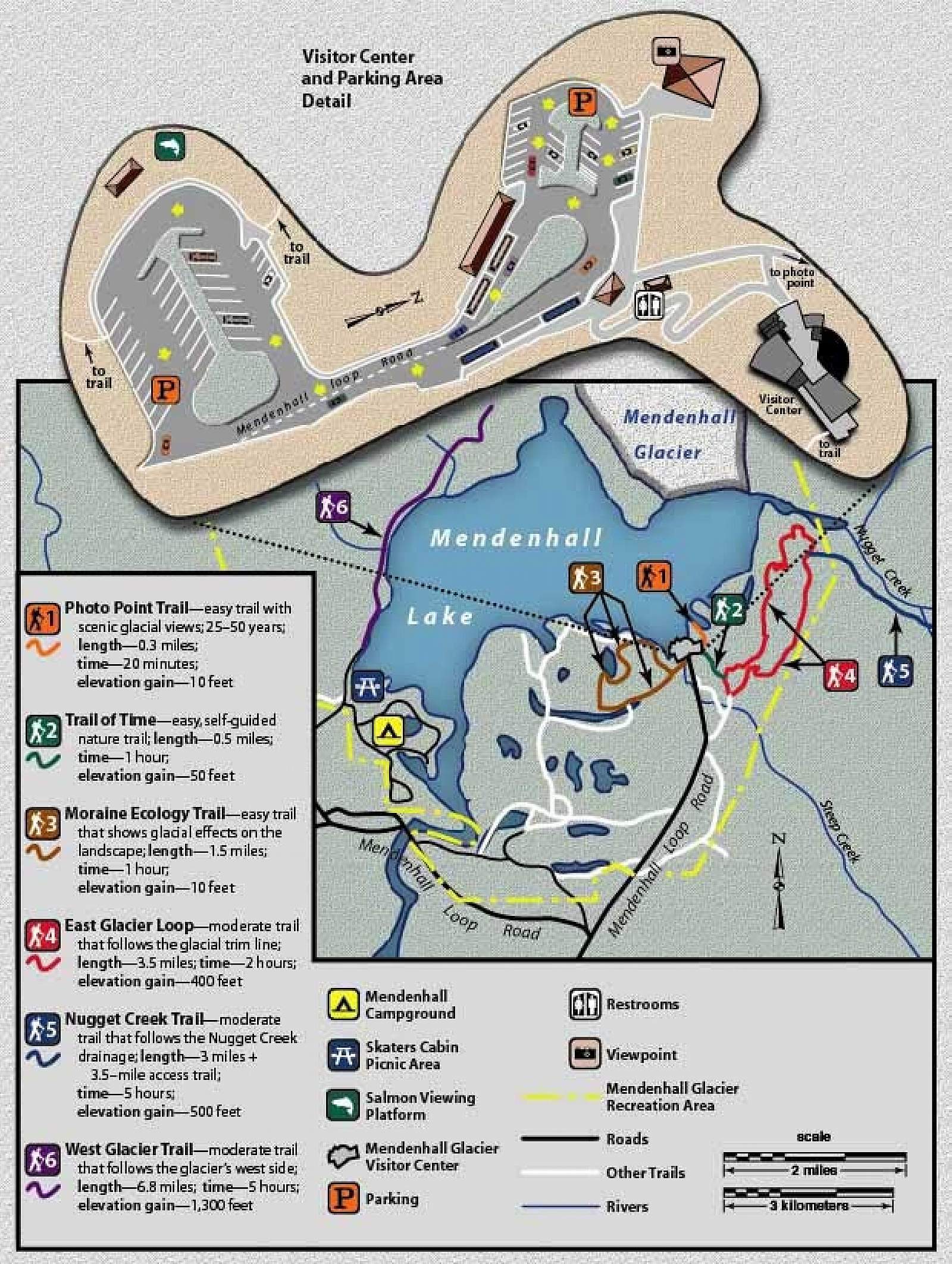
NOTE: The West Glacier trailhead cannot be reached from the Mendenhall Glacier Visitor Center. See directions below
Trip Details
- This hike showcases the impact of glaciation on the landscape. From the north side of the parking lot, the trail traverses an area dominated by willows, cottonwood and alders, vegetation that colonizes land recently exposed by retreating ice. In a few places, it skirts the old growth zones that went untouched by the glacier in recent times. The boundary between the two vegetation types is called the glacier “trimline.”
- About 2.5 miles out, you’ll find one of several potential routes to the glacier, often hard to follow or marked with rock cairns. Approaching the glacier without a guide is officially discouraged, but experienced hikers prepared for the terrain regularly make it to the ice and back. Before going, check in at the visitor center for advice and research online for recent trail reports.
- The main trail leads about 3.5 miles to a rock outcrop with a spectacular view of the glacier. A primitive route continues west toward the summit of Mt. McGinnis.
- CAUTION: The very rugged terrain off the main trail has a notorious reputation for hikers getting lost and/or injured and then requiring rescue. As a result, the U.S. Forest Service recommends that visitors keep to the obvious trail and not try to bushwhack or pioneer routes cross-country to the glacier. If you decide to make the attempt anyway, stick to an obvious route marked with cairns and take strict care to backtrack over the same track when returning to the main trail. Give yourself enough time to get back before dark, be prepared for backcountry conditions and bad weather, and be alert to bears.