Parks & Trails in Juneau
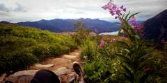
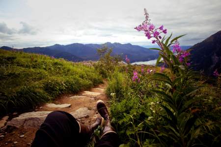
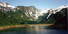
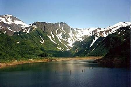
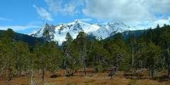
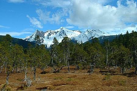
Juneau has some of the best hikes in Southeast Alaska. Some offer glacier views, others break out above to tree line for views of Juneau itself, the Gastineau Channel, and beyond.
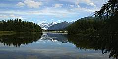
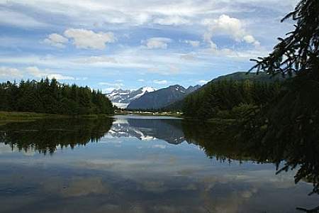
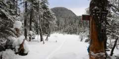
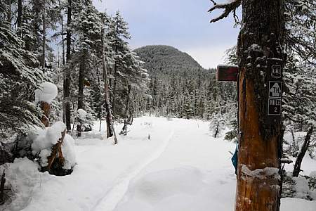
A few trails are can be accessed near downtown, like the Mount Roberts Trail that is a mile from downtown just off of Basin Road. Other trails aren’t as close to downtown, but they shouldn't be overlooked. For example, busses and taxis will bring you to the Mendenhall Visitor Center, located about 13 miles outside of downtown Juneau. There you will find several trails, each offering different views and vantage points of the Mendenhall Valley. A favorite is the East Glacier Loop Trail which takes roughly two to three hours to complete.
Below is a list of some of the best trails in Juneau.
Show Map
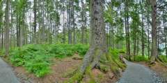
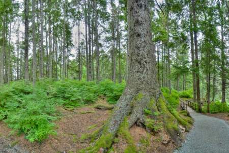
Juneau Hiking Trails
Located in Mendenhall Wetlands State Game Refuge, this trail is wheelchair-accessible and close to the airport. It has many opportunities for waterfowl and bird watching. It is excellently maintained. This makes the trail a very easy hike. Many times you will see strollers, runners and bikers on this trail because it is paved.
Once you reach the Mountain House at the 1,800-foot level of Mount Roberts, step onto trails that begin in a sub-alpine ecosystem and climb another 300 feet into the true alpine. With sixty stair steps, a length of one-half mile and an elevation gain of just 150ft, the main trail will take you to open vistas, mountain valleys, snow gullies, rocky ridges and stunning views of mountains in Glacier Bay, British Columbia, the Southeast Alaskan… ...more
This is a wheelchair-accessible trail that follows the Mendenhall River greenbelt area, starting at Brotherhood Bridge off Glacier Hwy. The name is Tlingit for “going back clearwater trail.” Expect a lot of traffic. The trail is 2‑miles long, paved, and provides one of the great views of Mendenhall Glacier, beginning at the Brotherhood Bridge trailhead. In mid-summer, over a flat field of iris and fireweed, the Mendenhall rises between… ...more
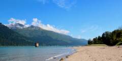
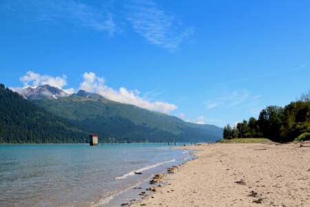
Nestled at the end of Douglas Highway, Savikko Park, often referred to as Sandy Beach, is a local favorite and a hidden gem for visitors. It’s the perfect spot for a scenic stroll, and locals love bringing their dogs here to run. Be sure to bring your camera — this is one of the best places to snap a photo, whether it’s the mountains, the water, or a bald eagle soaring by.
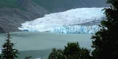
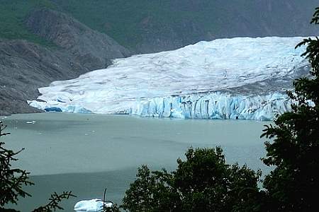
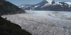
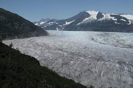
The lake and glacier are the premier destination for the thousands of cruise-ship tourists who visit Juneau, but they don’t venture much beyond the visitor center and the short trails just outside it, leaving the mountains above the center very quiet in comparison.
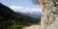
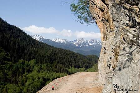
The path to the Perseverance trailhead, Basin Road, showcases a dramatic change from urban to wilderness, leading from downtown Juneau to a spectacular canyon. At the end of it is where Perseverance Trail begins, and this former rail line (named for the mine it once serviced) quickly climbs up above the Gold Creek valley. There’s plenty to see along the way, including old mine shafts that blow cool winds, and a stretch of trail where the ...more
The first part of the trail follows an old tramline where there are many berries. The right branch of the trail leads to the dam, which was built in 1914 to create hydroelectric power. The other trail leads to the reservoir.

This trail was built to provide access to the John Muir Cabin. The trail is extremely muddy in summer and rubber boots are recommended then, but it is a great snowshoe and ski trail in winter. There are many huckleberries and blueberries alongside the trail and most of the trail has been planked or has small bridges to protect the undergrowth. The cabin is open to the public between 10am and 5pm.
Drive to the end of Thane road and park at the dead end, where a nice waterfall sets the mood for this three-mile hike through a beautiful rain forest. Mud and exposed roots make for difficult footing, but the trail is flat — a rarity around here.
As glaciers retreat, plants move in to occupy the recently exposed land in a process called succession. This entire trail is a classic example of Ice Age succession, since you’ll pass from mature forest to scrub trees to rocky moraines as you approach the glacier. There are picturesque views along the Herbert River, and while the hike is mostly flat and one of the area’s easier walks, it’s long — about 5 hours round-trip. The trail is open to… ...more
This flat trail — a must for birders — takes you past the Juneau International Airport runway and into the famed Mendenhall Wetlands. You’ll start by following the Mendenhall River until you get past the runway. Then the trail veers left, but a smaller footpath follows the embankment above the Mendenhall out to where it empties into Lynn Canal. Follow the main trail for about another 1.5 miles, past a small covered shelter and the largest tree… ...more
This unmarked trail is named for Alaska’s Second Regional Forester, B. Frank Heintzleman. He was also Territorial Governor between 1953 and 1957. Mountain goats are often seen along this route. After crossing Jordan Creek, the steep ascent begins. It is possible to hike from the Mendenhall Glacier Visitor Center from this trail.
Adjacent to the Airport and accessible off Ratcliffe Road, this trail runs through the wetlands between the mainland and Douglas Island. It’s a great walk for families, birdwatchers, and exercisers.
Sheep Creek was named by Joe Juneau and Richard Harris after mistaking mountain goats for sheep. The trail begins in the forest, rises abruptly, then drops into Sheep Creek Valley. The old mining buildings are barely standing. The trail then switchbacks up. If the rest of the trail is hard to find, follow the powerlines. Be aware though — the powerlines are still fully charged!
This trail offers fantastic views of the surrounding mountains. The trail is not maintained and may be muddy in places. Above the treeline there are many wildflowers and small pools of water. Hiking boots as well as water boots are recommended.
As you approach the south side of Herbert River, there’s a turnoff that ends at the Windfall Lake trailhead. The trail, some of which is planked, follows the Herbert River through the forest. A spur trail once led to Herbert Glacier, but because of beaver damming it is no longer accessible during the summer. However, you can ski to Herbert Glacer via this trail in winter. This is a three-mile hike to a Forest Service cabin on picturesque… ...more
Juneau is one of only two capitols in the United States that isn’t accessed by roads — only boats and planes can reach the city. But there is a stretch of paved road that runs north from town, past Auke Bay and towards Berner’s Bay. You’ll pass the University of Southeast Alaska and the ferry terminal before getting “out” of town. It’s a great trip, nearly 50 miles out and back.
The trail is very muddy in summer but is a great ski trail in winter. It leads through a muskeg meadow, through the woods to another meadow. The hills past this trail offer many more skiing opportunities. The eastern part of this trail is open to snowmobiles.
Don’t confuse this unnamed trail with Sheep Creek Trail (which is a relatively flat, three-miler also worth your time). So how do you find the trail head? With your back to the water, it’s to the right of Sheep Creek and the hatchery buildings, to the left of the first house, and at the top of the embankment that leads up to the road. Hike up to the power line (from Snettisham Lake — Juneau is nearly 100% hydropower), cross it, and then follow… ...more
Just before Echo Cove is Bridget Point State Park, where you’ll find this well-maintained trail. It meanders through muskeg, mature forest, and grassland until it reaches a beaver dam and views of the Lynn Canal. Bears often visit the meadow, but leave it to fish the stream.
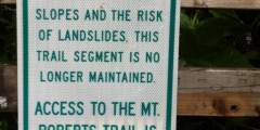
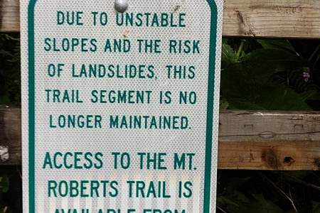
Steep trail that is worth the climb: you’ll find excellent views of Gastineau Channel, Juneau, and Douglas from here. NOTE: The 6th Street trail head is no longer maintained. Hikers must access Mt Roberts via the Basin Road trail head.
This makes for a good half-day to overnight hike that leads to a small lake with a fee cabin. Peterson Lake isn’t a classic beauty of an alpine lake, but its lower elevation (only about 750 feet above sea level) means a longer hiking season, and it is a peaceful spot to relax and row around a pretty lake edged by a garden of floating pond lilies
A side trail from Perseverance that breaks off 2 miles into the hike, this trail is generally muddy because of the beautiful waterfalls and snow that resides on the mountains until early summer. (And there’s extreme avalanche danger in winter.) But it’s a great day hike, and if you keep to the left you can access the alpine high country of Mount Juneau. There are beautiful alpine lakes and wildflowers along the way as you gain over 1,200… ...more
This trail winds its way back to three cabins in Point Bridget State Park. If you’re interested, find out more information about Cowee Meadow Cabin, Blue Mussel Cabin, and Camping Cove Cabin. It begins by quickly descending from muddy meadows through forest and into a broad valley. Another mile on this easy, well-maintained path brings you to Cowee Meadows cabin. Here you’ll find wonderful views of the surrounding mountains, just a few… ...more
The trail starts near Nugget Creek dam and hikes through the small vegetation to the Vista Creek Shelter. It passes through incredible chasms to above the timberline. Bears and mountain goats are often seen here and there are mining ruins alongside the trail.
This side trail leads to the edge of the AJ Glory Hole, a massive chasm with 800 foott deep walls. The mine produced millions of dollars in gold during its operational life. The hole was created in a process where miners would blast under a mound of earth and have it collapse. This allowed for easy mining of the ore and then the hole could be blasted a layer deeper. The hole is roughly 1⁄2 mile long and 1⁄3 mile wide and has vertical walls.… ...more
The trail is very steep from this point to the summit. When the weather is good, some people walk over toward Granite Basin on the ridge. There are marmot, spruce grouse and black bears seen here often.
Near the end of the North Douglas highway is a small half-mile trail leading out to the north end of Douglas Island. The small beach there offers excellent views of Admiralty Island, the Chilkats, Lynn Canal, and the mountains behind the Mendenhall Glacier. You’ll see sport fishers trolling for king salmon, and the occasional humpback. The trail is wheelchair accessible and used by tour bus groups, but go after 5PM and you’ll likely be… ...more
This trail was designed to be a hiking and skiing trail, and while there usually isn’t enough snow for great skiing, recent upgrades have made this an excellent hike through the woods. Big trees, good footing, and the remains of mines make for an interesting walk, and watch for porcupine and deer. You’ll be hiking near the Treadwell Ditch, which collected water runoff from the lakes above and turned it into hydroelectric power for miners. ...more
This hike begins on West Glacier Trail (Mendenhall Glacier) West Glacier Trail (Mendenhall Glacier) , which you’ll stay on from the parking lot past skater’s cabin. Keep going. You’ll gain elevation as you hike the edge of the Mendenhall Glacier down on your left. After a mile or so, the trail turns sharply to the left as you begin a long and strenuous ridge hike that eventually takes you to the apex of Mount McGinnis — the most perfect peak… ...more
This trail was named after John Lemon, one of the first prospectors to cross the Chilkoot Trail. It is recommended that you wear water boots and long-sleeved shirts because of the mud and overgrown brush. There are many berries and, therefore black bears in this area.
This trail was named for a local forester and is an undeveloped route. There are many flowers and blueberries as well as salmonberries along the trail. The trail begins with a moderate grade butsteepens quickly and becomes wet with no switchbacks. The trail disappears above the timberling, but you can continue on to Carin Peak if you wish to do so. Waterproof hiking boots are recommended.
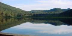
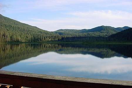
The Auke Lake Trail was originally built to access the John Muir Cabin. It also provides access to Spaulding Meadows, an excellent place for Nordic skiing during the winter. The trail provides views of the Chilkat Mountains, Admiralty Island, Gastineau Channel, and Mts. Stroller White and McGinnis. The trail also offers plenty of birding opportunities, especially now that a recent $1.2 million update was completed by the University of Alaska… ...more
Two lefts past the Alaska Marine Highway Juneau Terminus is the road to Auke Bay Recreational Area. Inside, you’ll find Point Louisa, a traditional fishing ground for the Auke people (a subgroup of Southeast Alaska’s First People, the Tlingit). Point Louisa is a good fishing spot with good water views, covered picnic areas, and gently sloping gravel beach make it a family favorite.