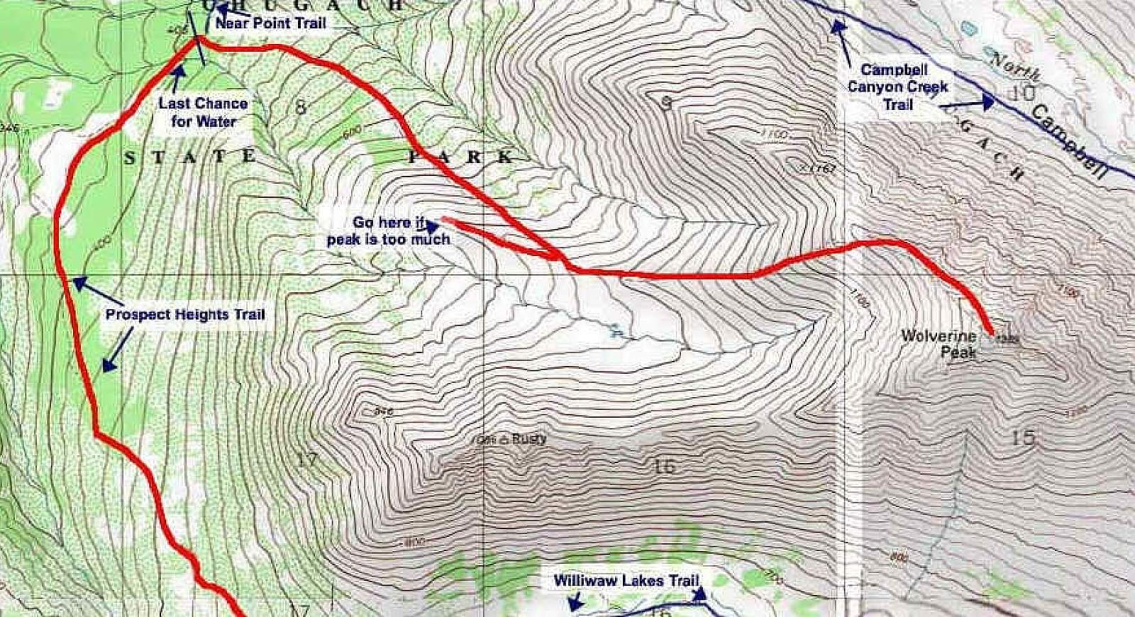
This is an easy hike, if not a bit muddy in the spring up to a popular peak. Take the trail out of Prospect Heights parking lot and turn left within 200 feet. The trail drops down to a creek and then climbs to where it eventually splits. Go straight for Near Point, or turn right for Wolverine. Near the top ridge, keep your eyes open for the remains of an old aircraft that crashed many years ago.
Directions: From the new Seward Highway go east on O'Malley Rd for ~4 miles at which point the road bends sharply left. Immediately after the bend, turn right onto Upper O'Malley Road. At the "T" intersection, turn left onto Prospect Dr. One mile further, bear left where Prospect Drive intersects Sidorof Lane and continue .1 miles to the Prospect Heights parking area.