Valley of 10,000 Smokes Backpack
Distance
40 miles
Difficulty
Moderate
Why Choose This Trip?
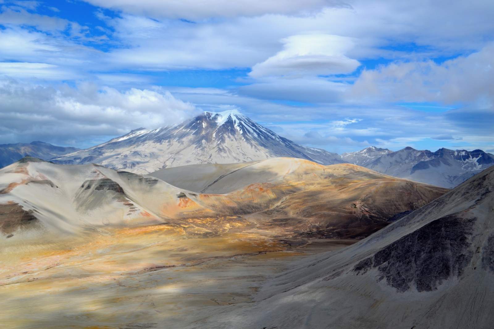
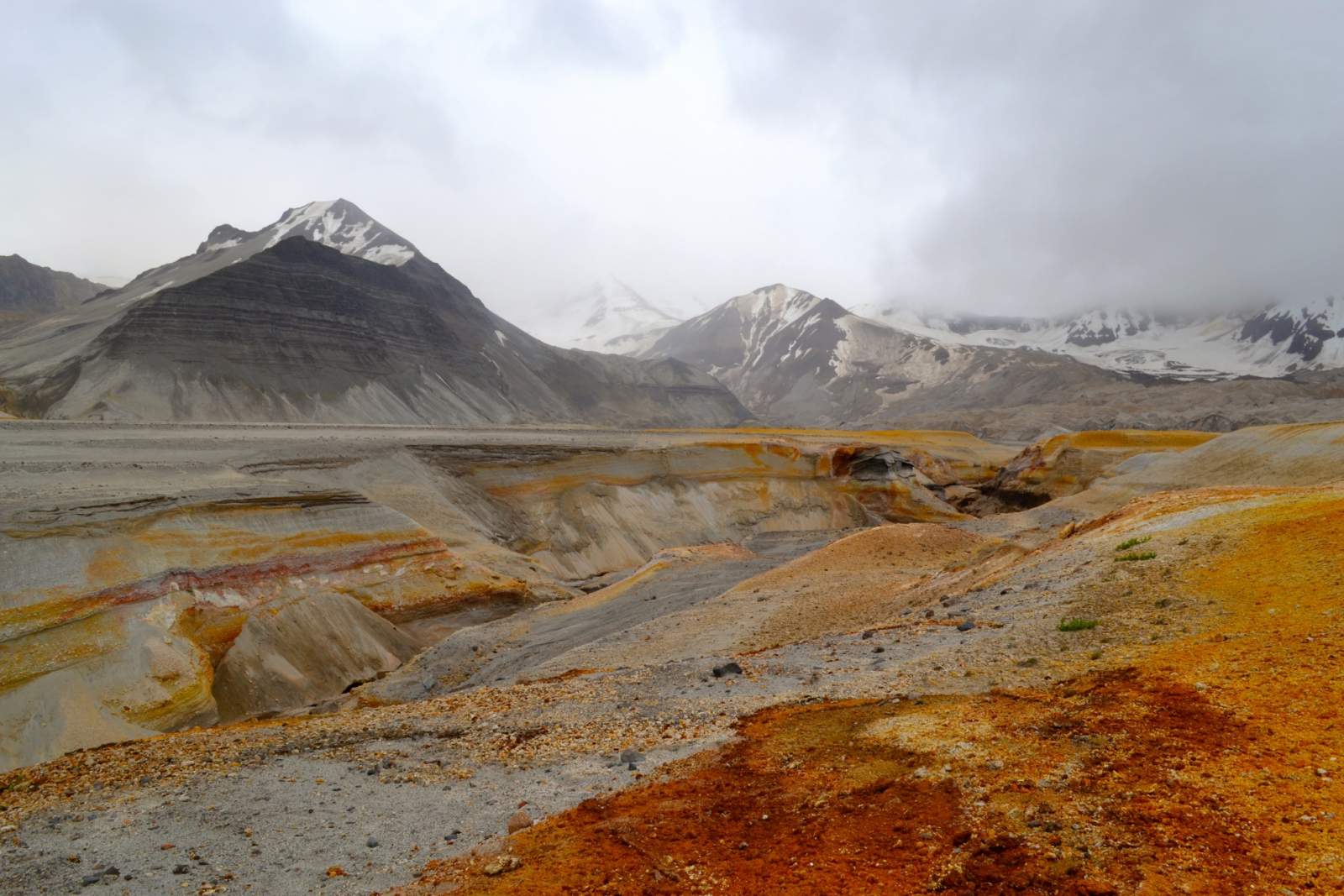
Experience a landscape like no other - a desert-like moonscape ringed by glaciated volcanoes!
Trip Type
Backpacking
Region
Southwest Alaska
The Route
This trip begins at the Three Forks Visitor Center. On the bus ride there, keep an eye out for the trail on the right side of the road; when the fireweed gets tall it can be hard to find. From the visitor center, walk back down the road 2/3 of a mile to a trail heading south.
Follow the trail just under one mile to Windy Creek. There's excellent camping along the creek if you arrive late in the day. Continue across Windy Creek, using caution on the river crossing. Look for the social trail worn into the pumice to lead you up to the Valley and around the Buttress Range of mountains to your south. There are a couple possible campsites on the east side of the Buttress Range where fresh water drains off the mountains.
Continue wrapping around the edge of the Buttress Range heading south and staying west of the River Lethe. Wait to cross that river until you're due west of Baked Mountain. Once across, head towards East or West Mageik Lake to make camp.

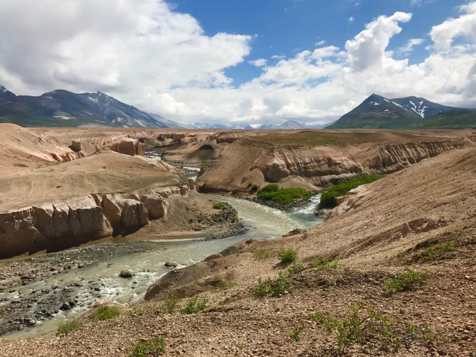
Unique rock formations between East and West Mageik Lakes (photo courtesy of Haley Johnston)
The next good campsite is along the banks of Knife Creek. On the way there, stop at the Novarupta crater to see the epicenter of the blast that created the Valley of 10,000 Smokes. Other excellent day hikes include Mt. Cerebus, Broken and Baked mountains, and Katmai Pass. When you're ready to exit the valley, wrap around the north side of Baked and Broken Mountains and head back to your previous crossing of the River Lethe. Continue back the way you came to Three Forks Visitor Center, and be sure to get there before the bus departs or you'll be camping in the visitor center's yard until the buss comes the following day.
Distance
40+ miles, depending on the side trips and routing
Number of Days
6-8
Backcountry Starting Point
Three Forks Visitor Center
Backcountry Ending Point
Three Forks Visitor Center
Trip Logistics: Complex
- Fly from Anchorage to King Salmon, AK via a commercial airline flight. Or fly directly from Anchorage to Brooks Camp and skip step #2.
- Transfer from King Salmon to Brooks Camp via one of King Salmon's air taxis.
- Spend a night at Brooks Camp in the National Park service campground. Make reservations well in advance if you're here during the busy July/August season.
- Catch the Katmailand bus from Brooks Camp to Three Forks Visitor Center. It typically departs Brooks Camp at 9 a.m.; reservations are required.
- On your return, catch the Katmailand bus back to Brooks Camp. A reservation is required.
- Return to King Salmon on an air taxi and then continue on to Anchorage, or arrange travel directly back to Anchorage from Brooks Camp.
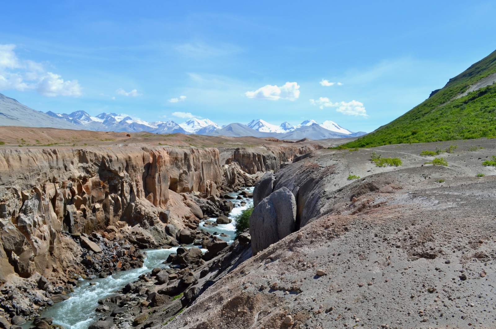
The River Lethe (photo courtesy of Haley Johnston)
Expected Hazards
- River crossings. These are even more hazardous in the Valley of 10,000 Smokes than elsewhere in Alaska. The rivers that flow through the valley erode their volcanic riverbanks, creating deeply incised canyons. When the water levels rise, it's especially difficult to determine the depth of creeks and rivers. Snow bridges can persist well into summer, spanning the deeply incised rivers of the valley. If crossing on a snowbridge, be absolutely sure of its strength before trusting it with your weight.
- Severe wind. The wind absolutely howls through the Valley of 10,000 Smokes from Katmai Pass. Take extra care to pitch your tent securely each night.
- Bear habitat. Make noise and carry bear deterrents, as brown bears live here.
- Scarce water. It is a rare trip in Alaska where water is not in copious and frequent supply, but this is one of them. Carry at least a day's worth of water at a time.
Experience Level Necessary: Intermediate
This trip is suitable for intermediate backpackers - those who have backpacked before, but not necessarily in Alaska. The actual hiking along this route is relatively easy; there's little steep or difficult terrain unless you seek it out. Previous backpacking experience is recommended, but the most important skills for this trip are safe river crossing technique and knowing how to solidly pitch your tent to withstand the valley's severe winds.
Other Advice
Because of the Valley's intense winds, a pair of ski goggles or safety glasses is a worthy addition to your gear list. These are great for protecting your eyes from airborne pumice, especially if you wear contacts.
Will you see other people in the backcountry?
Possibly. The Valley sees few backpacking groups, but it's a popular destination for National Park Service and US Fish and Wildlife Service employees based at Brooks Camp or in King Salmon.
Land Manager
Katmai National Park and Preserve
Starting Point: Three Forks Visitor Center, 58.368734, -155.383066
Possible Campsite along Windy Creek: 58.355576, -155.382723
West Mageik Lake: 58.238827, -155.282991
East Mageik Lake: 58.238827, -155.239733
Ending Point: Three Forks Visitor Center, 58.368734, -155.383066
USGS Maps
Mt Katmai B-5
Mt Katmai B-4
Mt Katmai A-4
Cost: $$$-$$$$
The price of flying to Brooks Camp makes this a relatively expensive trip. You may be able to fly from Anchorage to King Salmon using air miles.

Photos