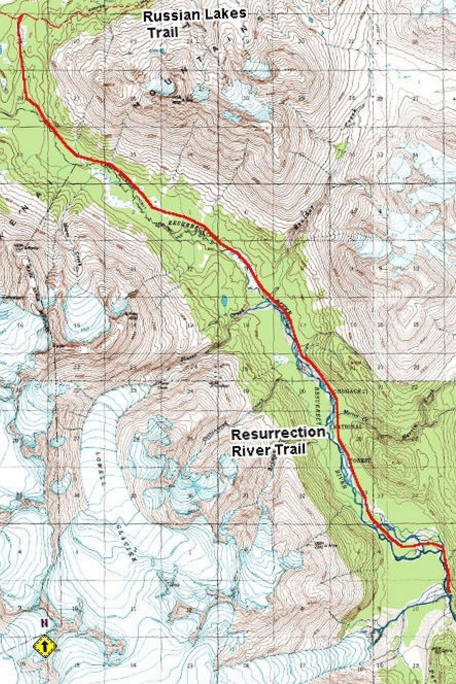
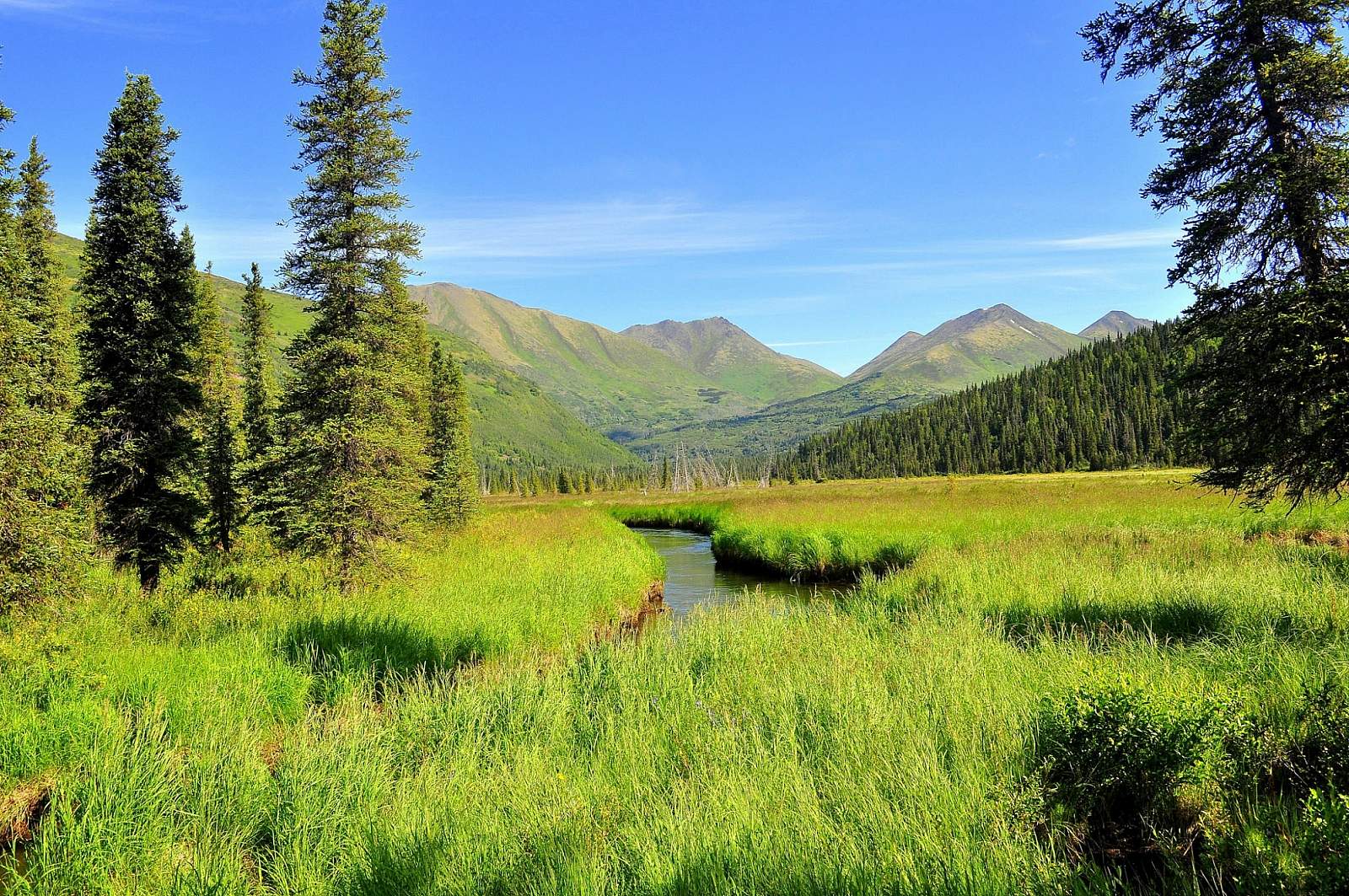
If you want a taste of dim spruce forest along a wild river bottom, try the first few miles of this mostly level route into the Resurrection River Valley. The quiet and the majesty of big trees will make you feel like you have journeyed deep into Alaskan coastal wilderness. From the trailhead Mile 7 of Exit Glacier Road, the trail runs 4.5 miles to Martin Creek and is suitable for mountain biking or skiing after snowfall. It features two primitive campsites and occasional access or views of to the river.
The trailhead is also only a few minutes by car from the Exit Glacier Nature Center and glacier access of the Kenai Fjords National Park (Mile 8.4.) After experiencing the raw beauty and bedrock of the glacial terminus, it can be fascinating to take a stroll into the lush forest along the river. It’s a dramatic real-time demonstration of plant succession, moving from ice age to rain forest in less than 2 miles.
Primitive hiking beyond Martin Creek
The trail’s upper 12 miles can be rugged—more a route than a maintained trail—and require major stream crossings and route finding. The bridge over Martin Creek washed out in 2002, and the bridge over Boulder Creek washed out in 1996. During spring melt or after heavy rains, fording these two streams by foot may be dangerous or even impossible. Many other streams must be crossed, too. Expect to deal with downed trees, muddy conditions and heavy brush.
Here’s what the Forest Service says: “Travel on this section is for those who seek risk and solitude, are self-reliant and want a challenge.” Venturing beyond Mile 4.5—north of Martin Creek—is not recommended for bicycles, livestock, children, snow vehicles or skis.
Still, the route does provide a link to the Russian Lakes and Resurrection Pass trail systems. An ambitious and well-prepared backpacker could travel from the Exit Glacier Road area to the all the way to Hope, a 70-mile trip through the heart of the Kenai Mountains.
Trail notes:
- Most of the territory west of the river is inside Kenai Fjords National Park.
- Fishing along the route is unexceptional.
- Steep icy side hills and deep tree wells can make winter travel more difficult.
- Lots of wildlife in the area—beaver, pine marten, moose, wolves, coyotes, Dall sheep and mountain goats. Relatively high density of black and brown bears.
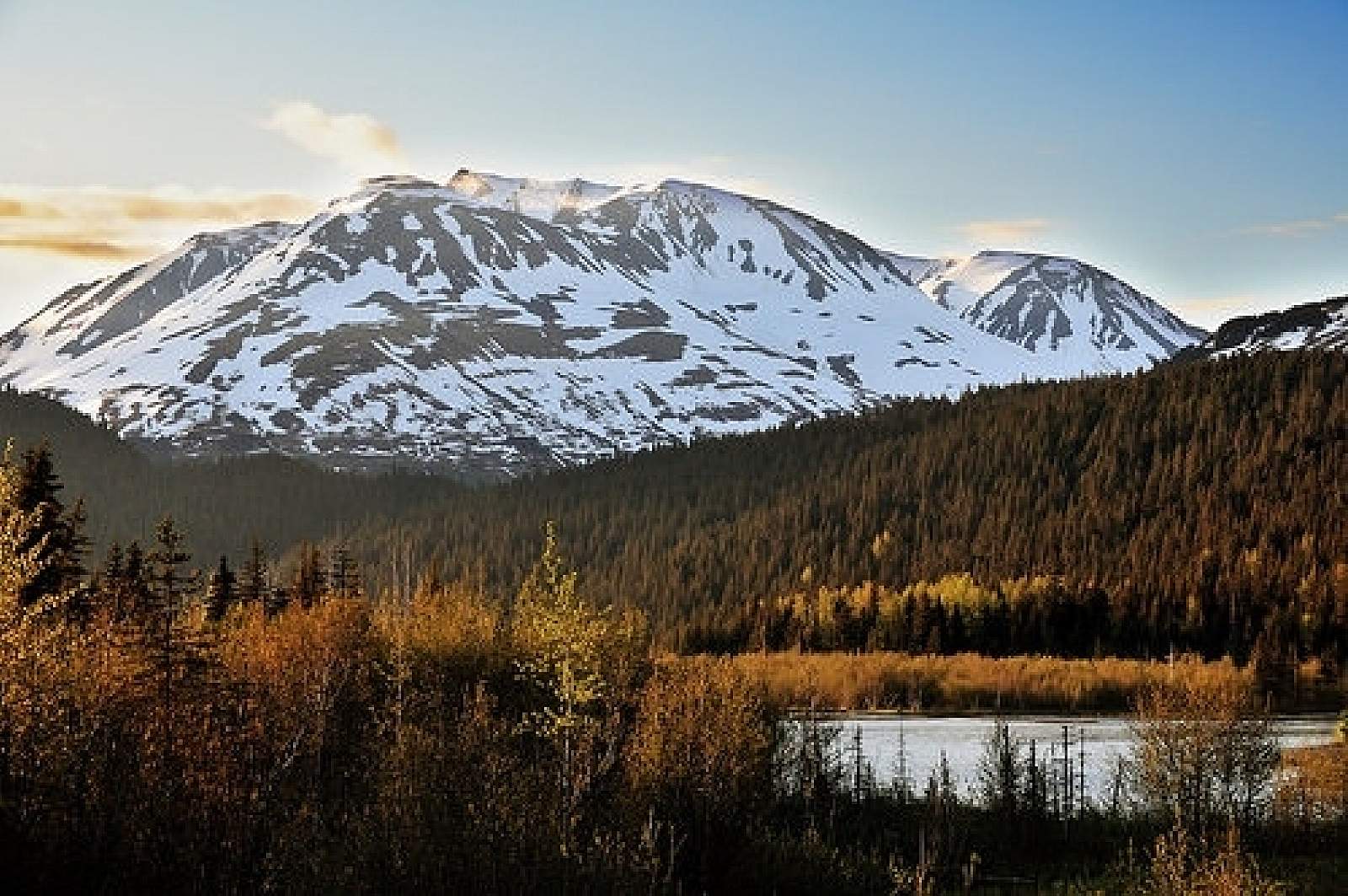
- The southern 12 miles of the route is mostly flat, rising only a few hundred feet. The route then climbs 500 to 600 feet over the last 3 to 4 miles to reach the popular Russian Lakes Trail corridor. This section features great views.
- The northern end connects to the Russian Lakes Trail west of Upper Russian Lake about six miles from the eastern trailhead near Cooper Lake.
- Trail is closed to saddle and pack stock April 1 to June 30 and motorized vehicles May 1 to Nov. 30
For more information:
Resurrection River Trail fact sheet and map (PDF)
Russian Lakes Trail fact sheet and map (PDF)