Difficulty: Moderate
Distance: 7 miles
Elevation Gain: More than 1500ft
Type: Out-and-Back
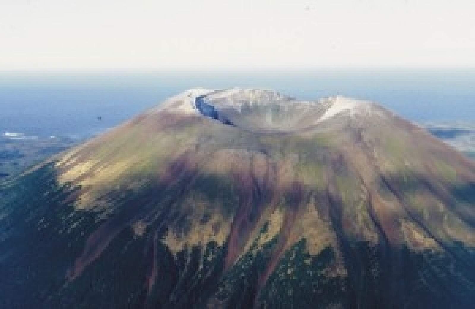
If you’re here on a sunny day, you know this peak—it’s the dominant, gentle volcano that fills the view to the west. And intrepid hikers can walk all the way to the top. The trail is about 10 miles west of Sitka and is only accessible by boat, so you’ll have to charter a boat and be comfortable with wilderness hiking. Bring layers, food, plenty of water, bear spray, and a first-aid kit. It’s an all-day hike, but it’s on a well-developed trail.
Originally built in the 1930s by the Civilian Conservation Corps, the trail gradually rises through muskeg and forest until it hits a spur trail that leads up to a three-sided shelter (about four miles in). About a mile beyond the spur trail the trail gets steep. You’ll climb above tree line at about 2,000 feet, where the trail ends. The ground becomes covered with red volcanic ash. Follow the white trail posts to reach the crater rim. The vistas at the top are beautiful on a clear day, with views of the open Pacific to the west and the town of Sitka to the east—dotted with islands and backed by huge peaks.
Boat Charters
Features: Kid Friendly