Why Take This Hike
The 5-mile-long Eska Falls Trail is located a 2-hour drive north of Anchorage in the mountains above the town of Sutton. And it leads to one of nature’s symmetrically framed wonders—a 100-foot waterfall located at the end of a mile-long valley that’s flanked by two massive summits. This setting makes Eska Falls not so much a hike to a destination as much as a hike to a presentation.
The Details
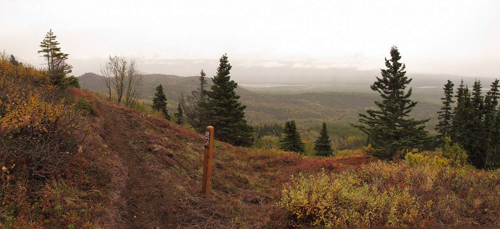
As you start up Eska Falls Trail from the upper end of Jonesville Road out of Sutton, it certainly seems nothing special. In fact, the ATV trail that Eska Falls Trail follows, up through a cottonwood and birch forest, may seem a trifle boring. After a heavy rain it will also turn excessively muddy.
Considering all the trail junctions you come upon, it may also seem confusing. Just stay continually to the left; eventually, you’ll reach a dead-end at a turn-around. Here, look for the trail—an actual trail—leading off the upper right side of the turnaround. It marks the beginning of a footpath that was finished in 2013.
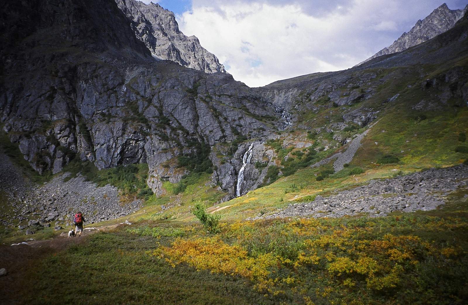
Here you can thankfully leave any ATVs behind (at least for a time). The trail contours up Eska Creek gorge; then a series of switchbacks climbs above tree line onto another ATV trail.
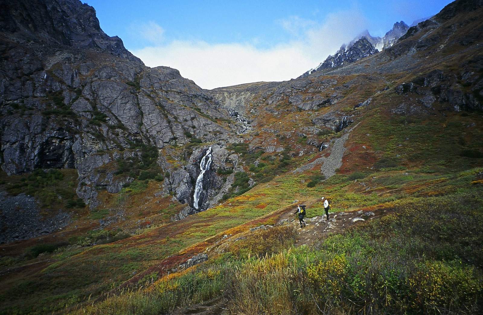
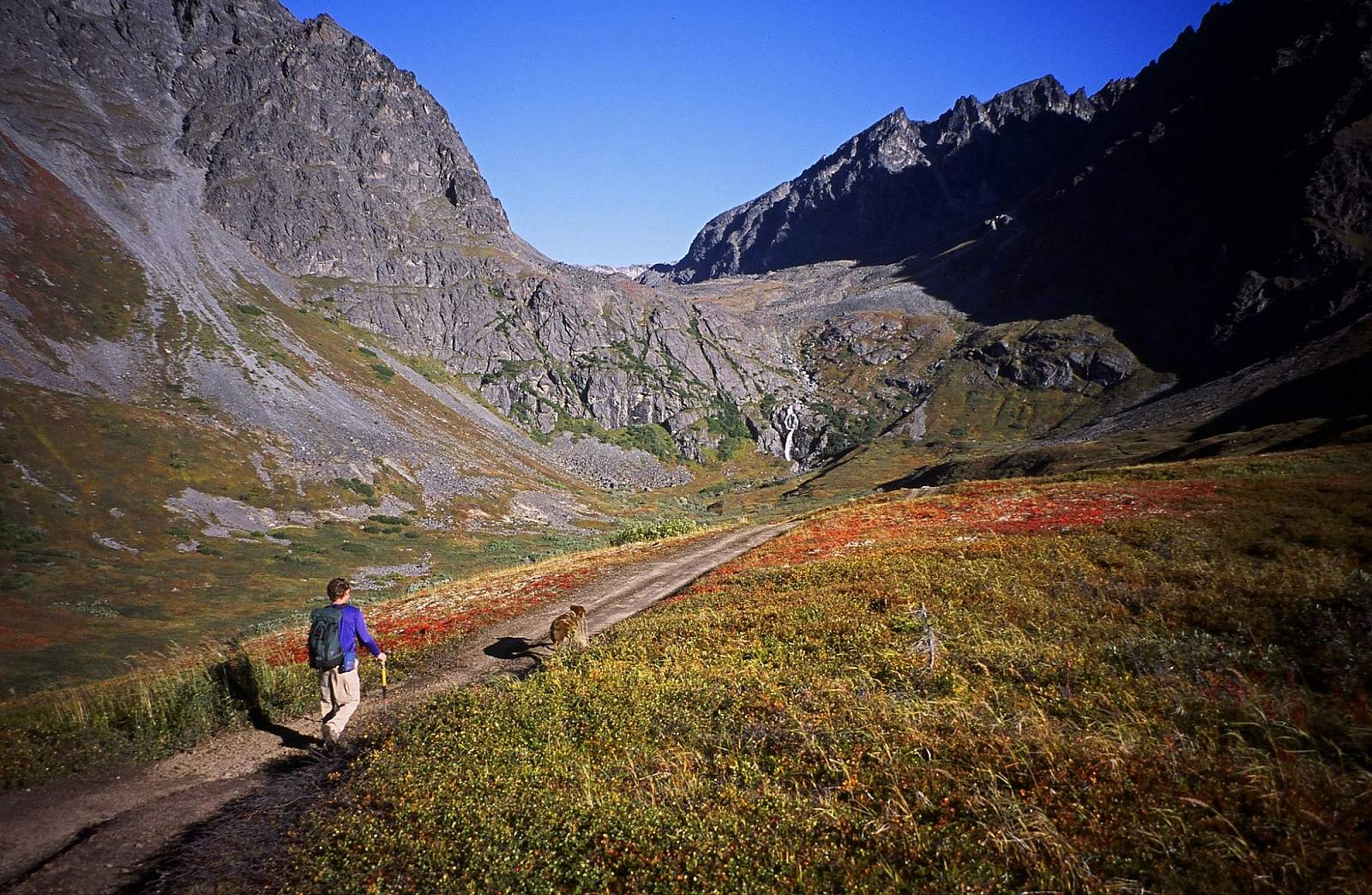
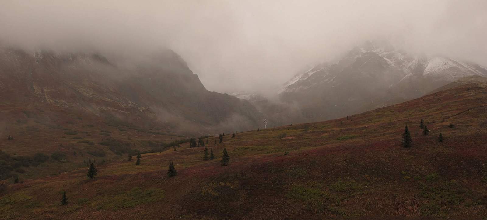
Soon, after turning right on this first ATV trail and then turning left onto another ATV trail, Eska Falls will come into view over the next rise. Framed by Granite Peak (6,729 feet) on the right and Eska Peak (5,680 feet) on the left, the falls plunge more than 100 feet from the notch between them at the uppermost end of the valley.
Once here, take note of how both mile-long flanks of the valley—as well as both slopes of the mountains—converge on the falls. This makes for a composition that any artist would take justifiable pride in conceiving and painting.
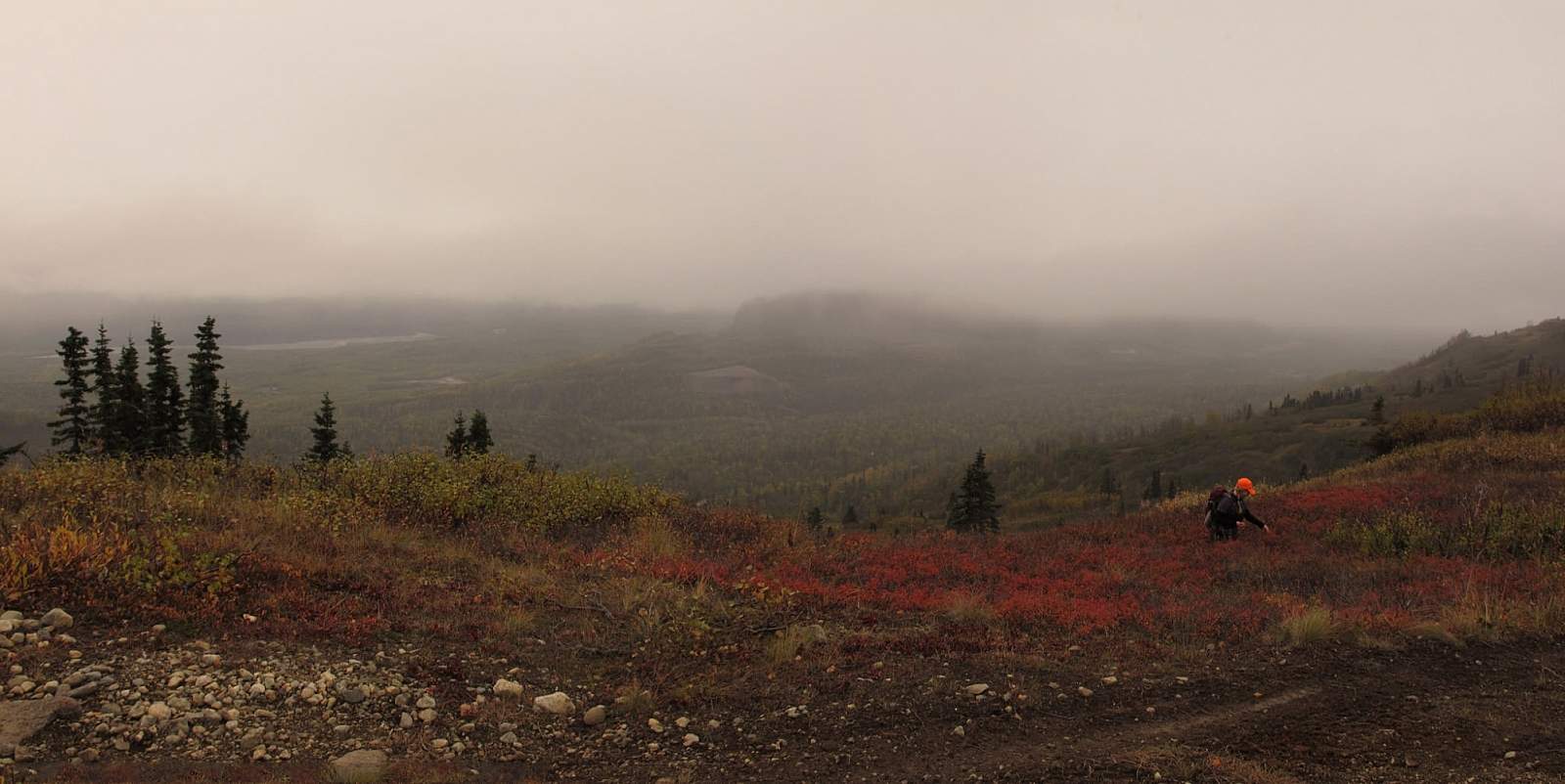
The trail follows the bench for the last mile, paralleling the right shore of Eska Creek. Along this entire part of the hike the falls stay continually in sight. Soon you’ll hear them as well. In fact, when the trail drops off the bench down to where it ends (in a small turnaround by the edge of the falls), you’ll have to raise your voice to be heard.
If you want to get even closer, another footpath continues off the end of the ATV trail. Walk through the brush and rocks to a noisy overlook alongside the falls. Here you can reach out your hand, feel the power of the water, and wish you could take such a tactile experience home with you.
*Take note: Bears and other wildlife are native to the area and proper precautions should be taken to make your presence known. Keep dogs on leash and/or under your control.
(For more, see Walk-About Guide to Alaska, Volume Four by Shawn R. Lyons)