The Best Mountain Hikes in Alaska
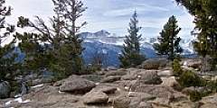
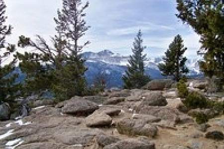
Alaska’s biggest mountains can make amazing photographs—all those calendar-worthy frosty behemoths that shimmer on the horizon. Who doesn’t marvel at the immensity of Denali? Flanked by Foraker and Hunter, it’s visible from just about every place on the road system from Anchorage on Cook Inlet to Fairbanks north of the Alaska Range. It demands your attention. And it’s great!
But what if admiring Denali from an impossible distance —or one of Alaska’s many other awesome peaks—just doesn’t satisfy your mountain hunger? What if you actually need to climb one of them, but don’t have the time or resources to book an expedition?
Here is our list of Alaska mountains that are both spectacular to view while also offering reasonably fit people a route to the summit. These include mountains that can be explored during a day trip without professional guides or specialized mountaineering equipment. All of them also feature good-weather, summer-season road access. As a result, many of these peaks are beloved among residents because they feature doable, no-fuss summits close to home. Climbing them is a great way to meet local mountain enthusiasts out for adventure.
Show Map
Mountain Trails
Anchorage
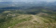
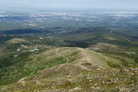
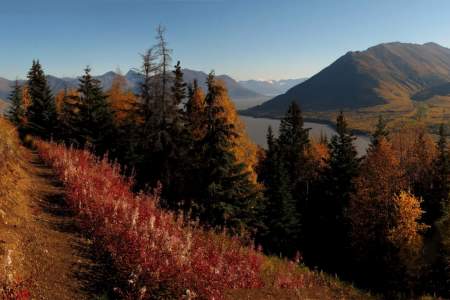
Flattop is Alaska’s most visited peak. Ascend the 1.5 — mile, 1,350 vertical foot trail to the rocky, football field-sized summit in about an hour and take in panoramic views from Denali (Mt. McKinley) to the Aleutian Islands. If you want vistas without the hike, walk the short path from the parking lot to the overlook.
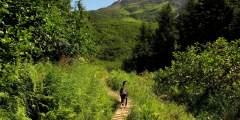
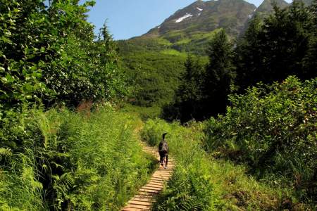
If you only have a little experience doing off-trail hiking, then this scenic 5‑miler will help you get a bit more under your belt. Beginning on Rabbit Creek Trail, in the Front Range just above Anchorage, this hike visits a surprisingly expansive and scenic plateau that remains hidden from sight until you actually climb to it.

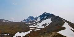
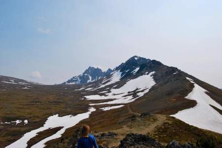
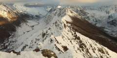
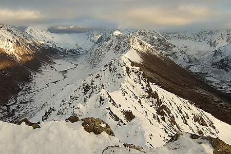
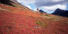
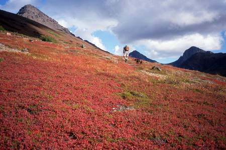
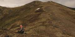
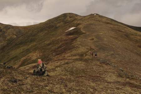
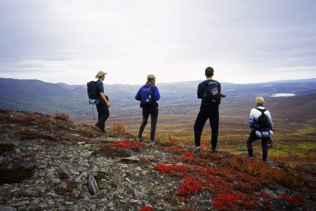
On a sunny summer day, take a delightful hike to Ship Lake Pass then climb a 5,240-foot peak. From the pass, the mountainside does indeed resemble a ramp. The walk up is a moderately steep climb, gaining 1,200 feet elevation in about half a mile. From the top are fine views, especially of the Ship Creek headwaters, and the drop toward Williwaw Lakes takes your breath away. An easier summit is The Wedge (4,660 feet) southwest of the pass. The… ...more
You don’t have to be a mountaineer to reach the summit of O’Malley Peak — the prominent spire rising from the Front Range above Anchorage — but don’t mistake it for an easy climb. Some of the 5‑mile-long trail climbs quite steeply; other parts add very loose gravel to the incline. Still, these conditions don’t make this hike excessively dangerous, just satisfyingly laborious.
Some people elect to follow the ridgeline further back and that can take you to many more peaks, and views.
This is an easy hike, if not a bit muddy in the spring up to a popular peak. Take the trail out of Prospect Heights parking lot and turn left within 200 feet. The trail drops down to a creek and then climbs to where it eventually splits. Go straight for Near Point, or turn right for Wolverine. Near the top ridge, keep your eyes open for the remains of an old aircraft that crashed many years ago. Directions: From the new Seward Highway go… ...more
If people suggest climbing Flattop, tell them you’d rather climb Rendezvous Peak. Flattop is arguably Alaska’s most popular (and therefore, most crowded) mountain; Rendezvous is far less crowded and offers better views from the summit. See them by hiking up 1,500 feet to the 4,050-foot summit.
This hike is popular in spring for those looking for an aerobic workout. It is very steep, but offers secure footing. One of many highlights along the scenic Seward Highway, Bird Ridge Trail climbs 3,000 feet in a little more than a mile to magnificent views of the fjord-like Turnagain Arm.
If you want a great workout — to stunning mountain views high above the valley floor below — but want to save your knees on the way down, this trail is for you. It leaves from the Alyeska Resort tram building and climbs steep switchbacks 2.2 miles and 2000 feet to the mid-mountain restaurant where you can catch a free aerial tram ride back down to the hotel.
Matanuska-Susitna Valley
Are you a mountain runner looking for a tough workout? Consider Pioneer Ridge Trail. This trail, located a 1‑hour drive north of Anchorage on scenic Knik River Road, climbs some 5,200 feet over its 6 miles. Other trails, like Lazy Mountain Trail and Mount Marathon Race Route, may be steeper or rockier, but no trail in the Chugach Mountains climbs so steadily for so long as Pioneer Ridge.
Why Take This Hike This trail, located 90 minutes north of Anchorage just across the Matanuska River from downtown Palmer, makes no pretense about its purpose. Almost immediately after leaving the parking area, it begins to climb straight up the steep west face of Lazy Mountain. For some 2,000 feet, there’s nary a switchback or respite as the trail winds up to the summit ridge. It’s a truly breathless workout. The Details Out of Palmer,… ...more
No official trail in Southcentral Alaska climbs as high as Matanuska Peak Trail. Beginning in a subdivision across the Matanuska River from Palmer, this nearly 6‑mile-long trail runs up some 5,700 vertical feet. Your destination is the 6,119-foot summit of Matanuska Peak, the very prominent rock spire that fills the sky just east of Palmer. But despite the imposing appearance of this mountain, the trail to its summit requires no extensive ...more
Beginning a 1‑hour drive north of Anchorage in Government Hill Recreation Area, Government Peak Race Trail offers a fine opportunity for a hard workout; it climbs some 3,700 vertical feet in just 3 miles. Plus, this climb doesn’t include any extraordinary dangers. (A friend refers to one short ledge on this trail as “death rock,” but she tends to exaggerate.) Some sections require special care to negotiate, but you won’t have to traverse any ...more

If you have some serious time and serious energy, take an adventure: hike the 20 miles out the Chase Trail to see what’s left of a luxury hotel built as a layover for the railroad journey between Seward and Fairbanks.
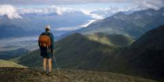
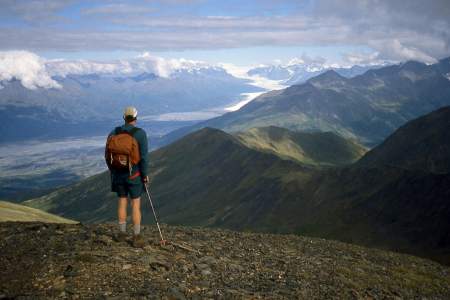
Beginning almost 120 miles northeast of Anchorage on the Glenn Highway, the trail to the summit of Gunsight Mountain takes a while to reach. After all, it involves a 3.5‑mile, 3,300-foot climb through some very big country. But the view from the top makes for an all-day excursion that you won’t easily forget.
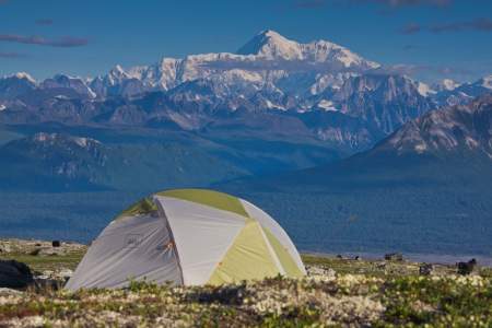
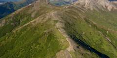
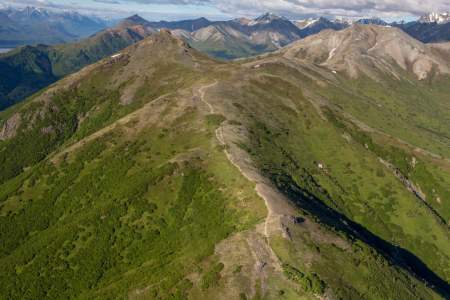
During periods of clear weather, this route through Denali State Park offers similar terrain and scenery to Denali National Park — including unparalleled views of Denali — without the cumbersome permitting process. This trail system offers many options for starting and ending points, as there are four trailheads along its length.
Kenai Peninsula
This family-friendly, 2.5‑mile trail climbs 3,600 feet to a summit halfway between the sea and the heavens
Every Fourth of July, racers scramble to the top and back in one of the state’s oldest traditions. But you don’t have to race to reach the top. Hikers can take a well-marked trail for a quieter, steadier climb. Whether you’re here for the race, the view, or just a good leg workout, Mount Marathon delivers.
Fairbanks, Denali & Interior
The first mile of this trail, which begins near the new Murie Science and Learning Center, is moderately steep, hiking through the forest. The forest eventually gives way to tundra. Trees turn to shrubs, and the landscape opens wide. The last 1.5 miles are even steeper. Your reward, however, is sweeping views of the Denali National Park entrance area, the Nenana River Valley, Healy Ridge, and nearby alpine ridges. Those who want to climb to the ...more
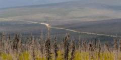
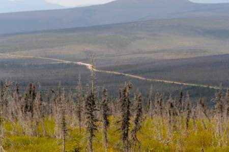
Easily one of the most scenic drives in the Interior, the trip out to Table Top Mountain from Fairbanks winds deep into the center of White Mountains National Recreation Area, rising up hillsides and dipping down into valleys for a rolling picture show of spruce forest and snaking riverbeds. The hike to Table Top Mountain is just as spectacular, providing panoramic views of the White Mountains from the center of the range, and is a short “must ...more
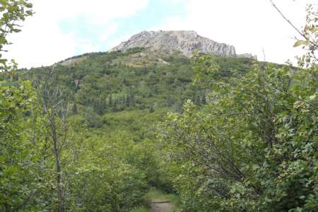
Southeast

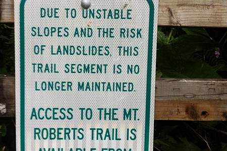
Steep trail that is worth the climb: you’ll find excellent views of Gastineau Channel, Juneau, and Douglas from here. NOTE: The 6th Street trail head is no longer maintained. Hikers must access Mt Roberts via the Basin Road trail head.
Deer Mountain is Ketchikan’s iconic backdrop. The path briefly threads between residential lots, then turns to a rocky trail that quickly ascends. On the way up there are multiple scenic overlooks.