Historic Park or Site
Forests filled with native totem poles. Gorgeously ornate Russian Orthodox churches. Abandoned gold rush towns. Alaska's rich history encompasses several eras and cultures, as well as countless fascinating—and sometimes downright surprising—chapters (such as the local World War II relics). Some historic sites offers tours, but others are simply points of interest that you can explore on your own. Pick a few and you can dig deep into the layered history of the 49th state.
Kenai Mountains - Turnagain Arm National Heritage Area
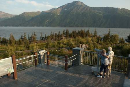
The United States’ 49th state boasts one of 49 National Heritage Areas across the country. The Kenai Mountains-Turnagain Arm National Heritage Area is a treasure trove of natural, cultural, and historic riches. The Congressional designation of the Kenai Mountains-Turnagain Arm as a National Heritage Area recognizes and promotes the cohesive nature of this enduring, dynamic transportation corridor.
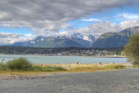
The National Heritage Area runs from the “Gateway City” of Seward north to Indian, and spans Whittier’s Prince William Sound port on the east to Cooper Landing on the west. Within these scenic miles is hidden a treasure trove of stories. From Native peoples to Russian fur traders, European explorers, and American gold prospectors, the quest for trade and treasures tested the limits of human endurance and inspired remarkable ingenuity.
Discover the story as you explore the KMTA National Heritage Area. Click here to access the guide, or use the filter on this page to view National Heritage Area Sites.
Show Map
Historic Park or Site
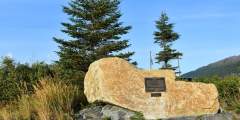
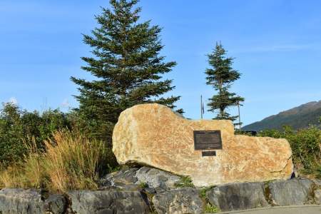
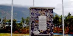
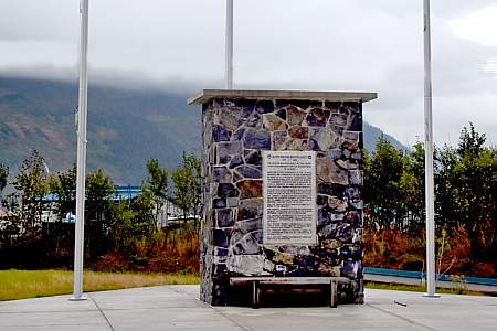
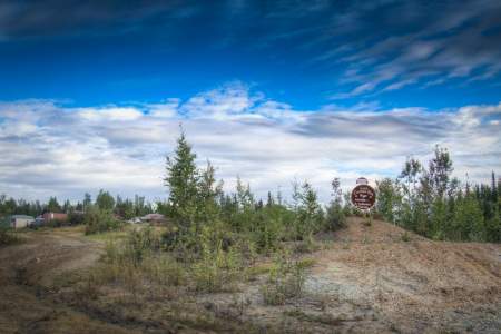
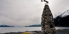
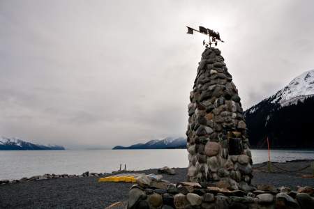
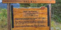
The monument, a plaque on a 13-ton rock, can be found in the town’s Triangle business district amidst a wild rose garden. It’s a tribute to those who It’s a fitting tribute to those who lost their lives during the 1964 earthquake.

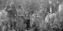
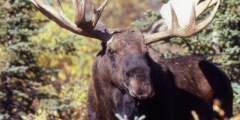
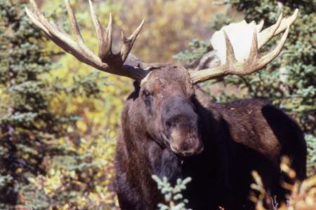
The art of totem pole carving was a luxury that experienced its heyday in the mid-1700s to the late 1800s. The fur trade had provided the Tlingit, Haida and Tsimshian peoples a newfound sense of wealth – and time to focus on the artistry of the totem

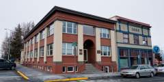
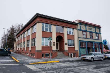
What elements make a great city? When Anchorage’s forefathers landed at Ship Creek in 1915, those elements were people, education, jobs, culture, capital investments, productivity and growth, food production and subsistence, wildlife and natural beauty. So these pioneers set out to make them all a reality. Four distinct neighborhoods arose to meet the call for housing and land management offices, as well as school, library, and museum facilities. ...more
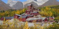
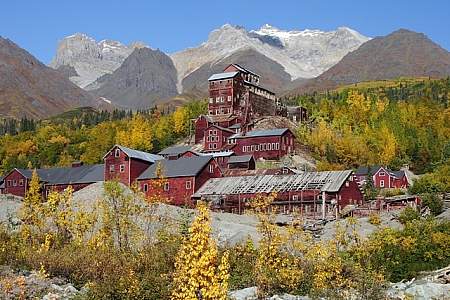
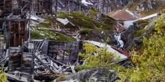
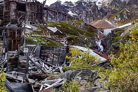
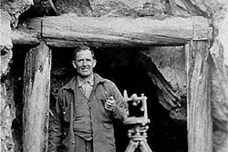
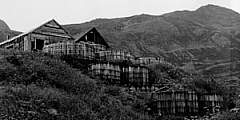
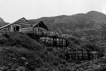
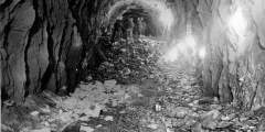
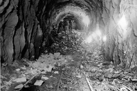
This abandoned copper mining camp is a National Historic Landmark District. Established in 1903, Kennecott Mining Corporation operated 5 mines in the area. Kennecott became a bustling mining camp filled with miners and their families. By 1938, Kennecott was a ghost town. This guide shows the self-guided walking tour points.
Downtown’s convenient grid pattern was set up at the same time that construction started on the Government Hill neighborhood. And in 1915, downtown’s plots of land were auctioned off to the highest bidders. Many of the buildings from that era not only still stand, but are still named after some of the city’s founding fathers, reminding us of the sacrifices they made to give a future to their budding city.
In 1943, The Army Corps of Engineers built a monument commemorating the effort of building the 2.5 mile long tunnel through the solid rock of Maynard to realize the vision of Whittier as a year-round ice-free port. The monument was recently restored in a new location with the original plaque.
Just a 10-minute walk from downtown along the waterfront, this fort was built by the U.S. Army starting in 1902, then purchased by Army veterans in 1947. The Fort originally housed the enlisted men in two Barracks buildings. Only one of the two buildings stands today. It is unoccupied and in need of major repairs. The other Barrack’s building burned down in 1981. Recently, the foundation of the burned building was transformed into an outdoor ...more
The Pioneer Monument commemorates residents of Whittier who have passed away. Flags fly above the monument and names are added periodically, as long-time residents pass.
Whittier is not only gorgeous; it’s also full of fascinating WWII and Cold War history. And that past is easy to explore — the town publishes a map outlining an engaging walking tour of the historic sites. (You’ll get a copy when you drive through the Whittier Tunnel; those arriving by cruise ship can pick one up in any local business.)
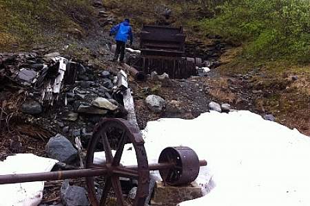
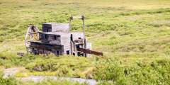
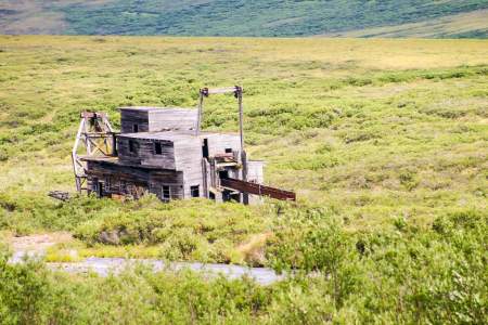
This mine played a significant role in the early settling of the Turnagain Arm. The building here are on the National Register of historic places and the mine is unique because of its association with load mining. Indian Valley Mine was founded in 1910 by a vagabond who ran away from home at the age of 12, joined the circus and then finally traveled to Alaska during the gold rush. The Cowles family will tell you all about the history of this… ...more
What was it like for a family living in Anchorage in 1915? The Oscar Anderson House Museum, located in Elderberry Park at 5th Avenue and M Street, is the perfect way to find out.
Quick: what’s the longest combined rail and highway tunnel in North America? It’s the Anderson Memorial Tunnel, and you’ll drive through it on the scenic and historic drive to Whittier. The Kenai Mountains-Turnagain Arm National Heritage Area is a place whose valleys and mountains, communities and people tell the larger story of a wild place and a rugged frontier. This audio guide gives you the inside scoop on its fascinating history. You’ll… ...more
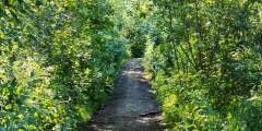
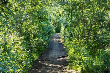
Segments of the trail near Seward (Nash Road) and Girdwood (Alyeska) can be hiked during summer.
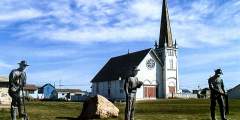
Nome’s Old St. Joe’s avoided the fate of many other gold rush era buildings, which were destroyed by fire or flood. Today it is restored and listed on the National Register of Historic Places. The story of Old St. Joe’s parallels that of the Alaskan pioneer spirit: one of hard work, resourcefulness and a deep respect for the past.
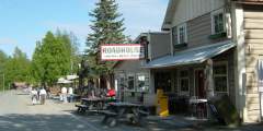
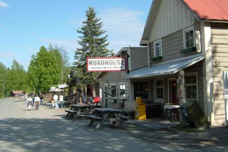
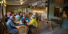
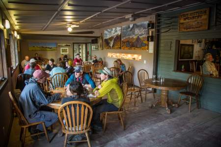
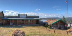
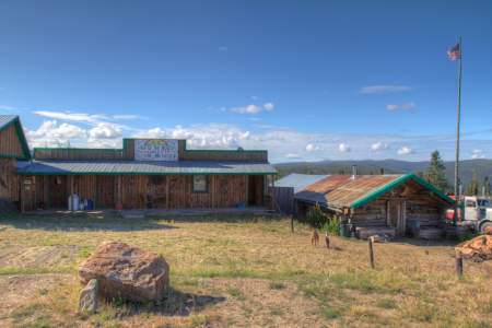
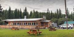
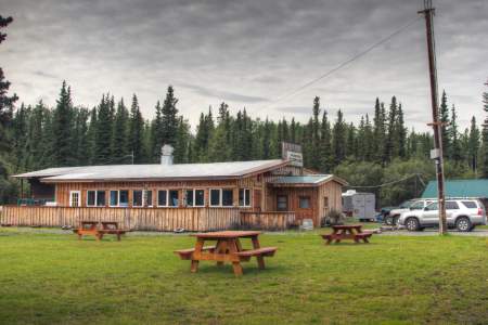
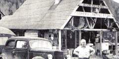
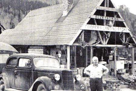
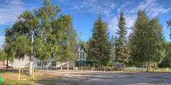
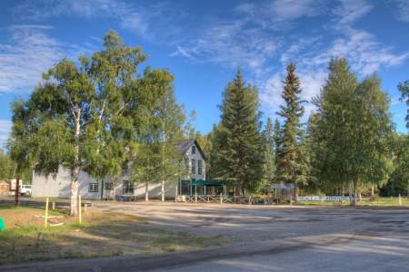
History, fun, and massive portions of food come together at this institution, which was built over 3 years starting in 1914. Choose from a variety of cozy rooms in the main roadhouse and wake up the smell of fresh baked goods from the Kitchen in the morning. Or, for a more private experience, book one of the cabins out back or the Museum Apartment at the end of the block.
When the United States military left Unalaska Island at the end of World War II, it also left behind buildings and equipment that would become war relics and reminders of the area’s importance during the Aleutian campaign, often called the “Forgotten War.” The buildings have deteriorated over the years and some have been torn down. But historical plaques marking the location of seven World War II points of interest were erected in 2007 to ensure ...more
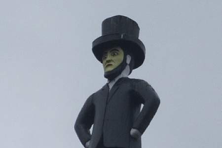
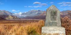
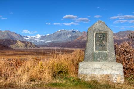
This monument is dedicated to Felix Pedro, a very patient Italian prospector who discovered gold here in July 1902. The gold rush that followed resulted in the founding of Fairbanks, Alaska’s second largest City.
The most catastrophic event in Seward’s history took place along the shoreline here. On March 27, 1964, the largest earthquake ever recorded in North America, and the tsunamis that followed, changed Seward’s history forever.
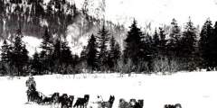
This historic 33-mile trail follows the route taken by gold rush prospectors in the late 1800s. It’s a challenging hike that takes 3 – 5 days to complete, but it offers incredible views of the rugged Alaskan wilderness.
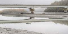
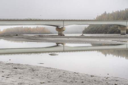
Surprise! This bridge over the Susitna River appears without warning, so if you want to stop and see this huge drainage, slow down and pull off the road at either end. Alaskans call it the Big Su. We fish it, paddle it, and snow machine its frozen braids. Bush pilots even navigate by this river. The Susitna River winds its way over 313 miles of Southcentral Alaska; this old railroad bridge crosses the water on the eastern edge of Denali… ...more
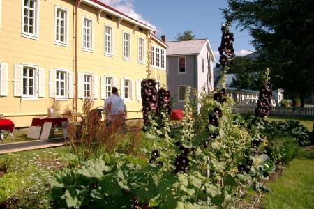
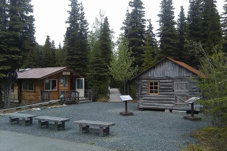
DescriptionLocated between the Chugach and Talkeetna Mountain ranges, The Alpine Historical Park provides community members, as well as visitors from far or near, a look back in time to understand the heritage and cultures of the early settlers of this area. The Park is a place for family and community members, often being used for gatherings, parties, business events, community picnics and many other events, as there is no community center in… ...more
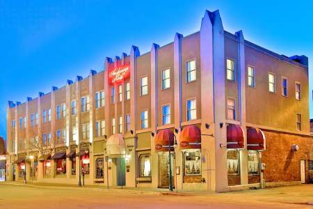
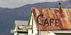
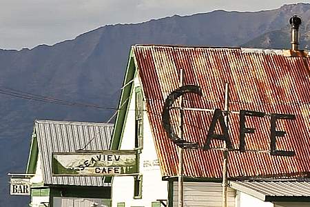
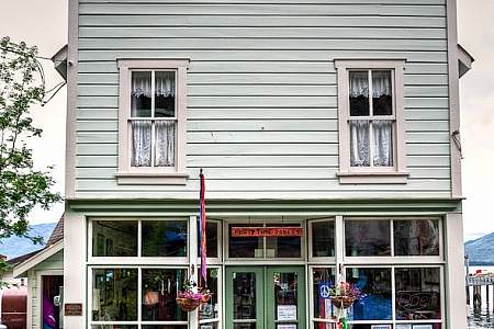
Walk through a series of historical buildings, some now occupied by shops and restaurants
This one cabin is all that’s left of the old Tiekal Mountain Roadhouse (not to be confused with the Tiekal Lodge a few miles north.)
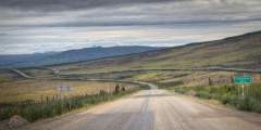
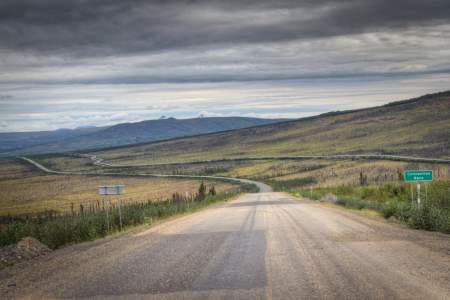
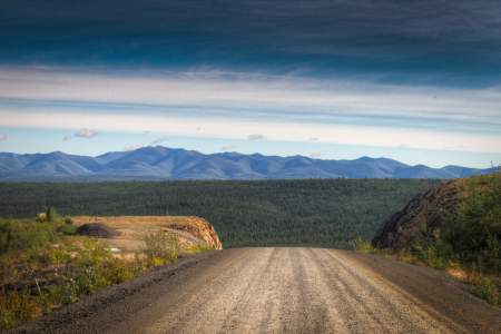
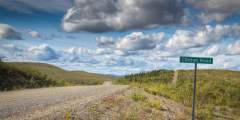
This is one of the spots where two separate construction crew met during the building of the Dalton Highway. The highway was built in 1974 to allow for the construction of the Trans Alaska Pipeline and finished in only 5 months. This highway, originally a haul road allowing access to Prudhoe Bay, opened to public travel in 1994.
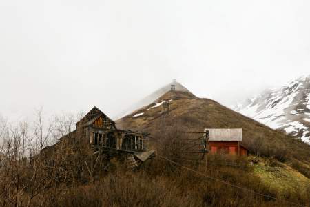
“Nomehenge,” as some of the locals call the four towering antennas on Anvil Mountain above Nome, operated during the height of the Cold War to link remote parts of Alaska with the rest of the country. These are the last of 71 White Alice structures, and serve as important historic and geographic landmarks in Nome.
Beyond the bridge, a long line of small buildings hugs the coast where a U.S. Army post once stood during the early gold rush. Fort Davis was dismantled in 1923 as Nome’s economy declined. The buildings you see today are locally-owned hunting and fishing subsistence camps. The Inupiat used this area well before the soldiers arrived because of diverse and abundant birds, fish, and mammals. Please do not disturb or trespass.
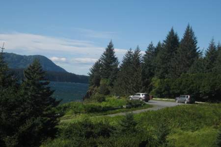
Loved by locals and travelers alike, this 182-acre state park has numerous trails, beaches, and rocky viewpoints. For history buffs, the trails take you past bunkers and relics from WWII outposts in the area. You’ll also find summer naturalist programs where you can learn about ecology as well as ocean and forest creatures.
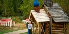
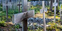
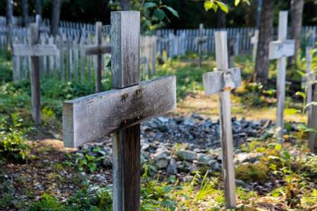
Dating back to 1650, the park is the area’s oldest continuously inhabited Athabaskan settlement. View the colorful Spirit Houses built over the graves of the deceased, along with an Orthodox Christian Cross — a custom that came from the melding of the cultures.
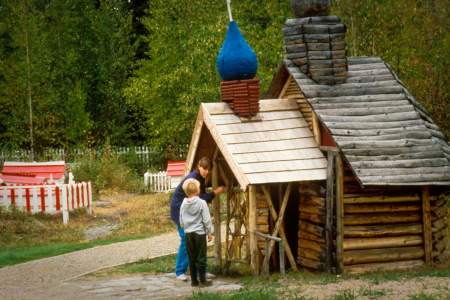
In 1906 the chapel was built to honor Father Igumen Nicolai and Makary Ivanov. Fr. Nicolai, Kenai’s first priest, brought small pox vaccine, which saved the lives of hundreds of Dena’ina. The chapel is on the site of the original 1849 church, located in the northwest corner of the Russian fur trading post of Fort St. Nicholas.
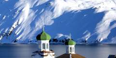
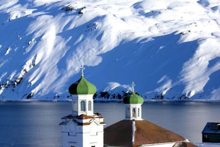
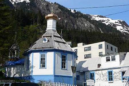
The striking Holy Ascension Russian Orthodox Church – with its red-shingled roofs and green onion domes – has become an integral part of the Unalaska skyline over the last century. It is both an oddity (architecturally different than anything else in the Aleutians) and a symbol of Russian influence on Aleut culture and religion.
About 75 Miles Southeast of Anchorage
At its peak, the Independence hard-rock gold mine was home to 206 workers and 16 families who lived high above tree line. Digging and blasting, these workers recovered 140,000 ounces of gold before the mine shut down in the wake of World War II. There are 1.5 miles of paved walkways throughout the site, with informational placards for a self-guided tour.
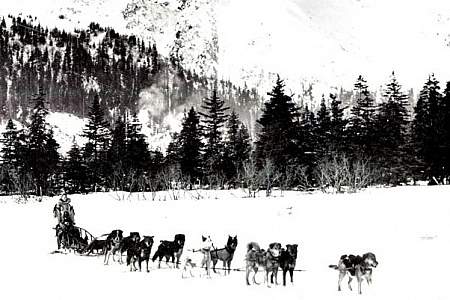
Railroad construction began in Nome the summer of 1900. By 1906 the track stretched 80 miles to the Kuzitrin River. Like many other residents, the world famous musher Leonhard Seppala ran his dog team along t he tracks using a small railroad car, called a “pupmobile.”
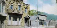
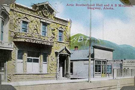
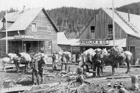
Stop and take your picture in front of the most photographed building in Alaska. In times past, it was a fraternal hall; the local chapter of the Brotherhood first met here in August 1899. (Step across the street, and you’ll notice the letters “A.B.” and the “1899” above the door, and “Camp Skagway No. 1” on the overhang. The organization’s symbol, a gold pan and nuggets, is up near the roof line. The façade, which dates from 1900, has been… ...more
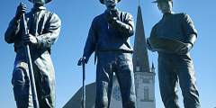
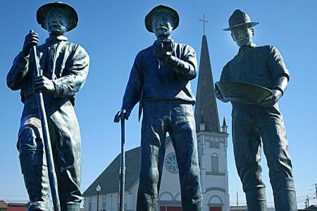
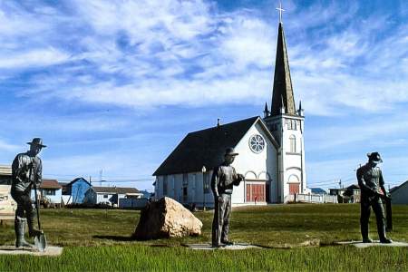
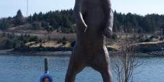
Three Scandinavians found gold in Anvil Creek in 1898 and quickly staked their claims. The fact that they knew little about mining didn’t impede their quick path toward wealth. Locals call them the “Three Lucky Swedes,” and their life-sized bronze statues stand in Anvil City Square, near where their lives were forever changed.
A short boat ride to George Island brings chances to see whales and marine life along the way, followed by invertebrates at low tide and a lovely walk through a beautiful temperate rainforest to an historic site that still has gun emplacements left over from World War II.
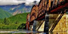
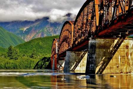
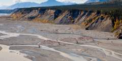
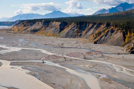
Construction of this early-1900s bridge cost a whopping (at the time) $1.4 million, which earned it the nickname Million Dollar Bridge. But the bridge quickly earned its keep, allowing the railroad to haul copper from Kennicott to the port of Cordova.
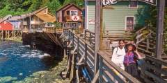
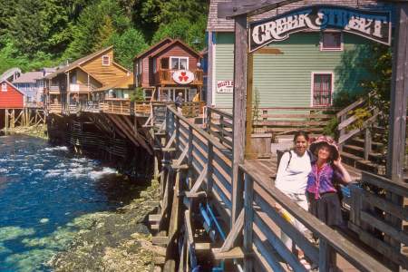
Nearly a century ago in 1903, this was the small mining and fishing town’s red-light district but today the boardwalk street, propped up over Ketchikan Creek on wooden pilings, teems with gift shops, museums and well-preserved homes.
This historical trail through the woods between McCarthy and Kennicott was the walking/wagon road when the railroad was still running. It’s a nice alternative to walking or biking up the 4.5‑mile-long road between McCarthy and Kennicott, where you’ll find more vehicles and dusty conditions.
Bring the spirit of the Gold Rush to life with Alaska.org’s exclusive Skagway Audio Guide, narrated by one of Skagways’ favorite sons, Buckwheat Donahue, a captivating storyteller, entertainer, historian, and adventurer.
At Milepost 69 you will arrive at the Lost Chicken Hill Mine, which was established in 1895. It got its name because it held a pay streak that had been “lost” for many years. The area has mining history that began before the Klondike Gold Rush of 1897 – 98. It is now privately owned and mined.
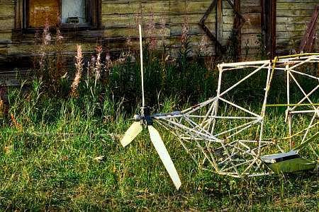
Teller Road crosses Anvil Creek one mile below the site of the 1898 gold discovery that triggered the Nome gold rush. From here you can view the wind turbines that form the start of Nome’s efforts to harvest wind as an alternative energy source.
Look to the south and you’ll see a WWII era building. Troops were stationed at Cordova.
Built in the 1920s, this bridge helped prospectors cross the Nizina River and reach the gold camps at Chititu Creek and Dan Creek. The glacier-dammed lake near here caused flooding with some regularity — and as result, would wash out the bridge with some regularity.
This 1898 house was the home of Judge James Wickersham, a legend in Alaska who brought civility and law to the wild gold-rush towns of Eagle, Fairbanks, and Nome. After climbing Denali (Mt McKinley), he also helped lobby for the creation of Denali National Park, and was a force in Washington, where he persuaded the federal government to build universities and railroads in Alaska while giving the territory legal rights. The house was in the… ...more
41 Places To See Fairbanks’ Past
Look across the valley for a view of the abandoned buildings from an early dredging operation at Cleary Creek.
On the ocean side (not bay side) of Rugged Island you can look up on the ridge of this island and see a bright orange and white day marker just above an old WWII military look out station. Fort Bulkley was located on Rugged Island and this ridge was the first defense if any enemy boats were to enter the bay.
Built as a cabin in 1896 by prospector Fritz Miller as a stop over on the sled dog trail between Circle City and Fairbanks. After the Steese Highway was completed it functioned as a roadhouse until 1970. It has since burned down, however, items from the Miller House can be found at the Museum in Central.
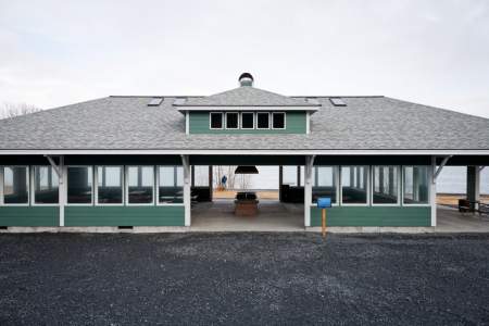
Home of the Delta Historical Society Museum, Rika’s Roadhouse at Big Delta State Historical Park is in a ten-acre state park on the shores of the Tanana River. The Valdez-to-Fairbanks Trail ran through here and continued across the river, aided by a ferry. The roadhouse was built to accommodate the travelers and is a National Historic Site. The museum is a separate building behind the roadhouse and has displays of artifacts from the Alaskan ...more
At Milepost 43 of Taylor Highway, there is a nice pinic area overlooking the creek.
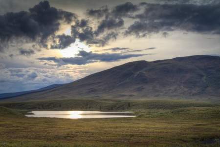
This is the largest lake you will see on the Dempster Highway. It was named for Ernest Chapman, a trader, trapper and prospector. There are many other smaller lakes in the vicinity and together they support a variety of waterfowl and shorebirds.
This was the largest base on Kodiak Island during WWII, and the center of the Harbor Defenses for Kodiak. At the peak, some 8,000 troops were stationed here. Now all that remains are some unmarked buildings.
At Milepost 75 Taylor Highway you can pull off and read the interpretive panels to learn more about the Fortymile gold rush.
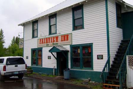
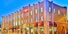
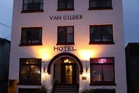
Opened in 1923 to accommodate travelers on the new Alaska Railroad, the small inn found fame (or notoriety) quickly: President Warren G. Harding came for lunch, and died just a few days later. Today, the hotel is comprised of six recently renovated rooms as well as a bar and live music venue. You’ll hear everything from jazz and folk to open mic nights and serious rock-n-roll. At the very least, do a walk-through to enjoy some local color and… ...more
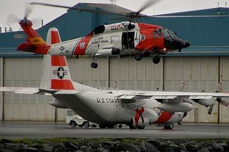
When the U.S. Navy closed their Kodiak station, Fort Greeley, in 1972, the Coast Guard took over. This is now the country’s largest station, with almost 1,000 personnel.
This spot was once a stop on the White Pass and Yukon Route. In 1900, gold was discovered in the area a town site was surveyed. Low mineral yield caused Robinson to be abandoned, but the old roadhouse still stands as a glimpse into Alaska’s gold rush history.
This stout structure is a re-creation of the guard tower that once stood here, part of the fortress enclosing the Russians during their time in Sitka, from 1804 to 1867. Fearful of the wilderness around them, and of Tlingit Natives, the Russians’ enclosed fort was open to outsiders only in the daytime.
If you have some serious time and serious energy, take an adventure: hike the 20 miles out the Chase Trail to see what’s left of a luxury hotel built as a layover for the railroad journey between Seward and Fairbanks.
Thursday evenings are open mic night in McCarthy. It’s a great chance to rub elbows with some locals and fellow travelers and get a taste for the neighborhood. All are welcome! Bring your guitar, harmonica, and voice – or just your eyes and ears. Occasionally on Fridays and Saturdays there’s a band playing after 8:30 p.m. Be on the lookout for special events that are free and open to the public.
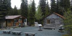
The Sullivan Roadhouse Historical Museum is housed in the oldest roadhouse in the interior of Alaska and is located in the heart of Delta Junction at the End of the Alaska Highway. Built in 1905 by John and Florence Sullivan, the log lodge now houses a museum that focuses on the Valdez-Fairbanks Trail and the roadhouses that operated along its route. Beautifully recreated rooms, as well as interpretive exhibits give our visitors a real feel… ...more
If your travel group includes a WWII enthusiast, a wildlife devotee, a birder, and a kid who enjoys rolling around on the tundra, Bunker Hill is the perfect spot. Plus, it has the best photo ops, with a 360-degree view of the entire area: Captains Bay, Amaknak Island, Unalaska Bay and Iliuliuk Harbor.
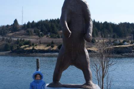
Hopefully this life-size bronze statue is the closest you’ll come to a Kodiak brown bear. The statue honors Charles Madsen, Kodiak’s pioneer-era bear-hunting guide and one of the first registered guides in Alaska.
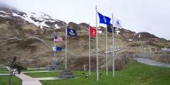
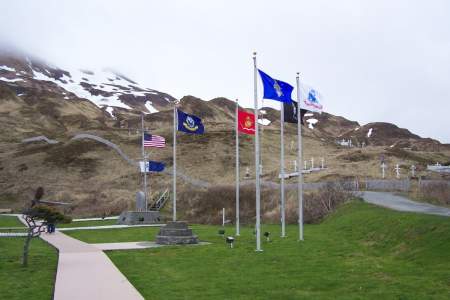
Memorial Park was built in 1992 in honor Coast Guard and Navy personnel that lost their lives during WWII.
Beyond the Pilgrim River Bridge, the road continues uphill and offers sweeping views of a network of lakes and the meandering river valley. North of the Pilgrim River drainage is a large hill topped with a series of granite rock outcroppings known as Hen and Chickens because of its resemblance to a small flock at certain angles. A cross was placed at the summit in memory of a priest who died in a blizzard on his way to the orphanage.
Palmer may look like it grew organically, like any other town. But it was actually designed by the government as a planned agricultural community. In fact, Palmer was part of FDR’s New Deal Resettlement Projects during the Great Depression: More than 200 families volunteered to move to Alaska to try farming in the Last Frontier!
One of only a few structures remaining from the original Russian settlement, the endurance of the Russian Bishop’s House reflects the dedication brought to the job by the missionary Bishop Innocent Veniaminov, its first occupant. Its chapel includes several icons Innocent imported from Russia.
The Copper River and Northwestern Railway used to serve the miners in this area in the early part of the 20th century, but the trains stopped rolling in 1938, and cargo planes became the only way to get freight in and out. This 14 X 18 mail cabin was built in one day in 1948 by employees of the Chititu mining company. It’s held up pretty well over the decades — it had to be rehabbed in 1998 to replace some rotting logs, but it still functions as… ...more
Housed in the circa 1898 White Pass & Yukon Route Railroad Depot, the historic Moore house and the Mascot Saloon. Collections consist of over 200,000 archaeology artifacts associated with the Klondike gold rush and 3,000 copies of historic photographs of the gold rush period. Library and 100-seat auditorium. Guided tours, interpretive programs, films and permanent exhibitions. Hours May-Sep: Daily 8am-6pm Admission No admission fee,… ...more
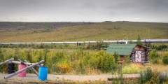
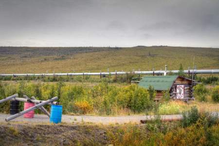
This Level Parking area was once the site of Old Man Camp, a former pipeline construction camp. There were a total of 31 construction camps operating during the construction of the Trans Alaska Pipeline from 1974 – 1977. These camps were temporary facilities to house the thousands of workers who build the pipeline.
Once the administrative headquarters for an empire stretching from Asia to California and Hawaii, Castle Hill today is little more than a grassy hill with a few interpretive signs, a modest stonewall, several old cannons, and a few flagpoles. But when you visit the top of this hill, you’re standing on rich historic grounds.
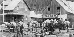
Historic site near Golovin opened by John Dexter where miners got their supplies and traded information. It’s where the “Three Lucky Swedes” stocked up (on supplies and help) after their big gold discovery on Anvil Creek in 1898. Also where Leonhard Seppala finished his long leg of the 1925 diptheria serum run. This building is still standing in Golovin, and was reportedly boarded up as is, with all its artifacts still inside.
The first two things visitors notice about Kennecott are the spectacular views and the town itself…in that order. The combination of dramatic scenery and strange mining town makes for a unique experience. Give yourself a couple hours to explore and take it in.
After four years of worshiping in the Presbyterian Chapel, Episcopalians finally had their own church in 1899, with the construction of St. Peters-by-the-Sea. Complete with stained glass windows, modified flying buttresses, and wooden pews, this small chapel is open to the public 24⁄7. The church and the adjacent See House (1905) are both on the National Register of Historical Places, and are largely the work of Bishop Peter Trimble Rowe.… ...more
Originally constructed by the Alaska Road Commission in 1924 – 1925, the Savage cabin and interpretive trails are now used as part of living history presentations in the summer months. During the winter the cabin become strictly utilitarian by providing shelter for patrols.
Charlie Anway, one of the town’s early pioneers who homesteaded the property, built the cabin in 1903. Anway had a knack for gardening and eventually developed the famous Anway strawberry — a berry so large and juicy that Haines became known as the Strawberry Capital of Alaska. In 2003, the property was donated to the Chilkat Valley Historical Society; plans are in the works to restore the cabin and open it to visitors.
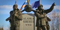
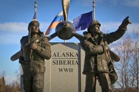
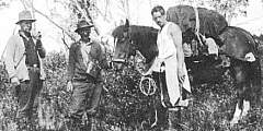
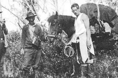
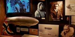
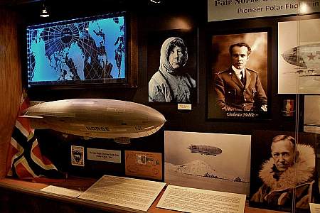
The U.S. and Russia were allies during World War II. Alaska was a key exchange point for warplanes in the Lend-Lease program, which leant thousands of American-made planes to Russia for use at the battlefront.
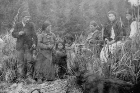
The Kenaitze Indian Tribe’s Dena’ina ancestors, recognizing the abundance of the place called Yaghanen, “the good land,” settled along the banks of its rivers and Tikahtnu (Cook Inlet). In the past several years, one location the Kenaitze Tribe has focused on is Sqilantnu, meaning “the grocery store,” located in the area now called Cooper Landing. Today, Kenaitze Indian Tribe partners with the Chugach National Forest to preserve, protect and ...more
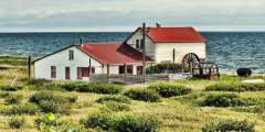
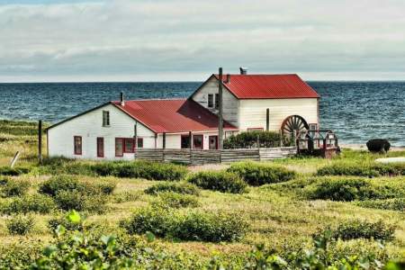
Arriving in Kake, you’ll see a large light-green warehouse built on pilings over the water. This is Kake’s historic salmon-packing cannery, which locals are working to restore as both a usable space for local businesses and an historic attraction for visitors.
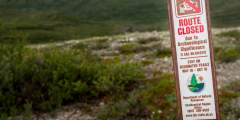
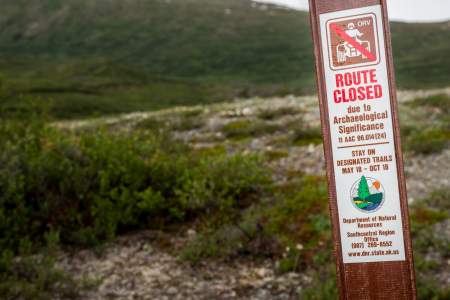
There are more than 500 archaeological sites in the Tangle Lakes District indicating that ancient people lived in this area for at least 10,000 years. Some of the densest concentrations of archaeological resources in the North American subarctic can be found here and the area is listed on the National Register of Historic Places.
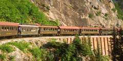
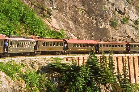
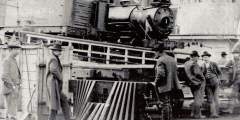
Take a ride on the Yukon Route Railway and head east just like the miners of the Gold Rush days. This locomotive cut travel time to Whitehorse from several weeks to just a few days.
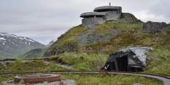
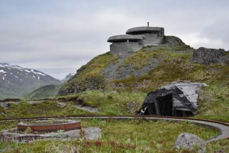
In the 1940’s more than 100 buildings peppered the hillside here, making up U.S. Army Base Fort Schwatka and Battery 402. This coastal outpost was considered cutting edge for its time. The Battery’s position high on Ulakta Head gave lookouts a strategic view and its 8‑inch, 21-ton guns boasted a range of 22 miles.
Trails were established by prospectors traveling through the Turnagain Pass area. The Ingram Creek trail followed the creek from Turnagain Arm up to Turnagain Pass. After the pass, the trail followed Granite Creek to Sixmile Creek, which then led prospectors to Sunrise and Hope.
If you’ve spent the day in Kennicott, on the glacier trail, or in the mountains and still can’t get enough of the outdoors, skip the shuttle ride down the hill to McCarthy and take this nice 1.5‑hour walk. The Wagon Trail cuts off the main road just to the right of the St. Elias Guides office.
One of the best spots to check out WWII relics, there’s a short trail from the parking area on the side of the road.
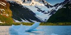
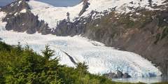
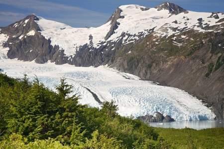
Glaciers are formed when more snow accumulates than melts through the seasons. The weight of the snow creates pressure that turns snowflakes into dense, rivers of ice that shape the land.
At Milepost 49, there is a campground with plenty of parking spaces availble for cars and RVs. From the scenic overlook on the upperroad you can spot trumpeter swans and moose in the small lake below. This river access point is the southernmost access point on the 400-mile Fortymile National Wild and Scenic River System.
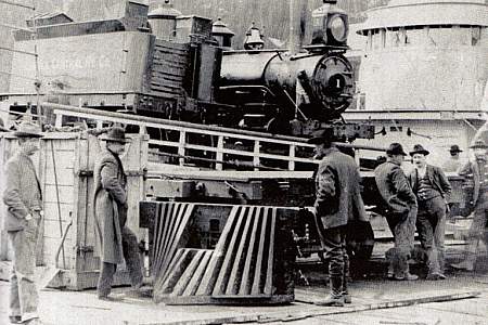
During the winter of 1907 the A.J. Meals Co. freighted a 70-ton steamboat over Marshall Pass from Valdez. The steamer was carried piece-by-piece on horse-drawn sled to the Copper River, 31 miles east. The 110-foot-long ship traveled 170 miles of the Copper and Chitna Rivers.
This is the site of the historic Fairbanks Exploration Company gold mining camp, established in 1925. Here you’ll find the old school house, which has been converted into a museum. This area is on the National Register of Historic Places.
Watch the bustle of the seafood industry and get great photos of a truly giant ship — the Star of Kodiak is 441 feet long and can hold 10,000 tons of cargo! Produced as part of a five-year government program during WWII, this ship was constructed in Portland, Maine and originally named the Albert M. Boe. Launched in 1945, it had only one year as an active military ship and saw very little action. Part of an improvised effort to get Kodiak back… ...more
Mile 43 Denali Park Rd, small cabin is visible down the embankment on the south side of the road
The bow of the sunken SS Northwestern points to the sky in Captains Bay, a fifty-foot-high symbol of Alaska’s role in World War II. The Northwestern had a fascinating history even before Japanese warplanes bombed her on June 4, 1942. After transporting passengers, troops and bananas on the East Coast, she logged more than thirty years in northern waters, carrying passengers between Southeast Alaska and Seattle.
If you had looked at the Seward waterfront area before 1964, you would have seen fish processing plants, warehouses, a small boat harbor, various pleasure and commercial vessels, and huge Texico and Standard Oil tanks. You would also have seen the Alaska Railroad facilities and tracks which ran to the south end of town near where the Alaska Sea Life Center is today. That’s where steamers would come in to off and on load materials. The bulk of… ...more
At Milepost 21 of Taylor Highway, you can stop and read about the life cycle of caribou and the fall and rise of the Fortymile herd.
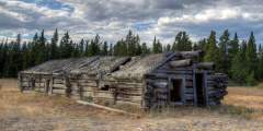
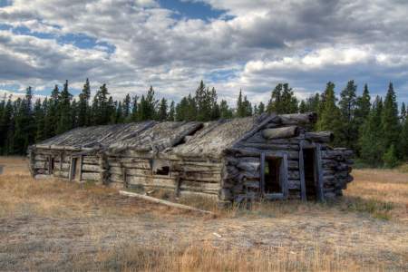
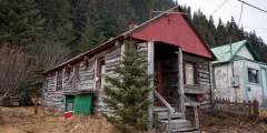
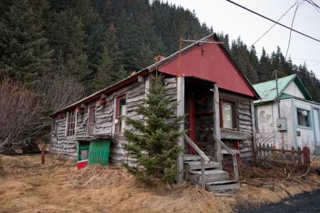
Talk about an authentic pioneer town. Time seems to have stood still on McCarthy’s Main Street, which is unpaved, only a few hundred yards long, and lined with classic buildings and memorabilia.Some visitors walk through McCarthy and complain that there’s nothing to do — and that’s exactly why folks like living here. But while you may not find much activity, you will find a lot of history: In the town’s heyday there were several hotels,… ...more
Across the street from the museum is a short path leading to the old railroad turntable used to flip the engine around so it could push the train the 4.5 remaining miles up to Kennicott. Look for a wooden sign across the street pointing the way. Two or three people can get it moving again. It’s a great activity for kids looking for a short but unique ride.
In 1904 a telephone line ran from Nome to the railroad terminus at Dickson, to the mining camps up Big Hurrah Creek, and on to Council. For one brief summer, parcels could be mailed to any point in the U.S. and money orders sent worldwide. The Council City & Solomon River Railroad also ran past, offering miners a one-hour trip to the coast. Grizzlies, moose, muskox, and reindeer are frequently sighted between the creek and East Fork Bridge. ...more
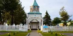
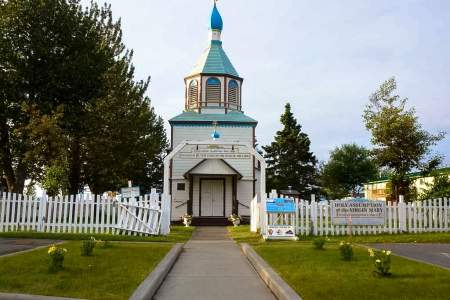
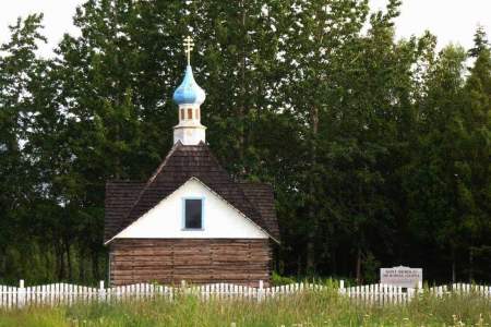
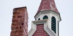
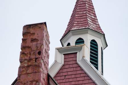
Built between 1894 – 96, the Holy Assumption Orthodox Church is the most enduring example of Russian culture in south central Alaska. For the Kenaitze Indians, who once comprised a significant portion of the population, this church constituted a major link to western culture. A simple, wood-frame structure with clapboard siding, Holy Assumption Church features a square two-story bell tower and a distinctive crown-shaped cupola, both with the… ...more
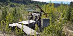
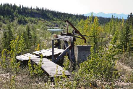
The mill was built in 1908 to ease the high cost of shipping silver ore out of the territory. Gravity pulled a line of buckets filled with ore down an aerial tramway cable from the mine above to the mill below.
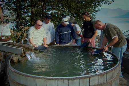
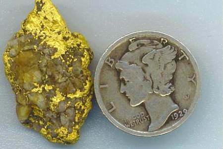
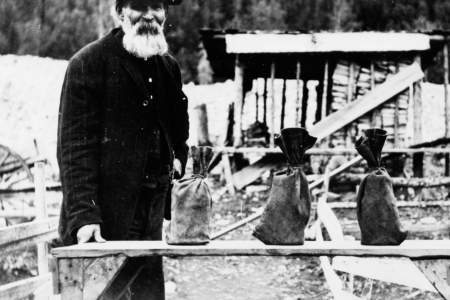
Beginning in the summer of 1899, thousands of men, women, and children worked shoulder-to-shoulder to glean treasure from these shores after news of Nome’s “Golden Beaches” rocketed around the world. To this day, hearty independent miners continue to work many area beaches with high bankers and sluice boxes. Most find themselves braving the cold waters in wetsuits to operate small, modern, floating suction dredges essentially vacuuming ...more
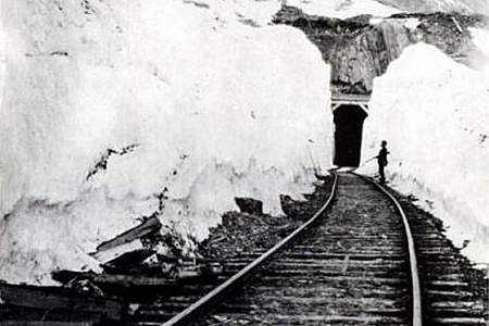
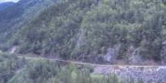
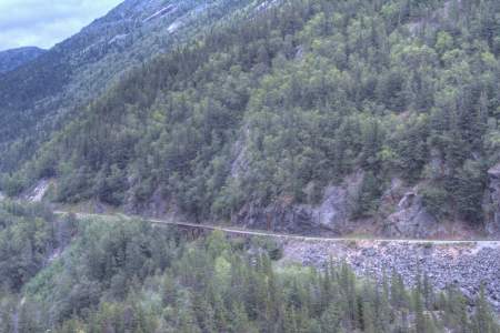
The rock cut you’re about to drive through was blasted out in the early 1900’s when the railroad to the copper mines of Kennicott was being built. The railroad began in Cordova and followed the Copper River to current day Chitina before turning through the rock cut and heading east towards the Wrangell Mountains. In the 1960’s the railroad handed over the land, and liability, to the newly established State of Alaska which promptly began… ...more
Palmer Creek and the road that follows it were named after George Palmer, who in 1894 first discovered gold on its banks. The creek was the site of early placer mining and later lode mining. Evidence of the historic Lucky Strike and Hirshey mines, as well as the Swetmann camp, can be found along trails that lead to Palmer Lakes. Several hiking trails are accessible from the Palmer Creek Road.
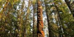
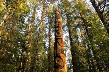
Alaska’s oldest National Park isn’t a big one — only 113 acres — but it’s rich with history and there’s plenty to do: hiking trails, ranger-led interpretive walks, carving demonstrations, ethnographic displays, and more. The park’s main attractions are the roughly 20 totem poles and the beautiful coastal rainforest, which you can explore on your own or with park rangers.
You won’t find any old buildings here, but there are great interpretive signs and numerous hiking trails at this state park. And it’s an important place — the site of the first Russian settlement on Baranof Island.
Here, Taylor Highway begins to descend into the valley of the Fortymile River. You will be able to see the intricately folded metamorphic rocks exposed by the road cut. Keep an eye out for white marble, quartzite, gneiss, and schist.
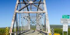
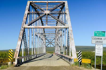
The Kuzitrin River Bridge had its origins in Fairbanks. It was originally named the Cushman Street Bridge when it was built across the Chena River in the heart of downtown Fairbanks in 1917. In the 1950s the bridge was replaced with a concrete span and the original metal bridge was disassembled, shipped down the Chena, Tanana, and Yukon rivers and barged up the Bering Sea coast to Nome. It was hauled in sections up the Nome-Taylor Highway and ...more
In 1882, the U.S. Navy bombarded the small village of Angoon, resulting in destruction of homes, winter food stores and all but one canoe. The community survived through much hardship. The event is still very much a part of the collective history passed down through generations of Angoon residents.
At Milepost 35 of Taylor Highway you can stop at the viewing deck. This spot offers amazing views of Mount Fairplay and surrounding valleys. Take this opportunity to get out, strech your legs, and take some great pictures!
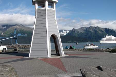
When visitors think of the Iditarod Trail, they often think of Anchorage where the race’s ceremonial start takes place. But the trail actually begins in Seward, right here. This spot is also where the town’s first settlers landed back in August 1903.
Overgrown and unmarked, this 200-year-old Russian cemetery is still used for Russian Orthodox parishioners of St. Michael’s. You’ll find stone and wood headstones, some of which are made from the ballasts of old Russian ships.
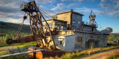
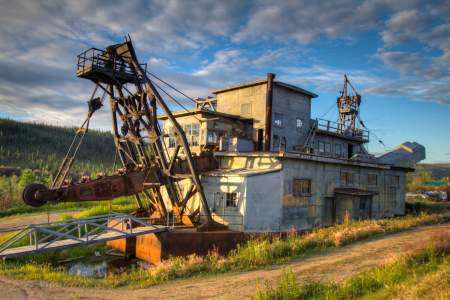
This dredge is located at Chicken Gold Camp and Outpost. The dredge mined on Pedro Creek just outside of Fairbanks from 1938 until 1959 before it was moved to Chicken Creek and operated between 1959 and 1967. Mike Busby and Bernie Karl purchased the dredge and moved it and other mining equipment down to Chicken in 1998 as a tourist attraction. It was put on the National Register of Historic Places in 2006.
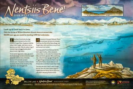
Traveling the Richardson Highway south of Glennallen, you will pass Willow Lake with spectacular views of the lake and the Wrangell Mountain volcanoes in the distance. Read about how ancient Lake Atna once filled the area you’re driving through and shaped the Copper River valley.
This abandoned lodge was once a full service stop for prospectors during the Klondike Gold Rush.
Old railroad building alongside the road.
Visit the site of one of the most famous shootings in early Alaska history – the spot where a U.S. Deputy Marshal was gunned down. We’ll also meet one of Alaska’s most respected lawyers and politicians.
This highway is named for the former Alaska road commission director, Captain Wilds P. Richardson. In 1903 Richardson presented the need for Alaska roads. He impressed Congress with his knowledge of Alaska and his abilities as an engineer. The monument here honors Richardson’s contribution as the Alaska’s first great road builder.
Here is access to the Dyea townsite, Skagway’s neighboring town during the Klondike Gold Rush days. Around 8,000 people lived at Dyea. You’ll find remains of a wharf, foundations of some buildings and Slide Cemetery, which contains the graves of those killed in the Palm Sunday Avalanche, April 3, 1898.Visit independently, making the roughly 25-minute drive from Skagway. Or, join a guided tour with Rainbow Glacier Adventures. ...more
At Milepost 68 Taylor Highway you pull off and enjoy this easy, 1.5 mile hike to an overlook above the remains of Mosquito Fork Dredge. This dredge was shut down in 1938 after operating for less than 2 seasons.
At this point in the drive you may need something to talk about.The Athabascan people traveled along the current McCarthy Road corridor to access their summer hunting camps in the Chugach Mountains. Their trails took them to prime mountain sheep country, as well as to some of their favorite spots for harvesting copper. One copper nugget taken from Dan Creek, almost pure and as big as a refrigerator, now sits in a museum at the University of… ...more
So don’t just stroll through town — take the official tour, brought to you by longtime resident experts: Alaska.org and the Anchorage Convention & Visitors Bureau.
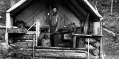
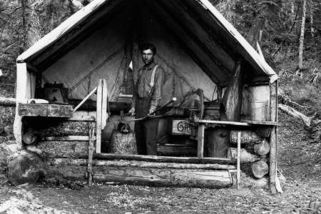
One of the First Roadhouses in Alaska
Look east across the Susitna River and you’ll see the old Valdez Creek gold mine in the foothills of the Clearwater Mountains. The mine was started by the Peter Monahan Party in 1903, triggering a small gold rush and an outpost settlement known as Denali. The original diggings and settlement are long gone.
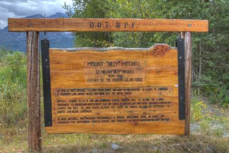
This roadstop honors Lt. “Billy” Mitchell, considered the father of the modern air force, and showcases the mountain named in his honor.
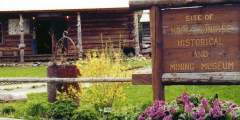
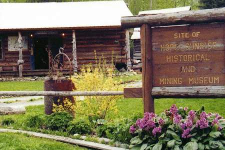
The Hope-Sunrise Historical and Mining Museum exhibits photographs and artifacts of the Turnagain Arm Gold Rush of 1896 and the years since.
See Historic Homes From Before Statehood
The Koyukuk Gold Rush is one of the most remote and oldest mining booms in Alaska. Word got out that gold had been found at the Koyukuk River and miners stampeded to the area in 1898. Today, the Koyukuk Mining District is one of the largest in the Yukon River region. Both life-long and recreational miners still find gold in this area today.
When Kake’s totem pole was raised on the bluff overlooking the city in 1971, it was celebrated as the tallest sanctioned totem pole in the world. It is now faded, and cracked at the top, but remains a symbol of Kake’s history and honors many traditions.
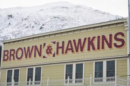
Built in 1909-10, this two-story building later became associated with one of Seward’s most beloved citizens – Sol Urie. An avid Seward promoter, Solly ran his bar and liquor store here.
Look to the left side of the highway and you’ll see what’s left of Gold Dredge Number 3. This dredge was build in 1927 and eventually produced $10 million in gold.
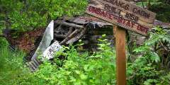
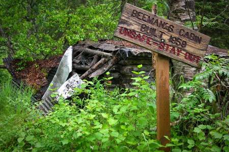
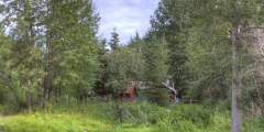
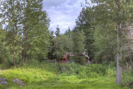
Don’t miss the old trapper’s cabin at Byers Lake. Most Sourdoughs — that means old-time Alaskans — don’t even know it’s there. Hidden in trees along the lakeshore trail, the old Beeman cabin stands as a reminder of simpler times. Peek in the windows and imagine living there all winter. Now part of Denali State Park, it’s an easy 10-minute walk from the main parking lot.
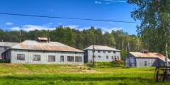
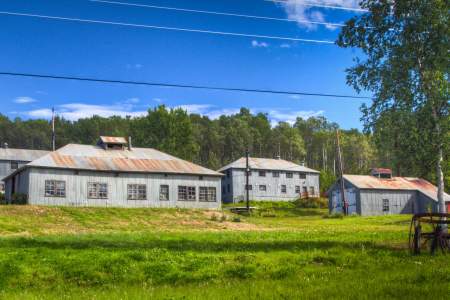
What was it like to be an Alaskan scientist back in the 1940s? This site, on the south side of Palmer’s downtown, near Gulkana and E. Fireweed streets, will give you a pretty good idea. Back then, this two-story cement building, the eight simple cottages, and the arboretum were built by the University of Fairbanks and used by researchers studying how to increase productivity in cold-weather crops.
This old company owned asbestos mining town once was home to 500 people. The main building housed the post office, grocery store and cafeteria. The town is abandoned but the road allows passage to the historic ghost town of Fortymile.
St. Peter’s Episcopal Church is the oldest surviving Protestant church building on the Kenai Peninsula. It was also the location of the first public school classroom in the town of Seward, and it housed a library reading room beginning in 1929. Soon after the town of Seward was established in the summer of 1903, a priest headquartered in Valdez began making periodic trips to Seward to hold services in a tent. The basement, or undercroft,… ...more
Miners worked this dredge up and down the Bluestone River and Gold Run Creek in the early 1900s. Now it serves as a nesting and perching site for common raven.
This little cabin was originally a rest stop for the McCormick Transportation Co.
Step back in time and explore historic Skagway using our detailed walking tour.
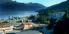
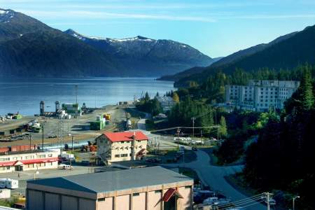
The area of Whittier has long served as passage between Prince William Sound and Turnagain Arm. The Alaska Engineering Expedition envisioned a rail line out to this largely unsettled area back in 1914, but it was the U.S. Army that made Whittier where and what it is.
King Mountain is the next hillside on the west side of the valley where it is easy to see the multiple cuts across its slopes for much of the year. Most cuts are manmade ditches that once brought water to Nome’s gold fields for hydraulic mining operations.
Look for the old outbuildings of the Sourdough Roadhouse on the banks of Sourdough creek.
This Russian Orthodox church was built by and for Serbian miners and Tlingit Indians — not Russians. Tlingits were attracted to the religion because of the church’s acceptance of their language and culture; Protestant missionaries attempted to erase their customs. Now, more than 110 years later, the church continues to serve the community, with services sung in English, Tlingit, and Slavonic. A classic Russian building, painted in the… ...more

This turn-of-the-century relic harks back to Tenakee’s busier times as a hub for miners, loggers and fishermen who hit town for a soak in the springs and a good time. It has served as everything from a jail, pool hall, dance hall, senior center to a bakery and art gallery.
As you round Cape Nome, the Cape Nome Roadhouse is on the shore-side of the road. Road-houses once flourished along trails around the state, providing food and shelter for winter travelers who often arrived by dog team or horse-drawn sleigh. The Cape Nome Roadhouse also served as an orphanage after the devastating epidemics of the early 1900s and as a World War II communications base. It is now a privately-owned camp.
This old bunker is open for exploration. If you make it this far on your hike, be sure to walk around the bunker and step inside to get a rough idea of how how soldiers lived during WWII.
George A. Brackett began building Brackett Wagon Road in November of 1897 and by March of 1898, the toll road was open and spanned 10-miles up the valley to White Pass City. The road was very popular with packers as it was a vast improvement over the miserable Trail of 1897. Brackett sold the road in June of 1898 to the railroad for $100,000.
Start at this landmark, in the center of town, to grasp the richness and depth of Sitka’s history as the capital of Russian America. The architecture and treasured icons of this landmark highlight Sitka’s long history as a European settlement decades before the American Revolution.
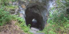
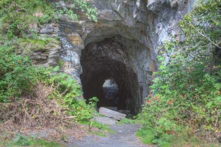
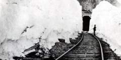
This railroad tunnel was hand-cut starting in 1905. Nine companies were battling to take advantage of the short route from the coast to copper country. Progress on the tunnel was interrupted and after a gun battle, construction halted and the tunnel was never finished. You can read about the tunnel and these events in Rex Beach’s novel, The Iron Trail.
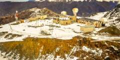
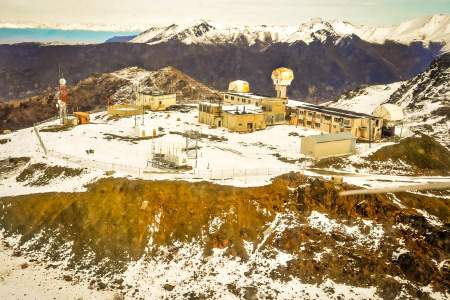
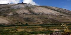
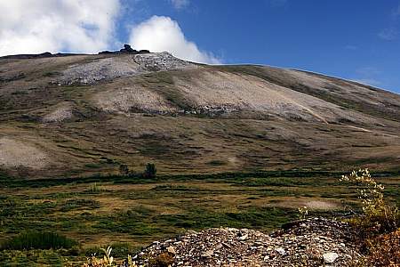
Site Summit, located in Arctic Valley at nearly 4,000 feet atop Mt. Gordon Lyon, was once home to a Nike Hercules missile battery, part of the ‘Rings of Steel’ missile defense system that surrounded major U.S. cities from possible Soviet missile attacks during the Cold War.
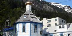
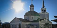
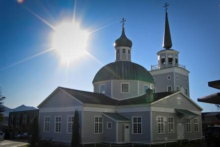
The town’s most recognizable building, with iconic blue onion-like cupolas capped by crosses, this cathedral was established in 1794. That’s the year Russian monk St. Herman arrived in Kodiak. A benevolent force in the colonization and exploitation of the Aleuts and Alutiiqs, he was known for his care of the sick and dying during Western-introduced epidemics, as well as his protection of the local populations. He was canonized in 1970,… ...more
Clan houses line Beaver Trail Road in Angoon, an area that hasn’t changed much in the last 100 years. The weather-beaten, wood-framed buildings are outward signs of a culture that has been maintained through generations.
After Finnish laborers completed St. Michael’s Russian Orthodox Cathedral, they asked Russian authorities if they could build a Lutheran church for themselves. The Russians allowed it, but only if the building didn’t look like a church. That building was torn down in 1888, but you can still see what it looked like: the current Lutheran church (which looks like a church) has a model and photo of the original. The Lutheran Church is right across… ...more
Although this cabin is not accessible from the road system, it bears mentioning as a National Historic Site in the Corridor. Harry A. Johnson arrived in Seward in 1904 from Erie, Pennsylvania. A 30-year-old blacksmith, he came north to help build the railroad.
The Wible Camp is marked by Gold Rush Centennial interpretive signs at a pull-out 3.2 Miles south of the Hope Junction on the Seward Highway. Looking east of Canyon Creek, visitors can see a straight strip of alder brush on the hillside where miners dug a ditch used for hydraulic mining. The ditches were dug to collect and divert water into metal pipes. The highly pressurized water then scoured hillsides. Location Milepost 59.5 Seward… ...more
Captain James Cook saw much of Alaska’s coastline during his troubled third voyage in search of a Northwest Passage. Prince William Sound, Prince of Wales Island, Norton Sound, and Bristol Bay are just some of the places he named during his travels. English Bay, on the eastern side of Unalaska Island, references the two landings Cook and crew made there in 1778 (just months before his death in the Hawaiian Islands).
In the 1950s, an Anchorage family worked tirelessly at their dream of building a ski resort here at the base of Gunsight Mountain. They built a small chalet and erected a rope tow. But financing was always a problem. Business did not boom. Today, the chalet is all that’s left of their efforts.
At Milepost 34 of Taylor Highway you are able to compare the gently rounded ridges of the Yukon-Tanana Uplands, that were to never covered in ice, to the rugged, glaciated Alaska Range in the distance.
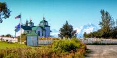
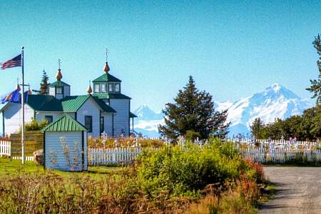
This road leads to Holy Transfiguration of Our Lord Russian Orthodox Church. Here you will find a magnificent view of Cook Inlet, volcanoes, the beach and Ninilchik Village. This is a wonderful photo opportunity when the flowers are in bloom.
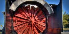
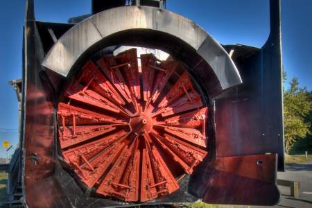
This rest area is the site of a railroad section house. The restored house and its outbuildings were built by the Alaska Railroad to house the section foreman and his family. The foreman was responsible for maintaining a 10-mile stretch of railroad track. You’ll find an old train car and rotary plow that used by the section foreman to clear snow off the tracks in winter. This is a fun stop for kids to take a look at railroad history and… ...more
Here is the former site of the Jack Wade Dredge. This was a popular attraction and photo subject for highway travelers for many years. The dredge was dismantled and scraped by the BLM in 2007. BLM officials said that the deteriorating condition of the old dredge was a safety hazard. T
Right next to the Talkeetna Historical Society, this original “trappers cabin” gives you an interior look at traps, antique tins, a washtub, and furs, offering a sense of how these pioneers lived. And Olé is quite the character: he came to Alaska in 1916 and worked as a logger, surveyor, and gold miner. His grandkids still attend the local schools.
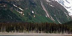
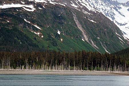
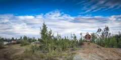
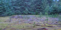
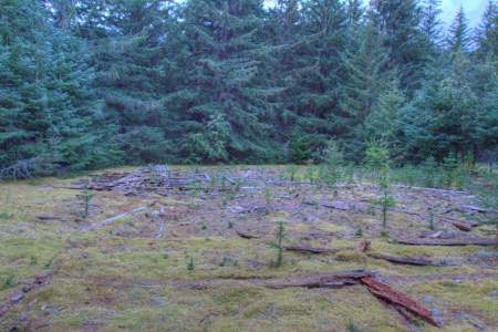
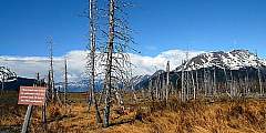
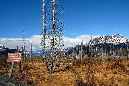
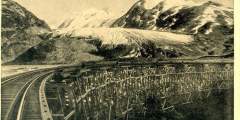
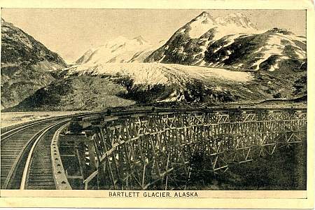
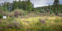
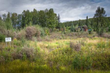
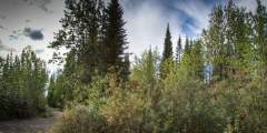
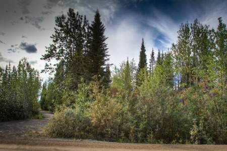
Believe it or not, but this area used to be covered by tall trees!
Located on Santa Claus Lane, the Terry Miller Memorial Park features a picnic area, children’s playground, a spacious gazebo donated by the North Pole Rotary Club and an up close view of the Alaska Railroad as it passes by.
Russian soldiers were a common sight around Nome during World War II. The government’s top secret Lend-Lease program provided Russia with critical war materials to aid the fight against Germany, and Nome was the last fuel stop for war planes headed West. A 1944-era hangar can be seen here today, a relic from this amazing effort.
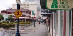
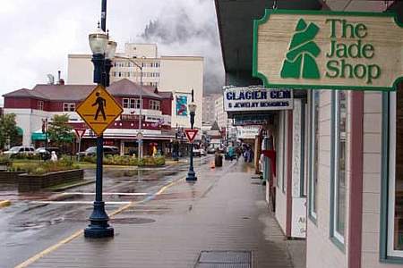
Take a walking tour through the historic district in Marine Park. Pick up a free map at the kiosk and just go! South Franklin Street is the main tourism district and one of the best shopping areas to find everything Alaskan, from cute and furry faux creatures (like iceworms) to handmade native crafts and expensive fine art. To ensure authenticity, look for the polar bear symbol for goods made in Alaska and the Silver Hand label for genuine… ...more
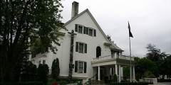
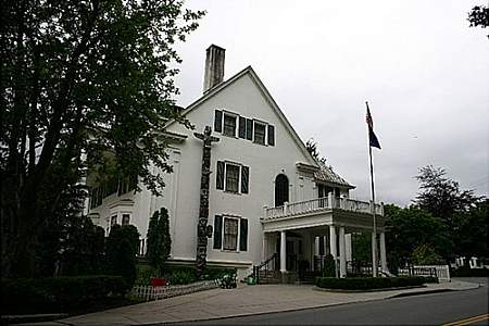
Just a short, mostly uphill, walk from downtown sits this estate that was built in 1913 for $40,000 and now houses Alaska Governor Bill Walker. Along with a totem pole outside, the 26-room building has eight fireplaces to keep the wet, cold winter at bay. There aren’t tours of the mansion, but local bus tours made it a destination during Sarah Palin’s time in office — particularly, of course, when she was the Vice Presidential nominee.
Alaska has served an important role in U.S. military strategy, especially during World War II, and the Cold War. But the military history in Nome actually started even before the city was incorporated, when gold rush dealings and a population boom required some old fashioned law and order brought by U.S. soldiers.
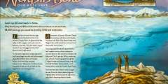
A visit to Nome and the Seward Peninsula brings you to the origins of the Americas’ indigenous populations. It was here that several great migrations took place from Asia to North America, across the Bering Land Bridge. The route was made possible by lowered sea levels, which exposed a land passage ranging up to 1,000 miles wide, linking what is now Russia to the Seward Peninsula of Alaska. ...more
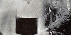
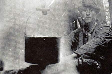
Like most seaport towns, Seward had ladies of the night from the town’s beginning. But in 1915, with the decision to start building the Alaska Railroad here, the town became concerned about the upcoming influx of construction workers. Seward decided to confine these ladies to a specific area, a place that became the town’s Red Light District. During prohibition it was also known for its moonshining, thus the nickname, Homebrew Alley.
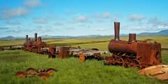
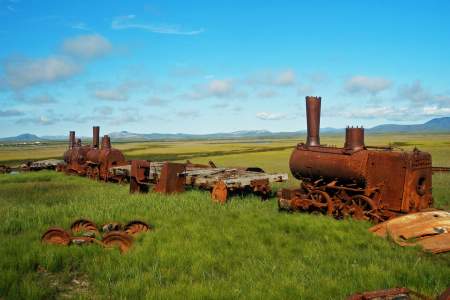
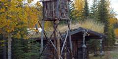
Just across Bonanza Bridge, three rusty steam locomotives and some rolling stock lie sinking into the water-logged tundra. Dubbed “The Last Train to Nowhere,” they are all that remain of a dream to build the most extensive and prosperous rail system on the Seward Peninsula. In the early 1900s, Chicago investors backed construction of the Council City & Solomon River Railroad in an effort to link the region’s major mining centers by rail. ...more
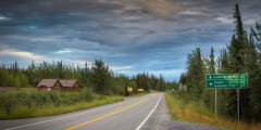
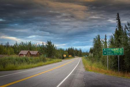
Here you can see what remains of the old Fortymile Roadhouse. In 1959, the Fortymile Roadhouse served Alaska Highway travelers who were heading up the new Forty-mile and Eagle Highway, now the Taylor Highway, which was still under construction with only about 20 miles of road finished. The roadhouse offered cabins, meals, a grocery store and a garage with gas and oil. The roadhouse closed in 1985.
Look for the Old Dalton Cache located behind the customs building. This little cabin has been a roadhouse, a tollhouse for the Dalton Trail and a customs office. Check with the U.S. Customs office before walking down to the cabin.
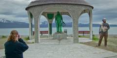
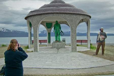
Because Homer loses so many loved ones at sea, mostly in the commercial fishing business, Homer residents constructed a Seafarers’ Memorial near the end of the Spit, emblazoned with brass plates listing the names of mariners lost or killed at sea.
Eight signs will guide you through the Copper River watershed landscape. See if you can visit all eight signs on your tour through this upriver basin formed by the ancient, glacial Lake Atna!
Arrange a water taxi ride to this man made archipelago extending into Sitka Sound, a relic of decaying fortifications built to defend Alaska from foreign invasion during World War II. During World War II, Sitka was the hub of military activity in Southeast Alaska, with a U.S. Naval Air Station and other installations.
There isn’t a much left of this old mining town, but at one time, it was home to 250 – 300 miners. The town, named for prospector Nels Olnes, boasted general stores, lodges, hotels and mail and telephone service. It was even a stop on the Tanana Valley Railroad.
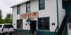
Whittier was built as a deepwater port and railroad terminus to transport fuel and supplies during World War II. Come inside the Anchor Inn where a small but fascinating museum gives a glimpse of Whittier’s interesting history.
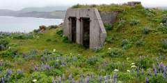
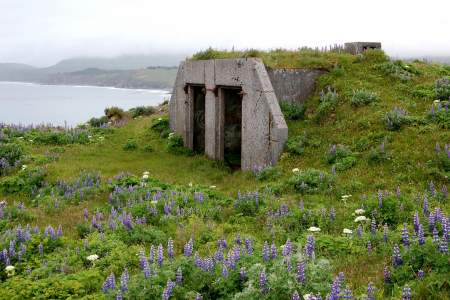
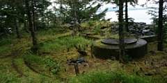
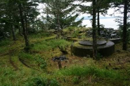
World War II buffs will want to check out remaining World War II defensive fortifications like elephant-steel magazines and the base-end station that overlook Summer Bay and Humpy Cove.
This is one of Alaska’s oldest original roadhouses from the gold rush era. Stop in for a slice of homemade pie or a giant cinnamon roll and mingle with the local miners, dog mushers, trappers and fishermen.
The end of the pavement, side roads in both directions follow where the North Fork Ditch passed by. It’s not much to look at now, but for nearly 60 years, the ditch channeled water from the North Klondike River to an electric power plant 25 km further West. It helped to provide electricity and water for gold dredging in the Klondike. Constructed in 1909 by the Granville power company, the hydroelectric plant provided 10,000 hp, later increased… ...more
An assortment of homes and cabins dots the road for the next two miles and comprises the town of Chiniak. Originally a native Alutiiq outpost, the population here exploded during WWII, following construction of a road from Olds River. The Army, Navy, and Air Force have based operations here, with workers living in Quonset huts and military housing. But following the closure of the housing in 1954, the residents built the “town.” Electrified in… ...more
This was the original port and city of Valdez. The city was moved to its current location 4 miles down the road after it was devastated by the 1964 Good Friday Earthquake.
One of the last ranches on the island, this cattle company is run by Bill and Kathy Burton, who started their 20,000-acre lease in 1967. With 60 – 70 cows, 400 buffalo, 70 elk, and 14 yaks, the ranch is a place for domesticated meat and guided hunts. Ranching was first brought to Kodiak by the Russians, who took advantage of the natural grasslands on the green, temperate island. Americans continued the ranching tradition, which peaked with some… ...more
At Milepost 67 Taylor Highway you will find the Chicken Creek Bridge. This is the site of a dredge that was operated by the Fairbanks Exploration Company from 1959 until 1965. In an average run of the dredge, it was operating 24 hours a day for 2 weeks. At it’s peak, one run would bring in $40,000 in gold.
This cabin, possibly the oldest in the Canyon Creek drainage, is a symbol of the area’s rich gold mining history. The cabin was built and used by the first generation of Canyon Creek miners. Northern European craftsmanship went into the construction of this cabin. The corner logs were dovetailed and hand-hewn. The ridgepole was hewn to fit the shape of the roof’s peak. Horizontal logs were rounded on the outside of the building and hewn flat… ...more
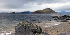
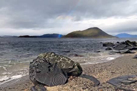
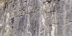
Some 40 – 50 rock etchings, possibly 8,000 years old, can be spotted here above and below mean high tide. The concentration of carvings is unmatched in Alaska and in few other places in the world. There is some belief that the petroglyphs pre-date the Tlingit Indians of this area.
Harry Karstens was the first ranger of Denali National Park. He arrived in early summer 1921, and established his headquarters on the northwest bank of Riley Creek, an ideal spot for monitoring visitors using the trail leading into the park. In 1925, the headquarters moved to it’s current location at mile 3.4 of the Denali Park Road.
At Milepost .7 of Taylor Highway you will notice dark gray sand dunes on either sides of the road. These were created over 10,000 years ago when strong winds carried loose sediments from the plains of the Tanana River and piled them against these low mountains.
Many locations around Nome are named after John Dexter, a miner and businessman who opened an important early trading post/roadhouse in Golovin. Two other roadhouse/bars have also carried the Dexter name, which can get confusing for visitors. Read our descriptions to help sort them out.