20 Best Photo Locations in Alaska
Show Map
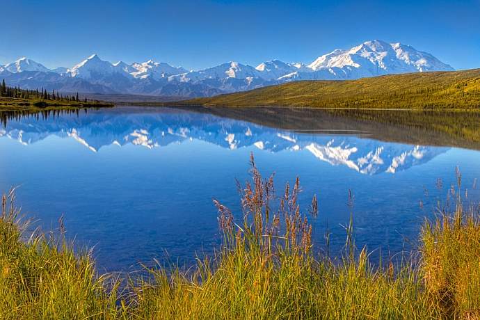
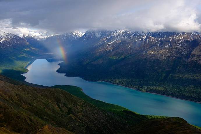
Wonder Lake in Denali National Park
Capture what is perhaps the quintessential Alaskan landscape shot: the Alaska Range mountains reflected in the still waters of Wonder Lake in Denali National Park. Do it under the warm light of a summer sunset; not only is the light much more photo-friendly then, but it’s often the only time you can see Denali during the summer (it’s frequently obscured by clouds). Plus, there’s nothing like standing out on the tundra and enjoying the solitude of the wilderness in the late evening. To reach this vantage point, you’ll need to take one of the Denali National Park shuttle or camper busses all the way to the 85-mile mark on the Park Road. And you’ll want to reserve a campsite at Wonder Lake so you have more time to explore the area.
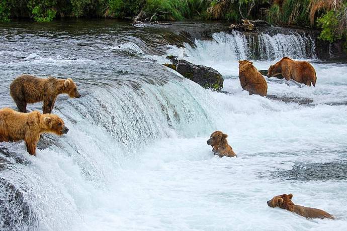
Bears at Brooks Falls
Brooks Falls in Katmai National Park is one of THE world’s most iconic places to watch and photograph active grizzly bears feeding on salmon. July is the best time to watch bears at the falls—that’s when the annual Sockeye (Red) Salmon run occurs—but bears are in the area from mid-spring until mid-fall. And it’s easy to get to this enormous park,which lies some 300 miles southwest of Anchorage: air taxis can to take you there for a day trip or an overnight in a campground or lodge. Or, Alaskan photographer Jeff Schultz offer's a Brown Bear Photo Trip. Photo by Scott Michaels/Flickr
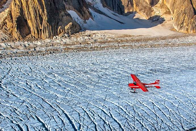
Ruth Amphitheater (via Skiplane)
A massive glacial hallway with 5,000-foot-high walls of vertical granite on either side, the Ruth Glacier makes up one of Alaska’s most rugged landscapes. At the north end, it opens up into the impressive Ruth Amphitheater, a huge open field of snow and ice that’s rimmed by even bigger peaks like Mt. Dan Beard, Mt. Huntington and, towering over it, the steep south face of 20,320-foot Denali. You can only explore the Ruth by airplane, and your best option is to go with one of the guided air taxi services in Talkeetna. Most of the flight services will land on the glacier and let you walk around this otherworldly snowscape.
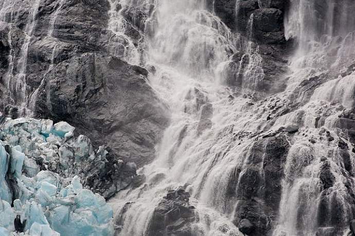
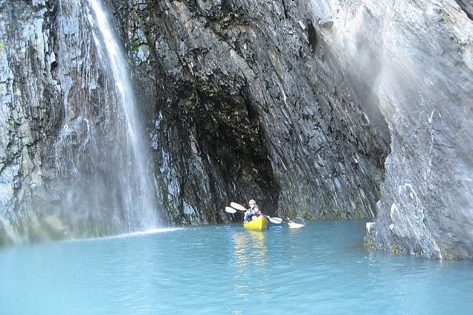
Blackstone Glacier (via Day Cruise)
Although it's just one of many icy tributaries spilling from the Chugach Mountains into Prince William Sound, breathtakingly beautiful Blackstone Glacier has its own unique charm. Hanging glaciers rim the tops of 800-foot vertical cliffs, and dizzyingly high waterfalls plunge into the turquoise waters. Look for grounded bergs along the shores of the bay; you may even be able to do a beach landing to view them up close. And traveling to Blackstone is an adventure in itself, requiring a trip to the port city of Whittier by way of the Anton Anderson Memorial Tunnel—a one-lane highway bored 2.5 miles through a mountain. Photo by Dan Bailey/Alaska Photo Treks
Barrow
There’s no better place to experience the midnight sun than in Barrow, Alaska. The northernmost town in the entire U.S., Barrow sits on the edge of the Arctic Ocean, 320 miles north of the Arctic Circle. In summer, the sun never sets—it just tracks endless circles around the sky for almost three months, from the second week in May until the first week in August. And from November until early February, the sun never rises above the horizon. However, if you brave the cold and dark, you’ll be treated to magical displays of the northern lights dancing in the sky above the frozen sea ice of the Chukchi Sea. Alaska Airlines offers daily flights from Anchorage to Barrow.
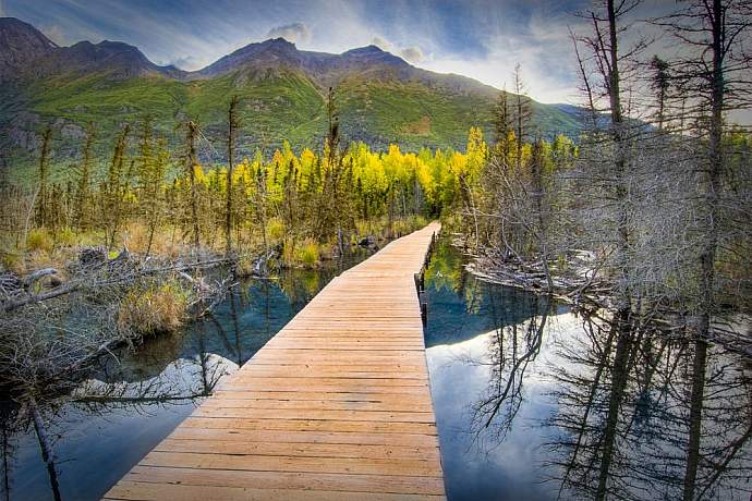
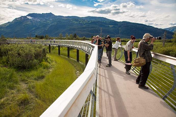
Eagle River Nature Center
The Eagle River Nature Center, located only a 40-minute drive from downtown Anchorage, is one of several gateways to Alaska’s largest state park, Chugach. As you turn onto Eagle River road to begin the 12-mile drive into the Eagle River Valley, you’ll find many views of the glacially carved mountains. You’ll also have opportunities to spot wildlife, including beaver and salmon, which you can see from dedicated viewing decks. If you’re a walker/hiker, you can enjoy several loop trails, from ¾-mile to six miles, each lined with many varieties of flora. The nature center is also an end or beginning point for the 25-mile “Crow Pass Trail” on the historic Iditarod Trail, extending to Girdwood.
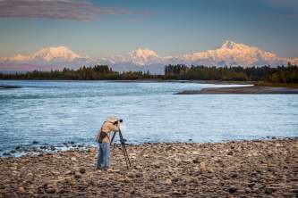
Byers Lake
Byers Lake, at mile 147 of the Parks Highway between Anchorage and Denali National Park (a 3 hour, 150-mile drive north of Anchorage), offers grand views of Denali and the Alaska Range from the east side, as well as the Veterans Memorial wayside at the entrance. And you can stay a while: there’s a 73-site campground and several state cabins for rent (cabin 1, 2 and 3). The lake doesn’t allow motorized boats, so bring a canoe or kayak or inflatable raft with you. And hikers can set off for Kesugi Ridge, a 36-mile trail with spectacular views of the entire Alaska Range. Photo by Dan Bailey/Alaska Photo Treks
Portage Pass
A short (one mile) but steep (750 feet in elevation) hike gets you one of the most spectacular glacier views near Anchorage; the tundra and ponds around Portage Glacier are reminiscent of the Swiss Alps. The trail continues another three miles to Portage Lake and an even better vantage point of the glacier. This trip does require a drive to Whittier, through the one-lane, 2.5-mile, Anton-Anderson Tunnel. Once through the tunnel, drive ¼ mile and take the first right past the railroad tracks to a gravel road marked “Forest Access,” and park at the end of the road. Photo by Alaska Photo Treks
Hatcher Pass, Independence Mine
You'll want to stop every thousand feet or so on your approach to Hatcher Pass, just to soak in the abundant natural features of this captivating place. First you’ll see a cascading river bouncing over river rocks along the steep climbing road. Then stop at the scenic pullout that affords panoramic views of Matanuska Valley. Finally, check out the remnants of historic Independence Goldmine, nestled among craggy peaks, alpine meadows, and babbling brooks. Just make sure your camera battery is fully charged before you begin! Photo by Frank Kovalchek/Flickr
Chugach Mountains from Flattop (Anchorage)
The Flattop Mountain hiking trail is a popular destination for both tourists and locals, and for good reason: the summit offers an expansive view over the entire Anchorage Bowl and Cook Inlet. On a clear day, you can see all the way from Mt. Redoubt to Denali, and three mountain ranges to the west—the Neacolas, Tordrillos, and Alaska ranges. And the view is even better at sunset. Located on the front range of the Chugach Mountains, the trailhead is reachable by car (take O’Malley Road four miles towards the mountains, turn right on Hillside, make a left on Upper Huffman, and then turn right on Toilsome Hill Road) or by one of the van tours that start in downtown Anchorage. Photo by Dan Bailey/Alaska Photo Treks
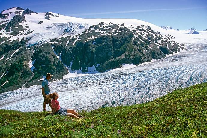
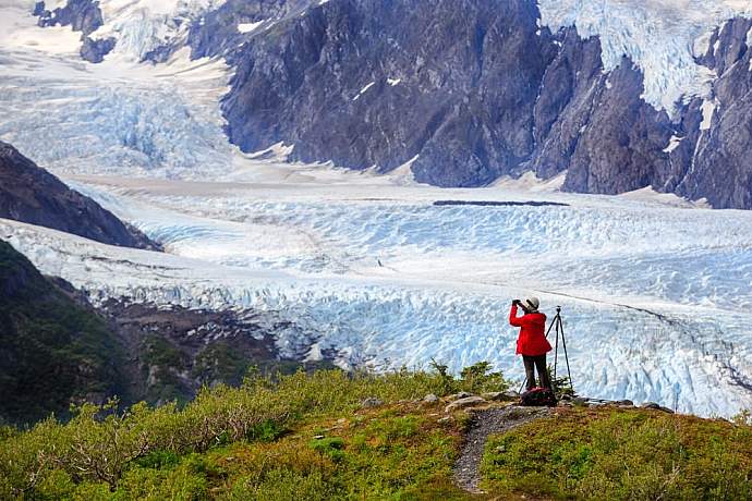
Exit Glacier and The Harding Ice Field (Seward)
Located just a few miles from Seward, Exit Glacier offers a rare opportunity: to view a glacier up close. You can walk on the gravel bar just below the glacier, and an easy hiking trail brings you very close to the ice. Take the more strenuous four-mile trail all the way to the top and you’ll reach the edge of the massive Harding Ice Field. With an area of over 300 square miles (1,100 if you include the 40 glaciers that it spawns), Harding is the largest ice field that lies entirely within the United States. You can drive to and hike the Exit Glacier trail on your own, or take a van tour from Seward and enjoy a guided National Park Service hike up and down the trail. Photo by Alaska Photo Treks
Skolai Pass, Wrangell St. Elias National Park
At over 13 million acres, Wrangell St. Elias is the largest National Park in the U.S. Youcan see some the park from a distance during the drive on the McCarthy road, but the best way to experience this magnificent wilderness is to take a bush plane ride into the backcountry with one of the local air taxis. Once there, Skolai Pass offers a stunning destination for remote day hikes and longer wilderness backpacking trips, where you can explore grassy hillsides, alpine valleys, wildflowers, tundra, river bars, the Russell Glacier, and upper Skolai Lake.
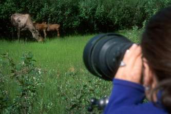
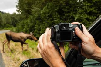
Alaska Wildlife Conservation Center
Alaska has a lot of wildlife. But it’s also a very big place. Wildlife goes where it likes, and very often it’s far away from us. Alaska Wildlife Conservation Center is a great solution to this problem, and is as close as many people will get to seeing the state’s biggame species in a natural setting. For instance, the brown bears occupy an 18-acre enclosure that’s set up with an aerial walk, allowing visitors to photograph without obstruction. Other species at the center include moose, musk ox, elk, caribou, and the North America’s largest land mammal, wood bison, all of which can be photographed with only mountains and wilderness in the background.
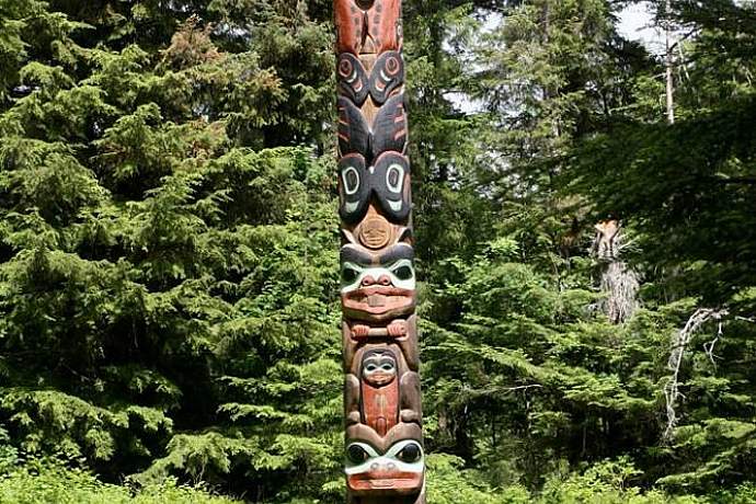
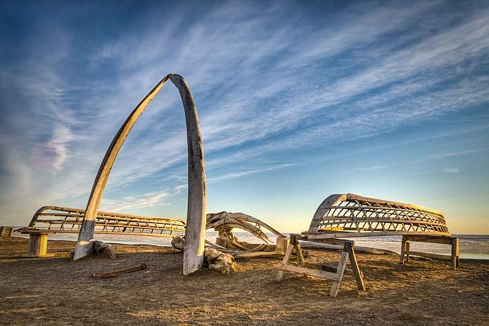
Sitka Totem Park
Standing like silent sentinels along a seaside path, a series of ornately carved totems lure visitors deep into their forest home. Fallen spruce needles silence footfalls along the way so that apart from the occasional trill of a bird, the park is filled with a sacred hush. Take your time. This is a place out of time. Photo by Eric Heath/Flickr
Aialik Bay (from Seward)
You'll be hard pressed to find a more idyllic Alaskan location than Aialik Bay. It has the best of everything this great land has to offer: mountains, glaciers, scenic coastline, and wildlife. Located in the heart of Kenai Fjords National Park, the bay is reachable via a pleasant cruise through coastal waters populated by sea otters, humpback and orca whales, puffin rookeries, and sea lion haulouts. Aialik Bay is a great day-trip destination or base camp for a multi-day sea kayak excursion. As far as we're concerned, the longer you can arrange to stay in this magical destination, the better. Photo by NAParish/Flickr
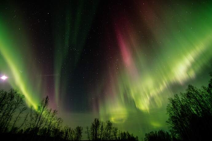
Northern Lights in Fairbanks
If there is one thing you'll not forget in a lifetime, it's seeing the northern lights. No words can adequately describe the shimmering strands of light weaving through the night sky. The lights are best seen near the Arctic Circle between September and March, and Fairbanks is a viewing hotspot. Prepare for awe. Bring a tripod, plenty of layers, and hand warmers.
Northern Alaska Tour Company offers a selection of tours that begin in Fairbanks and include trips north to Coldfoot, a remote town perfectly situated under the "auroral oval," where you will find the best displays of northern lights. These trips run from late August to late April.
Photo by FairbanksMike/Flickr
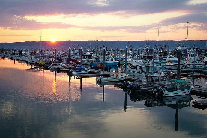
Homer Spit
Travel to the end of the Homer Spit and you might have the sense of being aboard a ship rather than on dry land. That's because the spit is a narrow, five-mile strip of road extending into pretty Kachemak Bay. During summer, it bustles with activity as tourist and fisher-folk collide. Winter is more sedate, but the Spit is still a great year-round getaway for some seaside therapy, which might include beachcombing, eagle watching, and sampling the fare at any of a number of great local eateries.
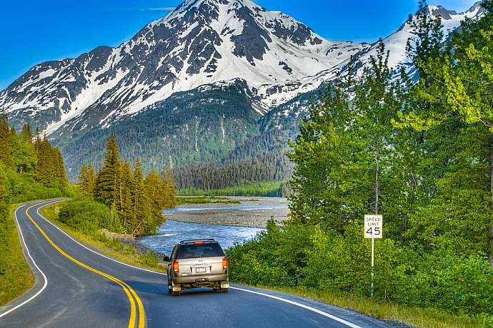
Seward Highway from Anchorage to Seward
The 127-mile Seward Highway has three designations to its credit, including the USDA Forest Service Scenic Byway, Alaska Scenic Byway, and All-American Road. And traveling this highway is a photographer’s paradise. In just the first 50 miles, the highway runs along Turnagain Arm, home to beluga whales, as well as the Chugach Mountains, where you might find Dall sheep, grizzly and black bears, and bald eagles. As the highway continues onto the Kenai Peninsula, it winds through the Kenai Mountains and crests Turnagain Pass, a haven of wildflowers and berries, and travels along many creeks as well as small and large lakes. Always in the shadow of mountains, the highway reaches its destination in Seward, a port city and gateway to Kenai Fjords National Park. Photo by Alaska Photo Treks
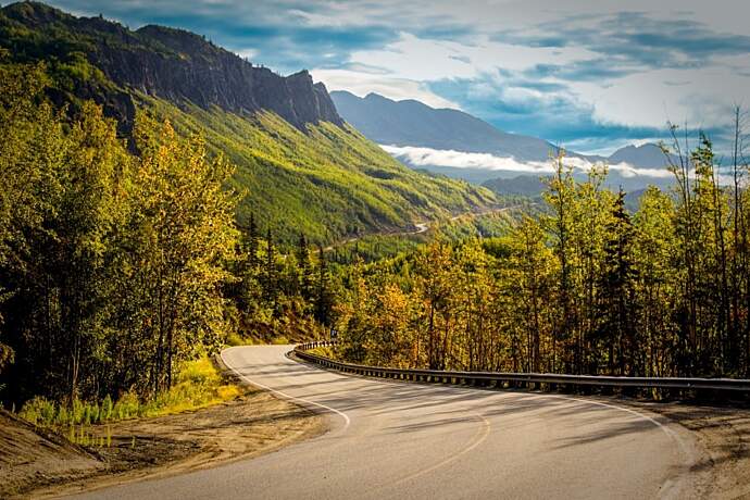
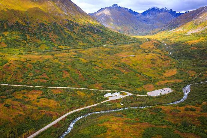
Glenn Highway up the Matanuska Valley
Designated as a National Scenic Byway, the 135-mile Glenn Highway between Anchorage and Glennallen is a photographer’s dream. Along the way, you can catch amazing views of the Chugach and Talkeetna Mountains, as well as the Wrangell St. Elias Range, the Matanuska Glacier, and the braided Matanuska River as it winds down through the valley. At Tahneta Pass, the landscape opens up into an endless expanse of spruce forests and views that stretch for over 100 miles on a clear day. Numerous pullouts, rest stops, campgrounds, and lodges along the way offer opportunities for you to stop and explore wildflowers, wildlife, hidden lakes, and other photo-worthy sights.
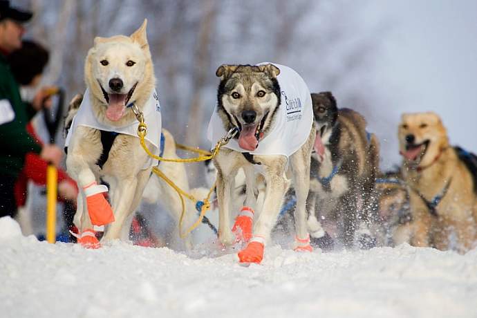
The Iditarod
The Iditarod is known as the granddaddy of sled dog races, and its popularity is second to none. Photographing on the trail itself, after the ceremonial start in Anchorage and the actual start in Willow, requires extensive planning, but you can get spectacular images during these two days. In Anchorage, review the trail map and drive to locations nearest the parking areas along the cross streets. In Willow, walk or snowmachine down the trail to get away from the crowds. You’ll also find wonderful opportunities in Nome to photograph dog teams as they finish the race, nine to twelve days later.
One way to catch views of the dogs along the trail is to stay at Winterlake Lodge. They are situated along Finger Lake, which is a checkpoint for the Iditarod. Photo by Alaska Photo Treks