Kesugi Ridge Trail Backpack
Difficulty
Difficult
Why Choose This Trip?
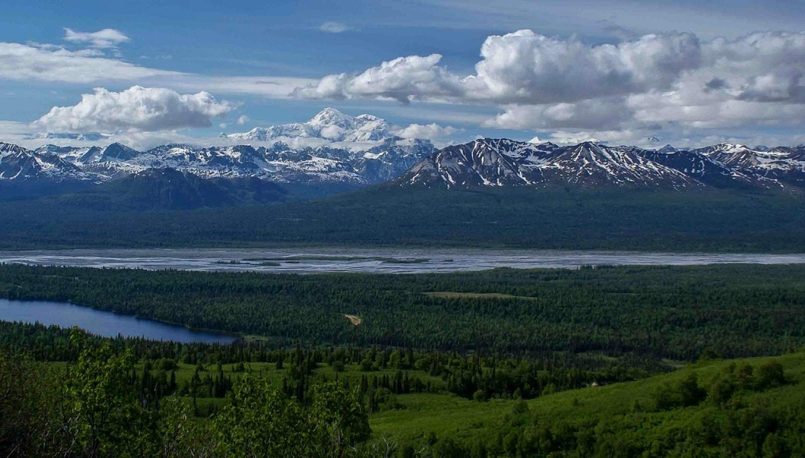
During periods of clear weather, this route through Denali State Park offers similar terrain and scenery to Denali National Park - including unparalleled views of Denali (formerly Mt. McKinley) - without the cumbersome permitting process.
Trip Type
Backpacking
Region
Central Alaska
The Route
The K'esugi Ridge trail system offers many options for starting and ending points, as there are four trailheads along its length. The trip outlined here starts at the northernmost trailhead, Little Coal Creek, and ends at the Byers Lake Campground and trailhead.
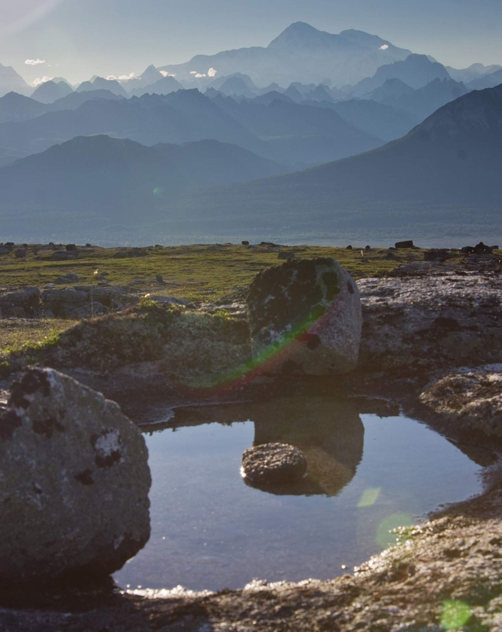
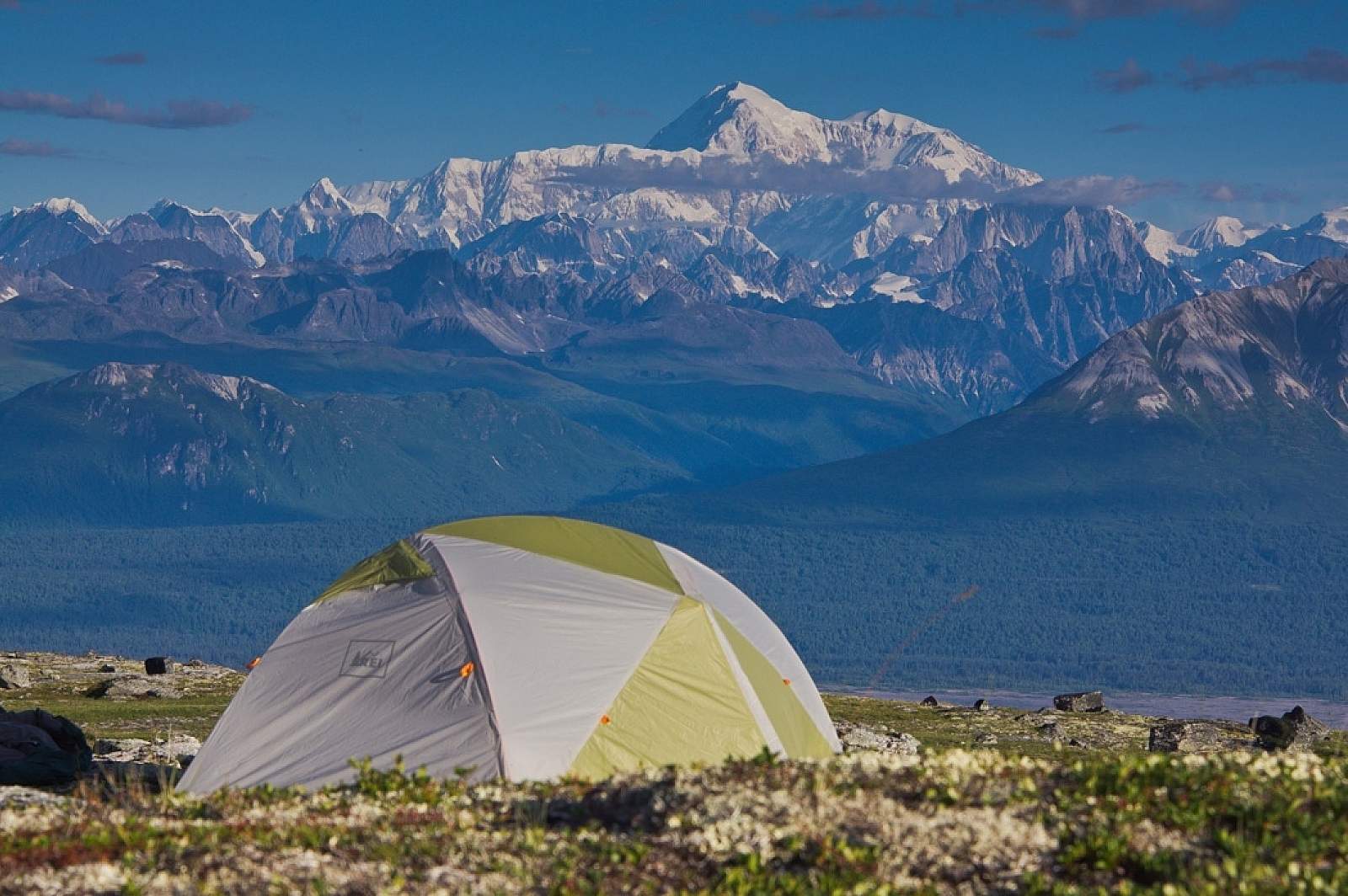
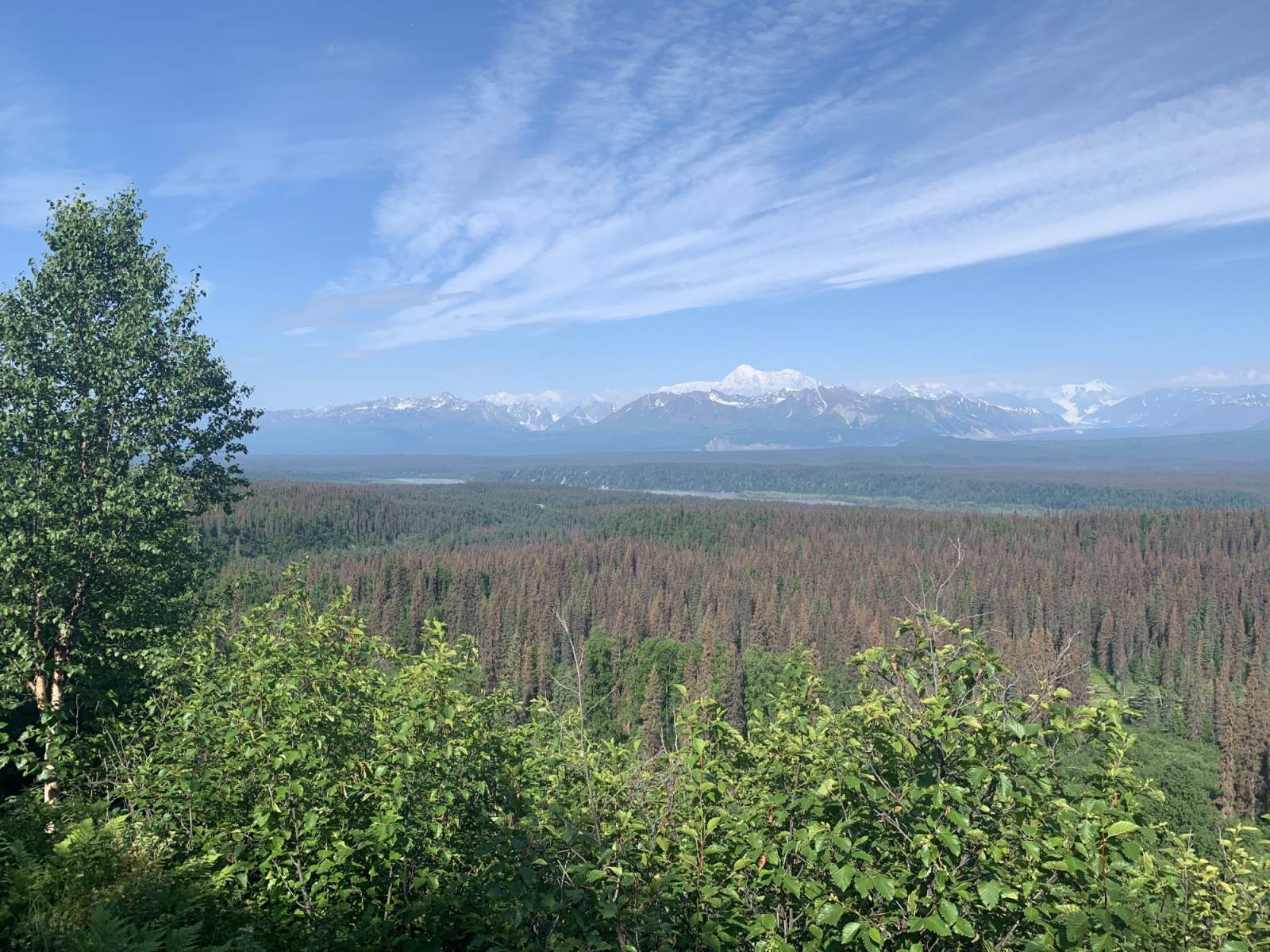
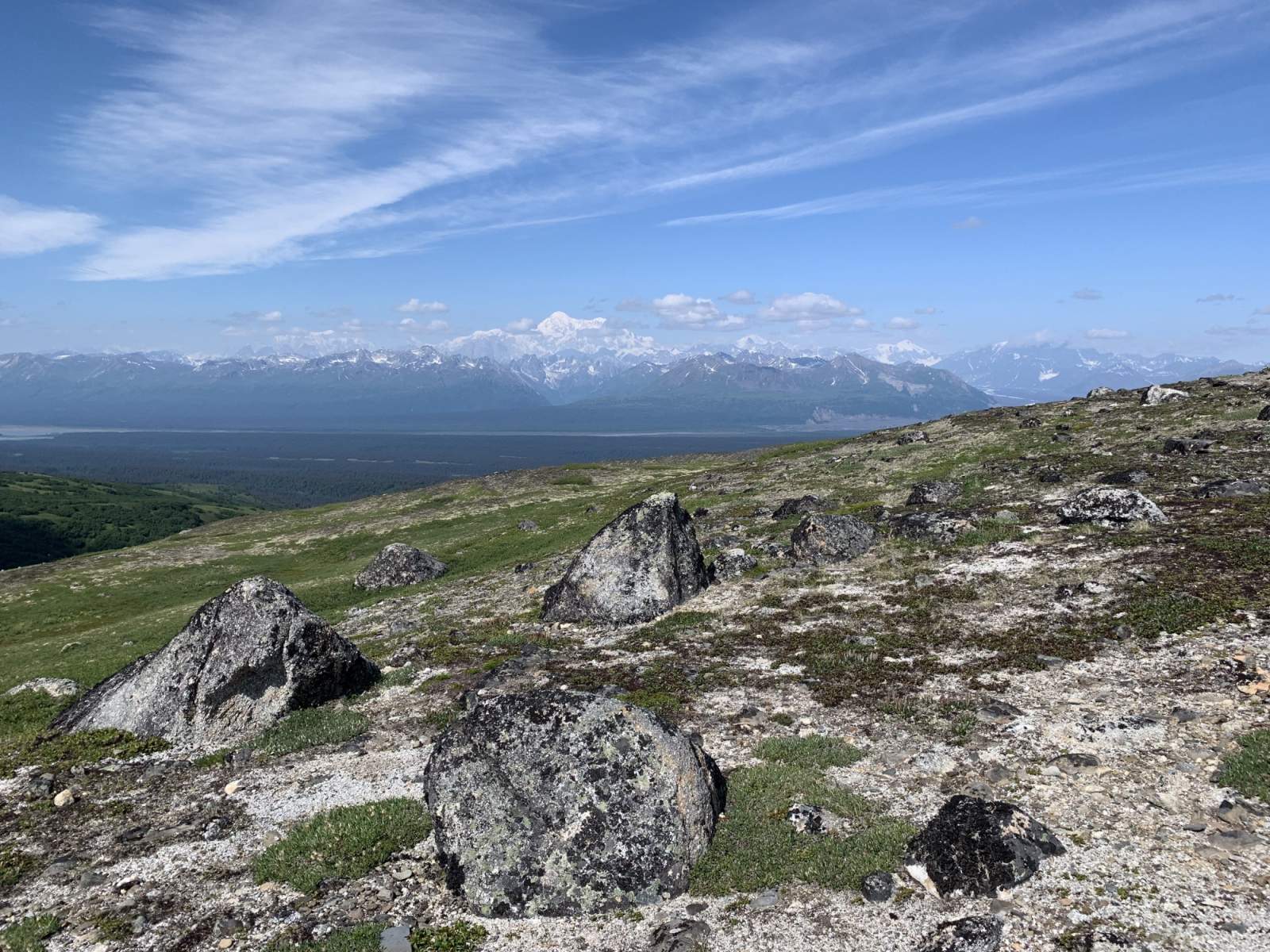
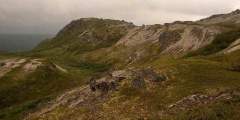
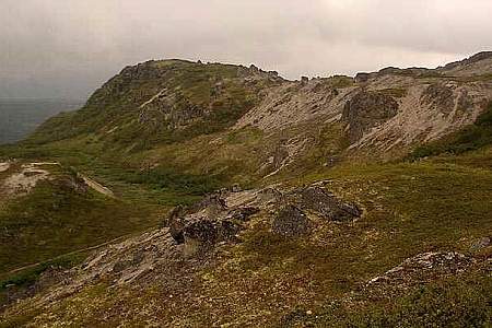
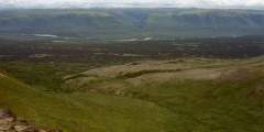
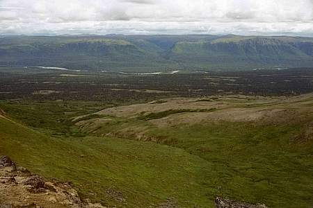
From the Little Coal Creek trailhead, there's a tough climb of more than 2,000 feet in the first four miles to access the ridgeline and the high point of this trail system. Once you reach the ridge, you'll be rewarded with gently undulating terrain, spectacular views, and occasional alpine tarns. These small lakes may be a welcome respite on hot days, since there's almost no shade on K'esugi Ridge. There's also little shelter from inclement weather - something to keep in mind when pitching your tent for the evening.
After almost 11 miles of ridge travel, the trail will descend to a low saddle. If you intend to leave the trail at the Ermine Hill trailhead, this is where you'll turn off. You'll see a lake to the northwest of the main trail; look to the west of this lake for the trail to Ermine Hill.
If you're continuing on, this low pass is a nice, protected place to camp. From the saddle, the trail very briefly climbs before descending again and crossing a broad, low valley. Then you'll climb for the next five miles to reach the high point of the southern portion of the trail, passing the mile-long Skinny Lake along the way.

Alaska Range Looms over the Kesugi Ridge Trail (Photo courtesy of Haley Johnston)
Some 25 miles from where you began, you'll come to another trail junction. If you're leaving the trail at the Byers Creek Campground and trailhead, as recommended here, this is your turnoff. Look for Cascade Trail/Byers Lake on trail signage.
If you're eager for more hiking, there are 11.7 more miles of trail from the final junction to Upper Troublesome Creek trailhead. This section of trail begins in the alpine, but descends into a forested valley for most of its mileage. If you came for the views, this is the section of trail to skip.
Distance
29 miles (as described); options exist for trips of 15.3 to 37 miles.
Number of Days
2-4
Backcountry Starting Point
Little Coal Creek trailhead
Backcountry Ending Point
Byers Lake Campground
Trip Logistics
Moderate
Little Coal Creek trailhead is located at milepost 163.9 on the Parks Highway/AK-3. There is parking here, but it may be crowded on weekends. You'll pass your takeout trailhead on the way north; if possible, leave a vehicle at your takeout to be a shuttle at the end of your trip.
If you don't have access to a vehicle to be the shuttle, if may be possible to hitchhike from your ending point back to Little Coal Creek trailhead along the Parks Highway. Alternately, as of this writing, Denali River Guides in Talkeetna offers shuttles to any of the K'esugi Ridge trailheads. Booking a ride with them may simplify your logistics.
Experience Level Necessary
Beginner
Expected Hazards
- Severe weather. What gives K'esugi Ridge its incredible views - extended periods of time in the alpine - also leaves campers and hikers exposed to wind and weather in the event of a large storm. If the weather looks particularly bad, plan to camp at lower elevations where possible.
- Bear habitat. Make noise and carry bear deterrents, as black and brown bears live here.
Other Adivce
If you're doing K'esugi Ridge for the unbeatable views of Denali, make sure to check the weather. Low clouds and rain can obscure the views.
Other great resources for this trip:
- DNR K'esugi Ridge Trail System North guide
- DNR K'esugi Ridge Trail System South guide
- DNR Upper Troublesome Creek Trail guide
Will you see other people in the backcountry?
Probably. This is a popular trail for visitors and locals alike. Weekends are the busiest times. The trails that connect the four trailheads to the ridge are the most likely spots to see other hikers, runners, or backpackers throughout the entirety of the trail.
Land Manager
State of Alaska Department of Natural Resources - Denali State Park
GPS Coordinates
Starting Point: Little Coal Creek trailhead: 62.89223, -149.74754
Ermine Hill - K'esugi Ridge Trail Junction: 62.79459, -149.86834
Ermine Hill trailhead: 62.82752, -149.90431
Ending Point - Byers Lake Campground: 62.74535, -150.11820
Troublesome Creek trailhead: 62.63013, -150.22572
USGS Maps
Talkeetna Mountains D-6
Talkeetna Mountains C-6
Cost: $-$$
There are no permits, flights, or fees associated with this trip. If you need a shuttle from Talkeetna to complete the trip, it will increase the cost.

Photos
Show Map
Kesugi Ridge Access Trails
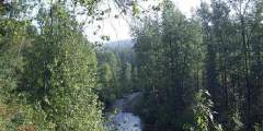
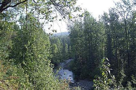
This is the southernmost trail that leads to Kesugi Ridge. On average, it takes a hiker 4 hours to get above the treeline. This trail is often closed due to flooding as well as bear activity for the safety of its hikers. Please check with Alaska’s Department of Natural Resources to make sure that the trail is open to hikers before starting this trip.
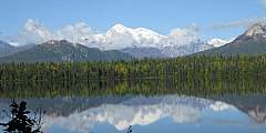
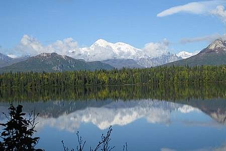
This is one of four trails that lead to Kesugi Ridge. From the Denali State Park campground at Byers Lake, this gentle stroll is the perfect way to spend a few hours. Wander through spruce and birch trees on the north side of the lake and enjoy big views of the Alaska Range and Denali (formerly Mt. McKinley) from the east side.
This is one of four trails that lead to the high Kesugi Ridge along the Parks Highway about an hour north of Talkeetna. The trail begins in a forested area and ends up above the tree line looking down on muliple drainages. The view at the top is wonderful, so bring a camera! It takes about 2 hours on average to get above treeline.
This trail is the northernmost trail that provides access to Kesugi Ridge. On a clear day, Little Coal Creek Trail takes you to amazing views of Denali (Mt. McKinley). It also gives you those views in the shortest amount of time, about 1.5 hours, of any of the access trails to Kesugi Ridge.