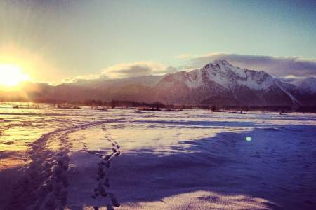
Mat-Su Valley Parks & Trails
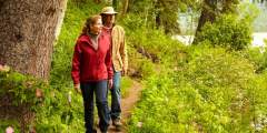
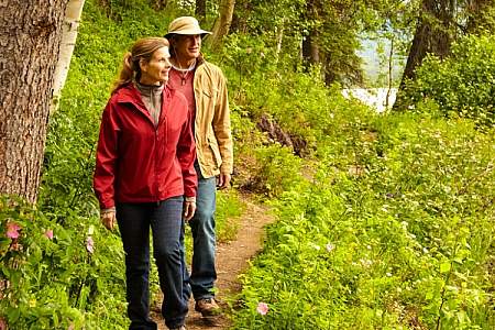
Whether you seek a leisurely stroll, a challenging day hike, or a lengthy backpacking trail, Mat-Su Valley parks and trails offer something for everyone. All are within an hour or two drive from Anchorage.
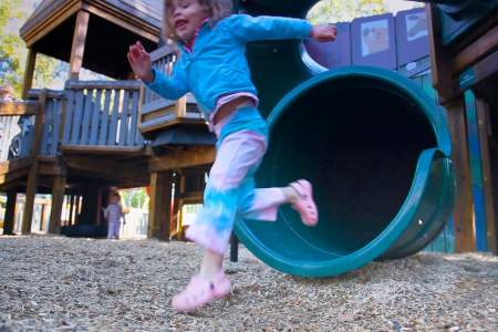
Great Family Walks & Hikes
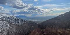
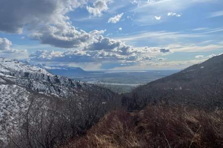
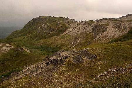
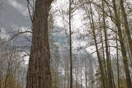
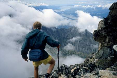
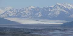
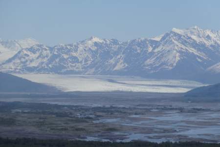
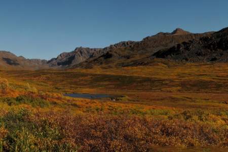
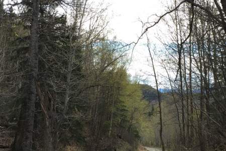
Bodenburg Butte Trail near Palmer, just 45-minutes north of Anchorage. Short but steep - 0.25 miles are stairs! Views at the top include the surrounding agricultural land laid out in what looks like a lush green quilt, Pioneer Peak towering in the distance and Knik Glacier nestled in the mountains in teh distance.
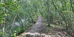
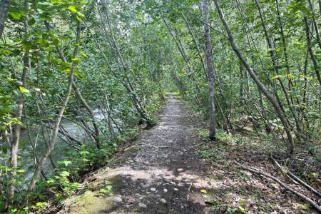
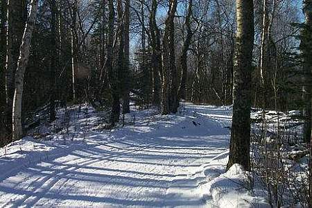
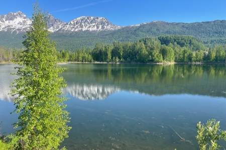
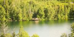
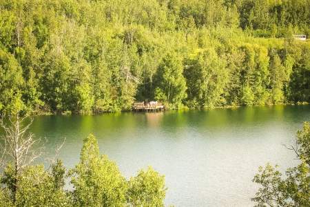
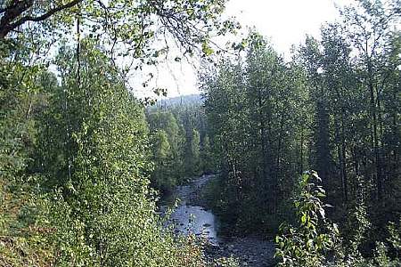
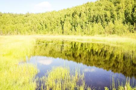
Talkeetna Lakes Park in Talkeetna offers wide, flat trails around a system of lakes. It’s just a mile and a half from town, but feels like deep wilderness.
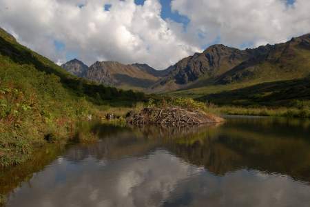
Gold Cord Lake Trail in Hatcher Pass crosses over a small bridge, and winds up past an old abandoned mining cabin, and then up a debris field and finally to the lake. Round trip, the hike is almost 2 miles, and the elevation gain is approximately 600 feet. At the top is crystal clear Gold Cord Lake nestled in the mountains. Families will pick a rock to enjoy a picnic on its shores.
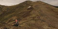
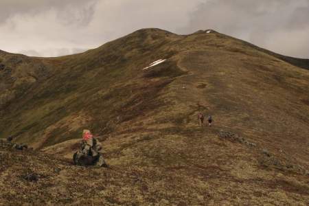
Challenging Ascents
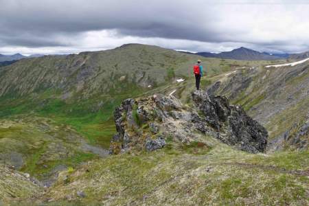
Lazy Mountain Trail is anything but lazy. located 90 minutes north of Anchorage just across the Matanuska River from downtown Palmer, makes no pretense about its purpose. Almost immediately after leaving the parking area, it begins to climb straight up the steep west face of Lazy Mountain. For some 2,000 feet, there’s nary a switchback or respite as the trail winds up to the summit ridge. It’s a truly breathless workout.
Matanuska Peak climbs higher than any other official trail in Southcentral Alaska. Beginning in a subdivision across the Matanuska River from Palmer, this nearly 6‑mile-long trail runs up some 5,700 vertical feet. Your destination is the 6,119-foot summit of Matanuska Peak, the very prominent rock spire that fills the sky just east of Palmer.
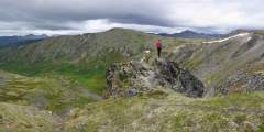
Multi-Day Treks
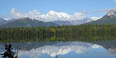
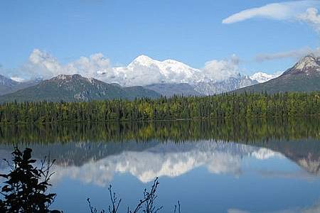
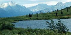
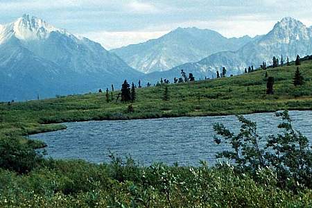
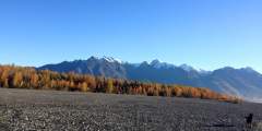
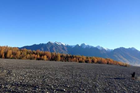
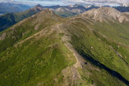
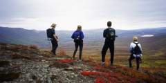
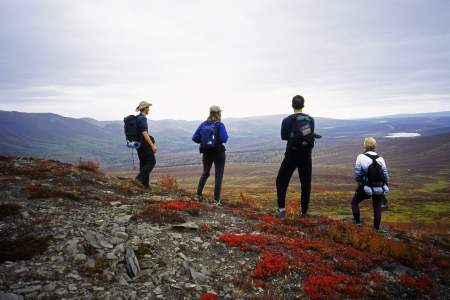
Kesugi Ridge within the boundaries of Denali State Park. It offers similar terrain and scenery to Denali National Park — including unparalleled views of Denali. This trail system offers many options for starting and ending points, as there are four trailheads along its length.
Gold Mint Trail is a straightforward trip with big scenery payoffs, like the picturesque Mint Hut and a valley dotted with hanging glaciers. This trip is a great first backpacking trip in Alaska with simple logistics. It’s 16 miles with options for additional miles and side trips.
Show Map
Parks & Trails
How to get ThereThe Plumley-Maud Trail can be accessed from the end of Maud Road, or from the corner on Plumley Road near Caudill Road. 1) Access from Maud Road: From Palmer go south east 3 1⁄2 miles on the Old Glenn Highway, take a left on Maud Road, follow Maud Road for 1 1⁄2 miles. There is a small turn around and limited parking before the creek directly east of the road. Please be careful not to block the entrance to the trail or the… ...more
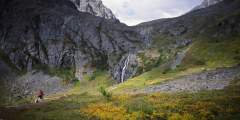
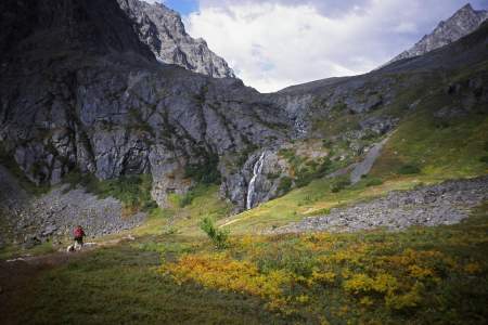
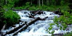
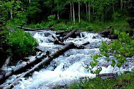
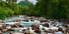
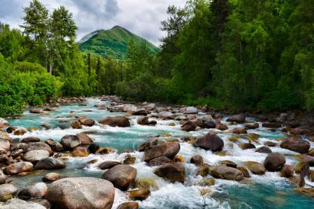
The 5‑mile-long Eska Falls Trail is located a 2‑hour drive north of Anchorage in the mountains above the town of Sutton. And it leads to one of nature’s symmetrically framed wonders — a 100-foot waterfall located at the end of a mile-long valley that’s flanked by two massive summits. This setting makes Eska Falls not so much a hike to a destination as much as a hike to a presentation.
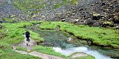
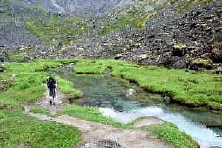
This is a popular, 4.3‑mile-long (8.6 round-trip) trail located 2 hours north of Anchorage in the Hatcher Pass area. It’s also gorgeous. At one point it climbs directly alongside a sheet of waterfalls falling from a wide granite ledge. As the trail winds its way to these falls, it passes the lake into which the falls drain. And after the falls, the trail ends at the tarn from which the falls drain. In other words, hike this trail and you’ll see a ...more
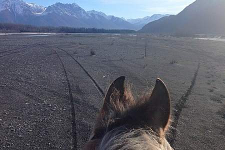
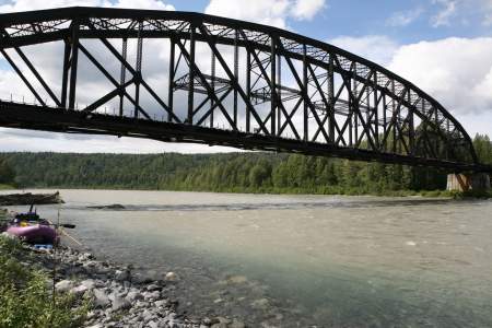
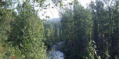
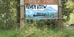
Explore the expansive gravel beds or meander along the mighty Matanuska-Susitna River and link up with the Matsu River Park trails, located in the trees to the west.
Beginning a 1‑hour drive north of Anchorage in Government Hill Recreation Area, Government Peak Race Trail offers a fine opportunity for a hard workout; it climbs some 3,700 vertical feet in just 3 miles. Plus, this climb doesn’t include any extraordinary dangers. (A friend refers to one short ledge on this trail as “death rock,” but she tends to exaggerate.) Some sections require special care to negotiate, but you won’t have to traverse any ...more
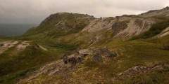
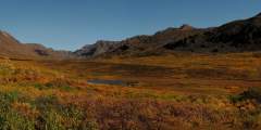
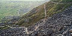
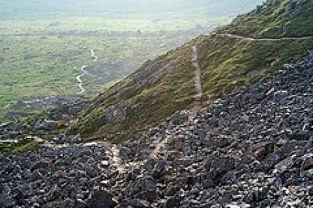
Want to feel dwarfed by Alaska’s mountains? Take a 2‑hour drive north on the Parks Highway and then up Hatcher Pass Road, where you’ll find this 2‑mile-long ATV trail — a wide but occasionally steep path that leads to the crest of Box Lake Ridge. From the big, rounded top of this ridge, you can’t help but feel overwhelmed by the enormous Talkeetna Mountains that surround you.
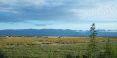
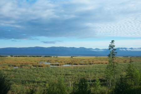
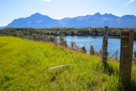
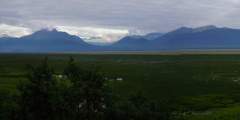
Visible outside the windows of the Mat-Su Convention and Visitors Bureau, this state wildlife refuge is the result of the 1964 earthquake. Literally overnight, the land dropped by 6 to 20 feet; hay fields and pastureland became salt flats and marshland. Once home to cows and grains, the land is now prime habitat for moose, birds, and fish. Some 20,000 acres are protected in the refuge, which is a popular recreation and wildlife-viewing… ...more
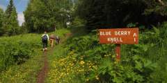
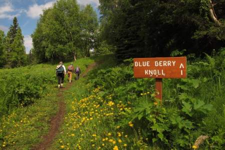
Located one-third of the way from Palmer to Wasilla, this 33-mile trail system meanders through boreal forest, farmland, and the rolling moraines left by the glaciers of the last Ice Age. The trails are some of the only non-mountain, non-motorized pathways in the area, and they’re popular with dog walkers, mountain bikers, geo-cachers, cross-country skiers, runners, and equestrians.
Are you a mountain runner looking for a tough workout? Consider Pioneer Ridge Trail. This trail, located a 1‑hour drive north of Anchorage on scenic Knik River Road, climbs some 5,200 feet over its 6 miles. Other trails, like Lazy Mountain Trail and Mount Marathon Race Route, may be steeper or rockier, but no trail in the Chugach Mountains climbs so steadily for so long as Pioneer Ridge.
The Fishhook Trailhead parking lot is located at mile 16.5 of Hatcher Pass Road. This area is actively used year round. In the summer it’s a great area to hike and in late summer the slopes are abundant with blueberries. This trailhead also leads to Marmot Mountain, were paragliders launch from the top and land in the parking lot. In the winter, the area draws individuals to sled, ski and snowmachine. This trailhead intersects with The Hatcher ...more
Why Take This Hike This trail, located 90 minutes north of Anchorage just across the Matanuska River from downtown Palmer, makes no pretense about its purpose. Almost immediately after leaving the parking area, it begins to climb straight up the steep west face of Lazy Mountain. For some 2,000 feet, there’s nary a switchback or respite as the trail winds up to the summit ridge. It’s a truly breathless workout. The Details Out of Palmer,… ...more
A straightforward trip with big scenery payoffs, like the picturesque Mint Hut and a valley dotted with hanging glaciers. This trip is a great first backpacking trip in Alaska with simple logistics. It’s 16 miles with options for additional miles and side trips.
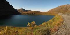
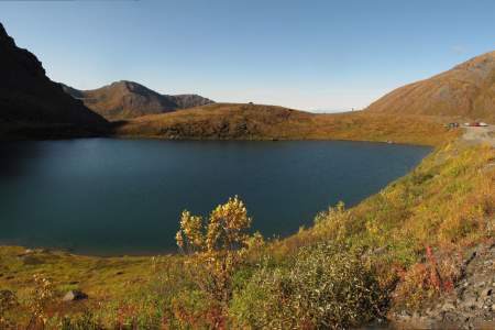
Summit Lake, located some 60 miles north of Anchorage at the crest of Hatcher Pass, offers a short, memorable lakeside ramble. Here you can explore the surrounding gullies and slopes or just sit and watch hang gliders drift out over the long Willow Creek Valley, which extends for miles from the west side of the pass.
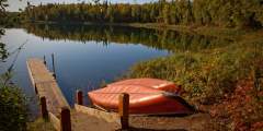
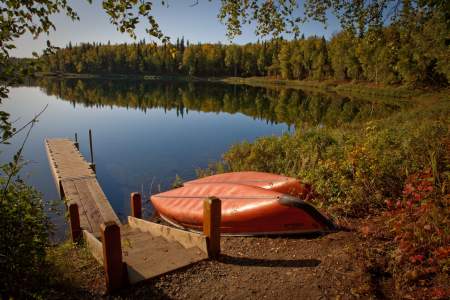
This recreation area is just a mile and a half from town, but it feels like wilderness — with deep woods and several lakes, it’s a great place to hike, run, canoe, fish, or look for wildlife. In winter, cross-country ski, walk, or fat bike on the multi-use trails.
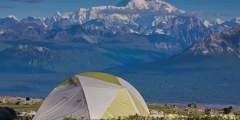
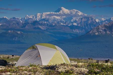
During periods of clear weather, this route through Denali State Park offers similar terrain and scenery to Denali National Park — including unparalleled views of Denali — without the cumbersome permitting process. This trail system offers many options for starting and ending points, as there are four trailheads along its length.
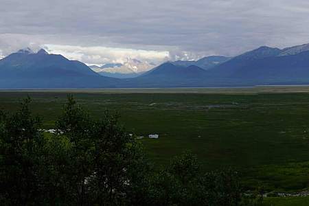
This short, paved trail is an hour’s drive north of Anchorage in southern Wasilla. It leads out to a bluff on Palmer Hay Flats — a large stretch of wetlands with all kinds of wildlife. There, a viewing platform overlooks the flats and the Chugach Mountains beyond.
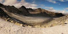
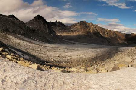
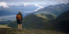
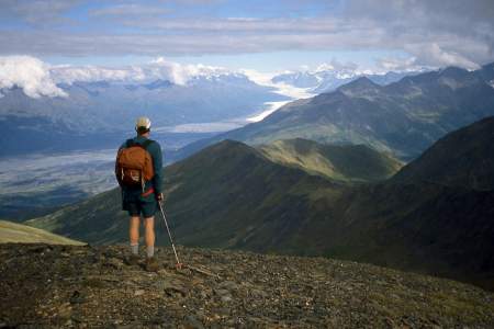
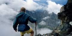
It’s not very often that people can see a glacier in an untamed and remote location, far from any road or cruise-ship route. But if you feel capable and confident enough to climb a very rough trail up many vertical feet of rocky terrain, then you might consider undertaking the hike to Snowbird Pass, located high in the Talkeetna Mountains just north of Hatcher Pass. From this vantage point you can look down the entire length of Snowbird Glacier. ...more
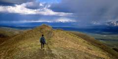
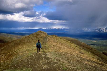
Syncline Mountain features two summits— whichever you choose, you’ll hike beneath a whole lot of sky and look out on a whole lot of country.
Some 50 miles north of Anchorage, this 1.5‑mile trail makes for a fine family outing. From the picnic table at the uppermost end of the trail, you’ll find a satisfying panoramic view of the Matanuska River and Knik River valleys. It’s a view as good, or better, than that from many summits.
No official trail in Southcentral Alaska climbs as high as Matanuska Peak Trail. Beginning in a subdivision across the Matanuska River from Palmer, this nearly 6‑mile-long trail runs up some 5,700 vertical feet. Your destination is the 6,119-foot summit of Matanuska Peak, the very prominent rock spire that fills the sky just east of Palmer. But despite the imposing appearance of this mountain, the trail to its summit requires no extensive ...more
Beginning almost 120 miles northeast of Anchorage on the Glenn Highway, the trail to the summit of Gunsight Mountain takes a while to reach. After all, it involves a 3.5‑mile, 3,300-foot climb through some very big country. But the view from the top makes for an all-day excursion that you won’t easily forget.
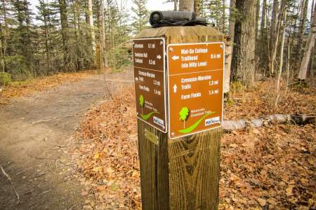
Two trails travel over the Mat-Su College lands; one from the college and one from Snodgrass Hall. The Mat-Su College trailhead leads to a hilly loop and opens to beautiful views of Lazy Mountain, Twin Peaks, Bodenburge Butte, and Knik Glacier — the best mountain views in the entire greenbelt system.
With a length of just 1.5 miles and a summit reaching only 874 feet, West Butte Trail on Bodenburg Butte — a 45-minute drive north of Anchorage — makes for a fine family outing. But even if you’re a more experienced hiker, don’t let the butte’s dwarf-like height dissuade you. This small bump in the center of a grand alluvial plain offers far-reaching views from its summit; plus, the climb includes a pulse-quickening 0.25 miles of stairs up the steep ...more
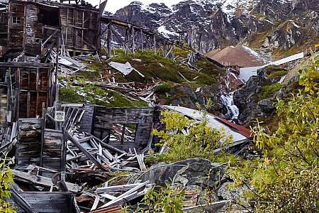
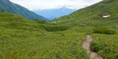
This 4.5‑mile trail, some 2 hours north of Anchorage on the west side of Hatcher Pass, climbs 1,000 feet up a very typical Talkeetna valley — long, broad, and lined with towering peaks on both sides. It also passes by relics and ruins of old mining days, when these valleys echoed with the sounds of picks and drills.
In the Talkeetna Mountains between the towns of Willow and Palmer, Hatcher Pass is a local favorite for recreation or a scenic drive. Hike in alpine tundra dotted with wildflowers and ptarmigan, ski fresh, deep powder, or visit Independence Mine Historical State Park.
There are some nice long downhills with banked turns, a few shallow creek crossings, and some chunk sections. Most of this trail lies on south-facing hillsides, with views of the Knik River Valley and Pioneer Peak.
As you approach the Independence Mine Parking Lot, the trail can be seen to the far right end. It crosses over a small bridge, and winds up past an old abandoned mining cabin, and then up a debris field and finally to the lake. Round trip, the hike is almost 2 miles, and the elevation gain is approximately 600 feet. The trail can be muddy and wet for the first .25 miles, but it’s worth the hike to see Gold Cord Lake, and a great view of the Mine ...more
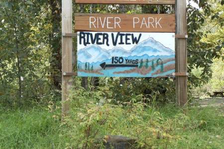
Where else can you walk to the end of Main Street and find yourself at the confluence of three wild rivers, overlooking a 20,000-foot peak? Close to downtown, this large, river-centered park offers wide open, untouched spaces, along with great panoramic view of the Alaska Range.