Alaska's Best Roadside Glaciers
Some of the most impressive glaciers in Alaska are surprisingly accessible. You don't need a helicopter tour or day cruise to reach them—just a car, perhaps, and some good walking shoes. Here are Alaska's seven best roadside glaciers:
Note: Stepping out of your car to scratch the face of a blue ice glacier is awe-inspiring. But even on warm, sunny days, it's like standing in front of an open refrigerator. Bring a light jacket, and as always, dress in layers. Winds pick up near glaciers as well.
Show Map
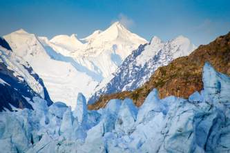
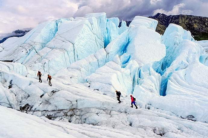
Exit Glacier (near Seward)
You can hike right up to Seward's Exit Glacier and feel the dense blue ice while listening to it crackle. Walk the lower trail to get a good photo in front of the glacier face. There is a short ranger-led walk daily at 11am and 3pm, from Memorial Day through Labor Day. Also, a longer hike to the Harding Ice Field (a trailside walk to a 3,500-foot summit) takes place at 9 a.m. on Saturdays in July and August. There are lots of other places to explore and camp for the avid backpacker.
Directions: Head south from Anchorage on the Seward Highway-or north from Seward-the turnoff is clearly marked at Seward Highway mile 3.7 and is nine miles long (half of it's gravel).
Distance: 125 miles south of Anchorage.
Drive Time: 3 hours.
Explore Time: 1 - 5 hours.
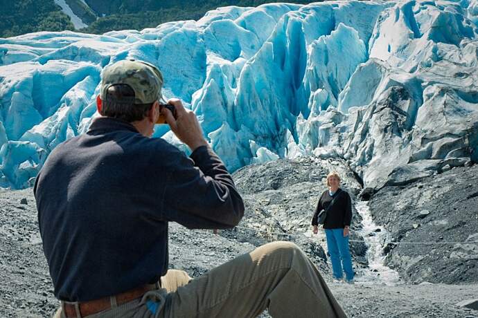
Matanuska Glacier (near Anchorage)
Some 15,000 years ago, this glacier reached another 50 miles west to the Palmer area. It now has a four-mile wide towering face that you can walk right up to and touch. Keep an eye out for summertime ice-climbers at this most impressive roadside glacier.
Directions: Head north from Anchorage on the Glenn Highway. At mile 102, you can drive down to Glacier Park and pay a day fee (888-253-4480), then hike 15-20 minutes to the face of glacier. (Update 2021 - Only tours are offered on the glacier summer of 2021).
Distance: 102 miles north of Anchorage.
Drive Time: 3 hours.
Explore Time: 1 - 2 hours.
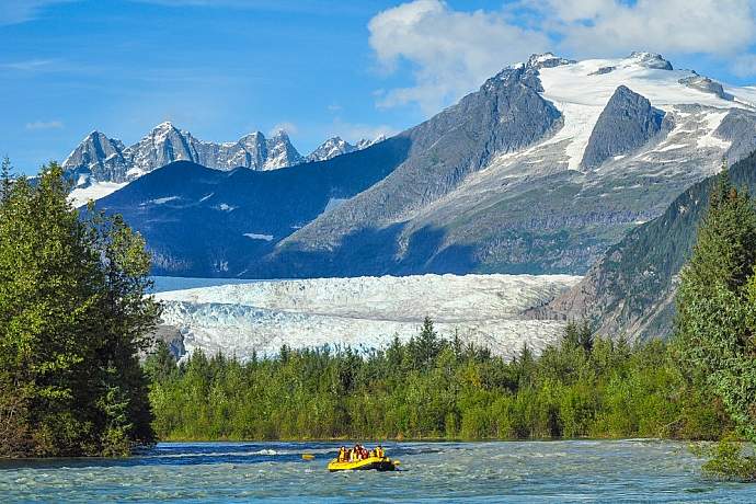
Mendenhall Glacier (near Juneau)
This 12-mile glacier is part of Tongass National Forest and its visitors’ center is just a half mile from the glacier’s face. Once dubbed the Auk Glacier by John Muir (after a member of the Tlingit tribe), the Mendenhall offers six trails for getting really close: The almost-7-mile West Glacier Trail will take you right to the glacier’s face, while you can also hike to a good viewing platform a quarter mile away. Or, take the more challenging Nugget Falls trail that ends at a five-story-high waterfall neighboring the glacier.
Directions: From downtown Juneau, take Egan Drive and turn right at Mendenhall Loop Road. Mendenhall Loop Road turns into Glacier Spur Road and ends at the visitor center.
Distance: 12 miles from Juneau.
Drive Time: Less than half an hour.
Explore Time: 1-6 hours.
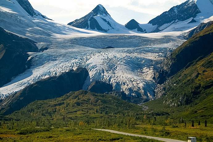
Worthington Glacier (near Valdez)
Worthington Glacier is found along Thompson Pass, 28 miles northeast of Valdez. Thompson Pass holds the honor of being the snowiest place in the state: During the peak winter of 1951-52, it got more than 80 feet of snow. It still gets plenty today, which keeps this 4-mile glacier from retreating as much as others. You can do a two-mile hike here along a sometimes treacherously narrow ridge, or you can also just do a short, paved hike to a viewing platform.
Directions: Take the Glenn Hwy to the Richardson Hwy. Worthington Glacier State Recreation Site is located at milepost 28.7 of the Richardson Hwy.
Distance: 28 miles from Valdez, 328 miles from Anchorage.
Drive Time: 45 minutes from Valdez, 5 hrs from Anchorage.
Explore Time: 1-4 hours.
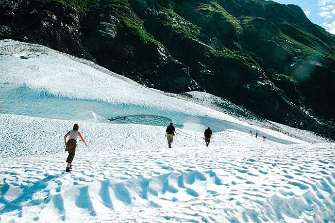
Portage and Byron Glaciers (near Anchorage)
Technically, Portage is no longer a roadside glacier, as it recedes an average of one foot a day and is now no longer visible from the road, but its big blue icebergs are often found along the shore of the lake, right in front of the parking area. On Byron, ice worms are common, if you get down and look. There are also beautiful ice caves and rivulets to see, but be careful not to walk too far onto the ice of this tempting glacier. You can see the lake in a half hour, but may want to spend time at the Begich Boggs Visitor Center (½-1 hour), hike to Byron Glacier (1 hour), take the boat cruise (1 hour), or have lunch at the local cafeteria.
Directions: Head south from Anchorage on the Seward Highway, to the end of the 5-mile Portage Spur Road. You can visit the face of Portage by tour boat from the dock at the lake. Byron Glacier trailhead is near Portage Lake. It's a one-mile scenic walk to the glacier face along Byron Creek. Bring a light jacket, as winds tend to pick up around the face of the glacier itself.
Distance: 48 miles south of Anchorage.
Drive Time: 1 hour.
Explore Time: 1-4 hours.

Middle and Explorer Glaciers (near Anchorage)
Not too spectacular in size, these hanging glaciers dangle from mountains in the Chugach National Forest. Several pullouts allow for viewing. They feed the nearby stream systems that harbor many species of salmon and trout. Tangle Pond and Tangle Creek are favorite fishing spots for locals, and there are lots of places to camp in Portage Valley itself.
Directions: Head south from Anchorage on the Seward Highway, along the 5-mile Portage Spur Road. You'll spot these glaciers on the south side of the road, halfway from the Seward Highway to Portage Lake (thus the name Middle Glacier). Check them out on your way to Portage and Byron.
Distance: 48 miles south of Anchorage.
Drive Time: 1 hour.
Explore Time: 1/2 – 2 hours.