Denali Park Road (McKinley Park to Kantishna)
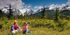
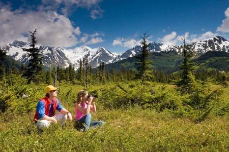
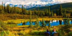
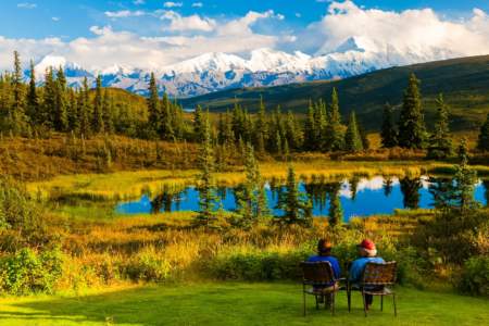
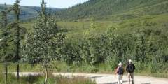
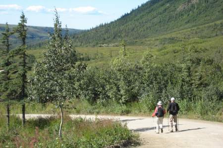
You’re sitting on the bus, binoculars in hand, heading into the heart of Denali National Park. You’re about to see a place where life continues as it has for thousands of years, without interference by man. It is not a zoo, and wild animals who live here set their own schedule. But if everyone on the bus keeps their eyes peeled, chances are excellent that it will pay off with wildlife sightings. Remember, there is no guarantee. But even if the only wildlife you see is a ground squirrel, the scenery alone is worth the trip.
2025 - 2026 Update: Construction will continue on a bridge to bypass a landslide at MP 45.4 of the Denali Park Road. Tour buses and transit buses will travel as far as MP 43. Construction is expected to take another year. Click here for available bus tours, hiking, and biking on the Denali Park Road.
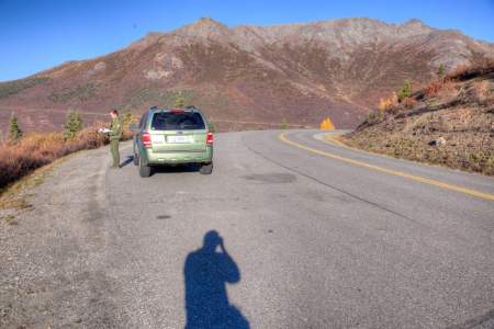
It’s 92 miles and about 5 hours from the park entrance to Kantishna, the end of the Park Road. Private vehicles aren’t permitted after Mile 15, so you’ll need to take either the hop-on, hop-off park shuttle bus or one of the tour buses. The summer bus tours begin as early as May 20th, and a 7-hour half-day tour will take you for the first 53 miles of the road. Full-day 13-hour bus tours covering the entire 92 miles of Denali Park Road begin June 8th.
Bus trips into the park generally start at the Denali Bus Depot. Once you leave the bulk of development behind – the Alaska Railroad Depot, the new Murie Science and Learning Center – you’ll climb Government Hill. Look off to your left and you’ll see an expansive view that includes part of the Yanert Valley, which stretches through the Alaska Range. A tall railroad bridge spans Riley Creek. This is an often-photographed scene in August and September, when bright yellow and blue Alaska Railroad engines pull a line of railroad cars across that bridge, surrounded by gold foliage of Fall.
At 6 million acres, Denali National Park is the third largest park in the United States. Alaska’s Gates of the Arctic National Park is a tad bigger and Wrangell St. Elias National Park and Preserve is the largest.
Denali National Park can be divided into three sections:
- One third of the park is comprised of rock and ice, in high elevations, mainly to the south of the park road. There are few animals in that area.
- The second third of the park is boggy in low elevations, more to the north and west. There are a few species who make that area their home.
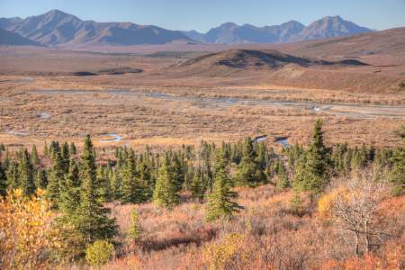
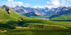
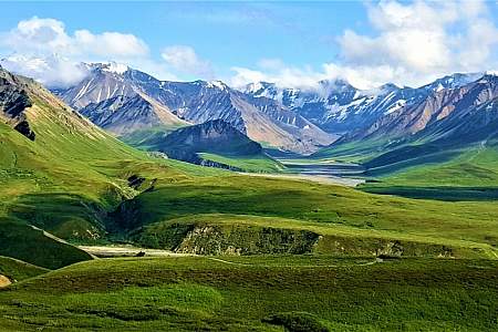
- The final third is high mountain passes and broad river valleys. This is where you are most likely to see wild animals. The park road goes right through this area.
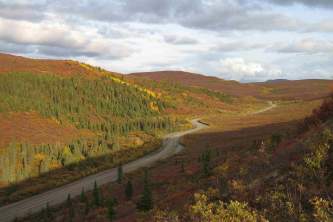
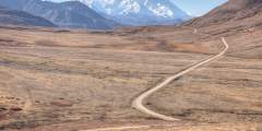
The park road runs generally east and west, over four high mountain passes, all just under 4000 feet elevation, between Igloo at Mile 33 and Eielson at Mile 66. That might not seem very high, but at Denali treeline is at about 3000 feet. (In Colorado, dry tundra and alpine plants and animals begin at about 14,000 feet).
The road also takes you through the major vegetation zones of the park – taiga, moist tundra and dry tundra. Enjoy the trip!
Human Powered Adventure
In addition to exploring the park road on a bus, you can opt to rent a bike or go for a hike! Bike Denali rents bikes and gear for day trips on the park road, or multi-day bike-packing trips if you'd like to stay overnight in a campground. Traverse Alaska offers guided hiking trips in Denali's backcountry.
Show Map
Driving Guide Points

Riley Creek Campground, located just inside Denali National Park at Mile 0.45 of Denali Park Road, offers 142 wooded sites near Riley Creek. Managed by the National Park Service, it features showers, laundry, and Wi-Fi for a comfortable stay. Surrounded by spruce, it provides easy access to park amenities, trails, bus tours, the visitor center, and nearby Healy services.
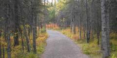
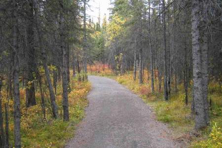
If you’re headed to the dog demonstration at the kennels, or if you just want to stretch your legs, try walking this wide, comfortable trail through the forest, up to headquarters from the Visitor Access Center. It basically follows the road, occasionally wandering out of sight of the traffic. Length: 1.8 miles Elevation: 300 ft. Time: 45 – 1 hr. one way
The first mile of this trail, which begins near the new Murie Science and Learning Center, is moderately steep, hiking through the forest. The forest eventually gives way to tundra. Trees turn to shrubs, and the landscape opens wide. The last 1.5 miles are even steeper. Your reward, however, is sweeping views of the Denali National Park entrance area, the Nenana River Valley, Healy Ridge, and nearby alpine ridges. Those who want to climb to the ...more

This popular trail attracts lots of folks, so don’t expect to be the only hiker. It’s still worth the trip. The trail begins at Mile 0.9 on the park road near the railroad tracks. You’ll walk on a developed trail down to the lake. After you reach the Overlook, the trail drops steeply. Along the way, especially at the overlook bench, you’ll have a panoramic view of the Nenana River, the development called “Glitter Gulch” right outside the park, ...more
In Summer (mid-May to mid-September), The Denali Star Train services Anchorage, Wasilla, Talkeetna, Denali and Fairbanks. Depot closed in winter.
The Alaska Railroad was responsible for opening this national park to the public since it provided the only access to the park for many years. The Railroad owned and operated the McKinley Park Hotel from its early beginnings and eventually turned over to the National Park Service for operations. After a fire destroyed the hotel, rail sleeper cars provided a novel lodging opportunity for visitors.
The Denali National Park Visitors Center is actually more of a campus. The center itself is the main National Park Service welcome and information center and it is surrounded by other facilities that include a restaurant, bookstore/giftshop, bag check, bus stop and the Alaska Railroad depot.
It isn’t until you actually drive past the headquarters area that you will begin to enter the wilderness for which you have really come. During the winter months, the road is closed at this point. Only non-motorized travelers, such as mushers and skiers can go further. This is taiga forest, filled with white spruce and black spruce, interspersed here and there with quaking aspen, paper birch, balsam poplar and tamarack. This is moose habitat… ...more
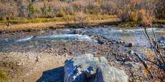
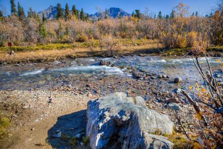
Rock Creek is the first of many waterways that the Denali Park Road crosses. In constrast to many glacial fed rivers, Rock Creek is contained in a defined channel at this point. Just upstream of the bridge is C Camp, a maintenance site for the area that has had ongoing clean-up efforts to contain and dispose of contaminated soil.
Although most viewpoints along the Park Road can only be accessed by private tour buses or park shuttle buses, you can drive to this viewpoint (the first 15 miles are open to private vehicles). The dense spruce forest opens up here, giving you the first view of Denali, as it is called in the native Athabaskan language (formerly Mt. McKinley). The mountain is roughly 72 miles away and you’re only seeing the top 8,000 feet or so. Still, it’s a ...more
Both peaks of Denali (Mt. McKinley) are visible to southwest, framed by Double Mountain and Sable Mountain. At this point on the drive, taiga disappears into tundra and waist-high thickets of willow and birch. That in turn stretches into alpine tundra that includes lichens and mosses.
Originally constructed by the Alaska Road Commission in 1924 – 1925, the Savage cabin and interpretive trails are now used as part of living history presentations in the summer months. During the winter the cabin become strictly utilitarian by providing shelter for patrols.

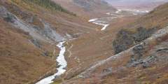
The Savage River was carved out by glaciers, and as a consequence it is a perfect example of a braided river. The flat gravel bars of the river offer a great opportunity for an easy hike, and minimize the chance of surprising a bear or other wildlife.
Savage River Campground, at Mile 13 of Denali Park Road, offers 32 wooded sites near the Savage River with possible Denali views on clear days. Managed by the National Park Service, it features vault toilets, fire rings, and bear-proof food lockers. Surrounded by spruce just below the treeline, it’s ideal for hiking the Savage River Loop, wildlife spotting, and enjoying Denali’s vast wilderness.
Either drive your own car or take the free shuttle 15 miles out the park road to the Savage River check station. This is a popular hiking trail, and you won’t be alone, but at least you’re away from the entrance area and entering the true wilderness of Denali National Park. This is a tundra walk on a developed trail that follows the river. Good hike for kids, with possibility of seeing Dall sheep, marmots, and caribou. You can do a loop walk, ...more
This informal hiking area begins at the Primrose rest area and heads up a gentle ridge until you reach the bench, which provides panoramic views of the park. Wildflowers are abundant in this area and usually peak between July 20 and August 10.
Sanctuary River Campground, at Mile 23 of Denali Park Road, offers 7 tent-only sites in a remote, wooded area near the Sanctuary River. Managed by the National Park Service, it’s surrounded by spruce forest just below the treeline, with no formal amenities beyond hiking access. Accessible only by park shuttle, it’s ideal for campers seeking solitude, backcountry hiking, and wildlife viewing.
Spindly spruce trees lean this way and that, looking as if they’re drunk. The actual cause of this odd alignment has to do with their shallow root systems, which get readjusted by the nearly continuous expansion and contraction of permafrost under the tundra surface. Permafrost is a layer of frozen ground, sometimes more than 6 feet thick, that never thaws. Without it, much of the tundra would be completely impassable.
Teklanika (aka “Tek”) River Campground is can be found at mile 29 on the Denali Park Road. It is the second largest campground in the park, offering 53 sites for RVs and tents.
Head either direction on the Teklanika Riverbed. The river bar is really wide in this area so the going is generally easy, even though you’re still below tree-line. Choose to go as far afield as you like. There are numerous route options.
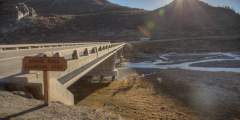
This sectioned bridge sits at an elevation of 2,655 feet. Park at the rest stop a few hundred meters before the east edge of the bridge for great views of the structure and the surrounding area.
Igloo Creek is one of three tent-only campgrounds in the park. Situated right next to the creek, it is a great place to relax and enjoy the wilderness and the area around the campground offers great hiking opportunities.
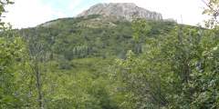
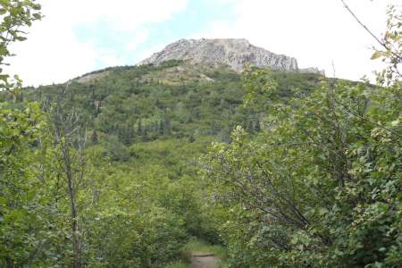
A great place to catch a glimpse of Dall Sheep, Igloo Mountain is also where the first dinosaur tracks in the park were discovered. You can see them yourself, if you go on one of the many easy day hikes that start here.

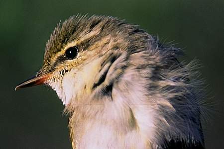
Tattler Creek is named for the Wandering Tattler, a large shorebird that you may be lucky enough to spot. The first Wandering Tattler nest known to science was found at Denali National Park. The first nests of the Arctic Warbler and Surfbird were also found here.
Pick up the trail right after you cross over Tatter Creek. Follow Tattler Creek upstream for 1⁄4 mile to a steep ravine that comes in from the left. Follow this ravine up until you reach a ridge that overlooks the Sable Pass restricted area. If you only plan to spend time on the ridge without going farther afield you may want to stock up on water in the ravine because there are no sources on the ridgeline. From the ridge you can choose to… ...more
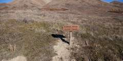
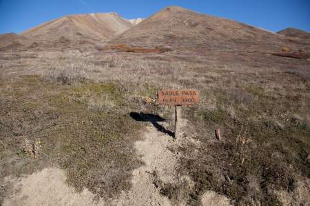
Sable Pass on the Denali Park Road is a wildlife hotspot. The area is designated as critical grizzly bear country in Denali National Park, so it is permanently closed in order to protect wildlife.
Mile 43 Denali Park Rd, small cabin is visible down the embankment on the south side of the road
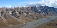
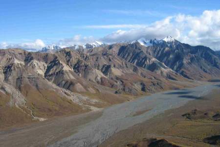
Polychrome Pass gets it’s name from the colorful volcanic rocks that you can see from the overlook, but the name could also be applied to the colorful vegetation, streams, mountains and glaciers that make this spot unique. This high overlook is a great spot to watch bears, moose and caribou from far enough away that you won’t risk disturbing them.
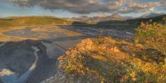
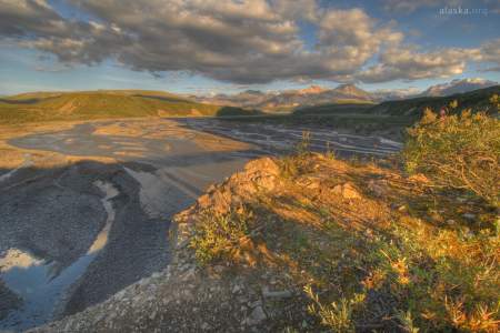
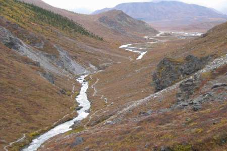
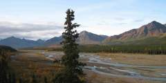
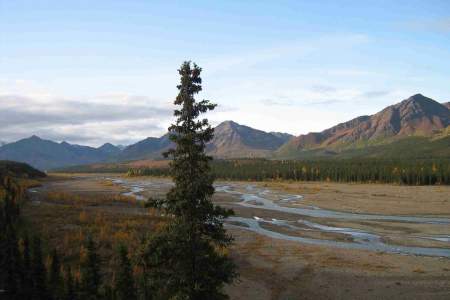
Denali National Park is full of rivers, with many of them originating from glaciers. What makes these rivers special? Why are they braided and what keeps them from just straightening out?
This hike does not require crossing any glaciers or dangerous streams, which makes for a good overnight hike for those who carry an overnight camping permit.
Vegetation cover in Denali is always changing. Find out why the forests around the Toklat River are changing, and how the Park Service uses historic photos to document these changes. Audio tour by Camp Denali Wilderness Lodge.
Not far from the Toklat River Bridge you’ll find yourself at the top of Highway Pass, the highest point on the park road at 3,980 feet. The vistas are expansive and wildlife viewing can be great.
Caribou trails weave back and forth across the alpine slopes above Stony Hill. These trails are evidence of the seasonal migration patterns of Denali’s caribou. Find out why caribou undertake this migration, and where you can expect to find them depending on the season. Audio tour by Camp Denali Wilderness Lodge.
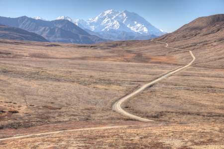
This is the most photographed view of Denali (Mt. McKinley) from the road. You’re up high, at the edge of a mountain pass, and there’s alpine tundra all around, with the road snaking towards the mountain in the foreground. And this is the first spot where you can see the whole mountain from base to summit. On clear days, Tundra Wilderness Tours will extend their trip several miles just to reach this spot. Stony Hill is also a great place to… ...more
The grizzly bears of Denali can be found feeding in almost every corner of Denali National Park. Early to mid summer, these bears can be often observed from Thorofare Pass. What draws these adaptable and persistent omnivores to this high alpine environment? Audio tour by Camp Denali Wilderness Lodge.
Only 33 miles from the summit of Denali, and at an elevation of 3300’, Eielson offers some of the most spectacular views of Denali (formerly Mt McKinley). There are many activities you can do here, including ranger-guided hikes up to nearby Thorofare Pass and self-guided expiration of the high-alpine tundra environment.
The fall moose rut is an unforgettable part of the interior Alaska fall. In Denali, the Eielson visitor center gives visitors a year round window into this dramatic event through the display of two sets of interlocked moose antlers. How did these antlers become locked, and what likely happened to the two unlucky bull moose? Audio tour by Camp Denali Wilderness Lodge. ...more
On a clear day, this stretch of the park road offers unparalleled views of Denali and the other high granitic peaks of the central Alaska Range. What role do glaciers play in carving out the ever growing shape of this mountain range? Audio tour by Camp Denali Wilderness Lodge.
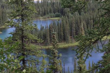
The 20 miles before Kantishna offers views of hundreds of small kettle lakes. These lakes provide critical habitat for moose, birds, and beavers. What are these animals after and how do the lakes provide? Audio tour by Camp Denali Wilderness Lodge.
Only a few miles from the end of the Denali Park Road (85 miles in, about 5 hours by bus), this is the classic Denali view from the north side, made famous by Ansel Adams’ photographs. 25 sites.
Wonder Lake is a somewhat unlikely lake. Learn how the lake was formed, and what makes it so unique.
An iron bridge crosses Moose Creek here. If you take a moment to observe the creek you’ll notice that the rushing waters are clear and full of grayling, quite the opposite of glacial fed waterways that appear milky due to the high sediment content.
At Camp Denali, you’ll immerse yourself in a remote backcountry, but with a cozy bed to settle into each night. Take in the quiet of the surrounding wilderness and enjoy the simple, sustainable amenities for around 38 guests. Here, the balance of “light touch on the land” and providing a comfortable stay is perfected. Refined rustic guest cabins, each of which claims a unique view of Denali, sleep from two to six people.
The Kantishna Roadhouse is an Indigenous owned and operated, all-inclusive backcountry lodge in the heart of Denali National Park. Accessible only by air, experience the wilds of Kantishna with just a handful of other guests and experienced staff. They limit the number of guests on property in order to provide you with a unique, intimate experience.
If you’ve ventured this far into the park, why stop here? In this area of the park you are encouraged to use old mining roads and established trails to get around. Skyline Drive takes you up into the Kantishna Hills, providing access to Quigley Ridge and the Wickersham Dome. You will be passing through chunks of private property that were grandfathered into the park so it is best if you don’t leave the road until you are on the ridge. Once you… ...more
There is gold in the hills above the historic settlement of Kantishna. A comparatively small gold rush in this part of Alaska indirectly foretells the establishment of the original Mt. McKinley National Park. How did mining activity nearly push wildlife populations to the brink? Audio tour by Camp Denali Wilderness Lodge.
Expert Advice