Alaska Volcanoes Directory
Best Places To View Volcanoes
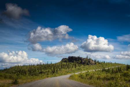
Some of Alaska’s most spectacular volcanoes are a snap to view from the highway system near Anchorage, the Kenai Peninsula and the Copper River Basin. Most of Alaska’s other 130 volcanoes (at least 50 active in recent centuries) are in more remote areas, but can be seen during airplane flights or ocean trips.
JUMP TO: MAP | Spurr | Redoubt | Iliamna | Augustine | Sanford | Drum | Wrangell | Edgecumbe | Novarupta | Makushin | Tours | View All
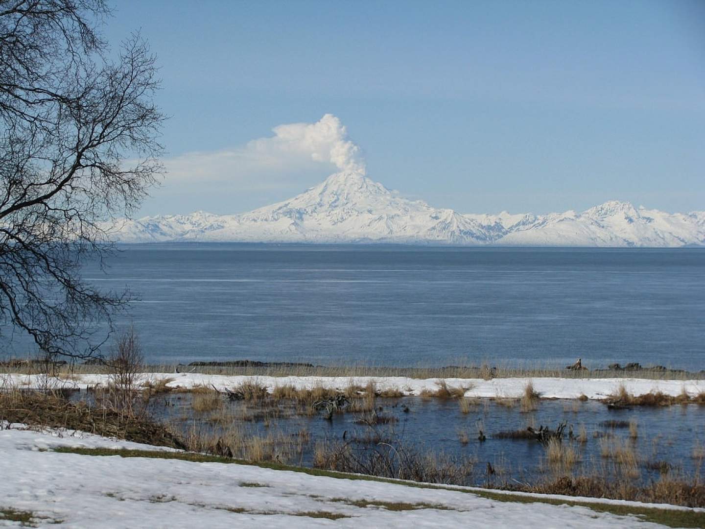
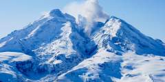
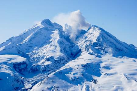
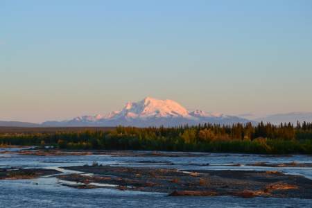
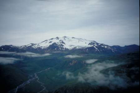
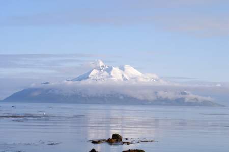
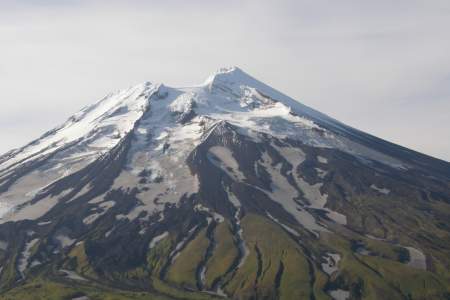
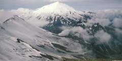
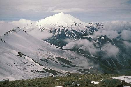
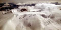
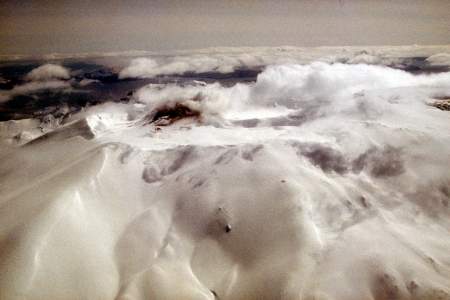
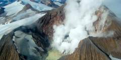
An active Redoubt Volcano visible from Kenai
The Easiest Volcanoes To See
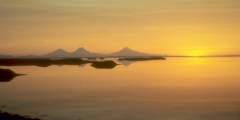
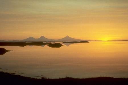
Cook Inlet
Vistas of the Cook Inlet volcanoes can be as scenic as it gets, with their immense, white cones looming above the ocean against a vast, blue sky. Best chances for these crystalline panoramas occur on clear weather days during spring and early summer, and during cold snaps in winter. Some are visible from Anchorage, but best views are found at beach parks or coastal recreation areas along the Sterling Highway between Kenai and Homer.
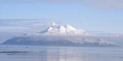
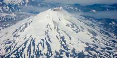
Mount Spurr
Visible from downtown Anchorage
For starters, try for a glimpse of this 11,070-foot white massif about 80 miles due west of Anchorage. And it’s not just a pretty postcard shot. A 1992 eruption blasted ash more than 10 miles into the sky and coated Alaska’s largest city with an eighth-inch of accumulation.
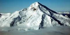
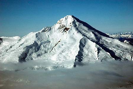
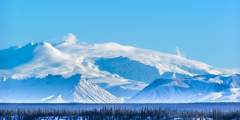
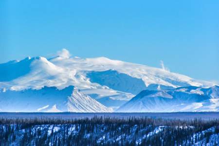
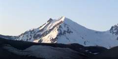
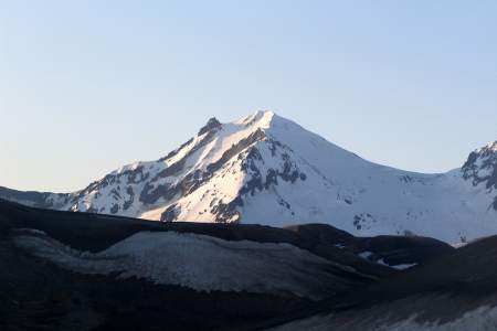
Redoubt Volcano
Visible from the mouth of the Kenai River
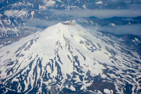
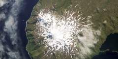
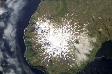
The 10,197-foot Redoubt Volcano dominates the horizon about 50 miles west of the Kenai River mouth and Clam Gulch, forming a craggy and conical mountain that regular emits steam above its summit. Its 1989-90 eruption caused millions in damages around the region.
Illiamna Volcano
Visible from Deep Creek and Anchor Point
Iliamna Volcano rises 10,016 feet about 50 miles directly across from Anchor Point and Deep Creek. It’s the most mysterious cone in Cook Inlet—it rumbles a lot and produces steam clouds. But scientists aren’t completely sure when it last blew its top.
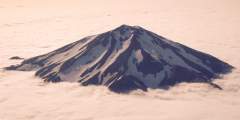
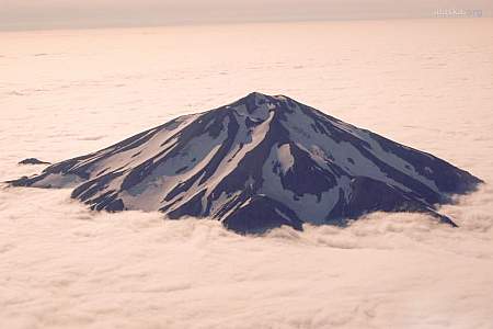
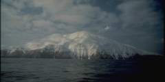
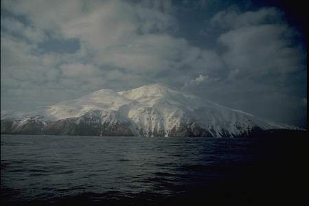
Augustine Volcano
Dominates lower Cook Inlet outside of Kachemak Bay
Augustine Volcano forms its own island about 70 miles southwest of Homer, rising from the sea a storybook cone that can appear almost other-worldly. Given clear weather, Augustine is easily visible during marine tours and fishing charters out of Homer.
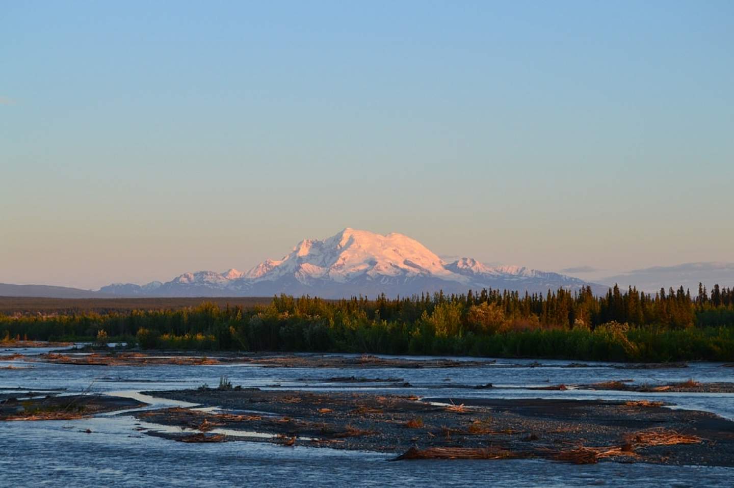
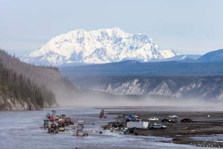
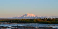
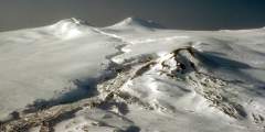
Mount Drum painted pink with alpenglow light
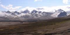
The Copper Basin Volcanoes
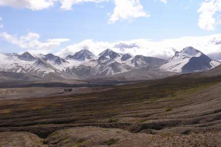
On a clear day, the final 10-mile drive east toward Glennallen on the Glenn Highway, about 180 miles east of Anchorage, presents one of the most extraordinary views in the state. Three large volcanoes loom from inside Wrangell-St. Elias National Park. Taken as a whole, they dominate the horizon with such immensity that the vista might seem unreal.
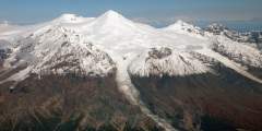
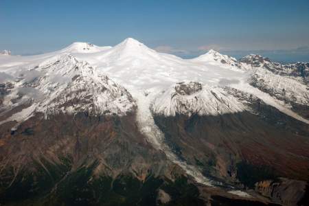
Mount Sanford
Visible from Glenn, Richardson and Tok Cutoff highways
The 16,237-foot Mount Sanford rises to the north, bookended by a long ridge and an immense cliff. Alaska’s sixth highest peak, Sanford has not erupted in at least 10,000 years.
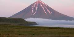
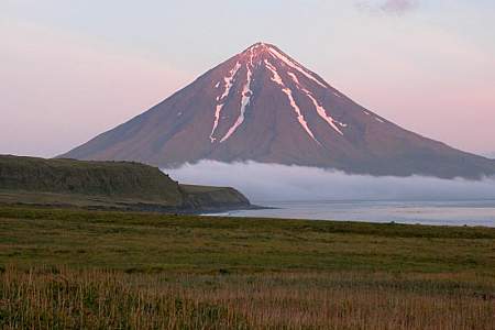
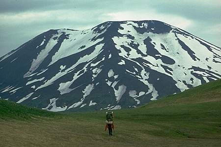
Mount Drum
Visible from Glenn and Richardson highways
Mount Drum, a 12,011-foot storybook cone, rises in the middle. Like Sanford, Drum has been snoozing for at least 10,000 years.
Mount Wrangell
Visible from Glenn and Richardson highways
The colossal 14,163-foot Mount Wrangell sprawls to the south, more like a mountain range all its own than a solitary peak. It last erupted in 1930, based on local reports, but observers frequently report steaming from the summit.
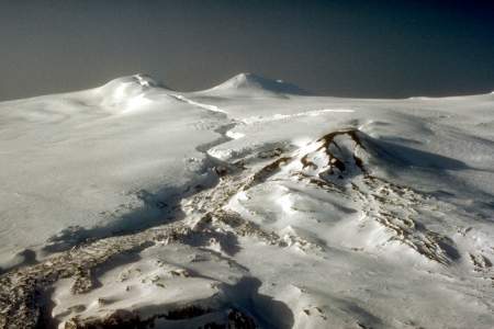
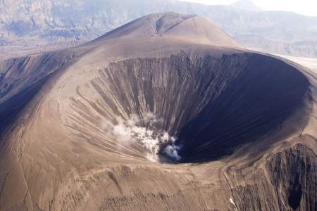
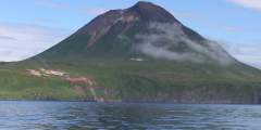
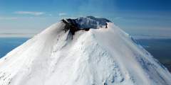
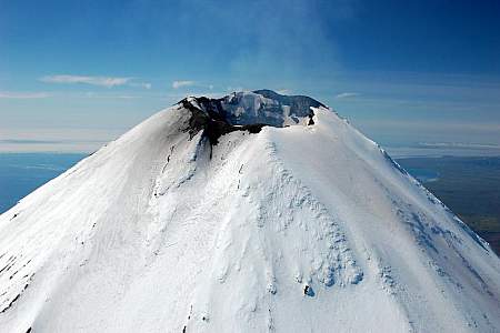
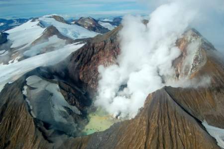
Makushin Volcano near Unalaska releases steam
Three More Easy Views
Mount Edgecumbe
On an island visible from Sitka
This dormant volcano dominates the horizon about 15 miles west of Sitka on the southern lobe of Kruzof Island, and is one of Southeast Alaska’s most interesting and beloved landmarks.
Novarupta (Valley of Ten Thousand Smokes)
Inside Katmai National Park & Preserve
Located about 290 miles southwest of Anchorage on the Alaska Peninsula across Shelikof Strait from Kodiak Island, Novarupta obliterated itself in 1912 during the most powerful volcanic eruption of the 20th Century. It left behind a moonscape valley that’s one of the Katmai’s most intriguing destinations.
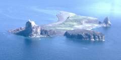
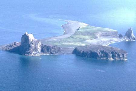
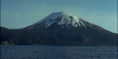
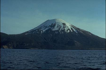
Makushin
About 800 miles southwest of Anchorage in the Aleutian Chain
Rising 5,906 feet from the western lobe of Unalaska Island only 16 miles from the village and the port of Dutch Harbor, Makushin Volcano is one of Alaska’s most restless, with 10 rumblings or events recorded since the early 1980s.
Are There Volcano Tours?
Visiting an Alaskan volcano in person usually requires hiring an air or marine charter, or committing to an overland expedition. Check out the Alaska Ultimate Safari and our list of backcountry guides. There are many potential trips into the Tordrillo Mountains near Mount Spurr, only 80 miles west of Anchorage, as well as other Cook Inlet and Alaska Peninsula volcanoes. Backcountry expeditions into Wrangell St. Elias National Park frequently climb or approach Wrangell, Drum or Sanford volcanoes. Katmai National Park visitors who can handle a day hike or a backpacking trip can make it into the vicinity of Novarupta and several other volcanoes, and flights to the park will almost certainly deliver great views of its active cones.
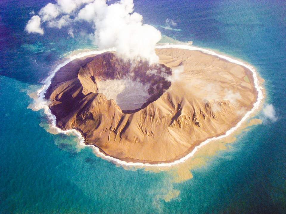
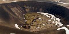
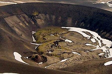
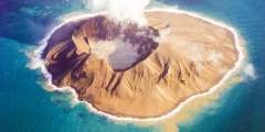
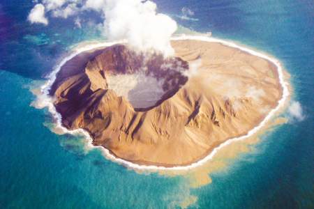
Kasatochi Volcano
OK, These Guys Can Explode! Should I Be Worried?
Not really. Most Alaska volcanoes probably won’t erupt again in any of our lifetimes. The 50 or so volcanoes known to be active since the 1700s typically go decades (or much longer) between blasts and give plenty of warning. Cook Inlet volcanoes—closest to Alaska’s population center—have consistently followed this pattern since monitoring ramped up during recent decades.
The very active volcanoes—most located on the Alaska Peninsula or islands of the Aleutian Chain —are generally far from towns and present little or no danger to regular travelers or residents. Still, drifting ash clouds from any eruption might pose serious hazards to airliners and other aircraft while in flight.
As a result, the Alaska Volcano Observatory monitors the region’s most restless volcanoes in real time. AVO scientists track ash clouds by satellite and issue alerts when necessary. They work closely with their Russian counterparts monitoring volcanoes in the Russian Far East, too.
Other Viewing Tips
- Many Aleutian and Alaska Peninsula volcanoes can be seen from the decks of the Alaska Marine Highway System ferry during one of the summer trips, or on certain cruises. In clear weather, the regular airline service to Unalaska-Dutch Harbor can offer great window views of many extremely remote and practically inaccessible volcanoes.
- Because Alaska’s volcanoes rumble far from roads or on islands, most people will observe them as part of a spectacular-but-distant vista during clear weather. The experience will be enhanced by good glass, so consider carrying a spotting scope or binoculars.
- Explore online! For a vast trove of information about Alaska volcanoes, check out the Alaska Volcano Observatory. This easy-to-navigate website has current status of erupting volcanoes plus an atlas with maps, photographs, webcams, eruption history, scientific research and more. It’s a great introduction to any volcano along your itinerary, especially if you’re traveling to the Alaska Peninsula or the Aleutian Chain.
- Alaska contains most of the active volcanoes in the United States. At least 90 have been come alive within the past 10,000 years, and more than 50 have rumbled or erupted since the 1760s.
Show Map
Volcanoes
This 10,197-foot massif about 110 miles southwest of Anchorage and 50 miles west of Kenai is one of the most active volcanoes in Alaska. A 1989 – 90 series of eruptions caused more than $160 million in damages and lost revenue, the second most costly eruption in U.S. history.
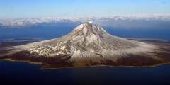
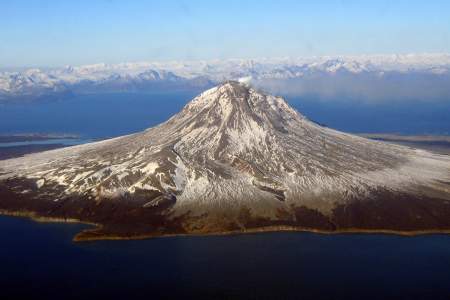
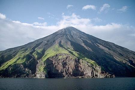
One of the most restless volcanoes in the region, this stunning 4,134-foot cone forms its own five-mile-diameter island in Cook Inlet about 70 miles west of Homer and 170 miles southwest of Anchorage
Iliamna rises less than 50 miles across the water from two state recreation beaches on the southwest corner of the Kenai Peninsula. Try Deep Creek State Recreation Area at Mile 137, where camping on the beach may be available. (Breakfast with a volcano!) Anchor River State Recreation Area at Mile 157 offers more fabulous viewing.
Mount Spurr forms the southern buttress of the Tordrillo Range, with an active vent on Crater Peak below the summit. This 11,070-foot volcano last erupted in September of 1992, when it dusted the region with an eighth-inch layer of volcanic ash and shut down the regular life in Alaska’s largest city for several days.
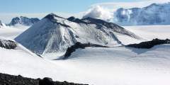
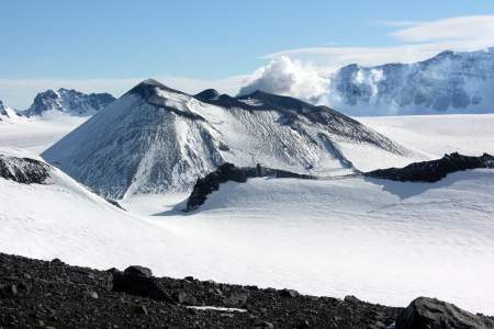
This colossal shield volcano may be one of the largest landforms in Alaska — rising 14,163 feet. The summit area features an ice-filled caldera more than 3,000 feet deep. A great view of Wrangell (and its sister volcanoes of Drum and Sanford) fills the windshield during the final 10-mile-drive east into Glennallen on the Glenn Highway.
Alaska’s sixth highest peak, the 16,237-foot Sanford dominates the northwest corner of the Wrangell Mountains. A great view of Sanford (and its sister volcanoes of Drum and Wrangell) fills the windshield during the final 10-mile-drive east into Glennallen on the Glenn Highway.
This 12,011-foot volcano rises only about 37 miles due east of Glennallen in a storybook cone with a snowy crown. Although Drum had a dramatic prehistoric eruption history, scientists believe it has not exploded in about 800,000 years.
This sweeping, wilderness valley with a collapsed central caldera inside Katmai National Park & Preserve experienced the most powerful volcanic explosion of the 20th Century. The eruption of Novarupta in 1912 blasted 3.5 cubic miles of ash into the sky, dumping a foot or more of grit on Alaska villages and altering the weather across the globe.
This active 5,906-foot volcano shrouded in ice on the western lobe of Unalaska Island last stirred awake in 1995, when it produced tremors and spit out a small cloud of steam and ash. Rising only 16 miles from the village of Unalaska and the port of Dutch Harbor, Makushin Volcano has seen at least five other eruptions in historic times, and produced rumblings or ash regularly since the 1980s.
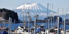
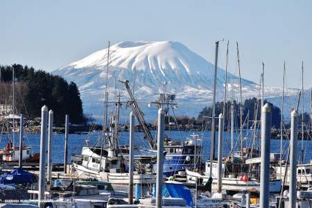
This dormant volcano rises 3,202 feet. Edgecumbe will be unmistakable during clear weather, looming to the west above Sitka Sound as an immense mound, often topped with a crown of snow.
This volcanic neck or volcanic plug is part of the Pacific Ring of Fire. These types of volcanic plugs can cause explosive eruptions, but if it is preserved, the surrounding rock erodes away creating a vertical rock outcropping.
This 8,225 ft volcano last erupted March, 2006.
This 5161 ft volcano last erupted September, 1996.
This 5315 ft volcano last erupted November, 1987.
This 7051 ft volcano last erupted March, 1957. Its most recent activity was January, 1999.
This 5118 ft volcano last erupted November, 1991. Its most recent activity was January, 2004.
This 7005 ft volcano last erupted July, 1971. Its most recent activity was July, 2005.
This 5030 ft volcano last erupted November, 2006.

This 299 ft volcano last erupted March, 1977.
This 6716 ft volcano last erupted June, 1911. Its most recent activity was May, 1931.
This 5709 ft volcano last erupted March, 1987. Its most recent activity was May, 2002.
This 4833 ft volcano’s most recent activity was August, 1988.
This 4003 ft volcano last erupted June, 1990.
This 3520 ft volcano last erupted July, 2008.
This 1804 ft volcano last erupted November, 1937.
This 4288 ft volcano last erupted June, 1996.

This 2930 ft volcano last erupted December, 1929.
This 3648 ft volcano last erupted August, 1830.
This 7103 ft volcano last erupted 1946. Its most recent activity was Febuary, 2005.
This 6903 ft volcano last erupted September, 2006.
This 8104 ft volcano’s most recent activity was 1845.
This 3599 ft volcano last erupted Febuary, 1953. Its most recent activity was June, 2005.
This 4275 ft volcano last erupted December, 1992. Its most recent activity was October, 2003.
This 9373 ft volcano last erupted April, 1999. Its most recent activity was Febuary, 2004.
This 6102 ft volcano’s most recent activity was January, 2006.
This 5676 ft volcano last erupted September, 2010.
This 5925 ft volcano last erupted 1914. Its most recent activity was October, 2005.
This 4836 ft volcano last erupted 1852.
This 2625 ft volcano last erupted April, 1987.
This 8261 ft volcano last erupted May 10, 2013 and you can read about it here.
This 4400 ft volcano last erupted May, 1931. Its most recent activity was Febuary, 2004.
This 492 ft volcano last erupted July, 1992.
1030 ft volcano
This 3497 ft volcano last erupted March, 1977.