Sitka Parks & Hiking Trails
You’ll be hard pressed to find a town in Alaska with as many hiking options as Sitka. Alpine hikes, self-guided naturalist walks, city trails, historic walks: Sitka has it all. And it was recently featured as one of America’s towns for running trails in the magazine “Canadian Runner.”
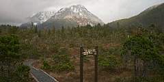
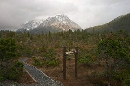
Photo by Tongass Treks
Top Hikes in Sitka
For an easy hike, explore the trails within Sitka National Historical Park or the Sitka Cross Trail. Mosquito Cove and Herring Cove are moderate hikes. Harbor Mountain is a steep hike with rewarding views.
Join Tongass Treks for a private guided hike customized for all experience levels with transportation included from your accommodations or cruise dock.
Wildlife Encounters
Because they’re so well-used, bear encounters are rare. Instead, bears generally use game trails, avoiding the high-traffic trail areas. Still, it’s smart to make some noise, consider carrying bear spray, and look for trailhead signs alerting hikers to any bear sightings.
How to Get to the Trailheads in Sitka
There are also shuttle rides out to the trails if you plan to hike on your own.
- 738-Taxi (907) 738-8294
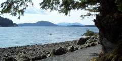
Top Photo: View from Harbor Mountain Trail
Sitka Trail Works
The extensive trail system is part of a plan by Sitka Trail Works, a nonprofit dedicated to creating and improving trails around the town. The group works with landowners and government agencies to ensure access to and development of trails. Their first project, in the late 1990s, used recently laid-off workers from the local mill to improve trails. The group’s goals include building 16 new hiking trails and reconstructing 14 more. Most of the new and improved trails adjacent to the road system are finished; a multi-day, hut-to-hut overnight backpacking loop will soon be added.
Show Map
Sitka Hiking Trails

Sitka was Alaska’s first official Bike-Friendly Community, and it shows. Bike lanes and racks abound. Besides 14 miles of paved roads, there are many mountain biking trails, and even a new, single-track route of the intimate experience of riding through old-growth forest.
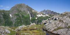
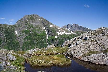
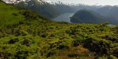
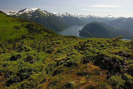
This is a beautiful hike in June and July, when the alpine wildflowers are at their peak. But it’s a beautiful hike anytime, because the views from up top — facing Mount Edgecumbe and overlooking Sitka Sound — are awesome. There are two ways up this mountain: a big climb or a big drive.
Close to town on moderate terrain, this trail is a popular destination for locals and travelers and is used for everything from family walks to trail runs. The trail follows the turquoise blue Indian River up through the valley to a waterfall. This riverside terrain makes it a good place to look for birds and other wildlife like deer. In late summer, the river fills with salmon (though fishing is prohibited). The bears have their own trail on ...more
Once the administrative headquarters for an empire stretching from Asia to California and Hawaii, Castle Hill today is little more than a grassy hill with a few interpretive signs, a modest stonewall, several old cannons, and a few flagpoles. But when you visit the top of this hill, you’re standing on rich historic grounds.
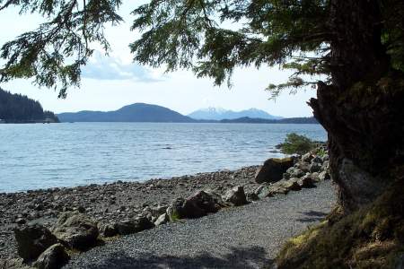
Harbor Mountain Trailhead can take you to the summit of Harbor Mountain, but you have to drive up to 1,800 feet. This road was originally built during World War II to provide access for military installations. Be careful: the road is in decent shape, but it’s narrow. From the trailhead/parking area, the trail follows a ridge with great views in all directions. It’s had recent upgrades, so it’s easy to follow and there are rock benches and… ...more
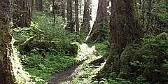
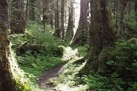
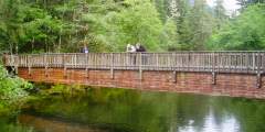
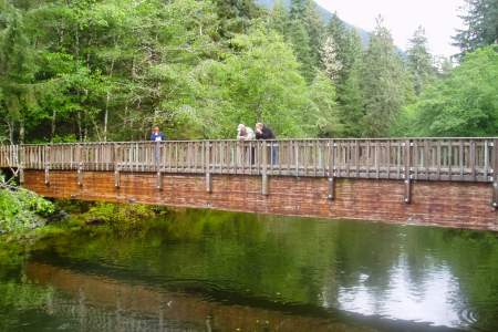
Starting at the National Park Service Visitor Center, this trail system takes you through rich coastal forest and along a salmon stream, then opens to views of the shoreline and coastal mountains. It also travels past totem poles and memorial sites, including that of the 1804 Battle of Sitka. The last armed conflict with the Tlingits in Sitka and the beginning of Russian rule, this battle is memorialized with a plaque installed in 2011. Park… ...more
This trail is close to town and starts on a floodplain. The Cross trail intersects Gavan Hill Trail at mile 1 then leads throough thick trees. Another off-shoot trail leads to Sitka High School. The next part of the trail is an old logging road and comes out behind the baseball field. The trail ends shortly thereafter.
This is a great, easy walk that can be linked to the Forest and Muskeg Trail and Mosquito Cove Trail. The boardwalk trail travels through a rich tidelands ecosystem, where you’ll find good bird watching for shore and seabirds. You may even spot bears, who show up here to feed on young grasses in early summer and return in mid-July to the end of September for the pink and silver salmon runs. The U.S. Forest Service manages the area, and the… ...more
This beautiful trail is part of an extensive local system of trails and boardwalks. It’s popular with locals and state ferry travelers, since it can be linked via trail to the ferry terminal, the Forest and Muskeg Trail, and the Estuary Life Trail.
One of the newest trails in Sitka, this beautiful hike follows a creek, passes several waterfalls, and takes you through old-growth forest. It’s quite popular, and you’ll find the Herring Cove parking area crowded on the weekends. It’s also great for families, despite being a little steep at points, thanks to fun trail features and fishing platforms at a lake stocked with grayling. The trail — made from gravel, rock steps, and… ...more
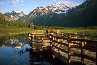
Overlooking the Eastern Channel, this park is designed for whale watching, with 3 covered viewing shelters, public-use binoculars, and 11 interpretive signs. Learn about whales’ feeding habits, migrations, and biology while walking the boardwalk.
If you’re looking for a nice day along the waterfront with the family, this is the spot. Watch fishing boats come and go, have a picnic at one of the covered shelters, or go tidepooling with the kids. At low tide you can access Magic Island and look for sea creatures. A nice one-mile loop trail winds through the park — it’s a good place to stretch your legs. And there’s an interesting modern totem pole, carved by Tommy Joseph in remembrance of… ...more
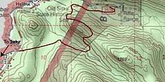
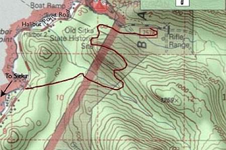
This is one of the prettiest trails for a visitor who’s not a big hiker. It’s an interpretive trail with a self-guided brochure, and you’ll travel through prime examples of the dominant forest ecosystems in the area: forest and muskeg. Learn about these ecologies while walking a gently sloping trail of gravel and boardwalk. One of the best ways to enjoy this trail is to park at Old Sitka State Park located just ½‑mile north of the Ferry… ...more
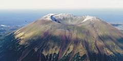
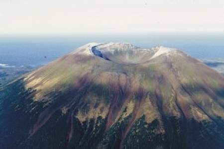
If you’re here on a sunny day, you know this peak — it’s the dominant, gentle volcano that fills the view to the west. And intrepid hikers can walk all the way to the top. The trail is about 10 miles west of Sitka and is only accessible by boat, so you’ll have to charter a boat and be comfortable with wilderness hiking.
This popular trail is well suited for family outings. It leads through stunted forests to a boardwalked section of the trail near Beaver Lake. Once you have reached the lake, there is a boat available for public use. This is a great place to take the kids and keep an eye open for grayling in the lake. It was periodically stocked with grayling between 1986 and 1991.
This is a big climb: you’ll gain 2,550 feet en route to the summit. And you can continue along an alpine ridge to the next summit (about one hour), Arrowhead, which sits at 3,300 feet! If you make it to these peaks, you’ll be rewarded with big views and a beautiful alpine environment. And the trail can be accessed via public transport.
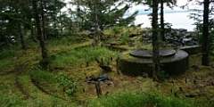
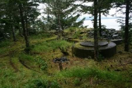
Arrange a water taxi ride to this man made archipelago extending into Sitka Sound, a relic of decaying fortifications built to defend Alaska from foreign invasion during World War II. During World War II, Sitka was the hub of military activity in Southeast Alaska, with a U.S. Naval Air Station and other installations.
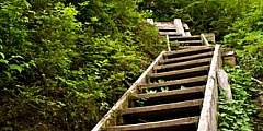
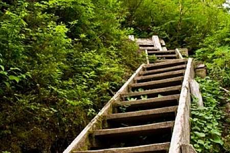
Starting from the Baranof Street trailhead, it’s about 2 miles up to 2,400 feet! That’s steep — steep enough to make for a challenging race, the Alpine Adventure Run, which coincides with an annual meeting of specialists in the sports medicine field. The trail starts easily, with a raised boardwalk that takes you through open meadows and then a forest of big hemlock and spruce to a steep trail, with stairs and steps. You can climb this for 1.6… ...more
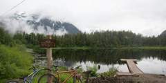
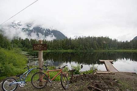
This is a popular trail for cyclists, families, and swimmers! Yep, on sunny days this is one of the warmer spots to take a dip. That’s because the small lakes warm up in the summer (relatively…if you’re from Florida you might disagree). The trail can be accessed using public transport, and cyclists can even mount their bike on the bus. A local bike shop does a tour here, and if you come back down Blue Lake Road there are some fun, steep… ...more