Homer Parks & Trails
Homer Side of Kachemak Bay Trails
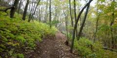
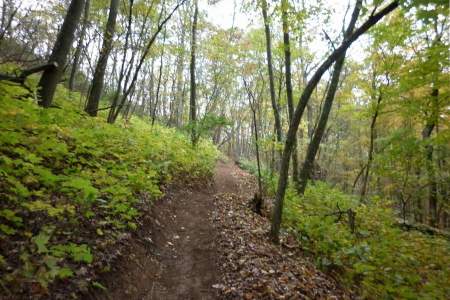
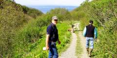
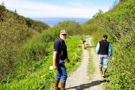
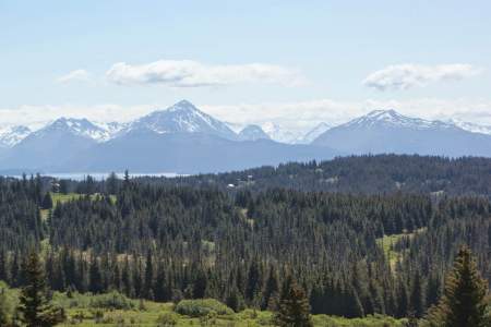
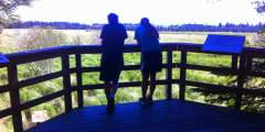
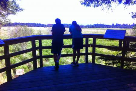
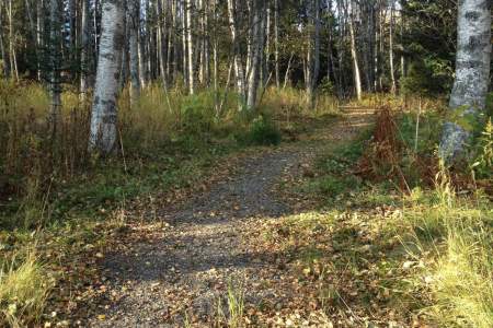
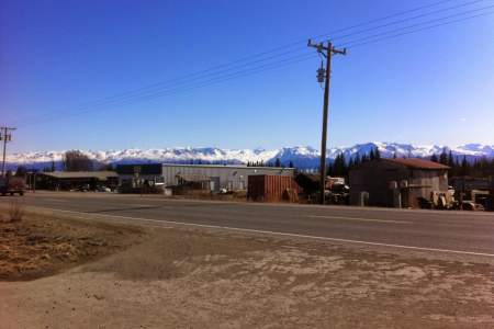
On the Homer side of Kachemak Bay, several hikes will connect you with both land and sea wildlife. Trails into the hills above Homer bring you great exercise as well as the beauties of trees and flowers and the occasional encounter with wildlife such as moose and bear and smaller animals. Above the high school, an easy trail into the woods is a pleasant stroll into the wilds. A trail that starts behind the McDonald's restaurant on the east side of Lake Street takes you to Ben Walters Park, along the shore of the Beluga Slough. The Calvin Coyle Trail (which starts at the end of Mariner Drive which also accesses the Cottonwood Horse Park), leads to a wetlands observation deck as does a short trail just east of the airport. Both decks put you in likely wildlife encounters, including bears and moose. Uphill on Bartlett Street above the Pratt Museum, take a left on Fairview, then right on Campground Road to the Karen Hornaday Park for more great outdoors fun which includes a playground for children. The city campground is just above this park.
Strolling through town, mainly on Pioneer Avenue and by the High School, is like visiting an art gallery, mural walls and businesses adorned with art are on display.
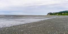
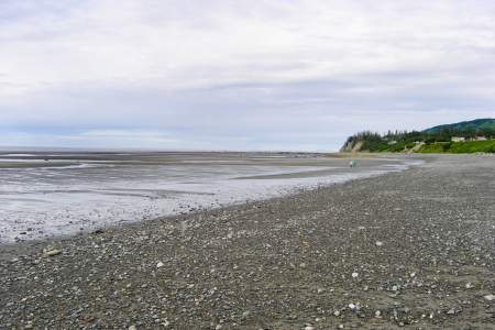
Bishop's Beach, just below Old Town, and easily accessible, is a great place to wander in the the sand and watch for whales, seals, porpoises and other sea life.
Kachemak Bay State Park Trails
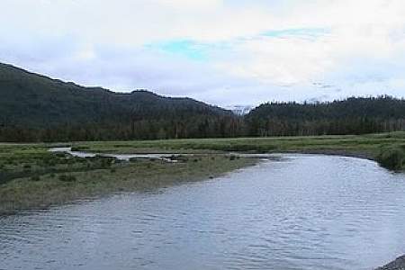
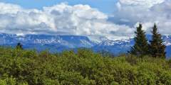
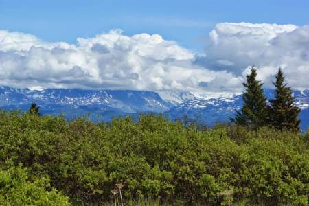
Across the bay from Homer, Kachemak Bay State Park tempts hikers to explore numerous easy and difficult trails.
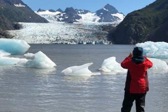
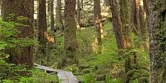
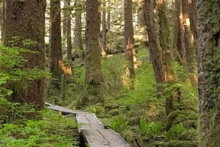
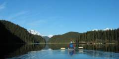
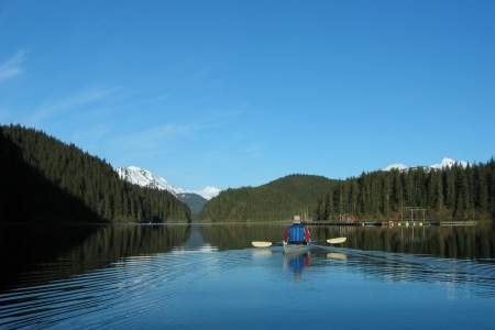
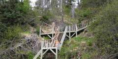
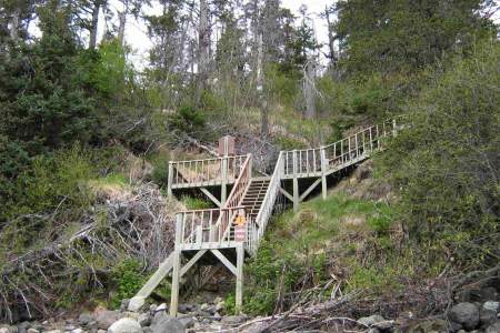
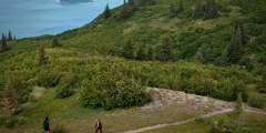
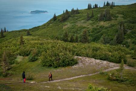
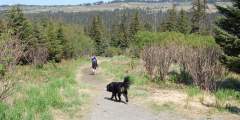
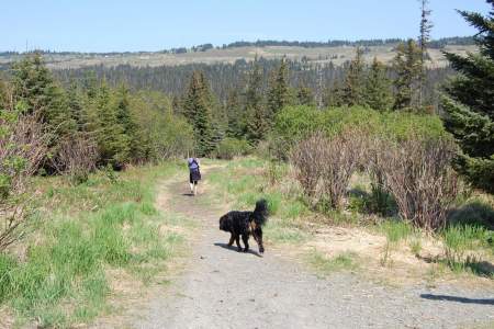
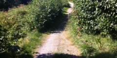
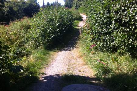
There are over 25 miles of trails in the park, many accessed by boat only. They range from easy to difficult. Many climb over steep, rugged terrain and offer excellent views. Others wind through coastal forest and meadows. Many of the trails are passable but challenging. There are areas of exposed rocks, roots, wet boggy areas, downed trees or tall grass. Trails and trailheads are marked with orange triangle signs with a "T" in the center. All trailheads are accessed by boat or plane, and some of the hikes require crossing glacial streams.
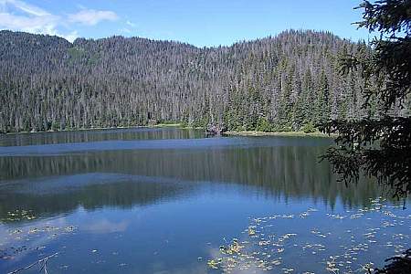
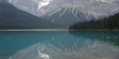
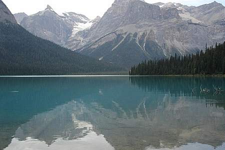
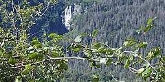
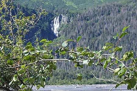
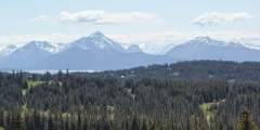
One of the easiest hikes with some of the best views is the Grewingk Glacier Lake Trail. One of the most traveled trails in the park is the China Poot Lake Trail, where switchbacks lead you to a place called First Lake, an excellent spot to take a dip on a hot day. Another popular option is the 8.2 mile Grace Ridge Trail North Access, where views from the top include views of Eldred Passage, Sadie Peak, and Cook Inlet Volcanoes.
Trails in the park are maintained through the efforts of volunteers and volunteering is a great way to do a service to mother earth and fellow humans as well as enjoy the park.
Looking to stay in the state park longer? Book into Alaska's Loonsong Lake Wilderness Lodge, a private log chalet surrounded by more than a million acres of Kachemak Bay State Wilderness Park. Only one booking at a time is accepted, two couples or a family have exclusive use. There are miles of lovely hiking trails, diverse enough to fill a week and match any appetite.
Kachemak Bay State Park Trails
Trails accessible by boat or plane across the Bay
This trail, hands down, is one of the most popular hikes in the Kachemak Bay State Park. It is one of the easiest hikes in the park as the trail is well maintained, and you can’t beat the view of the glacier at the lake. For the first 1.5 miles, the trail meanders through mixed cottonwood and Sitka spruce. These cottonwoods are some of the largest in the park so take time to appreciate their enormous size. After 1.5 miles, the trail proceeds ...more
Probably the second most traveled trail in the park, this trail offers a great day hike for those spending time in the lagoon. You can start hiking the trail from the ranger station or the trailhead in Halibut Cove Lagoon. The trail traverses up numerous switchbacks to a place called First Lake. On a hot summer day, a soak in this lake can’t be beat.
This trail winds along Halibut Cove and passes though to Halibut Creek delta, a wet boggy section. The river can be forded at low tide but may be difficult to cross at other times. The trail continues on to lead you to China Poot Lake Trail, should you choose to go on.
Access: Get to the trail from Humpy Creek or the Grewingk Glacier Trail. Description of this trail is from access via Humpy Creek North Trail. Trail begins at 650 via the Humpy Creek North Trail. The trail gains elevation quickly for close to 2 miles and will eventually leave the dead and down forest into alder fields. At this point you start to get great views north and south of Kachemak Bay. You will see the Homer Spit in all its glory. At… ...more
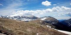
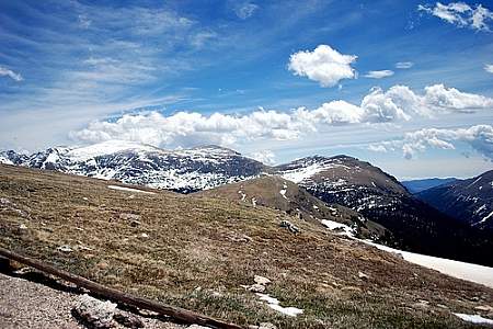
For a longer day hike, add this popular route to the Glacier Lake Trail loop. You’ll pick up the trail heading south down the Saddle Trail, then climb a steep ridge above tree-line to alpine tundra, with great views of Kachemak Bay, Grewingk Glacier, and the glacial valley. In August, you’ll find ripe blueberries. Retrace your steps and continue down the Saddle Trail to the Halibut Cove pickup. It is 5 miles out and back, plus Glacier Lake… ...more
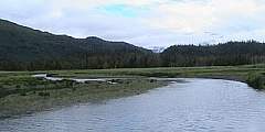
Going north from the Humpy Creek Trailhead, the trail will skirt along the edge of the high tide line through the grass. Follow the orange trail markers along the beach until the trail enters into the woods. BEWARE: The trail section along the beach may be impassable at times when the tide exceeds 17 or 18 feet. As the trail climbs into the woods it is strenuous at times, but you are rewarded with views back down into Humpy Creek drainage… ...more

Note: To get to the summit you most get to the Summit Junction, and continue the final .3 miles from there. The trail begins .5 miles beyond China Poot Lake. The elevation gain tells it all — 1632 feet in just over a mile! This trail doesn’t mess around. It is difficult but can be fun. Right from the trail junction, the trail will climb straight up, with no traversing or switchbacks. The trail climbs over exposed tree roots, several slick… ...more
This trail is short and steep through thick forest that leads to incredible scenary. The trailhead can be reached via the highest point of the Lagoon Trail, two miles from the ranger station. Rock cairns mark the trail to an open alpine ridge, where the trail gently climbs to a summit that has some of the finest views anywhere of Kachemak country.

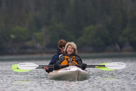
Although this can be a busy spot, it is a lot less congested than the Homer Spit. Things to do here include: taking small day hikes, paddling in the lagoon, camping, staying at one of the three nearby public use cabins, and the most popular, fishing for Kings during the month of June.
Hike 2 miles along the China Poot Lake Trail. The Moose Valley trail is one of the more unique trails in the park. It is one of the best hikes in the park because it can be combined with other trails to make a very big loop. The hike is full of flowers, deciduous trees, stands of cottonwoods and alpine lakes.
Access: Tutka Bay There are two trailheads for Grace Ridge. One is at the northern end of Tutka Bay at Kayak Beach. The second is located in the southern end of the bay about two thirds of the way down on the north shore. Some folks never hike the entire length of the trail, but rather hike from Kayak beach to the summit of Grace ridge, and back to the beach. This is a worthy hike, but if you can hike from north to south completely along… ...more
This trail’s purpose is to provide access to the Tutka Bay Lagoon Hatchery. Be sure to bring a kayak and the family to play in the lagoon for the day!
There are two different trails to reach the alpine area of Sadie Knob; from either the north or south trailheads. Each has campsites you can use as a base camp for hiking. You can hike from trailhead to trailhead and never go into the alpine if you choose. These are very well graded trails and offer leisurely hike if one wants to ‘smell the roses’ and do some bird watching or flower identification. The junction at the spur trail that takes… ...more
The trailhead is in Halibut Cove In conjunction with the Grewingk Glacier Lake Trail, this is the most heavily traveled trail in the park. Usually, people hike the Grewingk Glacier Lake Trail, hang out at the lake and hike the Saddle Trail back to Halibut Cove for their water taxi pickup.
This popular trail begins at Kayak Beach Campsite, accessible by water taxi, between Tutka Bay and Sadie Cove. Head up through spruce and alders, and stop at the alpine knob at 1,745 feet for great photo opportunities of Eldred Passage, Sadie Peak, and Cook Inlet volcanoes. Watch for mountain goats, black bears, and golden and bald eagles.
Elevation Gain: 873 feet Difficulty: Moderate Length: 2.8 miles Time: 1 1÷2−2 hours Going north from the Humpy Creek Trailhead, the trail will skirt along the edge of the high tide line through the grass. Follow orange trail ?T?s? along the beach until the trail enters into the woods. BEWARE: The trail section along the beach may be impassable at times when the tide exceeds 17 or 18 feet. As the trail climbs into the woods it is strenuous at… ...more
The Coalition Loop is a moderately difficult trail in Kachemak Bay State Park. It’s five and a half miles long with short steep climbs up to 400 feet, and it takes roughly three hours to hike the loop. Boat access to the trail is at the China Poot Bay trailhead during high tide. You can also join this trail at mile .2 and mile 1.8 of the China Poot Lake Trail. The trail itself connects Halibut Cove Lagoon with China Poot Bay. It climbs… ...more
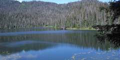
This easy trail winds along the banks of three lakes. There is a camping area on the side of the trail. The trail climbs a saddle and drops down into the valley. It can be dangerous to cross the rivers, as they are glacier-fed and you cannot see the bottom. The rivers are lower during the beginning of the year, but they are also colder.

Homer Trails
Trails on the Homer side of Kachemak Bay
One of the top trails on the Homer side of Kachemak Bay, Diamond Creek is a 2‑mile trail that takes you through forest, alders, and tall grass meadows before descending to the beach, where you’ll find small Alaskan sealife.
From the base of the Homer Spit, take this 4‑mile paved trail to the Nick Dudiak Fishing Lagoon. The trail is in excellent condition and is flat as a pancake for most of its length. The first mile of trail is along a broad estuary that is great for birding. Once you pass the one-mile mark you’ll be riding past fishing boats that are out of the water being worked on as well as a few shops.
This 0.4‑mile-long trail, which begins within earshot of downtown Homer, plays host to a variety of birds and plants. Wheelchairs may have some trouble in the first few feet of soft gravel, but once they reach the plastic boardwalk they should find the going much easier — and maybe worth the trouble it took to drive 4 hours from Anchorage.
This is one of Homer’s top hikes. It starts on top of Baycrest Hill, crosses Diamond Ridge Road, then follows Crossman Ridge to the Bridge Creek Reservoir. Throughout, it rolls through forests, meadows and over streams. The area is excellent for birding and catching a glimpse at the occasional moose.
The trailhead is located 3⁄4 miles east of the Skyline Drive intersection. The trail follows Crossman Ridge Rd before going down to cross bridge creek. From here it climbs up to Diamond Ridge Road where there’s another trailhead. You can also access the Homested Trail from the Rogers Loop Rd Trailhead.
This is an unmarked dirt road that isn’t well maintained but is good for biking and hiking.
This trail is a connector between Pioneer Ave and the Homer Bypass. It winds through the woods in town and a spur trail leads to the Homer Public Library.
This trail will take you 7.5 miles to Caribou Lake and is good for biking, hiking, ATV’s, and winter skiing.
This trail is an easy one-mile stroll to the east Beluga Slough viewing platform.
The Raven’s Way Loop is accessed from the Sterling Highway. You will see the Trailhead and large parking lot. The trail meanders through open spruce and muskeg terrain and there it is a great chance to see lots of eagles and ravens.
Everyone wants to explore a tidepool, don’t they? This is a must for the kids — even that little kid in those slightly more mature visitors. Here’s the perfect spot. Bring a towel and let’s have an intertidal adventure.
The Ray Clapp Trail is a nice short hike in Homer. It is located approximately 1 mile out East End Road in the Stream Hill Park Subdivision. You can park your car or bicycle at the trail head which is marked with a little footbridge. It winds through the edge of an estate and is filled with lovely meadows of wildflowers along with beautiful birch and cottonwood trees.
This trail switchbacks up .38 miles to an overlook that offers stunning views of Kachemak Bay.
Paved and flat, this three-mile long trail is great for in-town recreation.
Less than one mile through the woods, this is an easy, in-town hike.
This is an easy two-mile trail through meadows and forests that’s great for hiking in the summer and skiing during the winter. In summer, the highlight is fields of wildflowers, especially from June through August: Lupine, Wild Geranium, False Hellebore, Monk’s Hood, Chocolate Lily, Fireweed, and much more.