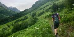
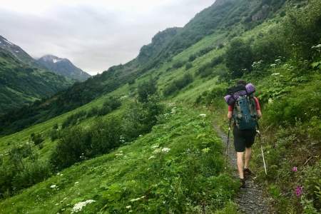
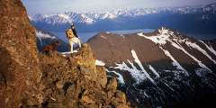
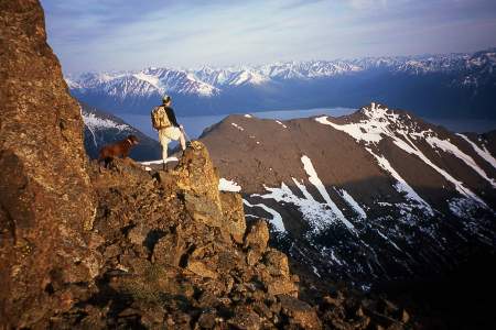
Shawn Lyon's Alaska Hiking Trail Guides
Shawn Lyons, by vocation and avocation, lives a life of many parts. As a professional classical guitarist, he plays dinner music every Thursday through Saturday at Villa Nova Restaurant in Anchorage. When not playing guitar at Villa Nova, Shawn gives private guitar at the University of Alaska in Anchorage. There he also teaches Music Appreciation, English Composition, and Literature.
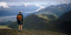
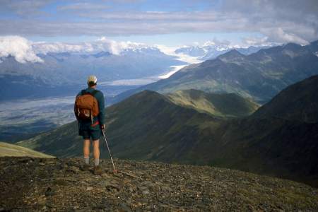
Most know him, however, as an avid hiker and hill scrambler. So much so that after many long hikes through many a valley and over many a summit, many consider him the hiking guru of South Central Alaska. In addition, as an ultra-athlete, he has won the Iditashoe wilderness snowshoe race times, and the 100-mile Coldfoot Classic, held each year on Halloween above the Arctic Circle, three times. For many years Shawn’s narratives about his hikes and races often appeared in a weekly hiking/climbing column that he writes for The Anchorage Daily News.
He now publishes articles and photographs of his hikes and climbs at his own web site: shawnlyonsbooks.com, and you can find his Walk-About Guides to Alaska in local book stores as well as online. Each hike in this guide for Alaska.org lists the book where you can find even more details on the hike.
Show Map
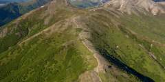
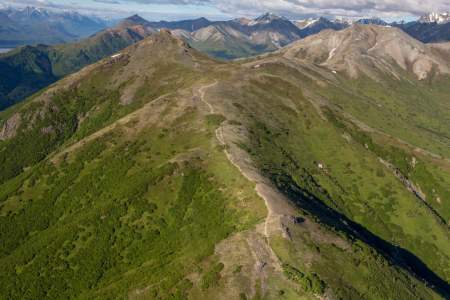
Hiking Trails
Family Hikes
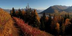
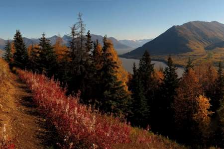
This 2‑mile-long, family-friendly trail, which begins 90 minutes south of Anchorage at the far end of the Whittier Tunnel, remains the only easy way to see Portage Glacier on foot. And it’s has a spectacular conclusion: After cresting Portage Pass, the trail drops through glacial scrub before popping out on the wide gravel shores of Portage Lake, directly across from the snout of gorgeous Portage Glacier.
If you want a great workout — to stunning mountain views high above the valley floor below — but want to save your knees on the way down, this trail is for you. It leaves from the Alyeska Resort tram building and climbs steep switchbacks 2.2 miles and 2000 feet to the mid-mountain restaurant where you can catch a free aerial tram ride back down to the hotel.
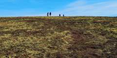
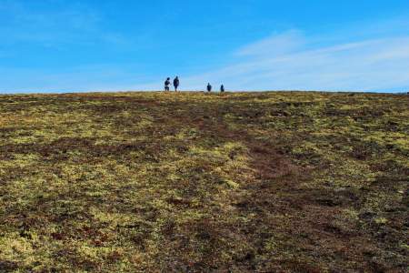
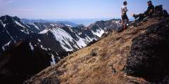
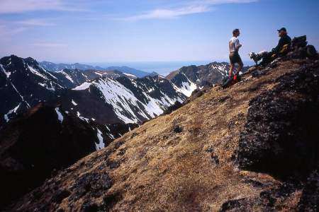
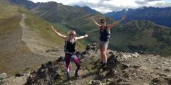
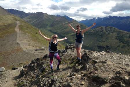
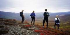
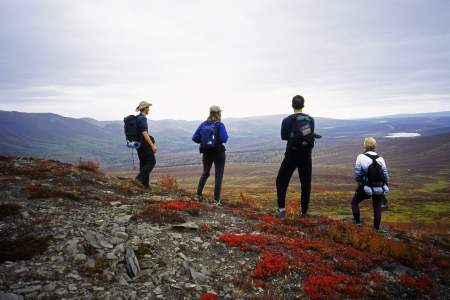
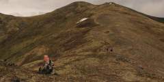
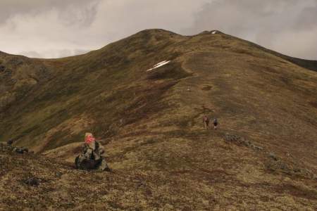
If people suggest climbing Flattop, tell them you’d rather climb Rendezvous Peak. Flattop is arguably Alaska’s most popular (and therefore, most crowded) mountain; Rendezvous is far less crowded and offers better views from the summit. See them by hiking up 1,500 feet to the 4,050-foot summit.
With a length of just 1.5 miles and a summit reaching only 874 feet, West Butte Trail on Bodenburg Butte — a 45-minute drive north of Anchorage — makes for a fine family outing. But even if you’re a more experienced hiker, don’t let the butte’s dwarf-like height dissuade you. This small bump in the center of a grand alluvial plain offers far-reaching views from its summit; plus, the climb includes a pulse-quickening 0.25 miles of stairs up the steep ...more
Summit Lake, located some 60 miles north of Anchorage at the crest of Hatcher Pass, offers a short, memorable lakeside ramble. Here you can explore the surrounding gullies and slopes or just sit and watch hang gliders drift out over the long Willow Creek Valley, which extends for miles from the west side of the pass.
Moderate Hikes
Every Fourth of July, racers scramble to the top and back in one of the state’s oldest traditions. But you don’t have to race to reach the top. Hikers can take a well-marked trail for a quieter, steadier climb. Whether you’re here for the race, the view, or just a good leg workout, Mount Marathon delivers.
This family-friendly, 2.5‑mile trail climbs 3,600 feet to a summit halfway between the sea and the heavens
It’s not as difficult as you might think to hike to stand atop the precipitous, gully-scarred face of Bear Point. But it’s not easy, either. The 2‑mile hike ascends 2,100 feet and can be tricky. But your reward is an amazing view in all directions, from the Kenai Peninsula to Denali and the Chugach Mountains to Matanuska Peak.
While many people find satisfaction in climbing to the top of Bear Point, others may wonder about reaching the summit of Mount Eklutna, the prominent peak rising just to the east. It involves two more miles of hiking, up 1,100 feet, including a short, sharp scramble up a gravel trail. You can return to the Peters Creek Trail trailhead via an alternate route, which makes for a fine loop hike.
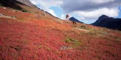
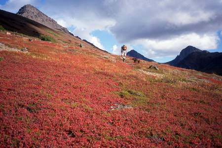
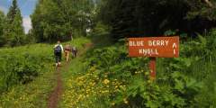
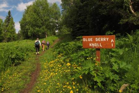
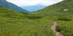
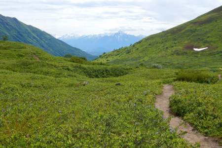
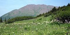
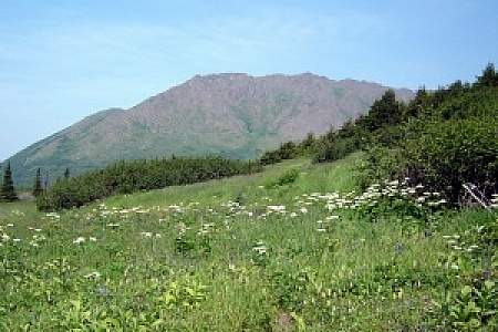
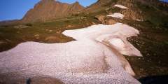
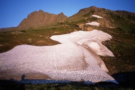
This trail quickly gains elevation on its way to an alpine meadow framed by the dramatic Twin Peaks and Goat Rock, but climbs to magnificent views overlooking the entire valley. Dall Sheep are often spotted above the timberline. From here there is a spectacular view of the lake below. This is also a good place for berry picking in the fall. Because of the crushed rocks, the trail is hardly ever muddy.
Some 50 miles north of Anchorage, this 1.5‑mile trail makes for a fine family outing. From the picnic table at the uppermost end of the trail, you’ll find a satisfying panoramic view of the Matanuska River and Knik River valleys. It’s a view as good, or better, than that from many summits.
This 4.5‑mile trail, some 2 hours north of Anchorage on the west side of Hatcher Pass, climbs 1,000 feet up a very typical Talkeetna valley — long, broad, and lined with towering peaks on both sides. It also passes by relics and ruins of old mining days, when these valleys echoed with the sounds of picks and drills.
The Fishhook Trailhead parking lot is located at mile 16.5 of Hatcher Pass Road. This area is actively used year round. In the summer it’s a great area to hike and in late summer the slopes are abundant with blueberries. This trailhead also leads to Marmot Mountain, were paragliders launch from the top and land in the parking lot. In the winter, the area draws individuals to sled, ski and snowmachine. This trailhead intersects with The Hatcher ...more
Big Hikes
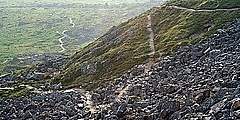
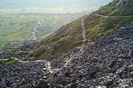
No other mining trail on the Kenai Peninsula climbs as high or takes in more extensive views as the 6‑mile-long Crown Mine Trail. Beginning some 2 hours south of Anchorage on the appropriately named Mine Road just south of Trail Lake, this trail climbs to 3,900 feet above sea level to a unique spot — a glacial cirque littered with mining paraphernalia.
Primarily built to provide pack-rafters and kayakers access to the headwaters of Twentymile River, this 9‑mile-long trail has also proved a draw for hikers — and with good reason. Just 45 minutes south of Anchorage, it makes for a very scenic hike into some high, wild, glacier-girted country.
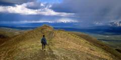
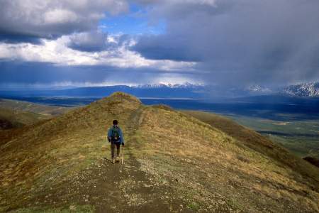
Want to feel dwarfed by Alaska’s mountains? Take a 2‑hour drive north on the Parks Highway and then up Hatcher Pass Road, where you’ll find this 2‑mile-long ATV trail — a wide but occasionally steep path that leads to the crest of Box Lake Ridge. From the big, rounded top of this ridge, you can’t help but feel overwhelmed by the enormous Talkeetna Mountains that surround you.
A straightforward trip with big scenery payoffs, like the picturesque Mint Hut and a valley dotted with hanging glaciers. This trip is a great first backpacking trip in Alaska with simple logistics. It’s 16 miles with options for additional miles and side trips.
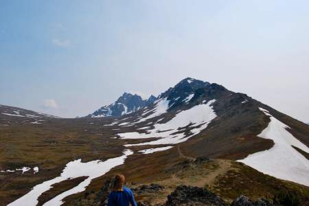
Syncline Mountain features two summits— whichever you choose, you’ll hike beneath a whole lot of sky and look out on a whole lot of country.
Big Climbs
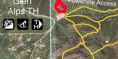
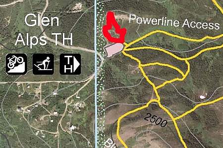
Reaching the summit of Avalanche Mountain takes a considerable amount of effort: a 5.5‑mile hike up Powerline Trail followed by a 1.5‑mile off-trail scramble. But this 3,200-foot climb — which begins at the Glen Alps parking area, just 10 miles from downtown Anchorage — takes no mountaineering skills. If you feel at all comfortable hiking and climbing over some loose stones and boulders, you should find this to be a very gratifying adventure. ...more
You don’t have to be a mountaineer to reach the summit of O’Malley Peak — the prominent spire rising from the Front Range above Anchorage — but don’t mistake it for an easy climb. Some of the 5‑mile-long trail climbs quite steeply; other parts add very loose gravel to the incline. Still, these conditions don’t make this hike excessively dangerous, just satisfyingly laborious.
Black Tail Rocks is a very airy climb that stretches to 4,446 feet above Eagle River, a town located just north of Anchorage. It’s a journey that involves only a minimal amount of hand-over-hand scrambling; you’ll be following a trail for most of the 4‑mile, 2,750-foot hike. And you’ll have a fine view from the top, looking up the length of the secluded Meadow Creek Valley and well into the deep inner reaches of the Chugach Mountains.
No official trail in Southcentral Alaska climbs as high as Matanuska Peak Trail. Beginning in a subdivision across the Matanuska River from Palmer, this nearly 6‑mile-long trail runs up some 5,700 vertical feet. Your destination is the 6,119-foot summit of Matanuska Peak, the very prominent rock spire that fills the sky just east of Palmer. But despite the imposing appearance of this mountain, the trail to its summit requires no extensive ...more
Beginning almost 120 miles northeast of Anchorage on the Glenn Highway, the trail to the summit of Gunsight Mountain takes a while to reach. After all, it involves a 3.5‑mile, 3,300-foot climb through some very big country. But the view from the top makes for an all-day excursion that you won’t easily forget.
Hikes to Lakes & Seashores
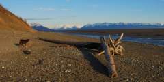
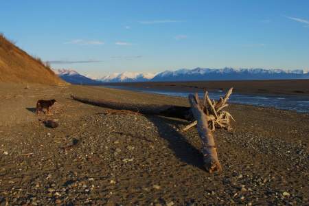
Beginning 103 miles south of Anchorage on the Seward Highway, the 3.5‑mile-long Ptarmigan Lake Trail makes for a fine family outing. The lake itself is a long and narrow body of water squeezed between ridges and mountains that tower as high as 6,000 feet. It even offers a small beach upon which to relax and enjoy the view while cooling your feet.
If you only have a limited amount of time in Anchorage but want go out for a great hike, consider Kincaid Bluff Trail. Just a 20-minute drive from downtown Anchorage, this is a 6‑mile loop hike to Kincaid Chalet. Along the way, you’ll find 3 miles of rugged trail that skirt the summit of precipitous bluffs at the end of the Anchorage Peninsula.
Trail head begins by traversing private land, but an easement has been provided for such. Easy to bike, ski, run or walk to mild slope with a wide sides, making is safe from avalanches in the winter. Should you choose to turn left at the start, you can go to Flat Top as an alternative route or Peak 2 or 3, depending how far down you go down the trail before turning left. Ptarmagan Peak would be a more prominate peak just before the Rabbit creek ...more
This 7‑mile hike, which begins in the mountains just above Anchorage, takes you to the numerous Williwaw Lakes, all of which are clustered below the sheer north face of Mount Williwaw — the highest peak in the Front Range.
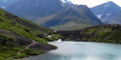
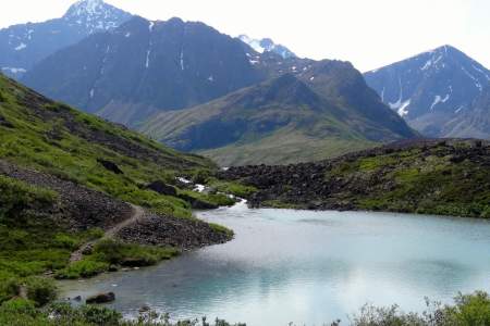
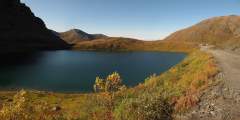
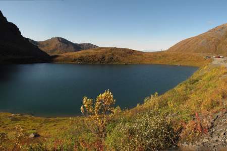
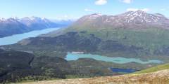
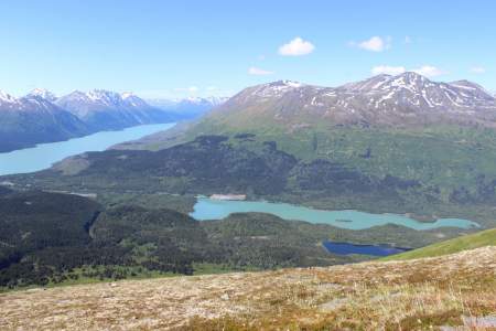
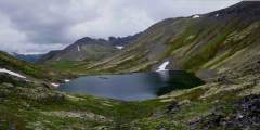
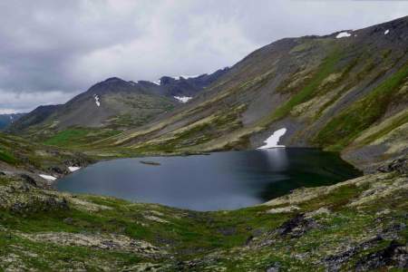
Rarely do two lakes lie within a few feet of each other. Fortunately, the trail to see this geological rarity begins just a 30-minute drive north of Anchorage. From the trailhead for South Fork Eagle River Trail, it’s a gradual 4.8‑mile (one-way) climb up a wide valley, leading to a narrow isthmus between the green waters of Eagle Lake and the blue waters of Symphony Lake.
As you approach the Independence Mine Parking Lot, the trail can be seen to the far right end. It crosses over a small bridge, and winds up past an old abandoned mining cabin, and then up a debris field and finally to the lake. Round trip, the hike is almost 2 miles, and the elevation gain is approximately 600 feet. The trail can be muddy and wet for the first .25 miles, but it’s worth the hike to see Gold Cord Lake, and a great view of the Mine ...more
Hikes to Waterfalls
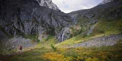
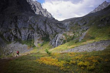
This leisurely, 0.75-mile trail begins just south of Whittier, a little seaside town located some 2 hours south of Anchorage. The trail doesn’t climb much, but it will take you high enough to get an unobstructed view of numerous waterfalls, including the long-dropping waters of Horsetail Falls as it sheets over the sheer rock face of Blackstone Ridge.
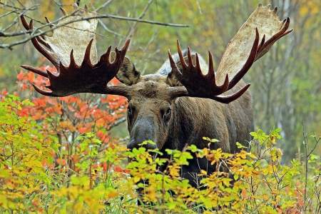
Considered to be one of the best hikes in all of the Chugach Mountains, Crow Pass follows a portion of the original Iditarod Trail, including its highest point. End to end, it’s a 21-mile trail, which most people do in 2 days, but just the first 4 miles will lead you past some breathtaking scenery. Along the way you’ll find glaciers, waterfalls, wildflowers, wildlife, mine ruins, and berries (in late August and September). Hiking is not ...more
This is a popular, 4.3‑mile-long (8.6 round-trip) trail located 2 hours north of Anchorage in the Hatcher Pass area. It’s also gorgeous. At one point it climbs directly alongside a sheet of waterfalls falling from a wide granite ledge. As the trail winds its way to these falls, it passes the lake into which the falls drain. And after the falls, the trail ends at the tarn from which the falls drain. In other words, hike this trail and you’ll see a ...more
The 5‑mile-long Eska Falls Trail is located a 2‑hour drive north of Anchorage in the mountains above the town of Sutton. And it leads to one of nature’s symmetrically framed wonders — a 100-foot waterfall located at the end of a mile-long valley that’s flanked by two massive summits. This setting makes Eska Falls not so much a hike to a destination as much as a hike to a presentation.
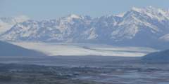
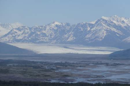
Hikes to Glaciers
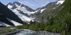
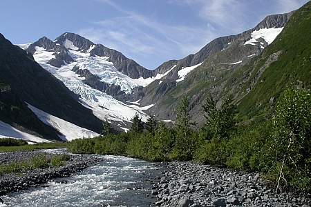
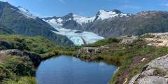
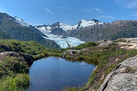
This short day hike — with an easily accessible trailhead a few hundred meters from the Begich Boggs Visitor Center — offers you big views of the Byron Glacier.
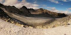
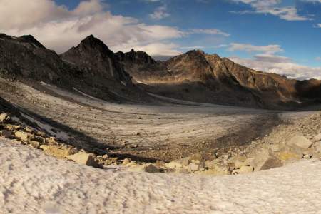
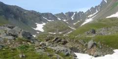
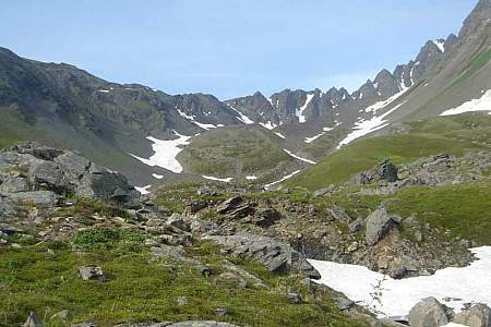
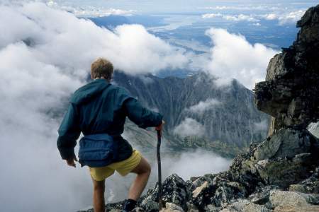
It’s not very often that people can see a glacier in an untamed and remote location, far from any road or cruise-ship route. But if you feel capable and confident enough to climb a very rough trail up many vertical feet of rocky terrain, then you might consider undertaking the hike to Snowbird Pass, located high in the Talkeetna Mountains just north of Hatcher Pass. From this vantage point you can look down the entire length of Snowbird Glacier. ...more
Off-Trail Adventures
If you have some outdoor experience and an adventurous spirit, consider this 11-mile traverse up the Colorado Creek valley and down the Summit Creek. Beginning 2 hours south of Anchorage, this traverse doesn’t involve any rock scrambling, river crossings, or arduous bushwhacking. But if you feel comfortable hiking in wide and trackless country, you may reap the reward of having an entire valley to yourself.
You’ll have a hard time losing your way on this 2.5‑mile climb of 4,301-foot-high McHugh Peak. You’ll also have a hard time forgetting the view from the summit, which extends up the length of Turnagain Arm and across Knik Arm to the Alaska Range. It’s even more satisfying knowing that you found your way to the summit with only minimal help from the trail.
If you only have a little experience doing off-trail hiking, then this scenic 5‑miler will help you get a bit more under your belt. Beginning on Rabbit Creek Trail, in the Front Range just above Anchorage, this hike visits a surprisingly expansive and scenic plateau that remains hidden from sight until you actually climb to it.
Not everyone should undertake this 13-mile traverse that begins at Glen Alps above Anchorage. Considerable off-trail hiking, plus a steep climb to a ridge top, might be outside your comfort zone. But this trail does offer a profound sense of solitude and some spectacular views. It also includes the novelty of hiking a mile-long sheep trail that traverses the back of The Wedge, some 500 feet above the secluded waters of Ship Lake.
Cardio Workouts
A short road called Konikson located just past Bird Ridge heading east will take you to the trailhead. Stay to the right until you see a trail about a quarter mile in going right and up. The trail follows a small drainage, and quickly gets past the tree line.
Are you a mountain runner looking for a tough workout? Consider Pioneer Ridge Trail. This trail, located a 1‑hour drive north of Anchorage on scenic Knik River Road, climbs some 5,200 feet over its 6 miles. Other trails, like Lazy Mountain Trail and Mount Marathon Race Route, may be steeper or rockier, but no trail in the Chugach Mountains climbs so steadily for so long as Pioneer Ridge.
Why Take This Hike This trail, located 90 minutes north of Anchorage just across the Matanuska River from downtown Palmer, makes no pretense about its purpose. Almost immediately after leaving the parking area, it begins to climb straight up the steep west face of Lazy Mountain. For some 2,000 feet, there’s nary a switchback or respite as the trail winds up to the summit ridge. It’s a truly breathless workout. The Details Out of Palmer,… ...more
Beginning a 1‑hour drive north of Anchorage in Government Hill Recreation Area, Government Peak Race Trail offers a fine opportunity for a hard workout; it climbs some 3,700 vertical feet in just 3 miles. Plus, this climb doesn’t include any extraordinary dangers. (A friend refers to one short ledge on this trail as “death rock,” but she tends to exaggerate.) Some sections require special care to negotiate, but you won’t have to traverse any ...more
Wheelchair-Accessible Hike
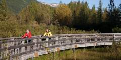
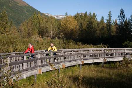
If you have the ability to transport bicycles, this trail makes for a great afternoon trip. The dirt path winds through the Portage Valley, passing glacial lakes and ending at Portage Lake (this part of the trip is 5 miles each way). Make sure to bring your camera: you’ll see hanging glaciers and, very likely, some wildlife.
This trail has its own sitting area and viewing deck with views of Anchorage, the Alaska Range, and Cook Inlet. It is really good for seeing sunsets in the evening but it is also windy. The whole route is wheelchair accessible. This is a good short hike for the family to see the view over Anchorage, but not a good trail for the training runner.
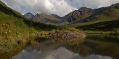
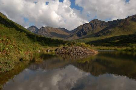
This trail is less than a mile, and very kid friendly. Two viewing decks offer views looking down the impressive valley, and wildlife is often seen here. Beaver Pond is also part of the show, and salmon spawning can be seen in late August through September. This popular trail is usually packed with walkers, strollers, and the family dog — all easily accommodated. The trail is wheelchair accessible and begins on a wide, slightly downhill path to ...more
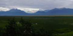
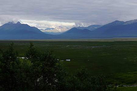
This short, paved trail is an hour’s drive north of Anchorage in southern Wasilla. It leads out to a bluff on Palmer Hay Flats — a large stretch of wetlands with all kinds of wildlife. There, a viewing platform overlooks the flats and the Chugach Mountains beyond.