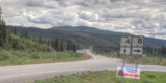
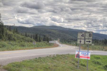
Denali Highway Paxson to Cantwell (Hwy 8)
Aerials from a road trip we took on the Denali Highway
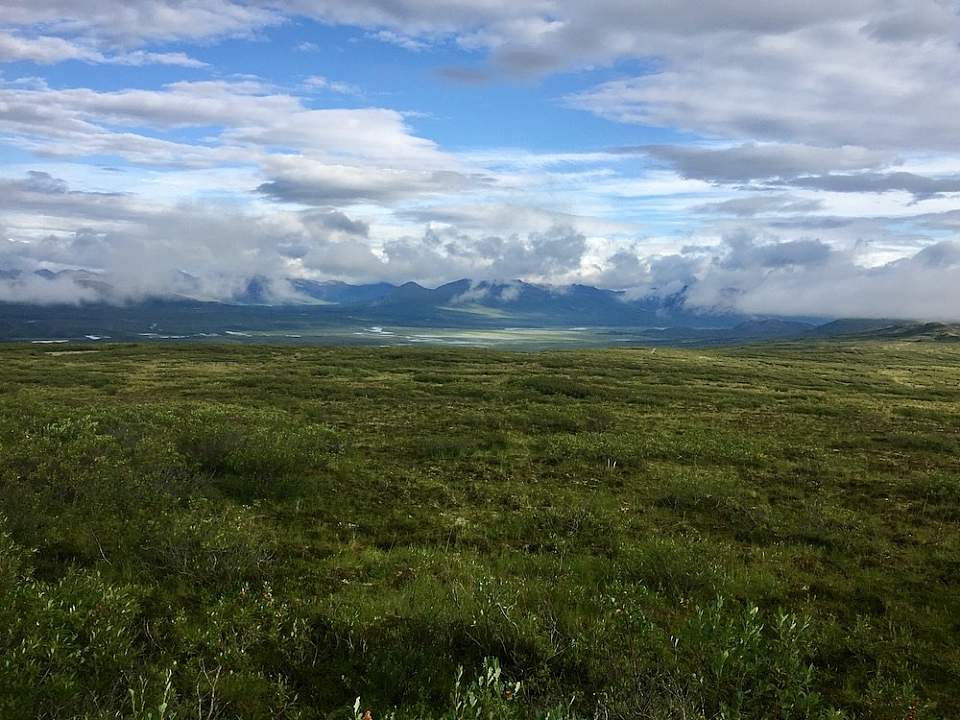
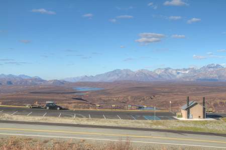
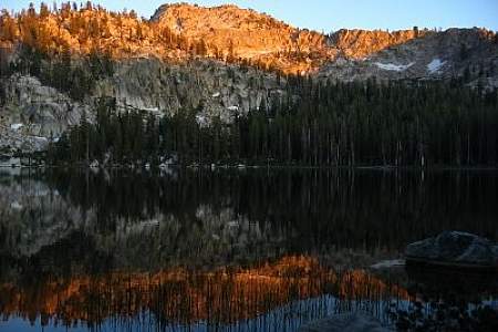
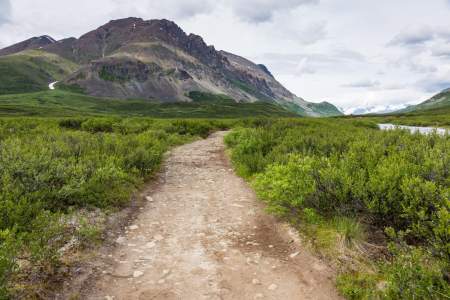
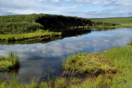
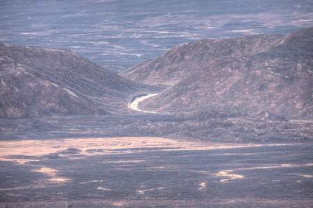
Denali Highway (:53)The Denali Highway is certainly one of the most spectacular drives in the world. Much of the route lies above timberline, so the vistas go on forever. The mountains and glaciers of the Alaska Range form a majestic backdrop, with miles of rolling tundra punctuated by shallow lakes in between.
The Denali Highway stretches 135 miles from Paxson to Cantwell, connecting the Richardson and Parks highways. Before the Parks Highway was completed in the early 1970s, the Denali Highway was the only road access to Denali National Park. The road is mostly gravel (max speed varies from 35–55 mph depending on surface conditions), and winter conditions close the road every year from October through mid-May. Because of the gravel, you'll need a rental car that allows you to drive here, like Alaska 4x4 Rentals, Alaska Overlander, Alaska Auto Rentals, or GoNorth Car & RV Rental. Depending on when you drive the Denali Highway, you may see only a few dozen cars the entire length of the road
You can drive the highway in a day, but we recommend at least one over night. There are four lodges along the highway: Tangle River Inn (MP 20), Maclaren River Lodge (MP 42), and Alpine Creek Lodge (MP 68) and Clearwater Mountain Lodge (MP 82.2). But you can camp anywhere along the highway. There are pullouts every couple miles, sufficiently large and flat even for 30+ foot RV’s.
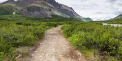
If you’re into hiking, biking, fishing, 4-wheeling, or photography, you can create a 4-7 day wilderness experience without the expense of a fly-in. Dozens of hiking and 4-wheel trails lead back into the wilderness. Clearwater streams cross the highway in many places, where you can cast a line for grayling and other fish. The landscape photography opportunities are endless. (However, the wildlife photography isn’t great, because the area is hunted heavily in the fall.
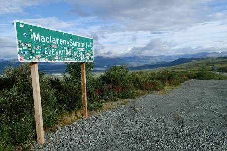
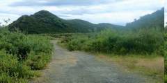
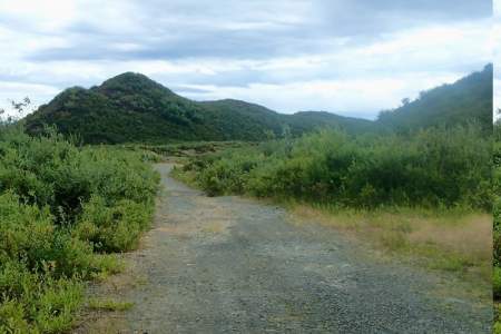
A misty view from Maclaren Summit
Many of the pullouts are in such sublime locations, that you’ll want to pull out your camp chair and take in the scene for hours. Three of our favorites are:
- Rock Creek (MP 22.5), in the heart of the Tangle Lakes Archaeological District: Camp only feet from a crystal clear stream, access the easy 3-mile hike to Landmark Gap Lake right nearby, look for archaeological sites
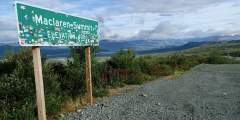
- Maclaren Summit (MP 37): The sweeping views are as if you backpacked for a week to get to a beautiful alpine clearing
- Clearwater Creek Wayside (MP 55.5): Camp at the confluence of two creeks, the main one being the 100-foot wide sparkling Clearwater Cree
If you choose this route, there are many scenic viewpoints and trails along the way. This guide covers the highlights.
Show Map
Driving Guide Points
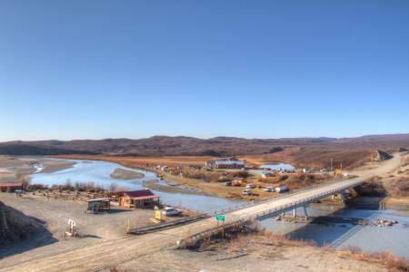
Paxson Junction (pop. 28) This small community began when Alvin Paxson opened the Timberline Roadhouse at mile 192 in 1906. His cook, Charles Meier, later opened a roadhouse at mile 170. Paxson built a larger roadhouse at mile 191 adding a barn with two sleeping rooms and a bath. Soon, a post office, store, woodhouse and small ice room were added.

The Denali Highway climbs quickly from the Gulkana River bottom land into a vast realm of brushy tundra with sweeping views of foothills, mountains, wetlands and lakes. You are dwarfed by immensity and quiet at every curve. A four-wheeler track off a pullout leads to a rise that overlooks Summit Lake and its community to the north. The view begs your attention.
A quarter-mile gravel road leads north downhill into an intimate valley with a serene lake and an unofficial boat ramp. Amid campsites, you find brush thick with blueberries in season. It’s one of scores of unmarked pullouts and access roads along the highway that lure you into secret places.
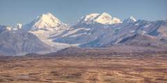
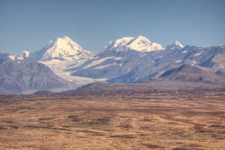
To the north is one of the state’s greatest mountain ranges, the Alaska Range. Several peaks in view have elevations greater than 12,000 feet. This range extends in a great arc from Cook Inlet through the Mount McKinley massif (a principal mountain mass) and on to the Canada border, a distance of 650 miles.
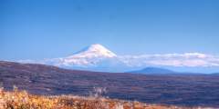
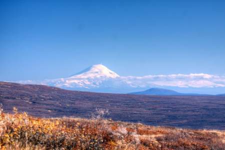
The Wrangell Mountains are about 78 air miles to the southeast. Mount Sanford (16,237’) is the prominent peak on the left, Mount Drum (12,010’) is on the right. In the center is Mount Wrangell (14,163’), which occasionally releases steam. It is the northernmost active volcano on the Pacific Rim.
This trail goes north to the northern end of Swede Lake. It then continues on to the Middle Fork Gulkana Branch Trail and another half mile to Alphabet Hills Trail. It is usually a very wet trail so rubber boots are usually recommended. Both Big Swede and Little Swede Lakes offer good opportunities for fishing. Lake Trout are found in Little Swede. Lake trout, grayling, burbot, and whitefish are found in Big Swede.
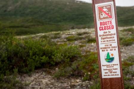
There are more than 500 archaeological sites in the Tangle Lakes District indicating that ancient people lived in this area for at least 10,000 years. Some of the densest concentrations of archaeological resources in the North American subarctic can be found here and the area is listed on the National Register of Historic Places.
This trail can be accessed via the Swede Lake Trail. It parallels the Middle Fork of Gulkana River and can be extremely wet. Rubber boots are recommended.
Located at mile 19.5 of the Denali Highway — just shy of the Tangle Lakes area — this foot trail can be strenuous. After a wet initial quarter-mile, the short steep route climbs 1,500 feet over a mile or so up the mountain to the south, delivering stunning views of the Tangle Lakes, Amphitheater Mts., and Alaska Range. No vehicles on this trail!
Tangle Lakes Campground, at Mile 21.5 of the Denali Highway, offers 41 campsites plus 4 walk-in sites in Alaska’s Interior. Managed by the BLM, it provides access to Tangle Lakes and the Delta National Wild and Scenic River. Surrounded by tundra and spruce, it features vault toilets, potable water, and a boat launch. Campers enjoy trout fishing, river floats, and spotting moose or caribou.
This BLM wayside is for day-use only (no camping) and is equipped with a picnic area and toilets. The boat launch provides access and parking for extended wilderness canoe trips in the Upper Tangle Lakes system to the south, where numerous lakes of all sizes provide important wildlife habitat.
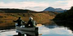
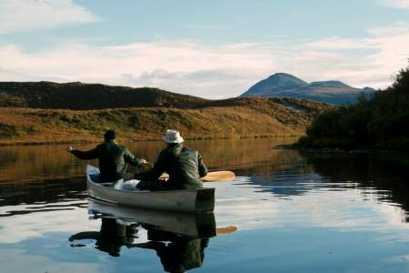
The Delta River offers diverse floating challenges, from quiet lakes to Class IV rapids. Stunning scenery, abundant wildlife, and great fishing make it a favorite. It’s a two-day trip from Tangle Lakes to mile 212 on the Richardson Highway. Beyond that, Black Rapids features Class IV rapids requiring portaging. The river then flows 30 miles of Class III and 18 miles of Class I‑II to the Tanana River.
Landmark Gap is a glacially scoured cut in the mountains that formed during an Ice Age more than 10,000 years ago. The gap was a caribou migration route and a favorite Indian hunting area in centuries past. The Nelchina caribou herd still migrates through this area.
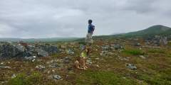
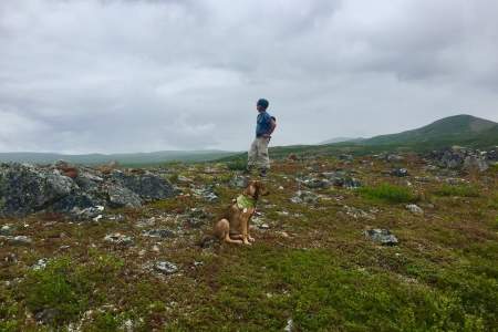
Countless paths meander into the tundra foothills above the lake. If you follow these tracks, you climb up ridges and finally reach dramatic prominences — clearings with good rock under foot and sweeping views beyond.
This trail extends approximately 3 miles to the south end of Landmark Gap Lake. The trail is rocky and dry with one marshy spot. Except after heavy rainfall, you can sidestep the marshy area without getting your feet wet. This is one of the easiest and most popular hikes in the Tangle Lakes vicinity.
At the beginning of this trail there is a muddy area. This trail travels south then branches into two. The southeast trail goes about 5 miles to a viewpoint of the upper Tangle Lakes and the southwest branch goes on 8 miles to Osar lake. Water crossings may be difficult after heavy rain.
If you’re hiking this trail to the glacier across the valley, it’s highly recommended that you not only take repellent for all kinds of critters, but that you also have a mosquito net with you. (And follow the high road where the trail splits.) Well worth the effort, it’s been described as “Tolkien’s Misty Mountains.”
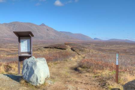
You are now at an elevation of about 4,000 feet, just a short distance from Maclaren Summit (4,086’), the second highest highway summit in Alaska. Stop and enjoy the panoramic view of the Alaska Range and the Maclaren River. Mount Hayes (13,832’) and the Maclaren River and Glacier are dominant features, but Aurora Peak, Mount Shand and Mount Geist may also be seen.
The trail starts in Maclaren Summit and travels south to the northwest shore of Osar Lake. It crosses glacial eskers and is fairly dry. The gravel trailhead area offers parking with space to bivouac for the night away from the highway.
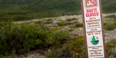
This 9.5 mile trail continues almost flat to the west end of Seventeen mile Lake, a water body tucked into the foothills. Because this trail is in the Department of Fish and Game’s Controlled Use Area, you must stay on the trails provided and not continue on where the trail ends. It is kid friendly, suitable for biking and running.
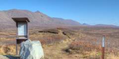
The summit area is a must stop attraction, a place unique even in Alaska for its stunning views and easy access to alpine tundra. Several pullouts offer room to safely park in a long the shoulder, but you’ll find off-road parking at the Osar and Maclaren Summit trailheads on either side of the highway just before it begins its descent. What might you do?
An ice age landform haunts the valley bottom. Construction of the highway in 1957 stripped the insulating cover from the ice-and-peat core of a partially collapsed palsa, and this road side example of a common subarctic phenomenon has been deteriorating ever since.
The lowland approaching the Maclaren River contains several geographic features with glacial and ice age origins. Look to the north side of the road for what appears to be a steep pit with a conical shape. This is an example of thermokarst.
Several small lakes and depressions in this area were formed when chunks of ice broke off retreating glaciers and were buried in the glacial debris. The ice eventually melted, leaving circular-shaped depressions called kettles.
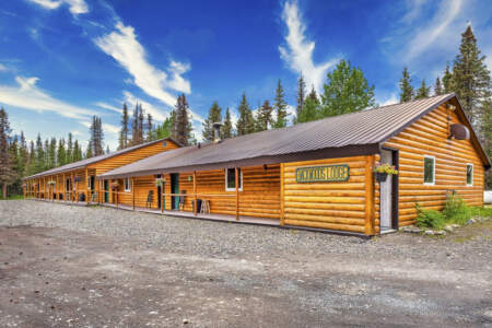
This old lodge and roadhouse has served hunters, trappers, and prospectors for half a century. It’s still open today — and is the last lodge on this highway open all winter — and still serves outdoors people of all kinds. Wifi available now!
View Maclaren Glacier 16 miles south.
Melting glaciers can leave behind ridges of gravel and sand that snake across the landscape with such perfect form that they almost seem manufactured. A gravel road leading south just before the road begins climbing into the Crazy Notch gives easy access to one of these ice-age remnants.
This notable geologic feature was formed by the Maclaren Glacier, which once flowed through this valley. The glacier deposited a buildup of rocks on either side creating a lateral moraine. A glacier stream cut through the moraine creating Crazy Notch.
MP 46.9 Denali Hwy. North Side of Road, Lake & outlet excellent for large grayling.
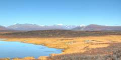
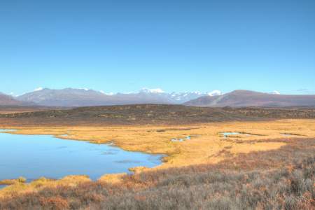
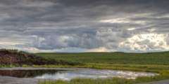
This string of lakes along the highway serves as a summer home for a great variety of waterfowl. Some, like the trumpeter swan, stay until the lake is freezing up. Several pull outs and wide spots along the shoulder allow safe parking, with many trails leading down to lakeshores. Watch for caribou crossing the highway in stretches with gaps between lakes.
Probably the best free campsite along the Denali Highway. With a large parking area next to a maintained pit toilet on the southside of the highway, and an informal parking area on the north, you can install an RV or set up a tent in many locations with a bit of privacy and then be serenaded by the melody of rushing water all night long.
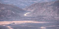
The highway mounts the spine of an esker, and follows it for a few miles — veering and curving with undulating coils of a landform deposited eons ago inside the bowels of a thousand-foot-deep glacier. It’s serpentine and a bit weird, so stylized and consistent that you might wonder if it could be the artifact of a human civilization.
The highway twines with countless feeder trails and pullouts — many pioneered and kept open by fall hunters using ATVs. But outside hunting season, these access points beg for exploration and overnight stays.
Immerse your private group in this luxury year-round lodge, surrounded by the beauty of the Alaskan wilderness just southeast of Denali National Park. Sitting on a private 75-acre plot on Yogi Lake, it offers the remote feeling of a fly-in lodge — even though it’s accessible by road in summer. Hire private guides for custom adventures, like hiking, pack rafting, canoeing, flightseeing, fishing, and bird watching. Or in winter, go cross-country ...more
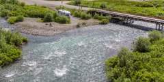
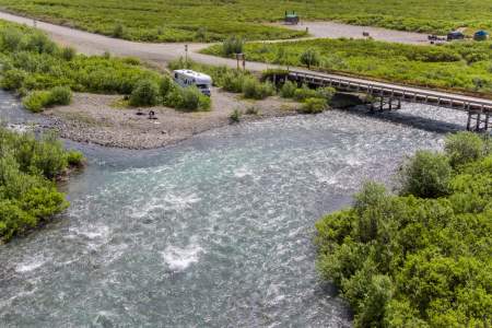
Pull off on the north side of the road as you approach the east side of the bridge, where a path leads to the shore. It’s a young river here, roiling with whirlpools and bulges. It hisses as it surges past. It’s disconcerting to realize this powerful current descends toward some of the most dangerous and challenging river rapids in the world.
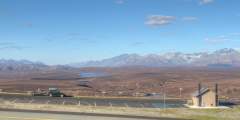
Look east across the Susitna River and you’ll see the old Valdez Creek gold mine in the foothills of the Clearwater Mountains. The mine was started by the Peter Monahan Party in 1903, triggering a small gold rush and an outpost settlement known as Denali. The original diggings and settlement are long gone.
As the highway climbs into the hills from the Susitna River Valley on its way east, it crosses from one of Alaska’s great watersheds into another. There’s no easy way to pinpoint exactly where the road crosses the divide — it’s not marked and it’s not obvious.
An unmarked side road leads down a gravel lane to a large parking area with an interpretive sign that’s a bit worse for wear. This old gravel pullout features one of the most spectacular panoramas in the state, with the Alaska Range dominating the northern horizon on clear days like a colossal snow-crowned palisade.
The old, well-appointed campground on the west bank of Brushkana Creek is very popular among seasoned Denali Highway travelers. The 22 campsites are well laid out, offering a modicum of privacy, with excellent access to the wide gravel bars along the clear-running creek and its famous grayling.
A trail beckons from the brushy expanse south of the highway, calling for a spontaneous hike or bike into unsigned wild country in search of caribou and berries and other wild critters. But only a few yards away, is an unexpected roadside display — two trees adorned with ornaments and beer cans and Mardi Gras beads, with flags and play money and business cards.
There are several spots along this stretch of the road where you can take in beautiful views looking down at the Nenana River. The road also comes right down to the river in a few spots. We like to stop here, pull out a camp chair, and cool off our tired feet in the chilly water.
During clear weather, there are excellent views of North America‘s highest peak on this six-mile section of the Denali Highway. Approximately 80 percent of its 20,320’ elevation rises above the surrounding landscape, making its base-to-summit rise greater than that of Mount Everest.
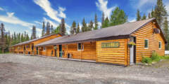
12-room, locally owned lodge 30 minutes south of Denali National Park at the intersection of the Parks and Denali Highways. This year-round accommodation provides simple but well-appointed rooms away from the main activity of the park entrance.