Things To Do In Cordova
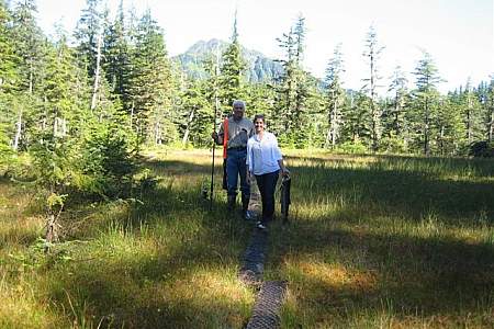
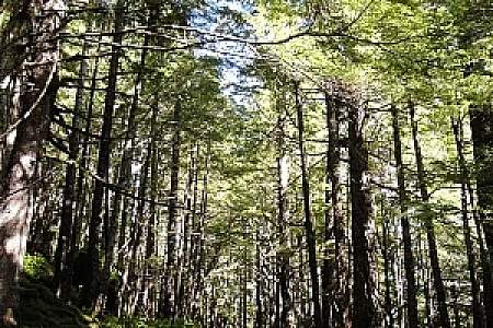
Drive the Copper River Highway
There are a few small car rental outfits available in Cordova, so reserve one well in advance.
Then travel east from Cordova across the sprawling delta to find hiking trails, wildlife viewing spots, campgrounds, canoeing, sport fishing, and birding.
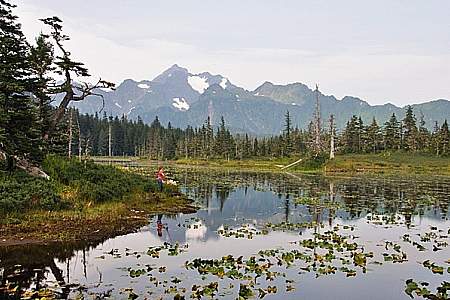
You can travel as far as mile 36, where a bridge is washed out.
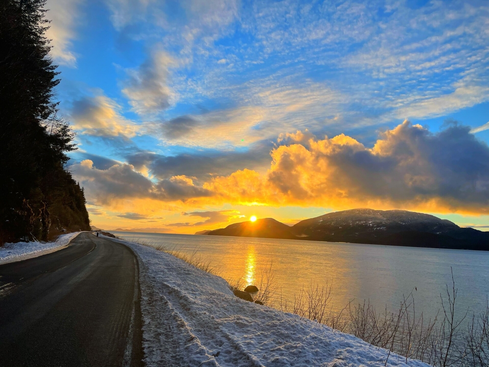
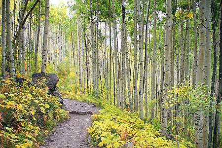
End of the road in Cordova. Photo by Brooke Broderick
View Local Glaciers
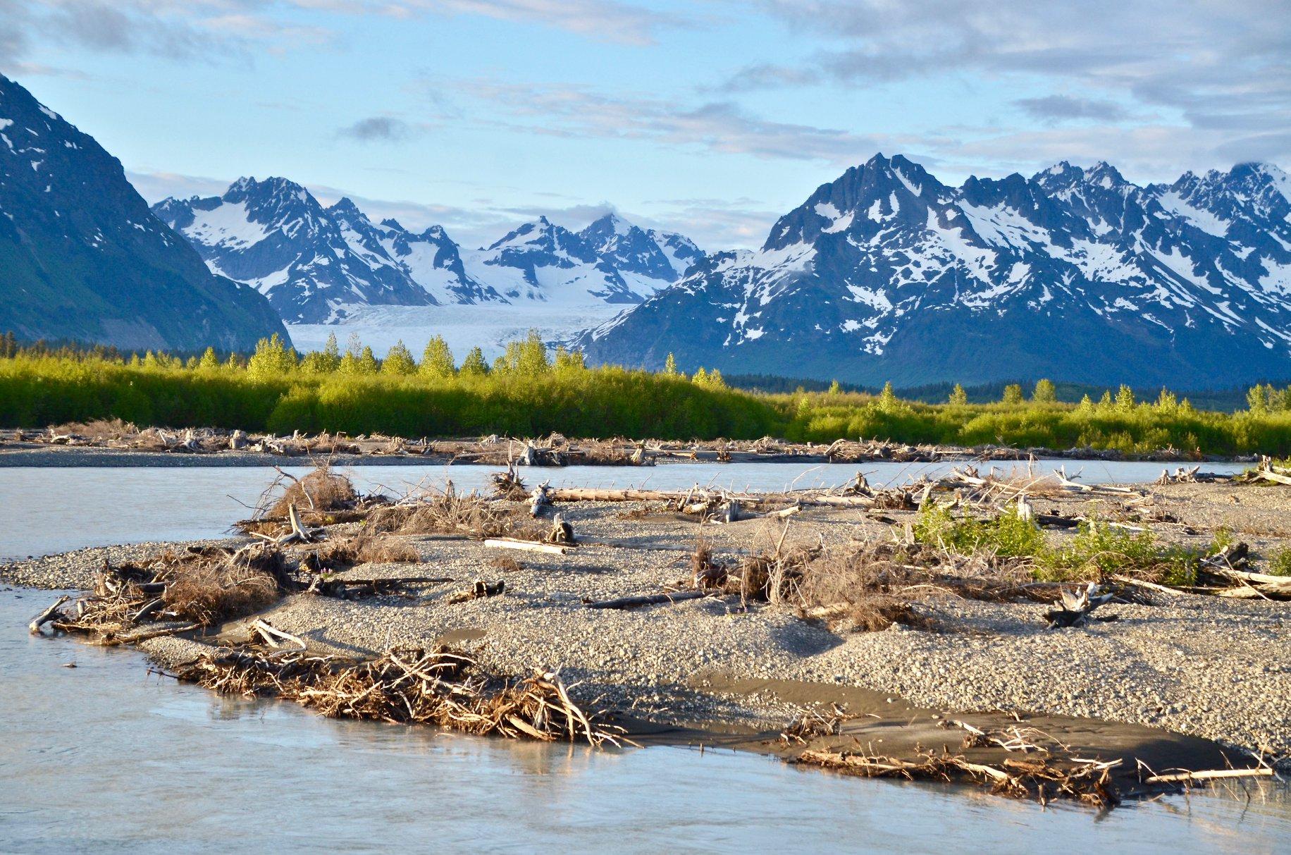
Drive out the Copper River Highway, and take the short 1.5 mile walk to see Sheridan Glacier, just past the Cordova Airport at mile 14. In winter (if conditions are right), locals hike with their ice skates to the lake’s edge, and then ice skate among bright blue icebergs that have calved off the glacier and are frozen in place.
Further down the highway at Mile 24.6 the Saddlebag Glacier Trail stretched 3.1 miles each way (for a 6.2-mile round-trip) that should take about 4.5 hours.
It’s an easy hike along flat ground that makes it doable for everyone. Mountain bikers take to the trail, too, sometimes with stand-up paddleboards to paddle out on the lake.
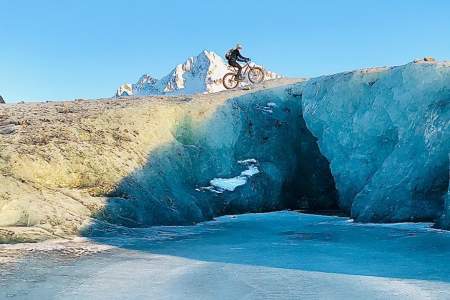
Unless you get out on the water, you won’t actually be able to see the receding glacier. But if you’re here in winter, you can walk across the lake and get right up to it. And if you come in winter, you can walk across the frozen ice
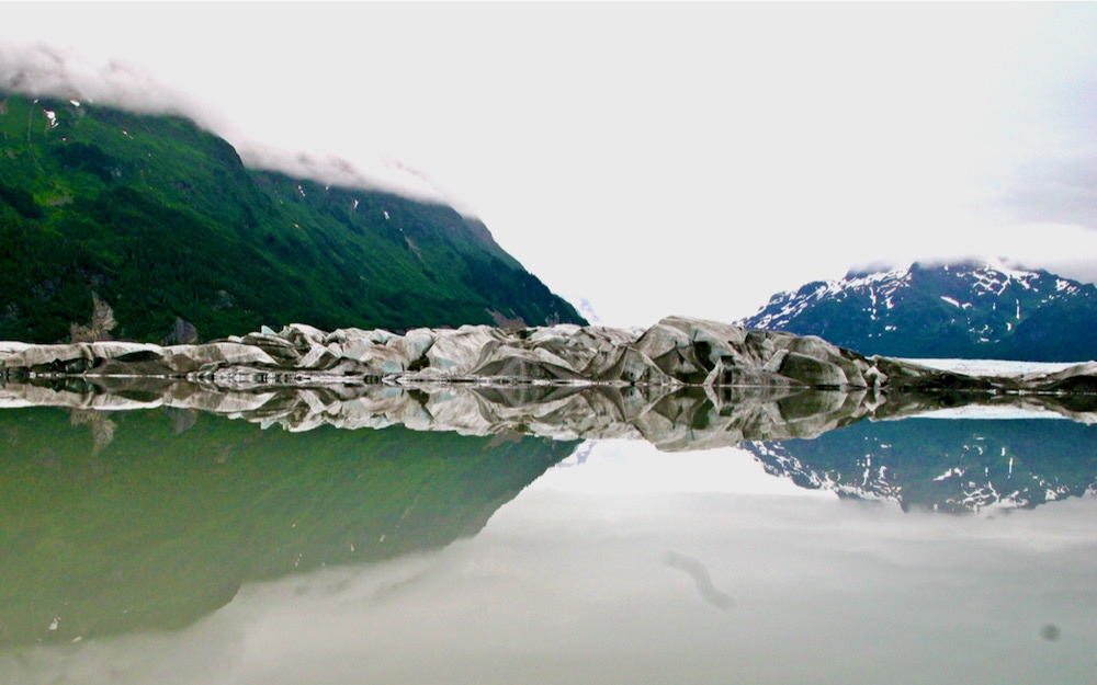
Take a short walk to see Sheridan Glacier
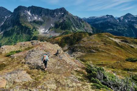
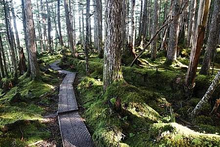
Hike
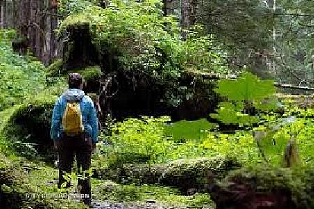
For such a remote area, Cordova has some impressive trails in the Chugach National Forest that are very well maintained by the Forest Service.
40 miles of maintained trails are road-accessible trails, and there are well over 100 miles of trail in total. And there’s an incredible variety.
You can experience muskeg meadow to alpine ridges above treeline, often in just a few miles.
Crater Lake Trail
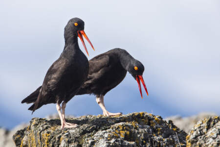
Look for Wildlife
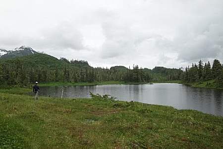
Located at Mile 17 of the Copper River Highway, the Alaganik Slough Trail provides an accessible boardwalk leading visitors to expansive wetlands of the Copper River Delta.
A wide variety of wetland animals including trumpeter swans, moose, brown bear, and shorebirds can be seen in the area, especially during the spring and fall.
In early May each year, millions of shorebirds migrate from South America to Alaska, where they stop to rest and feed on the Copper River Delta mudflats at Hartney Bay. This area also has potential for great bear viewing when the salmon are running.
Stand on the Hartney Bay Bridge and look inland.
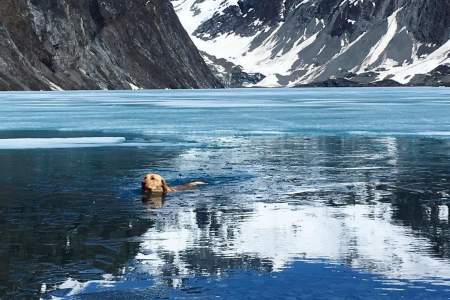
Cordova is also the sea otter capitol of the world! Look for them from Orca Inlet Road, the Cordova Harbor, or take a day cruise into Orca Inlet.
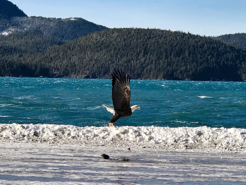
Bald eagle soaring the coastline in Cordova. Photo by Brooke Broderick
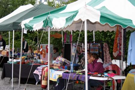
Attend a Local Festival
The Copper River Delta Shorebird Festival, held each May, celebrates the arrival of more than 5 million migratory birds. In July, the community is alive with vendors, games, races, live music and of course, good food, for the annual Copper River Salmon Jam.
In winter, there’s nothing quite like the Iceworm Festival. It’s held each year at the end of January/early February just when the days start to get long again. It’s the perfect cabin fever reliever!
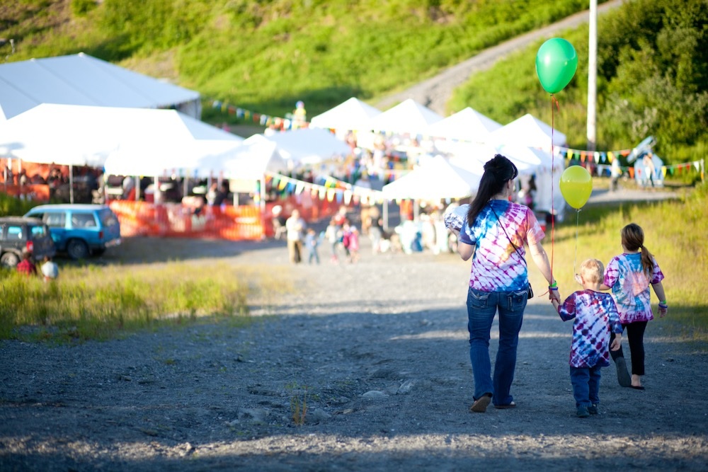
Festival in Cordova
Fishing
Cordova is home to the legendary Copper River reds (sockeye salmon) and Copper River Kings (Chinook salmon).
Go with a guide, hire a charter, or try your luck at one of many streams along the Copper River Highway that offer decent bank-side fishing.
Fish along side the Copper River Highway for Cooper Reds
Winter Magic
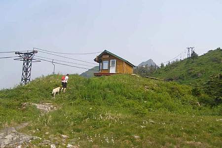
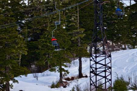
The local Mt. Eyak Ski Area is home fo one of America’s oldest single-chair lifts in the country!
Or go cross-country skiing or snowshoeing along local Forest Service trails.
Even before the snow flies, though, the cold weather in November and early December freezes the ponds along the Copper River Highway, making for magical ice skating.
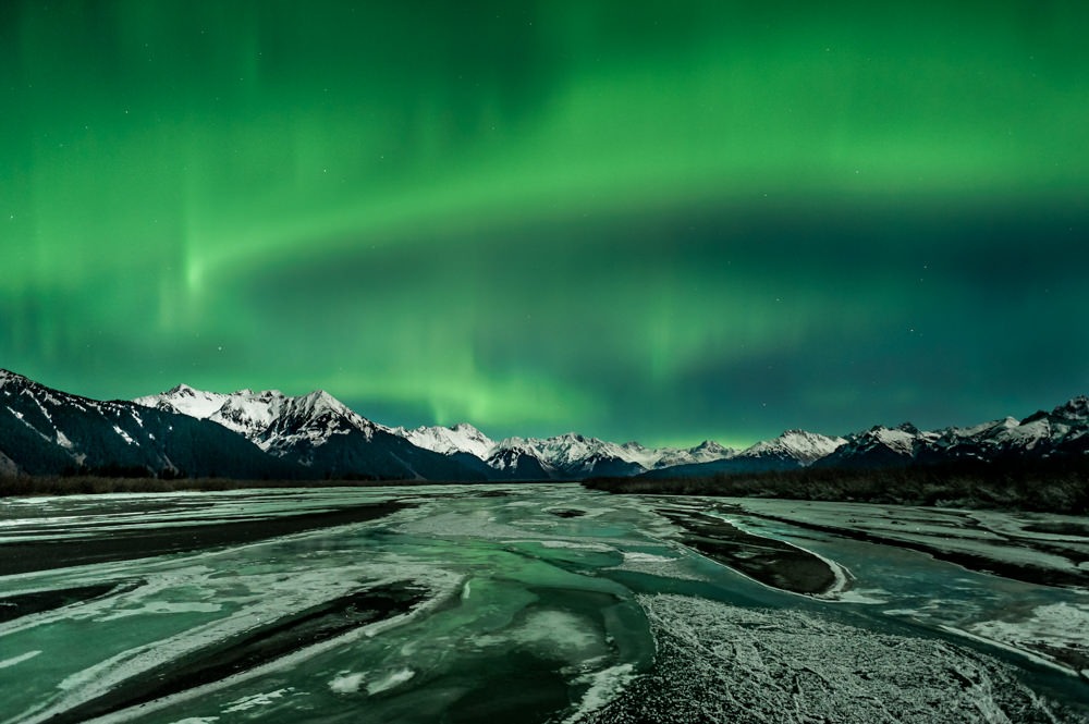
Watch the northern lights dance across the sky. Photo by Lauren Banks.
Cordova Fairs & Festivals
It’s only fitting that an Alaska fishing village throws a great salmon festival. Every year in July, the town of Cordova takes a break from fishing to turn out for the Copper River Salmon Jam. This festival aims to celebrate salmon and promote the health and sustainability of local salmon runs.
Considered one of Alaska’s top birding events, this annual festival during early May celebrates the arrival of more than 5 million migratory birds on the Copper River Delta east of Cordova.
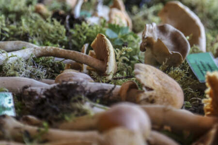
This annual three-day event celebrates the Cordova region’s abundant crop of wild mushrooms with classes, art and handcraft sessions, expert talks, kid’s activities and daily-guided trips into the rain forest foothills and the Copper River Delta.

Cordova’s oldest festival — which started back in 1961 — is about offering a cure for the winter blues. This weeklong festival happens during the hopeful time of year when the days are starting to get longer!
Cordova Points of Interest
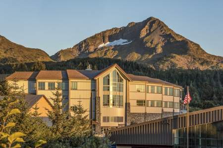
The Cordova Center is a sustainably built, state-of-the-art facility featuring meeting and event spaces. It can hold groups of up to 200 people and it blends perfectly into its surroundings, with big windows that look out onto Orca Inlet and Hawkins Island. Once work is done, it’s a landscape your group will want to explore!
Bald eagles. Brown bears. Black bears. Humpback whales. Orcas. Stellar sea lions. Harbor seals. Sea otters. Moose. Wolves. 200,000 seabirds of over 220 different species. You can find this impressive collection of iconic Alaskan animals right in Prince William Sound. Here’s where to go in each town for the best wildlife-viewing opportunities!
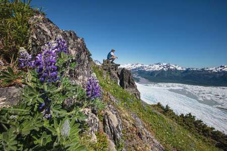
In Prince William Sound you’ll find some 150 glaciers packed into an area just 70 miles wide. These are the few that you shouldn’t miss!
Here’s our list of the best wildlife viewing spots in Cordova. Search for salmon, shorebirds, and more.
This 1.5‑mile hike is an easy stroll down to the lake that offers a great payoff in the form of a gorgeous glacier. If you’re here in winter and the conditions are right, it’s a great spot for wilderness ice skating, fat biking, or cross-country skiing!
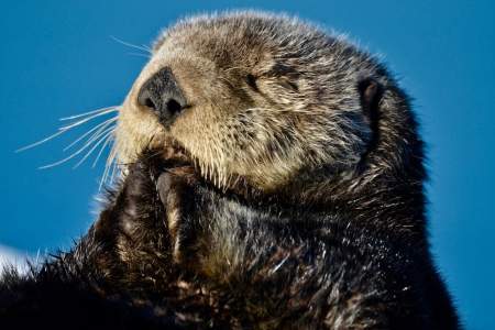
Cordova is the sea otter capitol of the world. They pup year-round, and there are many great places to see them!
NOTE: The Copper River Highway is currently closed beyond mile 36, where there is a failed bridge. As of this time, the road does not go beyond that point. The 49.5 mile Copper River Highway leads from the town of Cordova to the Million Dollar Bridge. The Million Dollar Bridge was once used by the railroad to haul copper from Kennicott to the port of Cordova, and was added to the National Register of Historic Places in 2000. Aside from the ...more
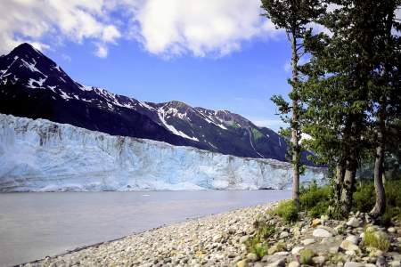
This very active glacier forms a wall along the fabled Copper River near a historic railroad route that once serviced the world’s largest copper mine. NOTE: A bridge at Mile 36 of the Copper River Highway is currently (2020) impassable, with repairs not expected for several years. Child’s Glacier is not currently accessible by road. Contact Cordova Ranger District for current venders providing transportation options to the far side. ...more
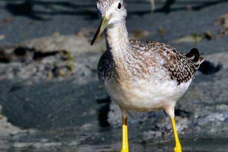
Every year, millions of shorebirds migrate from South America to Alaska, where they stop to rest and feed on the Copper River Delta mud flats at Hartney Bay. This area also has potential for great bear viewing when the salmon are running.
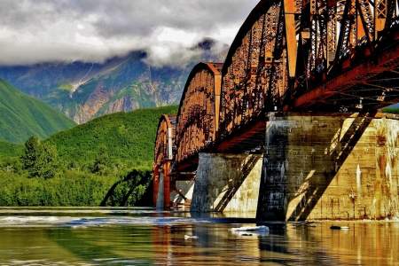
Construction of this early-1900s bridge cost a whopping (at the time) $1.4 million, which earned it the nickname Million Dollar Bridge. But the bridge quickly earned its keep, allowing the railroad to haul copper from Kennicott to the port of Cordova.
Eight signs will guide you through the Copper River watershed landscape. See if you can visit all eight signs on your tour through this upriver basin formed by the ancient, glacial Lake Atna!
Explore the Wild World of the Copper River Delta. In this Audio Guide, you’ll get to learn about carniverous plants, mushrooms that hunt their prey, and find out why Cordova is one of the best places in the world to see migrating shorebirds.
Cordova Museums & Cultural Centers
With exhibits, lore and its own orca whale skeleton, this museum on the Cordova waterfront celebrates the culture, art, history and ecological wisdom of the region’s rich Native heritage.
This cozy, well-regarded museum in the heart of downtown Cordova will bring you up to speed on the community’s natural history, Native and pioneer heritage, and a tumultuous modern era that included the Great Alaska Earthquake of 1964 and the 1989 Exxon Valdez oil spill in Prince William Sound.
Cordova Historic Sites
Construction of this early-1900s bridge cost a whopping (at the time) $1.4 million, which earned it the nickname Million Dollar Bridge. But the bridge quickly earned its keep, allowing the railroad to haul copper from Kennicott to the port of Cordova.
Look to the south and you’ll see a WWII era building. Troops were stationed at Cordova.
Eight signs will guide you through the Copper River watershed landscape. See if you can visit all eight signs on your tour through this upriver basin formed by the ancient, glacial Lake Atna!
Cordova Parks & Trails
6.2 round-trip easy hike through the Chugach National Forest to a glacial lake. Popular in winter for fat biking and ice skating. In summer, hiking and paddleboarding.
This 4.1‑mile trail starts through forest and muskeg meadows. You’ll cross a beautiful bridge over a creek that in mid-July and August is full of spawning chum salmon Then once you’re at the top take in views of Cordova, Nelson Bay, and Prince William Sound.
This 1.5‑mile hike is an easy stroll down to the lake that offers a great payoff in the form of a gorgeous glacier. If you’re here in winter and the conditions are right, it’s a great spot for wilderness ice skating, fat biking, or cross-country skiing!
This is a lightly sloping trail that parallels the Scott Valley and passes the shores of large and small lakes. The trail passes through an area that was previously logged. It is not a well-maintained trail.
An easy trail, about 0.6 miles long, that will take about 1 hour to hike and leads you to excellent views of Child’s Glacier. Important note: While the Forest Service still maintains it, you can’t get here by car, as the Copper River highway is washed out at Mile 36. You can only access the trail by hiring a boat or a plane from town.
This is a steep climb that ends where Crater Lake sits. The first half climbs over rocky sections with numerous switchbacks, with muddy areas and wood bridges. The second half continues to climb, but at a much nicer grade. At mile 1.2 there is an intertie to Ski Hill trail and at the lake there is the option to hike the Alice Smith Intertie. The entire loop from Crater Lake to Power Creek Trailhead is 12 miles. Along this trail there is good… ...more
The first mile and a half of this trail leads up over rocky slopes that offer a great view of Eyak Lake and the Orca Inlet. At this point the trail splits in two and the hiker has a choice of going around the south end of Mt. Eyak or climbing straight up to the top.
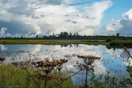
Located at Mile 17 of the Copper River Highway. An accessible boardwalk leads visitors to stunning views of both the expansive wetlands of the Copper River Delta and the surrounding mountains. A wide variety of wetland animals including trumpeter swans, moose, brown bear, and shorebirds can be seen in the area, especially during the spring and fall. The first half of this trail is paved with geoblock, so that it does not have a negative… ...more
Discover year-round recreation above Cordova on this gorgeous mountain. In winter, you can lose yourself among the puffy snowdrifts and powder-covered trees as you schuss down the slopes. And in the summer, you’ll find berry picking, hiking, and festivals.
This is an easy 2.4‑mile hike with excellent fishing for sockeye, Dolly Varden and cutthroat. You’ll find access to McKinley Trail and McKinley Lake public use cabins. It is a well-maintained trail that has several bridges for easy stream crossings and interpretive signs to explain the trail’s history.
This very active glacier forms a wall along the fabled Copper River near a historic railroad route that once serviced the world’s largest copper mine. NOTE: A bridge at Mile 36 of the Copper River Highway is currently (2020) impassable, with repairs not expected for several years. Child’s Glacier is not currently accessible by road. Contact Cordova Ranger District for current venders providing transportation options to the far side. ...more
This trail has impressive views of the Chugach Mountains. Short spur trails offer access to five small lakes that are excellent for cutthroat fishing.
The 3.3‑mile long trail is mostly boardwalk over muskeg. This is an excellent spot to bird-watch, look for waterfowl feeding on Eyak Lake. Trumpeter swans frequent this lake. Most fly south for the winter however, up to 100 swans will winter here in this ice-free lake.
This ridge route has amazing views of Prince William Sound, Eyak Lake, and the Copper River Delta. About halfway down the trail, there is small shelter available for day use or overnight camping. It is available on a first-come first-serve basis.
This ski trail weaves through muskeg and forest and gradually gains elevation until it ends. The trail leads to a high muskeg that overlooks the Copper River Delta, Heney Range and the Gulf of Alaska. This trail is very wet during all seasons excluding winter and is not a hiking trail.
This trail follows Power Creek then leads it’s hikers up multiple switchbacks. Midway, the Cordova Electric Hydropower Dam Can be seen from the trail. The last half passes by many beaver ponds and hanging glaciers.
This is an easy .8‑mile boardwalk trail with lots of stairs. The boardwalk leads to overlook of the Copper River Delta with many signs. Be sure to bring your camera, this is a great place to see moose and bear.
The hike begins through the forest before it begins to climb. There are rock cairns to help guide you along the way. From the top, you’ll have impressive views of the Sheridan and Sherman glaciers.