Copper River Highway (Cordova to Bridge)
The 49.5 mile Copper River Highway leads from the town of Cordova to the Million Dollar Bridge. The Million Dollar Bridge was once used by the railroad to haul copper from Kennicott to the port of Cordova, and was added to the National Register of Historic Places in 2000. Aside from the bridge, there are several highlights along this fairly short highway, such as great trails and scenic lookout points.
Not all rental vehicles are allowed on this road, so check with your rental agency before you travel. Or, rent from a company that allows their vehicle on gravel roads, like Alaska Auto Rental, Alaska 4x4 Rentals, or Alaska Overlander.
NOTE: The Copper River Highway is currently closed beyond mile 36, where there is a failed bridge. As of this time, the road does not go beyond that point.
Show Map
Highway Guide
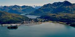
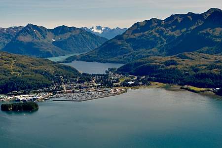
Cordova is known in to the locals as Alaska’s hidden treasure. It’s a small, hard-working fishing community with a population of about 2,270. Located near the mount of the Copper River, it nestles peacefully at the head of Orca Inlet in Prince William sound and has a mystique all its own. In the area are glacier-carved mountains, wildlife-rich wetlands, lush forests, and countless waterways that host many exciting activities such as skiing,… ...more
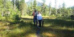
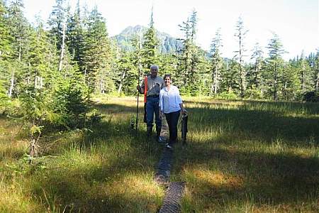
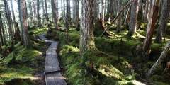
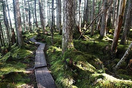
The 3.3‑mile long trail is mostly boardwalk over muskeg. This is an excellent spot to bird-watch, look for waterfowl feeding on Eyak Lake. Trumpeter swans frequent this lake. Most fly south for the winter however, up to 100 swans will winter here in this ice-free lake.
Watch for wildlife in this aquatic area, look for the beaver lodge. Beavers are common on most lakes and marshes all over Alaska.
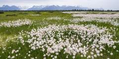
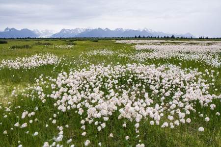
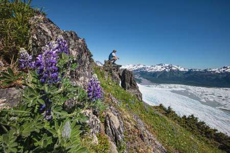
There’s a covered pavilion here with interpretive plaques about the Chugach National Forest area and the Copper River Delta. The Copper River Delta is the largest continuous wetland on the west coast of North America.
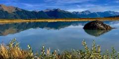
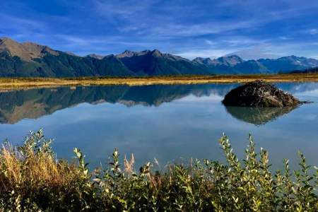
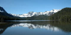
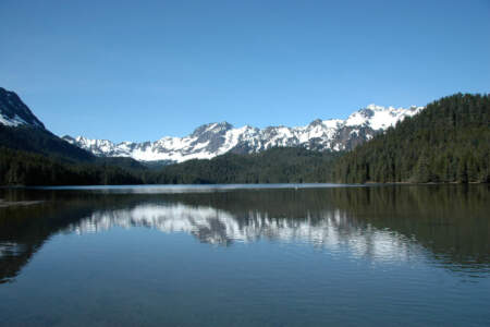
This 1.5‑mile hike is an easy stroll down to the lake that offers a great payoff in the form of a gorgeous glacier. If you’re here in winter and the conditions are right, it’s a great spot for wilderness ice skating, fat biking, or cross-country skiing!
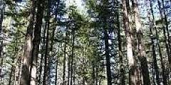
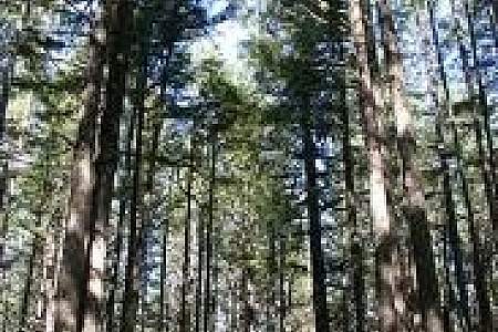
The hike begins through the forest before it begins to climb. There are rock cairns to help guide you along the way. From the top, you’ll have impressive views of the Sheridan and Sherman glaciers.

Look to the south and you’ll see a WWII era building. Troops were stationed at Cordova.
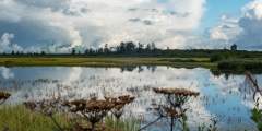
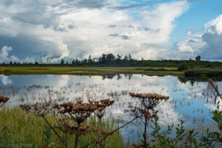
Located at Mile 17 of the Copper River Highway. An accessible boardwalk leads visitors to stunning views of both the expansive wetlands of the Copper River Delta and the surrounding mountains. A wide variety of wetland animals including trumpeter swans, moose, brown bear, and shorebirds can be seen in the area, especially during the spring and fall. The first half of this trail is paved with geoblock, so that it does not have a negative… ...more
This ski trail weaves through muskeg and forest and gradually gains elevation until it ends. The trail leads to a high muskeg that overlooks the Copper River Delta, Heney Range and the Gulf of Alaska. This trail is very wet during all seasons excluding winter and is not a hiking trail.
This is an easy .8‑mile boardwalk trail with lots of stairs. The boardwalk leads to overlook of the Copper River Delta with many signs. Be sure to bring your camera, this is a great place to see moose and bear.
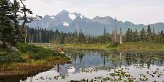
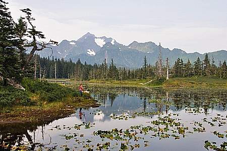
This trail has impressive views of the Chugach Mountains. Short spur trails offer access to five small lakes that are excellent for cutthroat fishing.
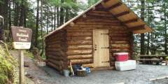
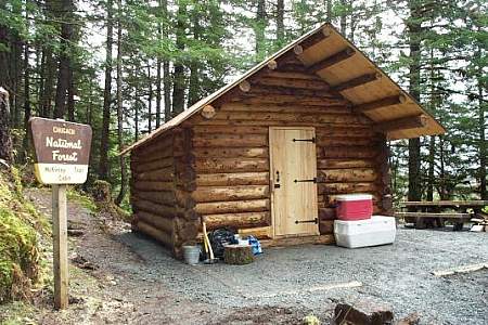
This is an easy 2.4‑mile hike with excellent fishing for sockeye, Dolly Varden and cutthroat. You’ll find access to McKinley Trail and McKinley Lake public use cabins. It is a well-maintained trail that has several bridges for easy stream crossings and interpretive signs to explain the trail’s history.
While on the highway look for the McKinley Lake Cabin sign and trailhead. From the trailhead, a 2 1⁄2 mile hike will take you to the Forest Service public cabin. Sockeye salmon viewing opportunities exist here and at the location another 75 yards past the cabin. Salmon viewing at this location is from mid July to mid August with best viewing in late July or early August.
Check Availability
Look for the channel to a beaver pond. The channel provides access to the pond for silver salmon fry and can support up to 25,400 young salmon. The fallen trees and brush provide cover from predators. Here you will also find access to Saddlebag Glacier USFA Trail, a 3‑mile trail to Saddlebag Lake, this is the best trail for mountain biking in the district.
6.2 round-trip easy hike through the Chugach National Forest to a glacial lake. Popular in winter for fat biking and ice skating. In summer, hiking and paddleboarding.
Here is a great view of Copper River. Take the short walk to a monument dedicated to the men who built the bridges to the islands that you see here. This monument especially dedicated to the crane crew who lost their lives on July 21, 1971.
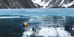
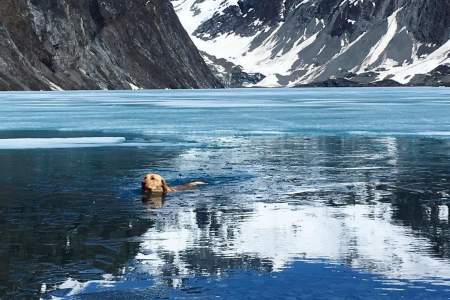
This is the main flow of Copper River, known for its wild salmon runs; in fact this is one of the most prized stocks of salmon in the world. Watch for harbor seals as they follow the salmon runs up the Copper River as far as Childs Glacier. You’ll see them bobbing along the river or resting on ice flows.
Currently not accessible due to washout at mile 36
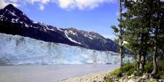
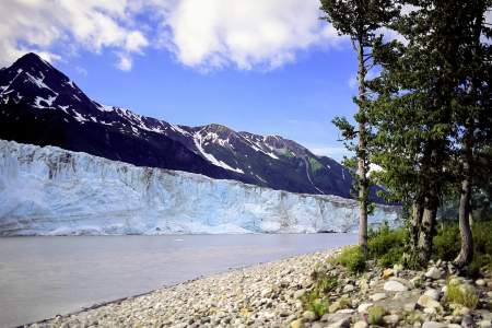
This very active glacier forms a wall along the fabled Copper River near a historic railroad route that once serviced the world’s largest copper mine. NOTE: A bridge at Mile 36 of the Copper River Highway is currently (2020) impassable, with repairs not expected for several years. Child’s Glacier is not currently accessible by road. Contact Cordova Ranger District for current venders providing transportation options to the far side. ...more
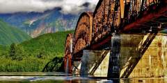
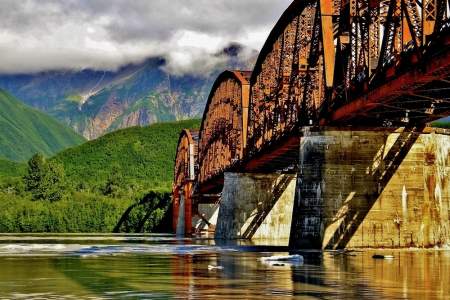
Construction of this early-1900s bridge cost a whopping (at the time) $1.4 million, which earned it the nickname Million Dollar Bridge. But the bridge quickly earned its keep, allowing the railroad to haul copper from Kennicott to the port of Cordova.