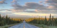
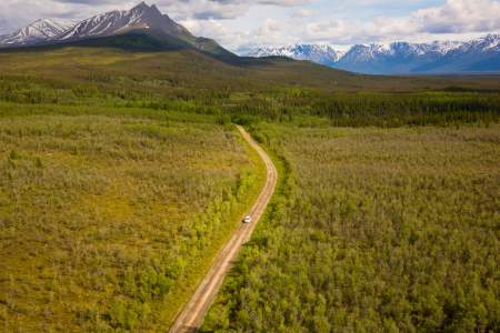
Glennallen to McCarthy
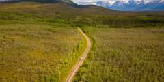
A little less than half of the 127 mile trip from Glennallen to McCarthy involves paved roadways, and the gravel surface of the McCarthy Road makes the trip slow going. However, if you’re prepared for any conditions (stop by the Chitina Ranger Stations, and be sure to bring a spare tire and jack!), the drive from Glennallen to McCarthy is well worth the effort. The drive is one of two access points to Wrangell-St.Elias National Park, and takes you through a number of small towns with a strong sense of history. Start in Glennallen, a town used to visitors passing through, then through Chitina to count the painted ghosts on the buildings in town. Lastly, take the bumpy McCarthy Road to see McCarthy and Kennicott, two small pioneer towns where time seems to have stood still.
Not all rental vehicles are allowed on this road, so check with your rental agency before you travel. Or, rent from a company that allows their vehicle on gravel roads, like Alaska 4x4 Rentals, Alaska Overlander, or Alaska Auto Rental.
Show Map
Road Guide
Glennallen to McCarthy
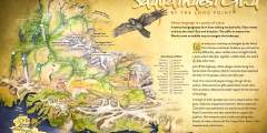
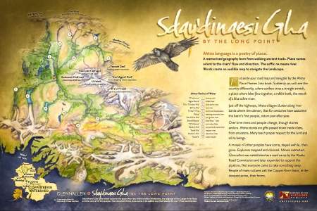
The town of Glenallen is named after two early explorers. Henry Allen was a lieutenant who travelled through this area in 1885 on his way to the Yukon River, and Capt. Edwin Glenn was part of the U.S. Government survey crew for the Richardson Highway that came through in 1898 – 99. Glennallen is also a part of the Copper River Watershed. Find the interpretive sign at the visitor’s center and orient yourself in the watershed with a map of Ahtna ...more
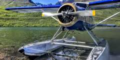
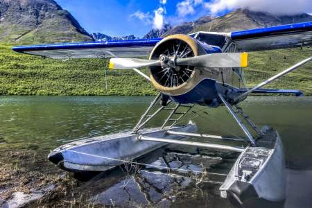
Year-round air service from Glennallen, Alaska. Short on time? Check Alaska’s largest national park off your list with a flightseeing tour that includes a landing in the wilderness of the park. Traveling to McCarthy / Kennicott? Travel like the locals and hop on a mail plane flight. See how backcountry mail is delivered and enjoy speedy transportation to McCarthy. Or, opt for their scheduled air service. Both have departures from Anchorage and ...more

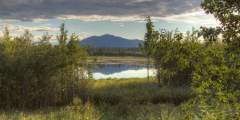
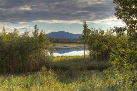
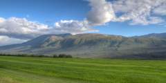
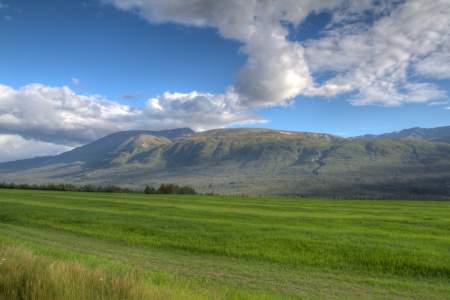
Just outside Glennallen you’ll find some great views of the Copper River and the Wrangell Mountains, as well as the chance to take some photos that don’t include any roads or buildings. Mt. Drum will be straight in front of you, with Mt. Sanford on the left side, and Mt. Wrangell— a massive shield volcano — on the right. Cloud cover is the only way you’ll miss this dramatic scene. And these mountains are definitely dramatic. The western… ...more
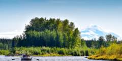
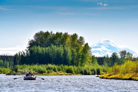
Exploring the rivers of Copper Center, around 4 hours from Anchorage and right on the edge of gorgeous Wrangell-St. Elias National Park, brings opportunities for everything from mild floats to Class III and IV rapids. Since the Copper River Basin is a little more remote than other areas, you’ll be able to truly appreciate the wilderness as you enjoy a relaxing day on the water.
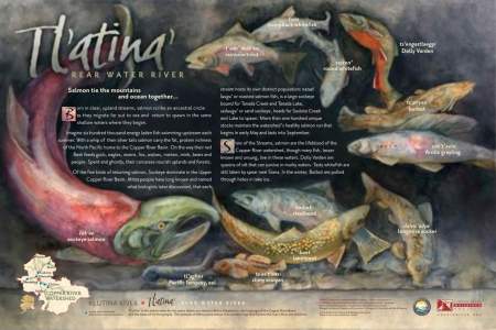
Historic Copper Center is one of the oldest non-native communities in Alaska’s Interior. Founded as a government agricultural experimental station, it later served as a transportation center for gold rush prospectors. Also find the interpretive sign where you’ll learn about the local fish species that make their home in different habitat niches of Copper River watershed creeks and rivers.
Get a taste of early 19th-century Alaska in Copper Center. This small community located at the confluence of the Klutina and Copper Rivers, was established in 1898 as a camp for prospecting gold miners. After the Richardson Highway route opened in 1900, roadhouses sprung up every 15 to 20 miles, providing services for travelers between Valdez and Fairbanks. You could get meals, lodging, mail service, medical help, hay for your horse, gasoline… ...more
Route 4 from Valdez to Delta Junction, Route 2 from Delta Junction to Fairbanks. Speed Limit: 50 – 60 mph, except 45 mph in Thompson Pass section
Kenny Lake (pop.500) Kenny lake was established in 1910 as an Alaska Road Commission Roadhouse for the Valdez-Fairbanks-Chitina Military Road. Today it is a small farming community where residents lead a self-sufficient lifestyle harvesting fish, game, berries and organic produce.
A 25-foot wide, 17b Easement that provides foot access to the bluffs overlooking the scenic lower Tonsina River. The trail is approximately 2 miles and is excellent for hiking. There is parking at the trailhead.
This trail follows an old road along the Copper River and has excellent views of the glacier along the way. The trail starts out in a section of thick vegetation, then follows the river until it reaches Childs Glacier Recreation Area. In early summer, this is the place to be for birdwatching.
This is an easy, well-marked BLM trail that leads 1.3 miles south through the spruce forest to a picnic site overlooking the Tonsina River. You’ll enjoy stunning views of the Chugach Mountains and the abundant wildflowers here.
In the summer, there may be fresh produce and homemade baked goods available at a roadside stand to the north. The stand is operated by SAPA, a Pentecostal Christian community of about 70 people. Pull over and enjoy the Alaskan hospitality and tasty treats. SAPA also runs a successful local sawmill.
Most fields are planted in hay. Watch for yaks grazing in the fields south of the road along here. These Tibetan natives are ideally suited for the Alaska climate. Stop by the Yak farm and learn why they are an economical alternative to raising cattle.
Only a short distance of 5 to 8 miles separates you from the braided upper Copper River.
The first part of this trail is a bit steep, but once you’re out of the spruce forest, the rest of the hike is pleasant and takes you along the ridge. Once on the ridge, there are places where the trees open up and there are great views of the surrounding mountains. The official trail ends at mile 1.7, but you can continue another 0.25 miles to the lake and even further on unbroken trails.
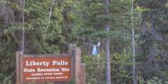
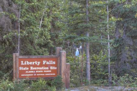
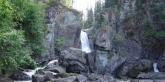
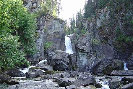
Liberty Falls Campground, at Mile 23.5 of Edgerton Highway in Alaska’s Copper River Valley, offers 10 tent-only sites near Liberty Creek. Managed by Alaska State Parks, it features vault toilets, tent platforms, picnic tables, and scenic views of Liberty Falls from a nearby bridge. Surrounded by spruce forest, it’s ideal for fishing grayling, hiking to the falls, or exploring Wrangell-St. Elias National Park.
A 25-foot wide, 17b Easement that provides foot access to excellent views of the Wrangell Mountains and Copper River. The one mile trail is in good condition but fairly steep. There is parking at the trailhead.

Watch for community fish wheels on the Copper River, they can be very interesting to watch and photograph. Keep in mind, it is illegal to walk on the fish wheel platforms or touch the fish if you do not have a license for the wheel.
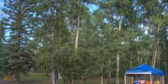
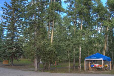
This is the airport where travelers take a 30-minute flight into McCarthy instead of driving the McCarthy Road.
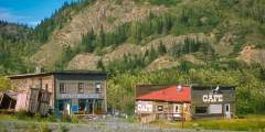
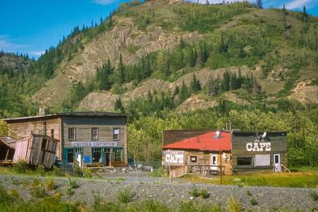
Chitina (pop. 105) came to life almost overnight with arrival of the Copper River & Northwestern Railway on September 11, 1910. The railway was built to haul ore from Kennicott Copper Mines at McCarthy to Cordova for shipment to Seattle. Chitina became a supply town for both the railway and the mine. When the mine closed in 1938, Chitina became a ghost town almost overnight. In the 1950s and 1970s, ghosts were painted on some of the old ...more
The rock cut you’re about to drive through was blasted out in 1909 as a railway to supply and support the Kennecott Copper Mines when they were being built. The railroad began in Cordova and followed the Copper River to current day Chitina before turning through the rock cut and heading east towards the Wrangell Mountains.
There’s a story about a local pioneer who in the 1950’s walked the entire way to McCarthy from Cordova. Across the Copper River was a steel cable, the current bridge having not been built until 1973.
How do you fish in a river full of glacial silt? The easiest way is to use the iconic fish wheel — long associated with Alaska Native subsistence. See them in action in the Copper River near Chitina.
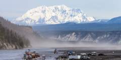
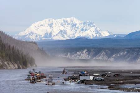
You’re now looking at the Chitina River just before it merges with the Copper River and disappears out of view. The braided Chitina below actually carries more water than the Copper River, despite losing the name battle. (It’s actually more of a name tie, though, as Chitina is the native word for copper.) Heavy rains, floods, and outbursts from glacially-dammed lakes can fill the riverbed, in comparison to the channels you’re likely seeing… ...more
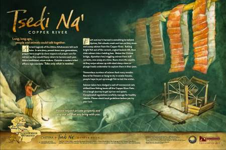
At this point in the drive you may need something to talk about.The Athabascan people traveled along the current McCarthy Road corridor to access their summer hunting camps in the Chugach Mountains. Their trails took them to prime mountain sheep country, as well as to some of their favorite spots for harvesting copper. One copper nugget taken from Dan Creek, almost pure and as big as a refrigerator, now sits in a museum at the University of… ...more
Walk in public fishing access to Silver Lake and Van Lake; you’ll find wonderful scenery and good rainbow trout fishing in both lakes.