Wrangell St. Elias Nat’l Park Points of Interest
Show Map
Points of Interest

Volcanoes not only shaped the face of Alaska but also make for spectacular sights. Here are the top volcanoes to look for and photograph during your Alaska vacation.
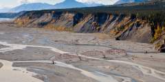
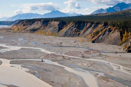
Built in the 1920s, this bridge helped prospectors cross the Nizina River and reach the gold camps at Chititu Creek and Dan Creek. The glacier-dammed lake near here caused flooding with some regularity — and as result, would wash out the bridge with some regularity.
This classic swimming hole is a local favorite — it’s the perfect spot to relax on a hot summer day. You’ll find it at the second footbridge, a 5‑minute walk from the Kennicott River, where you can park your car. Lounge on the beach or even go swimming — the water’s relatively warm when the sun is shining. While here, you can also explore near the toe of Kennicott Glacier and find all sorts of interesting glacial features, including a terminal… ...more
“4‑Mile” Road leads into the Slana Settlement, created in 1983 when the BLM opened over 10,000 acres north of the road to homesteading. It was one of the last opportunities for homesteading federal land. Eight hundred claims were filed, but most were soon abandoned. Alaskan winters took their toll. Many tried to live in hastily-built cabins and tents, with temperatures down to ‑60 degrees F. Jobs were scarce and the climate was not suited to… ...more
Maybe the cliffs aren’t a full mile high, but this area in Wrangell-St. Elias offers lofty scenery and a nice spot to hike or camp. Near the Nizina River and Nizina Glacier, the vertical cliffs are about 400 – 500 feet high and comprised of exposed limestone, with some beautiful waterfalls flowing off of it. You can get dropped off by a bush plane or air taxi nearby so that you can go hiking along the riverbed or even on the end-moraine of the… ...more
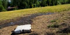
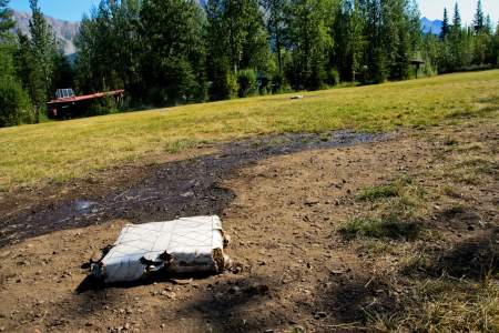
Known in town as “The Toe,” this area — the toe of the glacier — is a large open space at, yes, the toe of the glacier. It’s also relatively hidden, so you won’t find many people here. What you will find: a lake that’s formed below the ice, the spectacular display of rocks falling off the ice into the water, and, sometimes, a party or concert (an abandoned flatbed truck serves as the stage). There’s also space for camping — even a Park Service bear… ...more
At mile 14.5 McCarthy Road, turn left on the access road and follow it 2.5 miles to Nugget Creek and Dixie Pass trailheads. These remote trails offer visitors the chance to explore the wilderness and embark on an adventure they will never forget!Ask a park ranger for more information and trail descriptions.
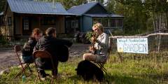
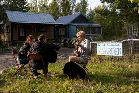
The Wrangell Mountain Center is a nonprofit organization dedicated to wilderness education and creative arts, housed in the old hardware store; stop by and see if any events are being held during your visit. There’s a kiosk out front with a schedule that often includes free lectures by visiting biologists, artists, naturalists, and students. Activities include early morning bird walks, gardening lessons, open-mic poetry jams, films on local… ...more
Looking for a mellow 3- to 4‑hour walk and a nice spot to relax with a book or a journal? Check out McCarthy Creek. To get here, just walk straight through McCarthy’s Main Street, past Ma Johnson’s Hotel (on the left), down the hill, and past the Wrangell Mountain Center.
This 525-foot-long bridge was built in 1911 during the dead of winter (with temperatures dipping to –60°F) as the railroad pushed to complete the line by spring. Copper was piling up in Kennicott and the pressure was on.
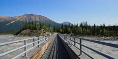
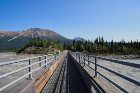
Locals say that “where the road ends, the adventure begins,” and the McCarthy Road (an adventure in itself) abruptly ends at the Kennicott River. This is a glacially-birthed torrent, and the best place to watch the action is from the footbridge.
Need some cigarettes or ammunition? Both are for sale in this growing community at the site of a historical railroad camp. Look for the building with a big sign that says “Cigarettes and Ammunition.” This is one of first opportunities to get a drink of mountain water on the McCarthy Road. You can pull over after the little bridge and try to find a spot to fill up. Don’t wander too far from the bridge as it’s both private property and a… ...more
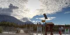
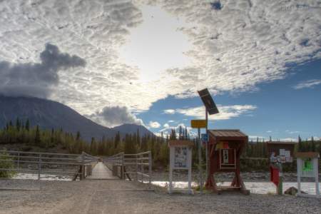
The road may end here but the journey isn’t over yet. Kennecott River Pedestrian Bridge crosses the main channel of the river, providing access to the road leading to the town of McCarthy and the old mining town of Kennecott. You can walk or bicycle the .6 miles to the town of McCarthy or the 5 miles to the historic mining town of Kennecott. Look for the old hand-pulled, open platform cable tram next to the pedestrian bridge. Before the state ...more
You have reached the highest point on the Nabesna Road, and crossed a major watershed divide. All waters flowing west and south from the divide are carried byt the Copper River to the Guld of Alaska. All waters flowing to the east ener the Nabesna River, the Tanana, the Yukon, and ultimately the Bering Sea.
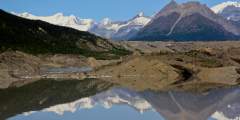
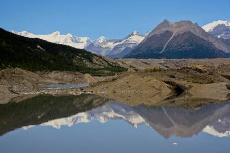
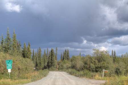
Over the next few miles, enjoy the splendid views of high snow-clad volcanoes of the Wrangell Mountains. Mt. Sanford (16,237′) is the tallest mountain that can be seen from the Nabesna Road. To the left of Sanford is the rounded, icy dome of Mt. Wrangell (14,163′). It is the park’s only active volcano and occasionally steam can be seen rising from the summit. Wrangell’s broad sloping profile is an excellent example of a shield volcano. The… ...more
It’s a hot and dusty day on the McCarthy Road and you’re starting to think of things in terms of relief. You may be imagining the end of the drive, or maybe it’s the vision of a cold beer sliding down your throat that gives you comfort. Long Lake provides you with another, more immediate, option. As you near the end of the lake closest to McCarthy you may see a car or two parked on the side of the road. If not, you may see a spot where you can… ...more
Everyone’s welcome to come play softball — gloves, bats, and balls are all provided! McCarthy’s softball nights typically begin sometime after 5 p.m. Friday from June through August. You may see signs about this fun activity around town, or overhear folks talking about it. Don’t be shy. Head down the street just to the right of Wrangell Mountain Air (in “downtown” McCarthy) and take the first left up the hill to the field. You’ll get a beautiful… ...more
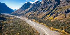
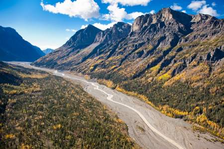
This remote canyon in Wrangell-St. Elias National Park makes for dramatic flightseeing: You’ll see mountains and glaciers, as well as an actual shift in terrains from Wrangell limestone to volcanic rock. Some of the mountains might even remind you of the buttes that you’d see in the Southwest. This is also a great spot to get dropped off by a bush plane so that you can hike above the treeline. The basic, wildlife-traveled trails are similar to… ...more
Owned and operated by the National Park Service, this hall often hosts speakers, movies, potlucks, yoga, music, weddings, and other community events. You’ll likely see flyers around town about these events, which are usually held for no charge (though they may request donations). If there is something going on during your visit to town, don’t be shy; it’s worth your while to find out what’s happening. And check in at the NPS visitor center to see ...more
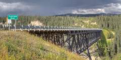
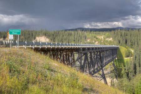
For many, crossing the Kuskulana Bridge is the most nerve-racking part of their drive down McCarthy Road. Mentally prepare yourself to drive across this old single-lane railroad bridge 238 feet above the raging Kuskulana River! The Kuskulana bridge was built during the winter of 1910. You will see for yourself what a remarkable achievement this was.
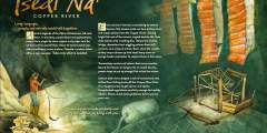
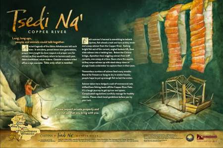
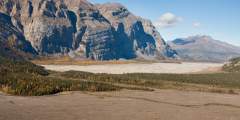
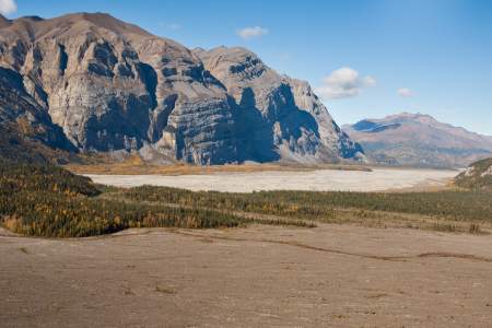
You’re now looking at the Chitina River just before it merges with the Copper River and disappears out of view. The braided Chitina below actually carries more water than the Copper River, despite losing the name battle. (It’s actually more of a name tie, though, as Chitina is the native word for copper.) Heavy rains, floods, and outbursts from glacially-dammed lakes can fill the riverbed, in comparison to the channels you’re likely seeing… ...more
A 1985 landslide created this vast expanse of rubble. You can hike it, though: you just follow the sandy stretches through the rubble, then whack up through the brush where the river meets the hillside. From there, you can get back onto the old river channel. While the aftermath here may look massive, it’s by no stretch the biggest landslide in the area. Not too far from here, just off the west fork of the Nizina, there was a landslide after… ...more
Talk about an authentic pioneer town. Time seems to have stood still on McCarthy’s Main Street, which is unpaved, only a few hundred yards long, and lined with classic buildings and memorabilia.Some visitors walk through McCarthy and complain that there’s nothing to do — and that’s exactly why folks like living here. But while you may not find much activity, you will find a lot of history: In the town’s heyday there were several hotels,… ...more
Along the road get good views of Kennicott Glacier, Mount Blackburn and Fireweed Mountain. McCarthy served as the supply and recreation stop for the Kennicott Mining District. Today, the town looks much like it did when it was first established in 1906 thanks to the local who have restored and preserved the original buildings.
The north side of the road is “National Preserve” whereas the south side is “National Park.” Sport hunting is allowed in the National Preserve but not in the National Park. However, subsistence hunting is allowed in both the National Park and Preserve.
If you’re hiking up to Kennicott from McCarthy and would like a 1- to 2‑hour diversion, the toe of the glacier is it. There are some amazing mountain views, and a good chance you’ll see a unique movement of nature involving rock, ice, and glacial silt. When you’re here, imagine yourself back in the early 1900s: McCarthy was a boomtown, and this land was completely covered by ice. That’s obviously changed, and the current lake will likely be 10… ...more
Walk in public fishing access to Silver Lake and Van Lake; you’ll find wonderful scenery and good rainbow trout fishing in both lakes.
Pull over and take in this amazing view of the river. Because this is a glacial river, it’s waters are highest during summer hot spells that cause rapid ice melt. Rafting trips from McCarthy down the Chitina River are very popular. If you are interested, there are several rafting companies that operate out of McCarthy.
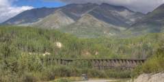
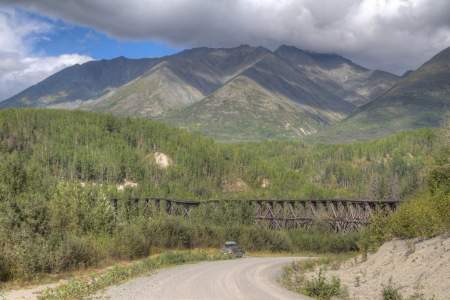
Coming around the corner after milepost 28, you can’t help but notice the Gilahina Trestle. There are 85+ miles of bridges and trestles within the 196 miles of rail between Cordova and Kennicott. Building them was a big job. The Gilahina Trestle is visual confirmation of the size of job it was, standing 80 – 90 feet high and 880 feet across. The crew used a half-million board-feet of lumber and completed the job in eight days.
As you cross this bridge, you will notice that the Copper River below you is quite dirty. Millions of tons of rock dust are scoured off of distant mountains by glaciers and carried downriver each year. These silty waters are the perfect camoflague for samon swimming up the river to spawn.