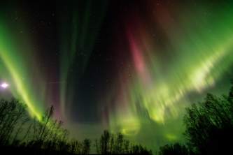
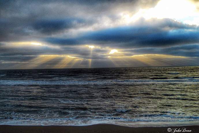
The Best Beaches in Alaska
With more than 33,000 miles of shoreline—more than twice Florida, California and Hawaii combined—Alaska boasts many accessible beaches that beg for a stroll or a picnic. Adventure beaches that are more rugged than sandy still deliver stunning vistas and intriguing tide pools. Classic sandy beaches—some with dunes and the possibility of swimming—are out there too, but you have to know where to look.
So here is our list of great Alaska beaches, where you might find beachcombing, fabulous views of scenery and wildlife, and sometimes—swimming, wading and warm sand to knead between your toes!
Show Map
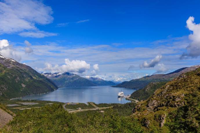
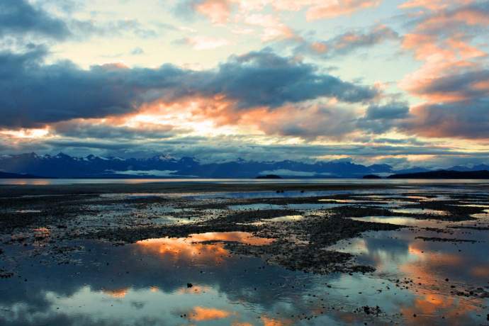
Whittier Beach, Whittier (Prince William Sound)
A gravel beach at the head of Passage Canal just off the road to Whittier opens onto a large flat when the tide goes out. While not a great beach per se, this often windy spot is the only road accessible beach in Western Prince William Sound. It’s worth a visit for a chance to experience this unique ecosystem. The view down the fiord includes snowy peaks, an immense kittiwake rookery, interesting boat traffic and frequent sightings of harbor seals and Steller sea lions.
Getting there: Take the Anton Anderson Memorial Tunnel to Whittier. After exiting the tunnel staging area, take the first left on the beach access road. The city operates a parking area with pit toilets. Some people launch boats and kayaks here.
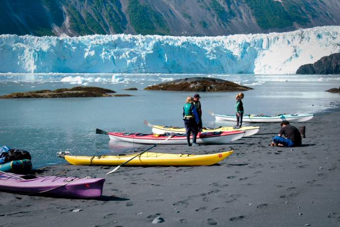
Black Sand Beach of Barry Arm in Harriman Fjord (Prince William Sound)
Black Sand Beach is popular for camping and landing inside Barry Arm at the northeast corner of Harriman Fjord. The fine black grains can be hot on summer days. But this quarter-mile-long beach has one of the most spectacular views in the world, with the looming face of Coxe Glacier just across the water. The strand can become littered by grounded bergs, with near shore waters jammed by floating ice. The location is notorious among sea kayakers for calving events that can throw waves on the beach, sometimes complicating launches.
Getting there: You’ll need to charter a boat, take a tour or embark on an extended kayaking trip. Barry Arm is about 36 miles from Whittier—out Passage Canal and up Port Wells into the entrance of Harriman Fjord.
Wild Pocket Beaches (Prince William Sound)
It might take a lifetime, but you can explore hundreds of pocket beaches along the rugged shoreline of the Sound, many with sandy breaks and beachcombing. The rise and fall of the tide continually changes the amount of coast that can be explored on foot.
Getting there: Many water taxi and charter operators based in Whittier offer beach walks, day trips or drop-offs. Ask for suggestions that will mesh with your time and budget.
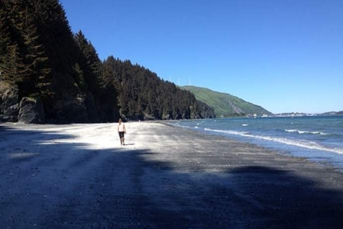
Lowell Point and Tonsina Point, Seward
You’ll find two adventure beaches—one next to parking and the other at the end of a two-mile hike—just south of Seward on Resurrection Bay. Both offer a great way to experience the Gulf of Alaska ecosystem without traveling over water by boat. Lowell Point features a dramatic half-mile beach cape below private houses and rentals (and the family-run Miller's Landing outfitters.) It overlooks boat traffic, snowy mountains, the town of Seward and marine life. The Lowell Point Recreation Site, located where the cape joins the fiord’s steep shore, is a 19-acre park popular as a kayaking launch point and the trailhead for 4.5-mile hike down the coast to Caines Head State Recreation Site and its ruins of a historic World War II-era fort. Two miles beyond Lowell Point on the Caines Head Trail, the route descends the mountainside to Tonsina Point. This wild beach where Tonsina Creek meets the ocean has the unkempt aura of a remote setting with unpredictable beachcombing and wildlife viewing. Beyond Tonsina Point spans a three-mile coastal route to Derby Cove that floods during rising tides. Do not attempt to traverse this stretch except during periods when the tide will be three feet or lower.
Getting there: Take the Seward Highway to Seward and pass through town. Turn right on Railway Avenue and keep going as it turns into Lowell Point Road along the base of the mountain. After about two miles, turn left on Border Avenue and then take an immediate right (south) on Pinnacle View Road. To access the Lowell Point trailhead and long-term parking, turn right up a road that climbs into the forest. The beach with limited parking is straight ahead. There is a steep but safe trail between the upper parking lot and the beach. $5 per day or state parking pass required.
Captain Cook State Recreation Area, Nikiski
An expanse of mud and sand littered with giant boulders that draw recreational climbers, this striking but sparsely visited beach stretches from the mouth of the Swanson River in the recreation area nearly 30 miles up the coast to the northwestern tip of the peninsula. During lower stages of the tide, it’s a beach hiker’s paradise, with views of oil production platforms, the Aleutian Range, migrating birds and (sometimes) beluga whales.
Getting there: Take the Kenai Spur Road north from Kenai, passing Nikiski, about 25 miles to about Milepost 36. The Captain Cook State Recreation Area features parking, picnicking, hiking, boating and camping, with a west and east access to the coast. Freshwater Stormy Lake has a swimming beach.
Kasilof River Beach, Kasilof
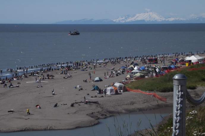
Beaches at the mouth of the Kasilof River feature the same great potential for sandy beachcombing, sightseeing, wildlife viewing and camping as the Kenai River beaches, but in a setting that’s more intimate and low-key, like visiting old-time Alaska. The river mouth has dunes and grassy uplands, salt marshes, an meandering estuary and mud flats at low tide. Three state parks are located nearby, and the river is popular for its productive drift boat and bank-side sport fishing for sockeye, coho and king salmon. A caveat: Locals converge between June 17 to Aug. 15 to dip net Kasilof salmon, with hundreds of people camping and working the tides on peak days. If you’re seeking solitude, visit outside of those dates.
Getting there: Kasilof is about 15 miles south of Soldotna on the Sterling Highway. To access the north beach, take Kalifornsky Beach Road to Kasilof Beach Road. Park on the road and do not drive though the dunes. To access the south beach, turn west on North Cohoe Loop Road after crossing the river heading south. Where the pavement turns south (left) continue straight on a rough, dirt road to the shore. The river mouth is about a quarter mile to the north. A nimble four-wheel-drive vehicle will be necessary to drive up the beach.
Road Trip Beaches, Sterling Highway South
Three Alaska state recreation areas on the lower Kenai Peninsula boast big beachfronts with crashing surf, beachcombing and wildlife viewing, plus a panorama of snowy mountains across Cook Inlet. Clam Gulch is a flat, mud-and-sand beach beneath the bluffs. During periods when state mangers certify the beach as safe and clams abundant, Clam Gulch is the best place in the region to dig for razor clams. Deep Creek features a broad beach with spectacular views of Iliamna and Redoubt volcanoes. Popular as a campground, boat-launching site and fishing mecca (and clam digging,) the Deep Creek area also has a salt marsh that draws sandhill cranes and other shorebirds in spring. The beach at Anchor Point in the Anchor River State Recreation Area is the furthest west you can drive on the U.S. road system. The beach features views of three Cook Inlet volcanoes, while the clear-running river is a popular destination for king and coho salmon fishing. Great beachcombing where a river meanders over sand flats.
Getting there: Clam Gulch is about 21 miles south of Soldotna off the Sterling Highway. Turn into Clam Gulch Road about Mile 117.5. Deep Creek beach is about 40 miles south of Soldotna off the Sterling Highway about Mile 137.7, close to the village of Ninilchik and the Salmonfest music festival. Anchor Point beach is about 60 miles south of Soldotna off the Sterling Highway. Turn west on the Old Sterling Highway about Mile 157, then take Anchor Point Road to the beach and campground.
Bishop’s Beach, Homer
Just outside of the Old Town of Homer and down a short trail from the Islands and Ocean Visitor Center, Bishop’s Beach is one of Alaska’s most dramatic coastal walks—and it’s only few minutes from services, lodging and restaurants. It is a must-visit beach for families, with tide pooling, an extraordinary vista of Lower Cook Inlet and (sometimes) thundering surf that will take your breath. During lower stages of the tide, you can walk miles along the coast to the northwest. Sea otters and shorebirds are common. Look for hunks of coal littering the sand! Homer’s Bishop’s Beach Park features trails, public art, a covered pavilion with fire pit, BBQ grill, picnic tables and restrooms.
Getting there: Take the Sterling Highway south to Homer. Turn toward the ocean at Main Street, then turn left on East Bunnell Avenue. After one block, turn right on Beluga Place. The beach is two blocks south.
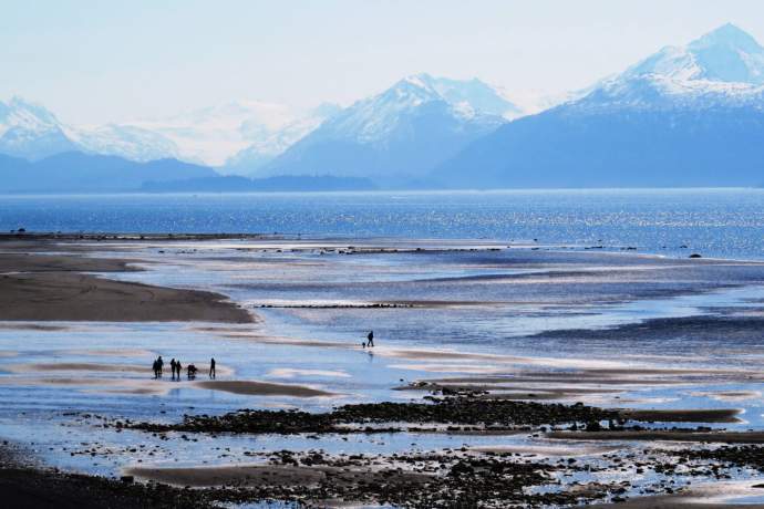
Homer Spit, Homer
An Alaskan landmark. Extending 4.5 miles into the middle of Kachemak Bay outside Homer, this ancient glacial moraine features miles of walkable, gently sloping sand with beachcombing, wildlife, surf and a snowy mountain panorama. That the spit serves as ground zero for sports fishing, wildlife touring and all sorts of marine activity only adds to its allure. During summer days with fine weather, the place takes on a carnival atmosphere, especially in the zone near the busy small boat harbor, where you’ll find restaurants, shops, venders, museums, information, and tours. There’s both camping and high-end lodging, parking and toilets. A fishing lagoon and a bike trail. Deep fried halibut and chips. Alaska’s most famous “dive” bar. A seafarers’ memorial. Not to be missed.
Getting there: Take the Sterling Highway to Homer. Follow the main road as it veers right to become Lake Street, then left to become Ocean Drive and finally curves right again onto Homer Spit Road.
Outside Beach, Seldovia
A favorite community beach with tremendous views and some tide pooling, the Outside Beach is a pleasant one-mile walk from the village of Seldovia and its famous boardwalk waterfront. It’s especially inviting on summer days, whether you’re spending the night or visiting during a trip from Homer, and can be accessed via a nature hike on the Otterbahn Trail. This wild pocket beach features picnicking and camping, beachcombing and tide pooling, with Iliamna and Redoubt volcanoes looming on the horizon. Excellent chance of seeing (and hearing) bald eagles and seabirds. Watch for sea otters offshore.
Getting there: From the waterfront, follow Anderson Way or English Street out of the village core to Jakolof Bay Road. Continue to the head of the Seldovia Lagoon and take the first left on Outside Beach Road. More scenic: Hike the Otterbahn Trail that begins behind the Susan B. English Elementary/High School at School Street and English Drive.
Bushkin River Beach, Kodiak Island
This quarter-mile gravel beach at the mouth of a clear-running stream just across from the Kodiak airport draws beachcombers, wildlife seekers and fishers in quest of epic salmon action. A sweeping view of the ocean is bookended by Kodiak’s emerald green uplands, with the potential for sightings of marine wildlife and interesting boat traffic, making this place popular among locals. The city and its harbor—one of the busiest fishing ports in the nation—can be seen about three miles across the water. A state recreation site provides camping and facilities, while a series of salmon runs deliver some of the most productive bank fishing on the island. Kodiak brown bears often work the creek when fish are present. Watch for the annual Bushkin River pink salmon derby for kids in August.
Getting there: The Buskin River beach is about 4.5 miles by road from Kodiak city and less than a mile from the airport. From the airport, turn right on Rezanof Drive for .7 miles, then go right at the state park sign. From the Kodiak ferry terminal, go west on Center Street, turn left on Rezanof Drive and drive 4.1 miles to a left at the park sign.
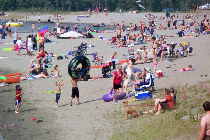
Wasilla Lake Beach, Wasilla
It might not be wild Alaska, but the beach in Newcomb Park on the western lobe of Wasilla Lake features that old-fashioned summer swimming pond vibe, ideal for families with kids and anybody seeking a lively, friendly place throw down a towel or lay out a picnic. It’s just off the highway, and close to Wasilla’s commercial core, with sandy beach, playground, picnic tables, a pavilion, restrooms and a grassy lawn. An excellent rest stop while shopping for supplies or passing through town on the Parks Highway.
Getting there: The park and beach are at the west end of Wasilla Lake at Mile 41.7 of the Parks Highway. Exit right on North Crusey Street with the parking lot on the right.
Christianson Lake, Talkeetna
For the best swimming and wading action in Talkeetna—and maybe the whole upper Susitna River Valley—head to this rural lake in the forest just outside of town. On summer days, the water can warm into the 60s. The 180-acre lake is regularly stocked with rainbow trout for fishing, too. Christianson Lake Park features parking ($5 fee or annual pass), restrooms, picnic sites, three pavilions and a boat launch for car-top canoes and kayaks. A great venue for a refreshing dip while visiting Talkeetna or exploring the Susitna Valley on a summer’s day.
Getting there: From Mile 98.7 of the Parks Highway, take the Talkeetna Spur Road 12 miles north and turn right on Comsat Road. (About 2 miles south of Talkeetna.) After .8 miles turn left on Christiansen Lake Road to a short access road into the park. NOTE: Majority of lake shoreline is privately owned.
Chena Lake, North Pole
The sandy swimming beaches in the Chena Lake Recreation Area can make one of those hot summer days of Interior Alaska feel like you’ve been transported to a more southern realm. Situated on a western-facing peninsula on the 260-acre Chena Lake, the beaches feature restrooms, picnicking, drinking water, pavilions, a playground and horsehoe pit, boat launch and rentals—all with camping nearby. The beaches are small part of a larger 2,000-acre park with camping, boating and wildlife viewing along a four-mile trail beside the Chena River, originally developed as part of a dike-and-dam system built to protect the Fairbanks community from flooding. (Note: the Chena River State Recreation Area is a different park, located northeast of Fairbanks on the Chena Hot Springs Road.)
Getting there: Take the Richardson Highway southeast from Fairbanks through the community of North Pole. Turn left on Laurence Road about Mile 15.4. The road follows the dike and passes through an entrance station. The lake park access is about three miles in.
Cannon Beach, Yakutat
Want to experience a big beach with rollers that draw serious surfers from outside the region? Check out this sandy shore accessible by road from Yakutat. Pounded by the Gulf of Alaska’s immense swells—with a fetch that reaches across the entire Pacific to Antarctica—Cannon Beach is one of many epic beaches along Alaska’s remote and difficult-to-visit Lost Coast between the Copper River and Southeast Alaska. What makes this one special is its no-fuss location—only two miles south of the Yakutat airport and three miles west of the Yakutat town. This wild, open-ocean coastal strip features picnic and camping sites, plus remnants of artillery cannon dating from World War II. The beach extends for about 10 miles between Ocean Cape (with rugged road connections to Yakutat) and the mouth of the Situk River, offering surfing (contact Icy Waves Surf Shop for details), beachcombing, wildlife viewing and picnicking. Spaced along the shore are three tent platforms good for falling asleep to the boom of crashing waves. (See tent site two and three.)
Getting there: Exit the Yakutat Airport on the Airport Road and turn south (right) on FS Road 9968 (also called Cannon Beach Road.) The beach is about 2.3 miles. At the beach, drive north on FS Road 9968 .7 miles to the first tent platform.
Eagle Beach, Juneau
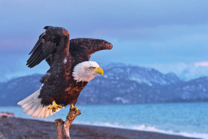
A scenic adventure beach where a productive river meets the sea offers great wildlife viewing and beachcombing on the coast of Lynn Canal about 27 miles north of Juneau. Falling tides expose extensive flats and river bars just off the Eagle Beach State Recreation Area, while spawning salmon regularly attracts dozens of bald eagles in the forest and along the channels, especially from mid-July into the fall. It’s one of the best wildlife viewing spots near Juneau, where you might see a black bear or two and other Alaska animals along the river and flats during low tide, and then sight harbor seals or sea lions approaching as the tide floods in. The 570-acre park features restrooms, picnicking, camping and a boat launch. The panoramic view of islands and mountains is simply stunning.
Getting there: Drive north from Juneau to Mile 29 of the Glacier Highway.
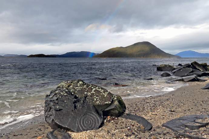
Petroglyph Beach, Wrangell
A rocky beach near the northern tip of Wrangell Island contains 40 different sketches carved into rocks about 8,000 years ago by ancient Tlingit people. The petroglyphs—fully visible only at low tide—include the outlines of salmon, whales and human faces. The array is the most concentrated collection of prehistoric petroglyphs in the region. The seven-acre Wrangell Petroglyph State Historic Park features a boardwalk overlooking the beach, plus replicas of several glyphs placed on a deck for visitors to make rubbings. Access to the beach is off the deck. While the archaeological treasure is the main attraction, the beach overlooks islands in the wildlife rich waters of Zimovia Straits, with a view of the mouth of the Stikine River beyond. It’s not difficult to imagine prehistoric artisans carving new art while keeping an eye on the channels offshore. Photo credit: Charity Hommel
Getting there: About one mile north of the ferry terminal in Wrangell. Take Stikine Avenue north as it morphs into Evergreen Avenue. Turn left (toward the ocean) on 5th Avenue for a short walk to the beach.
Arctic Beach, Shore of the Arctic ocean, Utqiaġvik (Barrow)
A compact sand beach runs along the shore of the Arctic Ocean in Utqiaġvik, the most northern community in Alaska. During the ice-free season—very generally summer into fall—it’s possible to leave footprints that will be washed away by Arctic surf! Most visitors make sure they dunk their hands in the chilly polar ocean, but some will wade or even take a dip. The Whale Bone Arch is a landmark about three-quarters-of-a-mile northeast of the town center, an iconic photo op, standing above the beach like a portal. Walking tours that include the beach are popular among visitors to the city, and many hire a guide. The beach extends 10 miles out the spit that ends at Point Barrow, the northern most point in the United States. It is private property and can only be visited during an authorized tour. Note: Locals caution visitors not to beach walk beyond the town due to the real chance of encountering a polar bear.
Sea Walk, Shore Avenue along the Chukchi Sea, Kotzebue
A half-mile walkway along the seawall protecting the heart of Kotzebue from storms and high seas offers horizon-spanning views of Arctic waters and brings the whole community out on sunny summer days. Built in 2012 for $34 million, the seawall transformed the Arctic town’s waterfront. With park benches and railings, plus spots where local kids jump into the Chukchi to swim, the sea walk lends the waterfront a welcoming resort atmosphere (in good weather.) Watch for locals fishing off the wall, boat traffic that might range from subsistence hunting craft to sea kayaks, and the passing of marine mammals offshore.
Gold Beach, Nome
The discovery of gold in the beach sands along the Bering Sea brought tens of thousands of prospectors from all over the world to the Seward Peninsula, and by 1899, the community of Nome had burst into a city with more than 20,000 inhabitants. Those “golden sands” can still be walked—on the beach running parallel to Front Street, the town’s main commercial center. This immediate sandy shore, in some places armored by rip-rap, runs about 1.8 miles from the modern breakwater that protects the town harbor to the Swanberg (gold) Dredge parked in a pond since the 1940s. During ice-free season (summer into fall,) the surf of Norton Sound breaks on the sand, where you can still find the sparkle of gold among its grains.
Rotary Beach, Ketchikan
With a salt-water pond separated from the ocean by a cement causeway, Rotary Beach about 3.5 miles south of Ketchikan has become a local favorite among families with kids for swimming and wading. Replenished by the rising tide, the pond’s configuration traps the chilly waters of Nichol’s Passage and allows them to warm up. The beach, also called Bugge Beach after the original owner, features a beloved public park with picnic tables, shelter, fire pits and grills, restrooms and fenced playground. The outgoing tide exposes pools rife with sea stars and other intertidal life. The place offers visitors a chance to experience Southeast Alaska at its best—residents and their kids having fun, tide pooling, and a stunning vista of the marine world.
Getting there: The beach is about 3.5 miles south of Ketchikan’s main waterfront, less than a mile past Saxman. 3550 S. Tongass Highway.

Mouth of the Kenai River, Kenai
The often-windy beaches where the Kenai River meets the sea offer beachcombing, picnicking and sightseeing on an expanse of handsome brown sand. The storybook cone of Redoubt Volcano rises over the vast reach of Cook Inlet, making the setting especially dramatic, great for viewing sunsets and watching boat traffic. A caveat: During July, both beaches draw thousands of locals in a quest to harvest salmon from the tide using dip nets. Dip net season definitely provides an interesting spectacle all of its own, but it temporarily transforms the beaches into harvest zones with restrictive parking and congestion. For solitude and scenery, visit outside of July. Webcams offer year-around views.
Getting there: North Beach can be reached on foot from the historic old town on the Kenai bluff down Meek’s Trail off Alaska Avenue a few blocks west of the Kenai Visitor & Cultural Center. If driving, take South Spruce Street off the Kenai Spur Highway to the beach parking area. South Beach can require four-wheel drive and experience on soft sand. After crossing the river on Bridge Access Road, take Kalifornsky Beach Road to Cannery Road and then Old Cannery Road.
Explore Further