Taylor Highway
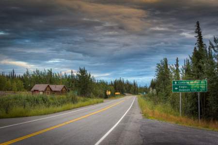
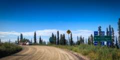
The Taylor Highway (Hwy #5) is open seasonally from April to mid-October. Conditions of the road can range anywhere between good to poor and depend heavily on weather and maintenance. Keep in mind that there are very limited services or facilities available along the road on the way to Eagle.
Taylor Highway is a route through gold mining history. Gold was discovered here as early as 1881, and discoveries in 1887 and 1888 lead to interior Alaska's first gold rush. Mining settlements like Jack Wade, Chicken, and Franklin were established practically overnight. Walking trails were quickly forged by men traveling between nearby Eagle and the new mining settlements. These paths eventually became wagon roads, and then Taylor Highway in 1951. Originally called the Fortymile Road, the name was later changed to the Taylor Highway in honor of Ike Taylor, Alaska Road Commission (ARC) president from 1932 to 1948.
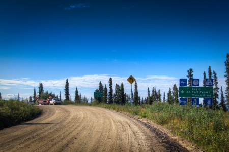
The Taylor Highway was built to provide access to Eagle, Chicken, and the historic Fortymile Mining District. It connects to the Top of the World Highway 96 miles (154 km) from Tetlin, at Jack Wade Junction, allowing road access to Dawson City, Yukon during the summer months. Most of the original cabins and buildings along the highway are gone, however there are still quite a few active mines proving that the dream of gold is still alive in Alaska.
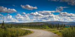
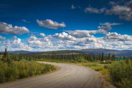
The first 60 miles of the Taylor Highway are paved as are the first 10 miles of the Top of the World Highway; the remaining sections are gravel. Not all rental vehicles are allowed on this road, so check with your rental agency before you travel. Or, rent from a company that allows their vehicle on gravel roads, like Alaska 4x4 Rentals, Alaska Overlander, Alaska Auto Rental, or GoNorth Car & RV Rental.
Show Map
Highway Guide

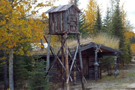
Here you can see what remains of the old Fortymile Roadhouse. In 1959, the Fortymile Roadhouse served Alaska Highway travelers who were heading up the new Forty-mile and Eagle Highway, now the Taylor Highway, which was still under construction with only about 20 miles of road finished. The roadhouse offered cabins, meals, a grocery store and a garage with gas and oil. The roadhouse closed in 1985.
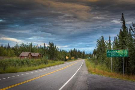
Taylor Highway (Hwy 5) is open seasonally from April to mid-October. Conditions of the road can range anywhere between good to poor and depend heavily on weather and maintenance. Keep in mind that there are very limited services or facilities available along the road past Eagle.

At Milepost .7 of Taylor Highway you will notice dark gray sand dunes on either sides of the road. These were created over 10,000 years ago when strong winds carried loose sediments from the plains of the Tanana River and piled them against these low mountains.
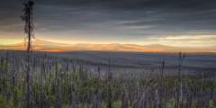
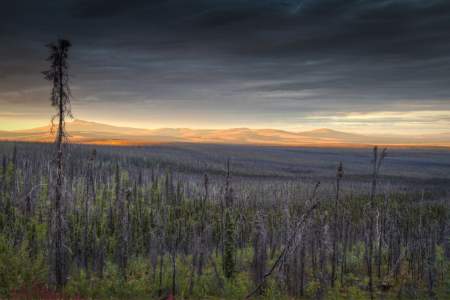
You will notice evidence of fire damage from the Taylor Complex Fires, which burned 1.3 million acres. The fires closed the Taylor Highway for several days in the summer of 2004. Wildfires are common in Alaska from April or May through the summer months, depending on rainfall. Lightning is the most common cause of wildfire. The total number of fires in 2004 was 707, which is not unusually high for a very hot dry year. What is unusual is the… ...more
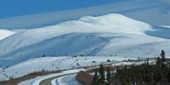
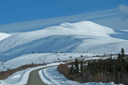
At Milepost 14 of Taylor Highway you will be able to enjoy a beautiful view of Mount Fairplay.
At Milepost 21 of Taylor Highway, you can stop and read about the life cycle of caribou and the fall and rise of the Fortymile herd.
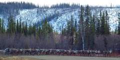
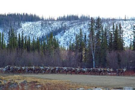
Watch for the Fortymile caribou herd in this area. Here you’ll find a pullout with three information panels about the Fortymile region, Mount Fairplay, the Taylor Highway, and the Fortymile caribou herd. The Fortymile area is home range to this caribou herd, once a massive herd of 500,000 animals, the herd declined to a low of 6,000 in the mid-1970s. A 4‑year recovery effort by the Alaska Department of Fish and Game using wolf control… ...more
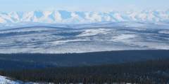
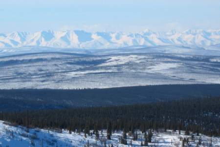
At Milepost 34 of Taylor Highway you are able to compare the gently rounded ridges of the Yukon-Tanana Uplands, that were to never covered in ice, to the rugged, glaciated Alaska Range in the distance.
At Milepost 43 of Taylor Highway, there is a nice pinic area overlooking the creek.
At Milepost 49, there is a campground with plenty of parking spaces availble for cars and RVs. From the scenic overlook on the upperroad you can spot trumpeter swans and moose in the small lake below. This river access point is the southernmost access point on the 400-mile Fortymile National Wild and Scenic River System.
West Fork Campground, at Mile 49 of the Taylor Highway near Chicken, offers 25 wooded sites along the West Fork River in Alaska’s Interior. Managed by Alaska State Parks, it features vault toilets, fire rings, and views of a small lake. It’s a quiet base for fishing, wildlife watching, and exploring the remote gold-mining region, with Chicken’s historic charm just a short drive away.
From the West Fork Bridge you can do a 4 to 5 day 75-mile run to the Obrien Creek Bridge at mile 112.4, with only up to Class III rapids.
Here you’ll find a viewing platform with excellent views of Mount Fairplay. Take the small root covered trail that leads to another viewpoint. This is the entrance to Fortymile Mining District. The second-oldest mining district in Alaska, it first produced gold in 1886. Claims were filed in both Alaska and Canada because of boundary uncertainties.
Chicken (pop. 21 in summer, 6 in winter). This little gold mining town was established around 1898 and there has been mining in this area ever since. In 1902, this area was to be the second Alaska town to be incorporated. The residents decided to call their home Ptarmigan, the only problem was that no one could decide on the correct spelling. They didn’t want to be the butt of jokes, so the residents decided to name the town Chicken. From the… ...more
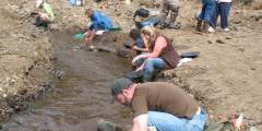
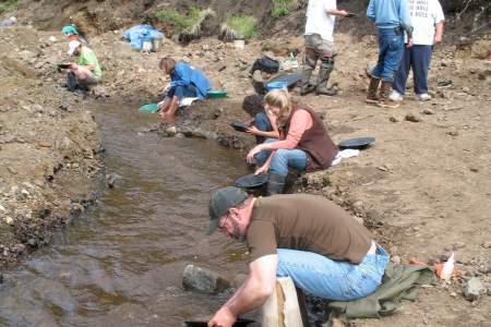
Campground, RV Park, and Cabin Rentals. On-site restaurant, gift store, historic gold dredge and museum, gold mine tours, recreational mining and gold panning.
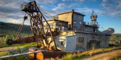
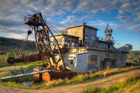
This dredge is located at Chicken Gold Camp and Outpost. The dredge mined on Pedro Creek just outside of Fairbanks from 1938 until 1959 before it was moved to Chicken Creek and operated between 1959 and 1967. Mike Busby and Bernie Karl purchased the dredge and moved it and other mining equipment down to Chicken in 1998 as a tourist attraction. It was put on the National Register of Historic Places in 2006.

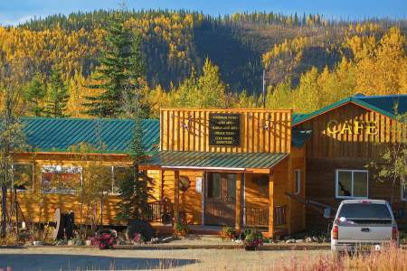
Café serving homemade breakfasts, soups, sandwiches, and more
At Milepost 67 Taylor Highway you will find the Chicken Creek Bridge. This is the site of a dredge that was operated by the Fairbanks Exploration Company from 1959 until 1965. In an average run of the dredge, it was operating 24 hours a day for 2 weeks. At it’s peak, one run would bring in $40,000 in gold.
Campground & RV Park with 30 electric sites and 70 dry sites
At Milepost 68 Taylor Highway you pull off and enjoy this easy, 1.5 mile hike to an overlook above the remains of Mosquito Fork Dredge. This dredge was shut down in 1938 after operating for less than 2 seasons.
A short 1.5‑mile hike will lead you to an overlook above what remains of the Mosquito Fork Dredge, which was used as part of the Lost Chicken Hill Mine. This dredge was shut down in 1938 after operating for only two seasons.
At Milepost 69 you will arrive at the Lost Chicken Hill Mine, which was established in 1895. It got its name because it held a pay streak that had been “lost” for many years. The area has mining history that began before the Klondike Gold Rush of 1897 – 98. It is now privately owned and mined.
At Milepost 75 Taylor Highway you can pull off and read the interpretive panels to learn more about the Fortymile gold rush.
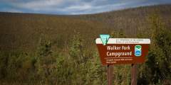
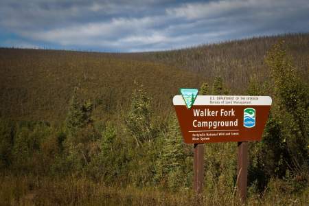
Walker Fork BLM Campground, near the Yukon border on Taylor Highway, offers 24 sites on the historic Lassen airstrip. Managed by BLM, it’s surrounded by spruce near Walker Fork River, featuring vault toilets and fire rings for a primitive stay. This remote campground is ideal for fishing grayling, exploring gold-mining history, and enjoying quiet wilderness, with the border nearby.
Here is the former site of the Jack Wade Dredge. This was a popular attraction and photo subject for highway travelers for many years. The dredge was dismantled and scraped by the BLM in 2007. BLM officials said that the deteriorating condition of the old dredge was a safety hazard. T
Whether you’re traveling the Taylor to the Top of the World Highway and Dawson City, or into Alaska from Dawson City, do take this diversion into the Yukon River village of Eagle.
Here, you are 64 miles south of the historic town of Eagle, and 14 miles west of Canada and Dawson City. If it is a clear day you will be able to see Canada’s Ogilvie Mountains in the northeast. From here to Eagle the road becomes very narrow and more dangerous for large trailers and oversized vehicles.
Here, Taylor Highway begins to descend into the valley of the Fortymile River. You will be able to see the intricately folded metamorphic rocks exposed by the road cut. Keep an eye out for white marble, quartzite, gneiss, and schist.
You may not be able to see the geologic fault zone that crosses the highway at this point, but you will notice a change in the topography over the next few miles. North of this fault are many landslides and very few cliffs.
Eagle Campground, near Eagle townsite along the Yukon River, offers 18 wooded sites with river access. Managed by Alaska State Parks, it features vault toilets and fire rings for a peaceful stay. Surrounded by spruce and close to Yukon-Charley Rivers National Preserve, it’s ideal for fishing salmon, hiking, and exploring Eagle’s gold-rush history, with town amenities minutes away.
Eagle (pop. 115). The town of Eagle has been incorporated since 1897 after the U.S. Army responded to the need for law and order during the Klondike Gold Rush. The Army built Fort Egbert in 1899; it is now a National Historic Landmark. Explore this historic site on your own or take a walking tour offered daily by the Eagle Historical Society.
Exhibits in six restored historic buildings dating from the end of the 19th century: James Wickersham’s first Courthouse, U.S. Custom House, the Improved Order of Red Men Lodge and three Fort Egbert buildings, all with period furnishings. Displays with photographs on the Gold Rush town, military fort and commercial center with judicial, communication, transportation, construction, agriculture, mining, pioneer activities and social… ...more
This is BLM headquarters for the Taylor Highway area.
The name isn’t completely arbitrary – For most of the ride you drive along the peaks and crests of mountains and hills, leaving you a view of the valleys below. Though only open in the summer months, this 79 mile gravel-road has some spectacular views of the Alaska Range, and can take you on your way to Dawson City in the Yukon.
From the Mosquito Fork Bridge you can do a 3 to 4 day, 50-mile run to Obrien Creek Bridge at mile 112.4 but high water is needed to get you down the Mosquito Fork. This is also only a Class II to III section through the main mining district of Chicken. You could continue from either start past the Obrien Creek confluence and commit to going all the way down the Fortymile, through the Class IV Canyon Rapids to the Yukon and on down it to Eagle… ...more