Nome-Taylor Highway Scenic Drive
The Nome - Taylor Road (also called Beam Rd. or Kougarok Rd.) spans 85 miles and takes 2 hours one-way without stops. The journey heads north, and back through Gold Rush history. Many signs of old mining claims remain. Along the side of the hills, look for straight horizontal lines. These are ditches that were dug, by hand, to transport water to the claims years ago. You’ll also be able to see some old railroad bridges and tracks.
At mile 26, a short hike rewards you with a small, beautiful waterfall, and close-up views of the Miocene ditch built during the gold rush years.
At mile 38 is expansive Salmon Lake and Salmon Lake Campground. With picnic tables, outhouses, and grills, it’s the perfect place for to have lunch or camp overnight. As you gain elevation, the road is intersected by rivers and creeks used for transportation during the Gold Rush. Many still bear the names given to them by early prospectors from other parts of the country, such as the “Grand Central River.”
Pilgrim Hot Springs Side-Trip
About 65 miles from Nome, there’s a worthwhile but very rocky detour: an 8-mile turnoff to Pilgrim Hot Springs, which some locals consider one of the most stunning spots on the Nome road system. Enjoy the historic buildings, the beautiful valley and the therapeutic hot springs.
Once you have returned to the Nome-Taylor Road, you will find the road ends at the Kougarok River Bridge. It’s not possible to drive into Taylor.
Show Map
Driving Guide Points

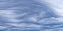
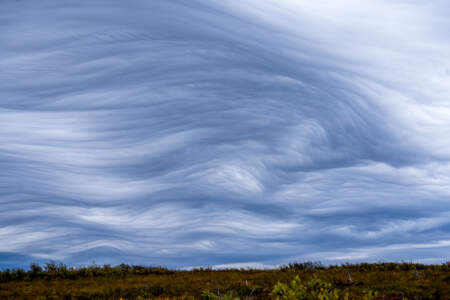
Spring provides some of the best opportunities to see semi-domestic reindeer along this section of road. In summer the drive provides good bird watching for waterfowl, gulls, terns, and tundra species.
The landfill draws many scavengers. Common raven is abundant year round. Glaucous, glaucous-winged, herring, mew, and — occasionally in summer — slaty-backed gulls show up as well. Red fox is also a frequent visitor to the facility.
Heading north, the Dexter Bypass branches off on the left. The road offers a scenic return to Nome in summer and the possibility of seeing muskox. On the right are seasonal camps and year-round homes that make up the community of Dexter.
King Mountain is the next hillside on the west side of the valley where it is easy to see the multiple cuts across its slopes for much of the year. Most cuts are manmade ditches that once brought water to Nome’s gold fields for hydraulic mining operations.
Reindeer round-ups are held at the corral once or twice a year.
Railroad construction began in Nome the summer of 1900. By 1906 the track stretched 80 miles to the Kuzitrin River. Like many other residents, the world famous musher Leonhard Seppala ran his dog team along t he tracks using a small railroad car, called a “pupmobile.”
A gravel pit pond may contain local nesting waterfowl, mew gull, Bonaparte’s gull, and semipalmated plover. The edges with the tallest willows are a good place to find blackpoll warbler. A large beaver lodge on the banks has helped to fertilize this once sterile gravel pit, which now supports juvenile coho salmon, Dolly Varden, and Arctic grayling.
The Nome River is a good place to see salmon. Pink and chum salmon spawn in August, coho are usually present in August and September. Sockeye salmon, Arctic grayling, and Dolly Varden may be present. Look for Arctic terns fishing, harlequin duck and red-breasted merganser riding swift water, spotted sandpiper or wandering tattler at waterline, and northern shrike in the willowed river edges.
This high point in the road gives you an excellent view across the valley. Three ditch lines from earlier mining activities are apparent on the far side of the valley, especially where they cross the exposed rock face of Cape Horn. The ditches originate near Hudson Creek about 12 miles upstream. Today these deep, wide gashes on the hillside offer cover and easier movement for wildlife — especially moose and grizzly bears.
There are two turn-offs to see raptors as you are heading down Kougarok rd. The first is a raptor nest, and the second give you a chance to see hawks
As you continue north, Dorothy Creek flows out of mountains to the left past the red cabin on the far bank of the Nome River. About one mile up the creek is a scenic waterfall. While there is no trail, some people visit the waterfall by crossing the open tundra on the south side of Dorothy Creek and clambering down the steep incline either just above or below the waterfall.
The pass at Nugget Divide separates the Nome River watershed from the Pilgrim River watershed to the north. A Game Management Unit sign at this location marks the boundary between two drainage-based hunting areas, each with their own regulations. From here the road descends to the Grand Central River, a major tributary of the Pilgrim River (originally called the Kruzgamepa or Kutskumipa) then across Broad Pass to the intersection with the ...more
Sockeye salmon migrate up Pilgrim River to Salmon Lake between late July and mid-August, and some continue up the Grand Central River as far as the bridge. Grizzlies are fairly common in late summer when spawned-out salmon and ripe berries are abundant. Birders watch for harlequin duck, red-breasted merganser, American dipper, Bluethroat, yellow warbler, Wilson’s warbler, and Arctic warbler.
Just past the entrance to the Salmon Lake Lutheran Bible Camp, water from a nearby spring is piped to the side of road. Many residents stop here to fill their containers with cold, clear drinking water.
Heading north, an access road on your right leads to a lakeside campground that is maintained by the Bureau of Land Management. It has a sandy beach, picnic tables, barbeque pits, a trash bin, and a restroom that is open during snow-free months. There is no running water.
Across the valley at the base of the far hills, you can still see the old train trestle spanning Iron Creek, just above its confluence with the Pilgrim River.
At the bottom of Golden Gate Pass where the road makes a sweeping curve to the right, a marked turn-off to the left leads to Pilgrim Hot Springs. The road traverses private property and travelers must obtain permission to access beforehand. Although this 7‑mile side trip offers excellent vistas and access to a unique and historic setting, sections of the road are very rough and, if flooded, may be impassible. The road summit, 2.5 miles from the ...more
The Pilgrim River crossing brings you close to groves of cottonwood that are abundant in this section of the valley. Look for spawning salmon, moose, and a variety of birds.
Beyond the Pilgrim River Bridge, the road continues uphill and offers sweeping views of a network of lakes and the meandering river valley. North of the Pilgrim River drainage is a large hill topped with a series of granite rock outcroppings known as Hen and Chickens because of its resemblance to a small flock at certain angles. A cross was placed at the summit in memory of a priest who died in a blizzard on his way to the orphanage.
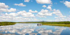
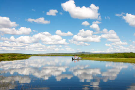
The northernmost lake is called Swan Lake but several lakes in this area may hold a wide variety of birds. Tundra swan with cygnets, Canada goose, sandhill crane, northern shoveler, black scoter, long-tailed duck, greater and lesser scaup, and canvasback frequent the ponds. Red-necked grebe build floating nest platforms. The perimeter of meadow habitat with threads of water drainages are good places to find Pacific golden-plover. Look for signs ...more
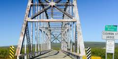
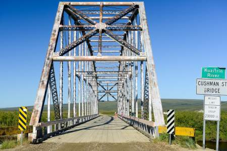
The Kuzitrin River Bridge had its origins in Fairbanks. It was originally named the Cushman Street Bridge when it was built across the Chena River in the heart of downtown Fairbanks in 1917. In the 1950s the bridge was replaced with a concrete span and the original metal bridge was disassembled, shipped down the Chena, Tanana, and Yukon rivers and barged up the Bering Sea coast to Nome. It was hauled in sections up the Nome-Taylor Highway and ...more
Several small lakes and ponds sprinkle the landscape on either side of the road. Look for a small hillock just beyond the first lake. This lone pingo rises above the surrounding flat tundra meadow and serves as a convenient lookout for hunters such as foxes, wolves, hawks, owls, and jaegers. The soil on the tops of pingos is fertilized by predator feces and prey remains and generally supports lush and diverse vegetation.
The Quartz Creek bush airstrip, up a short dirt road to the left, provides a jumping-off spot to mining claims at Serpentine Hot Springs and other points beyond the road system. It is also a staging area for ADF&G wildlife surveys. The airstrip was built during the road construction years and is still maintained by the state trans- portation department. A number of cabins in this area attract Say’s phoebe, American robin, and tree swallow. ...more
Though built to accommodate the road from Bunker Hill to Taylor in the early 1900s, the bridge is as far as you can go by highway vehicle. From here a rough, unmarked, and sometimes impassable ATV trail leads to Taylor where family-owned mines still operate. Look for canada goose and white- fronted goose. Bluethroat can be found on shrubby river banks. Arctic grayling are the most likely fish to be seen from the bridge.