Elliott Highway (Fox to Manley)
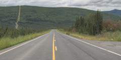
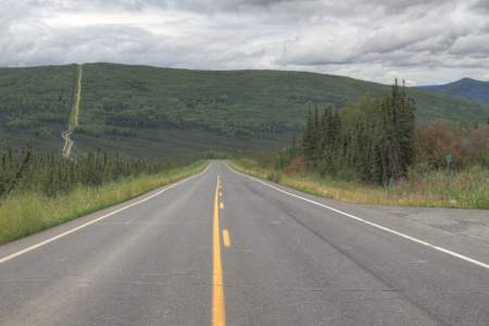
Open year-round, the Elliott Highway is paved until it meets the Dalton Highway at mile 73. But don’t let a little change in the road stop you from taking this amazing drive! Pass through the White Mountains where, depending on the season, you can hike, ski, snow machine, and skijor. Get the first good views of the Alaska Pipeline. Watch the land around you change as you drive from alpine to forested terrain. Then, relax from your exciting drive at a natural hot spring in Manley.
Not all rental vehicles are allowed on this road, so check with your rental agency before you travel. Or, rent from a company that allows their vehicle on gravel roads, like Alaska 4x4 Rentals, Alaska Overlander, Alaska Auto Rental, or GoNorth Car & RV Rental.
Show Map
Highway Guide

Originally the Fox Roadhouse, this old-style building has been renovated to house a brewery and brew pub. Ten miles from Fairbanks, the brewery has at least a dozen house-made beers on tap, and a huge selection of bottled brews, many of which can’t be found anywhere else in town. There’s a large, open beer garden out back, ideal for summer nights. And the food’s great.
The White Mountain National Recreation Area has over 200 miles of winter trails that are shared by dog mushers, skiiers, skijorers, and snow machiners and several cabins have been built along the White Mountain winter trails to provide visitors with safety and comfort during their adventures.
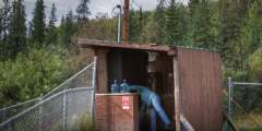
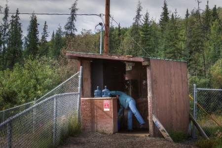
Stop and fill up your water bottles at this fresh spring water tap.
This is a moderately difficult 5 mile long trail that begins and ends at the Wickersham Dome Trailhead at Mile 28 Elliot Highway. This trail offers beautiful views of the Alaska Range and Denali (Mt. McKinley).
Summit Trail follows a ridge all the way from Elliot Highway to Beaver Creek. There is a shelter cabin 8 miles from the trail head that is available to hikers on a first-come, first-served basis.
There isn’t a much left of this old mining town, but at one time, it was home to 250 – 300 miners. The town, named for prospector Nels Olnes, boasted general stores, lodges, hotels and mail and telephone service. It was even a stop on the Tanana Valley Railroad.
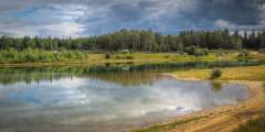
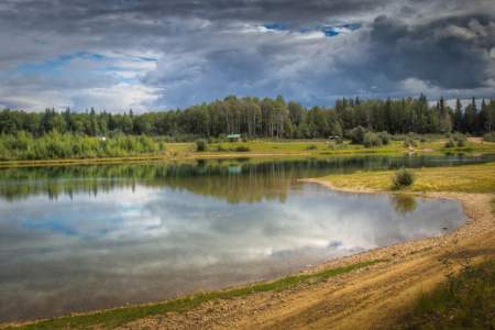
Olnes Pond Access & Campsites, near Mile 10.5 of the Elliott Highway, offers a few wooded and grassy sites along Olnes Pond near Fairbanks. Managed by Alaska State Parks, it’s surrounded by spruce forest and provides pond access and vault toilets. This peaceful campground is ideal for fishing trout, swimming, and blueberry picking, with Fairbanks amenities just 30 minutes away.
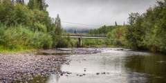
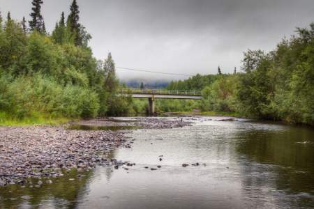
Whitefish Campground & Boat Launch, at Mile 11 of the Elliott Highway near Fairbanks, offers 25 campsites along the Chatanika River in Alaska’s Lower Chatanika State Recreation Area. Managed by Alaska State Parks, it features spruce surroundings, river access, vault toilets, and a boat launch. Ideal for fishing grayling, boating, and picnicking, it’s a quiet, convenient base just 30 minutes from Fairbanks.
Take a break here and look for the sign about the experimental trenching site in this area. This experiment is part of a project studying the feasibility to construct a natural gas pipeline to transport natural gas from Alaska’s North Slope to market. This site will be monitored for 10 years to evaluate the amount of fill substance and to study the success of several methods of re-vegetation.
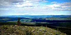
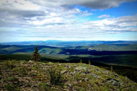
The White Mountains National Recreation Area is home to 200+-miles of trail traversing a million acres of wilderness and a mountain range named for the dominant color of its limestone foundation. To get there, drive 28 miles on the Elliott Highway from Fox (where it splits with the Steese) and look for signs marking the trailhead. The trailhead is the starting point for both the Summit Trail, and the Ski Loop Trail, a 5‑mile loop and a nice ...more
This is your first good view of the Trans-Alaska Pipeline as it emerges from the hillside. The pipeline carries crude oil from Prudhoe Bay on the Arctic Ocean, 800-miles to its terminus at Valdez.
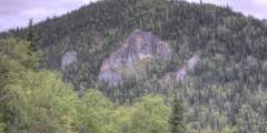
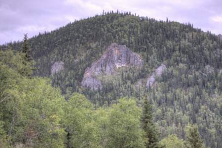
Look for the large rock outcroppings. These are very popular with technical rock climbers. A closer look at the Grapefruit Rocks is just a short hike away.
Joy (Pop. 30). This rural community is named for Joy Griffin, who homesteaded this area with her husband. Joy wrote Home Sweet Homestead about her experiences here.
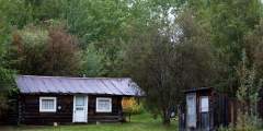
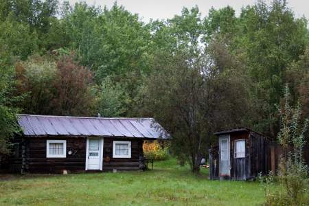
The original cabin was built in 1935 by Swedish trapper and prospector Fred Blixt but burned down in 1991. The cabin was replaced in 1992 and is now wheelchair-accessible.
Livengood (pop. 23) Nathaniel R. Hudson and Jay Livengood discovered gold on Livengood Creek in 1914. By 1915 there was a mining camp and post office. From 1915 — 1920, the claim yielded about $9.5 million in gold. A large-scale mining attempt in the late 1930s — 1940s failed and the post office was discontinued in 1957. There is active drilling in the area so do not trespass on mining claims.
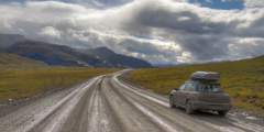
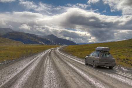
The 414-mile-long Dalton Highway is Alaska’s only road to the Arctic. This highway was built to support the Prudhoe Bay Oilfields and is still used today by both commercial and recreational traffic. Make sure you are on the right highway, the Elliot make a sharp turn left here.
Here you’ll find informal campsites and a boat launch. You may notice an abundance of dragonflies in this area; their main source of food is mosquitoes. The Four-Spot Skimmer Dragonfly was adopted as the Alaska state insect in 1995.
There is no road access, but this 11-mile moderate to strenuous hike is well worth the trip. The trail has spectacular views as it crosses over Tolovana Hot Springs Dome. The hot springs has two hot tubs, 3 cabins as well as outhouses.
In arctic and sub-arctic regions, the subsoil consists of permafrost, which is permanently frozen soil. Only vegetation with a very shallow root system can grow in permafrost. Now you will start to see spruce trees again as you make the transition from alpine to forested terrain.
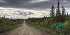
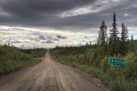
The Athabascan Village of Minto (pop. 190) is 11 miles from here. Many of the village’s resident still live a traditional subsistence lifestyle by hunting out on the Minto Flats.
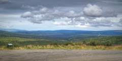
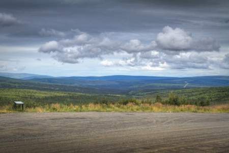
A large pullout provides a panoramic view of the countryside, as well as a nice informal campsite.
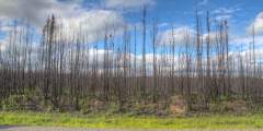
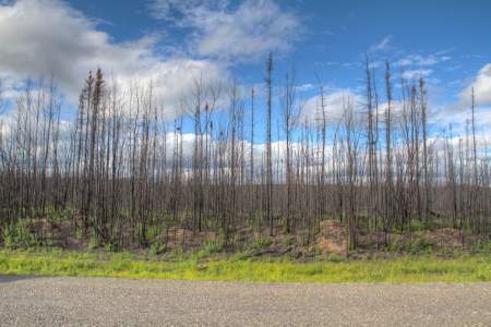
Forest fires are endemic to this region, usually occurring once every 100 to 200 years in any one place. New growth quickly takes root and provides habitat and browse for many different birds and animals that might find it more difficult to survive in mature forests.
Three concrete tubs offer a chance to soak in the soothing mineral water. To make arrangements for a visit, contact the Hot Springs Bathhouse where for $5 you can soak amid the splendor of grapes, Asian pears and flowers.
Manley Municipal Camping, located west of the bridge near the Roadhouse in Manley Hot Springs, offers a few wooded sites along the Tanana River. Managed by the local community, it features river access, showers, laundry, and a restaurant, providing a rustic yet comfortable stay. Ideal for fishing, soaking in hot springs, and enjoying the remote village atmosphere, with Fairbanks a few hours away.
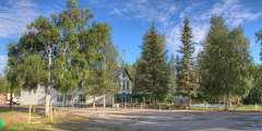
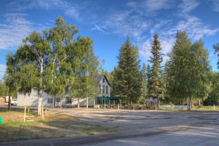
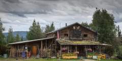
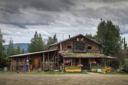
This is one of Alaska’s oldest original roadhouses from the gold rush era. Stop in for a slice of homemade pie or a giant cinnamon roll and mingle with the local miners, dog mushers, trappers and fishermen.