Dalton Highway (Livengood to Deadhorse)
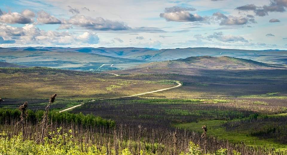
Embrace the vast emptiness along the Dalton Highway
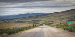
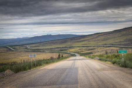
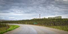
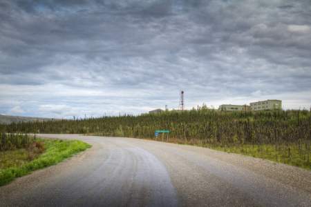
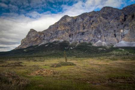
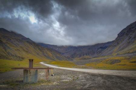
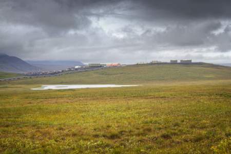
If you’ve seen the TV show Ice Road Truckers, then you’re familiar with the James W. Dalton Highway, a 414-mile stretch of gravel and dirt that runs from the town of Livengood up to Prudhoe Bay and through some of Alaska’s most remote wilderness.
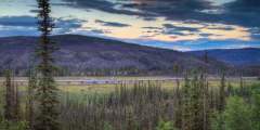
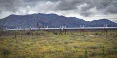
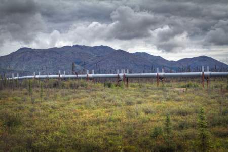
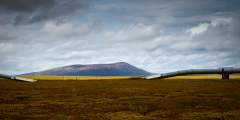
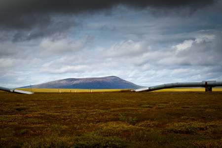
How remote is it up here? There are only three very small towns along the way. Often, the Trans-Alaska pipeline, which runs parallel to the road, is a driver’s only companion. And from the midpoint (the town of Coldfoot) to the end of the road (Deadhorse), you won’t find gas stations, restaurants, rest stops, or hotels—in fact, you won’t find services of any kind over this entire 240-mile stretch. In other words, if you love lonely roads, this is the drive for you.
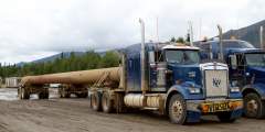
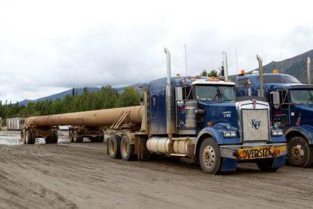
But not many travelers take this route. The highway—built in 1974 to facilitate the pipeline’s construction—is mostly used only by truckers carrying supplies to oilfield workers in Deadhorse. And it’s a tough drive: steep and slick in places and muddy in others, with those trucks occasionally flinging rocks and gravel onto your windshield. For this reason, most rental cars are not allowed on the Dalton. Instead, rent from Alaska 4X4 Rentals, Alaska Overlander, Alaska Auto Rental or GoNorth Car & RV Rental for this adventure. Also, it gets cold here in winter—temperatures as low as 82 below are said to have been recorded.
The iconic "Arctic Circle" sign
Still, with a rugged vehicle and plenty of supplies, you can do it: drive through the boreal forests and up to the misty Arctic oilfields of Deadhorse. Halfway, you’ll pass through Coldfoot (mile 174.8)—home to the world’s northernmost truck stop, and a place to have a drink and put up for the night, in accommodations that are basic yet expensive. In fact, the town got is name in 1900, when travelers got cold feet with the approaching winter and turned around. Don’t follow their example—after all, at that point, you’re already halfway done. Other lodging is available in Wiseman (mile 188.6) and the Yukon River crossing (mile 56).
Read more about the Dalton Highway in this great New York Times article.
And get BLM’s printed guide to the Dalton.
Show Map
Guide Points
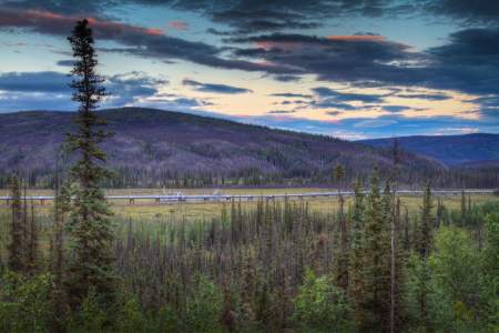
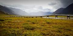
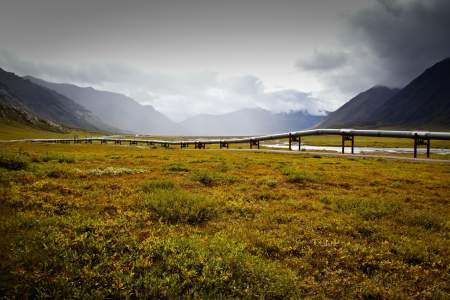
Here you’ll find a good view of Trans Alaska Pipeline and remote-operated valve site. At 151 points along the pipeline, pressure relief valves are used to relieve pressure and keep it below a designated level or stop the flow of oil if necessary. These valves are designed to open automatically. They are located at stream crossings, population areas and major uphill sections of the pipeline.

To the west is Pump Station No. 6. There were originally 10 pump stations along the Trans Alaska Pipeline, only 6 are used to move oil today. These pumps move the oil through the 800 mile-long pipeline from Prudhoe Bay to Valdez. Most stations have three gas-turbine-driven mainline pumps. Each pump can move 22,000 gallons of oil a minute, that’s 754,000 barrels a day.
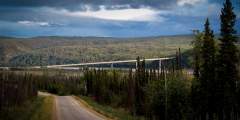
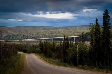
This ½‑mile-long span is one of only four vehicle-carrying bridges across the mighty Yukon, the longest river in Alaska and the Yukon Territory, and a primary means of transportation during the Klondike Gold Rush.
Wooden observation deck provides sweeping views of the Yukon Flats National Wildlife Refuge. This 9 million acre refuge was established to conserve fish and wildlife populations and their habitats including; nesting waterfowl, migratory birds, dall sheep, bears, moose, wolves, wolverines, caribou and salmon. Official protection of this area began in 1978, stemming from a proposed hydroelectric project for the Yukon River. If the dam had been… ...more

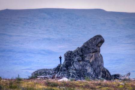
Look for Finger Rock pointing the way to Fairbanks. Rumor has it that early bush pilots in the area used this 40-foot granite rock as a navigation guide. Finger rock is actually a geologic formation called a tor. Tors are rock formations caused by weathering; in this area, the extreme freezing and thawing of the ground causes the rock to be pushed up into these dramatic formations. There are several tors visible in this area; Finger Rock is… ...more
This is a good place to stop and stretch your legs. The scenic viewpoint has plenty of parking, two outhouses and interpretive signs. Take the 1⁄2 mile interpretive trail to the summit of Finger Mountain for an up close view of the alpine tundra. Look for granite tors, the jutting rock formations caused by the freezing and thawing of the ground.
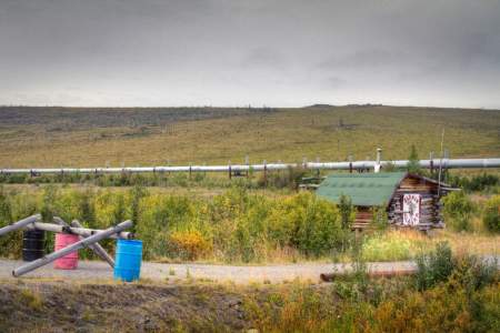
This Level Parking area was once the site of Old Man Camp, a former pipeline construction camp. There were a total of 31 construction camps operating during the construction of the Trans Alaska Pipeline from 1974 – 1977. These camps were temporary facilities to house the thousands of workers who build the pipeline.
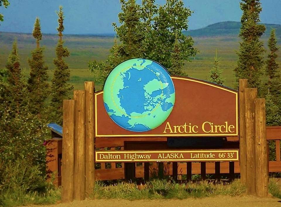
Welcome to the Alaska Arctic. Be sure to take a picture in front of the sign displaying N 66 33’W 150 48. You are now crossing the Arctic Circle. This is the place where the sun doesn’t set on summer solstice and doesn’t rise on winter solstice. The seasons are a little stranger up here, with extreme sun, extreme dark and extreme cold. Pull into the Arctic Circle Wayside to learn about how the different seasons affect life in the arctic… ...more
This is one of the spots where two separate construction crew met during the building of the Dalton Highway. The highway was built in 1974 to allow for the construction of the Trans Alaska Pipeline and finished in only 5 months. This highway, originally a haul road allowing access to Prudhoe Bay, opened to public travel in 1994.
Alaska is the land of the midnight sun and Gobblers Knob provides a stunning location to view this amazing phenomenon. The magnificent Brooks Range blocks the sun for a short time. But, if you take a hike up the hill on summer solstice you can experience 24-hour daylight. Make sure to bring your camera to capture this shining moment.
Pump Station No. 5 is unique from other pump stations because it is actually a pressure relief station. While other pump stations keep the oil moving, this station slows down the oil as it speeds through the pipeline after its decent from the Brooks Range. Oil is drained to relieve pressure and then re-injected. Pump Station No. 5 does not have mainline pumps and cannot boost the speed the oil is traveling through the pipeline.
There are 579 animal crossings built into the Trans-Alaska Pipeline System. This allows for free movement of large game across the pipeline right of way. There are 554 elevated crossings and 25 buried crossings, like this one. Two of the buried animal crossings are actually refrigerated to keep the permafrost from melting and the elevated crossings are a minimum of 10 feet high.
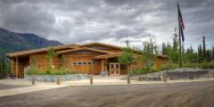
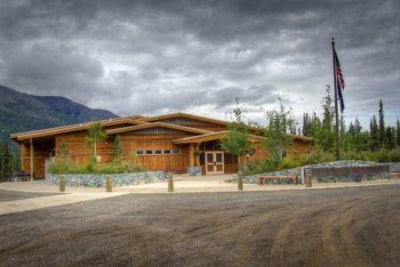
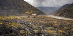
This information center is a partnership between the BLM, the US Fish & Wildlife Service and the National Park Service. The Center is open daily from noon to 10 p.m. late May — early September. Here you will find information and interpretive displays about the regions history, natural environment and recreation opportunities in the area. There’s also an Alaska Geographic Association bookstore.
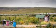
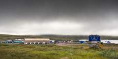
Coldfoot (Pop. 12) This settlement was established in 1898 by miners and originally named Slate Creek. The name was changed to Coldfoot in 1900 when a group of new prospectors got “cold feet” at the idea of spending the winter here and headed south. By 1902, Coldfoot was bustling with two roadhouses, two stores, seven saloons, a gambling house and a post office. Like many other boomtowns, Coldfoot was a ghost town by 1912. The town experienced… ...more
Wiseman (pop 20) This historic gold rush town was established in 1907, Wiseman’s hey-day was from 1911 to 1915. There was no mining in the actual town, however Wiseman attracted prospectors from outlying creeks wishing to provide or receive services. The town grew very quickly; a few cabins, a school and even a post office were brought upriver by sled from Coldfoot to support the population swell. In the grand tradition of mining towns, as the… ...more
A uniquely Arctic phenomenon, pingos are caused by water intrusions into permafrost that then freeze and expand, forcing soil and other surface features to rise and split. This pingo field is probably caused by meltwater from Sukakpak Mountain sinking into the ground through the rubble pile at its base, then resurfacing in this swampy area and freezing.
The Koyukuk Gold Rush is one of the most remote and oldest mining booms in Alaska. Word got out that gold had been found at the Koyukuk River and miners stampeded to the area in 1898. Today, the Koyukuk Mining District is one of the largest in the Yukon River region. Both life-long and recreational miners still find gold in this area today.
This is it, your last chance to see a tree on the Dalton Highway. Welcome to the arctic tundra, the word tundra actually means “treeless uplands”. The subsoil in this area consists of permafrost, which is permanently frozen soil. Only vegetation with a very shallow root system can survive this far north. Take a break and check out the interpretive signs with information on the transition from the boreal forest to the arctic tundra.
Atigun Pass, elev. 4739 ft. This is a very significant point of your journey. As you travel over Atigun Pass, you are crossing the Continental Divide. Rivers to the north empty into the Arctic Ocean, while rivers to the south empty into the Bering Sea. North of the Atigun Pass, the permafrost grows deeper (over 2,000 feet in the Prudhoe Bay area) and is present almost everywhere. South of the pass, permafrost areas become thinner and less… ...more
The Dalton Highway is open year-round, roughly 3,700 large trucks travel the road each month, even during the arctic winter. There are 40 to 50 avalanche paths along Atigun Pass and a massive avalanche could close the pass during winter months and shut down the transportation of supplies to Prudhoe Bay. The department of transportation uses 11-foot-long avalanche guns to shoot down potential slides, keeping the road clear and the truck drivers… ...more
There are 554 elevated crossings built into the Trans Alaska Pipeline System. These crossing are a minimum of ten feet high, and allow the free movement of large game across the pipeline. Watch for caribou and musk ox on these north slope crossings.
Pump station No. 4 has 2 unique qualities; first, it has the highest elevation of all 11 stations stretching from Prudhoe Bay to Valdez, sitting at 2760 feet. Second, this is one of the launching and receiving stations for devices called pigs. Pump Station 1 is also a launch point. There are two types of pigs, named for the squealing sound they make as they move through the Trans Alaska Pipeline. A cleaning or dump pig travels through the… ...more
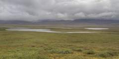
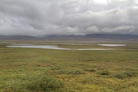
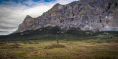
This large glacial lake was dammed by a terminal moraine located to the north. This area has beautiful views and good hiking opportunities into the Brooks Range. This is a great place to stop for information about this region. There are interpretive panels with information about the formation of the Brooks Range, historic uses of the area and major archaeological discoveries; the Arctic National Wildlife Refuge and Gates of the Arctic National… ...more
Here you will find Toolik Field Station, an arctic research station operated by the Institute of Arctic Biology at the University of Alaska Fairbanks. This is the US’s most important arctic research station and the site of the National Science Foundation’s Arctic Long-term Ecological Research Site. The mission of the Toolik Field Station is to facilitate and enhance arctic research as well as increase research and management efficiency,… ...more
There are 25 buried pipeline animal crossings on the Trans Alaska Pipeline System, and this is one of the two refrigerated crossings. Refrigeration keeps the hot oil in the pipeline from melting the permafrost.

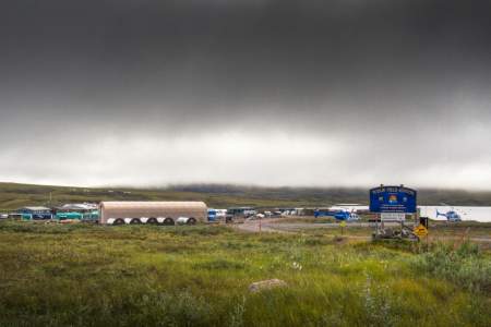
Deadhorse (pop. 4 permanent, 3000 — 6,000 part time). This is a town with a sole purpose — to support pipeline and oilfield operations for the Prudhoe Bay oilfields. The public road ends here, but you can take a two-hour tour with wildlife viewing, a visit to the oilfields and access to the Arctic Ocean.