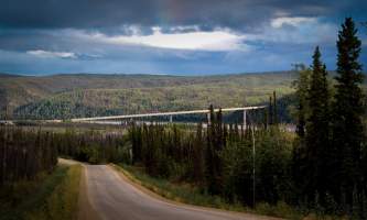
This ½-mile-long span is one of only four vehicle-carrying bridges across the mighty Yukon, the longest river in Alaska and the Yukon Territory, and a primary means of transportation during the Klondike Gold Rush. The bridge was built in 1974-5 as part of the construction of the Trans-Alaska Pipeline System. And you'll cross under that pipeline to reach the Yukon Crossing Visitor Contact Station, staffed by friendly BLM volunteers from 9 a.m. – 6 p.m. from late May to September. Take a short walk down the trail to the viewing deck for a great photo opportunity of the Yukon River.


