Mt. Denali Viewpoints: Where to See The Great One
Written by the Alaska.org Editorial Team. Updated September 2025.
One of the best things about visiting Alaska is catching sight of Denali, “the Great One,” the tallest peak in North America and one of the largest massifs in the world. The 20,310-foot mountain (also known as Mount McKinley) dominates the horizon like nothing else—a dazzling, white behemoth that can be seen from all over Southcentral and central Alaska.
Alaska’s Landmark Icon
Revered by Alaskans, Denali is the state’s iconic landmark, endlessly fascinating and mysterious. Up close, its granite cliffs and sparkling seracs punctuate a world of perpetual winter. Move back a few miles, and it appears as a craggy mound, buttressed by sweeping ridgelines and skirted by huge glaciers. Even from 130 to 150 miles out, the mountain still presents an overwhelming vision, looming like an entire range jumbled into one spot and armored in ice.
Against a blue sky, the shimmering sight is unmistakable and postcard perfect. It can glow in the midnight sun as though lit from within.
The Weather Gives, and the Weather Takes Away
When the weather cooperates, Denali is visible from almost anywhere in the region with an unobstructed view. But Denali is so large that it can create its own weather. During summer especially, clouds and fog can shroud the mountain up to one third of the time. But don’t give up! Southern Alaska’s volatile weather—big ocean storms wrestling for dominance with Interior high pressure—means the mountain can reemerge into blue sky without warning. It pays to keep watch and investigate promising viewpoints as you travel the state.
From Anchorage to Fairbanks—from highway pullouts to remote alpine summits—Alaskans always check to see if “the Mountain is out.”
Show Map
Anchorage
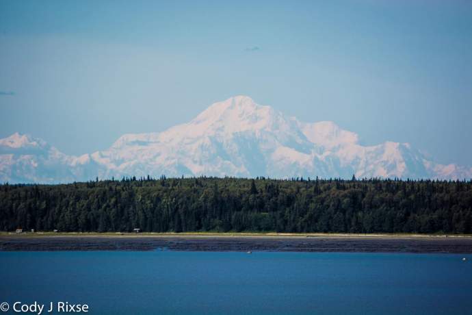
Denali is so large that it can be seen from Anchorage, 130 miles away! These are distant views, but it's still impressive to see the white peak glimmering on the horizon. And, it's a good opportunity to see the mountain if you're short on time and wont be traveling farther north than Anchorage.
Several parks, just minutes from downtown, offer great viewpoints. At Point Woronzof, you’re looking across Knik Arm. The view is completely unobstructed and makes for great photos in soft evening light. Also overlooking Knik Arm, Earthquake Park provides a similar, but often less crowded view. Further from downtown, the grassy slope outside the Kincaid Park Chalet offers a similar view to Woronzof, but with slightly more elevation. Plus you’re surrounded by all the hiking, biking and adventuring possibilities of Kincaid Park. For a true mountain to mountain experience, drive about 20 minutes from downtown to the trailhead at Glen Alps. Many hiking trails and overlooks in Chugach State Park feature excellent views of Denali, along with Hunter and Foraker. But the deck at the end of the Glen Alps Viewpoint Trail—250-yards out a paved pathway from the parking area – is the most accessible, and it’s handicapped accessible. Hiking up the trail toward the top of Flattop Mountain—the most climbed peak in Alaska—turbo charges the view with more elevation.
There are more urban views too. Arriving and departing Anchorage, you may catch sight of it at the Ted Stevens Anchorage International Airport. If you walk outside the ticketing counters on the upper level of the terminal complex, Denali may be visible on the northern (left as you exit) horizon.
Located atop Tower III of the Hotel Captain Cook in downtown Anchorage, the Crow’s Nest is a high-end restaurant offering fine dining with a most spectacular visual aperitif. Feast on fresh Alaska seafood while overlooking both Alaska’s biggest cityscape and its most fabulous mountain.
For a quick, no-fuss option to snatch some elevation with an unobstructed view when strolling or parking downtown, head to the top level of the JC Penney Parking Garage.
And if the weather just won’t cooperate, you can still experience the mountain. Check out the many paintings of Denali at the Anchorage Museum. 625 C Street. Laurence’s colossal landscape “Mount McKinley” is as impressive in its own way as any live view.
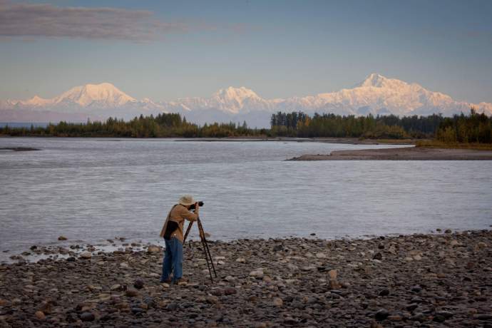
Talkeenta
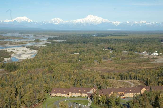
Several excellent views of Denali can be found up the Talkeetna Spur Road (Mile 98.9 of the George Parks Highway) and inside the village of Talkeetna itself. The Denali View Pullout at Mile 13 of the spur road features the mountain with Foraker and the Alaska Range spanning the horizon above the Susitna River. For the same view with a bit of elevation—plus refreshment and excellent dining—try the deck at the Talkeetna Alaskan Lodge. If you would like your mountain served up with the whoosh of roiling glacial rivers, try the Talkeetna Riverfront Park at the west end of the village. The mountain looms above the gravel bars where three rivers merge—the Chulitna, Susitna and Talkeetna.
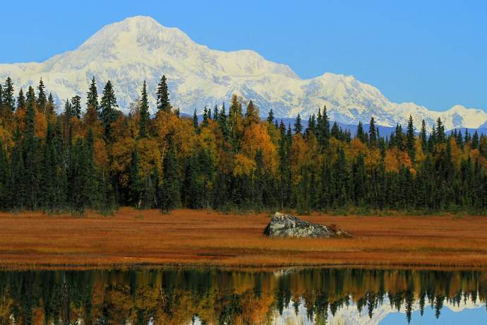
Petersville Road
Ready for an outdoor adventure? If you have a vehicle that can handle a rough gravel road (four wheel drive and high clearance recommended), drive west on Petersville Road (junction Mile 114.9 of the George Parks Highway.) Continue past the end of pavement. About 26 miles out you will pass the boarded up buildings of the abandoned mining camp of Petersville. Continue another mile or so—stop before you enter Peters Creek Canyon—and take a side trail leading north. (You might need to park and hike.) Climb to a high spot in the Peters Hills and feast on the view that inspired Sydney Laurence’s paintings.
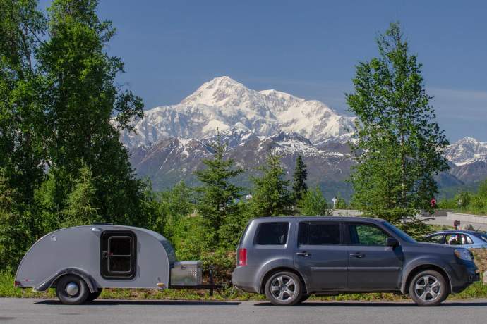
George Parks Highway: Denali State Park
The 360-mile drive from Anchorage to Fairbanks features many places to catch a glimpse of Denali, including two official waysides touted as the best views on the road system. Note: Don’t confuse the “Parks Highway” with the “Park Road” that travels into the heart of northern Denali National Park. Denali View South at Mile 135.2 is only about 40 miles from Denali, producing a stunning view that is unequaled anywhere outside the national park itself. The mountain rises above 325-acre Byers Lake at Mile 147.1 like a dream. If you have time to hike around the shore, or can paddle into position, you will be rewarded. On calm and clear days, it’s great place to snap that “reflecting pool” shot. Denali View North at Mile 162.7 is another wayside with a different view of Denali. Similar to the view at Denali View South.
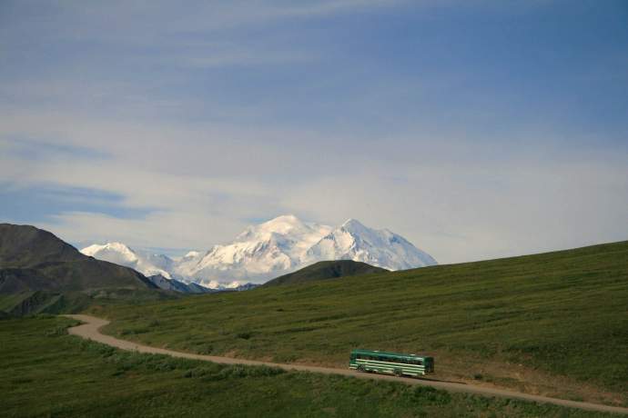
Denali Park Road
(Junction with George Parks Highway at Mile 237.4) The 91-mile road into the heart of Denali National Park flanks the mountain’s north face and offers many amazing views, ranging from 25 to 35 miles away. This famous road, closed to private vehicles after Savage River at Mile 15 during the summer season, features an extensive shuttle bus system. There are several viewpoints within the first 20 miles, but the farther you travel, the bigger the mountain gets. After the Eielson Visitor Center (park road mile 66) the summit is visible for the next 15 miles. Tour buses and park shuttle buses are permitted to drive the road, which ends at Kantishna, an old mining town turned lodging enclave. Note: 2026, the Denali Park Road is closed beyond mile 43. If you book into Camp Denali in the heart of the park, you'll also get amazing views on a clear day.
Fairbanks
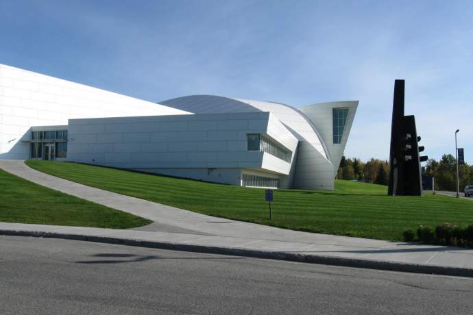
The north face of Denali can be seen from many spots in Alaska’s Interior city, about 150 miles from the mountain. The most beloved view can be found at the Alaska Range Overlook on the University of Alaska Fairbanks campus. Elevated above the surrounding valley, the viewpoint features an Alaska Range panorama and is popular with photographers trying time-lapse photography. A great place to see alpenglow on the distant peaks. Located on Yukon Drive across from the Reichardt Building. A block further west is the UA Museum of the North. The top of Denali, as well as the Alaska Range, can be seen from the huge lobby window most mornings.
By Air
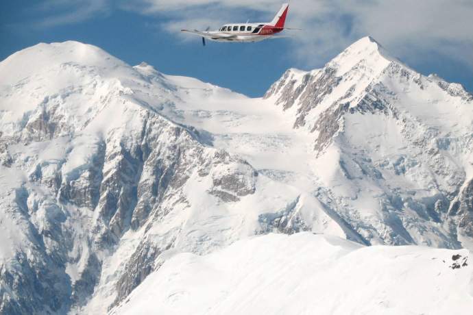
Other than climbing Denali’s slopes as a mountaineer, there’s no more intimate and impressive way to see the mountain than by air. In fact, you will probably see more of its shape and structure during an hour inside a light aircraft than you will during a couple weeks trudging up its glaciers. Leaving from Anchorage, Talkeetna, or Denali Park, these tours fly over the mountain, around it, or up to its edge. You will wing past snowfields, alpine glaciers, deep crevasses, and sheer granite walls. In a couple hours you’ll probably see more beautiful, dramatic, and savage mountain scenery than anywhere else in your life. You can even select a flight with a glacier landing, where you’ll land on a glacier and walk through Denali’s icy alpine world! It’s not cheap, but it’s one of Alaska’s all-time best high adventure outings. Click here for a comparison of the top flights.
OK, you’re not likely to book a commercial flight between Alaska’s two largest cities just to see Denali. But if you are making this trip anyway, and the weather is clear, get ready for one of the most extraordinary sights possible: The Mountain from 30,000 feet. Depending on the exact flight path, you may be able to grok the massive geography in a single glance—buttresses, glacial approaches, the two summit peaks. Sometimes you can even make out the popular route up the Kahiltna Glacier, etched into the snow and ice by hundreds of climbers during May and June. It’s like doing Google Earth Pro in real life. For best viewing, be alert as you approach mid point of the 260-mile commute (50 to 70 minutes total flight time) between the two cities. Ask your flight attendants for timing advice! On most itineraries, you should book a window seat on the left side if traveling north, on the right side if traveling south.
More Denali Details
- From Anchorage—about 130 miles away as the raven flies—Denali usually appears just to the right (east) of two mountain companions. The 17,400-foot Mt. Foraker rises on the far left (west) and 14,573-foot Mt. Hunter crouches in between the two larger peaks. Look just slightly west of due north and scan for three enormous, white mounds—like gigantic scoops of ice cream—lined up together along the horizon.
- The modern English word “Denali” derives from the ancient Koyukon Native word “Deenaalee,” meaning “tall one” or “great one.” Five other Athabascan languages share similar terms, and linguists think Alaskans may have been calling the mountain by this evocative name for thousands of years. Of course, in Alaska, you can just go ahead and call it “The Mountain.” Everybody will know of whom you speak.
- During the Gold Rush, the United States officially designated the mountain as “Mount McKinley”—after President William McKinley—and that moniker stuck for more than a century on official federal maps and documents. (Most Alaskans always used its ancient Native name.) President Barack Obama directed the U.S. Department of the Interior to adopt “Denali” during his visit to the state in 2015. For much more on the long-running political and cultural dispute over Denali’s name see this Live Science article.
- Denali is now considered to be 20,310 feet, based on GPS calculations completed in 2015. In 2013, scientists produced an estimate of 20,237 feet using a remote-sensing technique. The original official height of 20,320 feet came from calculations by the legendary mountaineer and cartographer Bradford Washburn in 1953. Scientists don’t think the mountain has shrunk, just more accurately measured. In fact, tectonic forces appear to be slowly increasing the mountain’s height, about one millimeter per year.
- From its base to its summit, Denali rises about 18,000 feet, about one third more total height than the same measurement for the world’s tallest peak, Mount Everest. That makes Denali the tallest mountain in the world—measured from base to peak—that’s wholly above sea level.
- If you measure from the bottom of the ocean, Denali is the fourth biggest peak on Earth. Only the oceanic shield volcanoes of Mauna Loa-Kea in Hawaii, Haleakala in Maui and Pico de Teida of the Canary Islands rise further from their bases.
- Want to take a broader perspective? Denali is the 18th highest peak—measured from base to summit—in the Solar System. Colossal mountains on Mars, Venus and various moons and asteroids fill out the top slots on this list.
- More than 32,000 people have tried to climb to the summit of Denali, most by the West Buttress Route. In 2017, 1,189 people made the attempt, but only 495 made it all the way, a success rate of about 41 percent. For more mountaineering stats, check out the park’s mountaineering reports site.

