Alaska Boat Launches & Harbors
Alaska features scores of boat launching sites and ramps, offering access to more navigable lakes, streams and ocean coastline than all of the other states combined. They range from high-capacity, fee-based facilities inside harbors and ports, to state park ramps aimed at vessels on trailers, to totally unmaintained dirt slopes that anglers and hunters have pioneered next to river bridges or along a shore.
They are managed many different public agencies and a few private entrepreneurs. No official, comprehensive directory exists. Outside of core recreation areas, the ramps may not always be located in the most convenient or sensible spots. But with some flexibility and a little research, you can almost always find a usable launch site for navigable water near your destination.
Quick Tips
- Launching into the ocean? Check first with the small boat harbor or launch site in the community nearest to your boating destination.
- Launching into a lake? Park and recreation sites adjacent to the shore will often be your best bet.
- Launching into a river? While parks and recreation sites will often feature well-appointed launch sites (the Kenai River corridor has many examples,) Alaskans regularly pioneer their own launch ramps, both for trailered boats and paddling craft. If you know what you’re doing, don’t hesitate to check pullouts beside highway bridges for access options.
For More Information
Here are several links to boat ramp lists. They have been posted by the Alaska Department of Fish and Game to help anglers and hunters figure out access to fishing and hunting, often in less-traveled areas in the Interior. Scan these as an additional resource to find launch sites along your itinerary.
Show Map
Boat Launches & Harbors by Destination
Anchorage
Eklutna Lake Campground, at Mile 26.5 of the Glenn Highway near Anchorage, offers 50 campsites plus 8 overflow along a 7‑mile lake. Surrounded by spruce forest with mountain views, it features vault toilets, a water pump, and access to a 25-mile trail network. Campers enjoy paddling, fishing for Dolly Varden, and hiking to alpine vistas, all within an hour of Anchorage.

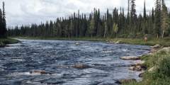
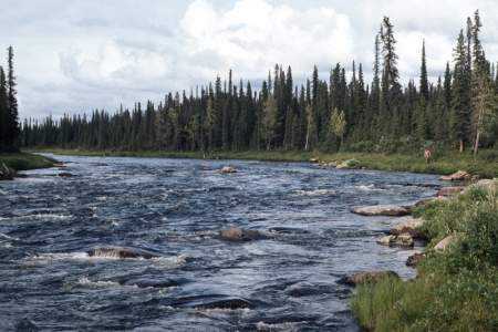
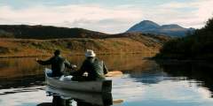
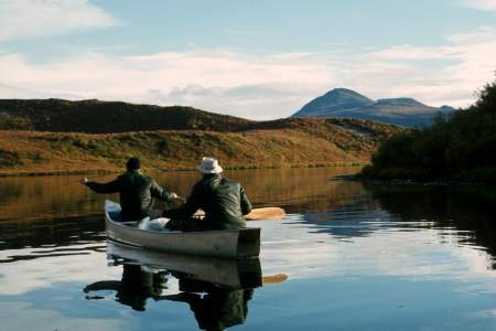
Class II Packrafting River.
Kenai Peninsula
If you want to camp beside subalpine Upper Summit Lake close to trumpeter swans and fishing for rainbows, take the family to this campground deep in the Kenai Mountains off Mile 46 of the Seward Highway. The 35 sites are spread along a loop in the alder, willow and spruce woods on the hillside above the lake, with clear-running Tenderfoot Creek passing through
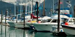
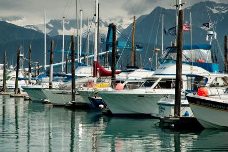
Established in 1964, Seward’s Small Boat Harbor is located on the northern edge of Resurrection Bay, which multiple publications have ranked as one of the top sailing destinations in the United States. From the harbor you’ll find easy access to Exit Glacier, Kenai Fjords National Park, fishing, kayaking, camping, flight-seeing, and an assortment of other activities. Seward plays host to a variety of vessels that make up the commercial fishing… ...more
RV park & campground, kayaking, and fishing charters in Seward, Alaska
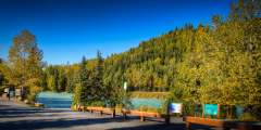
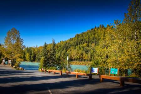
Access point to fish the Russian River near the confluence of the Kenai and Russian Rivers in Cooper Landing. It also provides parking for anglers using the Russian River Ferry which is right next door. Fishing opportunities for red (sockeye) and silver (coho) salmon, as well as dolly varden and rainbow trout.
This is a take out for the upper river or a put in for the middle and/or lower river.
Check out this salmon-friendly habitat and learn why so many salmon spawn here annually.
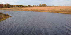
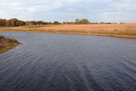
Izaak Walton State Rec Site near Sterling offers 31 campsites at the junction of the Kenai and Moose Rivers on Alaska’s Kenai Peninsula. Managed by Alaska State Parks, it features spruce surroundings, river access, a boat launch, vault toilets, and fire rings. Named after famed angler Izaak Walton, it’s ideal for salmon fly-fishing, exploring archaeology, and enjoying the Kenai’s scenic beauty.
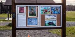
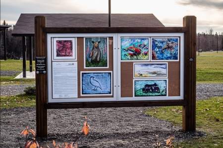
View locally created fine art or the works of artists from around Alaska and the Pacific Northwest.
This is a popular boat launch for drift boaters fishing for king salmon. The Kasilof River red salmon dipnet fishery is here, but only open to Alaska residents. It’s worth a look if you’ve never seen dipnetters in action before. There are 16 campsites, water, tables, toilets, hiking trails, a boat launch and fishing.
Anchor River State Rec Area, near the mouth of the Anchor River off the Sterling Highway, features 5 campgrounds with 186 campsites. Popular for salmon fishing, beachcombing, and enjoying coastal scenery, it offers easy access to the ocean and scenic views. Campers appreciate its natural beauty and proximity to the small-town charm of Anchor Point on Alaska’s Kenai Peninsula.
Prince William Sound
Southeast Alaska
From the boat ramp parking lot, walk along the driveway to Senator Gruening’s home. The path ends where Peterson creek cascades down into Lynn Canal. It’s an amazing place for wildlife viewing when the salmon are running.
“Out the Road” ends at Echo Cove. You’ll see only a boat ramp and some outhouses, but walk about a mile down the beach and you’ll come upon the beautiful view of Berner’s Bay, Lion’s Head Mountain, and possibly a whale or 20. You likely won’t be alone, though; this is a popular spot for ATVs, so be prepared for their noise. It’s also a popular spot for kayaking, as Echo Cove offers great access to Berner’s Bay. But the cove is narrow, shallow,… ...more
Susitna River Valley
Big Lake North State Rec Site offers 60 wooded campsites along Big Lake in Alaska’s Mat-Su Valley. Managed by Alaska State Parks, it features vault toilets, fire rings, a telephone, and lakefront access for fishing, paddling, and relaxing. Surrounded by spruce and near the Big Lake community, it’s a spacious, scenic base for enjoying the area’s outdoor recreation and peaceful setting.
Big Lake South State Rec Site, at Mile 5 of Big Lake Road near Wasilla, offers 20 wooded campsites along Big Lake in Alaska’s Mat-Su Valley. Managed by Alaska State Parks, it features spruce forest, lake access, a boat launch, vault toilets, and fire rings. This scenic campground is great for trout fishing, boating, or enjoying the area’s active outdoor vibe, with Wasilla’s amenities nearby.
Deshka Landing is a boat launch on the Susitna River that provides access to the Susitna, Yentna, and Deshka Rivers. The landing is open year-round (winter snowmobile use) and is managed by the Deshka Outdoor Association, LLC.
The Talkeetna River is a classic Alaska whitewater trip with Class IV – V rapids, fast canyons, and turquoise glacial water. It offers stunning Denali views, great hiking, fishing, and abundant wildlife. A bush plane is required for access, and jet boats crowd the lower reaches during King Salmon season. The 60-mile route takes 3 – 7 days and suits medium to large rafts or kayaks. Bears are common during the salmon run.
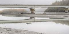
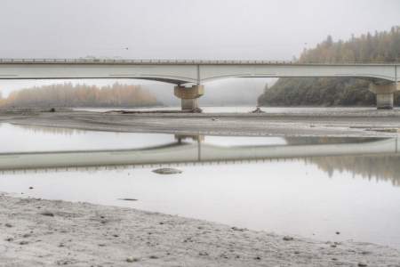
Surprise! This bridge over the Susitna River appears without warning, so if you want to stop and see this huge drainage, slow down and pull off the road at either end. Alaskans call it the Big Su. We fish it, paddle it, and snow machine its frozen braids. Bush pilots even navigate by this river. The Susitna River winds its way over 313 miles of Southcentral Alaska; this old railroad bridge crosses the water on the eastern edge of Denali… ...more
Matanuska River Valley
Matanuska Lakes (Kepler Bradley) Campground, at Mile 36 of the Glenn Hwy near Palmer, offers 9 RV sites and 8 campsites by Kepler Lake. Surrounded by spruce forest with lake access, trails, vault toilets, and fire rings, it’s a peaceful base for trout fishing, canoeing, and hiking the Matanuska Greenbelt — just minutes from the charm of downtown Palmer.
Finger Lake State Rec Site near Wasilla offers 24 campsites, 2 group sites, and 25 picnic areas along scenic Finger Lake. Managed by Alaska State Parks, it features lake access, spruce forest, vault toilets, and fire rings. Campers enjoy trout fishing, kayaking, and loon watching, with easy access to the nearby towns of Wasilla and Palmer for added convenience and amenities.
Overview With the Talkeetna Mountains to the north and the Chugach Mountains to the south, the Matanuska River pours forth from the large Matanuska Glacier in a swift, freezing cold, torrent of Class II to Class IV whitewater for nearly 70 miles before it meets the sea where the Knik Arm of Cook Inlet reaches into the interior. The river runs down the trench formed where the Border Ranges Fault line separates the two mighty mountain ranges,… ...more
Copper River Valley
Overview This interesting combination of rivers and lake is a rarely done circuit that would be a great multi-day wilderness float trip for kayaks and rafts. With good fishing opportunities and only Class III at times, it is mostly a Class II trip and for 80 miles it travels through an amazing landscape. The Nelchina River system is a rocky glacial river with daily water level fluctuations amid a forested valley and with spectacular views of… ...more
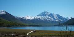
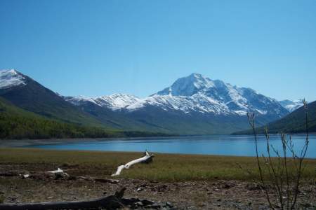
Lake Louise State Rec Area near Glennallen offers 67 wooded campsites along the lake in Alaska’s Copper River Valley. Surrounded by spruce forest with lake access and Tazlina Glacier views, it features vault toilets and fire rings. Campers enjoy trout fishing, hiking to berry patches, and soaking in the lake’s peaceful scenery, with Glennallen’s amenities just a short drive away.
This swift, glacially-fed river delivers one of the top sports salmon fisheries in the Copper Basin, with productive bankside fishing for famed Copper River reds and decent opportunities to land a big king salmon. You’ll find good parking and direct access to public easements along the river in Copper Center. Many professional guides also operate in the community.
Gulkana River
The Gulkana River is an 80-mile National Wild and Scenic River, popular for whitewater trips and fishing. It takes 5 – 7 days to paddle, starting with a 7‑mile stretch on Paxson Lake. Rapids range from Class I‑IV, with a fast, boulder-filled canyon (Class IV) that non-experts should portage. The river features King Salmon runs, scenic views, and a mix of slow and rocky waters, ideal for experienced paddlers.
Interior Alaska & Fairbanks
Popular camping, fishing, and outdoor recreation spot just an hour south of Fairbanks along the Richardson Highway. There are 19 campsites and 5 walk-in sites. In summer, the area is popular with boaters, fishermen, and jet-skiers / water skiers. The lake is stocked with Rainbow trout, grayling, and Arctic char, as well as salmon. It’s also a popular ice fishing spot in winter. You can even reserve an ice fishing hut!
Clearwater State Recreation Site, east of Delta Junction, offers 17 campsites along the Clearwater River. Managed by Alaska State Parks, it features spruce surroundings, river access, and a boat launch. Amenities include vault toilets and fire rings. This peaceful campground is ideal for fishing grayling, canoeing, and enjoying the serene beauty of the Delta area, with nearby services in Delta Junction.
Fielding Lake State Campground, at Mile 200.5 of the Richardson Hwy near Paxson, offers 17 remote campsites along Fielding Lake in Alaska’s Interior. Managed by Alaska State Parks, it features spruce forest, alpine tundra, lake access, vault toilets, and fire rings. It’s a peaceful base for trout fishing, enjoying serene lake views, or exploring the expansive landscapes of the Alaska Range.
Harding Lake State Rec Area, 44 miles from Fairbanks, offers 90 campsites and 5 group walk-in sites along Harding Lake in Alaska’s Interior. Managed by Alaska State Parks, it features spruce forest, lake access, a boat launch, vault toilets, and a playground. It’s a popular spot for trout fishing, boating, swimming, and enjoying family-friendly recreation, with Fairbanks and Delta Junction nearby.
Moon Lake State Rec Site near Tok offers 15 wooded campsites along scenic Moon Lake in Alaska’s Interior. Managed by Alaska State Parks, it features spruce forest, lake access, a boat launch, vault toilets, and fire rings. It’s a quiet base for trout fishing, boating, and hiking nearby hills, with the small-town conveniences of Tok just a short drive away.
Quartz Lake State Rec Area, near Mile 278.8 of the Richardson Hwy by Delta Junction, offers 103 campsites along Quartz Lake in Alaska’s Interior. Managed by Alaska State Parks, it features spruce surroundings, lake access, a fishing dock, vault toilets, and a pavilion. It’s a family-friendly base for fishing trout and salmon, swimming, or winter ice fishing, with nearby Delta Junction services.
You are now entering the 397-square mile Chena River State Recreation Area. Here you’ll find activities year round from hiking, rock climbing, and berry picking to dog sledding and cross-country skiing. Maintained and well-marked trails lead into alpine country and access very different hiking experiences. Once above treeline, smaller trails lead away from the main, developed trails to reach even more remote areas, many with unobstructed… ...more
The Delta River offers diverse floating challenges, from quiet lakes to Class IV rapids. Stunning scenery, abundant wildlife, and great fishing make it a favorite. It’s a two-day trip from Tangle Lakes to mile 212 on the Richardson Highway. Beyond that, Black Rapids features Class IV rapids requiring portaging. The river then flows 30 miles of Class III and 18 miles of Class I‑II to the Tanana River.