Things To Do In Nome
Day Tours & Attractions View All

Nome is becoming a well-known as a treasure for birders. The city is bounded by tundra on three sides and the Bering Sea coast on the other. Once the ice begins to break up, migration begins. Virtually the entire area of the Seward Peninsula that is accessible by road from Nome is comprised of extremely valuable nesting areas for many bird species, including most North American waterfowl.

Even by Alaska’s standards, Nome is a magical place — and longtime resident Carol Hobbs of Running Fox Tour Company knows it better than almost anyone. Carol customizes small-group tours around her guests’ interests, offering everything from a historical city walk through Gold Rush landmarks to guided beach walks, day hikes, and fully custom itineraries. During Iditarod week, special tours include an Arctic Sunrise Drive and a Gold Rush walking ...more
Snowmachines are part of the fabric of life in places like Nome, where snowfall closes the roads to cars and trucks for months on end. Snowmachines serve a practical role, transporting people and supplies. They also allow for backcountry exploration in winter — and are sure fun to race!
Scenic Drives View All
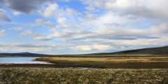
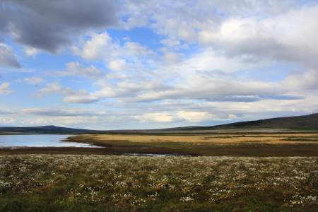
Less than 150 miles from the Arctic Circle, there are no trees, so you can see forever
Nome — Council Road spans 72 miles (East) and takes 2 hours one-way without stops. For spectacular birding, sweeping coastal views, and the famous “Last Train to Nowhere,” explore the Nome — Council Road. Additional highlights include the Safety Roadhouse, which is the last stop on the Iditarod Sled Dog Race, and the small community of Council, which boasted a population of 15,000 in its heydey.
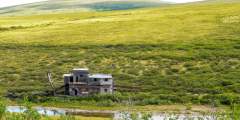
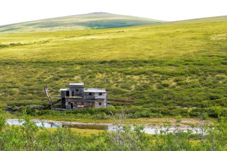
When locals want to see trees, they head north on The Nome — Taylor Road (also called Beam Rd. or Kougarok Rd.) The 85-mile gravel road runs north-south and takes 2 hours one-way without stops. The route winds past many old mining claims, the popular Salmon Lake, and offers a side trip to historic Pilgrim Hot Springs.
The Nome – Teller Road brings you within 55 miles of Russia, and is as close as you can drive to the Bering Strait Land Bridge. The road travels 73 miles northwest and takes about 2 hours one-way without stops. You end at Teller, an authentic Inupiat village of fewer than 300 people who survive on a subsistence lifestyle.
Parks & Trails View All
Heading north, there are two turn-offs for tundra ridge hiking with great views of the surrounding area
King Mountain is just a little northeast of Nome, providing easy access for day hike up the peak for incredible views of the Kigluaik Mountains or the Bering Sea.
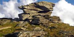
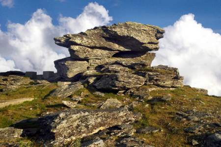
Anvil Rock perches above Nome, an early landmark for gold miners and an easy hike for those who want to take in spectacular views of Nome, the Bering Sea, and the Kigluaik Mountains. Its resemblance to a blacksmith’s anvil generated names for many nearby landscape features, including Anvil Mountain and Anvil Creek. The hike also promises a good chance to see musk oxen, birds, and maybe even reindeer or red fox. ...more
In the 1940s, soldiers stationed in Nome enjoyed a rope tow up Newton Peak for skiing and ski-jumping. The tow line is gone, but this is still a winter hot spot for skiing and snowboarding, and is great for a summertime hike.
Spend a magical afternoon hiking to Dorothy Falls, which provides just enough variety to feel like a real Alaskan adventurer: a river crossing, ascent to a ridgeline, steep descent to the falls and a walk along Dorothy Creek!
Take the hike up Anvil Mountain for incredible views of the city of Nome and the Bering Sea beyond. Running up and down the mountain can be done in 22 minutes, as proven by the local cross-country team. You’ll probably want to take it a little slower, to enjoy the tundra flowers, wildlife and view from the top.