Valdez Parks & Hiking Trails
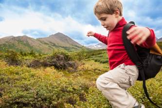
Whether you’re a hardcore hiker or a family looking for an easy stroll with great views, you can find it in Valdez—along with everything in between. This small city serves up a large number of well-maintained trails. Some hikes are close to town and feature beautiful waterfront views, while others further north off the Richardson Highway have a rainforest jungle feel, complete with cascading waterfalls. For information and recommendations from knowledgeable locals, stop by the Visitor Center.
Here are Top Trail Picks in Valdez
Easy: Dock Point Trail
For a quick, easy walk with amazing views, this is the trail locals will always recommend. Dock Point Trail is an 0.8-mile loop trail with just one steep section (hint: if you hike it clockwise you’ll walk that section downhill). One side of the loop looks over the Duck Flats, a rich estuary home to migratory birds. The other side overlooks the harbor’s shimmering waters and the snow-capped peaks beyond. It’s an easy walk from downtown, making for a great morning walk or a perfect stroll after dinner at one of the restaurants.
Moderate: Mineral Creek Trail
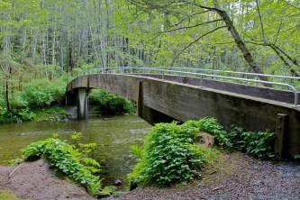
Head up the Richardson Highway to reach Mineral Creek Trail that’s popular with bikers, joggers, and hikers. You’ll walk on a nice wide gravel path, but the steady elevation gain makes this trail a bit strenuous. The first portion is open to ATVs, while the final section is for foot and bicycle traffic only; the trail ends at an abandoned Gold Rush-era stamp mill.
Challenging: Shoup Bay Trail - Section A
Shoup Bay Trail is broken out into two sections. Section A is a moderate 6.5-mile round-trip that will take 4 hours; you’ll cross flats, streams, and open meadow and get views of Port Valdez. Section B is not maintained and adds 12.6 strenuous, round-trip miles.
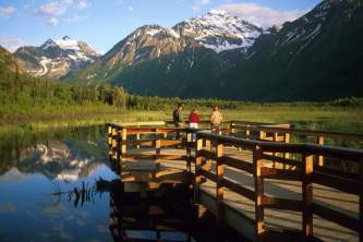
Best Views. Dock Point Trail; Goat Trail
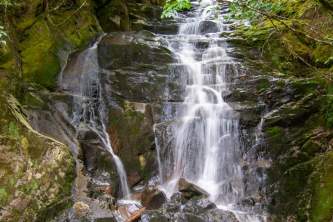
If you’re short on time or energy, the Dock Point Trail hike mentioned above offers the best views with the least effort. If you’re feeling more ambitious, try Goat Trail. This 4.3-mile trail moderately difficult trail features stunning canyon views and the chance to check out Bridal Veil Falls.
Wildlife Viewing: Homestead Trail
This 1.2-mile trail follows Mineral Creek down to a salmon-viewing area. Along with the fish, you may see the bears that come to feast on them. On the way, expect to see lots of birds and summertime wildflowers, as well as some fantastic ocean views.
Remote Feel: Keystone Canyon Pack Trail, Goat Trail, Wagon Road
Want to feel like you’re miles away from civilization (even if you’re not?) The road-accessible trails just off the Richardson Highway north of Town, like the Keystone Canyon Pack Trail, Goat Trail, or Wagon Road are for you. They were all part of the famous Trail of ’98 that led prospectors from the port of Valdez to the interior during the Gold Rush.
Show Map
Parks & Trails

This easy loop trail — just 0.8 miles long with less than 500 feet in elevation gain — offers probably the best bang for your buck in Valdez. It’s close to town yet feels immersed in nature, comes with awesome views, and you can do it in just 30 – 45 minutes at a leisurely pace.
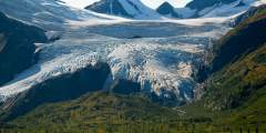
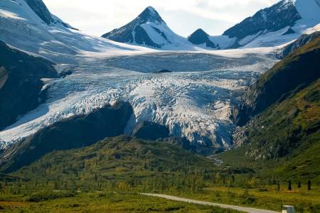
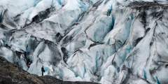
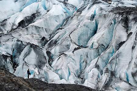
One of the most visited natural attractions along the Richardson Highway, this four-mile-long glacier descends almost to pavement and is easy to approach on foot. The state recreation site features parking, pit toilets, and a covered pavilion with a model of the glacier and interpretive signs, all close to small lake.
This trail has a split personality: It’s broken out into two different sections that will appeal to two different kinds of hikers! Section A is the tame sibling — a 6.5‑mile moderate round-trip that takes about 4 hours. Section B is the wild child: A full 12.6 miles out and back, this stretch takes 10 hours or so to hike and is difficult.
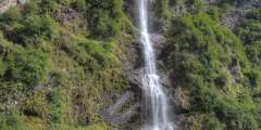
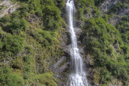
Bridal Veil Falls and the Valdez Goat Trail: This two-mile-long hike is a restored section of the Trans-Alaska Military Pack-train Trail that was the first glacier-free route from Valdez to the interior of Alaska. There’s a fantastic overlook about a mile down the trail.
If you’re interested in seeing remnants of Alaska’s Gold Rush heritage, you’ll find some fantastic ruins from that era along this 12.2‑mile trail that follows an old gravel road and takes about 6 hours. Don’t want to walk it all? Rent a bike in Valdez and pedal your way.
Hike uphill until you reach about 3100ft where you will find a good place to cross the stream. At 3500ft you will need to cross yet another stream. Walk alongside the hill until you reach a laks. The trail opens for many options here, all with excellent views of glaciers, ravines, and peaks.
Paddle around a quiet lagoon with the impressive Shoup Glacier at one end and icebergs that have calved from the glacier, marvel at the lively black-legged Kittiwake Rookery, and take in the feeling of being somewhere remote — even if you’re only 5 miles from town.
There are only a few places where you can spend time along the Lowe River without the sound of cars and motor homes — this unmarked turnoff is one of them. From here you can explore a little bit upstream and find a nice place to relax next to the river. And the only people you may see are local rafters, as this is used as a pickup spot after floating through Keystone Canyon.Just one warning: don’t fall into the water! Alaskan water temperatures… ...more
About four miles in, there is a fish hatchery on this trail. The trail was created to provide a close look at the hatchery’s dam, lake, and aqueducts. It also offers a good view of the Port of Valdez. It can be a step hike at times.
Explore Further
Expert Advice