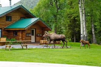
Cooper Landing Area Hiking Trails
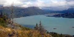
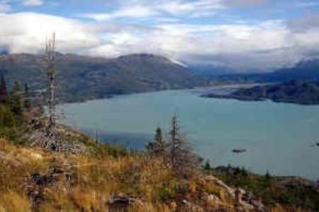
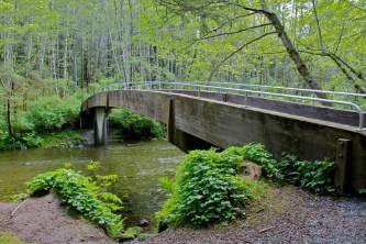
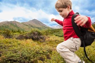
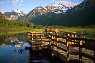
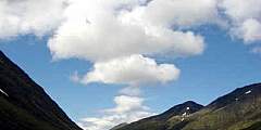
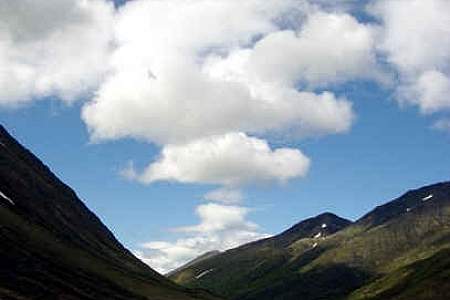
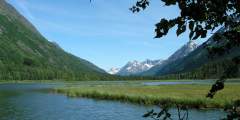
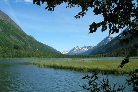
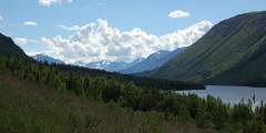
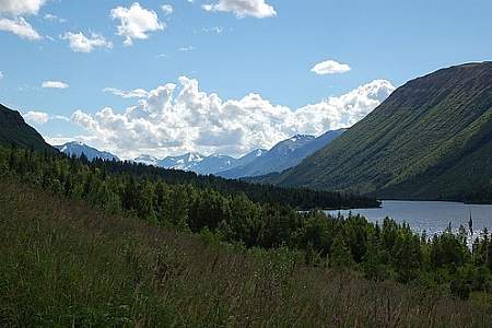
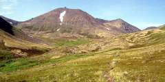
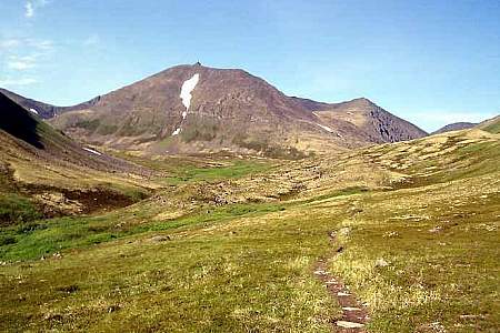
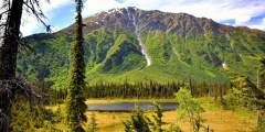
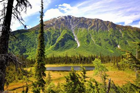
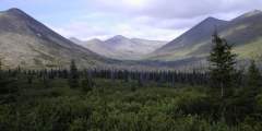
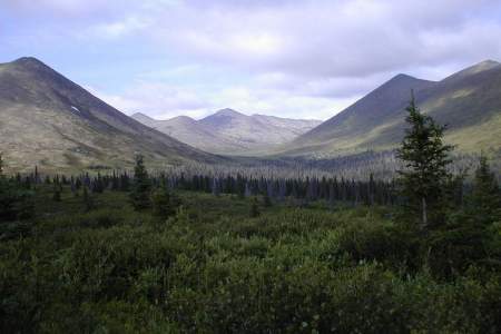
If you're a hiker, the Cooper Landing Area is paradise. A handful of the best hiking trails in Alaska are located within a few miles. Whether you want steep or flat, long or short, you'll find them here. Turn of-the-century prospectors blazed these trails and carried millions of dollars of gold over them. The well-worn footpaths climb through forested valleys to open meadows shimmering with wildflowers and gem-colored lakes. Most trails in this vicinity follow rushing streams into high country with scenery on par with the most beautiful parks of the Lower 48. Bridges make it one of Alaska's few regions where you can keep your socks dry.
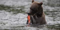
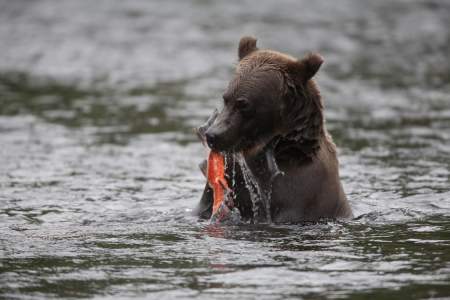
If you want to see bears in July, hike the Russian River Trail. If you want to go into wide open high country dotted with lakes and green mountainsides, consider the Johnson Pass Trail. Looking for a steep, thigh-burner? Try Carter Lake. There are so many choices, you could spend a week here, and not get our fill.
If you're looking for an overnight backpacking trip, the Forest Service maintains public use cabins in the area ($25-$45 per night). Get details on every one of these cabins on our Kenai Peninsula Public Use Cabins page.
Show Map
Hiking Trails
If you have some outdoor experience and an adventurous spirit, consider this 11-mile traverse up the Colorado Creek valley and down the Summit Creek. Beginning 2 hours south of Anchorage, this traverse doesn’t involve any rock scrambling, river crossings, or arduous bushwhacking. But if you feel comfortable hiking in wide and trackless country, you may reap the reward of having an entire valley to yourself.
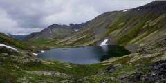
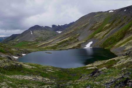
No other mining trail on the Kenai Peninsula climbs as high or takes in more extensive views as the 6‑mile-long Crown Mine Trail. Beginning some 2 hours south of Anchorage on the appropriately named Mine Road just south of Trail Lake, this trail climbs to 3,900 feet above sea level to a unique spot — a glacial cirque littered with mining paraphernalia.

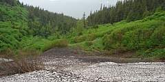
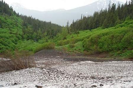
Located about 3 miles up a gravel road from Snug Harbor Road along Kenai Lake. A primitive camping area is nearby overlooking the lake
Well-maintained and suitable for summer hiking and biking, the 10-mile Devil’s Pass Trail features a steep route up a spectacular V‑shaped valley that intersects with the Resurrection Pass Trail and a rental cabin in the alpine realm. The country is rugged, with great access to cross-country tundra exploration and berry picking.
More a gated road than a trail, this hike largely remains a local secret among the residents of Cooper Landing, the fishing mecca located some 105 miles south of Anchorage on Sterling Highway. Many in this town consider it their personal getaway, which makes it quite a popular secret. A foreman for Chugach Electric (the company that manages the dam on Cooper Lake) said he often experienced congestion while driving to the dam, due to the heavy ...more
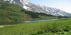
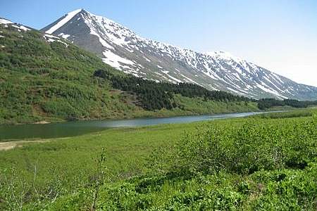
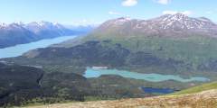
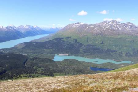
Beginning 103 miles south of Anchorage on the Seward Highway, the 3.5‑mile-long Ptarmigan Lake Trail makes for a fine family outing. The lake itself is a long and narrow body of water squeezed between ridges and mountains that tower as high as 6,000 feet. It even offers a small beach upon which to relax and enjoy the view while cooling your feet.
This is a day use site that offers 13 picnic sites with tables, a fish viewing platform, water, toilets, an information board, and fire grates.
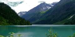
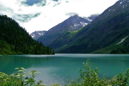
Popular with hikers and backpackers, this easy-to-follow trail connects the state’s most intense sockeye salmon sports fishery with stunning mountain backcountry. It offers many of the Kenai Peninsula’s highlights in one trip. The 21-mile route accesses Russian River Falls, Lower and Upper Russian Lakes, Cooper Lake, 3 federally managed recreational cabins, and numerous campsites
This meandering, single-track path leads to some of the Kenai Mountain’s most remote and fragile high country. On a route once trekked by gold rush prospectors, this trail ascends from spruce forest through the jungled zone of alders into a realm of sweeping tundra, with incredible views and productive berry picking. Plus, the top of the nine-mile journey ends in Resurrection Pass, about midway through the 39-mile Resurrection Pass Trail.
This trail is a good day hike for the whole family. It alternates between open meadows and forests and offers the option of tent camping or staying in Crescent Lake Cabin. There are options for longer hikes and there is a lot of wildlife to be seen such as moose, goats and bears.
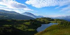
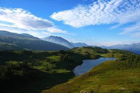
The 23-mile Johnson Pass Trail offers hikers, backpackers and bikers a well-marked route through a lush pass in the Kenai Mountains — featuring gradual climbs, two lakes with fish, spectacular peaks and some way cool gorges.
This wildlife sweet spot is worth a visit. The Russian Lakes Trail begins off the access road to the Russian River Campground in Cooper Landing, at milepost 52 of the Sterling Highway. Get off-the-beaten path, hike two miles to the falls and enjoy the immediate reward of spectacular salmon viewing.
This 38 mile long USFS trail climbs Resurrection Pass (elev. 2,600) and descends to the north to another trailheadtrailhead near Hope on Turnagain Arm. There are 8 public use cabins along the trail, making this an advanced but comfortable day cabin-to-cabin hike. There are also 19 campsites available along the trail.
The wildflowers are abundant and verdant undergrowth can be check high sometimes. Most of the trail lies below treeline, so there are established camp clearings along the way that are nestled into the trees. One of the best campsites is 10 miles in from the northern trailhead, set among trees on a spruce-covered knoll looking over the trail and Bench Lake.