Glacier Facts
By Elise Lockton
Today 10% of land area on Earth is covered with glacial ice, including glaciers, ice caps, and the ice sheets of Greenland, Antarctica. The greatest concentration of glaciers in Alaska, as during the last ice age, is in the mountains and southern part of the state. From the mountains to the sea glaciers have helped to shape the Alaskan landscape. One of the best places to see Alaska’s glaciers is a small ship cruise to Southeast, Alaska and Glacier Bay National Park or day trips into Prince William Sound or Kenai Fjords National Park. Let’s see how many glacial features you can pick out as you explore by land and sea.
How do glaciers form?
Glaciers form in regions of high snowfall in winter, and cool temperatures in summer. This condition allows more snow to accumulate in the winter than will melt in the summer. As snow accumulates over time it compacts into ice. What makes glaciers unique is their ability to flow. Glacial ice can be a half-mile thick. Today Alaska has 100,000 glaciers (less than 1% are named) covering 5% of the state. That is 128 times more glacial coverage than the rest of the U.S. combined.
Is that glacier moving?
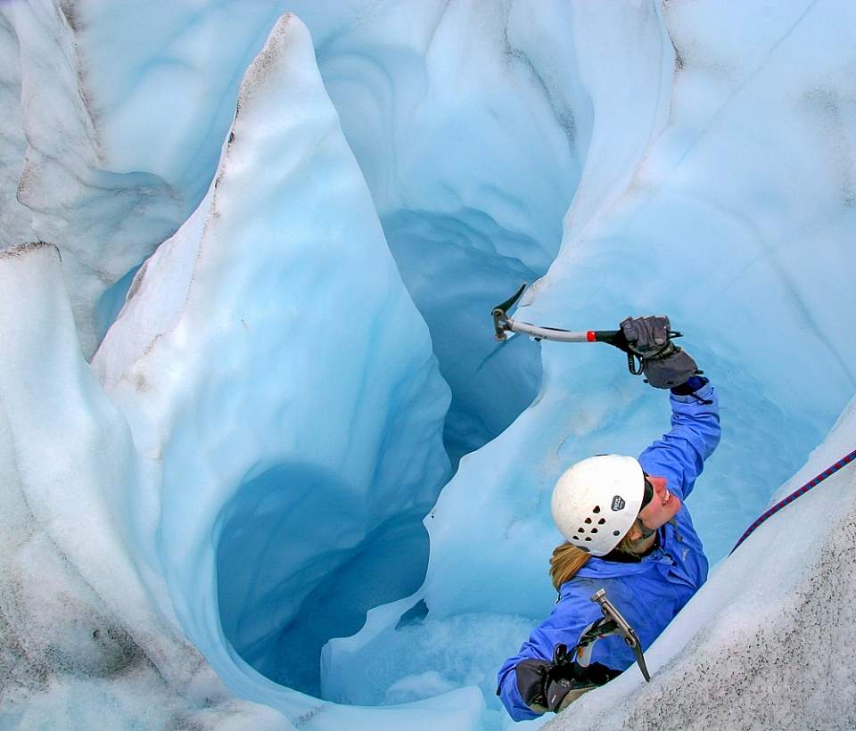
An ice climber makes their way out of a moulin
Every winter glaciers advance and every summer they retreat. Because of the extreme pressure of thousands of feet of ice combined with the pull of gravity, the glacier actually flows, like a slow river of ice. One of the greatest experiences in Alaska is visiting a glacier and listening for its movement as the ice calves internally or from the face. What do you think it sounds like? The native Tlingit people referred to this amazing rumble as “white thunder”.
Another way a glacier moves is by sliding over a thin layer of water that forms from the pressure of the ice rubbing up against the bedrock. Water can also percolate through cracks to the bottom. Moulins form on the top of the glacier when summer melt water streams on the surface find a crack other weak spot in the ice and begins to pour down through the ice. The lubricating effects of those vertical shafts draining water can lead to faster sliding of the glacier. Can you hear water running beneath the glacier or see a stream emerging from its base? 75% of Alaska's fresh water is locked up in glaciers. Each summer, glacier melting provides more than a trillion gallons of water to Alaskan rivers, streams, lakes and aquifers. Needless to say, it’s a slippery slope, no pun intended. Look for water flowing from beneath the glacier and listen for “white thunder” on a day boat from Seward exploring Kenai Fjords National Park or the 26 Glacier cruise out of Whittier.
Why do glaciers surge?
Surging is the sliding forward of glacial ice at great rates. Surges are caused by some instability inside the glacier caused by the supply of meltwater to the base of a glacier. The Bering Glacier in Southeast Alaska is North America's largest and longest glacier, at 125 miles in length. In 2008 it staged one of the great ice surges of the century. An area the size of Rhode Island was on the move, surging forward up to 300 feet in a single day, something scientists had never been able to watch before.
Does all the ice in a glacier move at the same speed?
Because of the friction of ice against bedrock at the bottom of the glacier the movement along the underside is slower than the movement at the top. That is also true for the sides of the glacier where the ice is rubbing up against bedrock. While you are out on a day cruise look closely as you can see in many glaciers that the center protrudes out further than the edges because of this friction.
What is up with all the cracks?
Can you see big cracks on the surface of the glacier? Crevasses form when a glacier moves rapidly over uneven terrain or a steep area in the bedrock, causing internal stresses to build up in the ice. They also form when different parts of a glacier move at different speeds. A glacier moves faster in the middle as the sides are slowed down as they scrape against valley walls. Can you imagine the challenges mountaineers must face when traversing this treacherous landscape? Keep a watchful eye for crevasses as you are walking across the Matanuska glacier.
Why is the ice blue?
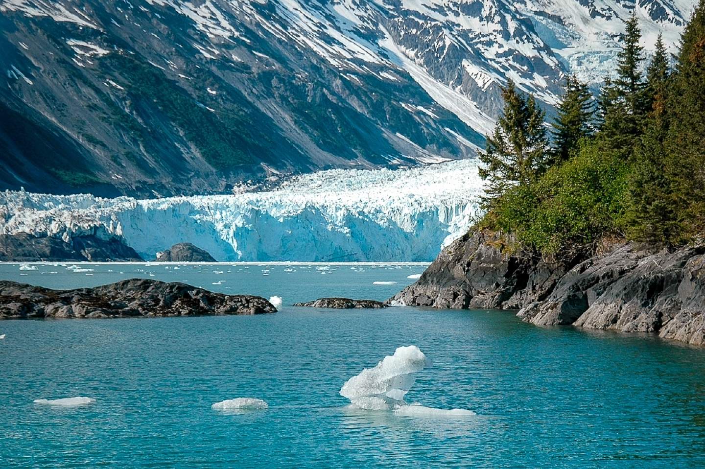
A tidewater glacier
Simply put, glacial ice appears blue because the ice is dense and free of air bubbles. Snow is white because it is full of air bubbles and light scatters when it hits the surface. Dense glacial ice absorbs all colors of the visible light spectrum except blue, which it transmits. Visiting the tidewater glaciers by day boat around Seward and Whittier gives you a good look at blue ice.
The power of ice
Flowing ice, like flowing water, has a tremendous ability to reshape the landscape. As these “rivers of ice” descend through the mountains they pick up loose rocks along their bottom and pluck rock from the sides of the walls. These rocks become embedded in the ice and act as powerful abrasives as the glacier moves over the land. Like a giant piece of sandpaper scouring away at the bedrock, the glaciers have transformed the landscape around us. Matanuska Glacier outside of Palmer and Exit Glacier outside of Seward are easy to access on the road system and provide good examples of the power of ice.
Dam that glacier!
There are over 750 glacier-dammed lakes in Alaska. The largest is Chakachamna Lake west of Anchorage at 28 square miles.
What are those linear piles of dirt?
Glaciers act like a giant conveyor belt carrying rock debris down from the mountains and depositing it along the glacier’s edge as moraines. See if you can identify all three types of moraine on your day of glacial exploration?
Lateral moraines are ridges of debris eroded from the valley walls along the sides of the moving glacier.
Medial moraines run down the middle of a glacier and are the result of two glaciers flowing into one another and their two lateral moraines merging together.
Terminal moraines are formed from the rock, soil and sediment that was scooped up and pushed to the front of the glacier. A receding glacier can leave behind moraines that are visible long after the glacier retreats. Maybe some of you have been to Long Island, NY? Long Island is a great example of a terminal moraine.
What kind of glacier is that?
Valley glaciers flow down valleys, looking much like giant tongues.
When valley glaciers reach sea level they become tidewater glaciers.
Hanging glaciers are perched precariously on steep faces and feed into the main glacier. As these glaciers melt and disappear the high valleys are called hanging valleys.

A valley glacier - Lower Ruth Glacier
Just the tip of the iceberg
Exploring some of Alaska’s tidewater glaciers you will see lots of ice in the water that has calved from the glacial face. About 90% of an iceberg lies below water. The masses you see above water are just the other ten percent. Alaskan glaciers can calve icebergs miles long, which can block shipping lanes. Technically speaking an “iceberg” refers to chunks of ice 15’ above the water line, a bergy bit is 5’ above the water line and a growler 1’ above. Look for the differences in the floating ice on a day cruise out of Whittier or Seward.
Features in a post glacial landscape
After glaciers disappear the once glaciated valleys are the most visible glacial landform. Steep-sided, flat-bottomed U-shaped valleys are the result of entire mountainsides scoured by glacial movement. One of the most striking examples of this is Yosemite Valley. If you look around can you see a big U in the valleys around you.
If you happen to be on the coast those U-shaped valleys became flooded with seawater as the ice retreated and became fjords. Fjords have steep walls and the water is typically very deep. Ask the captain of your boat how deep the water is? Can you imagine the amount of ice it would have taken to create this landscape? A 1000’ below the waterline and a few thousand feet above.
Cirques are bowl shaped basins created when glaciers carve out the mountainside. Looking up can you find any of these circular basins?
An arête is a jagged knife edge ridge created where the back walls of two glaciers have eroded the ridge on both sides.
Horns are created when three or more cirque glaciers erode a mountain until all that is left is a steep, pointed peak. The most famous horn is in Switzerland, do you know what it is? The Matterhorn.
Did you say erratic?
As you scan around the landscape can you see any huge boulders that seem a little out of place? Glacial erratics are rocks that have been swept from their place of origin and transported by ice, sometimes hundreds of miles. When the glacier retreated the rocks melted out stranding them in the tundra or forest.
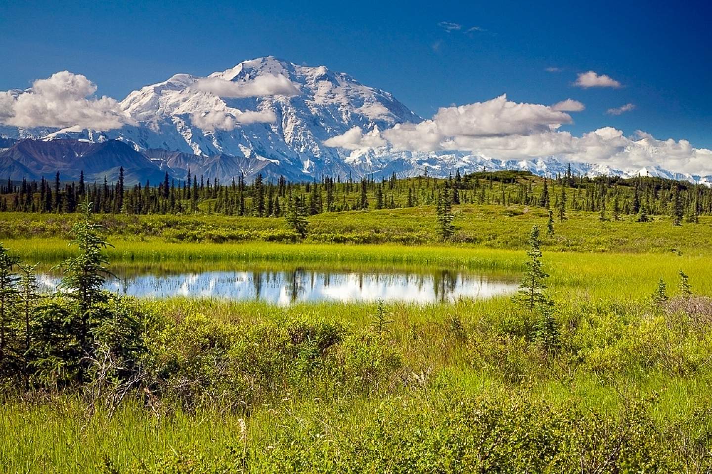
Kettle ponds at Wonder Lake
Scratchy scratch
Striations are small gouges left by the boulders and coarse gravel that gets trapped in the ice, and abrades the bedrock as the glacier moves down stream. When your visiting Exit Glacier in Seward get up close to the bedrock and look for scratch marks in the rock. Can you tell which direction the glacier was moving?
Kettle ponds form when a piece of glacier ice breaks off and becomes buried by glacial sediment or moraine deposits. Over time, the ice melts, leaving a small depression in the land, filled with water. In Denali National Park many kettle ponds are visible from the park road and are important habitat for ducks and moose.
Can you feel the earth move beneath your feet?
Can you imagine what thousands of feet of ice sitting on the surface of the earth must weigh? It weighs so much it actually depresses the crust of the earth! After glaciers retreat, the weight of the ice that had been depressing the crust, is removed. The land beneath begins to spring back. Isostatic rebound, or glacial uplift, is the rise of land masses that were depressed by the weight of ice sheets. Stand around long enough and you just might feel the earth move under your feet. The area around Glacier Bay and the community of Gustavus has one of the highest rates of rebound on earth and is rising 1.2” a year. The land has risen of over 18’ in the last 250 years and as it continues to rise interesting legal issues emerge around who owns the newly accumulated land.
Do ice worms really exist?
Yes, ice worms do, in fact, exist! Ice worms are related to earth worms and are the only worm known to spend their entire lives on glacier ice. Ice wormsare ¼-1”long, and are black or blue in color. What do you think the ice worms are eating? Ice worms come to the surface of the glaciers in the evening and morning to feed on algae that grows on the snow. The Portage Glacier visitor center south of Anchorage sometimes has ice worms on display.