Steese Highway
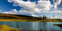
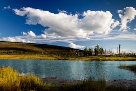
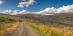
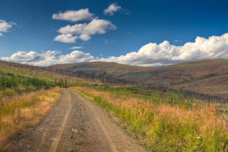
The skies of Interior Alaska are not something to miss, and the Steese Highway is an excellent way to experience them. In the summer, the sun hangs low in the sky for long periods of time and numerous small clouds come and go, creating a moving dance of light and shadow. You can drive to Eagle Summit (3,624 ft.) during summer solstice (June 21st) to see the sun crawl across the horizon. Or you can drive the Steese Highway in the winter and get a chance to view the Northern Lights overhead.
Not all rental vehicles are allowed on the Steese Highway, so check with your rental agency before you travel. Or, rent from Alaska Overlander, Alaska 4x4 Rentals, GoNorth Car & RV Rental, or Alaska Auto Rental companies that allow their vehicles on gravel roads.
Show Map
Highway Points

Originally the Fox Roadhouse, this old-style building has been renovated to house a brewery and brew pub. Ten miles from Fairbanks, the brewery has at least a dozen house-made beers on tap, and a huge selection of bottled brews, many of which can’t be found anywhere else in town. There’s a large, open beer garden out back, ideal for summer nights. And the food’s great.
The White Mountain National Recreation Area has over 200 miles of winter trails that are shared by dog mushers, skiiers, skijorers, and snow machiners and several cabins have been built along the White Mountain winter trails to provide visitors with safety and comfort during their adventures.
This station is one of two in the U.S. responsible for tracking and commanding the nation’s environmental and weather satellites. Several large antennae are used to downlink environmental data, which provides the nation with information for its weather forecasts, search & rescue capabilities and ozone monitoring. UPDATE: This NOAA site will no longer provide GOES-East imagery.
This monument is dedicated to Felix Pedro, a very patient Italian prospector who discovered gold here in July 1902. The gold rush that followed resulted in the founding of Fairbanks, Alaska’s second largest City.
This is a 16 mile trail that is popular with both hikers and 4‑wheelers. The trail crosses through spruce-forested valleys, alpine tundra, and cold mountain streams.
Cleary Summit, 2,233 ft. This is an excellent spot to watch the summer solstice (June 21). During this period, the “midnight” sun never sets. On a clear day, you can also catch a good view of Tanana Valley and Denali (Mt. McKinley) to the south and the White Mountains to the north.
Look across the valley for a view of the abandoned buildings from an early dredging operation at Cleary Creek.
This is the site of the historic Fairbanks Exploration Company gold mining camp, established in 1925. Here you’ll find the old school house, which has been converted into a museum. This area is on the National Register of Historic Places.
Look to the left side of the highway and you’ll see what’s left of Gold Dredge Number 3. This dredge was build in 1927 and eventually produced $10 million in gold.
The first, possible, take out is at mile 39 of the Steese for the upper run and this stretch should be doable in a couple of days.
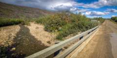
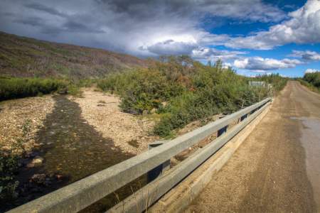
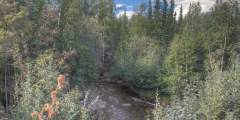
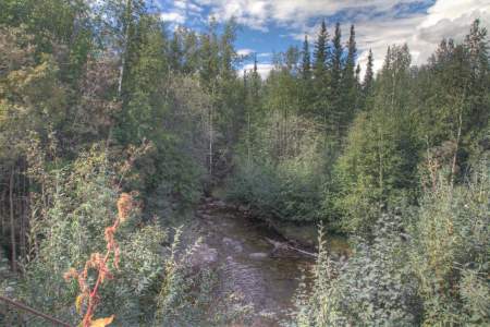
Upper Chatanika River State Rec Site, at Mile 39 of the Steese Highway near Fairbanks, offers 24 wooded campsites along the Upper Chatanika River. Managed by Alaska State Parks, it features spruce forest, river access, vault toilets, and fire rings for a peaceful stay. Campers come to fish for grayling, relax by the river, or explore Alaska’s northern wilderness, with Fairbanks nearby.
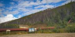
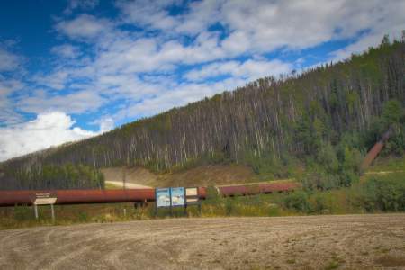
Look for the giant pipe running through the picnic area. This pipe was once part of an 83-mile-long system of pipes and ditches, which transported over 3 million gallons of water per hour to power the Fairbanks Exploration Company’s gold mining operations.
Cripple Creek Campground, at Mile 60 of the Steese Highway near Central, offers 18 sites along Cripple Creek in Alaska’s Interior. Managed by Alaska State Parks, it’s set in a remote, spruce-lined gold-mining area with fire rings for a rustic stay. Campers can fish for grayling, hike the nearby hills, or explore historic mining sites, with the small community of Central just a short drive away.
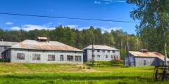
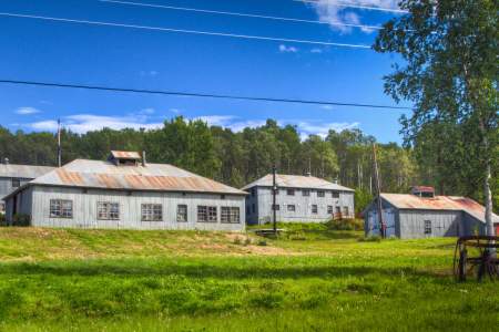
These cabins may not be very lively during the summer months, but every February they are alive with activity. This is one of the checkpoints for the Yukon Quest International Sled Dog Race, a grueling 1,000-mile race between Fairbanks, Alaska and Whitehorse, Yukon. At checkpoints like this one, mushers can feed and rest their dogs, restock supplies and even get veterinary care for their team.
This hike is great for the early-rising fly fisherman. The lake is full of grayling and there are often caribou, moose and bears along the trail. The hike follows an old mining trail that parallels the Susitna River to Snodgrass Lake. There are many active mines along this hike and be sure to keep an eye out for grizzleys.
Eagle Summit. 3,624 ft. This is the highest of the three summits on the highway. Around summer solstice this peak basks in 24 hours of sunlight. Take a walk down the quarter-mile-long loop trail leading to a viewing deck.
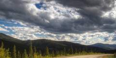
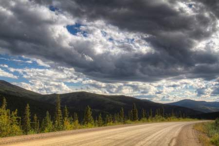
In the interior of Alaska, in the summer, the sun hangs low in the sky for long periods of time; and numerous small clouds come and go, creating a moving dance of light and shadow.
Often a fire will burn to the very highest tree on a mountain, as the surrounding fires did here.
Alaska has a fascinating archeology. The fossilized remains of many species of pre-glacial Alaskan mammals have been discovered here. These fossils are on display at the University of Alaska Museum in Fairbanks as well as the museum in Central.
Built as a cabin in 1896 by prospector Fritz Miller as a stop over on the sled dog trail between Circle City and Fairbanks. After the Steese Highway was completed it functioned as a roadhouse until 1970. It has since burned down, however, items from the Miller House can be found at the Museum in Central.
Mining equipment, gold display, artifacts from the local area, restored and fully outfitted miner’s cabin, wildflower display.
Central (pop. 95). This small log cabin community is the center of the regions mining activity and is a popular checkpoint for the Yukon Quest International Sled Dog Race. Stop by the Central Mining District Museum for information about this region’s mining history.
Get an up-close look at one of the world’s seven great engineering marvels.
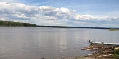
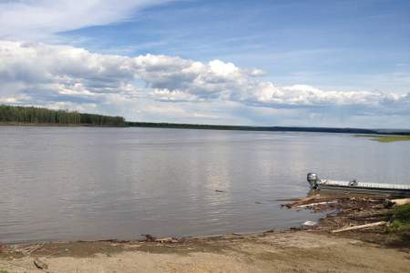
Circle (Pop. 94) Before the Klondike Gold Rush, Circle was the largest gold mining town on the Yukon River. Started in 1893 as a supply point for miners at Birch Creek, the town soon grew to be a hub for many different mining operations in this area. The town got its name because early settlers thought it was located on the Arctic Circle which is actually located 50 miles north of here.