Moose Pass Parks & Trails
Parks & Trails
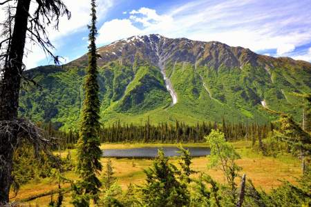
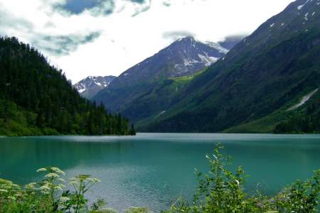
The 23-mile Johnson Pass Trail offers hikers, backpackers and bikers a well-marked route through a lush pass in the Kenai Mountains — featuring gradual climbs, two lakes with fish, spectacular peaks and some way cool gorges.
This trail is a good day hike for the whole family. It alternates between open meadows and forests and offers the option of tent camping or staying in Crescent Lake Cabin. There are options for longer hikes and there is a lot of wildlife to be seen such as moose, goats and bears.
The wildflowers are abundant and verdant undergrowth can be check high sometimes. Most of the trail lies below treeline, so there are established camp clearings along the way that are nestled into the trees. One of the best campsites is 10 miles in from the northern trailhead, set among trees on a spruce-covered knoll looking over the trail and Bench Lake.
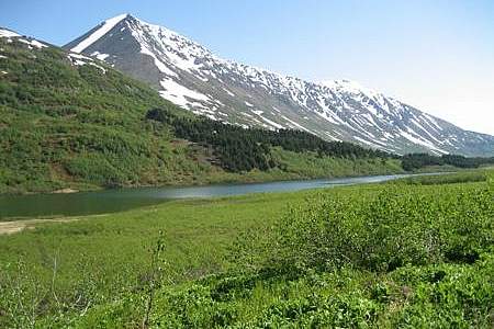
No other mining trail on the Kenai Peninsula climbs as high or takes in more extensive views as the 6‑mile-long Crown Mine Trail. Beginning some 2 hours south of Anchorage on the appropriately named Mine Road just south of Trail Lake, this trail climbs to 3,900 feet above sea level to a unique spot — a glacial cirque littered with mining paraphernalia.
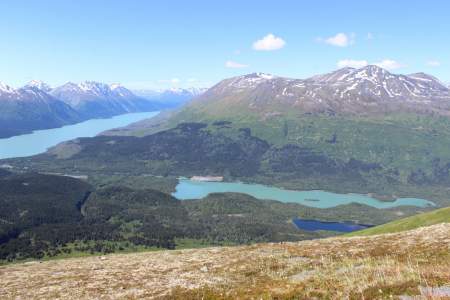
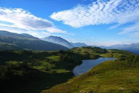
Beginning 103 miles south of Anchorage on the Seward Highway, the 3.5‑mile-long Ptarmigan Lake Trail makes for a fine family outing. The lake itself is a long and narrow body of water squeezed between ridges and mountains that tower as high as 6,000 feet. It even offers a small beach upon which to relax and enjoy the view while cooling your feet.
This trail follows an old mining road to the-still active- Primrose Mine. After mile 4 the trail becomes steep and eroded. There is a viewpoint that offers nice vistas here. The trail continues to a bridge that will take you to Lost Creek and Lost Lake eventually. This is a good 2 – 3 day hike for fishing and camping.Keep an eye out for black bear and mountain goats.

The Johnson Pass Trail originated in the 1890s as a route for Iditarod miners who raced north from Seward to Nome. It later was developed into a wagon road by merchants and miners who settled the area. The Alaska Road Commission then used it as a thoroughfare through the 1930s. Today this popular hiking trail travels portions of the historic Iditarod Trail between Moose Pass and Granite Creek with bridged streams, mostly easy grades, and… ...more
The trail takes hikers past mine activity on the lower part of the trail. The first mile is steep, but after that it levels out. Mountain goats and brown bears are seen on the mountainside occasionally. There is excellent berry-picking here in the fall. This trail should only be traveled in the summer due to avalanche danger.