Show Map
Kachemak Bay State Park Points
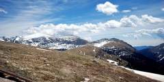
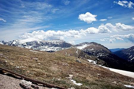
1
Difficulty: Moderate
For a longer day hike, add this popular route to the Glacier Lake Trail loop. You’ll pick up the trail heading south down the Saddle Trail, then climb a steep ridge above tree-line to alpine tundra, with great views of Kachemak Bay, Grewingk Glacier, and the glacial valley. In August, you’ll find ripe blueberries. Retrace your steps and continue down the Saddle Trail to the Halibut Cove pickup. It is 5 miles out and back, plus Glacier Lake… ...more
2

Difficulty: Difficult
Distance: 1 mile
Elevation Gain: 1632 feet
Note: To get to the summit you most get to the Summit Junction, and continue the final .3 miles from there. The trail begins .5 miles beyond China Poot Lake. The elevation gain tells it all — 1632 feet in just over a mile! This trail doesn’t mess around. It is difficult but can be fun. Right from the trail junction, the trail will climb straight up, with no traversing or switchbacks. The trail climbs over exposed tree roots, several slick… ...more
3
Difficulty: Difficult
Distance: 1 mile
This trail is short and steep through thick forest that leads to incredible scenary. The trailhead can be reached via the highest point of the Lagoon Trail, two miles from the ranger station. Rock cairns mark the trail to an open alpine ridge, where the trail gently climbs to a summit that has some of the finest views anywhere of Kachemak country.
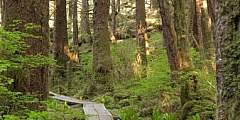
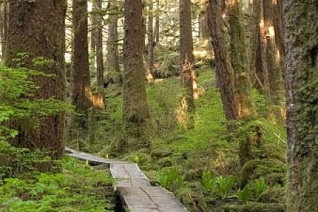
4
Difficulty: Difficult
This trail winds along Halibut Cove and passes though to Halibut Creek delta, a wet boggy section. The river can be forded at low tide but may be difficult to cross at other times. The trail continues on to lead you to China Poot Lake Trail, should you choose to go on.