Unalaska - Dutch Harbor Parks & Trails
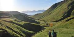
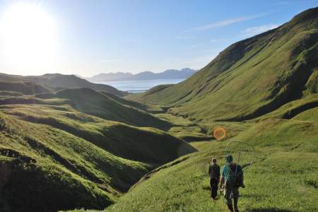
The people of Unalaska have been shaped by the land, water and weather of the Aleutians for thousands of years. Getting out onto the land by foot reveals vistas shared by those early residents on ancient trails that have been used for centuries. Other trails are newer, with their origins in WWII military roads. There are several options, with payoffs of frequent wildlife, historic artifacts and stunning overlooks. Climb high for clear views of Unalaska’s many bays, or dip into valleys to bushwhack through wild vegetation – including wildflowers, berries, and grasses.
Another fantastic reason to hike in this particular part of Alaska? No bears, and no bugs!
We’ve highlighted a few of the more popular trails here to get you started. Enjoy trekking, keeping these pointers in mind when you go.
Buy a Permit
Most of Amaknak and Unalaska Island is owned by the Ounalashka Corporation, which shares access to the land through an affordable recreational land use permit system. You’ll need to buy a permit before you go on many of these hikes.
Get a Map
You can also buy a copy of Ounalashka Corporation’s map of hiking trails, which includes the main routes, as well as several lesser-known trails.
Prepare/Have a Plan
Unalaska is a rugged place with rapidly changing weather. You should be prepared for rainy/windy weather even if the sun is shining brightly when you set out. Be sure to have plenty of water – and let someone know where you’re headed and when you expect to be back.
Resist Souvenir Collection
It’s nice to have a souvenir of your trip – but let it be a photo. Collecting natural items (eagle feathers, bone, ivory) and military remnants (nails, bullets) is illegal.
Show Map
Parks & Trails

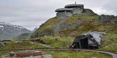
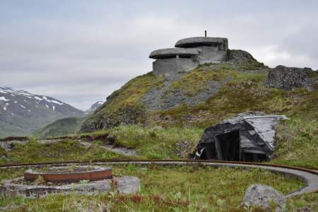
The mild stroll around Strawberry Hill offers great views, wildlife and some historic flavor. Old military roads cover the area, providing easy walking. Adventurers can bushwhack or scramble short distances for better views of the surrounding area or get up close to WWII-era trenches and the remains of old bunkers.
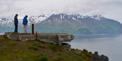
Beaver Inlet, on the other side of Unalaska Island, was an historic portage for the native Unangan people who lived in the village of Biorka just across on Sedanka Island. You can only get there by boat or by foot, but the pristine views away from the more populated areas of Unalaska are worth the effort. One popular and accessible route is the Peace of Mind Trail, a three-mile round-trip trek that showcases a range of topography and winds ...more

The Agamgik Bay trek is a bit longer than the others, has some difficult spots not easy for the very young or the very old, and offers access to an even longer hike over to English Bay, where Captain Cook arrived in 1778. As a longer, more difficult trail, it is also less frequented, a bonus for those who yearn for a more solitary journey.
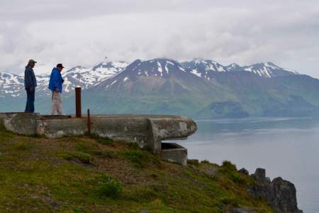
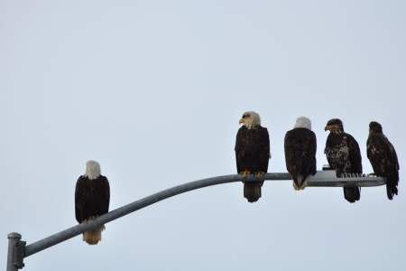
A drive or walk up Mt. Ballyhoo is interesting for both birders and those interested in World War II history. It’s such as good view that you might even catch sight of whales in the distance. The view from the 1,634-foot mountain gives you an idea of how birds might see the area (that is, if you can imagine the view with a lot more color and super-sharp clarity)
If your travel group includes a WWII enthusiast, a wildlife devotee, a birder, and a kid who enjoys rolling around on the tundra, Bunker Hill is the perfect spot. Plus, it has the best photo ops, with a 360-degree view of the entire area: Captains Bay, Amaknak Island, Unalaska Bay and Iliuliuk Harbor.
Mt. Ballyhoo is a lure for hikers wanting a moderate climb and an outstanding vista. Both the airport and city dock are located right at its base, so the south face of Ballyhoo is the first thing you’ll notice when you get here. Its 1,634-foot-peak is the highest point on Amaknak Island, with a panoramic view that helps orient you to Unalaska/Dutch Harbor geography.
For thousands of years, being able to survive in the Aleutians has depended on the ability to use what the land and sea provide. The rugged, remote and stunning landscape continues to inspire – and challenge – locals and visitors alike. Understanding this primal connection with the land is best done by exploring on foot. Hiking the Ugadaga Trail – reportedly in use for more than 9,000 years – allows the imagination to wander, and wonder, about ...more

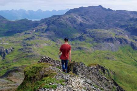
The 2,300-foot Pyramid Peak is surrounded by Pyramid Valley, Captains Bay and miles of popular hiking trails, including a circuit around the peak. This location is for the birder who wants to get out of the city and industrial areas of town to listen for birdsong while sitting among the wildflowers or berries of the Aleutian tundra.
A hike to the windy, northernmost point of Amaknak Island provides a good uphill workout, a peek into World War II history, and a breathtaking panoramic vista of the Bering Sea and the islands around you.
Take in many dimensions of Unalaska in just an hour on a 2‑mile hike around a spot called “Little South America.” Watch boats in the harbor, look for whales, spot birds (including puffins nesting in the cliffs), walk the beaches, search tidepools, and talk with locals who are also hiking or enjoying a beach party.
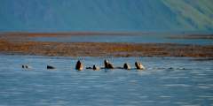
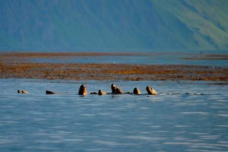
Jutting half a mile into the center of Unalaska Bay, the Dutch Harbor Spit offers a short, sea-level hike for all ages, with beach access, wildlife viewing and birding. The trail follows an old roadbed, which makes for an ideal hiking surface. You’ll want to stop frequently with a ready camera for close-up views of marine mammals on either side of the spit.