If you’re in shape and ready for a climb, this towering yet gentle peak above town makes for a great hike. You’ll experience the different ecosystems of a Southeast Alaskan mountain—lush forest, subalpine stunted trees, alpine meadow, and rocky summit. The weather can be variable at the top, so bring layers, food, and plenty of water. Also bring a camera and binoculars, to look for the resident herd of mountain goats that populate these alpine cliffs and ridges.
It’s 3,000 feet to the summit and it takes three to four hours one-way. You’ll start in lush forest, with great blueberry picking in August. The climb through the forest—stately hemlocks draped with wispy lichens—lasts several hours and there will be a couple of trails dropping off to the left. Don’t take these, stay on the main trail. There’s been a lot of trail work here in recent years, so you’ll enjoy walking on wooden stairs and plank walkways instead of trudging through mud. After about one hour, you’ll see a little side trail out to the left, which leads to a wetland bog. Check it out and you’ll find small carnivorous plants called sundews. You’ll have to hunt for them, but get down low and you’ll see the sticky teeth on these monsters! Continue the climb to the subalpine, where you’ll walk beside a small creek that has coltsfoot growing along it. From here, you’ll climb a rocky path through stunted mountain hemlock before emerging in the alpine. It’s glorious here! The alpine tundra is dotted with wildflowers, including the white bell-shaped flowers of mountain heather. There will be several false summits, but you are close!
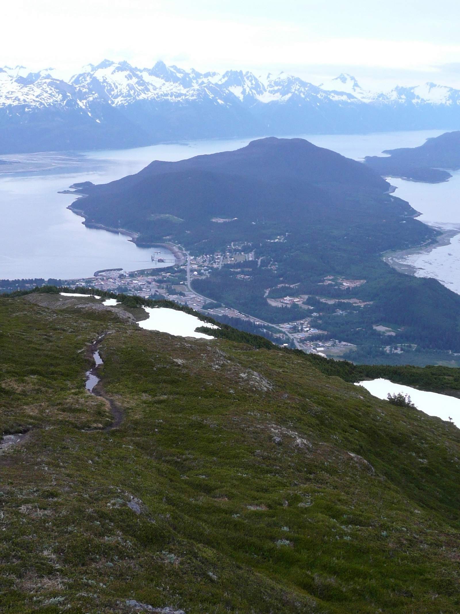
There’s a sign at the top, and a log book to record your climb—add a haiku, weather notes, or whatever you like. The views are amazing in every direction: to the NE is emerald blue Chilkoot Lake and Lutak Inlet; to the south is town and Juneau; to the West is the Cathedral Peaks (the highest summits in the Haines area); and to the north is the Chilkat River drainages and the Takshanuk Mountains. You can return the way you came, or make a bigger hike of it, following the ridge to another summit, called 3920, and down to the 7 Mile trailhead.
Directions
From town, follow the signs for the Ferry Terminal/Lutak Road. You’ll travel about ½ mile and then turn left onto Young Road. Follow this steep road, which eventually turns to dirt. Continue to drive uphill, veering left whenever given the choice. The road dead ends and you can park here. The trailhead is on the left side of the road. To include 3920, set up a shuttle and through hike to 7 Mile Haines Highway.