Lake Clark National Park Hiking Trails
Lake Clark only has two areas with maintained trails, the rest of the trail-less tundra of the park's alpine regions attracts adventurous backpackers. We've broken out the day hikes by area, as well as the three most popular backpacking treks.
Show Map
Parks & Trails
Tanalian Trails in Port Alsworth
This four-trail system starts in Port Alsworth and offers a variety of distances and difficulty levels. You can pick up a trail map at the visitor center in Port Alsworth or download a copy from the Lake Clark National Park website. To get to the trailhead, walk down the southernmost of Port Alsworth’s two airstrips, past the visit center towards Hardenberg Bay. Take the last road on the right and follow it to the trailhead.
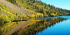
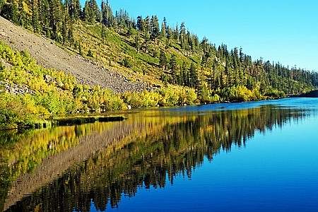
This trail makes a loop around a small beaver pond and connects back via the Tanalian Falls trail. It’s especially beautiful in fall, fall, when golden birch trees explode in color. This is the gentlest of the available hikes in Port Alsworth.
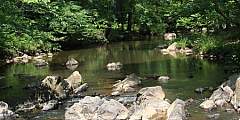
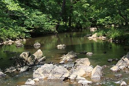
This relatively level, moderately intense trail meanders through the forest, with intermittent views of Lake Clark to the North, Tanalian Mountain to the east, and Holey and Martha’s Mountains to the south. It ends at the impressively powerful Tanalian Falls. Make it a loop by returning via the Beaver Pond Loop.
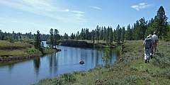
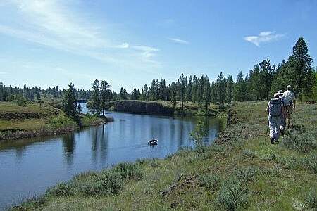
Begin this hike on the Tanalian Falls trail; continue past the falls to the shores of Kontrashibuna Lake. This long, narrow lake is nestled between steep mountains on either shore. The official trail ends at the lake, but a brushed, unmaintained social trail continues along the lake’s north shore.

This is the most strenuous of the hiking options in Port Alsworth, but the views are worth the effort. From the summit of Tanalian Mountain, you’ll enjoy a 360-degree view of Lake Clark, Kontrashibuna Lake, and the Chigmit Mountains.
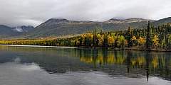
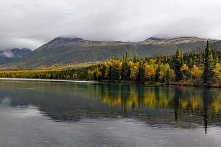
On Lake Clark
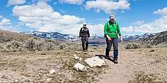
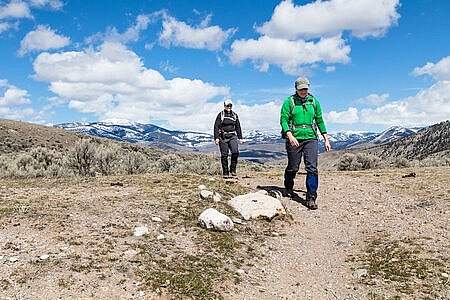
There’s only one maintained trail outside of Port Alsworth.
Climb the only maintained trail outside of Port Alsworth. Follow the trail for one mile to cross Portage Creek. Continue another two miles into the alpine tundra. From the end of the trail, you can explore for miles along an alpine ridge overlooking Lake Clark.
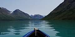
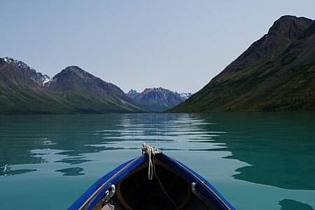
On Upper Twin Lake
Although none of the trails on Upper Twin Lake are officially maintained, they have been worn into the tundra by years of travel—first by Dick Proenneke and now by the visitors that come to his homestead and Twin Lakes each summer. Most are relatively easy to follow, but backcountry navigation skills are helpful.
This out-and-back trail leaves from the Historic Proenneke Cabin site and ascends to a prominent point ½‑mile behind the cabin to the north of Hope Creek. A uniquely balanced rock marks the end of this trail and makes a great spot to take in the view of Upper Twin Lake.
This trail leaves from the primitive campground at Hope Creek. The trail follows the south side of Hope Creek ascending the creek’s valley for miles. This is a great valley for catching a glimpse of black or brown bears or Dall sheep.
This trail leaves from the Emerson Creek delta, on the north side of Upper Twin Lakes, just east of the stream that connects the Upper and Lower Twin Lakes. A good ending point is a large waterfall, 1.75 miles up the trail. You can stop at the bottom of the falls or climb a steep trail to the bluff above the falls. The trail continues into the alpine, but eventually disappears into the tundra.
Backpacking
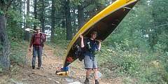
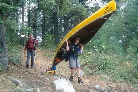
All backpacking trips in Lake Clark require Backcountry Navigation Skills due to the scarcity of maintained trails. There are hundreds of options for backpacking routes; the only limits are your skills and imagination. A few popular routes are outlined below. These are not complete trip reports, but instead ideas to get you started on planning your own trip. If you’re not confident in your wilderness traveling abilities, consider hiring a guide.
This 12-plus-mile backpacking route lets you see the park’s most iconic lakes: the alpine Turquoise Lake and the boreal Twin Lakes. Wildlife is common along this route, especially Dall sheep in the alpine valleys between the lakes.
Choose this trip if you want to commit to fewer miles and don’t mind a little bushwacking. The flights for this trip are typically the least expensive of the trips listed here; since it’s the closest to Port Alsworth it requires less flight time.
Choose this trip if you definitely want to visit Richard Proenneke’s cabin and you want a challenging hike. Of the main three Lake Clark backpacking trips, this trip offers the most challenging terrain and requires the most backcountry navigation skills.